Embed Size (px)
Citation preview
SOLAR SHADOWINGAN OPPORTUNITY FOR SURVEYORS
Rod Deakin
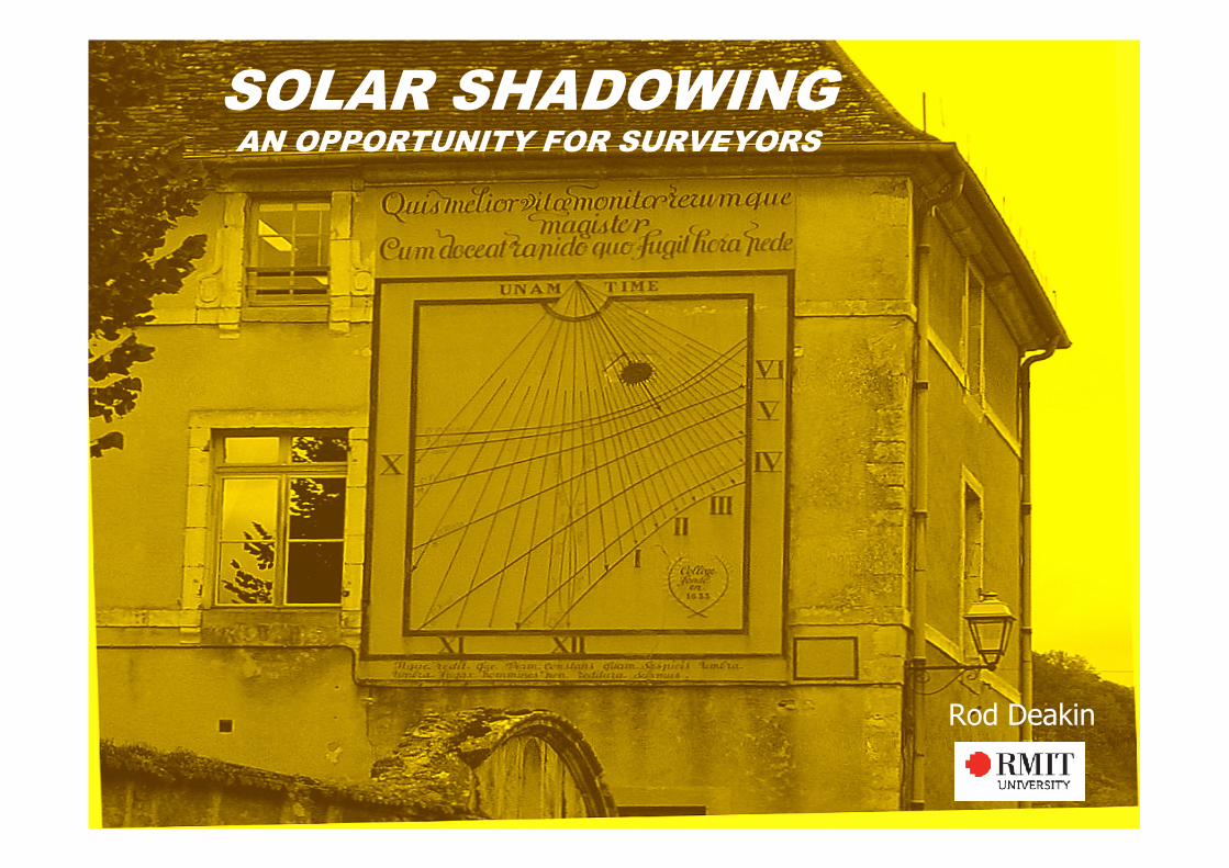
Simple Shadow Diagrams:
Buildings BLUE; Shadows RED
Constructing Shadow Diagrams
Basic Requirements:• Dimensions of building including height
above natural surface.• Reduced level of natural surface.• Profile of natural surface in the direction
of the shadow.• Table of Sun Azimuths and Altitudes.• Trigonometry (sine, cosine, tangent!)
• CORRECT ORIENTATION• Pencil, paper, protractor, scale rule and
parallel ruler (?)
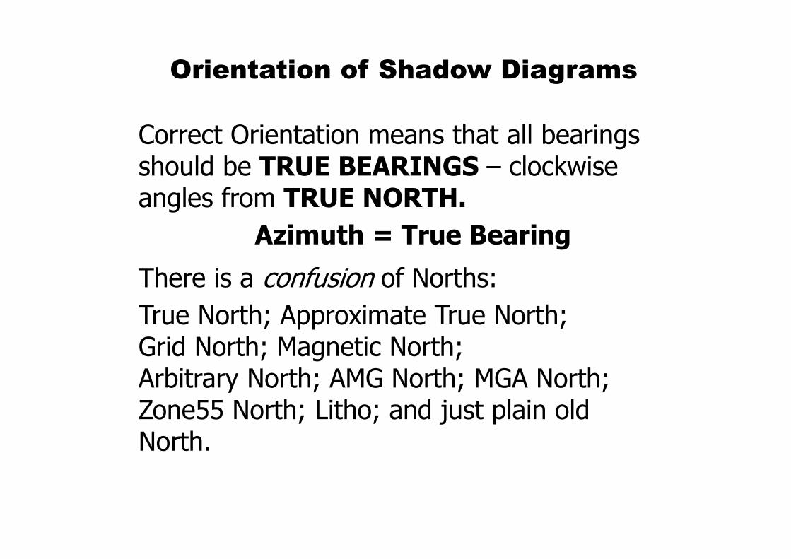
Orientation of Shadow Diagrams
Correct Orientation means that all bearings should be TRUE BEARINGS – clockwise angles from TRUE NORTH.
Azimuth = True Bearing
There is a confusion of Norths:
True North; Approximate True North; Grid North; Magnetic North; Arbitrary North; AMG North; MGA North; Zone55 North; Litho; and just plain old North.
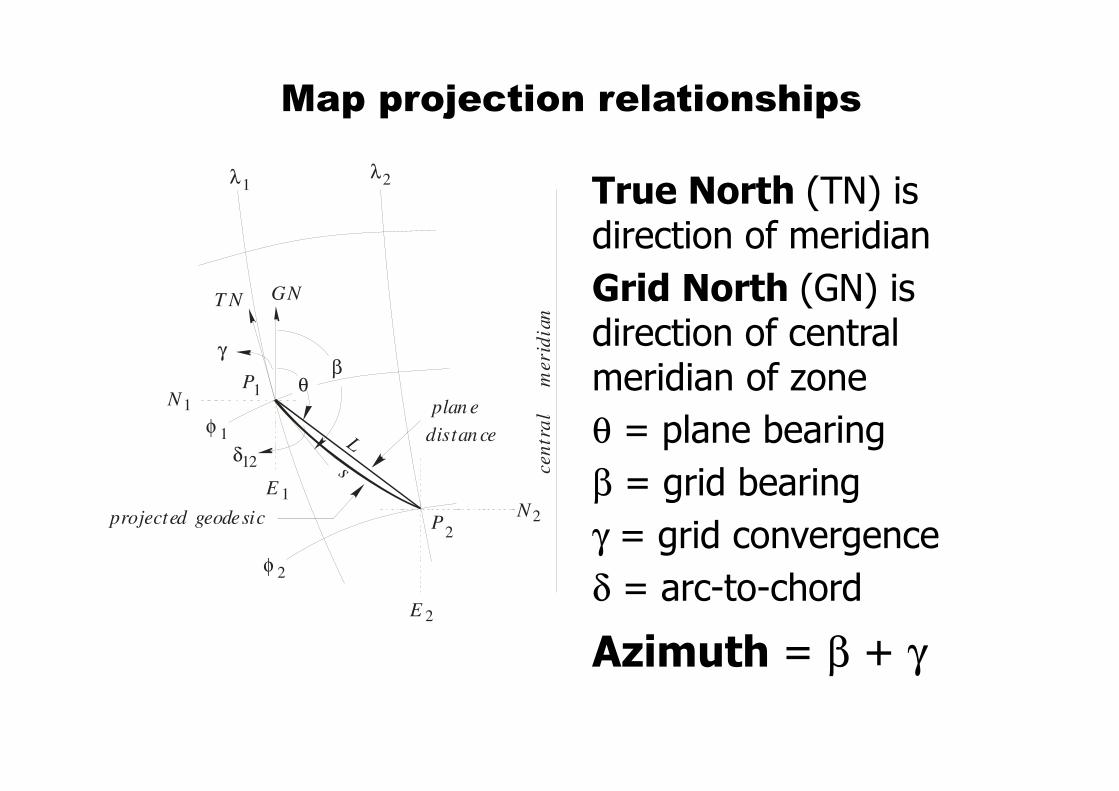
Map projection relationships
True North (TN) is direction of meridian
Grid North (GN) is direction of central meridian of zone
θ = plane bearing
β = grid bearing
γ = grid convergence
δ = arc-to-chord
Azimuth = β + γ
λ
φ
cen
tra
l
merid
ian
GNT N
γ
s
L
θβ
projected geodesic
plan e
distan ce
1λ2
1
φ 2
P2
P1
N
N
2
1
E
E
2
1
δ12
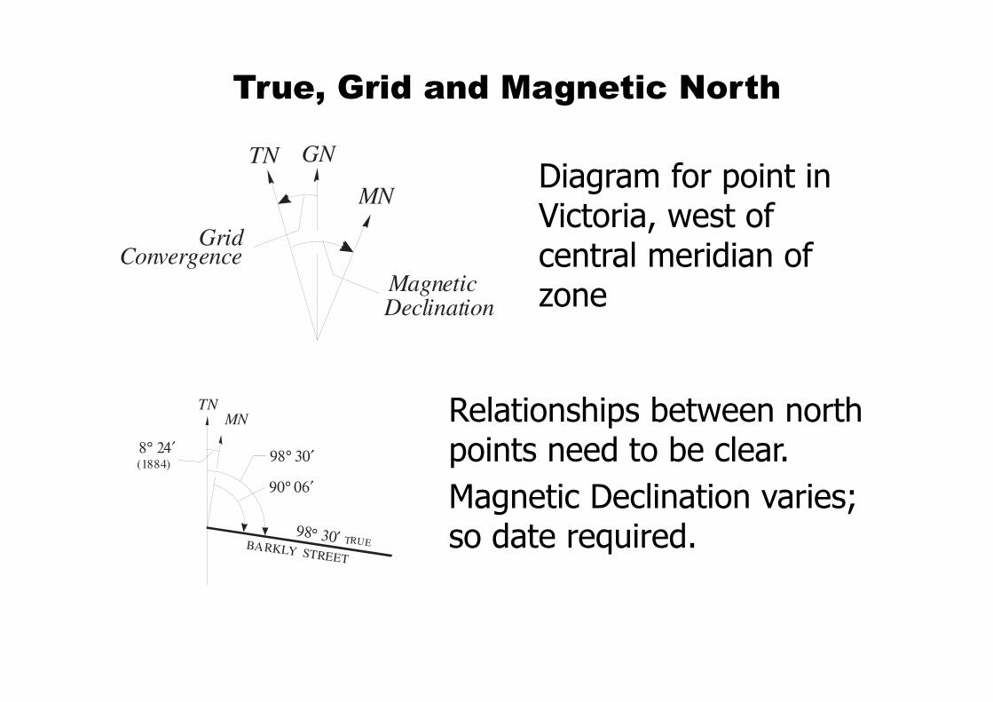
True, Grid and Magnetic North
Relationships between north points need to be clear.
Magnetic Declination varies; so date required.
TN GN
MN
DeclinationMagnetic
GridConvergence
Diagram for point in Victoria, west of central meridian of zone
TNMN
BARKLY STREET
98° 30′
8° 24′ (1884)
TRUE
90° 06′
98° 30′
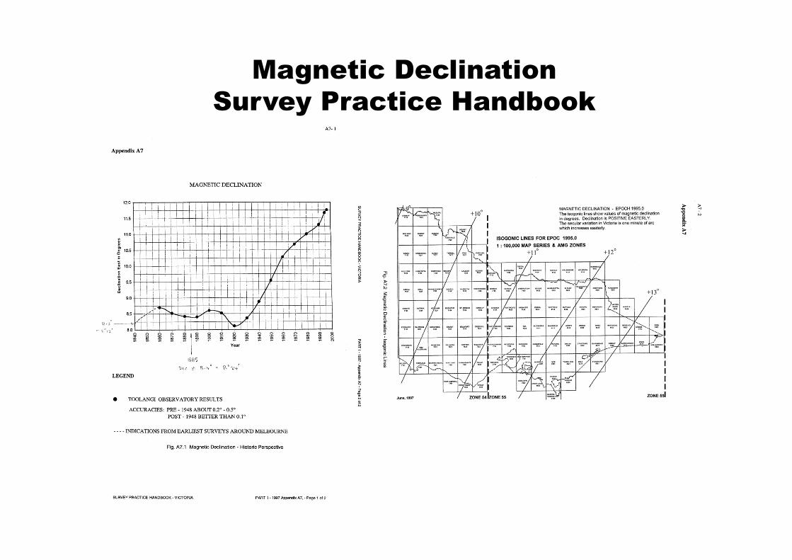
Magnetic Declination
Survey Practice Handbook
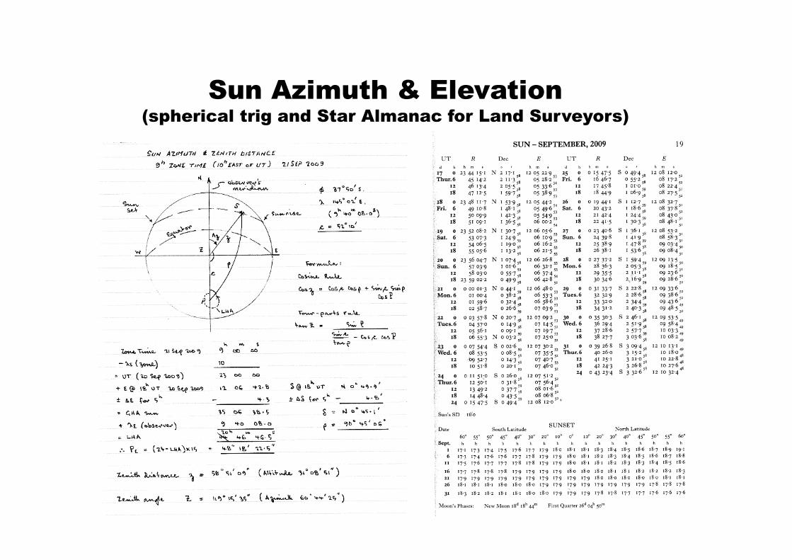
Sun Azimuth & Elevation(spherical trig and Star Almanac for Land Surveyors)
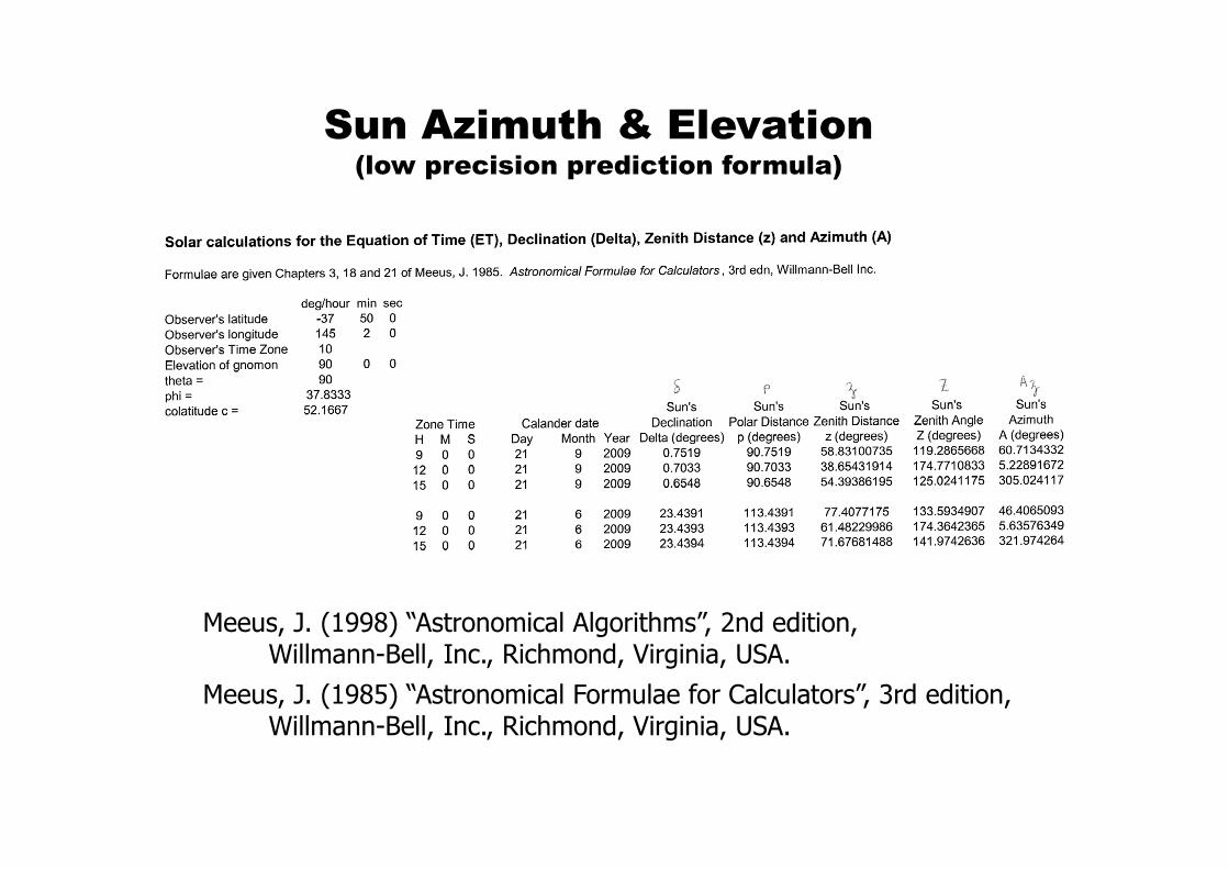
Sun Azimuth & Elevation(low precision prediction formula)
Meeus, J. (1998) “Astronomical Algorithms”, 2nd edition,Willmann-Bell, Inc., Richmond, Virginia, USA.
Meeus, J. (1985) “Astronomical Formulae for Calculators”, 3rd edition,Willmann-Bell, Inc., Richmond, Virginia, USA.
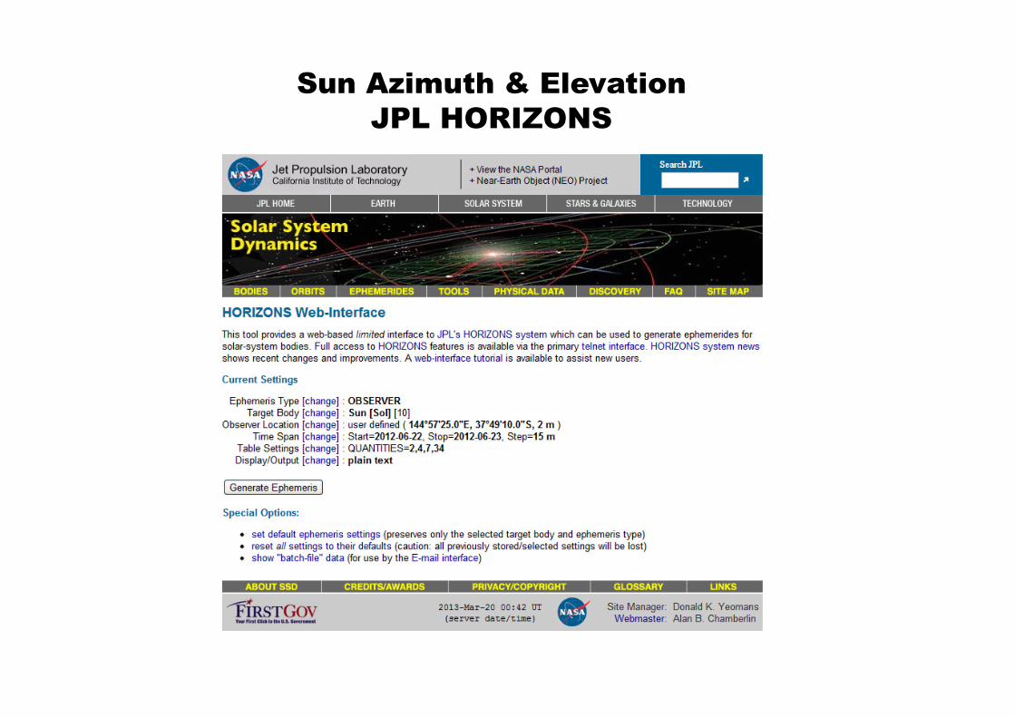
Sun Azimuth & Elevation
JPL HORIZONS
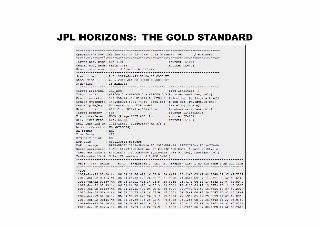
JPL HORIZONS: THE GOLD STANDARD
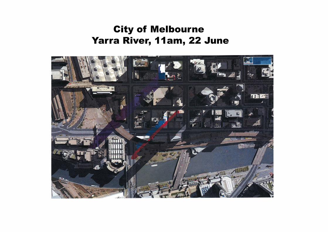
City of Melbourne
Yarra River, 11am, 22 June
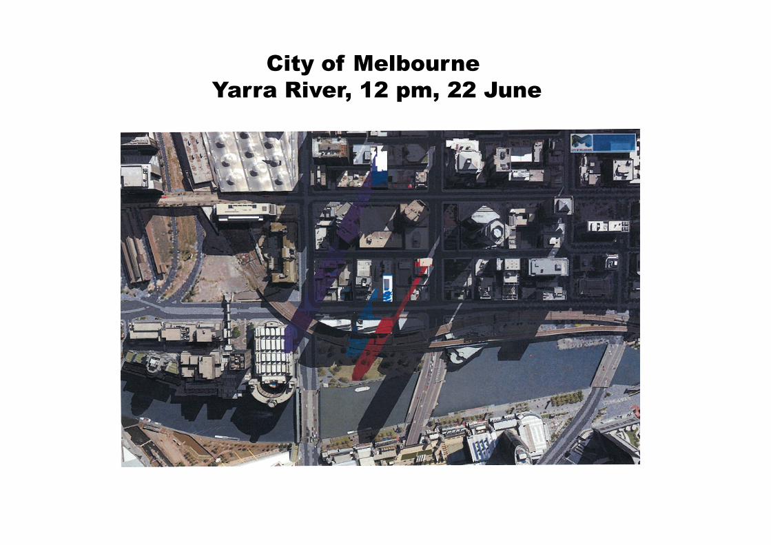
City of Melbourne
Yarra River, 12 pm, 22 June
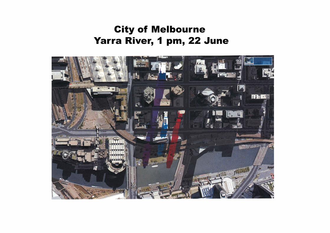
City of Melbourne
Yarra River, 1 pm, 22 June
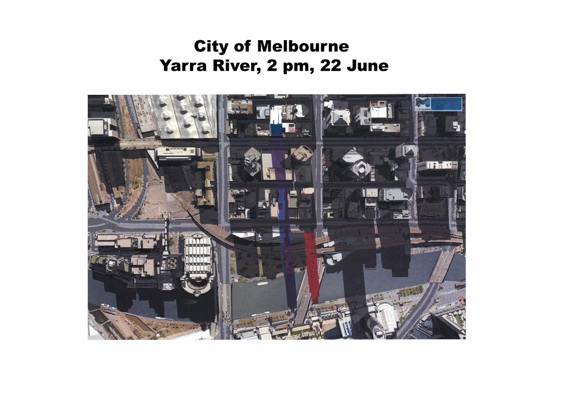
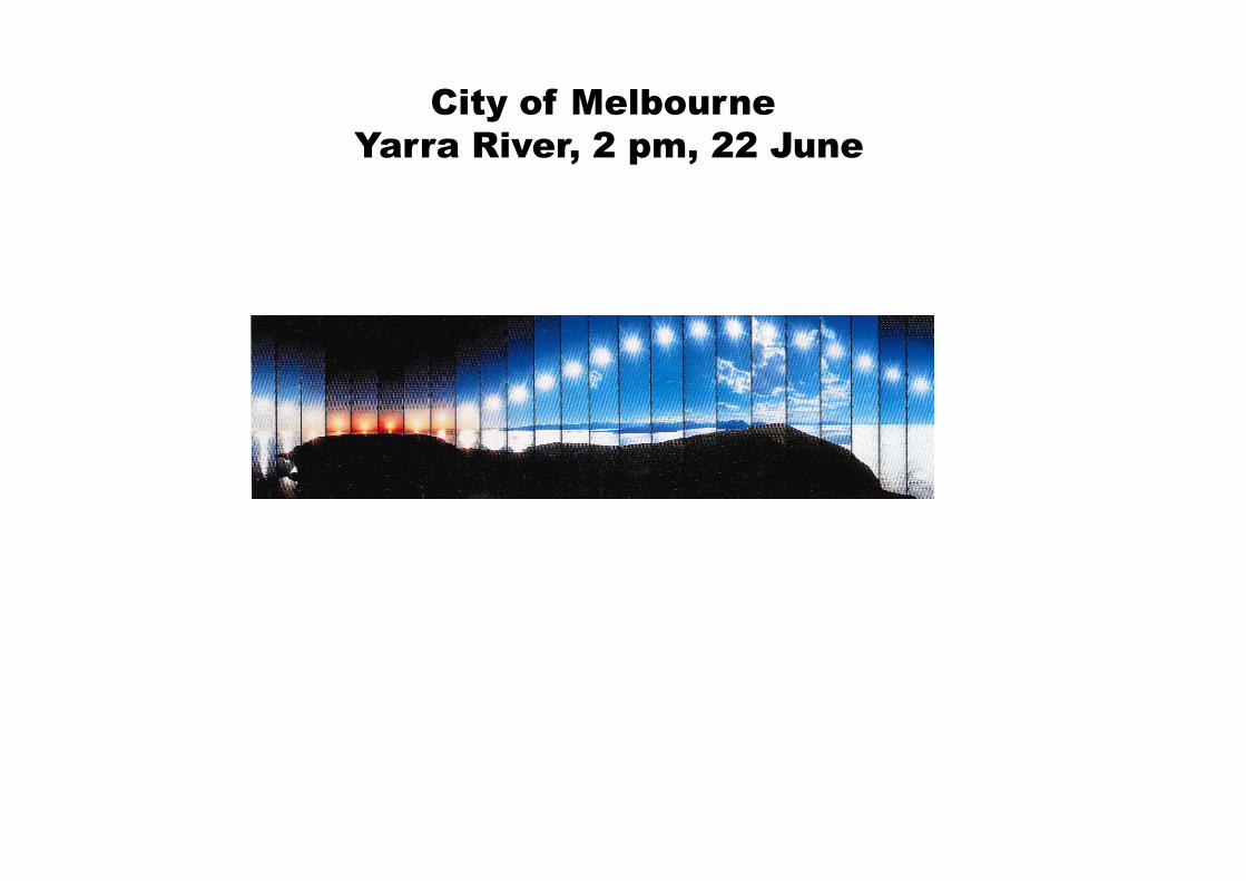
City of Melbourne
Yarra River, 2 pm, 22 June
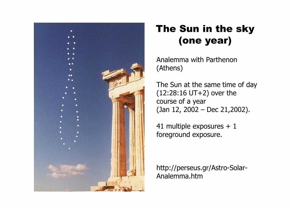
The Sun in the sky
(one year)
Analemma with Parthenon (Athens)
The Sun at the same time of day (12:28:16 UT+2) over the course of a year (Jan 12, 2002 – Dec 21,2002).
41 multiple exposures + 1 foreground exposure.
http://perseus.gr/Astro-Solar-Analemma.htm
City of Melbourne
Yarra River, 2 pm, 22 June