Embed Size (px)
Citation preview
1
Guadalupe Watershed Model
Year 1 Progress ReportSPLWG Meeting May 14th 2008
John Oram, Lester McKee, Michelle Lent
Item #3b
2
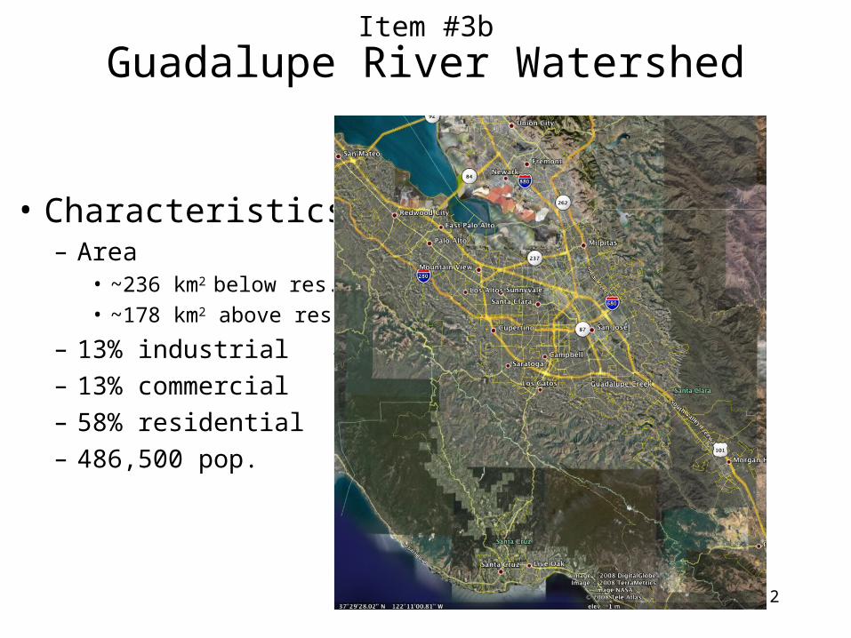
Guadalupe River Watershed
• Characteristics– Area
• ~236 km2 below res.• ~178 km2 above res.
– 13% industrial– 13% commercial– 58% residential– 486,500 pop.
Item #3b
3
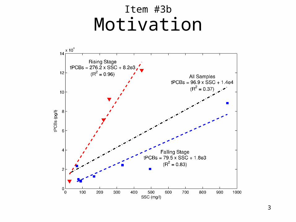
MotivationItem #3b
4
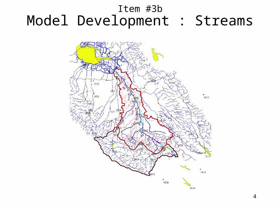
Model Development : StreamsItem #3b
5
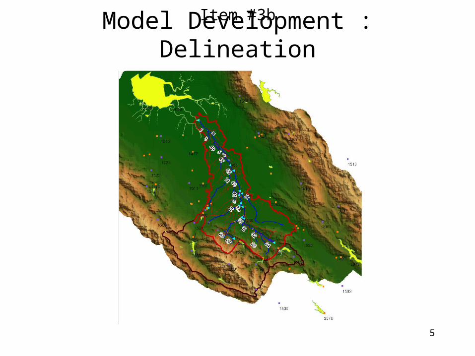
Model Development : DelineationItem #3b
6
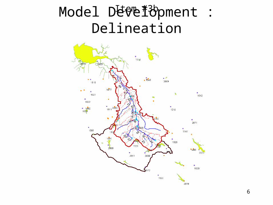
Model Development : DelineationItem #3b
7
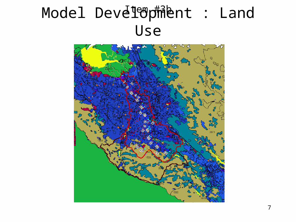
Model Development : Land UseItem #3b
8
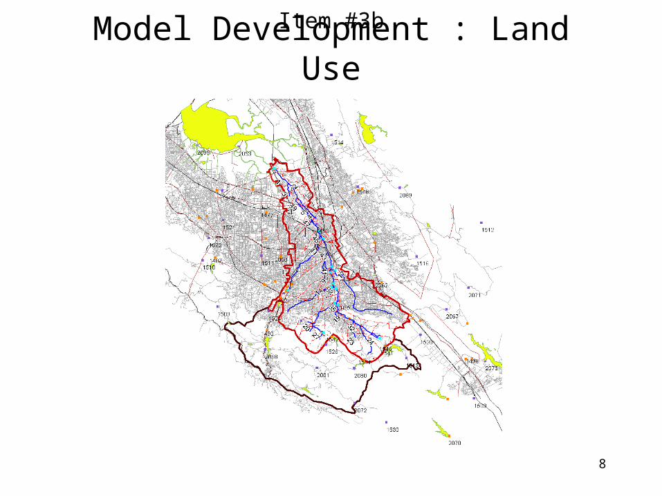
Model Development : Land UseItem #3b
9
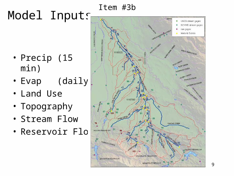
Model Inputs
• Precip (15 min)• Evap (daily)• Land Use• Topography• Stream Flow• Reservoir Flow
Item #3b
10
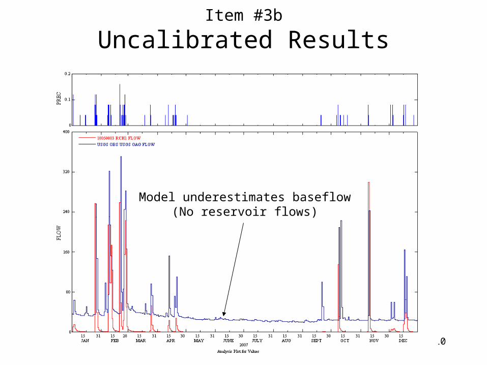
Uncalibrated Results
Model underestimates baseflow(No reservoir flows)
Item #3b

11
Uncalibrated Results : Reservoir Flows
Item #3b
12
Next Steps
• Add additional precip stations• Add reservoir flows• Calibrate & validate• Run scenarios
– Determine lag times– Long-term water budget– Others?
Item #3b