Embed Size (px)
Citation preview

Question number
Indicative content
1(b) AO1 (3 marks)/AO2 (9 marks)Marking instructions
Markers must apply the descriptors in line with the general marking guidance and the qualities outlined in the levels-based mark scheme below.
Responses that demonstrate only AO1 without any AO2 should be awarded marks as follows:
• Level 1 AO1 performance: 1 mark• Level 2 AO1 performance: 2 marks• Level 3 AO1 performance: 3 marks.
Indicative content guidance
The indicative content below is not prescriptive and candidates are not required to include all of it. Other relevant material not suggested below must also be credited. Relevant points may include:
AO1
• mega-disasters are large-scale disasters on either an areal scale or in terms of their economic and human impact
• they pose serious problems for successful management to minimise impact and mitigate the impact of the disaster
• they need often require international management both short term and longer term
AO2
• extreme events are likely to pose serious challenges for any governance, however well-planned, e.g. the 2011 Japanese tsunami
• extreme events are by their nature unpredictable (1- in a 1000-year events) and so prediction is difficult and prevention is impossible, sometimes secondary and tertiary outcomes occur, e.g. Fukushima
• disaster management, pre-, during and after the event, can have a significant impact on losses, e.g. comparison of Japanese tsunami with Indian Ocean, Boxing Day tsunami
• strong governance can lead to very effective management of immediate disaster recovery, e.g. Sichuan earthquake in China, as well as the development of longer-term education and community preparation strategies
• however, management is expensive and with long return intervals there are strains on budgets that may affect levels of investment, e.g. San Francisco and ‘the big one’
• democratic governance is also often driven by short-term budgetary constraints which make saving money on management measures very tempting, given that it is expensive
• governance is important but it has limitations such as the affordability of prediction and prevention measures, especially in the management of mega-disasters immediately after the event, e.g. Haiti, therefore,
Question number
Indicative content
other factors such as level of development are likely to be more important.
Level Mark Descriptor
0 No rewardable material.
Level 1 1–4
• Demonstrates isolated elements of geographical knowledge and understanding, some of which may be inaccurate or irrelevant. (AO1)
• Applies knowledge and understanding of geographical information/ideas, making limited logical connections/relationships. (AO2)
• Applies knowledge and understanding of geographical information/ideas to produce an interpretation with limited relevance and/or support. (AO2)
• Applies knowledge and understanding of geographical information/ideas to make unsupported or generic judgements about the significance of few factors, leading to an argument is unbalanced or lacks coherence. (AO2)
Level 2 5-8 • Demonstrates geographical knowledge and understanding, which is mostly relevant and may include some inaccuracies. (AO1)
• Applies knowledge and understanding of geographical information/ideas logically, making some relevant connections/relationships. (AO2)
• Applies knowledge and understanding of geographical information/ideas to produce a partial but coherent interpretation that is mostly relevant and supported by evidence. (AO2)
• Applies knowledge and understanding of geographical information/ideas to make judgements about the significance of some factors, to produce an argument that may be unbalanced or partially coherent. (AO2)
Level 3 9-12 • Demonstrates accurate and relevant geographical knowledge and understanding throughout. (AO1)
• Applies knowledge and understanding of geographical information/ideas logically, making relevant connections/relationships. (AO2)
• Applies knowledge and understanding of geographical information/ideas to produce a full and coherent interpretation that is relevant and supported by evidence. (AO2)
• Applies knowledge and understanding of geographical information/ideas to make supported judgements about the significance of factors throughout the response, leading to a balanced and coherent argument. (AO2)
34 Pearson Edexcel Level 3 Advanced GCE in Geography – Sample Assessment Materials – Issue 2 – February 2017 © Pearson Education Limited 2017
PMT

Question number
Indicative content
1(b) AO1 (3 marks)/AO2 (9 marks)Marking instructions
Markers must apply the descriptors in line with the general marking guidance and the qualities outlined in the levels-based mark scheme below.
Responses that demonstrate only AO1 without any AO2 should be awarded marks as follows:
• Level 1 AO1 performance: 1 mark• Level 2 AO1 performance: 2 marks• Level 3 AO1 performance: 3 marks.
Indicative content guidance
The indicative content below is not prescriptive and candidates are not required to include all of it. Other relevant material not suggested below must also be credited. Relevant points may include:
AO1
• mega-disasters are large-scale disasters on either an areal scale or in terms of their economic and human impact
• they pose serious problems for successful management to minimise impact and mitigate the impact of the disaster
• they need often require international management both short term and longer term
AO2
• extreme events are likely to pose serious challenges for any governance, however well-planned, e.g. the 2011 Japanese tsunami
• extreme events are by their nature unpredictable (1- in a 1000-year events) and so prediction is difficult and prevention is impossible, sometimes secondary and tertiary outcomes occur, e.g. Fukushima
• disaster management, pre-, during and after the event, can have a significant impact on losses, e.g. comparison of Japanese tsunami with Indian Ocean, Boxing Day tsunami
• strong governance can lead to very effective management of immediate disaster recovery, e.g. Sichuan earthquake in China, as well as the development of longer-term education and community preparation strategies
• however, management is expensive and with long return intervals there are strains on budgets that may affect levels of investment, e.g. San Francisco and ‘the big one’
• democratic governance is also often driven by short-term budgetary constraints which make saving money on management measures very tempting, given that it is expensive
• governance is important but it has limitations such as the affordability of prediction and prevention measures, especially in the management of mega-disasters immediately after the event, e.g. Haiti, therefore,
Question number
Indicative content
other factors such as level of development are likely to be more important.
Level Mark Descriptor
0 No rewardable material.
Level 1 1–4
• Demonstrates isolated elements of geographical knowledge and understanding, some of which may be inaccurate or irrelevant. (AO1)
• Applies knowledge and understanding of geographical information/ideas, making limited logical connections/relationships. (AO2)
• Applies knowledge and understanding of geographical information/ideas to produce an interpretation with limited relevance and/or support. (AO2)
• Applies knowledge and understanding of geographical information/ideas to make unsupported or generic judgements about the significance of few factors, leading to an argument is unbalanced or lacks coherence. (AO2)
Level 2 5-8 • Demonstrates geographical knowledge and understanding, which is mostly relevant and may include some inaccuracies. (AO1)
• Applies knowledge and understanding of geographical information/ideas logically, making some relevant connections/relationships. (AO2)
• Applies knowledge and understanding of geographical information/ideas to produce a partial but coherent interpretation that is mostly relevant and supported by evidence. (AO2)
• Applies knowledge and understanding of geographical information/ideas to make judgements about the significance of some factors, to produce an argument that may be unbalanced or partially coherent. (AO2)
Level 3 9-12 • Demonstrates accurate and relevant geographical knowledge and understanding throughout. (AO1)
• Applies knowledge and understanding of geographical information/ideas logically, making relevant connections/relationships. (AO2)
• Applies knowledge and understanding of geographical information/ideas to produce a full and coherent interpretation that is relevant and supported by evidence. (AO2)
• Applies knowledge and understanding of geographical information/ideas to make supported judgements about the significance of factors throughout the response, leading to a balanced and coherent argument. (AO2)
35Pearson Edexcel Level 3 Advanced GCE in Geography – Sample Assessment Materials – Issue 2 – February 2017 © Pearson Education Limited 2017
PMT
Question number
Answer
2(a) AO1 (3 marks)/AO2 (3 marks)Marking instructions
Markers must apply the descriptors in line with the general marking guidance and the qualities outlined in the levels-based mark scheme below.
Indicative content guidance
The indicative content below is not prescriptive and candidates are not required to include all of it. Other relevant material not suggested below must also be credited. Relevant points may include:
AO1
• meltwater creates both erosional features and depositional features
• depositional features dominate and tend to produce plains of outwash material, as water slows down and deposits its load
• the features are inevitably complex and mixed with glacial features which are frequently modified by meltwater
AO2
• the meltwater from the proglacial lake may spill through the lower ground between ice front and higher ground carving a meltwater channel
• the layers of material on the lake floor will be varved deposits as alternate winter and summer melting leads to banded deposits forming on the lake floor – little deposition in winter, much more in summer
• The proglacial lake’s shoreline may have kames and terraces where it juxtaposes higher ground
• There are signs of a kame delta where the ice front is in contact with the proglacial lake
• There are discreet lumps of ice partially buried in the Outwash Plain when these melt they will form kettle holes which become kettle lakes in post-glacial times
• The extensive proglacial flat area or outwash; plain is also known as sandur is formed from coarser, sandy deposits carried outwards from the edge of an ice sheet by anastomosing/braided meltwater streams that will have highly variable discharge and capacity
Level Mark Descriptor
0 No rewardable material.
Level 1 1–2 • Demonstrates isolated or generic elements of geographical knowledge and understanding, some of which may be inaccurate or irrelevant. (AO1)
• Applies knowledge and understanding to geographical information inconsistently. Connections/relationships between stimulus material and the question may be irrelevant. (AO2)
Level 2 3–4 • Demonstrates geographical knowledge and understanding, which is mostly relevant and may include some inaccuracies. (AO1)
• Applies knowledge and understanding to geographical information to find some relevant connections/relationships between stimulus material and the question. (AO2)
Level 3 5–6 • Demonstrates accurate and relevant geographical knowledge and understanding throughout. (AO1)
• Applies knowledge and understanding to geographical information logically to find fully relevant connections/relationships between stimulus material and the question. (AO2)
36 Pearson Edexcel Level 3 Advanced GCE in Geography – Sample Assessment Materials – Issue 2 – February 2017 © Pearson Education Limited 2017
PMT

Question number
Answer
2(a) AO1 (3 marks)/AO2 (3 marks)Marking instructions
Markers must apply the descriptors in line with the general marking guidance and the qualities outlined in the levels-based mark scheme below.
Indicative content guidance
The indicative content below is not prescriptive and candidates are not required to include all of it. Other relevant material not suggested below must also be credited. Relevant points may include:
AO1
• meltwater creates both erosional features and depositional features
• depositional features dominate and tend to produce plains of outwash material, as water slows down and deposits its load
• the features are inevitably complex and mixed with glacial features which are frequently modified by meltwater
AO2
• the meltwater from the proglacial lake may spill through the lower ground between ice front and higher ground carving a meltwater channel
• the layers of material on the lake floor will be varved deposits as alternate winter and summer melting leads to banded deposits forming on the lake floor – little deposition in winter, much more in summer
• The proglacial lake’s shoreline may have kames and terraces where it juxtaposes higher ground
• There are signs of a kame delta where the ice front is in contact with the proglacial lake
• There are discreet lumps of ice partially buried in the Outwash Plain when these melt they will form kettle holes which become kettle lakes in post-glacial times
• The extensive proglacial flat area or outwash; plain is also known as sandur is formed from coarser, sandy deposits carried outwards from the edge of an ice sheet by anastomosing/braided meltwater streams that will have highly variable discharge and capacity
Level Mark Descriptor
0 No rewardable material.
Level 1 1–2 • Demonstrates isolated or generic elements of geographical knowledge and understanding, some of which may be inaccurate or irrelevant. (AO1)
• Applies knowledge and understanding to geographical information inconsistently. Connections/relationships between stimulus material and the question may be irrelevant. (AO2)
Level 2 3–4 • Demonstrates geographical knowledge and understanding, which is mostly relevant and may include some inaccuracies. (AO1)
• Applies knowledge and understanding to geographical information to find some relevant connections/relationships between stimulus material and the question. (AO2)
Level 3 5–6 • Demonstrates accurate and relevant geographical knowledge and understanding throughout. (AO1)
• Applies knowledge and understanding to geographical information logically to find fully relevant connections/relationships between stimulus material and the question. (AO2)
37Pearson Edexcel Level 3 Advanced GCE in Geography – Sample Assessment Materials – Issue 2 – February 2017 © Pearson Education Limited 2017
PMT

Question number
Answer
2(b) AO1 – (3 marks)/AO2 – (3 marks)Marking instructions
Markers must apply the descriptors in line with the general marking guidance and the qualities outlined in the levels-based mark scheme below.
Indicative content guidance
The indicative content below is not prescriptive and candidates are not required to include all of it. Other relevant material not suggested below must also be credited. Relevant points may include:
AO1
• till fabric analysis reveals details both of ice direction and the provenance of the ice through the presence of erratics
• the alignment of drumlins and other sub-glacial features reveals evidence of the speed and direction of ice flow
• the position of marginal fluvioglacial (kames) and glacial (lateral moraines) affords evidence of ice thickness via trim lines
• micro-features such as chatter marks and rock striations give important evidence of ice direction and speed
• distinctions between ablation and lodgement till give evidence of ice speed and direction
AO2
• recessional and terminal moraines in Figure 2B shows the history of ice extent and retreat on this landscape
• ground moraine on Figure 2B made up of till is widely distributed wherever ice has been
• drumlin ‘field’ on Figure 2B also made up of till and extent limited by terminal moraine marking limit to impact of moving ice
• fluvioglacial landforms, e.g sandur on Figure 2B can give evidence of the direction of meltwater, as the material is horizontally sorted with the largest deposits at the snout.
Level Mark Descriptor
0 No rewardable material.
Level 1 1–2 • Demonstrates isolated or generic elements of geographical knowledge and understanding, some of which may be inaccurate or irrelevant. (AO1)
• Applies knowledge and understanding to geographical information inconsistently. Connections/relationships between stimulus material and the question may be irrelevant. (AO2)
Level 2 3–4 • Demonstrates geographical knowledge and understanding, which is mostly relevant and may include some inaccuracies. (AO1)
• Applies knowledge and understanding to geographical information to find some relevant connections/relationships between stimulus material and the question. (AO2)
Level 3 5–6 • Demonstrates accurate and relevant geographical knowledge and understanding throughout. (AO1)
• Applies knowledge and understanding to geographical information logically to find fully relevant connections/relationships between stimulus material and the question. (AO2)
38 Pearson Edexcel Level 3 Advanced GCE in Geography – Sample Assessment Materials – Issue 2 – February 2017 © Pearson Education Limited 2017
PMT
Question number
Answer
2(b) AO1 – (3 marks)/AO2 – (3 marks)Marking instructions
Markers must apply the descriptors in line with the general marking guidance and the qualities outlined in the levels-based mark scheme below.
Indicative content guidance
The indicative content below is not prescriptive and candidates are not required to include all of it. Other relevant material not suggested below must also be credited. Relevant points may include:
AO1
• till fabric analysis reveals details both of ice direction and the provenance of the ice through the presence of erratics
• the alignment of drumlins and other sub-glacial features reveals evidence of the speed and direction of ice flow
• the position of marginal fluvioglacial (kames) and glacial (lateral moraines) affords evidence of ice thickness via trim lines
• micro-features such as chatter marks and rock striations give important evidence of ice direction and speed
• distinctions between ablation and lodgement till give evidence of ice speed and direction
AO2
• recessional and terminal moraines in Figure 2B shows the history of ice extent and retreat on this landscape
• ground moraine on Figure 2B made up of till is widely distributed wherever ice has been
• drumlin ‘field’ on Figure 2B also made up of till and extent limited by terminal moraine marking limit to impact of moving ice
• fluvioglacial landforms, e.g sandur on Figure 2B can give evidence of the direction of meltwater, as the material is horizontally sorted with the largest deposits at the snout.
Level Mark Descriptor
0 No rewardable material.
Level 1 1–2 • Demonstrates isolated or generic elements of geographical knowledge and understanding, some of which may be inaccurate or irrelevant. (AO1)
• Applies knowledge and understanding to geographical information inconsistently. Connections/relationships between stimulus material and the question may be irrelevant. (AO2)
Level 2 3–4 • Demonstrates geographical knowledge and understanding, which is mostly relevant and may include some inaccuracies. (AO1)
• Applies knowledge and understanding to geographical information to find some relevant connections/relationships between stimulus material and the question. (AO2)
Level 3 5–6 • Demonstrates accurate and relevant geographical knowledge and understanding throughout. (AO1)
• Applies knowledge and understanding to geographical information logically to find fully relevant connections/relationships between stimulus material and the question. (AO2)
39Pearson Edexcel Level 3 Advanced GCE in Geography – Sample Assessment Materials – Issue 2 – February 2017 © Pearson Education Limited 2017
PMT

Question number
Answer
2 (c) AO1 – (8 marks)Marking instructions
Markers must apply the descriptors in line with the general marking guidance and the qualities outlined in the levels-based mark scheme below.
Indicative content guidance
The indicative content below is not prescriptive and candidates are notrequired to include all of it. Other relevant material not suggested below must also be credited. Relevant points may include:
• systems consist of inputs, stores and outputs
• inputs include accumulation from direct snowfall and other precipitation, blown snow and avalanches
• store is the quantity of glacier ice that can be transferred down valley to the snout
• outputs result from ablation by melting, sublimation and calving
• mass balance results from the gains and losses in the ice store and is the difference between inputs and outputs
• in a positive net balance, inputs are greater than outputs and in a negative net balance, outputs are greater than inputs
• short-term, mass balances vary over a year and their cumulative impact longer term will determine whether the store will increase and the glacier advance or whether the store will decrease and the glacier decrease in size/retreat
• systems help the understanding of glacier behaviour.
Level Mark Descriptor
0 No rewardable material.
Level 1 1–2 • Demonstrates isolated elements of geographical knowledge and understanding, some of which may be inaccurate or irrelevant. (AO1)
• Understanding addresses a narrow range of geographical ideas, which lack detail. (AO1)
Level 2 3–5 • Demonstrates geographical knowledge and understanding, which is mostly relevant and may include some inaccuracies. (AO1)
• Understanding addresses a range of geographical ideas, which are not fully detailed and/or developed. (AO1)
Level 3 6–8 • Demonstrates accurate and relevant geographical knowledge and understanding throughout. (AO1)
• Understanding addresses a broad range of geographical ideas, which are detailed and fully developed. (AO1)
40 Pearson Edexcel Level 3 Advanced GCE in Geography – Sample Assessment Materials – Issue 2 – February 2017 © Pearson Education Limited 2017
PMT

Question number
Answer
2 (c) AO1 – (8 marks)Marking instructions
Markers must apply the descriptors in line with the general marking guidance and the qualities outlined in the levels-based mark scheme below.
Indicative content guidance
The indicative content below is not prescriptive and candidates are notrequired to include all of it. Other relevant material not suggested below must also be credited. Relevant points may include:
• systems consist of inputs, stores and outputs
• inputs include accumulation from direct snowfall and other precipitation, blown snow and avalanches
• store is the quantity of glacier ice that can be transferred down valley to the snout
• outputs result from ablation by melting, sublimation and calving
• mass balance results from the gains and losses in the ice store and is the difference between inputs and outputs
• in a positive net balance, inputs are greater than outputs and in a negative net balance, outputs are greater than inputs
• short-term, mass balances vary over a year and their cumulative impact longer term will determine whether the store will increase and the glacier advance or whether the store will decrease and the glacier decrease in size/retreat
• systems help the understanding of glacier behaviour.
Level Mark Descriptor
0 No rewardable material.
Level 1 1–2 • Demonstrates isolated elements of geographical knowledge and understanding, some of which may be inaccurate or irrelevant. (AO1)
• Understanding addresses a narrow range of geographical ideas, which lack detail. (AO1)
Level 2 3–5 • Demonstrates geographical knowledge and understanding, which is mostly relevant and may include some inaccuracies. (AO1)
• Understanding addresses a range of geographical ideas, which are not fully detailed and/or developed. (AO1)
Level 3 6–8 • Demonstrates accurate and relevant geographical knowledge and understanding throughout. (AO1)
• Understanding addresses a broad range of geographical ideas, which are detailed and fully developed. (AO1)
41Pearson Edexcel Level 3 Advanced GCE in Geography – Sample Assessment Materials – Issue 2 – February 2017 © Pearson Education Limited 2017
PMT

Question number
Answer
2(d) AO1 (5 marks)/AO2 (15 marks)Marking instructions
Markers must apply the descriptors in line with the general marking guidance and the qualities outlined in the levels-based mark scheme below.
Responses that demonstrate only AO1 without any AO2 should be awarded marks as follows:
• Level 1 AO1 performance: 1 mark• Level 2 AO1 performance: 2 marks• Level 3 AO1 performance: 3 marks.• Level 4 AO1 performance: 4–5 marks.
Indicative content guidance
The indicative content below is not prescriptive and candidates are not required to include all of it. Other relevant material not suggested below must also be credited. Relevant points may include:
AO1
• periglacial landscapes both active and relict are widely distributed and include substantial areas of permafrost
• glaciated landscapes both active and relict include both upland and lowland landscapes formed by a variety of ice mass
• both periglacial and glaciated landscapes can occur as active and relict environments
• climate change will lead to increases in temperature and changes in precipitation, which will impact on both the size and movement of active glaciers and the occurrence of permafrost
AO2
• vulnerability suggests change – in this context, shorter term change over time
• all landscapes change over time without environmental change, simply through the long-term operation of denudational processes
• there is a wide variety of both glaciated and periglacial landscapes thatwill be subject to change, to a greater or lesser degree
• the degree of change can be related not only to the type of landscape but also to the scale and pace of climate change
• the impacts of climate change are difficult to predict and there are significant regional variations that will impact on these landscapes accordingly, with some of the most significant impacts occurring in both Polar and Alpine environments
• mountain landscapes are inherently more fragile than lowland landscapes simply through gravity, so will be more sensitive to changes in climate than lowland regions
• short-term climate changes are less likely to affect relict glacial and periglacial landscapes in the sense that there will be modifications rather than dramatic change, such as periglacial processes
Question number
Answer
• active periglacial and active glacial areas will show much more substantial landscape changes although in the case of periglaciallandscapes, these will not translate into such dramatic surface changes.
Level Mark Descriptor
0 No rewardable material.
Level 1 1–5 • Demonstrates isolated elements of geographical knowledge and understanding, some of which may be inaccurate or irrelevant. (AO1)
• Applies knowledge and understanding of geographical ideas, making limited and rarely logical connections/relationships. (AO2)
• Applies knowledge and understanding of geographical information/ideas to produce an interpretation with limitedcoherence and support from evidence. (AO2)
• Applies knowledge and understanding of geographical information/ideas to produce an unsupported or generic conclusion, drawn from an argument that is unbalanced or lacks coherence. (AO2)
Level 2 6–10 • Demonstrates geographical knowledge and understanding, which is occasionally relevant and may include some inaccuracies. (AO1)
• Applies knowledge and understanding of geographical information/ideas with limited but logical connections/relationships. (AO2)
• Applies knowledge and understanding of geographical ideas in order to produce a partial interpretation that is supported by some evidence but has limited coherence. (AO2)
• Applies knowledge and understanding of geographical information/ideas to come to a conclusion, partially supported by an unbalanced argument with limited coherence. (AO2)
Level 3 11–15 • Demonstrates geographical knowledge and understanding, which is mostly relevant and accurate. (AO1)
• Applies knowledge and understanding of geographical information/ideas to find some logical and relevant connections/relationships. (AO2)
• Applies knowledge and understanding of geographical ideas in order to produce a partial but coherent interpretation that is supported by some evidence. (AO2)
• Applies knowledge and understanding of geographical information/ideas to come to a conclusion, largely supported by an argument that may be unbalanced or partially coherent. (AO2)
42 Pearson Edexcel Level 3 Advanced GCE in Geography – Sample Assessment Materials – Issue 2 – February 2017 © Pearson Education Limited 2017
PMT

Question number
Answer
2(d) AO1 (5 marks)/AO2 (15 marks)Marking instructions
Markers must apply the descriptors in line with the general marking guidance and the qualities outlined in the levels-based mark scheme below.
Responses that demonstrate only AO1 without any AO2 should be awarded marks as follows:
• Level 1 AO1 performance: 1 mark• Level 2 AO1 performance: 2 marks• Level 3 AO1 performance: 3 marks.• Level 4 AO1 performance: 4–5 marks.
Indicative content guidance
The indicative content below is not prescriptive and candidates are not required to include all of it. Other relevant material not suggested below must also be credited. Relevant points may include:
AO1
• periglacial landscapes both active and relict are widely distributed and include substantial areas of permafrost
• glaciated landscapes both active and relict include both upland and lowland landscapes formed by a variety of ice mass
• both periglacial and glaciated landscapes can occur as active and relict environments
• climate change will lead to increases in temperature and changes in precipitation, which will impact on both the size and movement of active glaciers and the occurrence of permafrost
AO2
• vulnerability suggests change – in this context, shorter term change over time
• all landscapes change over time without environmental change, simply through the long-term operation of denudational processes
• there is a wide variety of both glaciated and periglacial landscapes thatwill be subject to change, to a greater or lesser degree
• the degree of change can be related not only to the type of landscape but also to the scale and pace of climate change
• the impacts of climate change are difficult to predict and there are significant regional variations that will impact on these landscapes accordingly, with some of the most significant impacts occurring in both Polar and Alpine environments
• mountain landscapes are inherently more fragile than lowland landscapes simply through gravity, so will be more sensitive to changes in climate than lowland regions
• short-term climate changes are less likely to affect relict glacial and periglacial landscapes in the sense that there will be modifications rather than dramatic change, such as periglacial processes
Question number
Answer
• active periglacial and active glacial areas will show much more substantial landscape changes although in the case of periglaciallandscapes, these will not translate into such dramatic surface changes.
Level Mark Descriptor
0 No rewardable material.
Level 1 1–5 • Demonstrates isolated elements of geographical knowledge and understanding, some of which may be inaccurate or irrelevant. (AO1)
• Applies knowledge and understanding of geographical ideas, making limited and rarely logical connections/relationships. (AO2)
• Applies knowledge and understanding of geographical information/ideas to produce an interpretation with limitedcoherence and support from evidence. (AO2)
• Applies knowledge and understanding of geographical information/ideas to produce an unsupported or generic conclusion, drawn from an argument that is unbalanced or lacks coherence. (AO2)
Level 2 6–10 • Demonstrates geographical knowledge and understanding, which is occasionally relevant and may include some inaccuracies. (AO1)
• Applies knowledge and understanding of geographical information/ideas with limited but logical connections/relationships. (AO2)
• Applies knowledge and understanding of geographical ideas in order to produce a partial interpretation that is supported by some evidence but has limited coherence. (AO2)
• Applies knowledge and understanding of geographical information/ideas to come to a conclusion, partially supported by an unbalanced argument with limited coherence. (AO2)
Level 3 11–15 • Demonstrates geographical knowledge and understanding, which is mostly relevant and accurate. (AO1)
• Applies knowledge and understanding of geographical information/ideas to find some logical and relevant connections/relationships. (AO2)
• Applies knowledge and understanding of geographical ideas in order to produce a partial but coherent interpretation that is supported by some evidence. (AO2)
• Applies knowledge and understanding of geographical information/ideas to come to a conclusion, largely supported by an argument that may be unbalanced or partially coherent. (AO2)
43Pearson Edexcel Level 3 Advanced GCE in Geography – Sample Assessment Materials – Issue 2 – February 2017 © Pearson Education Limited 2017
PMT

Level Mark Descriptor
Level 4 16–20 • Demonstrates accurate and relevant geographical knowledge and understanding throughout. (AO1)
• Applies knowledge and understanding of geographical information/ideas to find fully logical and relevant connections/relationships. (AO2)
• Applies knowledge and understanding of geographical information/ideas to produce a full and coherent interpretation that is supported by evidence. (AO2)
• Applies knowledge and understanding of geographical information/ideas to come to a rational, substantiated conclusion, fully supported by a balanced argument that is drawn together coherently. (AO2)
Questionnumber
Answer
3(a)(i) AO1 (3 marks)/AO2 (3 marks)Marking instructions
Markers must apply the descriptors in line with the general marking guidance and the qualities outlined in the levels-based mark scheme below.
Indicative content guidance
The indicative content below is not prescriptive and candidates are not required to include all of it. Other relevant material not suggested below must also be credited. Relevant points may include:
AO1
• cliff profiles are a consequence of wave attack, subaerial processes and the nature of the material
• wave action undercuts cliffs through abrasion and hydraulic action
• softer and more jointed rocks will erode more rapidly because of lower levels of physical strength and cohesion and smaller surface areas
• beaches can act as ‘shock absorbers’ to dissipate wave energy and protect cliff lines
AO2
• this cliff is low – about 6 metres and low angled, suggesting rapid erosion rates
• the boulder clay shown is a soft and relatively easily eroded material
• the impact of abrasion employing the large boulders, seen in the photograph, that are a consequence of erosion, will make cliff erosion very rapid
• there are clear signs of rotational slumping on the cliffs, suggesting that subaerial processes are significantly de-stabilised by wave action at the cliff base.
44 Pearson Edexcel Level 3 Advanced GCE in Geography – Sample Assessment Materials – Issue 2 – February 2017 © Pearson Education Limited 2017
PMT

Level Mark Descriptor
Level 4 16–20 • Demonstrates accurate and relevant geographical knowledge and understanding throughout. (AO1)
• Applies knowledge and understanding of geographical information/ideas to find fully logical and relevant connections/relationships. (AO2)
• Applies knowledge and understanding of geographical information/ideas to produce a full and coherent interpretation that is supported by evidence. (AO2)
• Applies knowledge and understanding of geographical information/ideas to come to a rational, substantiated conclusion, fully supported by a balanced argument that is drawn together coherently. (AO2)
Questionnumber
Answer
3(a)(i) AO1 (3 marks)/AO2 (3 marks)Marking instructions
Markers must apply the descriptors in line with the general marking guidance and the qualities outlined in the levels-based mark scheme below.
Indicative content guidance
The indicative content below is not prescriptive and candidates are not required to include all of it. Other relevant material not suggested below must also be credited. Relevant points may include:
AO1
• cliff profiles are a consequence of wave attack, subaerial processes and the nature of the material
• wave action undercuts cliffs through abrasion and hydraulic action
• softer and more jointed rocks will erode more rapidly because of lower levels of physical strength and cohesion and smaller surface areas
• beaches can act as ‘shock absorbers’ to dissipate wave energy and protect cliff lines
AO2
• this cliff is low – about 6 metres and low angled, suggesting rapid erosion rates
• the boulder clay shown is a soft and relatively easily eroded material
• the impact of abrasion employing the large boulders, seen in the photograph, that are a consequence of erosion, will make cliff erosion very rapid
• there are clear signs of rotational slumping on the cliffs, suggesting that subaerial processes are significantly de-stabilised by wave action at the cliff base.
45Pearson Edexcel Level 3 Advanced GCE in Geography – Sample Assessment Materials – Issue 2 – February 2017 © Pearson Education Limited 2017
PMT

Level Mark Descriptor
0 No rewardable material.
Level 1 1–2 • Demonstrates isolated or generic elements of geographical knowledge and understanding, some of which may be inaccurate or irrelevant. (AO1)
• Applies knowledge and understanding to geographical information inconsistently. Connections/relationships between stimulus material and the question may be irrelevant. (AO2)
Level 2 3–4 • Demonstrates geographical knowledge and understanding, which is mostly relevant and may include some inaccuracies. (AO1)
• Applies knowledge and understanding to geographical information to find some relevant connections/relationships between stimulus material and the question. (AO2)
Level 3 5–6 • Demonstrates accurate and relevant geographical knowledge and understanding throughout. (AO1)
• Applies knowledge and understanding to geographical information logically to find fully relevant connections/relationships between stimulus material and the question. (AO2)
Question number
Answer
3(a)(ii) AO1 (3 marks/AO2 (3 marks)Marking instructionsMarkers must apply the descriptors in line with the general marking guidance and the qualities outlined in the levels-based mark scheme below. Indicative content guidanceThe indicative content below is not prescriptive and candidates are not required to include all of it. Other relevant material not suggested below must also be credited. Relevant points may include:AO1
• structure involves the disposition of rock and its bedding planes which determines its strength and the surface area exposed to wave erosion and subaerial processes
• structure involves the jointing of rocks which will also impact on surface area and the physical resistance of rocks to erosion
• lithology is the hardness or rock strength/make up• rock hardness affects its resistance to wave processes• lithology will also determine the porosity of rocks
AO2• photograph suggests that sandstone is relatively resistant –
high cliffs (12 metres)• the cliffs shown are steep/quasi-vertical, suggesting resistance• the large, flat-slabbed boulders on beach suggest both high strength
and limited jointing• the photograph suggests that sandstone is horizontally bedded• the variation of the profile (notch) shown suggests impact of
differential erosion either because of the contrasting geology and/or wave action.
46 Pearson Edexcel Level 3 Advanced GCE in Geography – Sample Assessment Materials – Issue 2 – February 2017 © Pearson Education Limited 2017
PMT

Level Mark Descriptor
0 No rewardable material.
Level 1 1–2 • Demonstrates isolated or generic elements of geographical knowledge and understanding, some of which may be inaccurate or irrelevant. (AO1)
• Applies knowledge and understanding to geographical information inconsistently. Connections/relationships between stimulus material and the question may be irrelevant. (AO2)
Level 2 3–4 • Demonstrates geographical knowledge and understanding, which is mostly relevant and may include some inaccuracies. (AO1)
• Applies knowledge and understanding to geographical information to find some relevant connections/relationships between stimulus material and the question. (AO2)
Level 3 5–6 • Demonstrates accurate and relevant geographical knowledge and understanding throughout. (AO1)
• Applies knowledge and understanding to geographical information logically to find fully relevant connections/relationships between stimulus material and the question. (AO2)
Question number
Answer
3(a)(ii) AO1 (3 marks/AO2 (3 marks)Marking instructionsMarkers must apply the descriptors in line with the general marking guidance and the qualities outlined in the levels-based mark scheme below. Indicative content guidanceThe indicative content below is not prescriptive and candidates are not required to include all of it. Other relevant material not suggested below must also be credited. Relevant points may include:AO1
• structure involves the disposition of rock and its bedding planes which determines its strength and the surface area exposed to wave erosion and subaerial processes
• structure involves the jointing of rocks which will also impact on surface area and the physical resistance of rocks to erosion
• lithology is the hardness or rock strength/make up• rock hardness affects its resistance to wave processes• lithology will also determine the porosity of rocks
AO2• photograph suggests that sandstone is relatively resistant –
high cliffs (12 metres)• the cliffs shown are steep/quasi-vertical, suggesting resistance• the large, flat-slabbed boulders on beach suggest both high strength
and limited jointing• the photograph suggests that sandstone is horizontally bedded• the variation of the profile (notch) shown suggests impact of
differential erosion either because of the contrasting geology and/or wave action.
47Pearson Edexcel Level 3 Advanced GCE in Geography – Sample Assessment Materials – Issue 2 – February 2017 © Pearson Education Limited 2017
PMT

Level Mark Descriptor
0 No rewardable material.
Level 1 1–2 • Demonstrates isolated or generic elements of geographical knowledge and understanding, some of which may be inaccurate or irrelevant. (AO1)
• Applies knowledge and understanding to geographical information inconsistently. Connections/relationships between stimulus material and the question may be irrelevant. (AO2)
Level 2 3–4 • Demonstrates geographical knowledge and understanding, which is mostly relevant and may include some inaccuracies. (AO1)
• Applies knowledge and understanding to geographical information to find some relevant connections/relationships between stimulus material and the question. (AO2)
Level 3 5–6 • Demonstrates accurate and relevant geographical knowledge and understanding throughout. (AO1)
• Applies knowledge and understanding to geographical information logically to find fully relevant connections/relationships between stimulus material and the question. (AO2)
Question number
Answer
3(b) AO1 (8 marks)Marking instructions
Markers must apply the descriptors in line with the general marking guidance and the qualities outlined in the levels-based mark scheme below.
Indicative content guidance
The indicative content below is not prescriptive and candidates are not required to include all of it. Other relevant material not suggested below must also be credited. Relevant points may include:
• the processes of erosion, transportation and deposition within the coastal margin is largely contained in sediment cells or littoral cells
• so coastal systems are largely self-contained
• there are both onshore and offshore processes which contribute to the sediment cells, influencing the size of store
• there are 11 large sediment cells in England and Wales
• a sediment cell is generally thought to be a closed system, which suggests that no sediment is transferred from one cell to another
• the boundaries of sediment cells are determined by the topography and shape of the coastline, with a major role played by peninsulas
• these act as natural barriers that prevent the transfer of sediment from one cell to another
• in reality, however, it is unlikely that sediment cells are fully closed with variations in wind direction and tidal currents, meaning that there is some transfer between cells. Fine material is most likely to be transported between sediment cells
• there are also many sub-cells of a smaller scale existing within the major cells.
48 Pearson Edexcel Level 3 Advanced GCE in Geography – Sample Assessment Materials – Issue 2 – February 2017 © Pearson Education Limited 2017
PMT

Level Mark Descriptor
0 No rewardable material.
Level 1 1–2 • Demonstrates isolated or generic elements of geographical knowledge and understanding, some of which may be inaccurate or irrelevant. (AO1)
• Applies knowledge and understanding to geographical information inconsistently. Connections/relationships between stimulus material and the question may be irrelevant. (AO2)
Level 2 3–4 • Demonstrates geographical knowledge and understanding, which is mostly relevant and may include some inaccuracies. (AO1)
• Applies knowledge and understanding to geographical information to find some relevant connections/relationships between stimulus material and the question. (AO2)
Level 3 5–6 • Demonstrates accurate and relevant geographical knowledge and understanding throughout. (AO1)
• Applies knowledge and understanding to geographical information logically to find fully relevant connections/relationships between stimulus material and the question. (AO2)
Question number
Answer
3(b) AO1 (8 marks)Marking instructions
Markers must apply the descriptors in line with the general marking guidance and the qualities outlined in the levels-based mark scheme below.
Indicative content guidance
The indicative content below is not prescriptive and candidates are not required to include all of it. Other relevant material not suggested below must also be credited. Relevant points may include:
• the processes of erosion, transportation and deposition within the coastal margin is largely contained in sediment cells or littoral cells
• so coastal systems are largely self-contained
• there are both onshore and offshore processes which contribute to the sediment cells, influencing the size of store
• there are 11 large sediment cells in England and Wales
• a sediment cell is generally thought to be a closed system, which suggests that no sediment is transferred from one cell to another
• the boundaries of sediment cells are determined by the topography and shape of the coastline, with a major role played by peninsulas
• these act as natural barriers that prevent the transfer of sediment from one cell to another
• in reality, however, it is unlikely that sediment cells are fully closed with variations in wind direction and tidal currents, meaning that there is some transfer between cells. Fine material is most likely to be transported between sediment cells
• there are also many sub-cells of a smaller scale existing within the major cells.
49Pearson Edexcel Level 3 Advanced GCE in Geography – Sample Assessment Materials – Issue 2 – February 2017 © Pearson Education Limited 2017
PMT

Level Mark Descriptor
0 No rewardable material.
Level 1 1–2 • Demonstrates isolated elements of geographical knowledge and understanding, some of which may be inaccurate or irrelevant. (AO1)
• Understanding addresses a narrow range of geographical ideas, which lack detail. (AO1)
Level 2 3–5 • Demonstrates geographical knowledge and understanding, which is mostly relevant and may include some inaccuracies. (AO1)
• Understanding addresses a range of geographical ideas, which are not fully detailed and/or developed. (AO1)
Level 3 6–8 • Demonstrates accurate and relevant geographical knowledge and understanding throughout. (AO1)
• Understanding addresses a broad range of geographical ideas, which are detailed and fully developed. (AO1)
Question number
Answer
3(c) AO1 (5 marks)/AO2 (15 marks)Marking instructions
Markers must apply the descriptors in line with the general marking guidance and the qualities outlined in the levels-based mark scheme below.
Responses that demonstrate only AO1 without any AO2 should be awarded marks as follows:
• Level 1 AO1 performance: 1 mark• Level 2 AO1 performance: 2 marks• Level 3 AO1 performance: 3 marks.• Level 4 AO1 performance: 4–5 marks.
Indicative content guidance
The indicative content below is not prescriptive and candidates are not required to include all of it. Other relevant material not suggested below must also be credited. Relevant points may include:
AO1
• coastal landscapes are made up of an assemblage of landforms that have developed over time – some in the short term, e.g. beach cusps, some over a much longer term, e.g. headland and bays
• coastal landscapes are affected by the nature of the coastline before sea-level change, e.g. whether it is glaciated or not, which will affect the rate of erosion and deposition
• the topography of the coastline is important – steep as opposed to low-lying coastal regions
• the disposition of rocks, concordant or discordant, will affect the development of particular landforms
• the direction of sea-level change (i.e. positive or negative) will have significant impact on the type of landscape that develops
AO2• submergence of coasts results from a relative rise in sea level and
results is a variety of flooded valleys changing the shape and form of coastlines and, inevitably the landforms
• emergence of coasts results from a relative fall in sea level, resulting in a variety of features such as offshore bars, raised beaches and fossilcliff lines.
• coastal landscapes are a consequence of a complex history of relative change so both emergent and submerged features can be found in the same areas, e.g. Scotland with fjords and raised beaches
• sea-level change is both short term and long term with short-term changes involving a tidal range, e.g. between spring and neap tides, that has a significant impact on landform formation. Short-term sea-level changes create daily changes to some coastal landforms, especially beaches
• storm surges will also increase sea levels in the short term and have a significant impact on the creation of landforms, which can be dramatic, e.g. Hurricane Katrina
• longer-term changes are a result of a complex combination of eustatic,
50 Pearson Edexcel Level 3 Advanced GCE in Geography – Sample Assessment Materials – Issue 2 – February 2017 © Pearson Education Limited 2017
PMT

Level Mark Descriptor
0 No rewardable material.
Level 1 1–2 • Demonstrates isolated elements of geographical knowledge and understanding, some of which may be inaccurate or irrelevant. (AO1)
• Understanding addresses a narrow range of geographical ideas, which lack detail. (AO1)
Level 2 3–5 • Demonstrates geographical knowledge and understanding, which is mostly relevant and may include some inaccuracies. (AO1)
• Understanding addresses a range of geographical ideas, which are not fully detailed and/or developed. (AO1)
Level 3 6–8 • Demonstrates accurate and relevant geographical knowledge and understanding throughout. (AO1)
• Understanding addresses a broad range of geographical ideas, which are detailed and fully developed. (AO1)
Question number
Answer
3(c) AO1 (5 marks)/AO2 (15 marks)Marking instructions
Markers must apply the descriptors in line with the general marking guidance and the qualities outlined in the levels-based mark scheme below.
Responses that demonstrate only AO1 without any AO2 should be awarded marks as follows:
• Level 1 AO1 performance: 1 mark• Level 2 AO1 performance: 2 marks• Level 3 AO1 performance: 3 marks.• Level 4 AO1 performance: 4–5 marks.
Indicative content guidance
The indicative content below is not prescriptive and candidates are not required to include all of it. Other relevant material not suggested below must also be credited. Relevant points may include:
AO1
• coastal landscapes are made up of an assemblage of landforms that have developed over time – some in the short term, e.g. beach cusps, some over a much longer term, e.g. headland and bays
• coastal landscapes are affected by the nature of the coastline before sea-level change, e.g. whether it is glaciated or not, which will affect the rate of erosion and deposition
• the topography of the coastline is important – steep as opposed to low-lying coastal regions
• the disposition of rocks, concordant or discordant, will affect the development of particular landforms
• the direction of sea-level change (i.e. positive or negative) will have significant impact on the type of landscape that develops
AO2• submergence of coasts results from a relative rise in sea level and
results is a variety of flooded valleys changing the shape and form of coastlines and, inevitably the landforms
• emergence of coasts results from a relative fall in sea level, resulting in a variety of features such as offshore bars, raised beaches and fossilcliff lines.
• coastal landscapes are a consequence of a complex history of relative change so both emergent and submerged features can be found in the same areas, e.g. Scotland with fjords and raised beaches
• sea-level change is both short term and long term with short-term changes involving a tidal range, e.g. between spring and neap tides, that has a significant impact on landform formation. Short-term sea-level changes create daily changes to some coastal landforms, especially beaches
• storm surges will also increase sea levels in the short term and have a significant impact on the creation of landforms, which can be dramatic, e.g. Hurricane Katrina
• longer-term changes are a result of a complex combination of eustatic,
51Pearson Edexcel Level 3 Advanced GCE in Geography – Sample Assessment Materials – Issue 2 – February 2017 © Pearson Education Limited 2017
PMT

Question number
Answer
isostatic and sometimes tectonic movements which result in landscape changes, e.g. post-glacial sea-level rise
• sea-level changes both short term and long term suggest that coastal landforms are in dynamic equilibrium with the processes that create them.
Level Mark Descriptor
0 No rewardable material.
Level 1 1–5 • Demonstrates isolated elements of geographical knowledge and understanding, some of which may be inaccurate or irrelevant. (AO1)
• Applies knowledge and understanding of geographical ideas, making limited and rarely logical connections/relationships. (AO2)
• Applies knowledge and understanding of geographical information/ideas to produce an interpretation with limited coherence and support from evidence. (AO2)
• Applies knowledge and understanding of geographical information/ideas to produce an unsupported or generic conclusion, drawn from an argument that is unbalanced or lacks coherence. (AO2)
Level 2 6–10 • Demonstrates geographical knowledge and understanding, which is occasionally relevant and may include some inaccuracies. (AO1)
• Applies knowledge and understanding of geographical information/ideas with limited but logical connections/relationships. (AO2)
• Applies knowledge and understanding of geographical ideas in order to produce a partial interpretation that is supported by some evidence but has limited coherence. (AO2)
• Applies knowledge and understanding of geographical information/ideas to come to a conclusion, partially supported by an unbalanced argument with limited coherence. (AO2)
Level 3 11–15 • Demonstrates geographical knowledge and understanding, which is mostly relevant and accurate. (AO1)
• Applies knowledge and understanding of geographical information/ideas to find some logical and relevant connections/relationships. (AO2)
• Applies knowledge and understanding of geographical ideas in order to produce a partial but coherent interpretation that is supported by some evidence. (AO2)
• Applies knowledge and understanding of geographical information/ideas to come to a conclusion, largely supported by an argument that may be unbalanced or partially coherent. (AO2)
Level Mark Descriptor
Level 3 16–20 • Demonstrates accurate and relevant geographical knowledge and understanding throughout. (AO1)
• Applies knowledge and understanding of geographical information/ideas to find fully logical and relevant connections/relationships. (AO2)
• Applies knowledge and understanding of geographical information/ideas to produce a full and coherent interpretation that is supported by evidence. (AO2)
• Applies knowledge and understanding of geographical information/ideas to come to a rational, substantiated conclusion, fully supported by a balanced argument that is drawn together coherently. (AO2)
52 Pearson Edexcel Level 3 Advanced GCE in Geography – Sample Assessment Materials – Issue 2 – February 2017 © Pearson Education Limited 2017
PMT

Question number
Answer
isostatic and sometimes tectonic movements which result in landscape changes, e.g. post-glacial sea-level rise
• sea-level changes both short term and long term suggest that coastal landforms are in dynamic equilibrium with the processes that create them.
Level Mark Descriptor
0 No rewardable material.
Level 1 1–5 • Demonstrates isolated elements of geographical knowledge and understanding, some of which may be inaccurate or irrelevant. (AO1)
• Applies knowledge and understanding of geographical ideas, making limited and rarely logical connections/relationships. (AO2)
• Applies knowledge and understanding of geographical information/ideas to produce an interpretation with limited coherence and support from evidence. (AO2)
• Applies knowledge and understanding of geographical information/ideas to produce an unsupported or generic conclusion, drawn from an argument that is unbalanced or lacks coherence. (AO2)
Level 2 6–10 • Demonstrates geographical knowledge and understanding, which is occasionally relevant and may include some inaccuracies. (AO1)
• Applies knowledge and understanding of geographical information/ideas with limited but logical connections/relationships. (AO2)
• Applies knowledge and understanding of geographical ideas in order to produce a partial interpretation that is supported by some evidence but has limited coherence. (AO2)
• Applies knowledge and understanding of geographical information/ideas to come to a conclusion, partially supported by an unbalanced argument with limited coherence. (AO2)
Level 3 11–15 • Demonstrates geographical knowledge and understanding, which is mostly relevant and accurate. (AO1)
• Applies knowledge and understanding of geographical information/ideas to find some logical and relevant connections/relationships. (AO2)
• Applies knowledge and understanding of geographical ideas in order to produce a partial but coherent interpretation that is supported by some evidence. (AO2)
• Applies knowledge and understanding of geographical information/ideas to come to a conclusion, largely supported by an argument that may be unbalanced or partially coherent. (AO2)
Level Mark Descriptor
Level 3 16–20 • Demonstrates accurate and relevant geographical knowledge and understanding throughout. (AO1)
• Applies knowledge and understanding of geographical information/ideas to find fully logical and relevant connections/relationships. (AO2)
• Applies knowledge and understanding of geographical information/ideas to produce a full and coherent interpretation that is supported by evidence. (AO2)
• Applies knowledge and understanding of geographical information/ideas to come to a rational, substantiated conclusion, fully supported by a balanced argument that is drawn together coherently. (AO2)
53Pearson Edexcel Level 3 Advanced GCE in Geography – Sample Assessment Materials – Issue 2 – February 2017 © Pearson Education Limited 2017
PMT

Question number
Answer Mark
4(a) AO1 – (2 marks)/AO2 – (1 marks)Award 1 mark for analysing the resource to identify a possible reason why abstraction of groundwater could become a problem and a further 2 marks expansion up to a maximum of 3 marks.For example:
• Over-abstraction of water can lead to shortages (1) as 500 mm of rainfall (1) combined with high temperatures at 25° C (1) means that water is not replenished.
• Two sources of water supply have disappeared or are not available (1) as the supply from the cryosphere is no longer available as the glaciers have melted (1) and the fossil groundwater is a finite source and not reachable (1).
• There is limited availability of groundwater supply (1) as the granite is impermeable and has no storage (1) so much of the rainfall runs overland as storm flow (1) into a salt lake so is not usable.
(3)
Question number
Answer
4(b) AO1 (6 marks)Marking instructions
Markers must apply the descriptors in line with the general marking guidance and the qualities outlined in the levels-based mark scheme below.
Indicative content guidanceThe indicative content below is not prescriptive and candidates are not required to include all of it. Other relevant material not suggested below must also be credited. Relevant points may include:River regimes indicate the annual variations on discharge in the river. They vary because of:
Climate• amount and seasonal distribution of rainfall, i.e. input• temperature which determines the rate of evapotranspiration,
i.e. output• temperatures below freezing lead to a suspension of flowGeology• porous or pervious rocks (permeable) act as aquifers, i.e.
groundwater storage, so water is released slowly through the system, leading to a very steady regime
• impermeable geology can lead to a very variable and quick response regime, with peaks following periods of heavy rain
• deep soils can also store water, again leading to a steady regime• size of basin. Large river basins have complex regimes as they cross
many climatic types, e.g. the major impact of the Blue Nile meeting the White Nile.
Level Mark Descriptor
0 No rewardable material.
Level 1 1–2 • Demonstrates isolated elements of geographical knowledge and understanding, some of which may be inaccurate or irrelevant. (AO1)
• Understanding addresses a narrow range of geographical ideas, which lack detail. (AO1)
Level 2 3–4 • Demonstrates geographical knowledge and understanding, which is mostly relevant and may include some inaccuracies. (AO1)
• Understanding addresses a range of geographical ideas, which are not fully detailed and/or developed. (AO1)
Level 3 5–6 • Demonstrates accurate and relevant geographical knowledge and understanding throughout. (AO1)
• Understanding addresses a broad range of geographical ideas, which are detailed and fully developed. (AO1)
54 Pearson Edexcel Level 3 Advanced GCE in Geography – Sample Assessment Materials – Issue 2 – February 2017 © Pearson Education Limited 2017
PMT

Question number
Answer Mark
4(a) AO1 – (2 marks)/AO2 – (1 marks)Award 1 mark for analysing the resource to identify a possible reason why abstraction of groundwater could become a problem and a further 2 marks expansion up to a maximum of 3 marks.For example:
• Over-abstraction of water can lead to shortages (1) as 500 mm of rainfall (1) combined with high temperatures at 25° C (1) means that water is not replenished.
• Two sources of water supply have disappeared or are not available (1) as the supply from the cryosphere is no longer available as the glaciers have melted (1) and the fossil groundwater is a finite source and not reachable (1).
• There is limited availability of groundwater supply (1) as the granite is impermeable and has no storage (1) so much of the rainfall runs overland as storm flow (1) into a salt lake so is not usable.
(3)
Question number
Answer
4(b) AO1 (6 marks)Marking instructions
Markers must apply the descriptors in line with the general marking guidance and the qualities outlined in the levels-based mark scheme below.
Indicative content guidanceThe indicative content below is not prescriptive and candidates are not required to include all of it. Other relevant material not suggested below must also be credited. Relevant points may include:River regimes indicate the annual variations on discharge in the river. They vary because of:
Climate• amount and seasonal distribution of rainfall, i.e. input• temperature which determines the rate of evapotranspiration,
i.e. output• temperatures below freezing lead to a suspension of flowGeology• porous or pervious rocks (permeable) act as aquifers, i.e.
groundwater storage, so water is released slowly through the system, leading to a very steady regime
• impermeable geology can lead to a very variable and quick response regime, with peaks following periods of heavy rain
• deep soils can also store water, again leading to a steady regime• size of basin. Large river basins have complex regimes as they cross
many climatic types, e.g. the major impact of the Blue Nile meeting the White Nile.
Level Mark Descriptor
0 No rewardable material.
Level 1 1–2 • Demonstrates isolated elements of geographical knowledge and understanding, some of which may be inaccurate or irrelevant. (AO1)
• Understanding addresses a narrow range of geographical ideas, which lack detail. (AO1)
Level 2 3–4 • Demonstrates geographical knowledge and understanding, which is mostly relevant and may include some inaccuracies. (AO1)
• Understanding addresses a range of geographical ideas, which are not fully detailed and/or developed. (AO1)
Level 3 5–6 • Demonstrates accurate and relevant geographical knowledge and understanding throughout. (AO1)
• Understanding addresses a broad range of geographical ideas, which are detailed and fully developed. (AO1)
55Pearson Edexcel Level 3 Advanced GCE in Geography – Sample Assessment Materials – Issue 2 – February 2017 © Pearson Education Limited 2017
PMT

Question number
Answer
4(c) AO1 (8 marks)Marking instructionsMarkers must apply the descriptors in line with the general marking guidance and the qualities outlined in the levels-based mark scheme below. Indicative content guidanceThe indicative content below is not prescriptive and candidates are not required to include all of it. Other relevant material not suggested below must also be credited. Relevant points may include:• water insecurity is a consequence of a finite supply (physical) and a
growing demand (human), creating water scarcity• water stress occurs when supply is less than 1700 m3 per person and
water scarcity occurs when supply is less than 1200 m3 per person• water quality and utility can be affected by salt encroachment and
contamination• there are global variations in this pattern, with local insecurities
reflecting both human and physical factors• decreasing global supplies of a finite resource can be related to
short-term climate change• climate change may have human triggers, whereas El Niño events are
more likely to have physical causes• increased unpredictability and periods of drought are associated with
climate change• salt contamination is largely a physical factor resulting from rising sea
levels, but human-induced climate change may have contributed to rising sea levels
• rising demands are all human induced• pollution of water supplies from agriculture/industry/domestic use again
influences availability – a human factor• rising demand of emerging economies is increasing water use, rising
populations and living standards and industrialisation• over-abstraction from rivers, lakes and reservoirs, largely for
agriculture, industrial and consumer use• the bottom billion may have access to water but cannot afford to pay for
it, i.e. economic scarcity. While the number of people in absolute poverty worldwide is decreasing, for LDCs there is an increasing risk of insecurity as governments or communities cannot afford water.
Level Mark Descriptor
0 No rewardable material.
Level 1 1–3 • Demonstrates isolated elements of geographical knowledge and understanding, some of which may be inaccurate or irrelevant. (AO1)
• Understanding addresses a narrow range of geographical ideas, which lack detail. (AO1)
Level 2 4–6 • Demonstrates geographical knowledge and understanding, which is mostly relevant and may include some inaccuracies. (AO1)
• Understanding addresses a range of geographical ideas, which are not fully detailed and/or developed. (AO1)
Level 3 7–8 • Demonstrates accurate and relevant geographical knowledge and understanding throughout. (AO1)
• Understanding addresses a broad range of geographical ideas, which are detailed and fully developed. (AO1)
56 Pearson Edexcel Level 3 Advanced GCE in Geography – Sample Assessment Materials – Issue 2 – February 2017 © Pearson Education Limited 2017
PMT

Question number
Answer
4(c) AO1 (8 marks)Marking instructionsMarkers must apply the descriptors in line with the general marking guidance and the qualities outlined in the levels-based mark scheme below. Indicative content guidanceThe indicative content below is not prescriptive and candidates are not required to include all of it. Other relevant material not suggested below must also be credited. Relevant points may include:• water insecurity is a consequence of a finite supply (physical) and a
growing demand (human), creating water scarcity• water stress occurs when supply is less than 1700 m3 per person and
water scarcity occurs when supply is less than 1200 m3 per person• water quality and utility can be affected by salt encroachment and
contamination• there are global variations in this pattern, with local insecurities
reflecting both human and physical factors• decreasing global supplies of a finite resource can be related to
short-term climate change• climate change may have human triggers, whereas El Niño events are
more likely to have physical causes• increased unpredictability and periods of drought are associated with
climate change• salt contamination is largely a physical factor resulting from rising sea
levels, but human-induced climate change may have contributed to rising sea levels
• rising demands are all human induced• pollution of water supplies from agriculture/industry/domestic use again
influences availability – a human factor• rising demand of emerging economies is increasing water use, rising
populations and living standards and industrialisation• over-abstraction from rivers, lakes and reservoirs, largely for
agriculture, industrial and consumer use• the bottom billion may have access to water but cannot afford to pay for
it, i.e. economic scarcity. While the number of people in absolute poverty worldwide is decreasing, for LDCs there is an increasing risk of insecurity as governments or communities cannot afford water.
Level Mark Descriptor
0 No rewardable material.
Level 1 1–3 • Demonstrates isolated elements of geographical knowledge and understanding, some of which may be inaccurate or irrelevant. (AO1)
• Understanding addresses a narrow range of geographical ideas, which lack detail. (AO1)
Level 2 4–6 • Demonstrates geographical knowledge and understanding, which is mostly relevant and may include some inaccuracies. (AO1)
• Understanding addresses a range of geographical ideas, which are not fully detailed and/or developed. (AO1)
Level 3 7–8 • Demonstrates accurate and relevant geographical knowledge and understanding throughout. (AO1)
• Understanding addresses a broad range of geographical ideas, which are detailed and fully developed. (AO1)
57Pearson Edexcel Level 3 Advanced GCE in Geography – Sample Assessment Materials – Issue 2 – February 2017 © Pearson Education Limited 2017
PMT

Question number
Answer
4(d) AO1 (3 marks)/AO2 (9 marks)Marking instructionsMarkers must apply the descriptors in line with the general marking guidance and the qualities outlined in the levels-based mark scheme below.
Responses that demonstrate only AO1 without any AO2 should be awarded marks as follows:
• Level 1 AO1 performance: 1 mark• Level 2 AO1 performance: 2 marks• Level 3 AO1 performance: 3 marks.
Indicative content guidanceThe indicative content below is not prescriptive and candidates are not required to include all of it. Other relevant material not suggested below must also be credited. Relevant points may include:
AO1
• overall, climate warming will accelerate in the Arctic at an increasing rate which, given the large area of global permafrost, is very significant for future climate change
• some forecasts suggest warming as much as 5o C by the end of this century
• melting snow cover will decrease albedo which in turn will impact on the amount of solar energy re-radiated
• increased vegetation might also impact on the Earth’s albedo, creating darker, more absorbent, surfaces
• heading towards tipping point, which will disrupt fluxes and sinks in future and be irreversible whatever controls on carbon emissions are imposed
• uncertainty over rate of these processes and therefore the onset of ‘tipping point’
AO2
• there is a positive feedback loop indicated on diagram, showing key effect of climate warming will be to heat up air temperatures, which will, in time, lead to increased vegetation cover that will change albedo and so increase air temperatures further
• three greenhouse gases shown on diagram – with methane perhaps being the most significant but there will also be changes in carbon dioxide (CO2) and nitrous oxide (NO)
• the different peat depths indicated on diagram will undergo differentrates of change e.g. warming will increase activity of microbes resulting in a release of nitrous oxide, a potent greenhouse gas, with significant impacts on soil stores over years/decades
• the positive feedback loop shown on the diagram will grow over a long period of time (centuries/millennia) in which the melting of the permafrost will release significant quantities of greenhouse gases such as methane
Question number
Answer
• in the tundra environment shown on the diagram, increases in vegetation may also increase evapotranspiration but likely increased photosynthesis rates could actually strengthen carbon sinks, as carbon is sequestered during photosynthesis
• as all elements are interlinked, these changes will lead to very significant impact on the components of the carbon cycle shown in the diagram.
58 Pearson Edexcel Level 3 Advanced GCE in Geography – Sample Assessment Materials – Issue 2 – February 2017 © Pearson Education Limited 2017
PMT

Question number
Answer
4(d) AO1 (3 marks)/AO2 (9 marks)Marking instructionsMarkers must apply the descriptors in line with the general marking guidance and the qualities outlined in the levels-based mark scheme below.
Responses that demonstrate only AO1 without any AO2 should be awarded marks as follows:
• Level 1 AO1 performance: 1 mark• Level 2 AO1 performance: 2 marks• Level 3 AO1 performance: 3 marks.
Indicative content guidanceThe indicative content below is not prescriptive and candidates are not required to include all of it. Other relevant material not suggested below must also be credited. Relevant points may include:
AO1
• overall, climate warming will accelerate in the Arctic at an increasing rate which, given the large area of global permafrost, is very significant for future climate change
• some forecasts suggest warming as much as 5o C by the end of this century
• melting snow cover will decrease albedo which in turn will impact on the amount of solar energy re-radiated
• increased vegetation might also impact on the Earth’s albedo, creating darker, more absorbent, surfaces
• heading towards tipping point, which will disrupt fluxes and sinks in future and be irreversible whatever controls on carbon emissions are imposed
• uncertainty over rate of these processes and therefore the onset of ‘tipping point’
AO2
• there is a positive feedback loop indicated on diagram, showing key effect of climate warming will be to heat up air temperatures, which will, in time, lead to increased vegetation cover that will change albedo and so increase air temperatures further
• three greenhouse gases shown on diagram – with methane perhaps being the most significant but there will also be changes in carbon dioxide (CO2) and nitrous oxide (NO)
• the different peat depths indicated on diagram will undergo differentrates of change e.g. warming will increase activity of microbes resulting in a release of nitrous oxide, a potent greenhouse gas, with significant impacts on soil stores over years/decades
• the positive feedback loop shown on the diagram will grow over a long period of time (centuries/millennia) in which the melting of the permafrost will release significant quantities of greenhouse gases such as methane
Question number
Answer
• in the tundra environment shown on the diagram, increases in vegetation may also increase evapotranspiration but likely increased photosynthesis rates could actually strengthen carbon sinks, as carbon is sequestered during photosynthesis
• as all elements are interlinked, these changes will lead to very significant impact on the components of the carbon cycle shown in the diagram.
59Pearson Edexcel Level 3 Advanced GCE in Geography – Sample Assessment Materials – Issue 2 – February 2017 © Pearson Education Limited 2017
PMT

Level Mark Descriptor
0 No rewardable material.
Level 1 1–4 • Demonstrates isolated elements of geographical knowledge and understanding, some of which may be inaccurate or irrelevant. (AO1)
• Applies knowledge and understanding of geographical information/ideas, making limited logical connections/relationships. (AO2)
• Applies knowledge and understanding of geographical information/ideas to produce an interpretation with limited relevance and/or support. (AO2)
• Applies knowledge and understanding of geographical information/ideas to make unsupported or generic judgements about the significance of few factors, leading to an argument is unbalanced or lacks coherence. (AO2)
Level 2 5–8 • Demonstrates geographical knowledge and understanding, which is mostly relevant and may include some inaccuracies. (AO1)
• Applies knowledge and understanding of geographical information/ideas logically, making some relevant connections/relationships. (AO2)
• Applies knowledge and understanding of geographical information/ideas to produce a partial but coherent interpretation that is mostly relevant and supported by evidence. (AO2)
• Applies knowledge and understanding of geographical information/ideas to make judgements about the significance of some factors, to produce an argument that may be unbalanced or partially coherent. (AO2)
Level 3 9–12 • Demonstrates accurate and relevant geographical knowledge and understanding throughout. (AO1)
• Applies knowledge and understanding of geographical information/ideas logically, making relevant connections/relationships. (AO2)
• Applies knowledge and understanding of geographical information/ideas to produce a full and coherent interpretation that is relevant and supported by evidence. (AO2)
• Applies knowledge and understanding of geographical information/ideas to make supported judgements about the significance of factors throughout the response, leading to a balanced and coherent argument. (AO2)
Question number
Answer
4(e) AO1 (5 marks)/AO2 (15 marks)Marking instructionsMarkers must apply the descriptors in line with the general marking guidance and the qualities outlined in the levels-based mark scheme below.
Responses that demonstrate only AO1 without any AO2 should be awardedmarks as follows:
• Level 1 AO1 performance: 1 mark• Level 2 AO1 performance: 2 marks• Level 3 AO1 performance: 3 marks.• Level 4 AO1 performance: 4–5 marks.
Indicative content guidanceThe indicative content below is not prescriptive and candidates are not required to include all of it. Other relevant material not suggested below must also be credited. Relevant points may include:
AO1
• Growing demand for energy leads to changes in land use cover (largely deforestation but some afforestation)
• Growing use of energy creates increased greenhouse gases, which impacts on carbon emissions
• Some energy developments are more complex, such as the development of biofuel: conversion of forest to farmland for biofuels and growth of renewables offers some hope of a reduction in emissions
• Other human factors also modify the carbon cycle, especially land use changes causing deforestation and changes to the chemistry and temperature of oceans, which may disrupt their role in the carbon cycle
AO2
• there are two major factors modifying the carbon cycle – the burning of fossil fuels and deforestation – yet the evaluation of their relative importance is challenging
• the growing demand for energy is a significant cause in modifying the carbon cycle and is largely a function of economic growth, which remains a priority for most governments despite the clear environmental impacts and risks associated
• fossil fuels still dominate the global economy and there is little sign of change, despite some growth of renewables
• importantly, oil drives the transport systems and coal remains the most important primary source for the production of electricity – reductions in energy prices in recent years have been welcomed by many, so there is no check to rising demand
• most emerging countries are using significantly more fossil fuels each year as they grow with rates of energy usage, running slightly ahead of economic growth rates so with economic growth remaining as the priority for global organisations, increasing demand is likely to continue
• many methods of energy extraction produce high levels of carbon
60 Pearson Edexcel Level 3 Advanced GCE in Geography – Sample Assessment Materials – Issue 2 – February 2017 © Pearson Education Limited 2017
PMT

Level Mark Descriptor
0 No rewardable material.
Level 1 1–4 • Demonstrates isolated elements of geographical knowledge and understanding, some of which may be inaccurate or irrelevant. (AO1)
• Applies knowledge and understanding of geographical information/ideas, making limited logical connections/relationships. (AO2)
• Applies knowledge and understanding of geographical information/ideas to produce an interpretation with limited relevance and/or support. (AO2)
• Applies knowledge and understanding of geographical information/ideas to make unsupported or generic judgements about the significance of few factors, leading to an argument is unbalanced or lacks coherence. (AO2)
Level 2 5–8 • Demonstrates geographical knowledge and understanding, which is mostly relevant and may include some inaccuracies. (AO1)
• Applies knowledge and understanding of geographical information/ideas logically, making some relevant connections/relationships. (AO2)
• Applies knowledge and understanding of geographical information/ideas to produce a partial but coherent interpretation that is mostly relevant and supported by evidence. (AO2)
• Applies knowledge and understanding of geographical information/ideas to make judgements about the significance of some factors, to produce an argument that may be unbalanced or partially coherent. (AO2)
Level 3 9–12 • Demonstrates accurate and relevant geographical knowledge and understanding throughout. (AO1)
• Applies knowledge and understanding of geographical information/ideas logically, making relevant connections/relationships. (AO2)
• Applies knowledge and understanding of geographical information/ideas to produce a full and coherent interpretation that is relevant and supported by evidence. (AO2)
• Applies knowledge and understanding of geographical information/ideas to make supported judgements about the significance of factors throughout the response, leading to a balanced and coherent argument. (AO2)
Question number
Answer
4(e) AO1 (5 marks)/AO2 (15 marks)Marking instructionsMarkers must apply the descriptors in line with the general marking guidance and the qualities outlined in the levels-based mark scheme below.
Responses that demonstrate only AO1 without any AO2 should be awardedmarks as follows:
• Level 1 AO1 performance: 1 mark• Level 2 AO1 performance: 2 marks• Level 3 AO1 performance: 3 marks.• Level 4 AO1 performance: 4–5 marks.
Indicative content guidanceThe indicative content below is not prescriptive and candidates are not required to include all of it. Other relevant material not suggested below must also be credited. Relevant points may include:
AO1
• Growing demand for energy leads to changes in land use cover (largely deforestation but some afforestation)
• Growing use of energy creates increased greenhouse gases, which impacts on carbon emissions
• Some energy developments are more complex, such as the development of biofuel: conversion of forest to farmland for biofuels and growth of renewables offers some hope of a reduction in emissions
• Other human factors also modify the carbon cycle, especially land use changes causing deforestation and changes to the chemistry and temperature of oceans, which may disrupt their role in the carbon cycle
AO2
• there are two major factors modifying the carbon cycle – the burning of fossil fuels and deforestation – yet the evaluation of their relative importance is challenging
• the growing demand for energy is a significant cause in modifying the carbon cycle and is largely a function of economic growth, which remains a priority for most governments despite the clear environmental impacts and risks associated
• fossil fuels still dominate the global economy and there is little sign of change, despite some growth of renewables
• importantly, oil drives the transport systems and coal remains the most important primary source for the production of electricity – reductions in energy prices in recent years have been welcomed by many, so there is no check to rising demand
• most emerging countries are using significantly more fossil fuels each year as they grow with rates of energy usage, running slightly ahead of economic growth rates so with economic growth remaining as the priority for global organisations, increasing demand is likely to continue
• many methods of energy extraction produce high levels of carbon
61Pearson Edexcel Level 3 Advanced GCE in Geography – Sample Assessment Materials – Issue 2 – February 2017 © Pearson Education Limited 2017
PMT
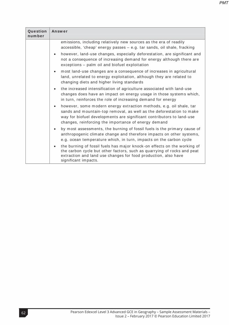
Question number
Answer
emissions, including relatively new sources as the era of readily accessible, ‘cheap’ energy passes – e.g. tar sands, oil shale, fracking
• however, land-use changes, especially deforestation, are significant and not a consequence of increasing demand for energy although there are exceptions – palm oil and biofuel exploitation
• most land-use changes are a consequence of increases in agricultural land, unrelated to energy exploitation, although they are related to changing diets and higher living standards
• the increased intensification of agriculture associated with land-use changes does have an impact on energy usage in those systems which, in turn, reinforces the role of increasing demand for energy
• however, some modern energy extraction methods, e.g. oil shale, tar sands and mountain-top removal, as well as the deforestation to make way for biofuel developments are significant contributors to land-use changes, reinforcing the importance of energy demand
• by most assessments, the burning of fossil fuels is the primary cause of anthropogenic climate change and therefore impacts on other systems, e.g. ocean temperature which, in turn, impacts on the carbon cycle
• the burning of fossil fuels has major knock-on effects on the working of the carbon cycle but other factors, such as quarrying of rocks and peat extraction and land use changes for food production, also have significant impacts.
Level Mark Descriptor
0 No rewardable material.
Level 1 1–5 • Demonstrates isolated elements of geographical knowledge and understanding, some of which may be inaccurate or irrelevant. (AO1)
• Applies knowledge and understanding of geographical ideas, making limited and rarely logical connections/relationships. (AO2)
• Applies knowledge and understanding of geographical information/ideas to produce an interpretation with limited coherence and support from evidence. (AO2)
• Applies knowledge and understanding of geographical information/ideas to produce an unsupported or generic conclusion, drawn from an argument that is unbalanced or lacks coherence. (AO2)
Level 2 6–10 • Demonstrates geographical knowledge and understanding, which is occasionally relevant and may include some inaccuracies. (AO1)
• Applies knowledge and understanding of geographical information/ideas with limited but logical connections/relationships. (AO2)
• Applies knowledge and understanding of geographical ideas in order to produce a partial interpretation that is supported by some evidence but has limited coherence. (AO2)
• Applies knowledge and understanding of geographical information/ideas to come to a conclusion, partially supported by an unbalanced argument with limited coherence. (AO2)
Level 3 11–15 • Demonstrates geographical knowledge and understanding, which is mostly relevant and accurate. (AO1)
• Applies knowledge and understanding of geographical information/ideas to find some logical and relevant connections/relationships. (AO2)
• Applies knowledge and understanding of geographical ideas in order to produce a partial but coherent interpretation that is supported by some evidence. (AO2)
• Applies knowledge and understanding of geographical information/ideas to come to a conclusion, largely supported by an argument that may be unbalanced or partially coherent. (AO2)
62 Pearson Edexcel Level 3 Advanced GCE in Geography – Sample Assessment Materials – Issue 2 – February 2017 © Pearson Education Limited 2017
PMT

Question number
Answer
emissions, including relatively new sources as the era of readily accessible, ‘cheap’ energy passes – e.g. tar sands, oil shale, fracking
• however, land-use changes, especially deforestation, are significant and not a consequence of increasing demand for energy although there are exceptions – palm oil and biofuel exploitation
• most land-use changes are a consequence of increases in agricultural land, unrelated to energy exploitation, although they are related to changing diets and higher living standards
• the increased intensification of agriculture associated with land-use changes does have an impact on energy usage in those systems which, in turn, reinforces the role of increasing demand for energy
• however, some modern energy extraction methods, e.g. oil shale, tar sands and mountain-top removal, as well as the deforestation to make way for biofuel developments are significant contributors to land-use changes, reinforcing the importance of energy demand
• by most assessments, the burning of fossil fuels is the primary cause of anthropogenic climate change and therefore impacts on other systems, e.g. ocean temperature which, in turn, impacts on the carbon cycle
• the burning of fossil fuels has major knock-on effects on the working of the carbon cycle but other factors, such as quarrying of rocks and peat extraction and land use changes for food production, also have significant impacts.
Level Mark Descriptor
0 No rewardable material.
Level 1 1–5 • Demonstrates isolated elements of geographical knowledge and understanding, some of which may be inaccurate or irrelevant. (AO1)
• Applies knowledge and understanding of geographical ideas, making limited and rarely logical connections/relationships. (AO2)
• Applies knowledge and understanding of geographical information/ideas to produce an interpretation with limited coherence and support from evidence. (AO2)
• Applies knowledge and understanding of geographical information/ideas to produce an unsupported or generic conclusion, drawn from an argument that is unbalanced or lacks coherence. (AO2)
Level 2 6–10 • Demonstrates geographical knowledge and understanding, which is occasionally relevant and may include some inaccuracies. (AO1)
• Applies knowledge and understanding of geographical information/ideas with limited but logical connections/relationships. (AO2)
• Applies knowledge and understanding of geographical ideas in order to produce a partial interpretation that is supported by some evidence but has limited coherence. (AO2)
• Applies knowledge and understanding of geographical information/ideas to come to a conclusion, partially supported by an unbalanced argument with limited coherence. (AO2)
Level 3 11–15 • Demonstrates geographical knowledge and understanding, which is mostly relevant and accurate. (AO1)
• Applies knowledge and understanding of geographical information/ideas to find some logical and relevant connections/relationships. (AO2)
• Applies knowledge and understanding of geographical ideas in order to produce a partial but coherent interpretation that is supported by some evidence. (AO2)
• Applies knowledge and understanding of geographical information/ideas to come to a conclusion, largely supported by an argument that may be unbalanced or partially coherent. (AO2)
63Pearson Edexcel Level 3 Advanced GCE in Geography – Sample Assessment Materials – Issue 2 – February 2017 © Pearson Education Limited 2017
PMT
Level Mark Descriptor
Level 4 16–20 • Demonstrates accurate and relevant geographical knowledge and understanding throughout. (AO1)
• Applies knowledge and understanding of geographical information/ideas to find fully logical and relevant connections/relationships. (AO2)
• Applies knowledge and understanding of geographical information/ideas to produce a full and coherent interpretation that is supported by evidence. (AO2)
• Applies knowledge and understanding of geographical information/ideas to come to a rational, substantiated conclusion, fully supported by a balanced argument that is drawn together coherently. (AO2)
Centre Number Candidate Number
Write your name hereSurname Other names
Total Marks
Turn over
Paper Reference
Pearson Edexcel Level 3
*S49795A0124*S49795A©2016 Pearson Education Ltd.
1/1/1/1/1/1/1/1/1
Instructions
• Use black ink or ball-point pen.• Fill in the boxes at the top of this page with your name, centre number and candidate number.• Answer all questions in Section A.• Answer one question in Section B and one question in Section C.• Answer the questions in the spaces provided
– there may be more space than you need.• Calculators may be used.• Any calculations must show all stages of working out and a clear answer.
Information
• The total mark for this paper is 105. • The marks for each question are shown in brackets – use this as a guide as to how much time to spend on each question.
Advice
• Read each question carefully before you start to answer it.• Check your answers if you have time at the end.
You must have:Ruler, calculator, the Resource Booklet enclosed
9GE0/02Sample assessment material for first teaching September 2016Time: 2 hours 15 minutes
GeographyAdvanced Paper 2
64 Pearson Edexcel Level 3 Advanced GCE in Geography – Sample Assessment Materials – Issue 2 – February 2017 © Pearson Education Limited 2017
PMT