Embed Size (px)
Citation preview
New features in Meteodyn WT 4.6
10/2013
Release information • User account control
• Processing monitoring window
• New stability tool
• Synthesis – meso-scale data files
• Automatic report
• IEC export
• ATLAS option
• Other
Release information • User account control
• Processing monitoring window
• New stability tool
• Synthesis – meso-scale data files
• Automatic report
• IEC export
• ATLAS option
• Other
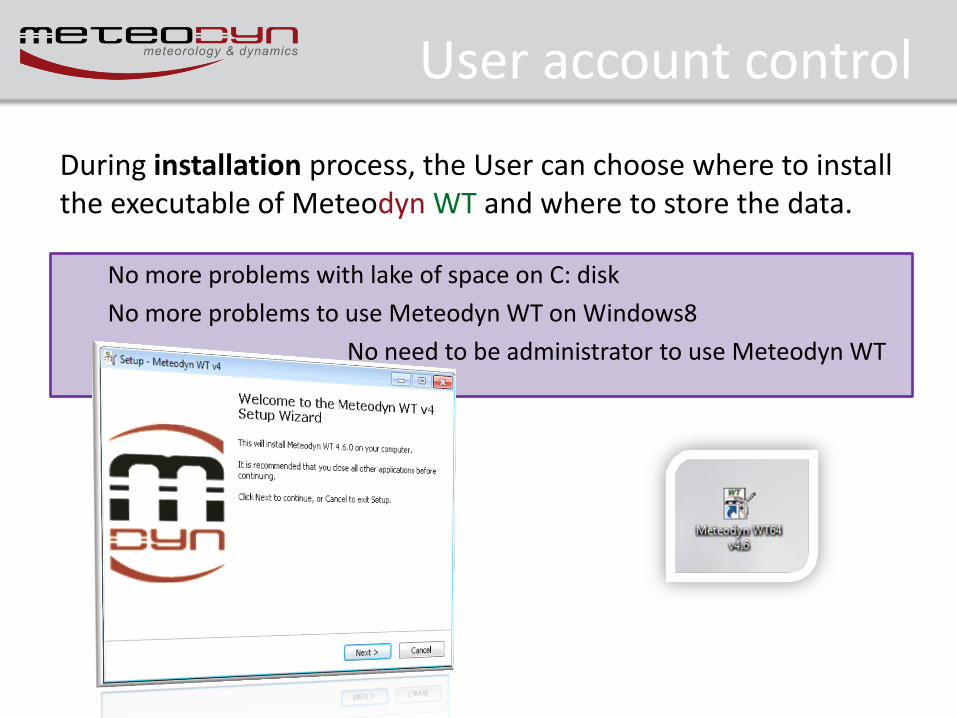
User account control
During installation process, the User can choose where to install the executable of Meteodyn WT and where to store the data.
No more problems with lake of space on C: disk
No more problems to use Meteodyn WT on Windows8
No need to be administrator to use Meteodyn WT
Release information • User account control
• Processing monitoring window
• New stability tool
• Synthesis – meso-scale data files
• Automatic report
• IEC export
• ATLAS option
• Other
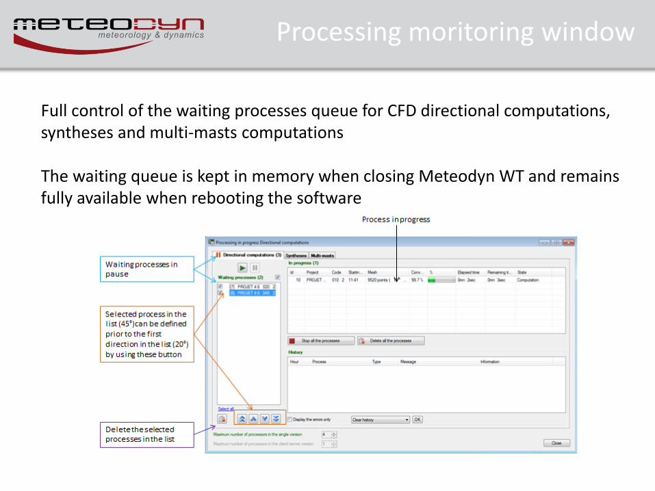
Processing moritoring window
Full control of the waiting processes queue for CFD directional computations, syntheses and multi-masts computations The waiting queue is kept in memory when closing Meteodyn WT and remains fully available when rebooting the software
Release information • User account control
• Processing monitoring window
• New stability tool
• Synthesis – meso-scale data files
• Automatic report
• IEC export
• ATLAS option
• Other
New stability tool
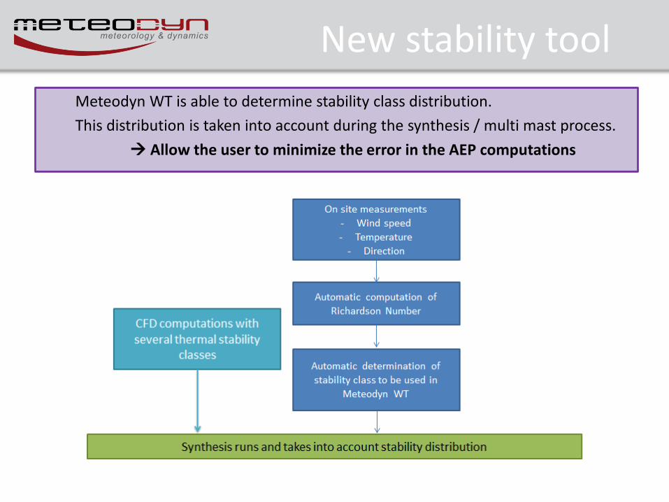
Meteodyn WT is able to determine stability class distribution.
This distribution is taken into account during the synthesis / multi mast process.
Allow the user to minimize the error in the AEP computations
New stability tool
2/
/
zV
zgRi v
v
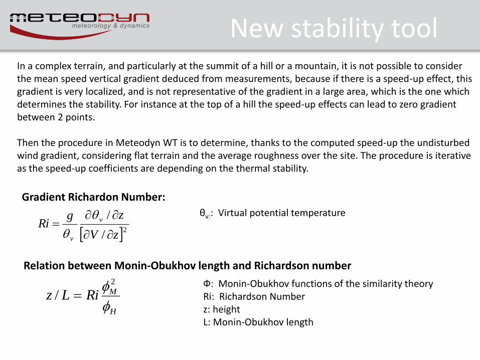
Gradient Richardon Number:
H
MRiLz
2
/
θv:: Virtual potential temperature
Ф: Monin-Obukhov functions of the similarity theory Ri: Richardson Number z: height L: Monin-Obukhov length
In a complex terrain, and particularly at the summit of a hill or a mountain, it is not possible to consider the mean speed vertical gradient deduced from measurements, because if there is a speed-up effect, this gradient is very localized, and is not representative of the gradient in a large area, which is the one which determines the stability. For instance at the top of a hill the speed-up effects can lead to zero gradient between 2 points. Then the procedure in Meteodyn WT is to determine, thanks to the computed speed-up the undisturbed wind gradient, considering flat terrain and the average roughness over the site. The procedure is iterative as the speed-up coefficients are depending on the thermal stability.
Relation between Monin-Obukhov length and Richardson number
New stability tool
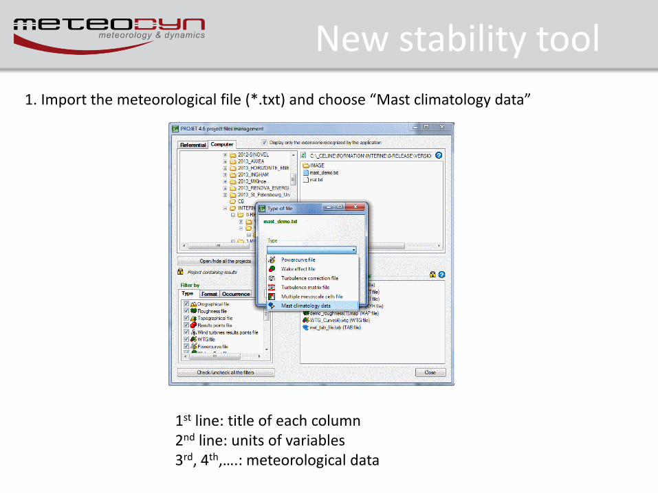
1. Import the meteorological file (*.txt) and choose “Mast climatology data”
1st line: title of each column 2nd line: units of variables 3rd, 4th,….: meteorological data
New stability tool
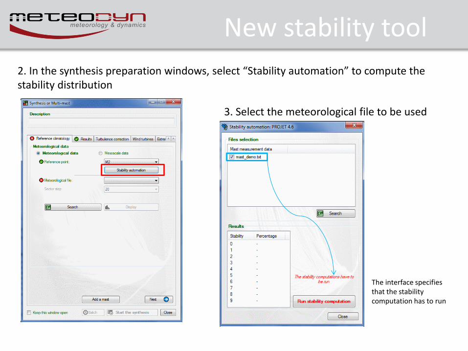
2. In the synthesis preparation windows, select “Stability automation” to compute the stability distribution
3. Select the meteorological file to be used
The interface specifies that the stability computation has to run
New stability tool
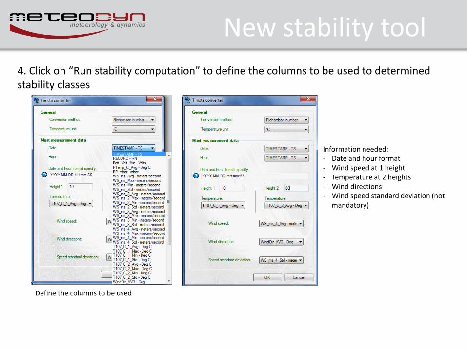
4. Click on “Run stability computation” to define the columns to be used to determined stability classes
Define the columns to be used
Information needed: - Date and hour format - Wind speed at 1 height - Temperature at 2 heights - Wind directions - Wind speed standard deviation (not
mandatory)
New stability tool
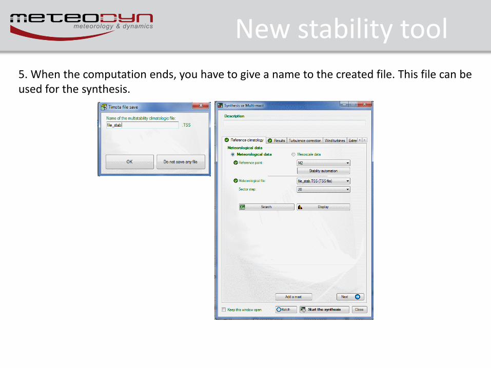
5. When the computation ends, you have to give a name to the created file. This file can be used for the synthesis.
Release information • User account control
• Processing monitoring window
• New stability tool
• Synthesis – meso-scale data files
• Automatic report
• IEC export
• ATLAS option
• Other
Meso-scale data files
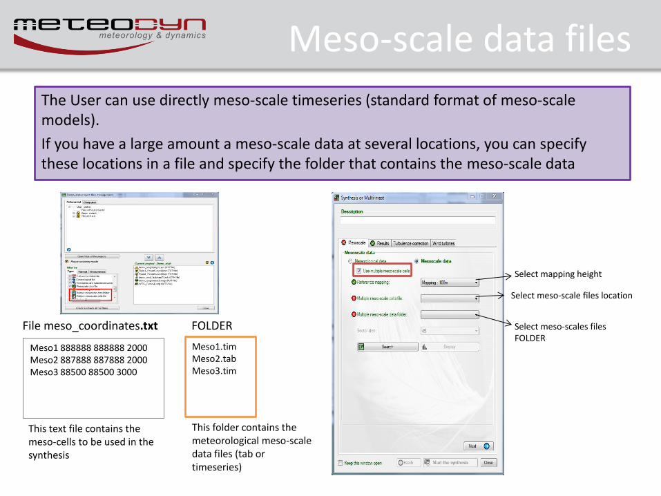
The User can use directly meso-scale timeseries (standard format of meso-scale models).
If you have a large amount a meso-scale data at several locations, you can specify these locations in a file and specify the folder that contains the meso-scale data
Meso1 888888 888888 2000 Meso2 887888 887888 2000 Meso3 88500 88500 3000
File meso_coordinates.txt
This folder contains the meteorological meso-scale data files (tab or timeseries)
FOLDER
Meso1.tim Meso2.tab Meso3.tim
This text file contains the meso-cells to be used in the synthesis
Select mapping height
Select meso-scale files location
Select meso-scales files FOLDER
Release information • User account control
• Processing monitoring window
• New stability tool
• Synthesis – meso-scale data files
• Automatic report
• IEC export
• ATLAS option
• Other
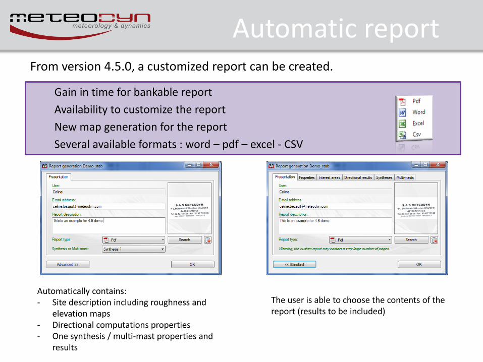
Automatic report
Gain in time for bankable report
Availability to customize the report
New map generation for the report
Several available formats : word – pdf – excel - CSV
From version 4.5.0, a customized report can be created.
Automatically contains: - Site description including roughness and
elevation maps - Directional computations properties - One synthesis / multi-mast properties and
results
The user is able to choose the contents of the report (results to be included)
Release information • User account control
• Processing monitoring window
• New stability tool
• Synthesis – meso-scale data files
• Automatic report
• IEC export
• ATLAS option
• Other
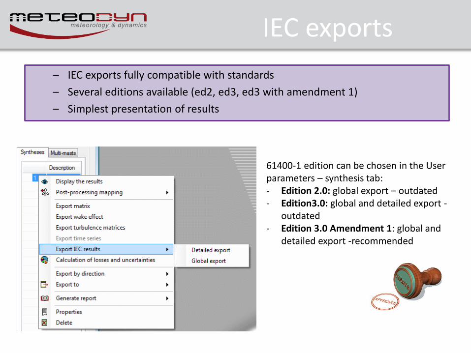
IEC exports
– IEC exports fully compatible with standards
– Several editions available (ed2, ed3, ed3 with amendment 1)
– Simplest presentation of results
61400-1 edition can be chosen in the User parameters – synthesis tab: - Edition 2.0: global export – outdated - Edition3.0: global and detailed export -
outdated - Edition 3.0 Amendment 1: global and
detailed export -recommended
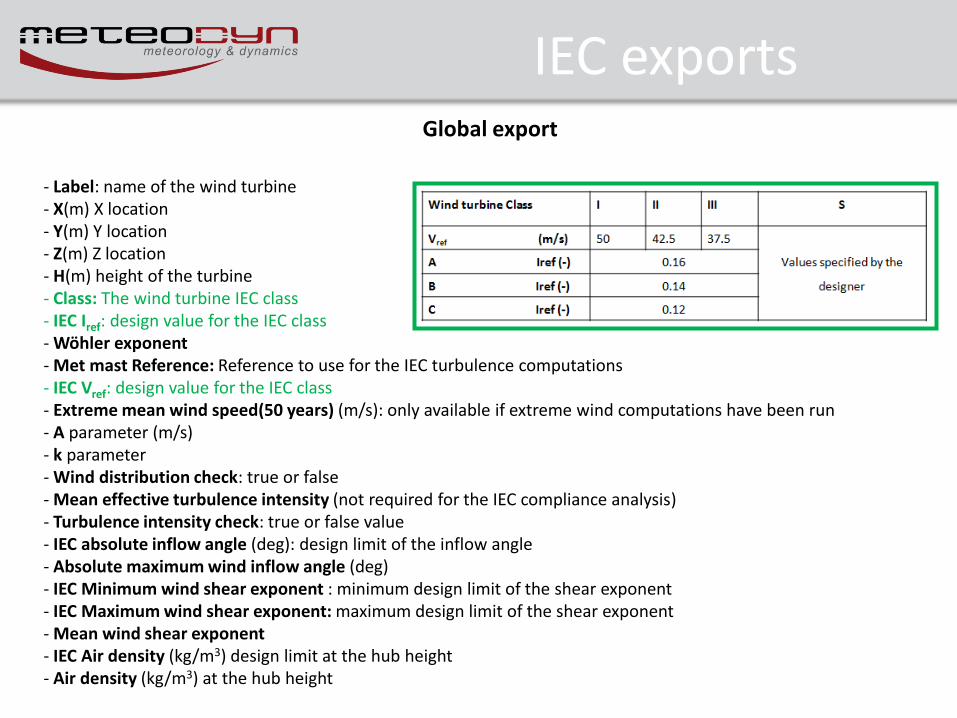
IEC exports Global export
- Label: name of the wind turbine - X(m) X location - Y(m) Y location - Z(m) Z location - H(m) height of the turbine - Class: The wind turbine IEC class - IEC Iref: design value for the IEC class - Wöhler exponent - Met mast Reference: Reference to use for the IEC turbulence computations - IEC Vref: design value for the IEC class - Extreme mean wind speed(50 years) (m/s): only available if extreme wind computations have been run - A parameter (m/s) - k parameter - Wind distribution check: true or false - Mean effective turbulence intensity (not required for the IEC compliance analysis) - Turbulence intensity check: true or false value - IEC absolute inflow angle (deg): design limit of the inflow angle - Absolute maximum wind inflow angle (deg) - IEC Minimum wind shear exponent : minimum design limit of the shear exponent - IEC Maximum wind shear exponent: maximum design limit of the shear exponent - Mean wind shear exponent - IEC Air density (kg/m3) design limit at the hub height - Air density (kg/m3) at the hub height
Release information • User account control
• Processing monitoring window
• New stability tool
• Synthesis – meso-scale data files
• Automatic report
• IEC export
• ATLAS option
• Other
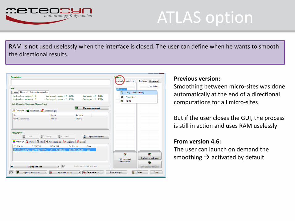
ATLAS option
Previous version: Smoothing between micro-sites was done automatically at the end of a directional computations for all micro-sites But if the user closes the GUI, the process is still in action and uses RAM uselessly From version 4.6: The user can launch on demand the smoothing activated by default
RAM is not used uselessly when the interface is closed. The user can define when he wants to smooth the directional results.
Release information • User account control
• Processing monitoring window
• New stability tool
• Synthesis – meso-scale data files
• Automatic report
• IEC export
• ATLAS option
• Other
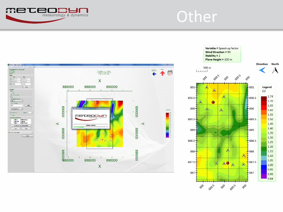
Other


![Asearchfor tt resonances with the ATLAS detector in … · This article is published with open access at Springerlink.com ... 4.6 pb (s-channel) [26] and 15.7 pb (Wt process) [27]](https://img.pdfslide.us/doc/110x75/5b7bfe1b7f8b9a474a8dd944/asearchfor-tt-resonances-with-the-atlas-detector-in-this-article-is-published.jpg)