Embed Size (px)
Citation preview
UAV Solutions to Disaster Management
#DronesForGood
Drones in First Responder & Humanitarian Projects
responsibility.dji.com

ROMEO DURSCHERDirector of Education
DTwitter: @RomeoCH
Instagram: VisualAerials


August 19, 2015


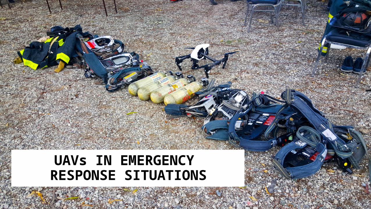
UAVs IN EMERGENCY RESPONSE SITUATIONS

THE FUTURE OF POSSIBLE
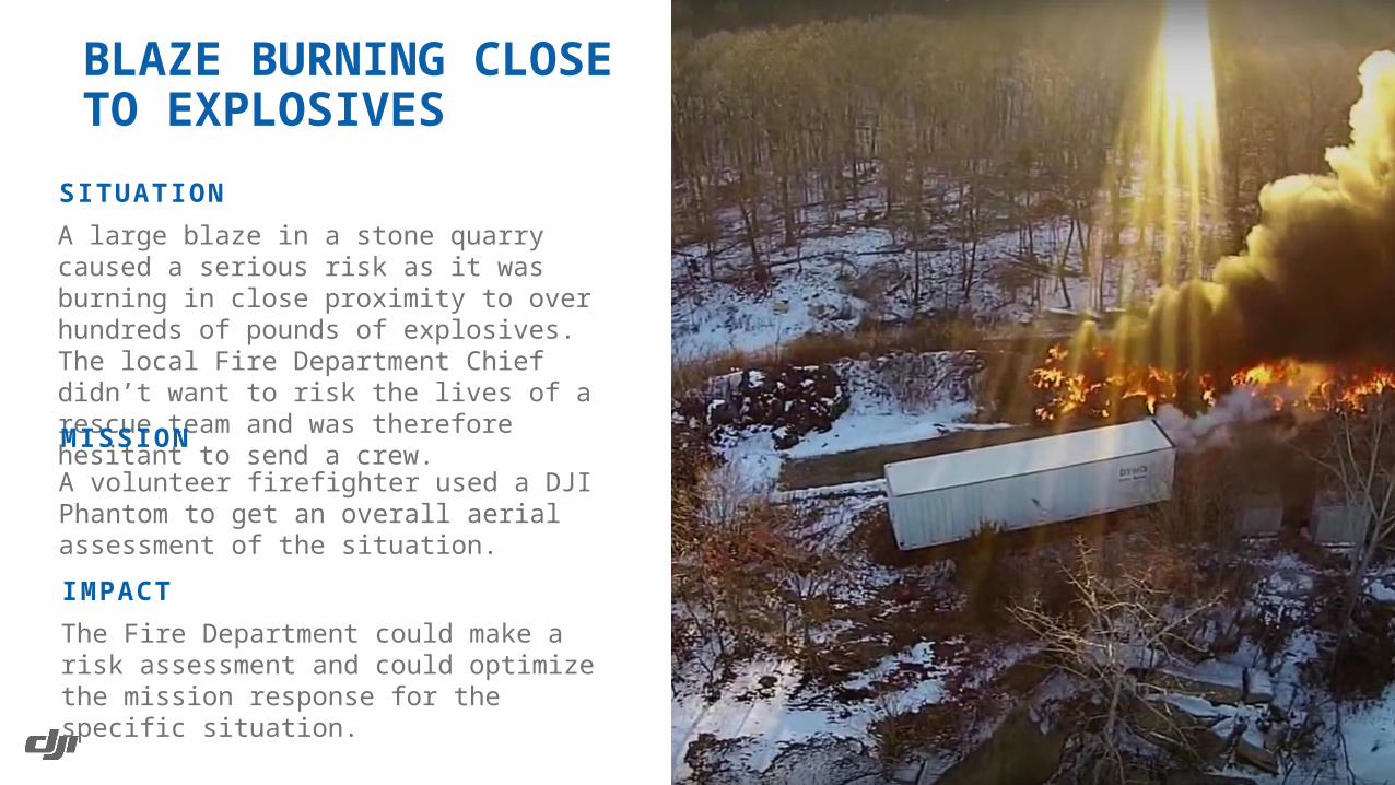
A large blaze in a stone quarry caused a serious risk as it was burning in close proximity to over hundreds of pounds of explosives. The local Fire Department Chief didn’t want to risk the lives of a rescue team and was therefore hesitant to send a crew.
SITUATION
BLAZE BURNING CLOSETO EXPLOSIVES
A volunteer firefighter used a DJI Phantom to get an overall aerial assessment of the situation.
MISSION
The Fire Department could make a risk assessment and could optimize the mission response for the specific situation.
IMPACT
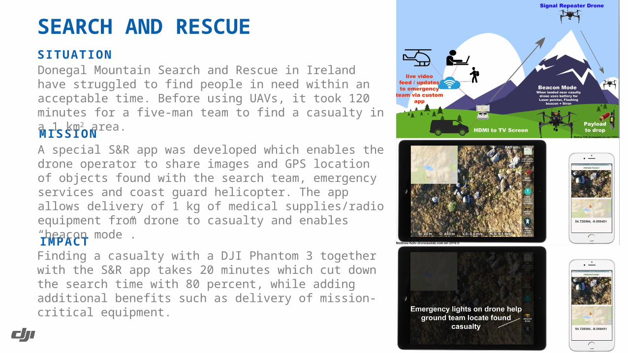
SITUATION
SEARCH AND RESCUE
MISSION
IMPACT
Donegal Mountain Search and Rescue in Ireland have struggled to find people in need within an acceptable time. Before using UAVs, it took 120 minutes for a five-man team to find a casualty in a 1 km2 area.
A special S&R app was developed which enables the drone operator to share images and GPS location of objects found with the search team, emergency services and coast guard helicopter. The app allows delivery of 1 kg of medical supplies/radio equipment from drone to casualty and enables “beacon mode”.
Finding a casualty with a DJI Phantom 3 together with the S&R app takes 20 minutes which cut down the search time with 80 percent, while adding additional benefits such as delivery of mission-critical equipment.
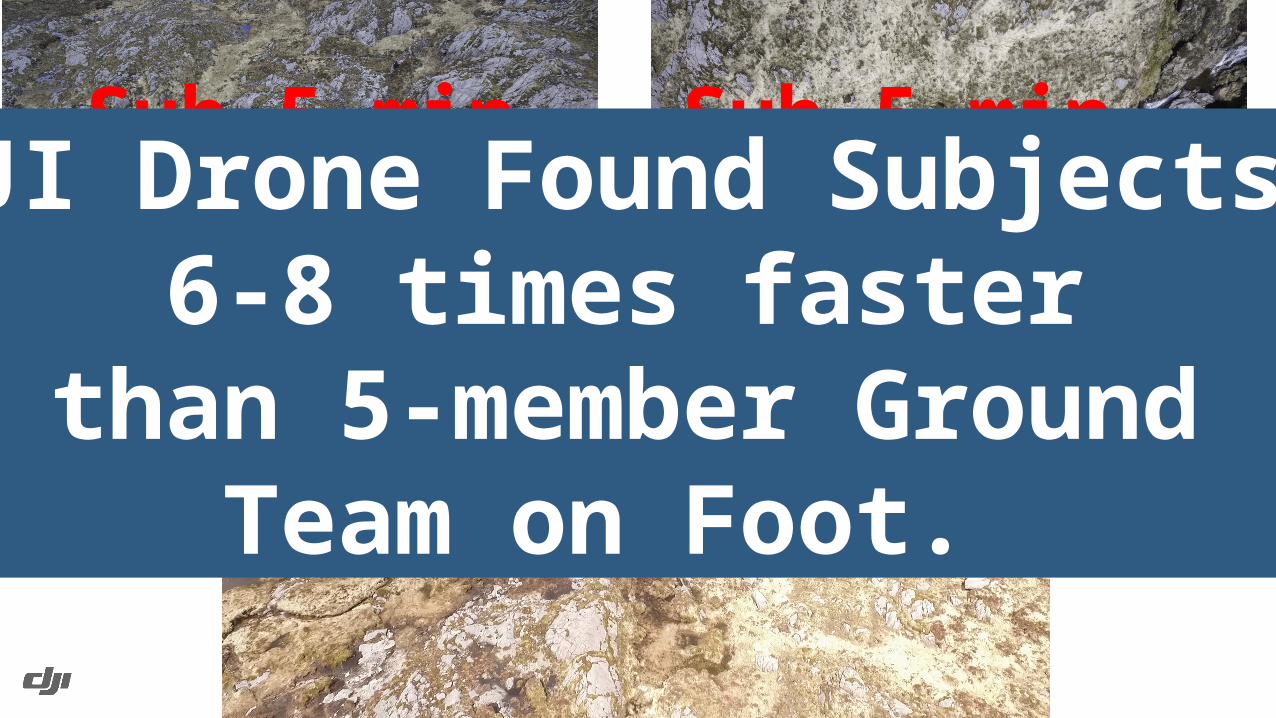
Sub 5 minSub 5 min
Sub 13 min
DJI Drone Found Subjects 6-8 times faster
than 5-member GroundTeam on Foot.
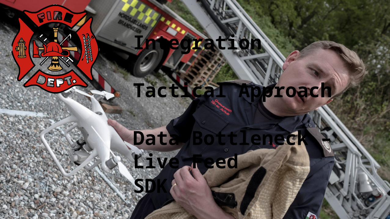
Integration
Tactical Approach
Data Bottleneck – Live Feed SDK
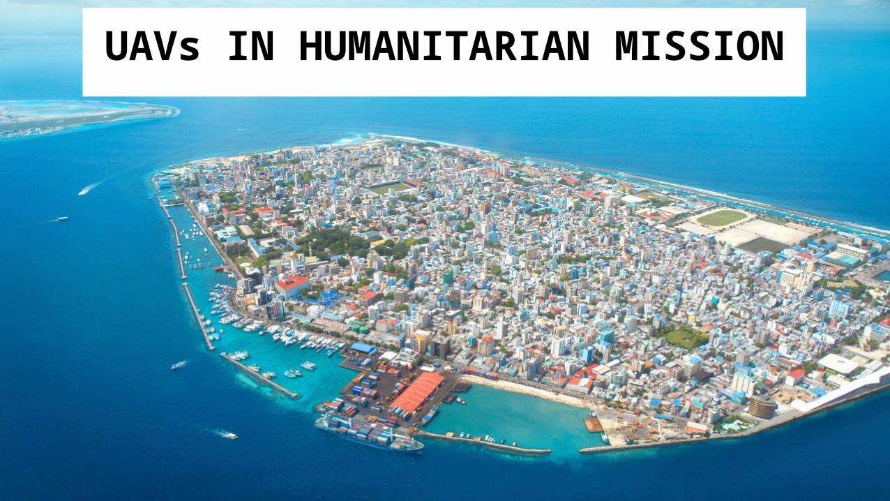
UAVs IN HUMANITARIAN MISSION
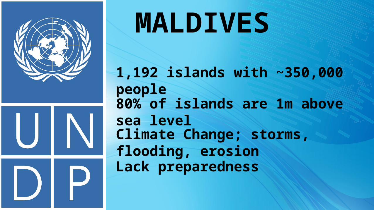
MALDIVES1,192 islands with ~350,000 people80% of islands are 1m above sea levelClimate Change; storms, flooding, erosionLack preparedness

STAKEHOLDERS
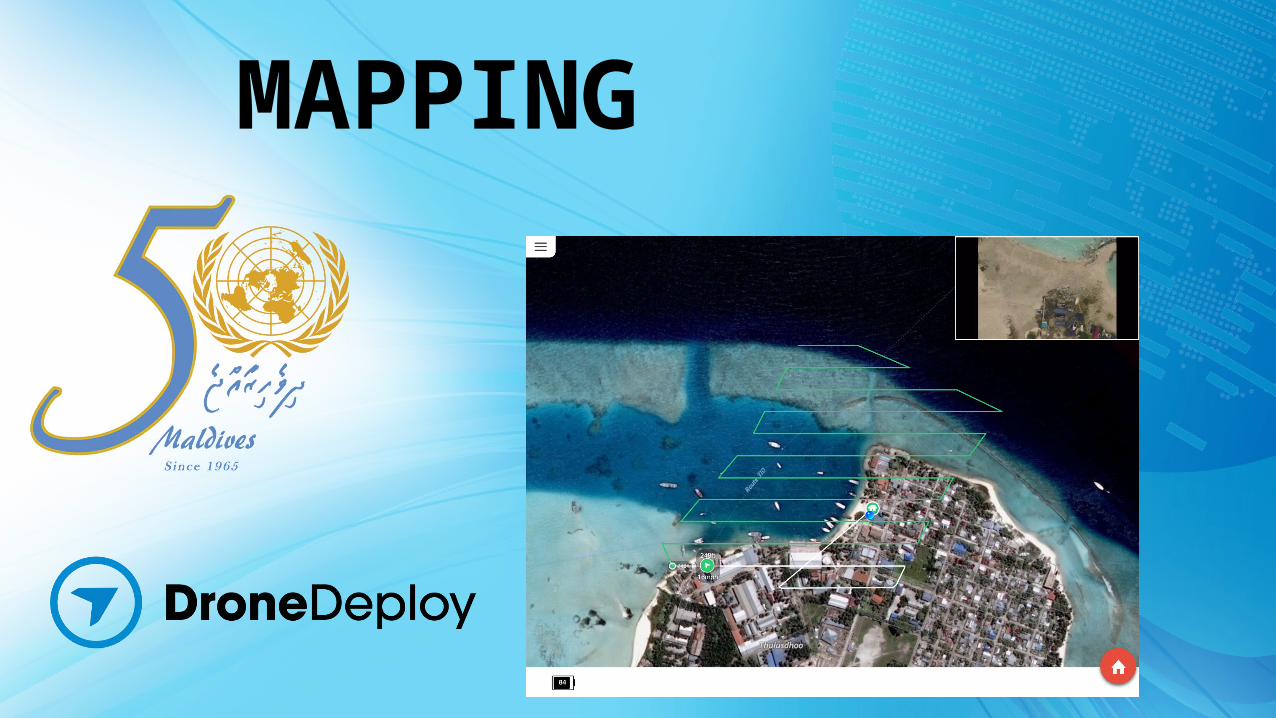
MAPPING

Get Stakeholders on BoardSet-up Sustainability
Train & Knowledge TransferOffer Support
#DronesForGood
responsibility.dji.com