Embed Size (px)
Citation preview

Using GIS in the Marijuana Permitting
process Bruce M Reagan, GISP
Judy Steele, Deputy Director, Excise and LicensesCity and County of Denver

Overview
Retail Marijuana sales are now legal in the City of Denver
Must be permitted by the City and the State. Excise and License is the Agency responsible GIS is used to evaluate the suitability of locations

Meanwhile….
The City began implementing Accela as its Permit issuing softare
The Denver GIS Intranet application (ArcIMS) was being replaced with Geocortex
Used both to help with this process

Permitting Process
Applicant fills out some ‘paperwork’ Permit staff evaluate suitability A needs and desires hearing is to be performed –
GIS used to help determine who is to be notified. If hearing is successful, City permit is issued –
applicant proceeds to the State.
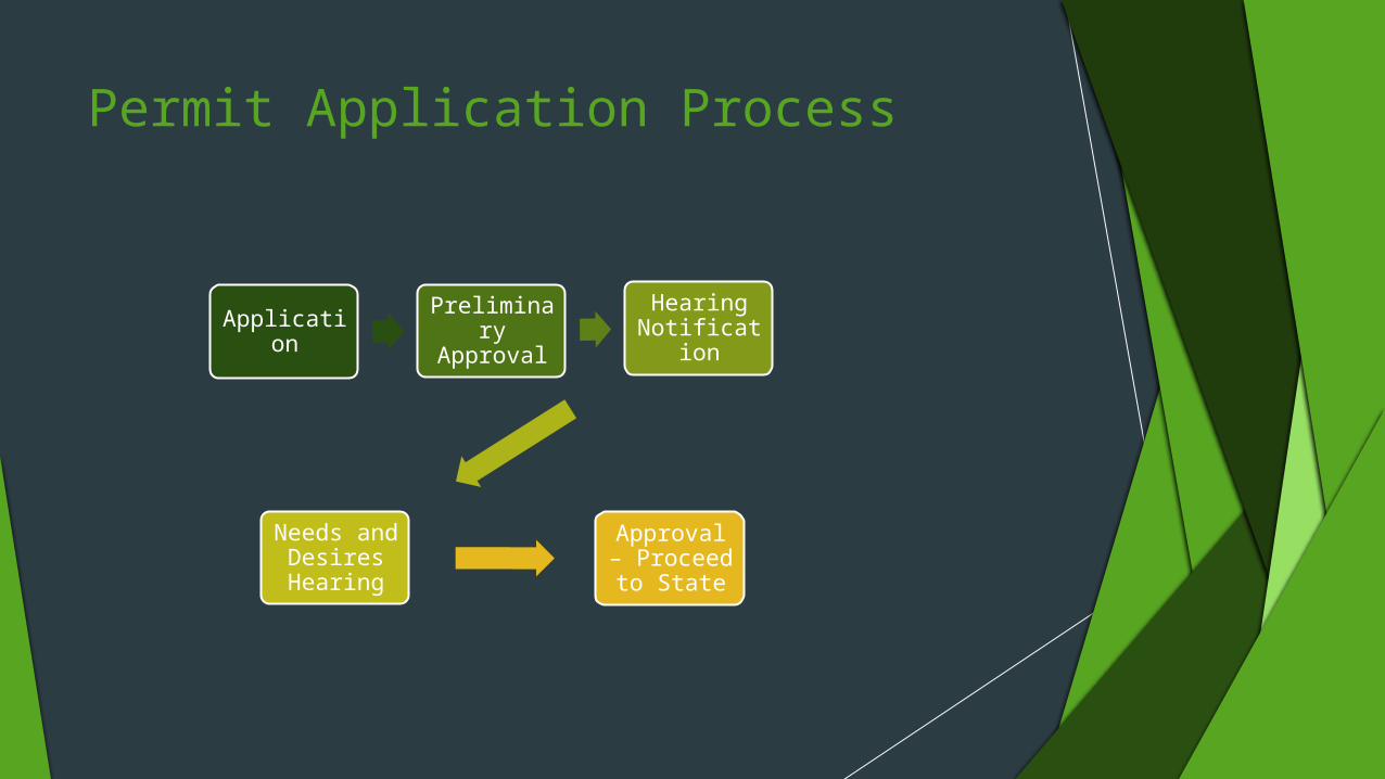
Permit Application Process
Application
Preliminary Approval
Hearing Notificatio
n
Needs and Desires Hearing
Approval – Proceed to
State
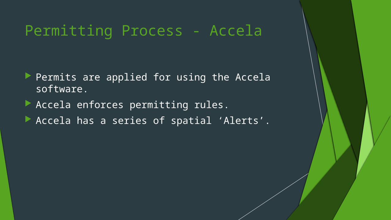
Permitting Process - Accela
Permits are applied for using the Accela software. Accela enforces permitting rules. Accela has a series of spatial ‘Alerts’.

Accela Alerts
An address is entered Address checked to determine:
Validity of the address Proximity to
Other retail marijuana salesChild care centersSchools

Data requirements for Accela Alerts
Other Marijuana locations Requires a validated address. Validation produces an X,Y stored in
Accela Nightly script updates the GIS layer
• Child Care locations• Permits stored in Accela.• Requires a validated address. Validation produces an X,Y stored in
Accela• Nightly script updates the GIS layer • Schools• Includes both public and private schools. Data layers
maintained by Community Planning

Accela Spatial Operators
What is an address? Point to Point Point to Polygon Polygon to Polygon Regulation currently being revised Opportunity for GIS Education

Accela – mostly non graphical
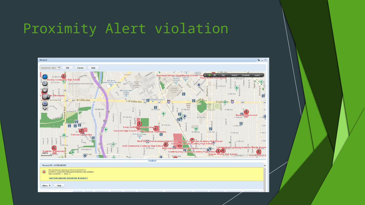
Proximity Alert violation

Accela Proximity DiscussionOpportunity for GIS EducationTo Permitting and Legal staff
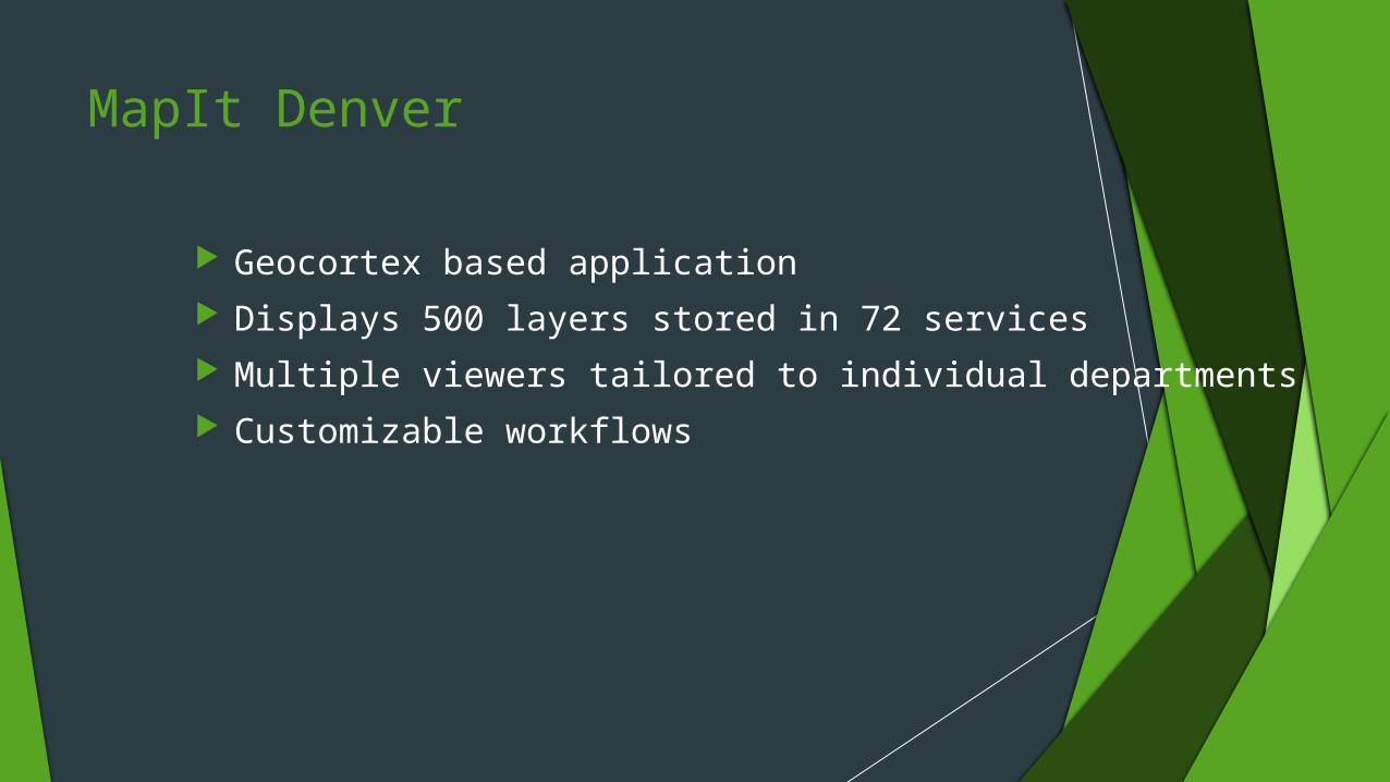
MapIt Denver
Geocortex based application Displays 500 layers stored in 72 services Multiple viewers tailored to individual departments Customizable workflows
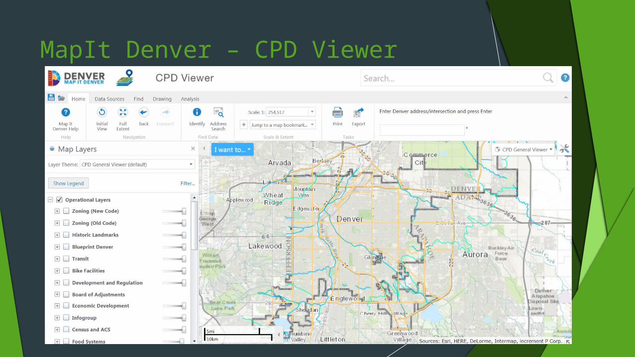
MapIt Denver – CPD Viewer

MapIt Denver – I Want To …. Evaluate a Retail Marijuana License
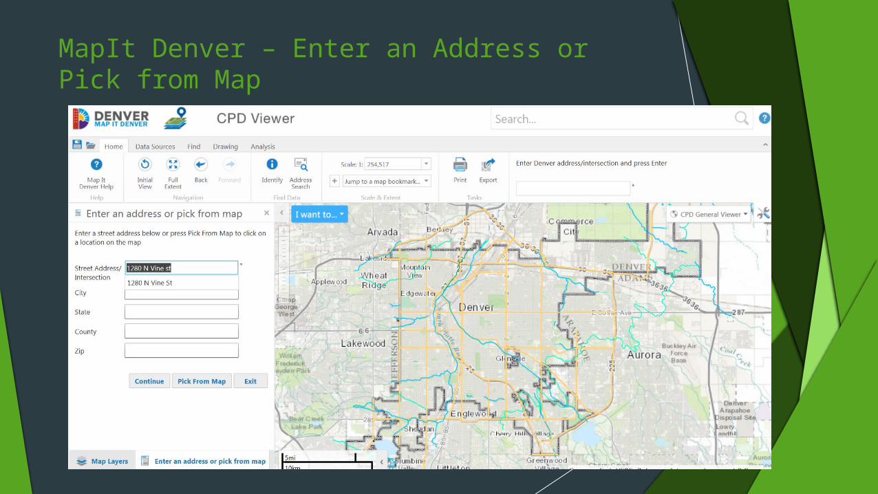
MapIt Denver – Enter an Address or Pick from Map
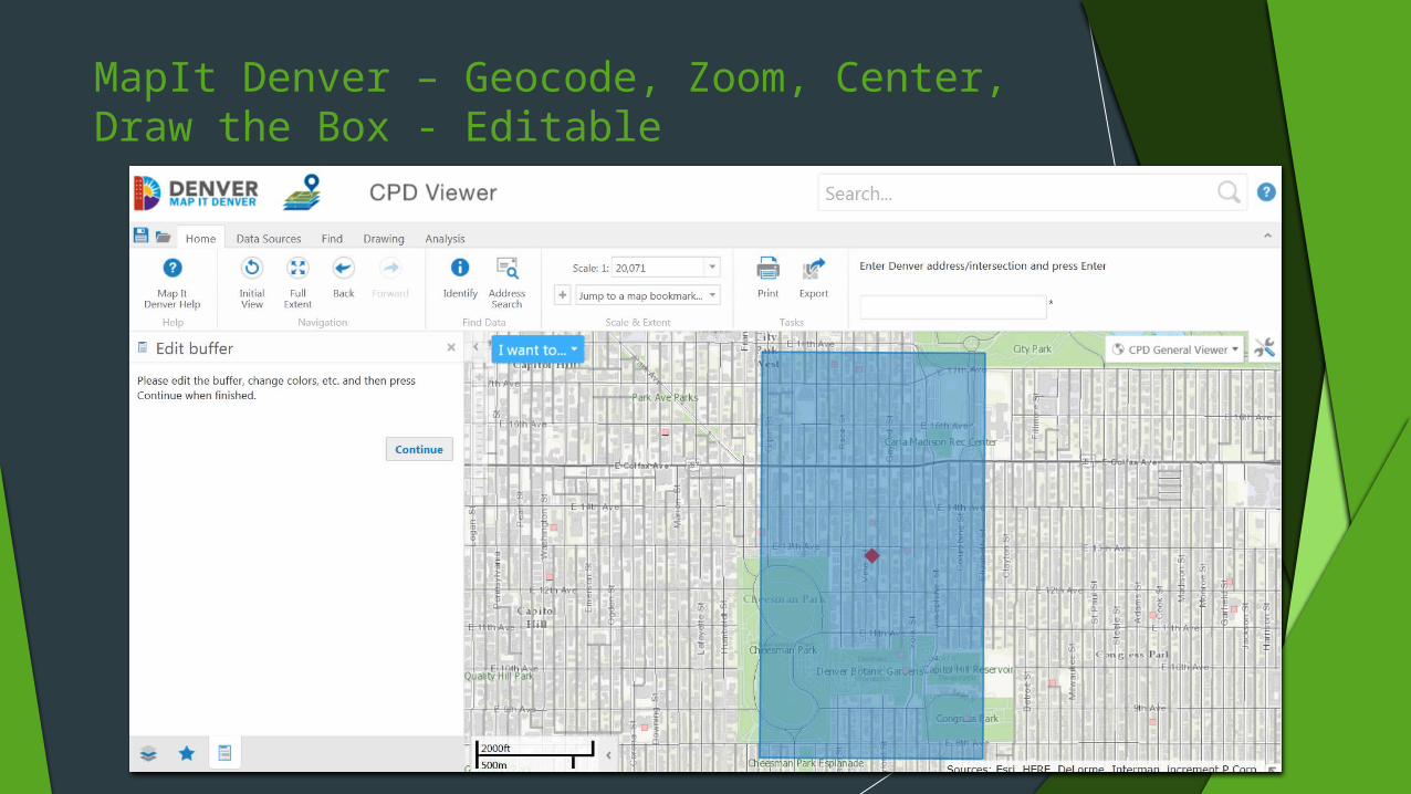
MapIt Denver – Geocode, Zoom, Center,Draw the Box - Editable
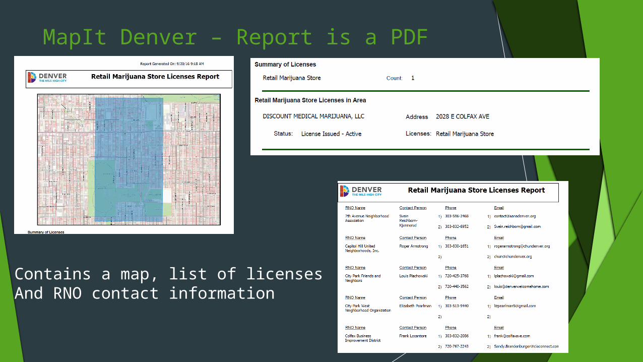
MapIt Denver – Report is a PDF
Contains a map, list of licensesAnd RNO contact information

Marijuana Site Evaluation workflow
Enter an address Address validated against the Denver Address database – obtain an
X,Y Overlay to retrieve the other retail locations within 1000’ buffer Point in polygon to get a list of Registered Neighborhood
Organizations in which the address falls Generate a report

MapItDenver Workflow Demonstration

Future plans
Add Medical Marijuana permits to the report. Make changes as the Regulations change Create a Geocortex Site that is specific to this workflow. Obtain data outside the City

Shameless plug
DMMS2016.org
38
Contact Information: Bruce Reagan
Associate GIS Developer [email protected] (720) 913- 5883
Judy Steele Deputy Director, Excise and Licenses [email protected] (720) 865 - 2765