Embed Size (px)
Citation preview
the Open Source WebGIS
AGIT 2017, GMF Version 2.2
Emmanuel Belo [email protected] +41 21 619 10 25 @emmanuel_belo
www.camptocamp.com
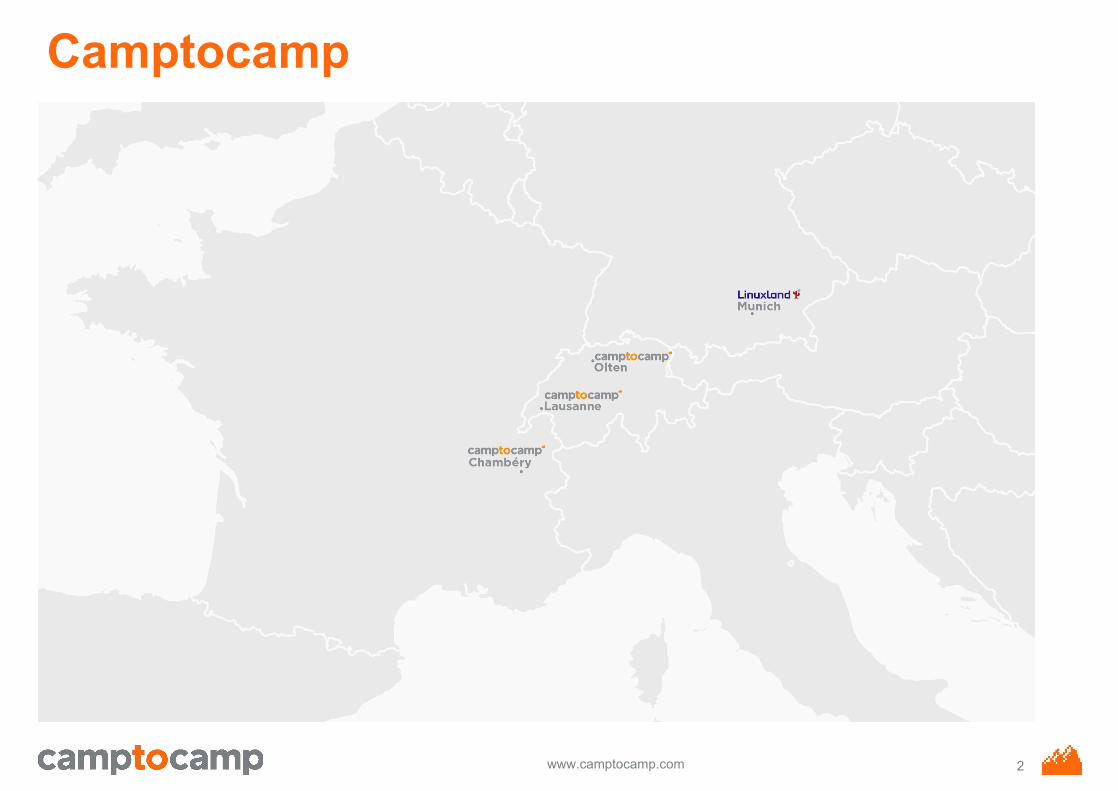
Camptocamp
2
www.camptocamp.com
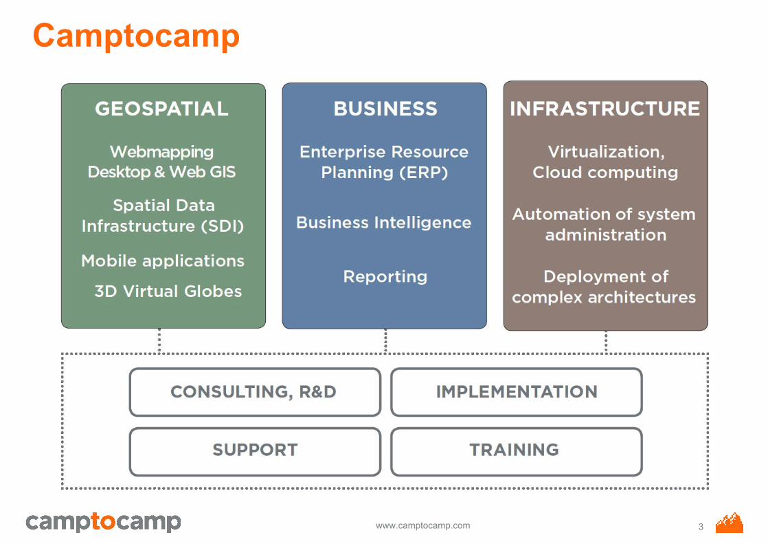
Camptocamp
3
www.camptocamp.com
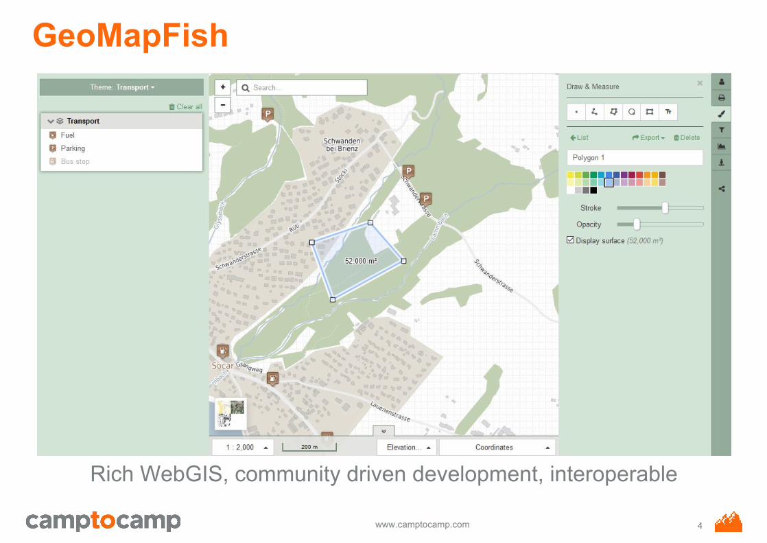
GeoMapFish
Rich WebGIS, community driven development, interoperable
4
www.camptocamp.com
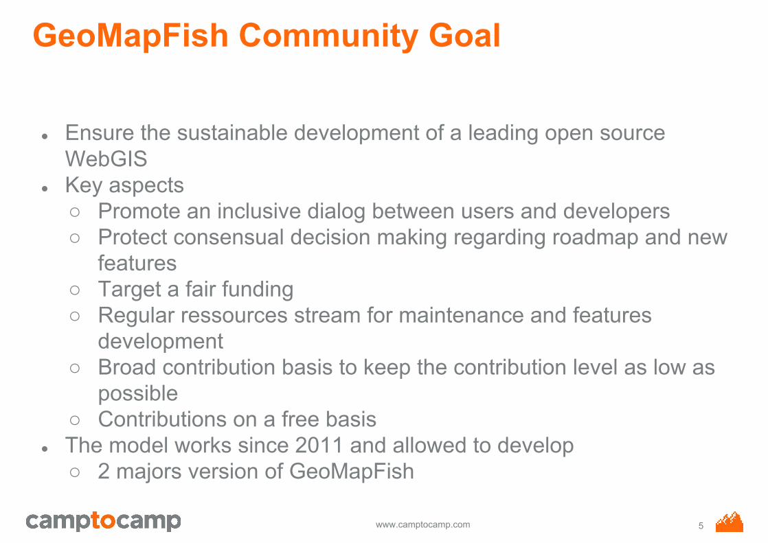
GeoMapFish Community Goal
● Ensure the sustainable development of a leading open source WebGIS
● Key aspects○ Promote an inclusive dialog between users and developers○ Protect consensual decision making regarding roadmap and new
features○ Target a fair funding○ Regular ressources stream for maintenance and features
development○ Broad contribution basis to keep the contribution level as low as
possible○ Contributions on a free basis
● The model works since 2011 and allowed to develop○ 2 majors version of GeoMapFish
5
www.camptocamp.com
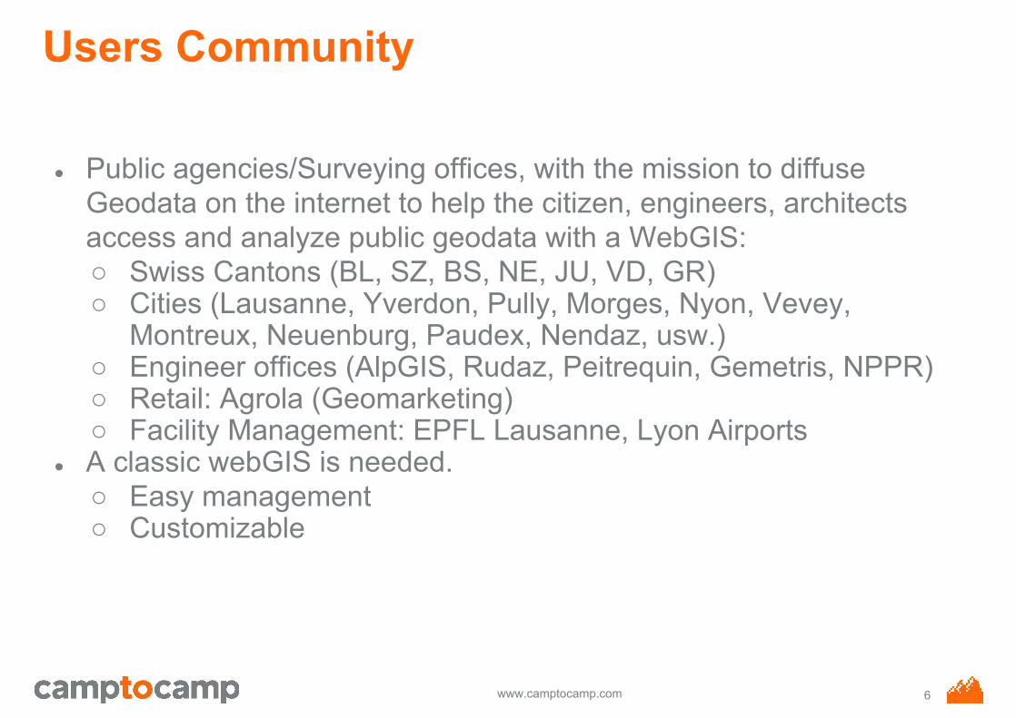
Users Community
● Public agencies/Surveying offices, with the mission to diffuse Geodata on the internet to help the citizen, engineers, architects access and analyze public geodata with a WebGIS:○ Swiss Cantons (BL, SZ, BS, NE, JU, VD, GR)○ Cities (Lausanne, Yverdon, Pully, Morges, Nyon, Vevey,
Montreux, Neuenburg, Paudex, Nendaz, usw.)○ Engineer offices (AlpGIS, Rudaz, Peitrequin, Gemetris, NPPR)○ Retail: Agrola (Geomarketing)○ Facility Management: EPFL Lausanne, Lyon Airports
● A classic webGIS is needed.○ Easy management○ Customizable
6
www.camptocamp.com
a global collaboration
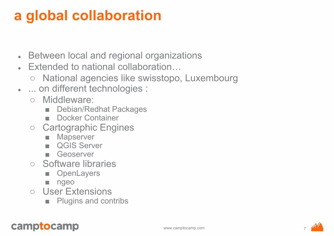
● Between local and regional organizations● Extended to national collaboration…
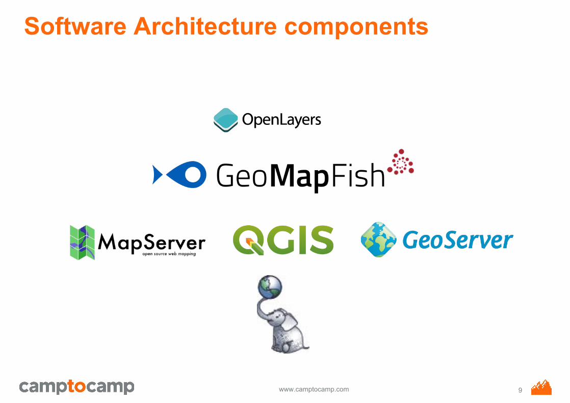
○ National agencies like swisstopo, Luxembourg● ... on different technologies :
○ Middleware:■ Debian/Redhat Packages■ Docker Container
○ Cartographic Engines■ Mapserver■ QGIS Server■ Geoserver
○ Software libraries■ OpenLayers■ ngeo
○ User Extensions■ Plugins and contribs
7
www.camptocamp.com
Software architecture concepts
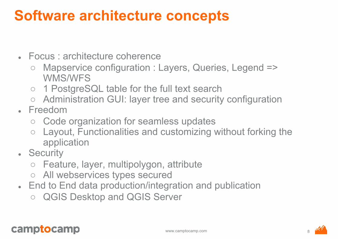
● Focus : architecture coherence○ Mapservice configuration : Layers, Queries, Legend =>
WMS/WFS○ 1 PostgreSQL table for the full text search○ Administration GUI: layer tree and security configuration
● Freedom○ Code organization for seamless updates○ Layout, Functionalities and customizing without forking the
application● Security
○ Feature, layer, multipolygon, attribute○ All webservices types secured
● End to End data production/integration and publication○ QGIS Desktop and QGIS Server
8
www.camptocamp.com
Software Architecture components
9
www.camptocamp.com
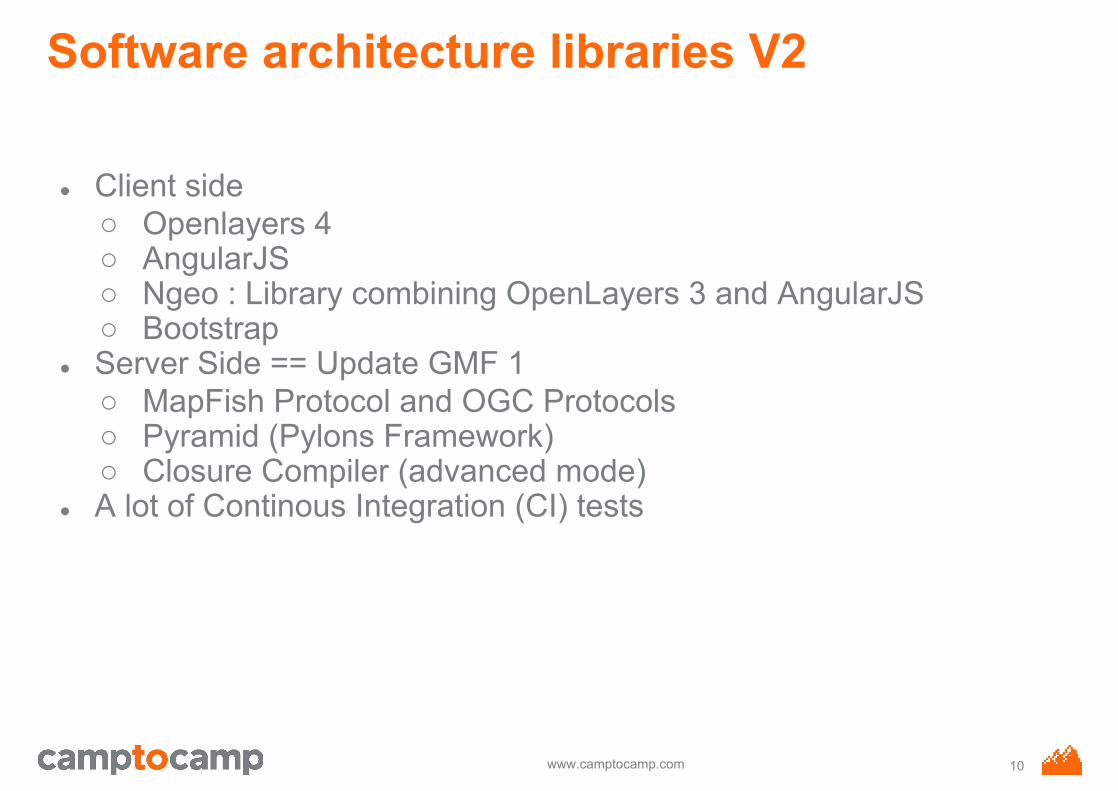
Software architecture libraries V2
● Client side○ Openlayers 4○ AngularJS○ Ngeo : Library combining OpenLayers 3 and AngularJS○ Bootstrap
● Server Side == Update GMF 1○ MapFish Protocol and OGC Protocols○ Pyramid (Pylons Framework)○ Closure Compiler (advanced mode)
● A lot of Continous Integration (CI) tests
10
www.camptocamp.com
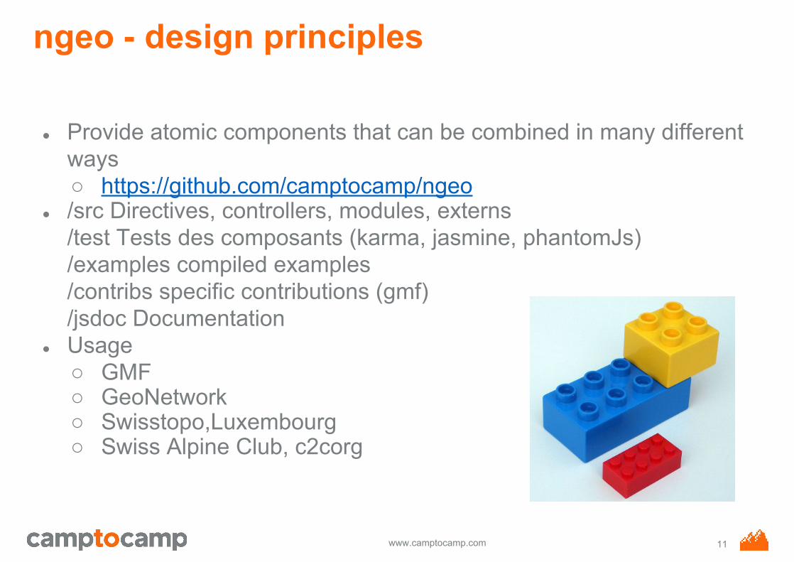
ngeo - design principles
● Provide atomic components that can be combined in many different ways○ https://github.com/camptocamp/ngeo
● /src Directives, controllers, modules, externs/test Tests des composants (karma, jasmine, phantomJs)/examples compiled examples/contribs specific contributions (gmf)/jsdoc Documentation
● Usage○ GMF○ GeoNetwork○ Swisstopo,Luxembourg○ Swiss Alpine Club, c2corg
11
www.camptocamp.com
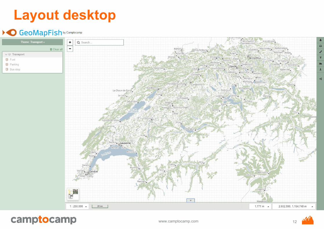
Layout desktop
12
www.camptocamp.com
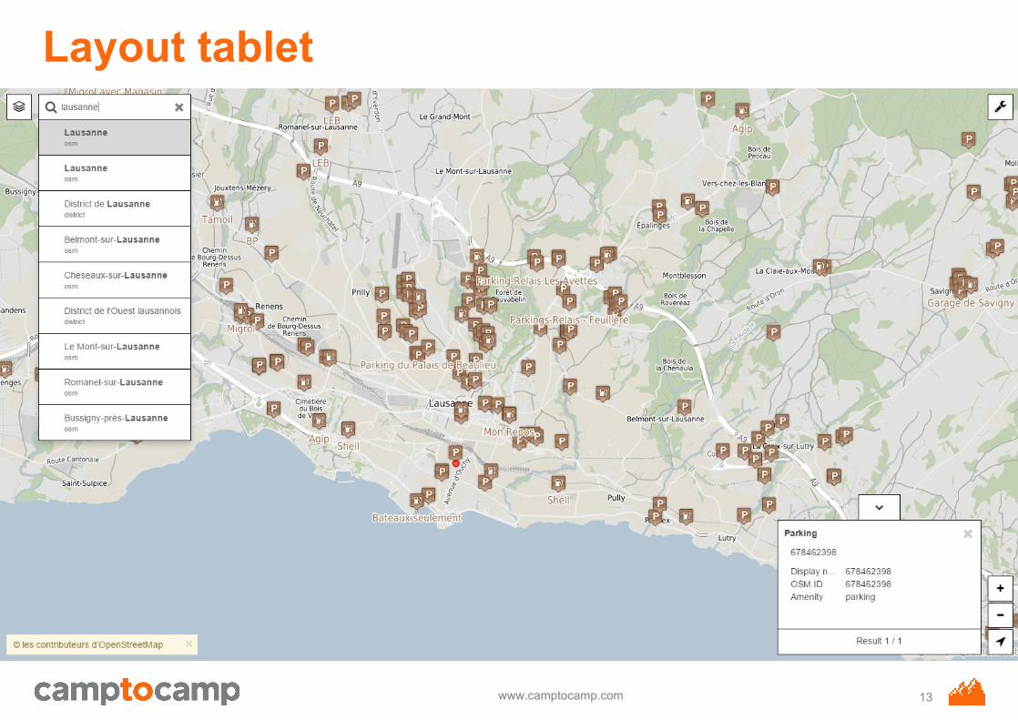
Layout tablet
13
www.camptocamp.com
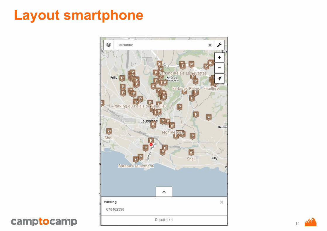
Layout smartphone
14
www.camptocamp.com
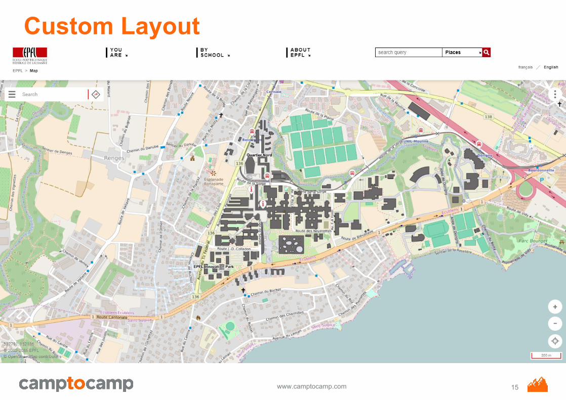
Custom Layout
15
www.camptocamp.com
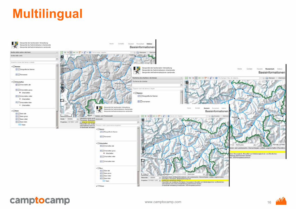
Multilingual
16
www.camptocamp.com
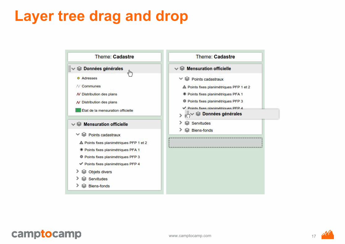
Layer tree drag and drop
17
www.camptocamp.com
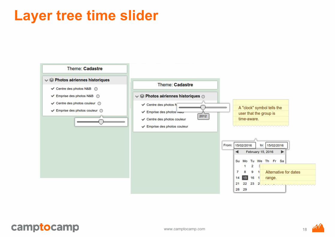
Layer tree time slider
18
www.camptocamp.com
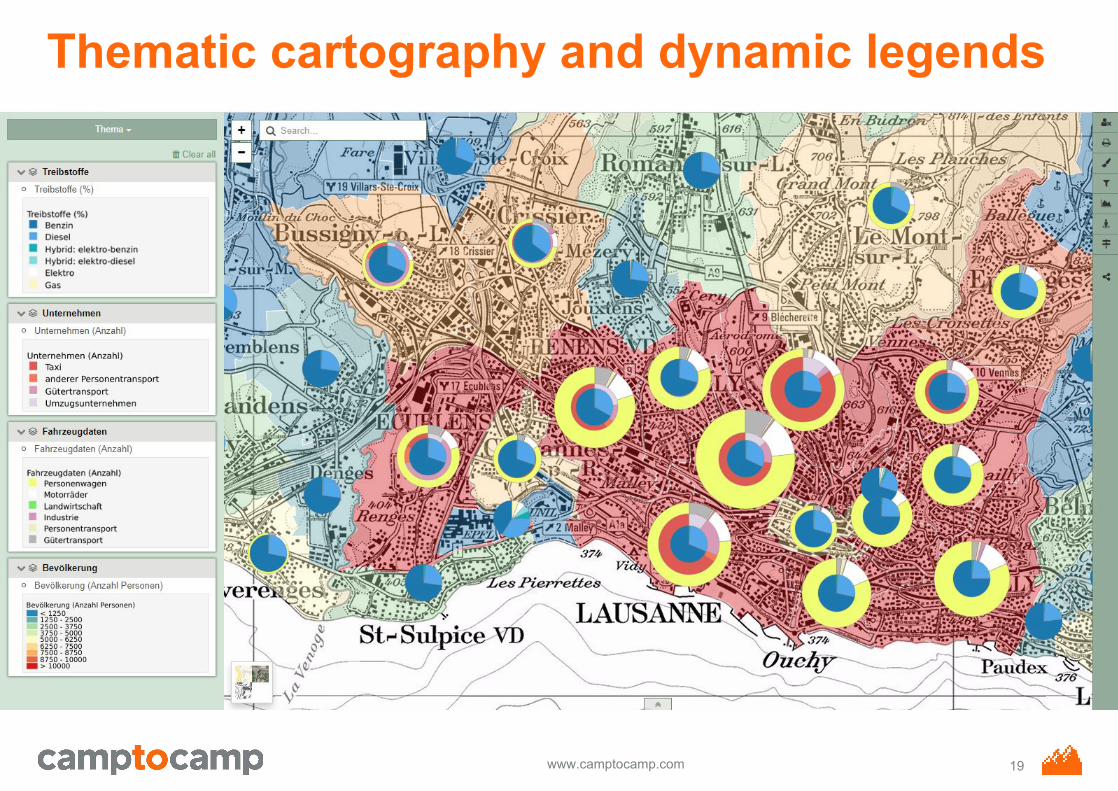
Thematic cartography and dynamic legends
19
www.camptocamp.com
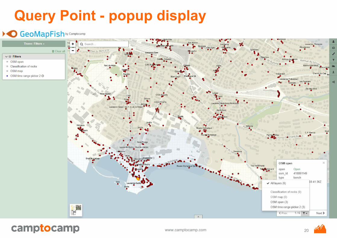
Query Point - popup display
20
www.camptocamp.com
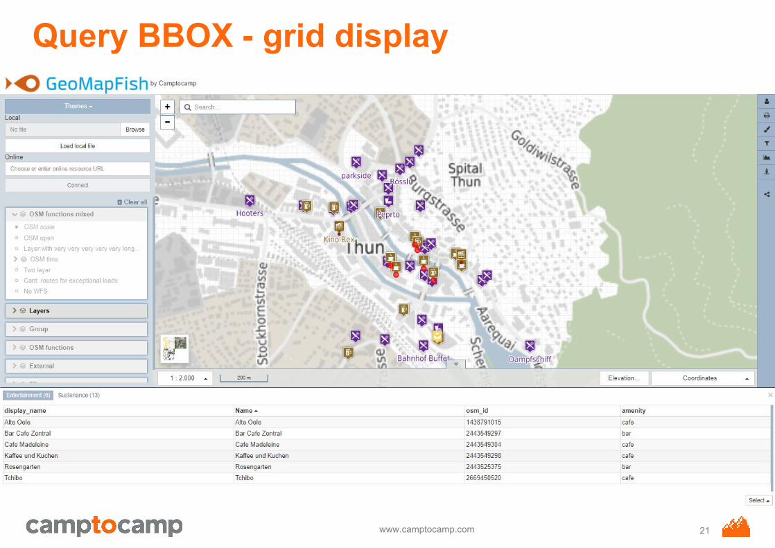
Query BBOX - grid display
21
www.camptocamp.com
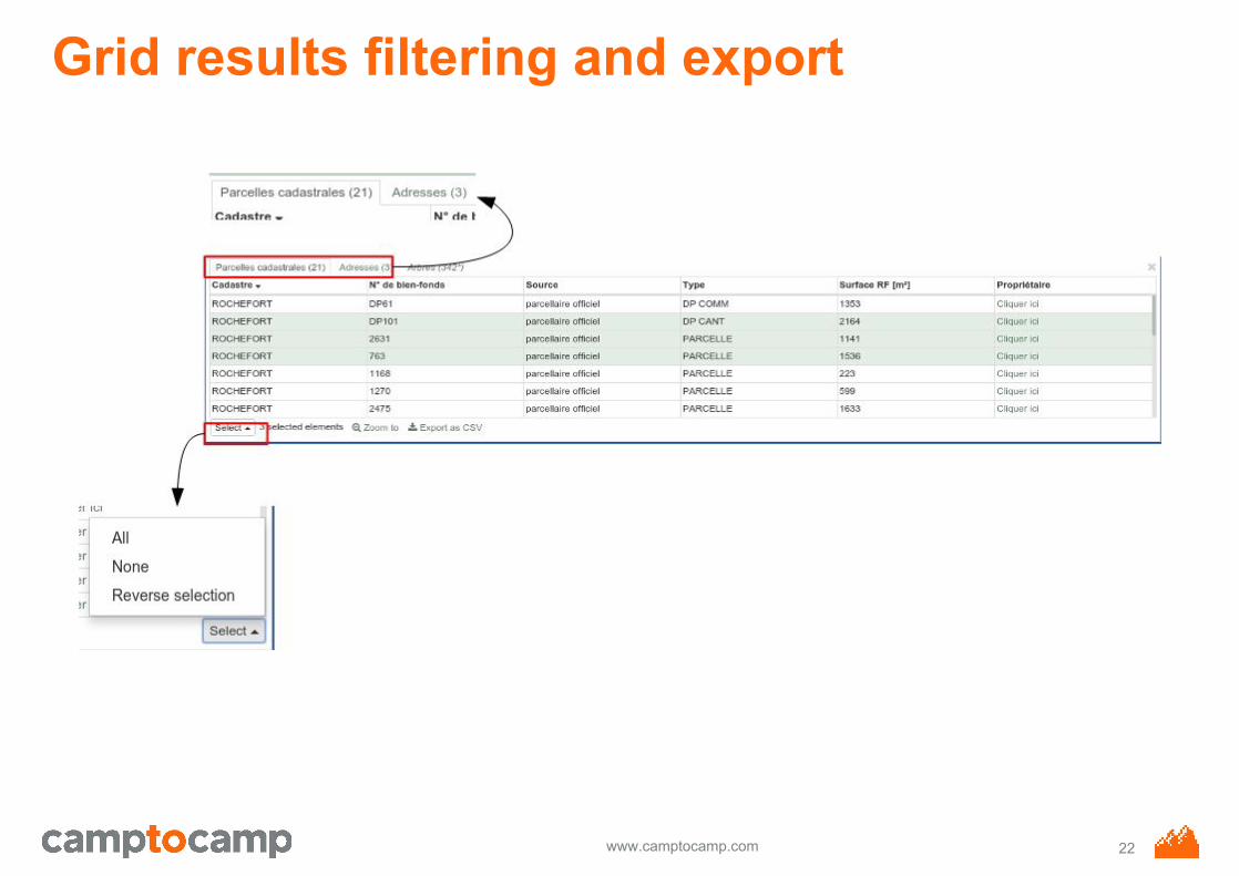
Grid results filtering and export
22
www.camptocamp.com
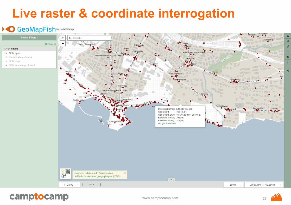
Live raster & coordinate interrogation
23
www.camptocamp.com
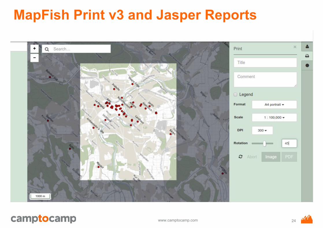
MapFish Print v3 and Jasper Reports
24
www.camptocamp.com
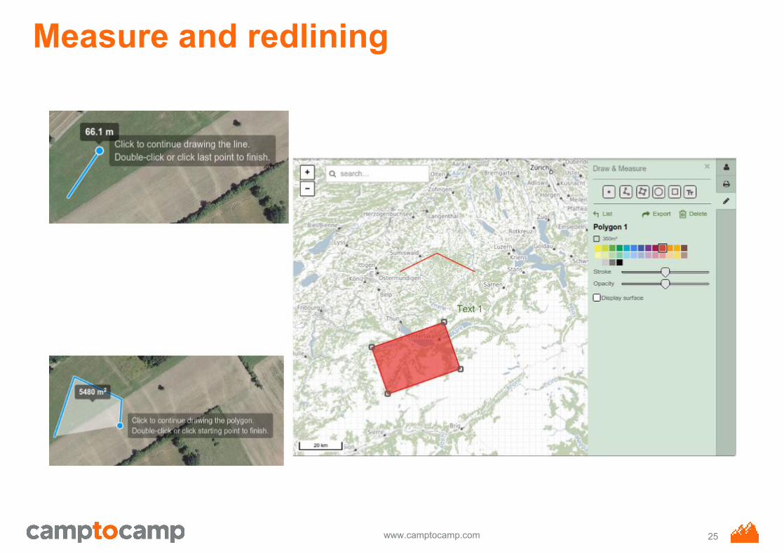
Measure and redlining
25
www.camptocamp.com
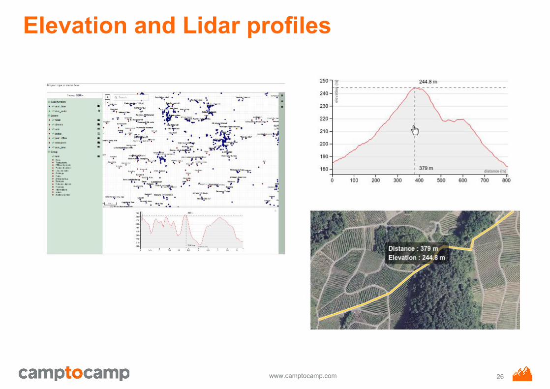
Elevation and Lidar profiles
26
www.camptocamp.com
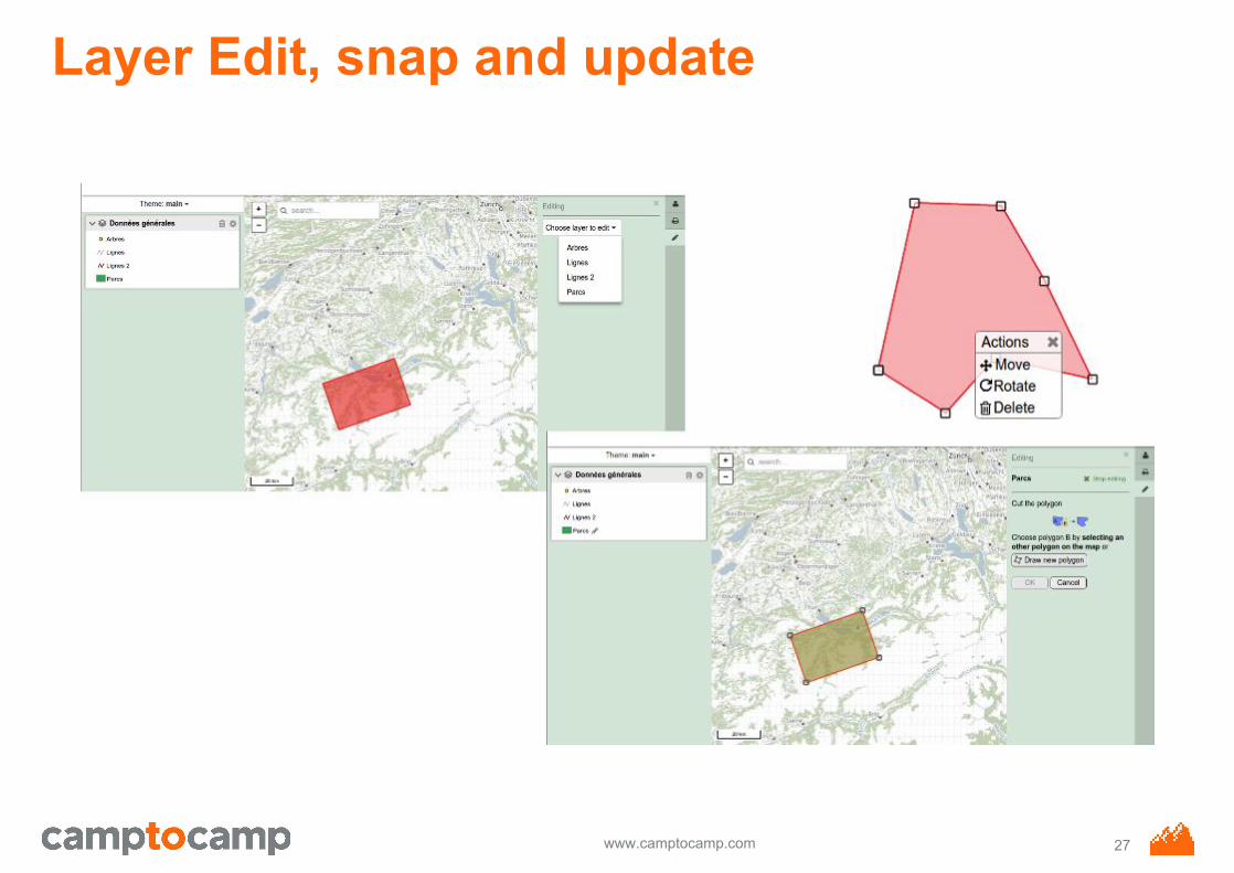
Layer Edit, snap and update
27
www.camptocamp.com
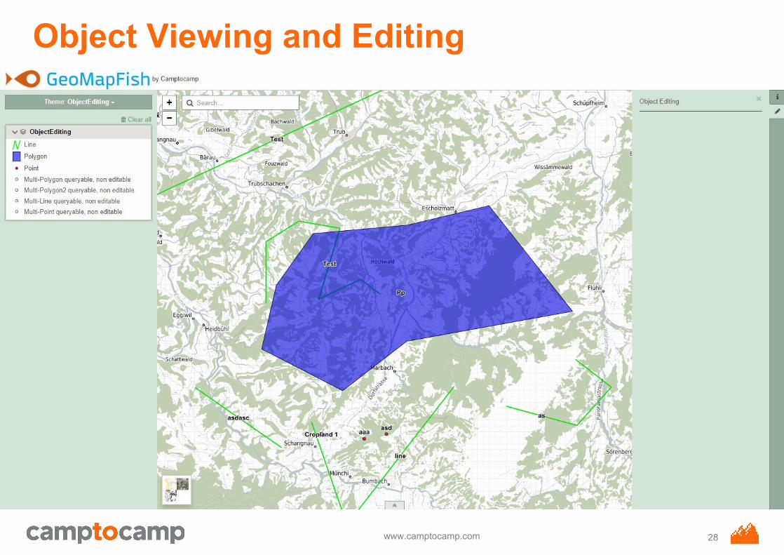
Object Viewing and Editing
28
www.camptocamp.com
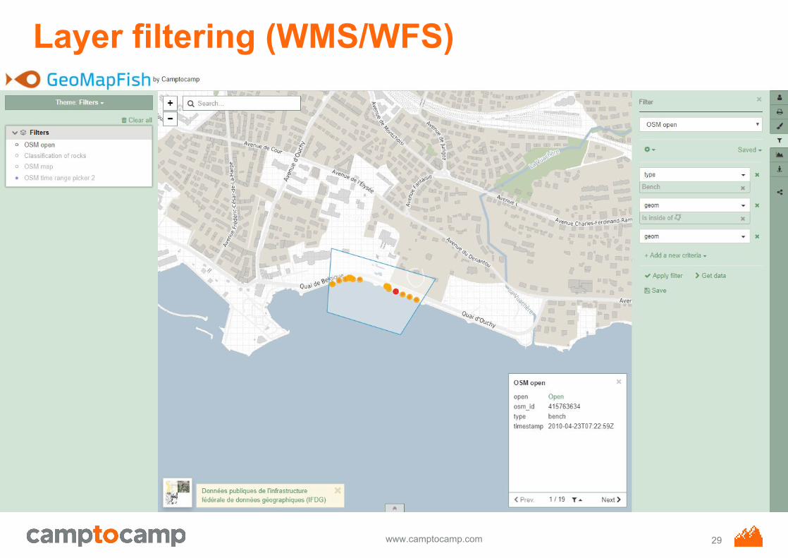
Layer filtering (WMS/WFS)
29

www.camptocamp.com
Floor selector
30
www.camptocamp.com
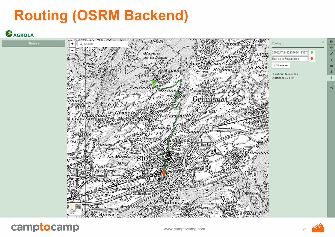
Routing (OSRM Backend)
31
www.camptocamp.com
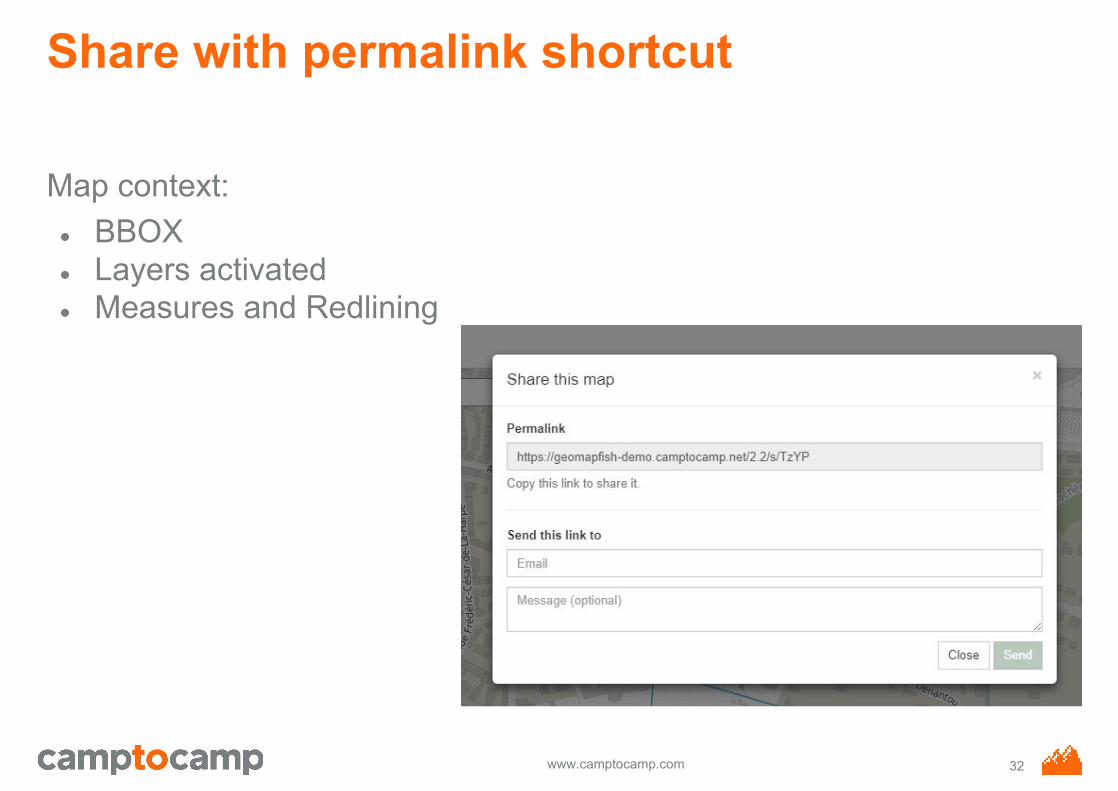
Share with permalink shortcut
Map context:● BBOX● Layers activated● Measures and Redlining
32
www.camptocamp.com
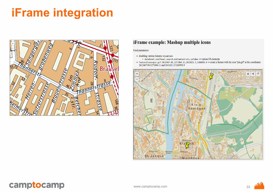
iFrame integration
33
www.camptocamp.com
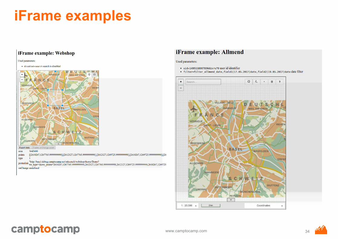
iFrame examples
34
www.camptocamp.com
Authentication & Autorization
Authentication● Postgresql,● LDAP,● NTLM, ● SSO (like Nevis)
Autorization● Roles configuration● User configuration● User restricted areas● User functionalities
35
www.camptocamp.com
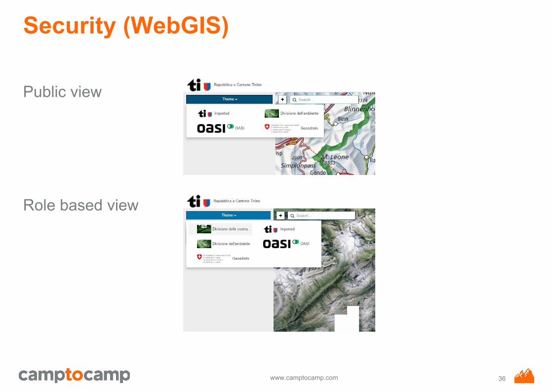
Security (WebGIS)
Public view
Role based view
36
www.camptocamp.com
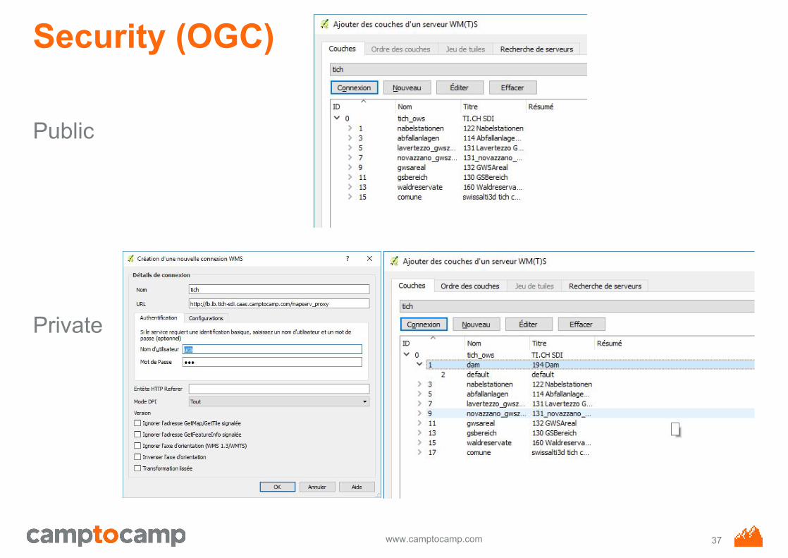
Security (OGC)
Public
Private
37
www.camptocamp.com
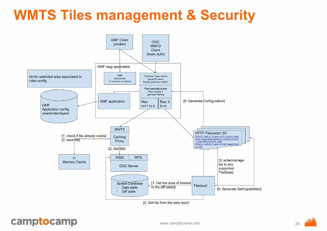
WMTS Tiles management & Security
38
www.camptocamp.com
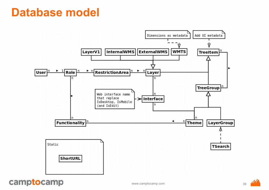
Database model
39
www.camptocamp.com
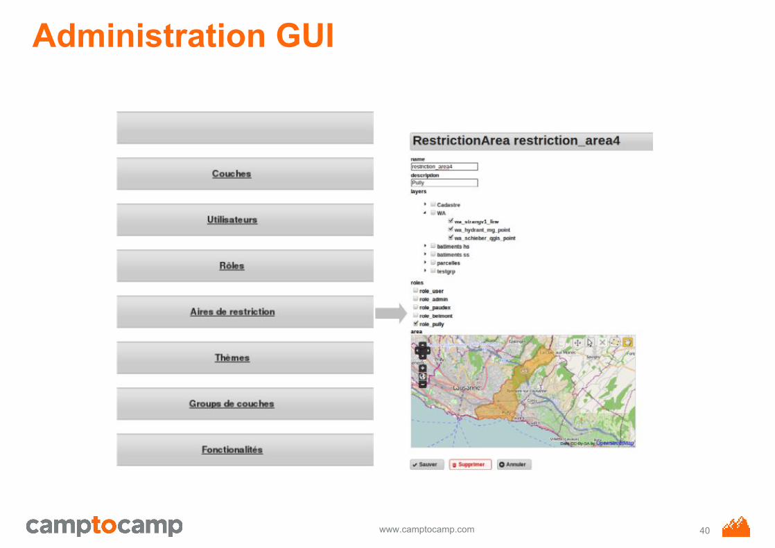
Administration GUI
40
www.camptocamp.com
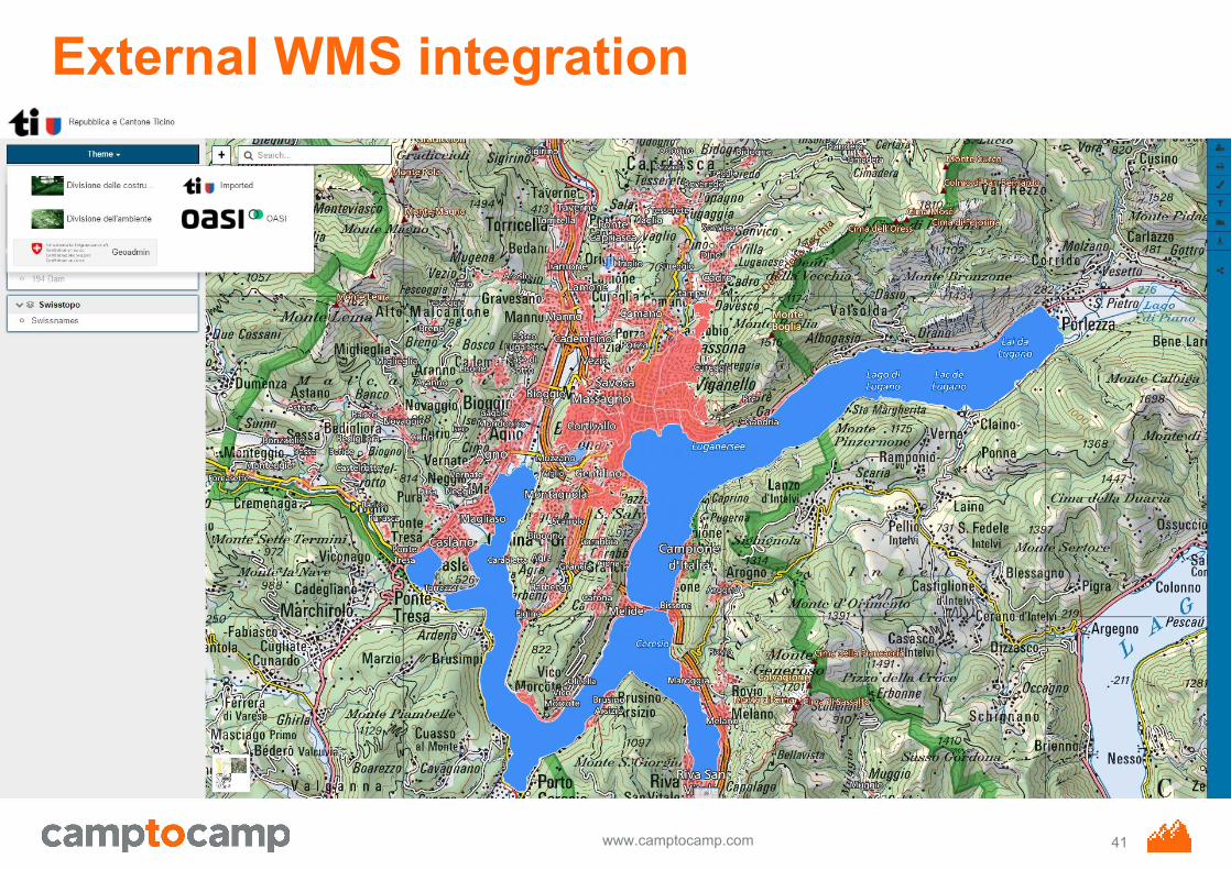
External WMS integration
41
www.camptocamp.com
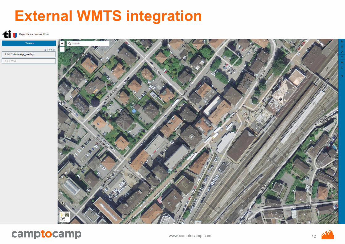
External WMTS integration
42
www.camptocamp.com
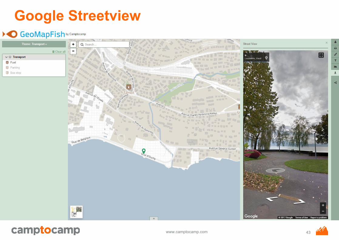
Google Streetview
43
www.camptocamp.com
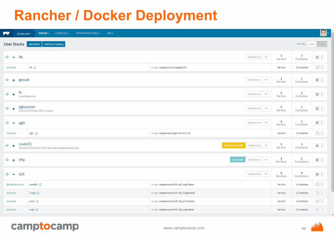
Rancher / Docker Deployment
44
www.camptocamp.com
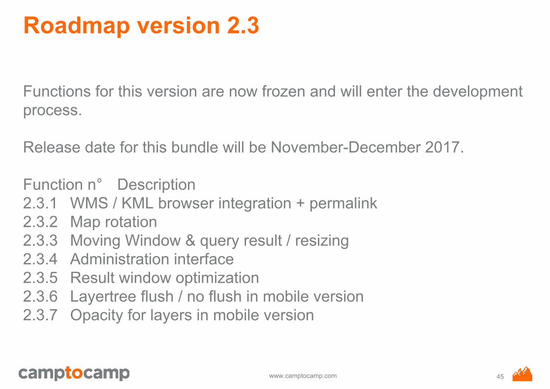
Roadmap version 2.3
Functions for this version are now frozen and will enter the development process.
Release date for this bundle will be November-December 2017.
Function n° Description2.3.1 WMS / KML browser integration + permalink2.3.2 Map rotation2.3.3 Moving Window & query result / resizing2.3.4 Administration interface2.3.5 Result window optimization2.3.6 Layertree flush / no flush in mobile version2.3.7 Opacity for layers in mobile version
45
www.camptocamp.com
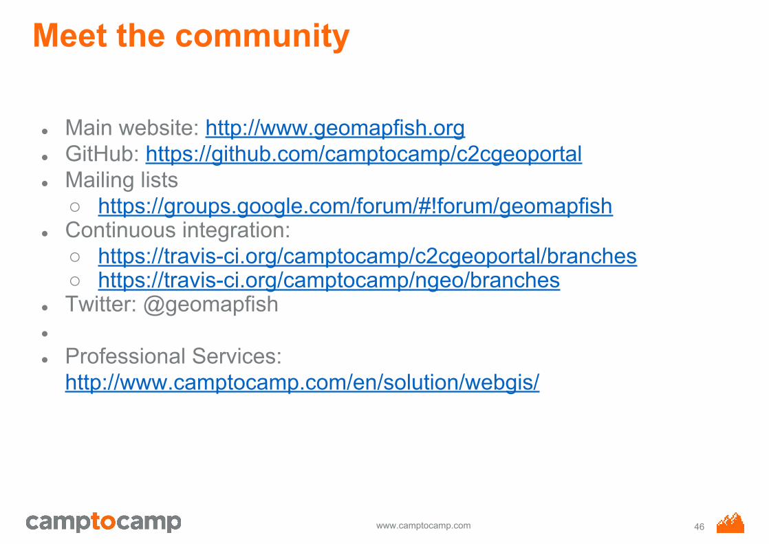
Meet the community
● Main website: http://www.geomapfish.org ● GitHub: https://github.com/camptocamp/c2cgeoportal ● Mailing lists
○ https://groups.google.com/forum/#!forum/geomapfish● Continuous integration:
○ https://travis-ci.org/camptocamp/c2cgeoportal/branches○ https://travis-ci.org/camptocamp/ngeo/branches
● Twitter: @geomapfish●
● Professional Services: http://www.camptocamp.com/en/solution/webgis/
46