Embed Size (px)
Citation preview

1
LECTURE 3LECTURE 3
What is Remote Sensing? What is Remote Sensing?
INTRODUCTION TOINTRODUCTION TO
REMOTE SENSINGREMOTE SENSING
2
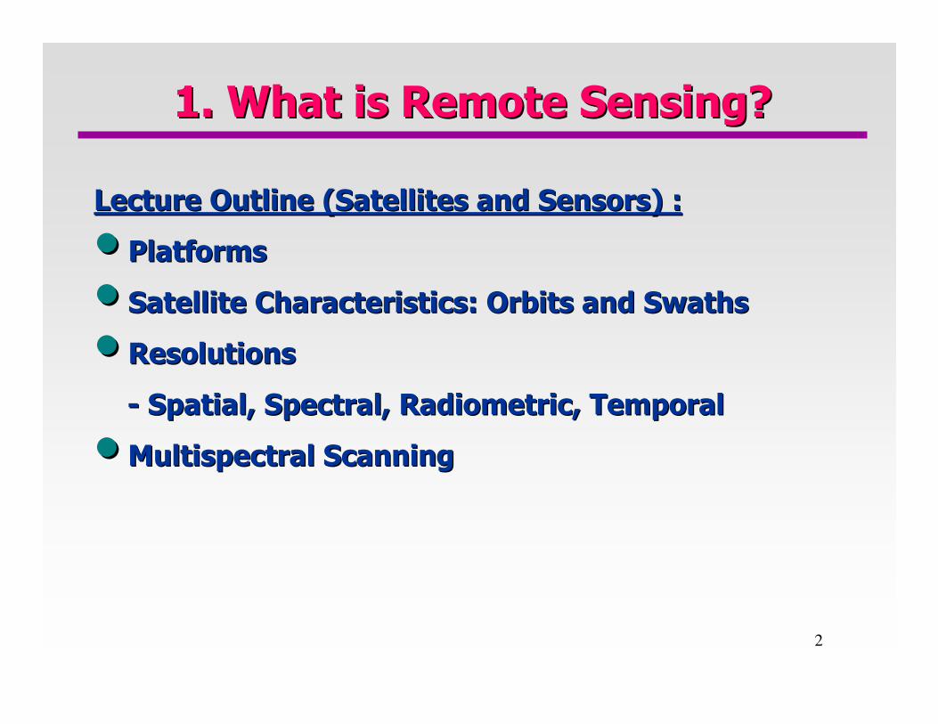
1. What is Remote Sensing?1. What is Remote Sensing?
Lecture Outline (Satellites and Sensors) :Lecture Outline (Satellites and Sensors) :
•• PlatformsPlatforms
•• Satellite Characteristics: Orbits and SwathsSatellite Characteristics: Orbits and Swaths
•• Resolutions Resolutions
-- Spatial, Spectral, Radiometric, TemporalSpatial, Spectral, Radiometric, Temporal
•• MultispectralMultispectral Scanning Scanning

3
On the Ground, In the Air, In SpaceOn the Ground, In the Air, In Space
�� PlatformsPlatforms
•• On the ground On the ground
•• On an Aircraft or Balloon (some other platform within the EarthOn an Aircraft or Balloon (some other platform within the Earth’’s s
atmosphere) atmosphere)
•• On a Spacecraft or Satellite Outside of the EarthOn a Spacecraft or Satellite Outside of the Earth’’s Atmospheres Atmosphere
QUESTION:QUESTION: What advantages do sensors carried on board satellites What advantages do sensors carried on board satellites
have over those carried on aircraft? Are there any disadvantageshave over those carried on aircraft? Are there any disadvantages that that
you can think of?you can think of?

4
Satellite Characteristics: Orbits and SwathsSatellite Characteristics: Orbits and Swaths
Geostationary OrbitsGeostationary Orbits::
�� These These satellites are at very high altitudes, satellites are at very high altitudes,
which view the same portion of the Earthwhich view the same portion of the Earth’’s s
surface at all times.surface at all times.
�� These satellites, at altitudes of approximately These satellites, at altitudes of approximately
36,000 kilometers, revolve at speeds which 36,000 kilometers, revolve at speeds which
match the rotation of the Earth so they seem match the rotation of the Earth so they seem
stationary, relative to the Earthstationary, relative to the Earth’’s atmosphere.s atmosphere.
QUESTION:QUESTION: Can one satellite cover the entire EarthCan one satellite cover the entire Earth’’s surface?s surface?

5
Satellite Characteristics: Orbits and SwathsSatellite Characteristics: Orbits and Swaths
NearNear--Polar OrbitsPolar Orbits::
�� These These satellites are designed to follow an orbit (basically satellites are designed to follow an orbit (basically
northnorth--south) which, in conjunction with the Earthsouth) which, in conjunction with the Earth’’s rotation s rotation
(west(west--east), allows them to cover most of the Eartheast), allows them to cover most of the Earth’’s surface s surface
over a certain period of time.over a certain period of time.
�� Two types of nearTwo types of near--polar orbits:polar orbits:
•• SunSun--SynchronousSynchronous: :
-- Cover each area of the world at a constant local time of dayCover each area of the world at a constant local time of day
-- At any given latitude, the position of the sun in the sky as thAt any given latitude, the position of the sun in the sky as the satellite e satellite
passes overhead will be the same within the same seasonpasses overhead will be the same within the same season
•• NonNon--SunSun--Synchronous: Synchronous: Opposite of SunOpposite of Sun--SynchronousSynchronous

6
Satellite Characteristics: Orbits and SwathsSatellite Characteristics: Orbits and Swaths
NearNear--Polar OrbitsPolar Orbits::
QUESTION:QUESTION: Discuss advantages and disadvantages of SunDiscuss advantages and disadvantages of Sun--
synchronous satellites.synchronous satellites.

7
Satellite Characteristics: Orbits and SwathsSatellite Characteristics: Orbits and Swaths
NearNear--Polar OrbitsPolar Orbits::
�� The satellite travels northward on one side of the Earth and The satellite travels northward on one side of the Earth and
then toward the southern pole on the second half of its orbit. then toward the southern pole on the second half of its orbit.
These are called These are called ascending and descending passesascending and descending passes, ,
respectively.respectively.
�� If the orbit is also sunIf the orbit is also sun--synchronous, the ascending pass is most likely on synchronous, the ascending pass is most likely on
the shadowed side of the Earth while the descending pass is mostthe shadowed side of the Earth while the descending pass is most likely on likely on
the sunlit side.the sunlit side.
�� Sensors recording reflected solar energy only image the surface Sensors recording reflected solar energy only image the surface on a on a
descending pass, when solar illumination is available. descending pass, when solar illumination is available.
�� Active sensors which provide their own illumination or passive sActive sensors which provide their own illumination or passive sensors ensors
that record emitted (e.g. thermal) radiation can also image the that record emitted (e.g. thermal) radiation can also image the surface on surface on
ascending passes.ascending passes.

8
Satellite Characteristics: Orbits and SwathsSatellite Characteristics: Orbits and Swaths
Orbit LengthOrbit Length::
�� Orbit LengthOrbit Length: If we start with any randomly selected pass in : If we start with any randomly selected pass in
a satellitea satellite’’s orbit, an orbit cycle will be completed when the s orbit, an orbit cycle will be completed when the
satellite traces its path, passing over the same point on the satellite traces its path, passing over the same point on the
EarthEarth’’s surface directly below the satellite (called the nadir s surface directly below the satellite (called the nadir
point) for a second time.point) for a second time.
QUESTION:QUESTION: Is the orbit length the same as the revisit period?Is the orbit length the same as the revisit period?
The revisit period is an important consideration for a The revisit period is an important consideration for a number of number of
monitoring applications, especially when frequent imaging is monitoring applications, especially when frequent imaging is
required (for example, to monitor the extent of flooding).required (for example, to monitor the extent of flooding).

9
Satellite Characteristics: Orbits and SwathsSatellite Characteristics: Orbits and Swaths
SwathSwath::
�� As a satellite revolves around the Earth, the sensor As a satellite revolves around the Earth, the sensor
““seessees”” a certain portion of the Eartha certain portion of the Earth’’s surface. The s surface. The
area imaged on the surface, is referred to as the area imaged on the surface, is referred to as the
swathswath..
�� Imaging swaths for Imaging swaths for spacebornespaceborne sensors generally sensors generally
vary between tens and hundreds of kilometers wide.vary between tens and hundreds of kilometers wide.
10
Satellite Characteristics: Orbits and SwathsSatellite Characteristics: Orbits and Swaths
QUESTION:QUESTION: Does the revisit period change with latitude?Does the revisit period change with latitude?
�� In nearIn near--polar orbits, areas at high latitude will be imaged more frequenpolar orbits, areas at high latitude will be imaged more frequently tly
than the equatorial zone due to the increasing than the equatorial zone due to the increasing overlap in adjacent swathsoverlap in adjacent swaths
as the orbit paths come closer together near the poles.as the orbit paths come closer together near the poles.

11
Spatial Resolution and Pixel SizeSpatial Resolution and Pixel Size
�� For remote sensors, the distance between the target being imagedFor remote sensors, the distance between the target being imaged and and
the platform plays a large role in determining the detail of infthe platform plays a large role in determining the detail of information ormation
and the total area imaged by the sensor.and the total area imaged by the sensor.
QUESTION:QUESTION: Look at the two images below. One of them is taken from a Look at the two images below. One of them is taken from a
satellite, and the other one from an aircraft. Can you tell whicsatellite, and the other one from an aircraft. Can you tell which is h is
which? which?

12
Spatial Resolution and Pixel SizeSpatial Resolution and Pixel Size
�� Spatial ResolutionSpatial Resolution of the Sensors: refers to the size of of the Sensors: refers to the size of
the smallest possible feature that can be detected.the smallest possible feature that can be detected.
�� Spatial resolution of passive sensors depends primarily Spatial resolution of passive sensors depends primarily
on their on their Instantaneous Field of View (IFOV).Instantaneous Field of View (IFOV).
�� IFOV: IFOV: is the angular cone of visibility of the sensor (A) and determinis the angular cone of visibility of the sensor (A) and determines the es the
area on the Eartharea on the Earth’’s surface which is s surface which is ““seenseen”” from a given altitude at one from a given altitude at one
particular moment in time (B).particular moment in time (B).
�� The size of the area viewed is determined by multiplying the IFOThe size of the area viewed is determined by multiplying the IFOV by the V by the
distance from the ground to the sensor (C). This area on the grodistance from the ground to the sensor (C). This area on the ground is und is
called the called the resolution cellresolution cell..

13
Spatial Resolution and Pixel SizeSpatial Resolution and Pixel Size
QUESTION:QUESTION: Are the pixel size and resolution the same?Are the pixel size and resolution the same?
�� Images where only large features are visible are said to have Images where only large features are visible are said to have coarse or low coarse or low
resolutionresolution. In . In fine or high resolutionfine or high resolution images, small objects can be images, small objects can be
detected.detected.

14
Spectral ResolutionSpectral Resolution
�� Broad classes, such as water and vegetation, can usually be sepaBroad classes, such as water and vegetation, can usually be separated rated
using very broad wavelength ranges using very broad wavelength ranges –– the visible and near Infraredthe visible and near Infrared
�� Other more specific classes, such as different Other more specific classes, such as different
rock types, may not be easily distinguishable rock types, may not be easily distinguishable
using either of these broad wavelength ranges using either of these broad wavelength ranges
and would require comparison at much finer and would require comparison at much finer
wavelength ranges to separate them. Thus, we wavelength ranges to separate them. Thus, we
would require a sensor with higher spectral would require a sensor with higher spectral
resolution.resolution.
�� Spectral resolutionSpectral resolution describes the ability of a sensor to define fine describes the ability of a sensor to define fine
wavelength intervals. The finer the spectral resolution, the narwavelength intervals. The finer the spectral resolution, the narrower rower
the wavelength range for a particular channel or band.the wavelength range for a particular channel or band.

15
Spectral ResolutionSpectral Resolution
�� Many remote sensing systems record energy over separate wavelengMany remote sensing systems record energy over separate wavelength th
ranges at various spectral resolutions. These are referred to asranges at various spectral resolutions. These are referred to as multimulti--
spectral sensorsspectral sensors. .
�� Advanced multiAdvanced multi--spectral sensors called spectral sensors called hyperspectralhyperspectral sensorssensors detect detect
hundreds of very narrow spectral bands.hundreds of very narrow spectral bands.
QUESTION:QUESTION: What would be some of the advantages and disadvantages of What would be some of the advantages and disadvantages of
hyperspectralhyperspectral scanners? scanners?

16
Radiometric ResolutionRadiometric Resolution
�� The The radiometric resolutionradiometric resolution of an imaging system describes its ability to of an imaging system describes its ability to
discriminate very slight differences in energy.discriminate very slight differences in energy.
�� The finer the radiometric resolution of a sensor, the more sensiThe finer the radiometric resolution of a sensor, the more sensitive it is to tive it is to
detecting small differences in reflected or emitted energy.detecting small differences in reflected or emitted energy.

17
You canYou can’’t have it all!t have it all!
�� There are tradeThere are trade--offs between offs between spatial, spectral, and spatial, spectral, and
radiometric resolutionradiometric resolution which must be taken into which must be taken into
consideration when engineers design a sensor.consideration when engineers design a sensor.
QUESTION: For high spatial resolution, what should
be the characteristics of the sensor?
� For high spatial resolution, the sensor has to have a
small IFOV (Instantaneous Field of View).
However, this reduces the amount of energy that
can be detected as the area of the ground resolution
cell within the IFOV becomes smaller. This leads
to reduced radiometric resolution

18
You canYou can’’t have it all!t have it all!
QUESTION: To increase the amount of energy To increase the amount of energy
detected (and thus, the radiometric resolution) detected (and thus, the radiometric resolution)
without reducing spatial resolution,without reducing spatial resolution, what should be
the characteristics of the sensor?
�� To increase the amount of energy detected (and To increase the amount of energy detected (and
thus, the radiometric resolution) without reducing thus, the radiometric resolution) without reducing
spatial resolution, we would have to broaden the spatial resolution, we would have to broaden the
wavelength range detected for a particular channel wavelength range detected for a particular channel
or band. Unfortunately, this would reduce the or band. Unfortunately, this would reduce the
spectral resolution of the sensor.spectral resolution of the sensor.
19
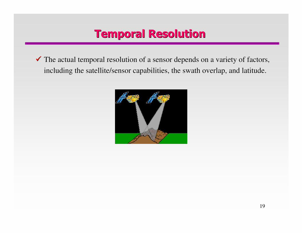
Temporal ResolutionTemporal Resolution
�� The actual temporal resolution of a sensor depends on a variety The actual temporal resolution of a sensor depends on a variety of factors, of factors,
including the satellite/sensor capabilities, the swath overlap, including the satellite/sensor capabilities, the swath overlap, and latitude.and latitude.

20
MultispectralMultispectral ScanningScanning
�� Many electronic (as opposed to photographic) remote sensors acquMany electronic (as opposed to photographic) remote sensors acquire data ire data
using using scanning systemsscanning systems, which employ a sensor with a narrow field of view , which employ a sensor with a narrow field of view
(i.e. IFOV) that sweeps over the terrain to build up and produce(i.e. IFOV) that sweeps over the terrain to build up and produce a twoa two--
dimensional image of the surface.dimensional image of the surface.
�� A scanning system used to collect data over a variety of differeA scanning system used to collect data over a variety of different nt
wavelength ranges is called a wavelength ranges is called a multispectralmultispectral scanner (MSS),scanner (MSS), and is the and is the
most commonly used scanning system.most commonly used scanning system.
�� Two main modes of scanning: Two main modes of scanning: acrossacross--track scanningtrack scanning, and , and alongalong--track track
scanningscanning..

21
MultispectralMultispectral ScanningScanning
�� AcrossAcross--track Scanners:track Scanners:
•• Scan the Earth in a series of lines. The lines are Scan the Earth in a series of lines. The lines are
perpendicular to the direction of motion of the perpendicular to the direction of motion of the
sensor platform (i.e. across the swath).sensor platform (i.e. across the swath).
•• Each line is scanned from one side of the sensor to the other, Each line is scanned from one side of the sensor to the other, using a using a rotating rotating
mirror (A).mirror (A). As the platform moves forward over the Earth, successive scans As the platform moves forward over the Earth, successive scans
build up a twobuild up a two--dimensional image of the Earthdimensional image of the Earth’’s surface.s surface.
•• A bank of internal A bank of internal detectors (B)detectors (B), each sensitive to a specific range of , each sensitive to a specific range of
wavelengths, detects and measures the energy for each spectral bwavelengths, detects and measures the energy for each spectral band.and.
•• The The angular field of viewangular field of view (E) is the sweep of the mirror, measured in degrees, (E) is the sweep of the mirror, measured in degrees,
used to record a scan line, and determines the width of the imagused to record a scan line, and determines the width of the imaged ed swathswath (F). (F).

22
MultispectralMultispectral ScanningScanning
�� AcrossAcross--track Scanners:track Scanners:
•• Because the distance from the sensor to the target increases toBecause the distance from the sensor to the target increases towards wards
the edges of the swath, the ground resolution cells also become the edges of the swath, the ground resolution cells also become larger larger
and introduce geometric distortions to the images.and introduce geometric distortions to the images.
•• The length of time the IFOV The length of time the IFOV ““seessees”” a ground resolution cell as the a ground resolution cell as the
rotating mirror scans (called the rotating mirror scans (called the dwell timedwell time), is generally quite short ), is generally quite short
and and influences the design of the spatial, spectral, and radiometric influences the design of the spatial, spectral, and radiometric
resolution of the sensor.resolution of the sensor.

23
MultispectralMultispectral ScanningScanning
�� AlongAlong--track Scanners:track Scanners:
•• Instead of a scanning mirror, they use a Instead of a scanning mirror, they use a
linear array of detectors (A) located at the linear array of detectors (A) located at the
focal plane of the image (B) formed by lens focal plane of the image (B) formed by lens
systems (C), which are systems (C), which are ““pushedpushed”” along the along the
flight track direction (i.e. along track). These flight track direction (i.e. along track). These
systems are referred to as systems are referred to as pushbroompushbroom
scannersscanners..
•• Each individual detector measures the energy for a single grounEach individual detector measures the energy for a single ground d
resolution cell (D) and thus the size and IFOV of the detectors resolution cell (D) and thus the size and IFOV of the detectors
determines the spatial resolution of the system.determines the spatial resolution of the system.
•• A separate linear array is required to measure each spectral baA separate linear array is required to measure each spectral band or nd or
channel. channel.

24
MultispectralMultispectral ScanningScanning
�� Advantages of AlongAdvantages of Along--track Scanners over Acrosstrack Scanners over Across--track Scanners:track Scanners:
•• The array of detectors combined with the The array of detectors combined with the pushbroompushbroom motion allows motion allows
each detector to each detector to ““seesee”” and measure the energy from each ground and measure the energy from each ground
resolution cell for a longer period of time (dwell time). resolution cell for a longer period of time (dwell time).
•• This allows more energy to be detected and improves the radiomeThis allows more energy to be detected and improves the radiometric tric
resolution. resolution. The increased dwell time also facilitates smaller The increased dwell time also facilitates smaller IFOVsIFOVs and and
narrower bandwidths for each detector.narrower bandwidths for each detector.
•• Detectors last longer because they have no moving parts.Detectors last longer because they have no moving parts.
�� Disadvantages of AlongDisadvantages of Along--track Scannerstrack Scanners
CrossCross--calibrating thousand of detectors to achieve uniform intensity calibrating thousand of detectors to achieve uniform intensity
across the array is necessary and complicated.across the array is necessary and complicated.
QUESTION: Discuss the advantages and disadvantages of along-track
scanners w.r.t. across-track scanners.