Embed Size (px)
Citation preview
Degree & Profession©
Cre
ati
vit
y in
C
on
text
Florence World Festivalw
ww
.flore
nce
-expo.c
om
Name: Lucia Argento
City: Florence Country: Italy
Title of the Project: Historical GIS of ancient landscape in the northern Tuscany: the plain of Bisenzio and Mugello
Prof. Tutor: prof. ssa M. Azzari
University: University of Florence
Faculty of Litterature (SAGAS department)
Type of degree: MA
Degree & Profession©
Cre
ati
vit
y in
C
on
text
Florence World Festivalw
ww
.flore
nce
-expo.c
om
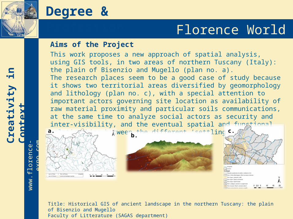
Aims of the Project This work proposes a new approach of spatial analysis, using GIS tools, in two areas of northern Tuscany (Italy): the plain of Bisenzio and Mugello (plan no. a). The research places seem to be a good case of study because it shows two territorial areas diversified by geomorphology and lithology (plan no. c), with a special attention to important actors governing site location as availability of raw material proximity and particular soils communications, at the same time to analyze social actors as security and inter-visibility, and the eventual spatial and functional relationships between the different ‘settling units’.
Title: Historical GIS of ancient landscape in the northern Tuscany: the plain of Bisenzio and MugelloFaculty of Litterature (SAGAS department)
a.b.
c.
Degree & Profession©
Cre
ati
vit
y in
C
on
text
Florence World Festivalw
ww
.flore
nce
-expo.c
om
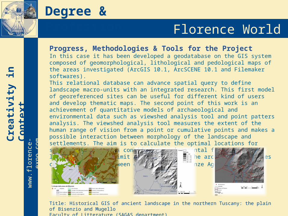
Progress, Methodologies & Tools for the ProjectIn this case it has been developed a geodatabase on the GIS system composed of geomorphological, lithological and pedological maps of the areas investigated (ArcGIS 10.1, ArcSCENE 10.1 and Filemaker softwares). This relational database can advance spatial query to define landscape macro-units with an integrated research. This first model of georeferenced sites can be useful for different kind of users and develop thematic maps. The second point of this work is an achievement of quantitative models of archaeological and environmental data such as viewshed analysis tool and point patters analysis. The viewshed analysis tool measures the extent of the human range of vision from a point or cumulative points and makes a possible interaction between morphology of the landscape and settlements. The aim is to calculate the optimal locations for settlement strategies considering environmental factors of the landscape with its limit and criticality. The archaeological sites cover the period between early and late bronze Age.
Title: Historical GIS of ancient landscape in the northern Tuscany: the plain of Bisenzio and MugelloFaculty of Litterature (SAGAS department)

Degree & Profession©
Cre
ati
vit
y in
C
on
text
Florence World Festivalw
ww
.flore
nce
-expo.c
om
ResultsIt has been examined the use of predictive modeling in archaeology for exploring location preferences and settlement strategies as a mean to assess archaeological potential for spatial planning policy and to guide future developments in the modern landscape. Possible developments and strategies:Monitoring Investigation and researchWebGIS, a small example under constructionhttp://a.tiles.mapbox.com/v3/3dculturalheritage.ToscanaSettentrionale/page.html#9/43.8731/11.0289
Title: Historical GIS of ancient landscape in the northern Tuscany: the plain of Bisenzio and MugelloFaculty of Litterature (SAGAS department)

Degree & Profession©
Cre
ati
vit
y in
C
on
text
Florence World Festivalw
ww
.flore
nce
-expo.c
om
Many thanks for your attention!
“Visual models are the equivalent of sensory representations in the brain: a translation of empirical phenomena into a geometric language. As models, they are the results of a transformation of input data into a geometric explanation of the input, with light
and texture information” 2006, BARCELO