Embed Size (px)
Citation preview
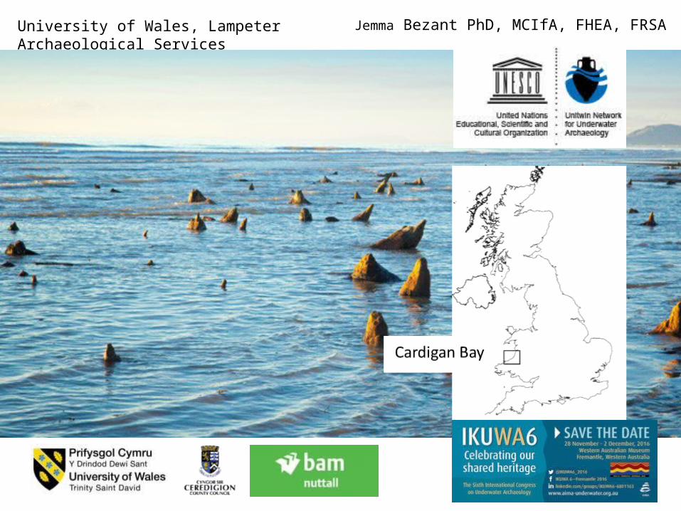
Jemma Bezant PhD, MCIfA, FHEA, FRSAUniversity of Wales, Lampeter Archaeological Services
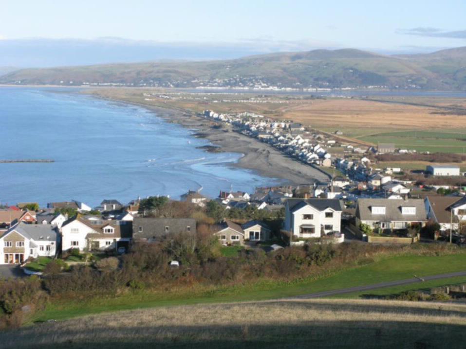
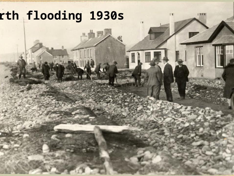
Borth flooding 1930s
Aims and Methods
* UWLAS updated an WSI
* full watching brief* recording and
sampling for palaeo* recovery of fossil tree
and archaeological material:
dendrochronology, wood species, pollen, plant
macro, faunal, geoarch
* to spatial dataset - GIS0 200 400 600 800100
Meters
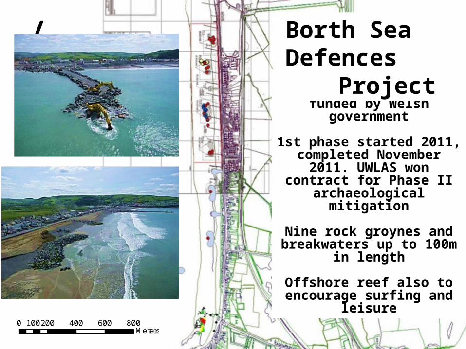
/£29m phased scheme
coastal protection funded by Welsh
government1st phase started 2011, completed November
2011. UWLAS won contract for Phase II
archaeological mitigation
Nine rock groynes and breakwaters up to 100m
in lengthOffshore reef also to
encourage surfing and leisure
Borth Sea Defences
Project
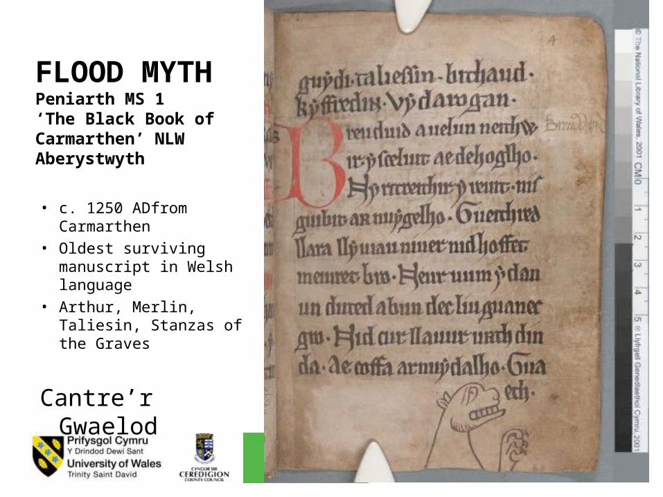
FLOOD MYTHPeniarth MS 1 ‘The Black Book of Carmarthen’ NLW Aberystwyth
• c. 1250 ADfrom Carmarthen
• Oldest surviving manuscript in Welsh language
• Arthur, Merlin, Taliesin, Stanzas of the Graves
Cantre’r Gwaelod
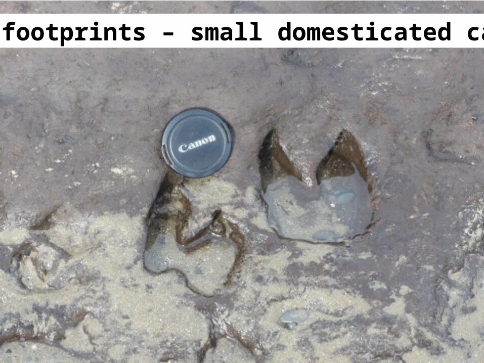
Animal footprints – small domesticated cattle
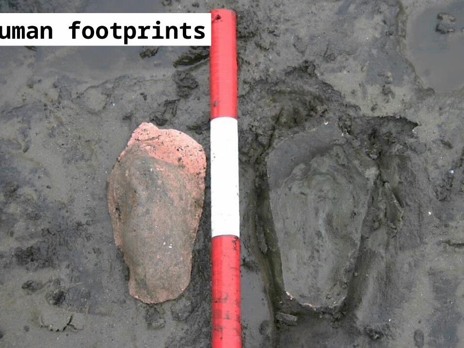
Jemma Bezant PhD, MCIfA, FHEA, FRSAUniversity of Wales, Lampeter Archaeological ServicesHuman footprints
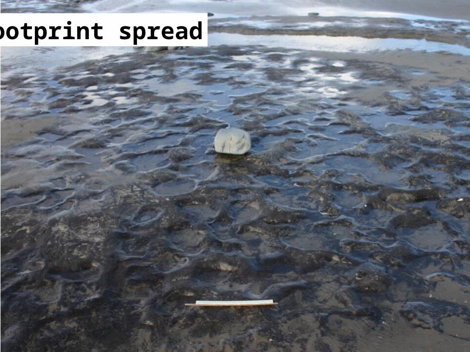
Footprint spread
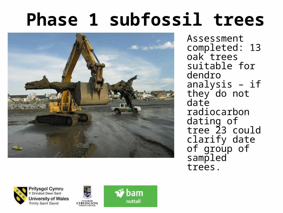
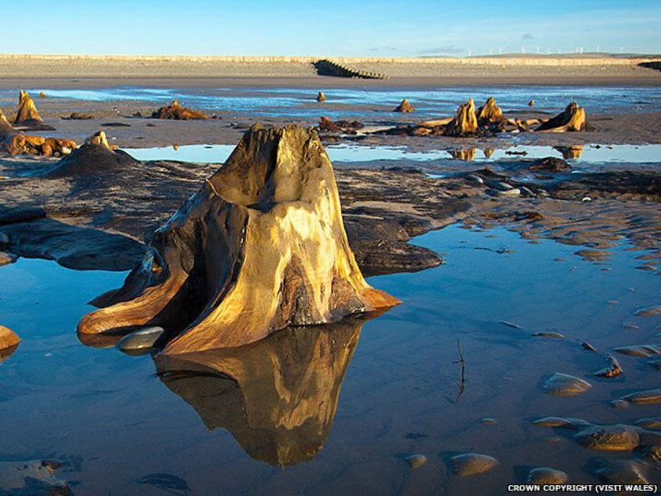
Phase 1 subfossil treesAssessment completed: 13 oak trees suitable for dendro analysis – if they do not date radiocarbon dating of tree 23 could clarify date of group of sampled trees.
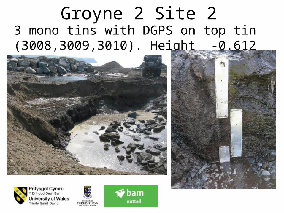
Groyne 2 Site 23 mono tins with DGPS on top tin (3008,3009,3010). Height -0.612 to -1.612
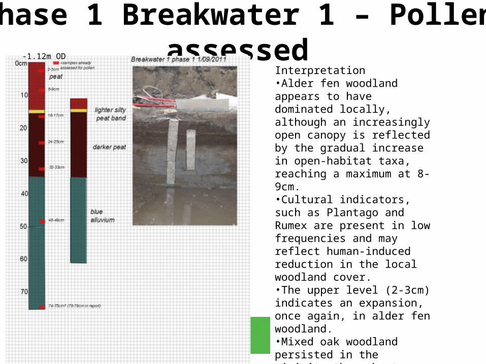
Phase 1 Breakwater 1 – Pollen assessed-1.12m OD
Interpretation•Alder fen woodland appears to have dominated locally, although an increasingly open canopy is reflected by the gradual increase in open-habitat taxa, reaching a maximum at 8-9cm. •Cultural indicators, such as Plantago and Rumex are present in low frequencies and may reflect human-induced reduction in the local woodland cover. •The upper level (2-3cm) indicates an expansion, once again, in alder fen woodland. •Mixed oak woodland persisted in the vicinity throughout.
•From DAT report (Sarah Jones) http://www.dyfedarchaeology.org.uk/projects/borthcoastaldefence.pdf
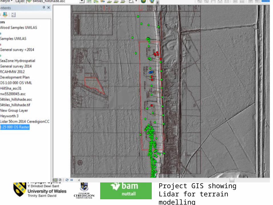
Project GIS showing Lidar for terrain modelling
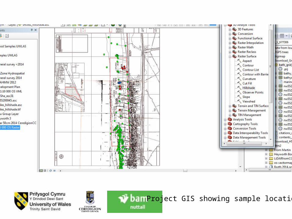
Project GIS showing sample locations
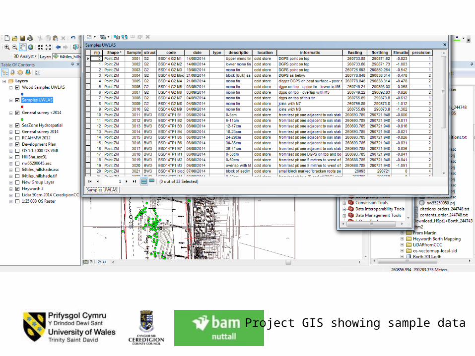
Project GIS showing sample data

Project GIS showing bathymetric data
• Final wider thoughts:–Specific challenges of intertidal developments• Archaeologists with paleo/wetland experience
–Human adaptation past coastal change• How were humans adapting to rapid sea level rise
in the past?• What can archaeologists offer policy makers in
terms of:social and cultural behaviourmanaging heritage in face of climate change