Embed Size (px)
Citation preview
From Land to Sea UXO detection surveys in the intertidal and nearshore environments
THS UXO Survey Seminar 19th June 2015
David Rider MSc

Outline

3
• Introduction
• Welcome
• Company Overview
• What is the intertidal zone.
• Land Techniques and Equipment
• Case Studies
• The Gap
• Survey Design
• Lessons Learned
• The Future

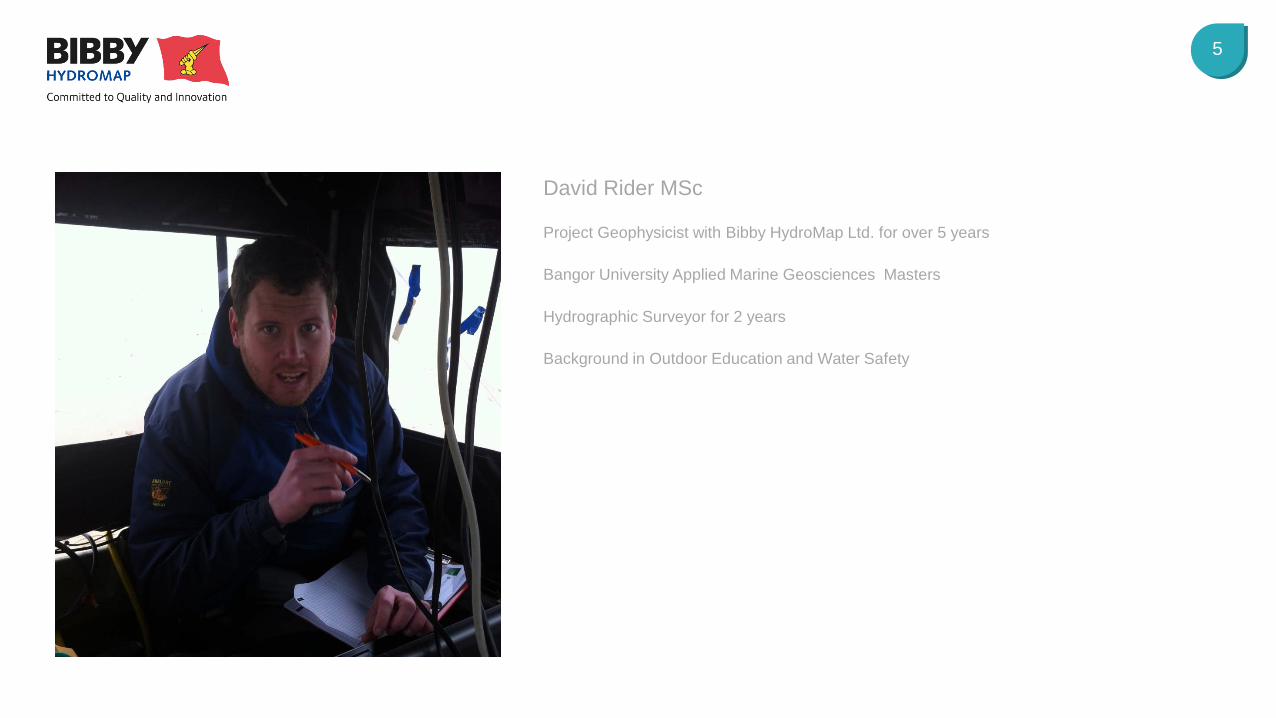
Introduction David Rider MSc
5
Project Geophysicist with Bibby HydroMap Ltd. for over 5 years
Bangor University Applied Marine Geosciences Masters
Hydrographic Surveyor for 2 years
Background in Outdoor Education and Water Safety
David Rider MSc

Introduction Company Overview
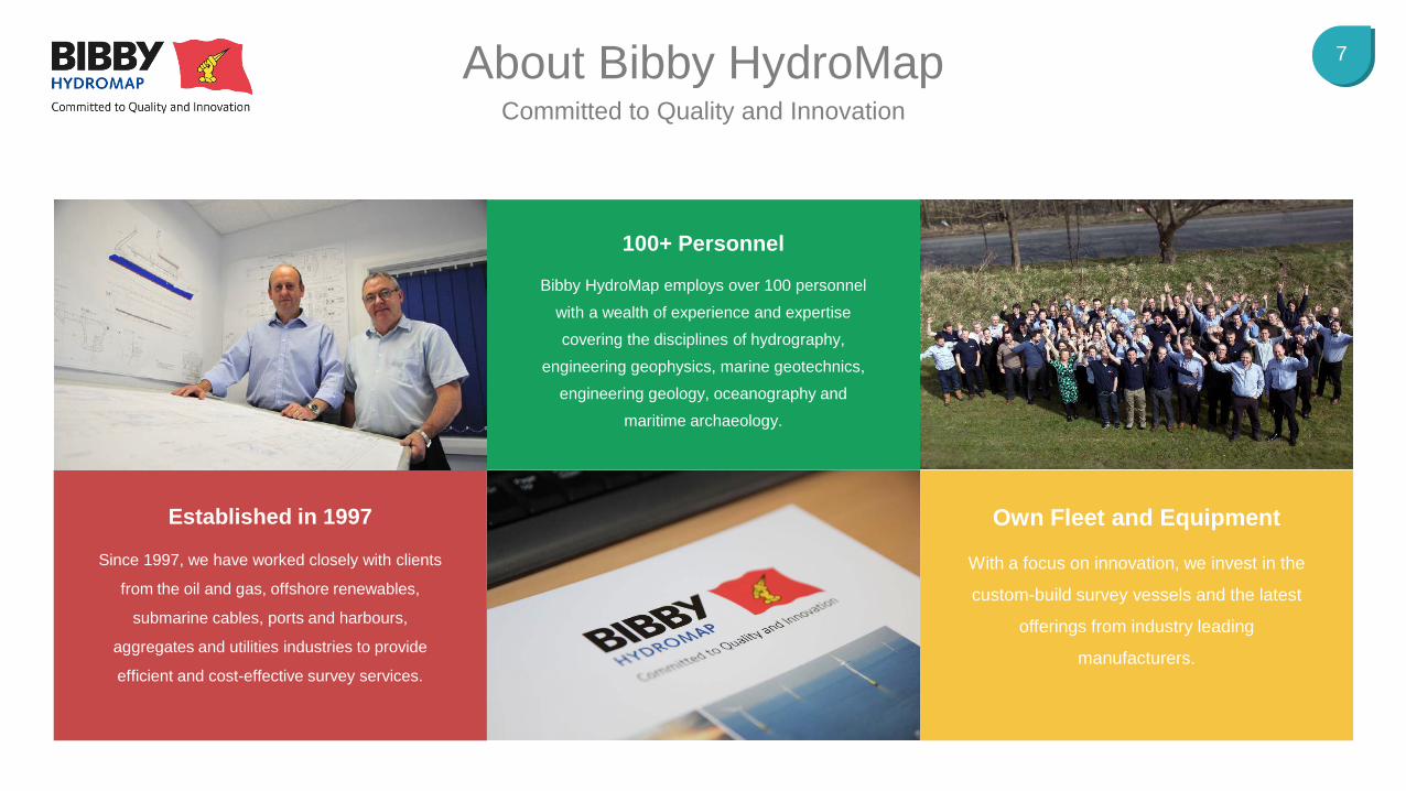
7 About Bibby HydroMap Committed to Quality and Innovation
Established in 1997
Since 1997, we have worked closely with clients
from the oil and gas, offshore renewables,
submarine cables, ports and harbours,
aggregates and utilities industries to provide
efficient and cost-effective survey services.
100+ Personnel
Bibby HydroMap employs over 100 personnel
with a wealth of experience and expertise
covering the disciplines of hydrography,
engineering geophysics, marine geotechnics,
engineering geology, oceanography and
maritime archaeology.
Own Fleet and Equipment
With a focus on innovation, we invest in the
custom-build survey vessels and the latest
offerings from industry leading
manufacturers.
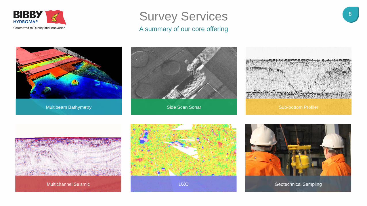
8 Survey Services A summary of our core offering
Multibeam Bathymetry Side Scan Sonar Sub-bottom Profiler
Multichannel Seismic UXO Geotechnical Sampling
What is the intertidal zone?
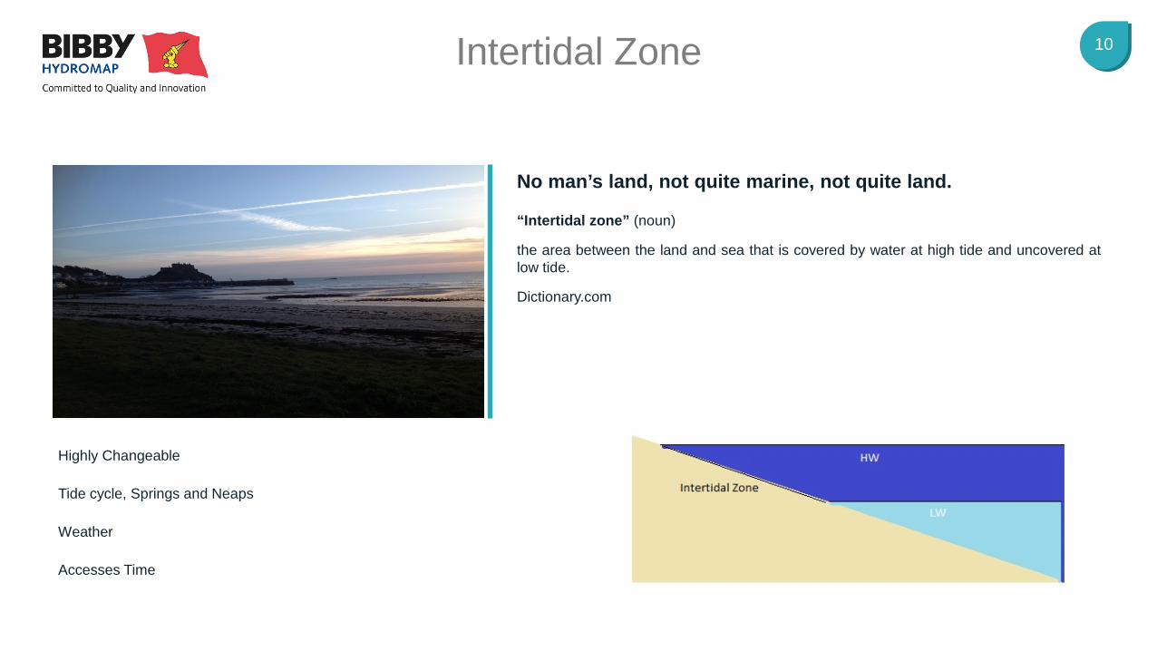
10 Intertidal Zone
Highly Changeable
Tide cycle, Springs and Neaps
Weather
Accesses Time
“Intertidal zone” (noun)
the area between the land and sea that is covered by water at high tide and uncovered at low tide.
Dictionary.com
No man’s land, not quite marine, not quite land.
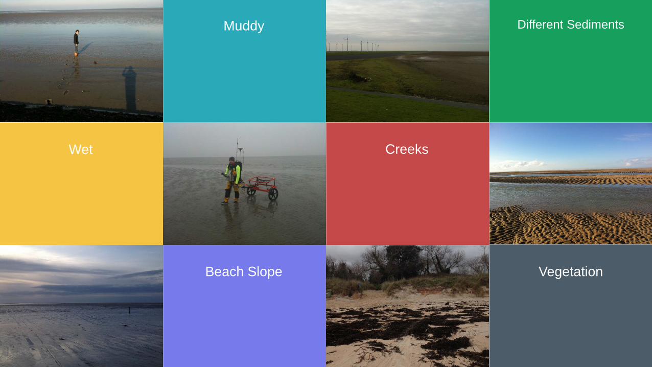
Muddy Different Sediments
Wet Creeks
Beach Slope Vegetation

Land Techniques and Equipment
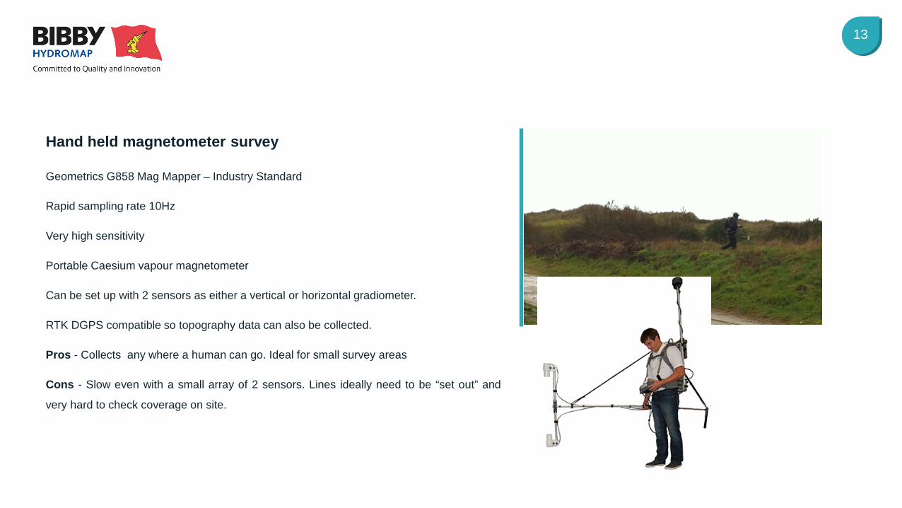
13
Geometrics G858 Mag Mapper – Industry Standard
Rapid sampling rate 10Hz
Very high sensitivity
Portable Caesium vapour magnetometer
Can be set up with 2 sensors as either a vertical or horizontal gradiometer.
RTK DGPS compatible so topography data can also be collected.
Pros - Collects any where a human can go. Ideal for small survey areas
Cons - Slow even with a small array of 2 sensors. Lines ideally need to be “set out” and
very hard to check coverage on site.
Hand held magnetometer survey
14
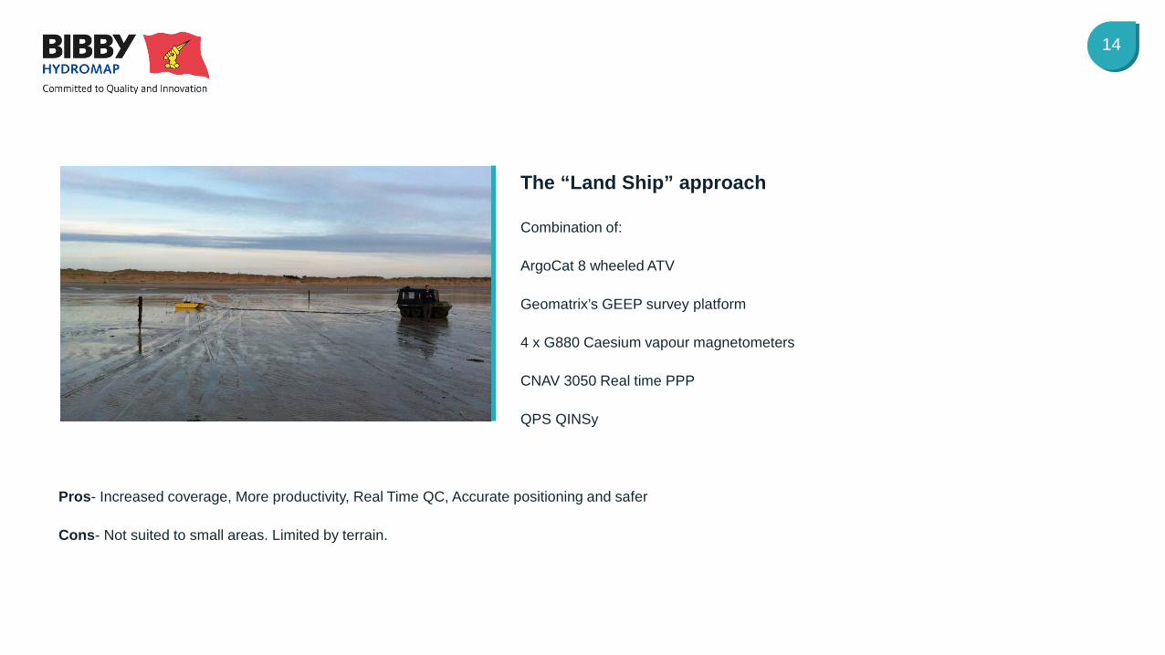
Pros- Increased coverage, More productivity, Real Time QC, Accurate positioning and safer
Cons- Not suited to small areas. Limited by terrain.
Combination of:
ArgoCat 8 wheeled ATV
Geomatrix’s GEEP survey platform
4 x G880 Caesium vapour magnetometers
CNAV 3050 Real time PPP
QPS QINSy
The “Land Ship” approach
15
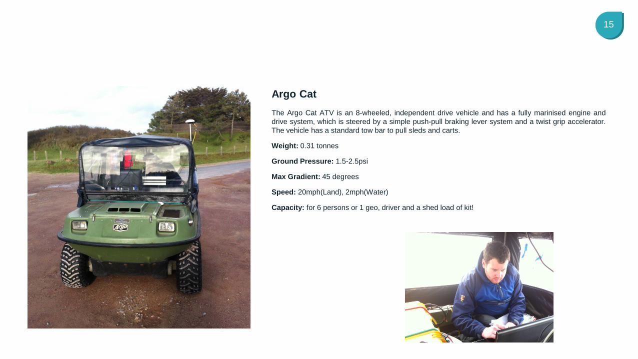
The Argo Cat ATV is an 8-wheeled, independent drive vehicle and has a fully marinised engine and drive system, which is steered by a simple push-pull braking lever system and a twist grip accelerator. The vehicle has a standard tow bar to pull sleds and carts.
Weight: 0.31 tonnes
Ground Pressure: 1.5-2.5psi
Max Gradient: 45 degrees
Speed: 20mph(Land), 2mph(Water)
Capacity: for 6 persons or 1 geo, driver and a shed load of kit!
Argo Cat
16
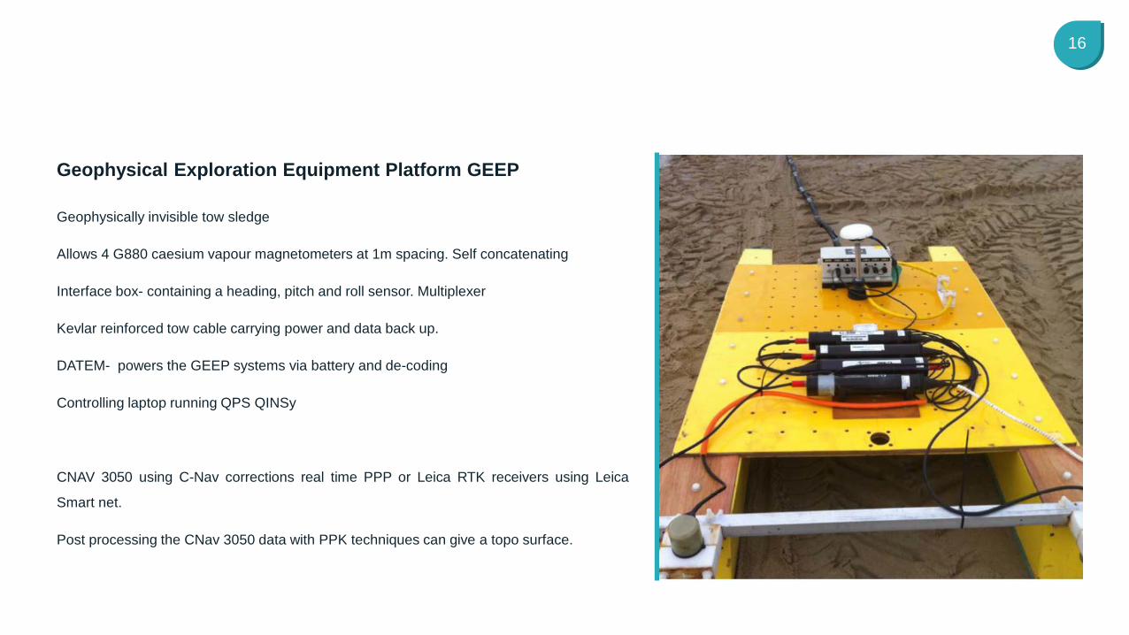
Geophysically invisible tow sledge
Allows 4 G880 caesium vapour magnetometers at 1m spacing. Self concatenating
Interface box- containing a heading, pitch and roll sensor. Multiplexer
Kevlar reinforced tow cable carrying power and data back up.
DATEM- powers the GEEP systems via battery and de-coding
Controlling laptop running QPS QINSy
CNAV 3050 using C-Nav corrections real time PPP or Leica RTK receivers using Leica
Smart net.
Post processing the CNav 3050 data with PPK techniques can give a topo surface.
Geophysical Exploration Equipment Platform GEEP

Case Studies East Coast Pre lay cable landing UXO Survey
18
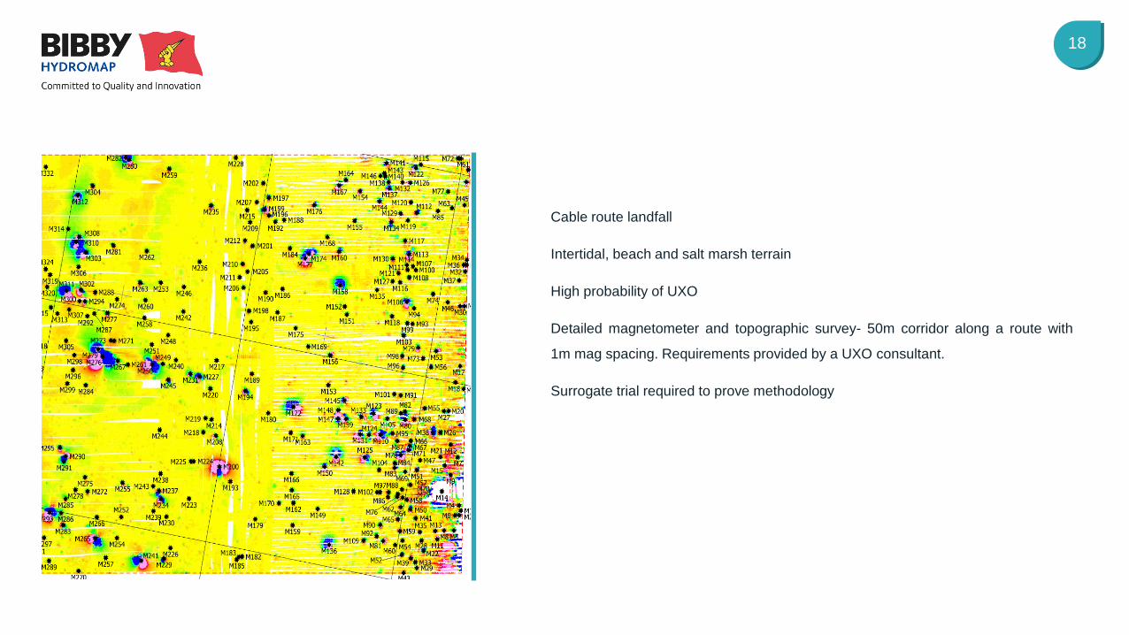
Cable route landfall
Intertidal, beach and salt marsh terrain
High probability of UXO
Detailed magnetometer and topographic survey- 50m corridor along a route with
1m mag spacing. Requirements provided by a UXO consultant.
Surrogate trial required to prove methodology
19
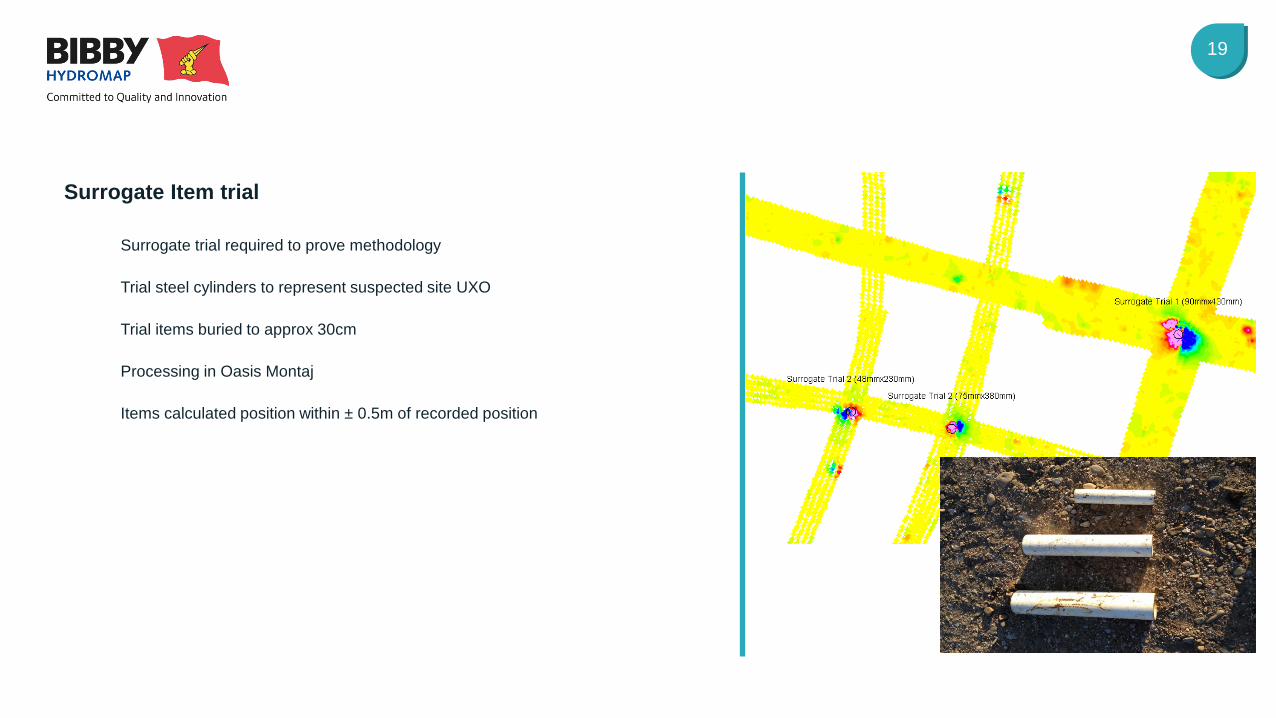
Surrogate trial required to prove methodology
Trial steel cylinders to represent suspected site UXO
Trial items buried to approx 30cm
Processing in Oasis Montaj
Items calculated position within ± 0.5m of recorded position
Surrogate Item trial
20
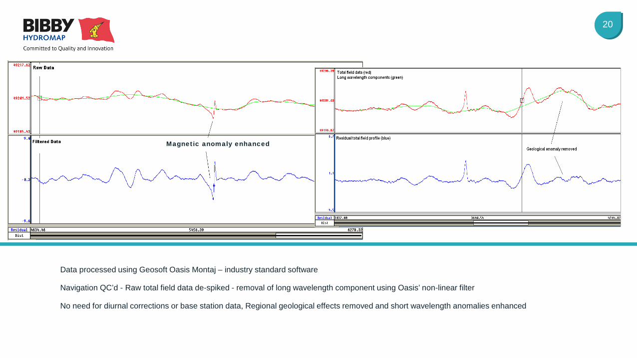
Data processed using Geosoft Oasis Montaj – industry standard software
Navigation QC’d - Raw total field data de-spiked - removal of long wavelength component using Oasis’ non-linear filter
No need for diurnal corrections or base station data, Regional geological effects removed and short wavelength anomalies enhanced
Magnetic anomaly enhanced
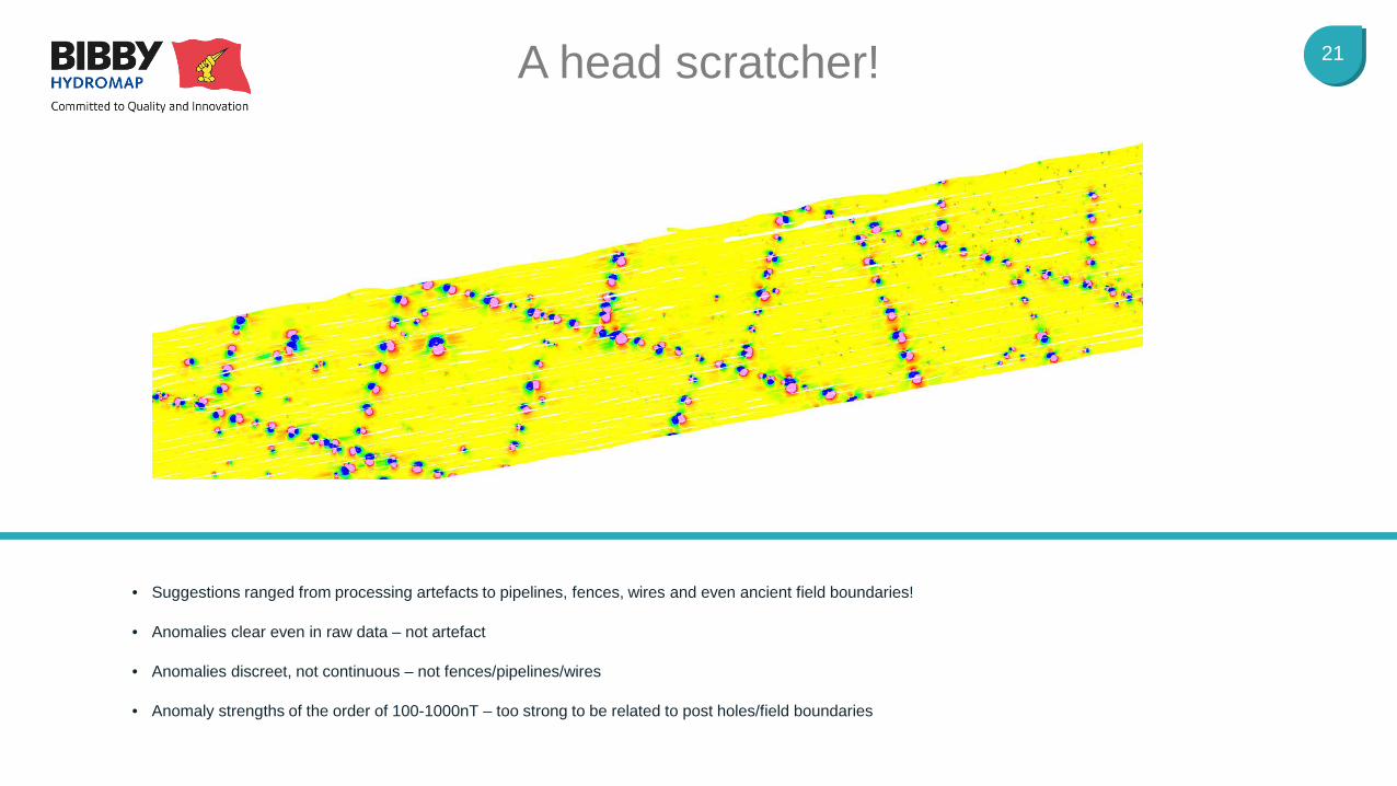
21 A head scratcher!
• Suggestions ranged from processing artefacts to pipelines, fences, wires and even ancient field boundaries!
• Anomalies clear even in raw data – not artefact
• Anomalies discreet, not continuous – not fences/pipelines/wires
• Anomaly strengths of the order of 100-1000nT – too strong to be related to post holes/field boundaries
22
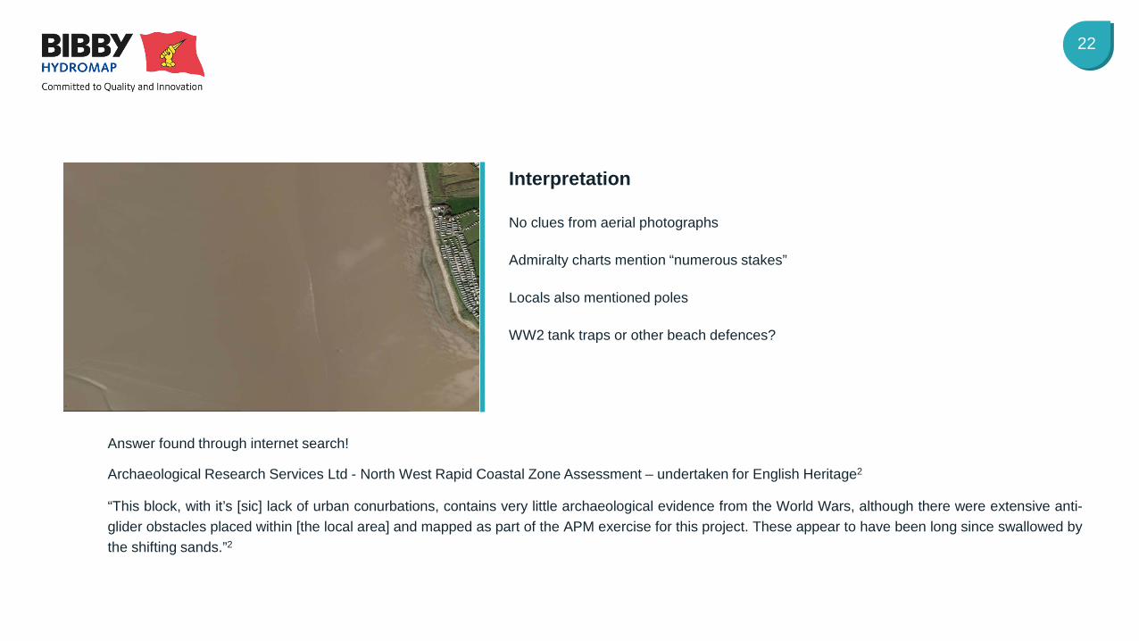
Answer found through internet search!
Archaeological Research Services Ltd - North West Rapid Coastal Zone Assessment – undertaken for English Heritage2
“This block, with it’s [sic] lack of urban conurbations, contains very little archaeological evidence from the World Wars, although there were extensive anti-glider obstacles placed within [the local area] and mapped as part of the APM exercise for this project. These appear to have been long since swallowed by the shifting sands.”2
No clues from aerial photographs
Admiralty charts mention “numerous stakes”
Locals also mentioned poles
WW2 tank traps or other beach defences?
Interpretation
23
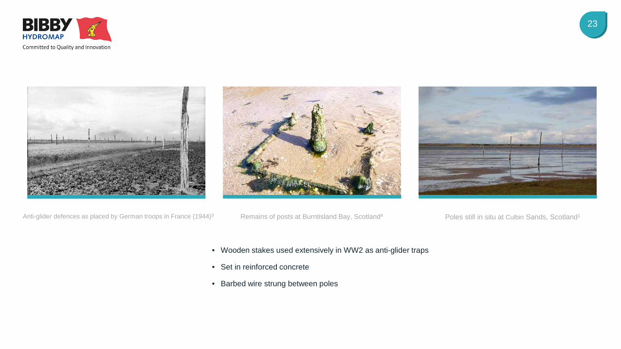
Anti-glider defences as placed by German troops in France (1944)3
Remains of posts at Burntisland Bay, Scotland4
• Wooden stakes used extensively in WW2 as anti-glider traps
• Set in reinforced concrete
• Barbed wire strung between poles
Poles still in situ at Culbin Sands, Scotland1

Case Studies Normandie 3 Pre lay cable landing UXO Survey
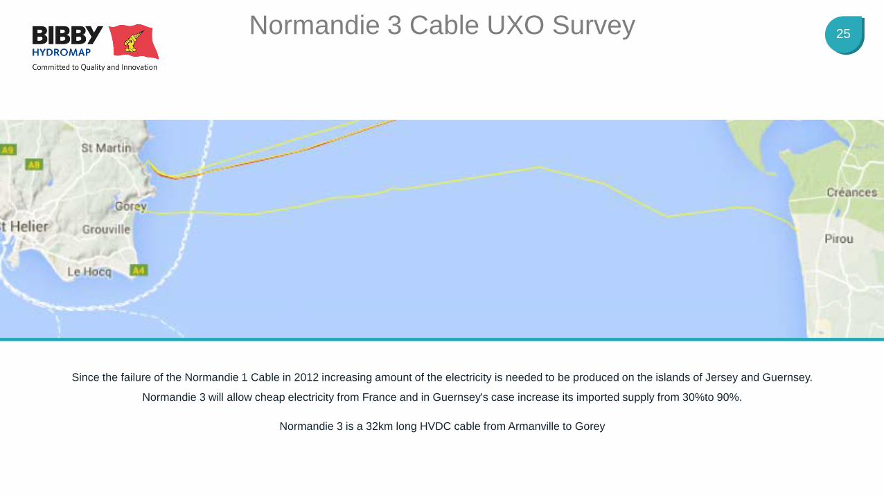
25 Normandie 3 Cable UXO Survey
Since the failure of the Normandie 1 Cable in 2012 increasing amount of the electricity is needed to be produced on the islands of Jersey and Guernsey.
Normandie 3 will allow cheap electricity from France and in Guernsey's case increase its imported supply from 30%to 90%.
Normandie 3 is a 32km long HVDC cable from Armanville to Gorey
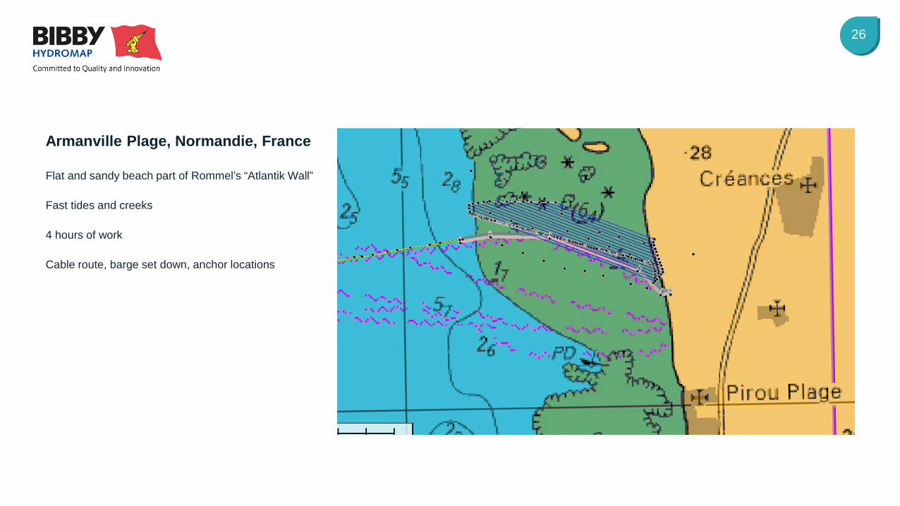
26
Flat and sandy beach part of Rommel’s “Atlantik Wall”
Fast tides and creeks
4 hours of work
Cable route, barge set down, anchor locations
Armanville Plage, Normandie, France
27
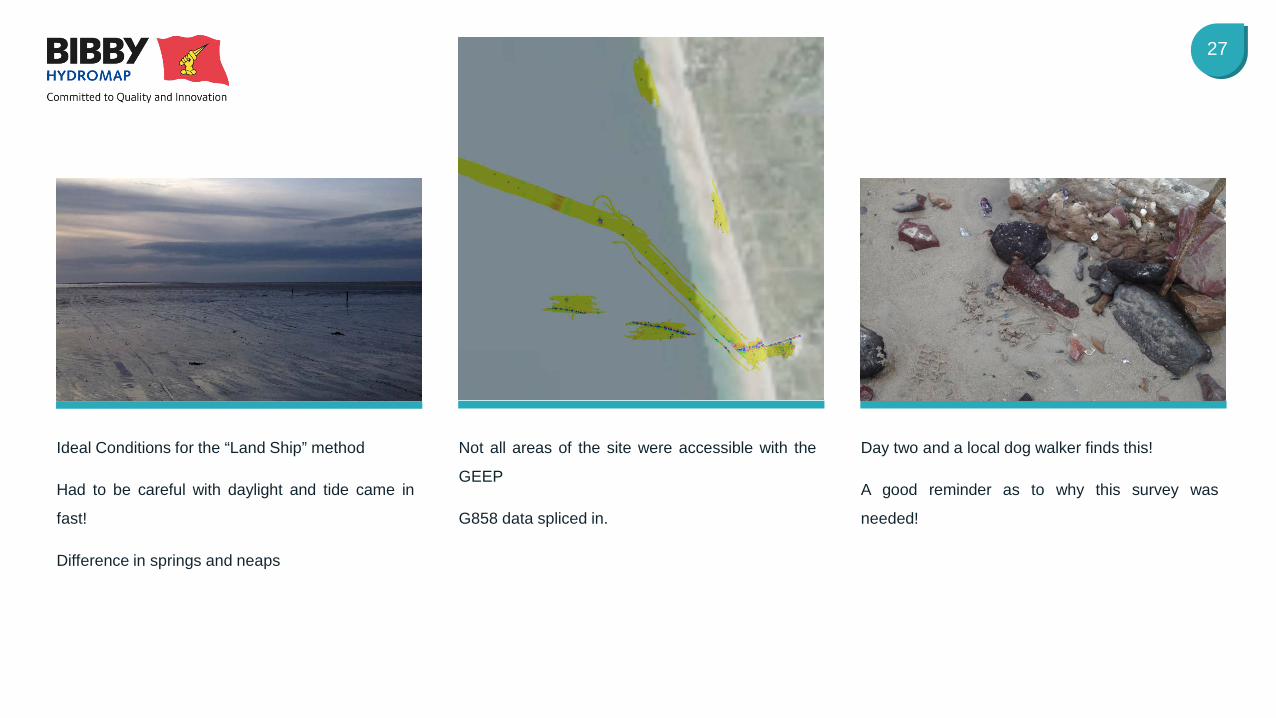
Ideal Conditions for the “Land Ship” method
Had to be careful with daylight and tide came in
fast!
Difference in springs and neaps
Not all areas of the site were accessible with the
GEEP
G858 data spliced in.
Day two and a local dog walker finds this!
A good reminder as to why this survey was
needed!
28
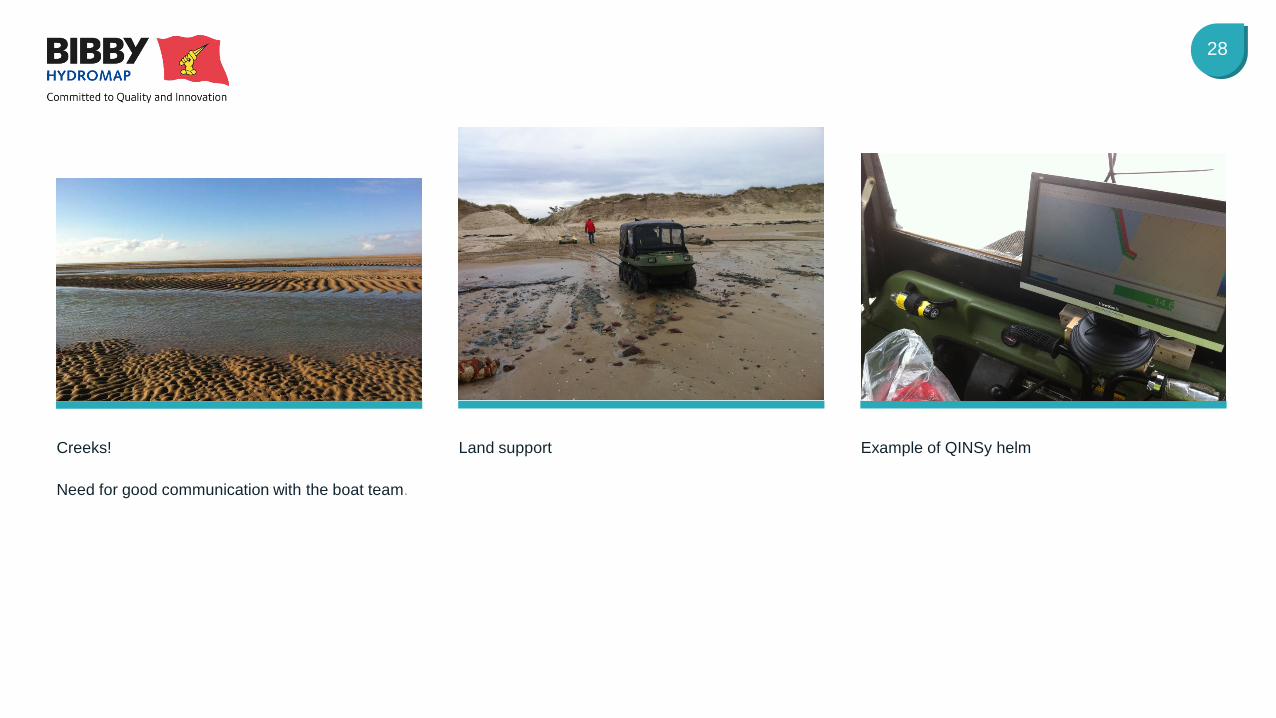
Creeks!
Need for good communication with the boat team.
Land support Example of QINSy helm
29
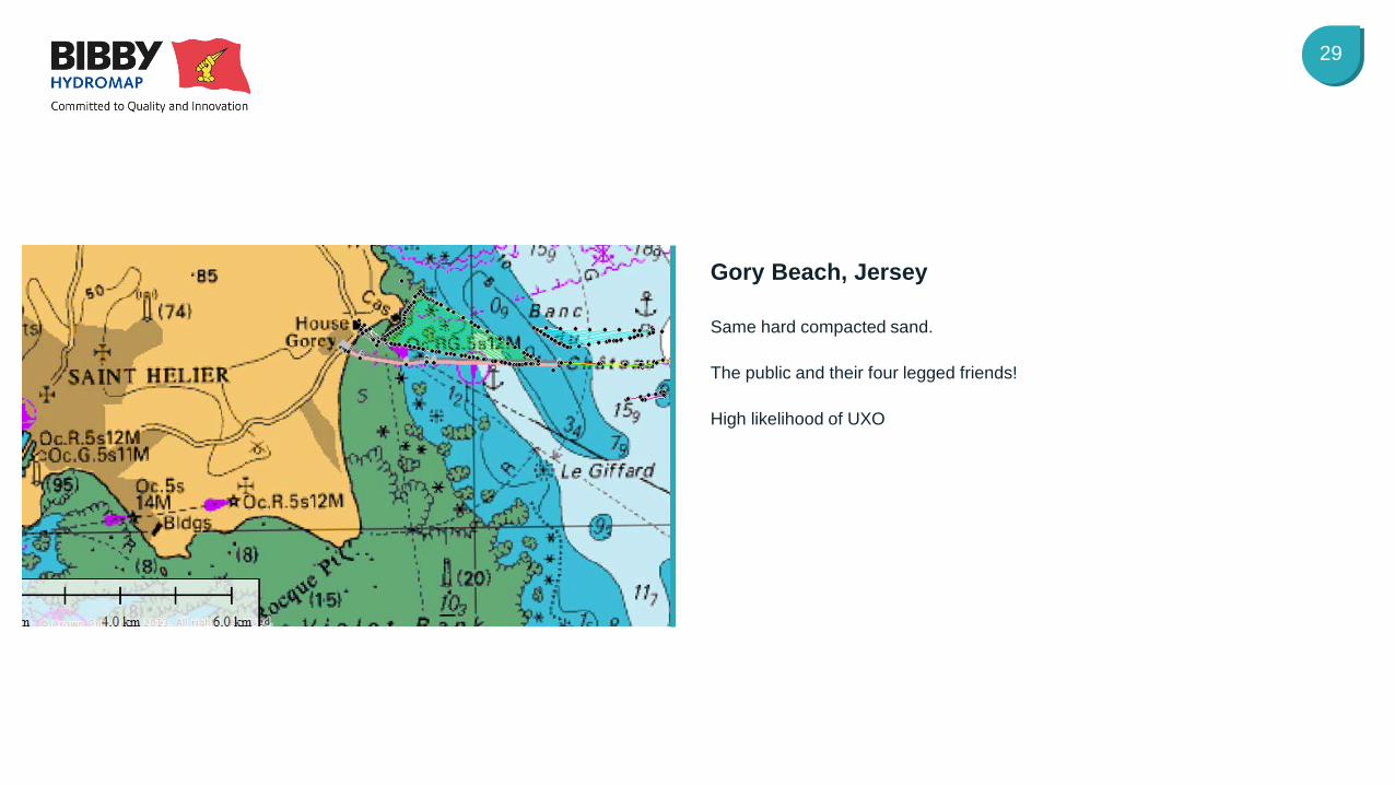
Same hard compacted sand.
The public and their four legged friends!
High likelihood of UXO
Gory Beach, Jersey
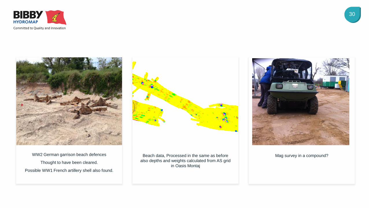
30
WW2 German garrison beach defences
Thought to have been cleared.
Possible WW1 French artillery shell also found.
Beach data, Processed in the same as before also depths and weights calculated from AS grid
in Oasis Montaj
Mag survey in a compound?

The Gap Very Near Shore Marine UXO Surveys
32
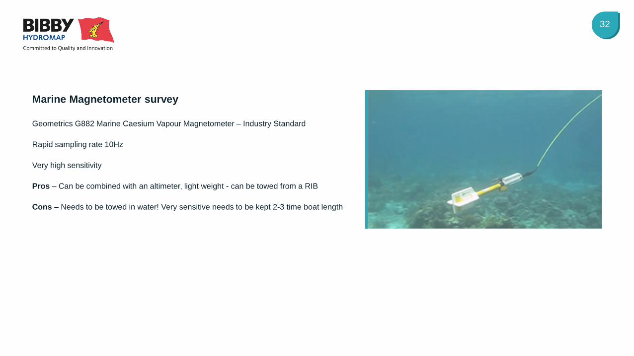
Geometrics G882 Marine Caesium Vapour Magnetometer – Industry Standard
Rapid sampling rate 10Hz
Very high sensitivity
Pros – Can be combined with an altimeter, light weight - can be towed from a RIB
Cons – Needs to be towed in water! Very sensitive needs to be kept 2-3 time boat length
Marine Magnetometer survey
33
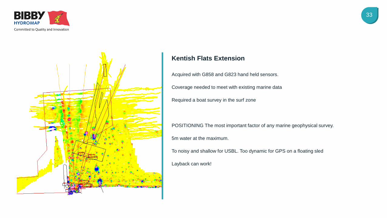
Acquired with G858 and G823 hand held sensors.
Coverage needed to meet with existing marine data
Required a boat survey in the surf zone
POSITIONING The most important factor of any marine geophysical survey.
5m water at the maximum.
To noisy and shallow for USBL. Too dynamic for GPS on a floating sled
Layback can work!
Kentish Flats Extension
34
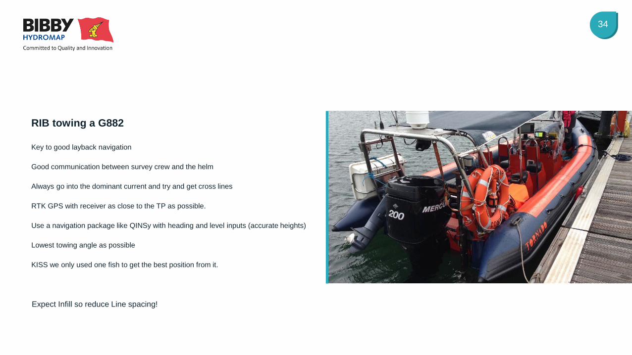
Expect Infill so reduce Line spacing!
Key to good layback navigation
Good communication between survey crew and the helm
Always go into the dominant current and try and get cross lines
RTK GPS with receiver as close to the TP as possible.
Use a navigation package like QINSy with heading and level inputs (accurate heights)
Lowest towing angle as possible
KISS we only used one fish to get the best position from it.
RIB towing a G882
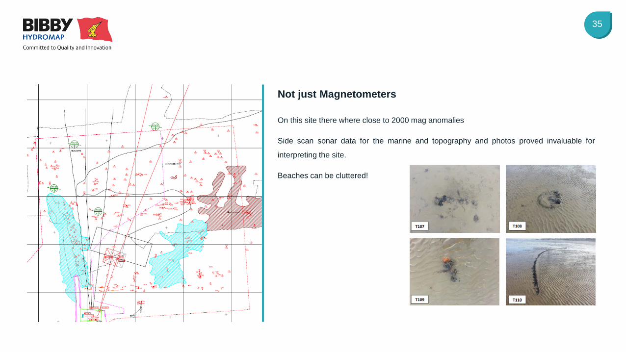
35
On this site there where close to 2000 mag anomalies
Side scan sonar data for the marine and topography and photos proved invaluable for
interpreting the site.
Beaches can be cluttered!
Not just Magnetometers

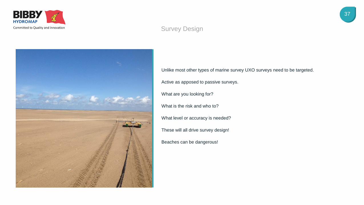
Survey Design What is needed and where
37
Survey Design
Unlike most other types of marine survey UXO surveys need to be targeted.
Active as apposed to passive surveys.
What are you looking for?
What is the risk and who to?
What level or accuracy is needed?
These will all drive survey design!
Beaches can be dangerous!
38
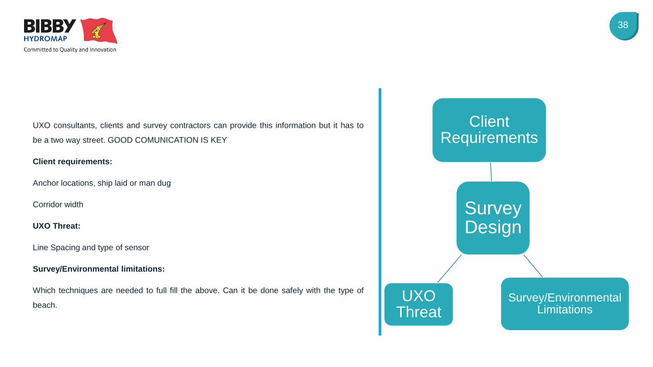
UXO consultants, clients and survey contractors can provide this information but it has to
be a two way street. GOOD COMUNICATION IS KEY
Client requirements:
Anchor locations, ship laid or man dug
Corridor width
UXO Threat:
Line Spacing and type of sensor
Survey/Environmental limitations:
Which techniques are needed to full fill the above. Can it be done safely with the type of
beach.
Survey Design
Client Requirements
Survey/Environmental Limitations
UXO Threat
Lessons Learnt Conclusions
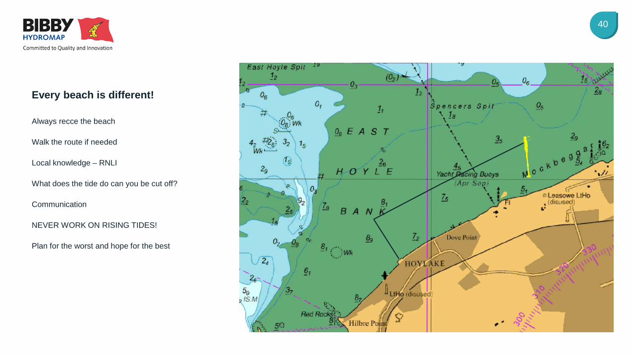
40
Always recce the beach
Walk the route if needed
Local knowledge – RNLI
What does the tide do can you be cut off?
Communication
NEVER WORK ON RISING TIDES!
Plan for the worst and hope for the best
Every beach is different!

The Future What’s next for near shore survey
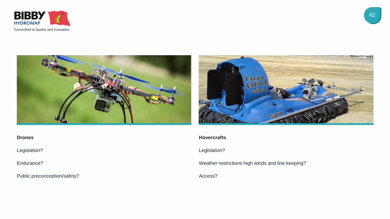
42
Hovercrafts
Legislation?
Weather restrictions high winds and line keeping?
Access?
Drones
Legislation?
Endurance?
Public preconception/safety?

Questions