Embed Size (px)
Citation preview
1
EGLINTON CROSSTOWN UPDATE:FORMER KODAK LANDS CURRENT PLAN
Metrolinx – Crosslinx Community Update
November 19, 2015 | Open House LEF 116 Industry Street
22
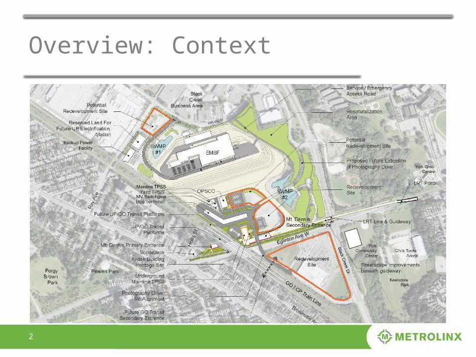
Overview: Context
33
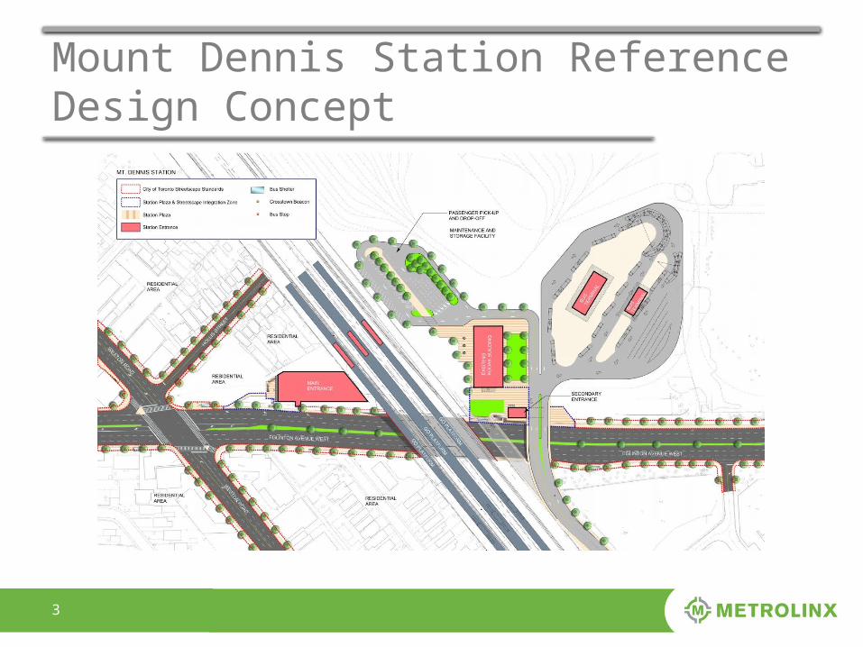
Mount Dennis Station Reference Design Concept
44
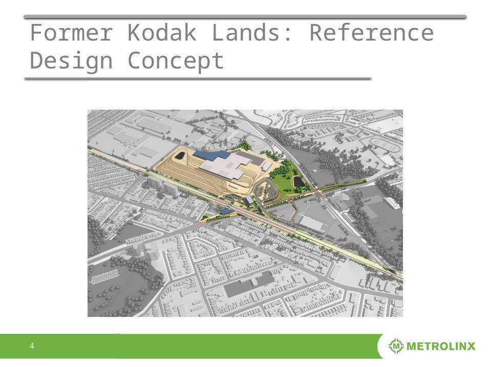
Former Kodak Lands: Reference Design Concept
55
Overview: 9 Guiding Principles
1. The design and development of the EMSF are to consider a broad range of uses on the lands, beyond the functional requirements and technical EMSF components.2. A development approach that minimizes the footprint of the EMSF, while identifying and maximizing areas of potential development.3. Establish an agreed upon engagement protocol with community members.4. Propose a phased-approach to the intensification of lands allowing for a broad range of uses on lands identified in later phase(s) that demonstrates under what conditions and general timeframe that additional development can occur.5. Acknowledge that the stable Employment Lands along Industry Street to the north and west of the former Kodak lands are to be protected and sensitive (residential and non-residential) uses that will not negatively impact the Employment Areas.6. Apply innovative approaches to the design and engineering of the Eglinton West frontage with respect to grade differences and site access.7. Ensure that the EMSF lands will be connected to and supportive of the nearby green space, employment lands, established residential communities and the commercial main streets surrounding the site.8. Adopt design excellence for all aspects of the proposed development.9. Respect and protect the heritage attributes of the Scotiabank Building and former Kodak No. 9 Building.
66
Principle 1:A broad range of land uses
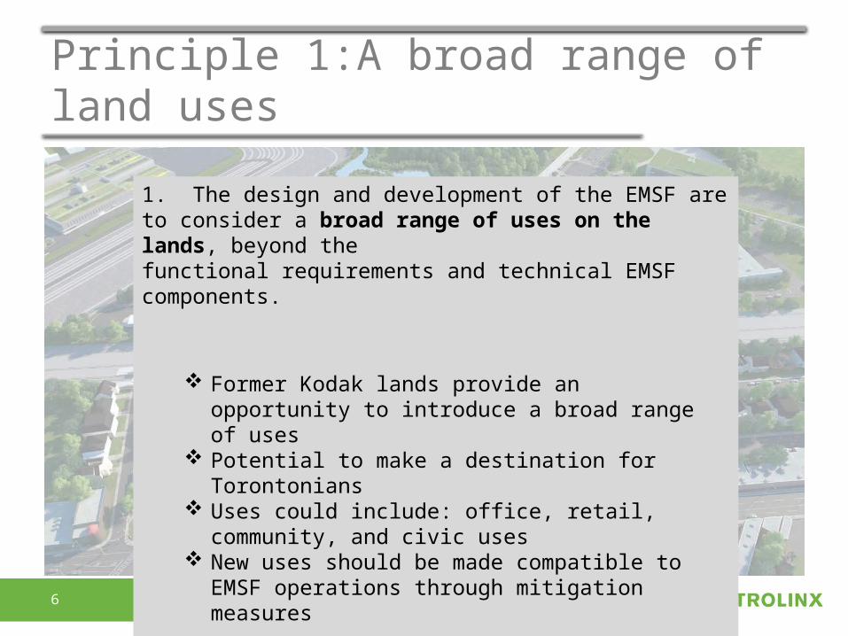
1. The design and development of the EMSF are to consider a broad range of uses on the lands, beyond thefunctional requirements and technical EMSF components.
Former Kodak lands provide an opportunity to introduce a broad range of uses
Potential to make a destination for Torontonians Uses could include: office, retail, community, and civic
uses New uses should be made compatible to EMSF
operations through mitigation measures
77
Principle 1:A broad range of land uses
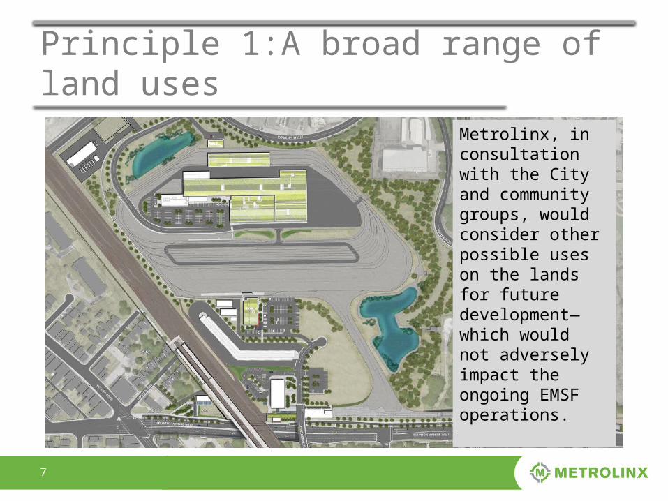
Metrolinx, in consultation with the City and community groups, would consider other possible uses on the lands for future development—which would not adversely impact the ongoing EMSF operations.
88
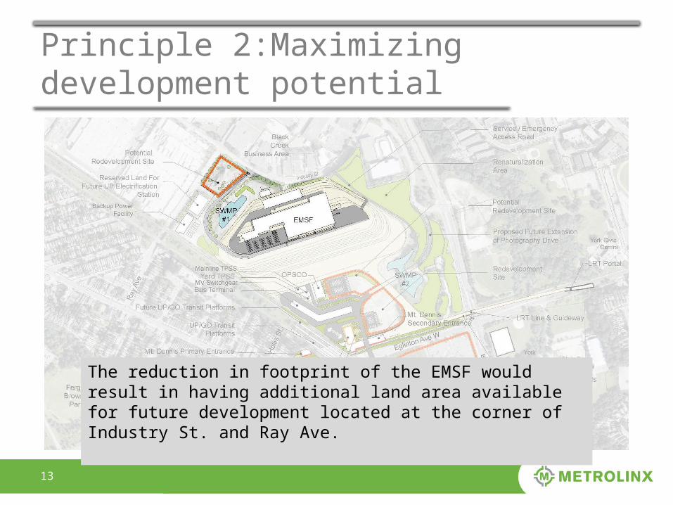
Principle 2:Maximizing development potential
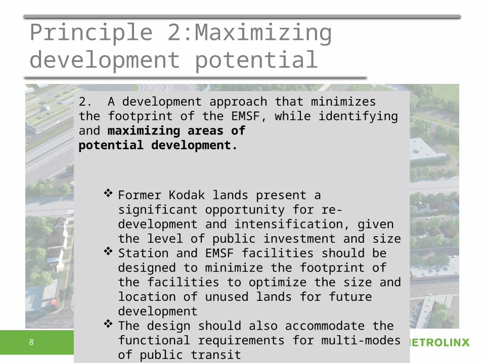
2. A development approach that minimizes the footprint of the EMSF, while identifying and maximizing areas ofpotential development.
Former Kodak lands present a significant opportunity for re-development and intensification, given the level of public investment and size
Station and EMSF facilities should be designed to minimize the footprint of the facilities to optimize the size and location of unused lands for future development
The design should also accommodate the functional requirements for multi-modes of public transit
99
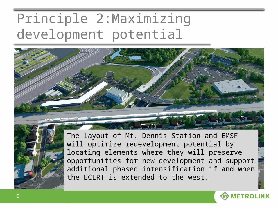
Principle 2:Maximizing development potential
The layout of Mt. Dennis Station and EMSF will optimize redevelopment potential by locating elements where they will preserve opportunities for new development and support additional phased intensification if and when the ECLRT is extended to the west.
1010
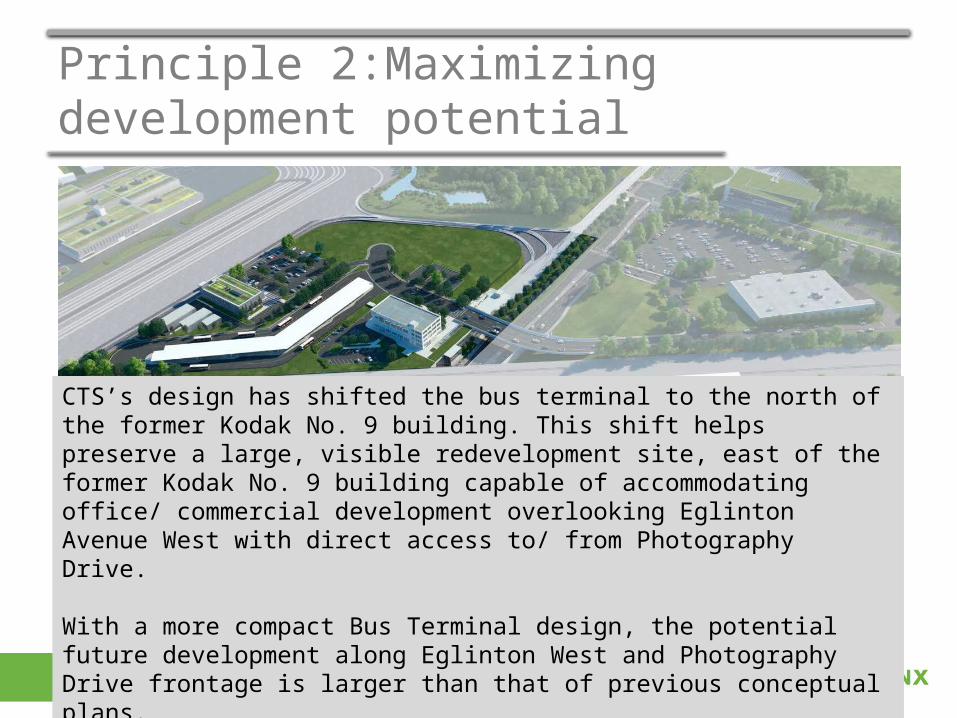
Principle 2:Maximizing development potential
CTS’s design has shifted the bus terminal to the north of the former Kodak No. 9 building. This shift helps preserve a large, visible redevelopment site, east of the former Kodak No. 9 building capable of accommodating office/ commercial development overlooking Eglinton Avenue West with direct access to/ from Photography Drive.
With a more compact Bus Terminal design, the potential future development along Eglinton West and Photography Drive frontage is larger than that of previous conceptual plans.
1111
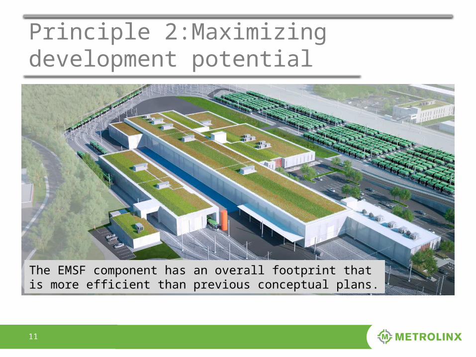
Principle 2:Maximizing development potential
The EMSF component has an overall footprint that is more efficient than previous conceptual plans.
1212
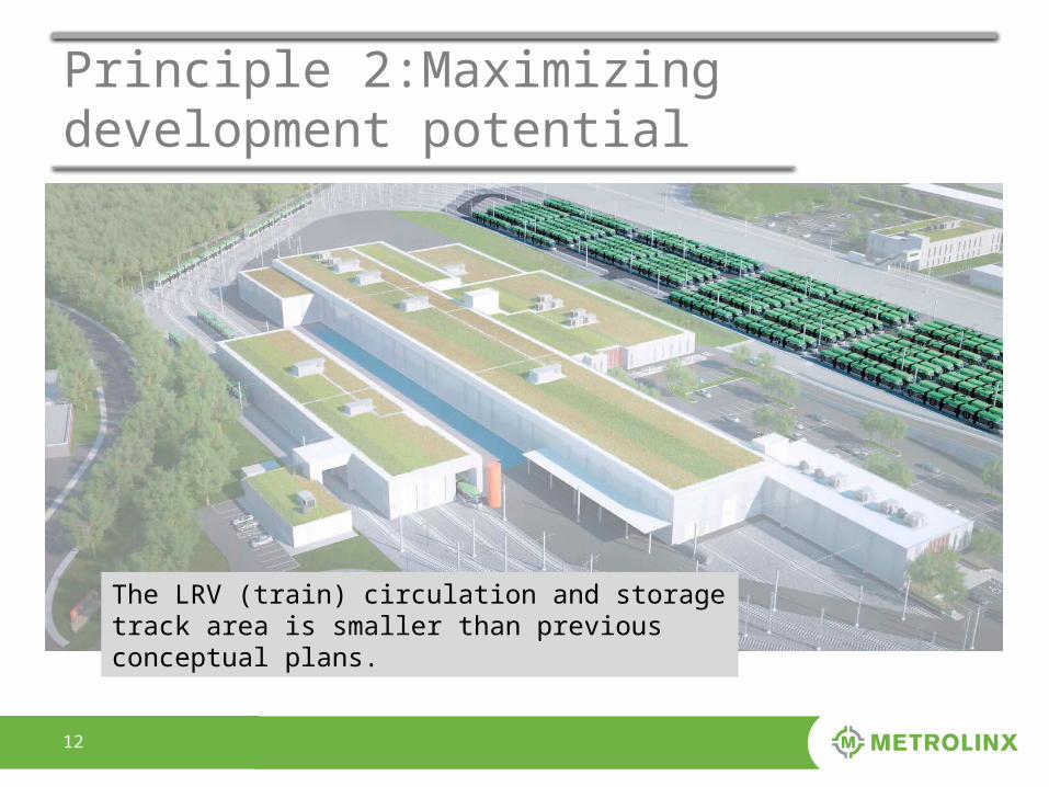
Principle 2:Maximizing development potential
The LRV (train) circulation and storage track area is smaller than previous conceptual plans.
1313
Principle 2:Maximizing development potential
The reduction in footprint of the EMSF would result in having additional land area available for future development located at the corner of Industry St. and Ray Ave.
1414
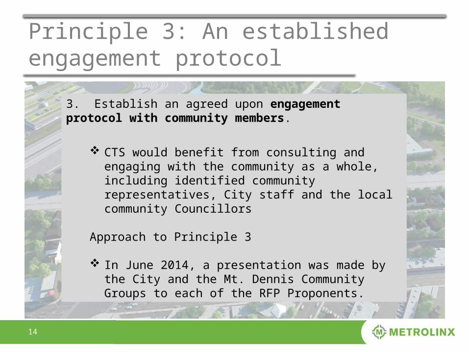
Principle 3: An established engagement protocol
3. Establish an agreed upon engagement protocol with community members.
CTS would benefit from consulting and engaging with the
community as a whole, including identified community representatives, City staff and the local community Councillors
Approach to Principle 3
In June 2014, a presentation was made by the City and the Mt. Dennis Community Groups to each of the RFP Proponents.
1515
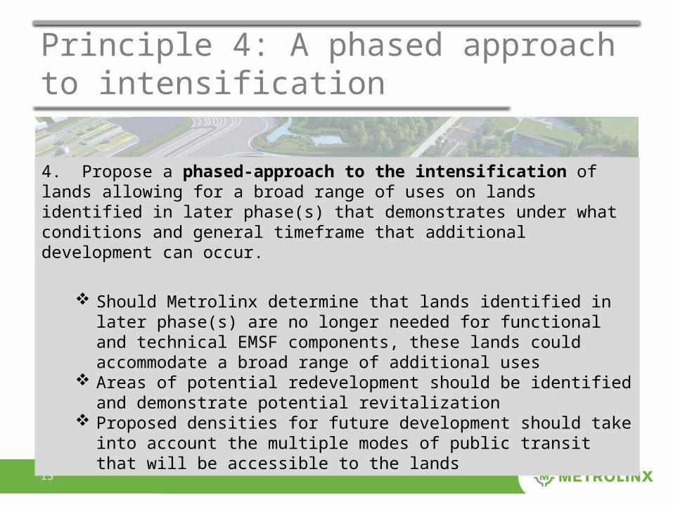
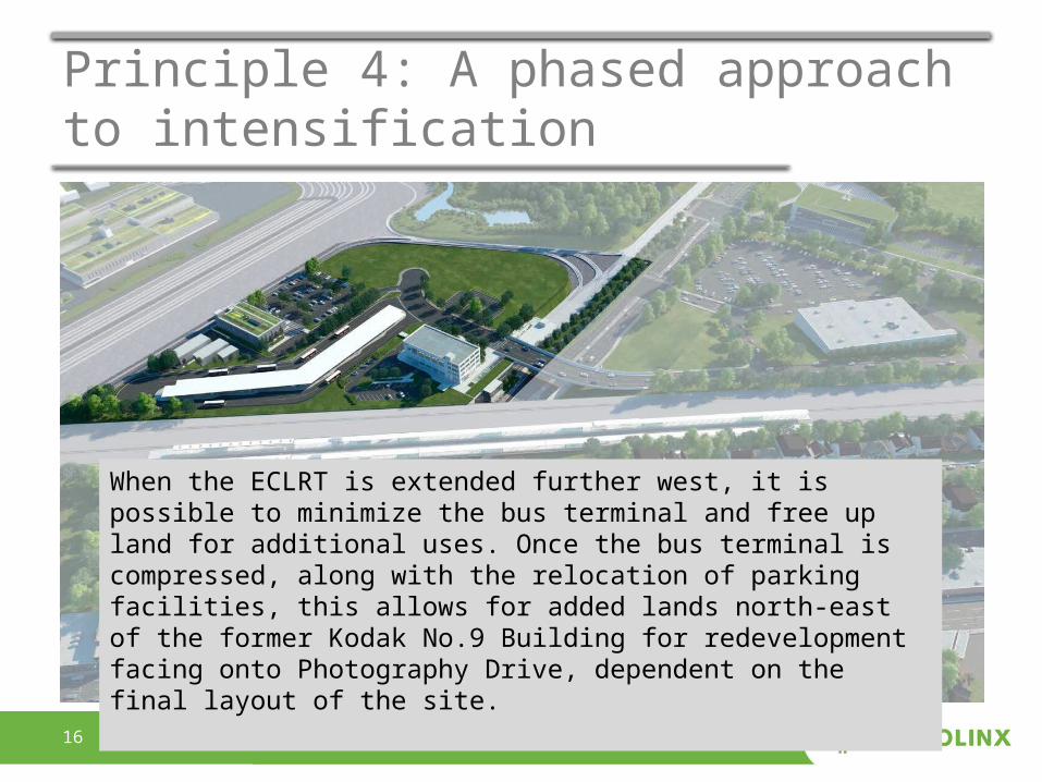
Principle 4: A phased approach to intensification
4. Propose a phased-approach to the intensification of lands allowing for a broad range of uses on landsidentified in later phase(s) that demonstrates under what conditions and general timeframe that additional development can occur.
Should Metrolinx determine that lands identified in later phase(s) are no
longer needed for functional and technical EMSF components, these lands could accommodate a broad range of additional uses
Areas of potential redevelopment should be identified and demonstrate potential revitalization
Proposed densities for future development should take into account the multiple modes of public transit that will be accessible to the lands
1616
Principle 4: A phased approach to intensification
When the ECLRT is extended further west, it is possible to minimize the bus terminal and free up land for additional uses. Once the bus terminal is compressed, along with the relocation of parking facilities, this allows for added lands north-east of the former Kodak No.9 Building for redevelopment facing onto Photography Drive, dependent on the final layout of the site.
1717
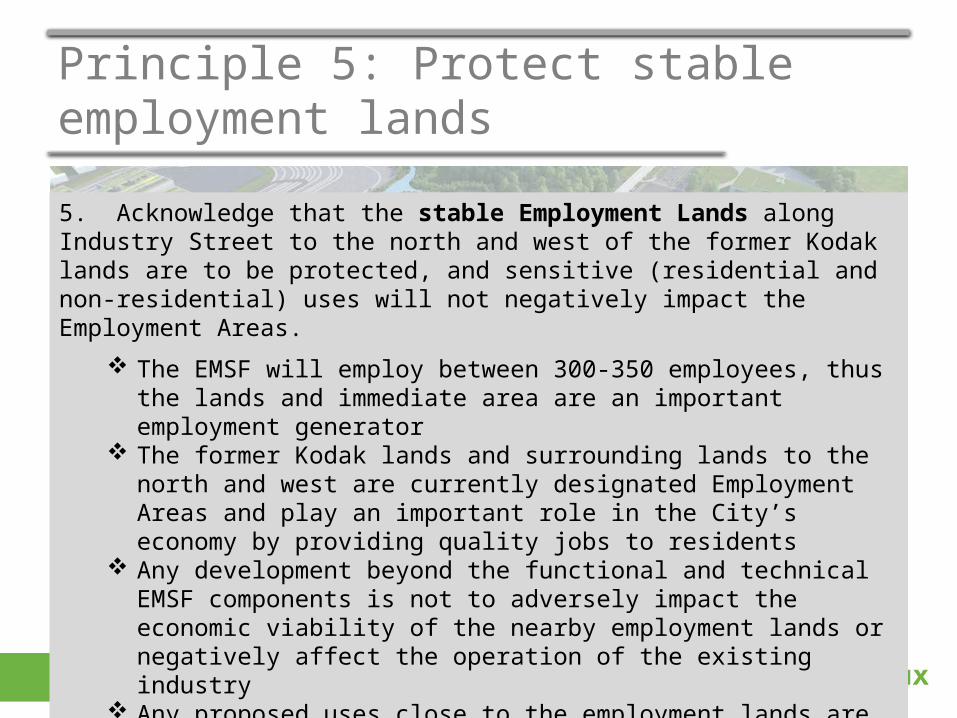
Principle 5: Protect stable employment lands
5. Acknowledge that the stable Employment Lands along Industry Street to the north and west of the former Kodaklands are to be protected, and sensitive (residential and non-residential) uses will not negatively impact the Employment Areas.
The EMSF will employ between 300-350 employees, thus the lands and immediate area are an important employment generator
The former Kodak lands and surrounding lands to the north and west are currently designated Employment Areas and play an important role in the City’s economy by providing quality jobs to residents
Any development beyond the functional and technical EMSF components is not to adversely impact the economic viability of the nearby employment lands or negatively affect the operation of the existing industry
Any proposed uses close to the employment lands are to be compatible with existing and permitted industrial uses
1818
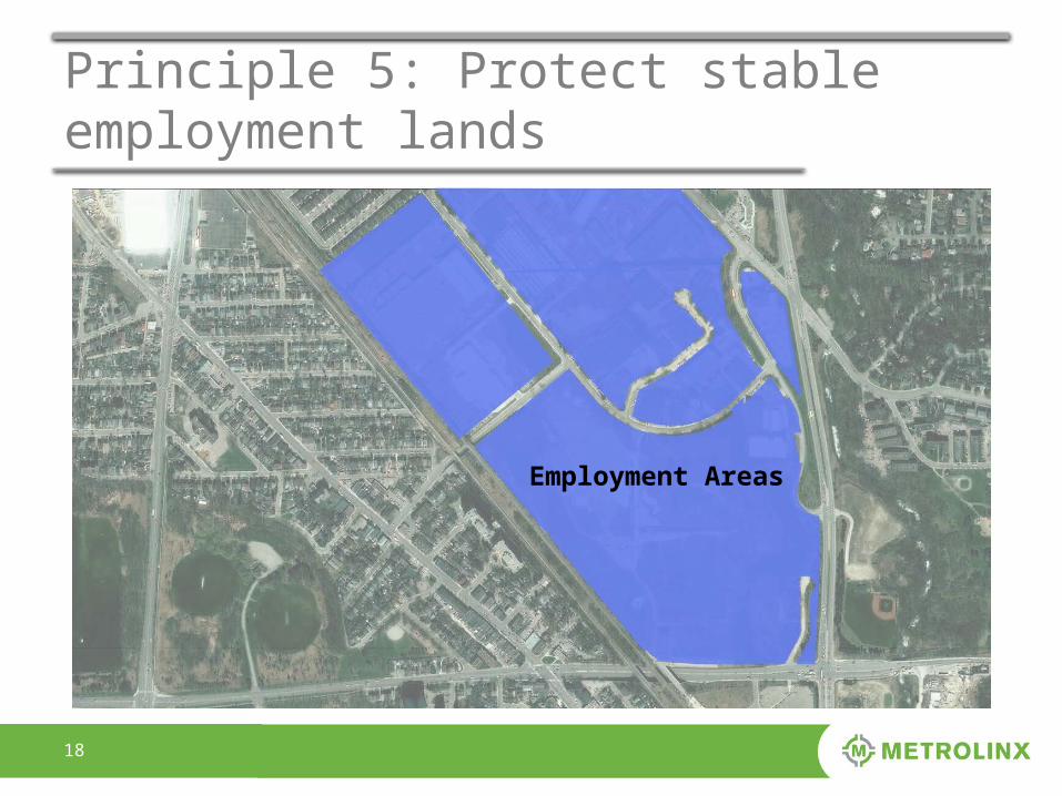
Principle 5: Protect stable employment lands
Employment Areas
1919
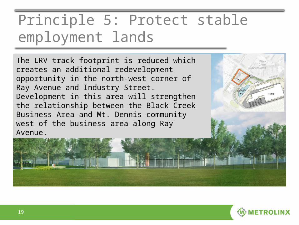
Principle 5: Protect stable employment landsThe LRV track footprint is reduced which creates an additional redevelopment opportunity in the north-west corner of Ray Avenue and Industry Street. Development in this area will strengthen the relationship between the Black Creek Business Area and Mt. Dennis community west of the business area along Ray Avenue.
2020
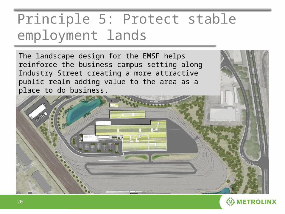
Principle 5: Protect stable employment landsThe landscape design for the EMSF helps reinforce the business campus setting along Industry Street creating a more attractive public realm adding value to the area as a place to do business.
2121
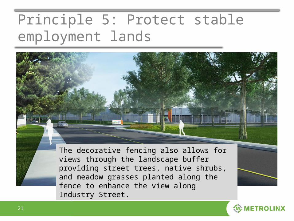
Principle 5: Protect stable employment lands
The decorative fencing also allows for views through the landscape buffer providing street trees, native shrubs, and meadow grasses planted along the fence to enhance the view along Industry Street.
2222
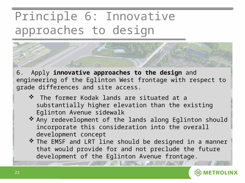
Principle 6: Innovative approaches to design
6. Apply innovative approaches to the design and engineering of the Eglinton West frontage with respect tograde differences and site access.
The former Kodak lands are situated at a substantially higher elevation than the existing Eglinton Avenue sidewalk
Any redevelopment of the lands along Eglinton should incorporate this consideration into the overall development concept
The EMSF and LRT line should be designed in a manner that would provide for and not preclude the future development of the Eglinton Avenue frontage.
2323
Principle 6: Innovative approaches to design
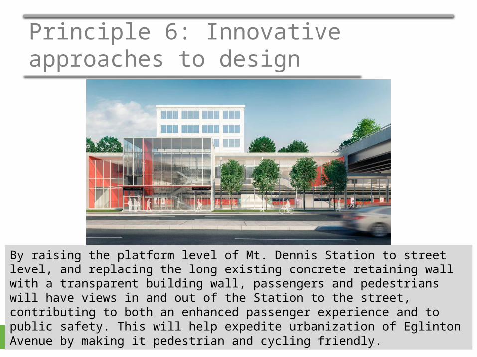
By raising the platform level of Mt. Dennis Station to street level, and replacing the long existing concrete retaining wall with a transparent building wall, passengers and pedestrians will have views in and out of the Station to the street, contributing to both an enhanced passenger experience and to public safety. This will help expedite urbanization of Eglinton Avenue by making it pedestrian and cycling friendly.
2424
Principle 6: Innovative approaches to design
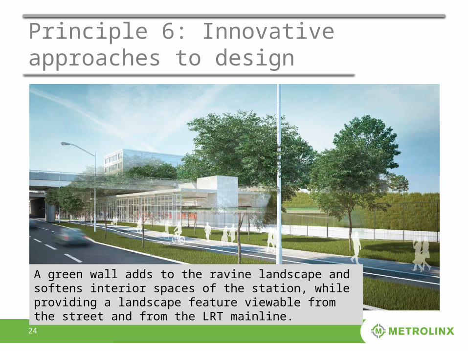
A green wall adds to the ravine landscape and softens interior spaces of the station, while providing a landscape feature viewable from the street and from the LRT mainline.
2525
Principle 6: Innovative approaches to design
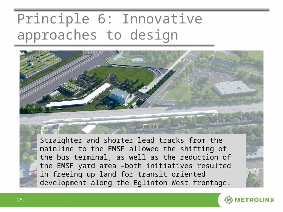
Straighter and shorter lead tracks from the mainline to the EMSF allowed the shifting of the bus terminal, as well as the reduction of the EMSF yard area –both initiatives resulted in freeing up land for transit oriented development along the Eglinton West frontage.
2626
Principle 7: Connected and supportive of nearby uses
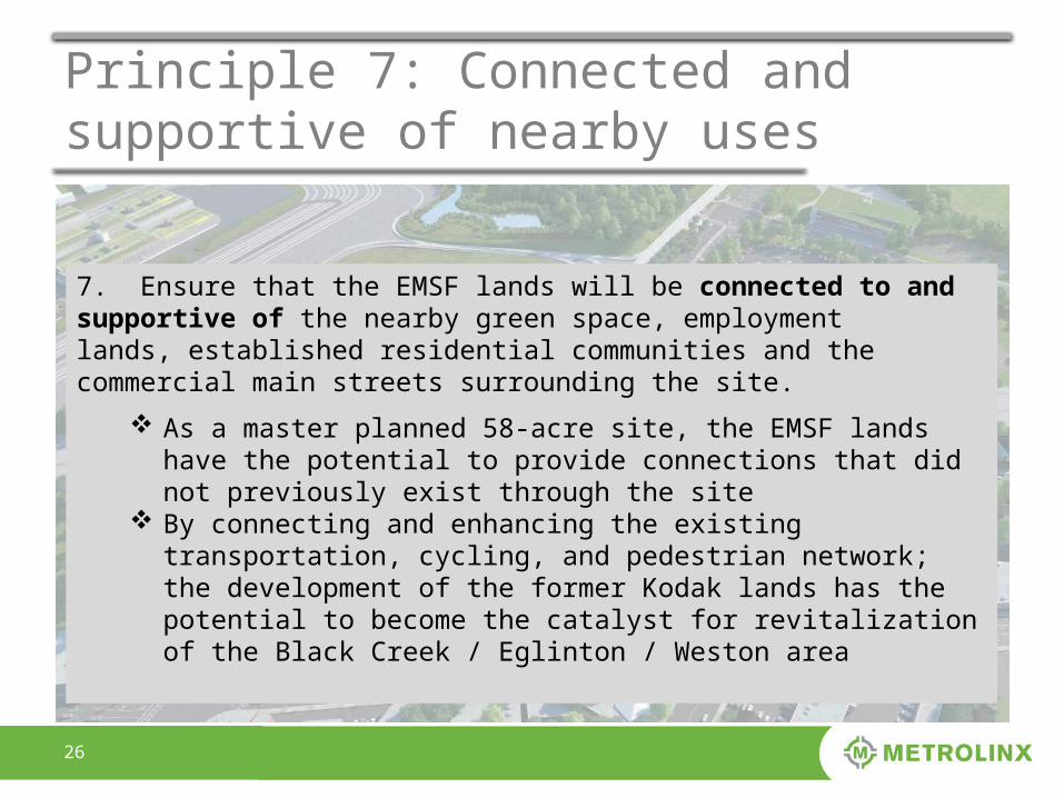
7. Ensure that the EMSF lands will be connected to and supportive of the nearby green space, employmentlands, established residential communities and the commercial main streets surrounding the site.
As a master planned 58-acre site, the EMSF lands have the potential to provide connections that did not previously exist through the site
By connecting and enhancing the existing transportation, cycling, and pedestrian network; the development of the former Kodak lands has the potential to become the catalyst for revitalization of the Black Creek / Eglinton / Weston area
2727
Principle 7: Connected and supportive of nearby uses
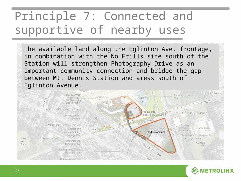
The available land along the Eglinton Ave. frontage, in combination with the No Frills site south of the Station will strengthen Photography Drive as an important community connection and bridge the gap between Mt. Dennis Station and areas south of Eglinton Avenue.
2828
Principle 7: Connected and supportive of nearby uses
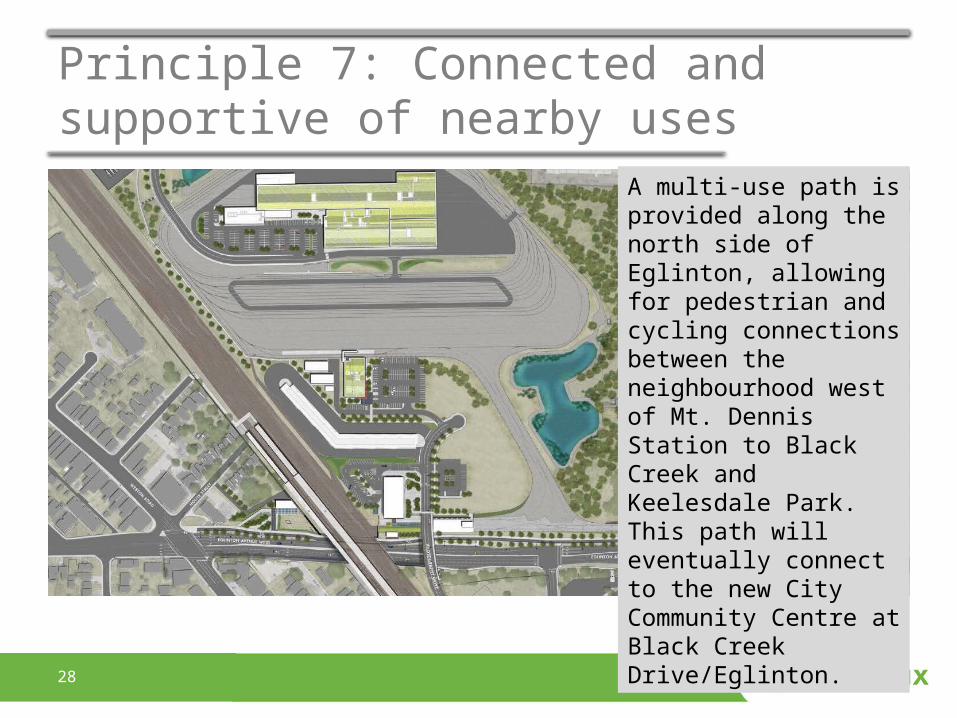
A multi-use path is provided along the north side of Eglinton, allowing for pedestrian and cycling connections between the neighbourhood west of Mt. Dennis Station to Black Creek and Keelesdale Park. This path will eventually connect to the new City Community Centre at Black Creek Drive/Eglinton.
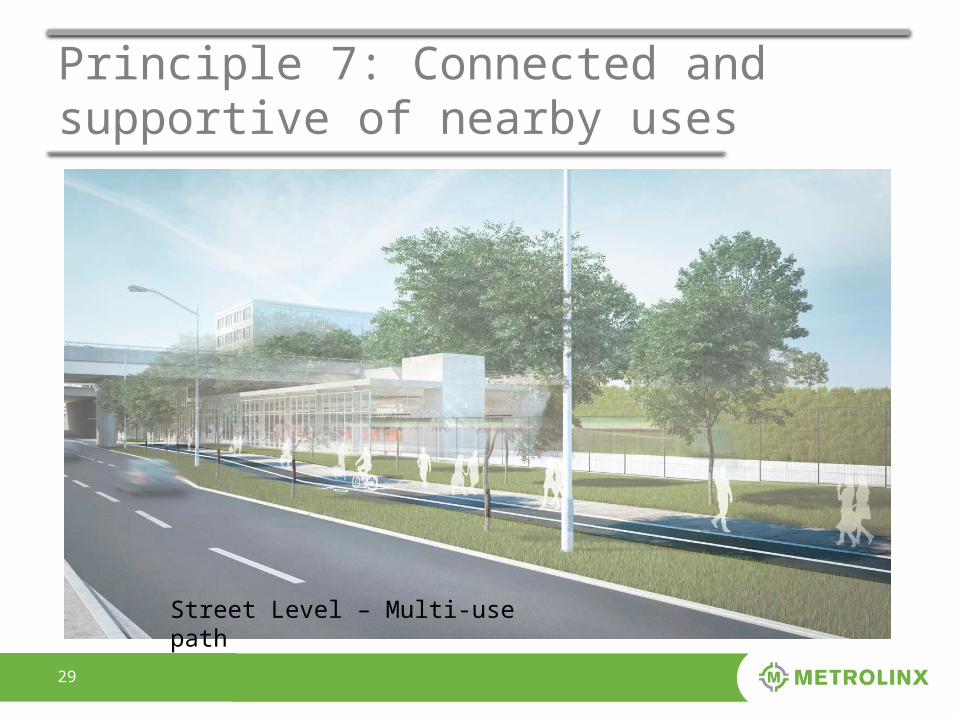
2929
Principle 7: Connected and supportive of nearby uses
Street Level – Multi-use path
3030
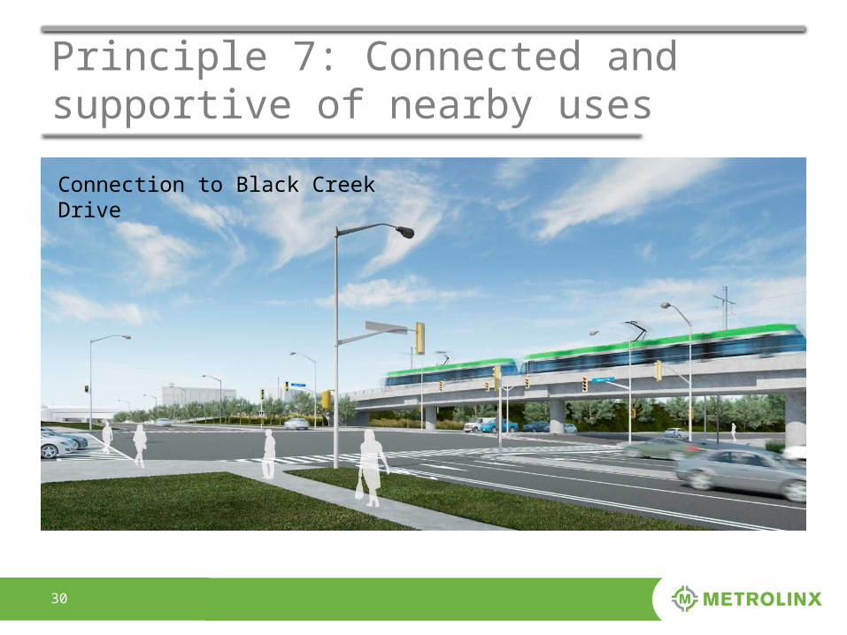
Principle 7: Connected and supportive of nearby uses
Connection to Black Creek Drive
3131
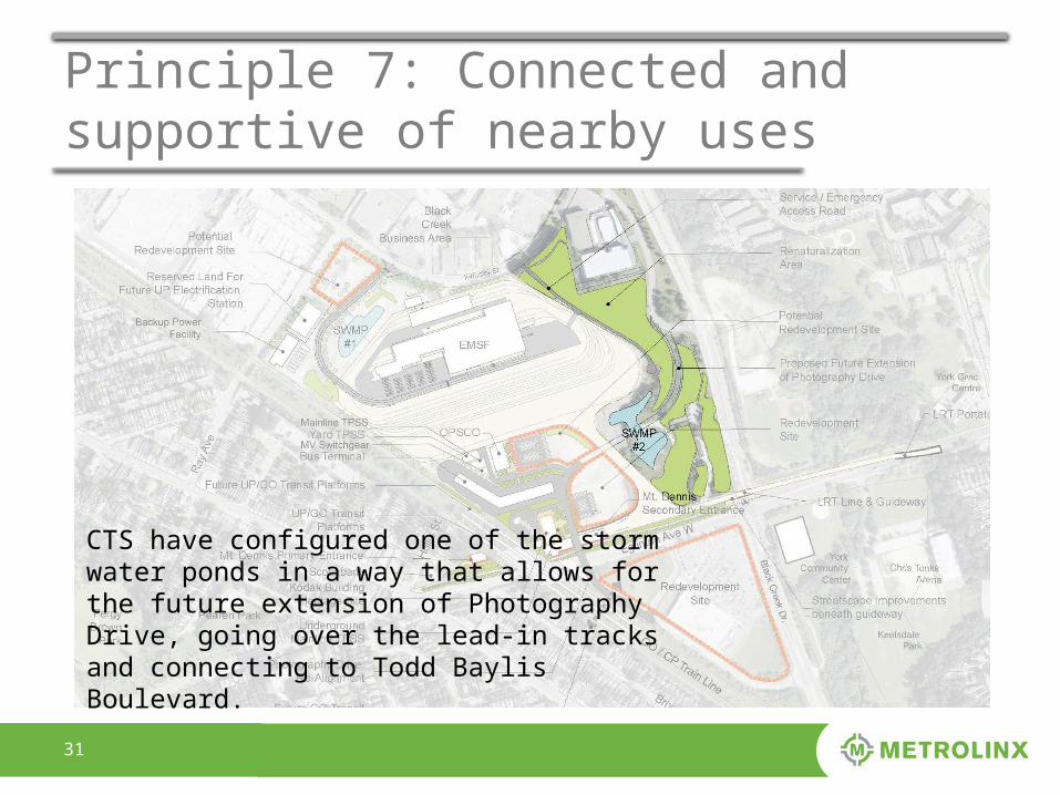
Principle 7: Connected and supportive of nearby uses
CTS have configured one of the storm water ponds in a way that allows for the future extension of Photography Drive, going over the lead-in tracks and connecting to Todd Baylis Boulevard.
3232
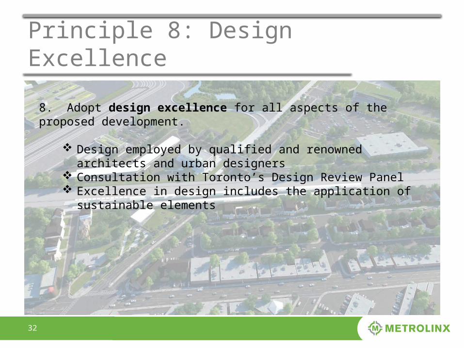
Principle 8: Design Excellence
8. Adopt design excellence for all aspects of the proposed development.
Design employed by qualified and renowned architects and urban designers
Consultation with Toronto’s Design Review Panel Excellence in design includes the application of sustainable
elements
3333
Principle 8: Design Excellence
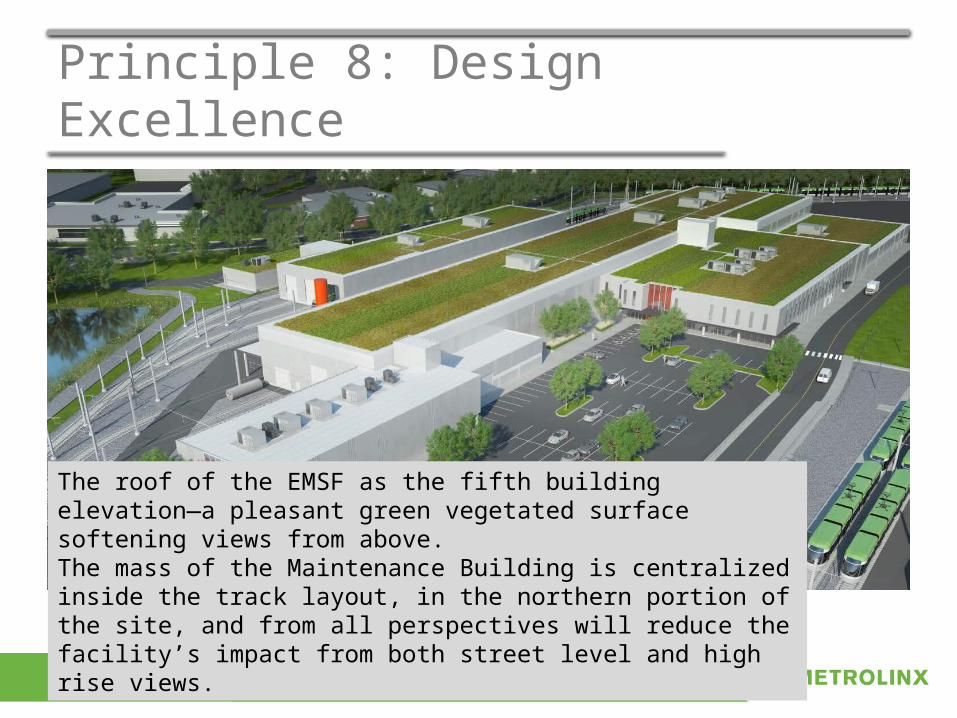
The roof of the EMSF as the fifth building elevation—a pleasant green vegetated surface softening views from above.The mass of the Maintenance Building is centralized inside the track layout, in the northern portion of the site, and from all perspectives will reduce the facility’s impact from both street level and high rise views.
3434
Principle 8: Design Excellence
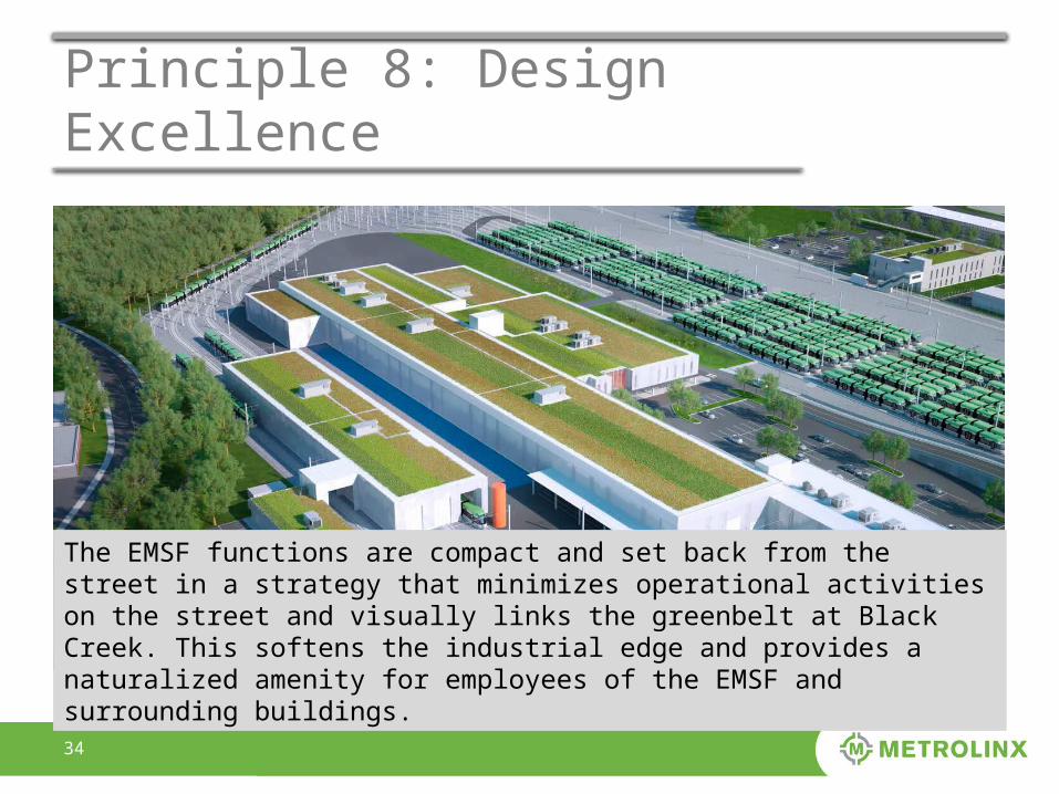
The EMSF functions are compact and set back from the street in a strategy that minimizes operational activities on the street and visually links the greenbelt at Black Creek. This softens the industrial edge and provides a naturalized amenity for employees of the EMSF and surrounding buildings.
3535
Principle 9: Respect & protect heritage attributes
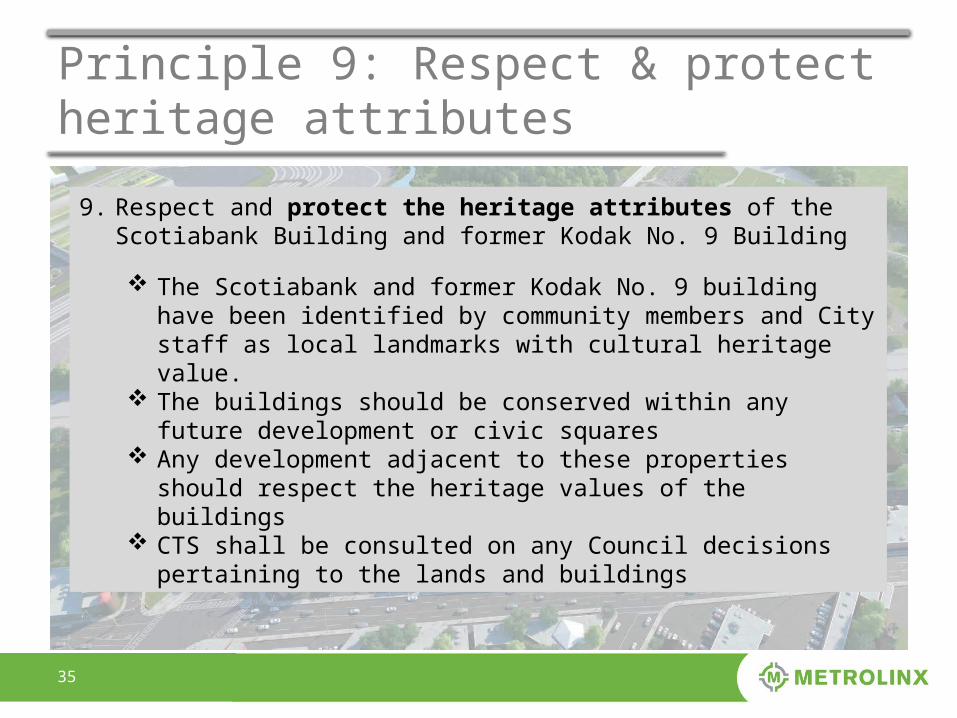
9. Respect and protect the heritage attributes of the Scotiabank Building and former Kodak No. 9 Building
The Scotiabank and former Kodak No. 9 building have been identified by community members and City staff as local landmarks with cultural heritage value.
The buildings should be conserved within any future development or civic squares
Any development adjacent to these properties should respect the heritage values of the buildings
CTS shall be consulted on any Council decisions pertaining to the lands and buildings
3636
Principle 9: Respect & protect heritage attributes
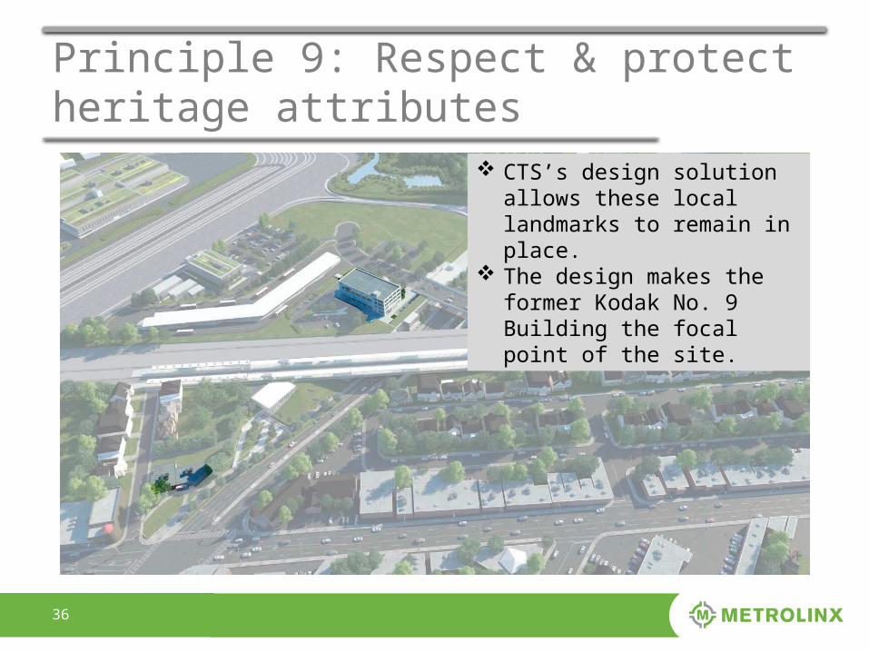
CTS’s design solution allows these local landmarks to remain in place.
The design makes the former Kodak No. 9 Building the focal point of the site.
3737
Principle 9: Respect & protect heritage attributes
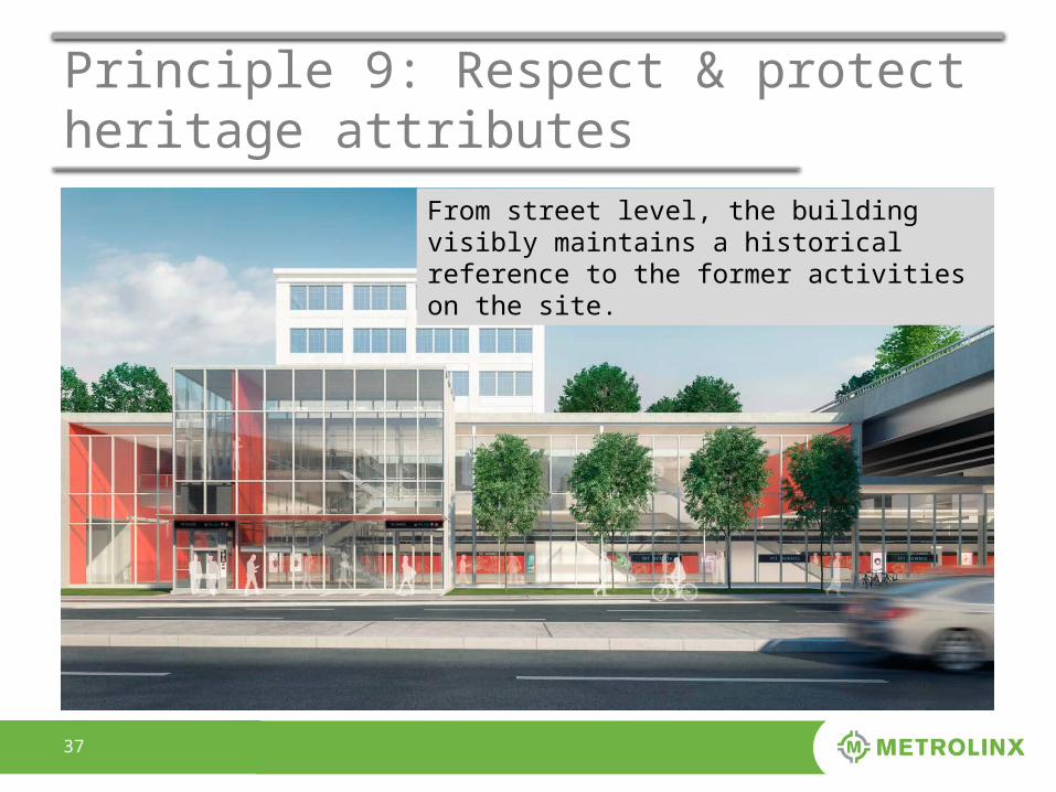
From street level, the building visibly maintains a historical reference to the former activities on the site.
3838
Principle 9: Respect & protect heritage attributes
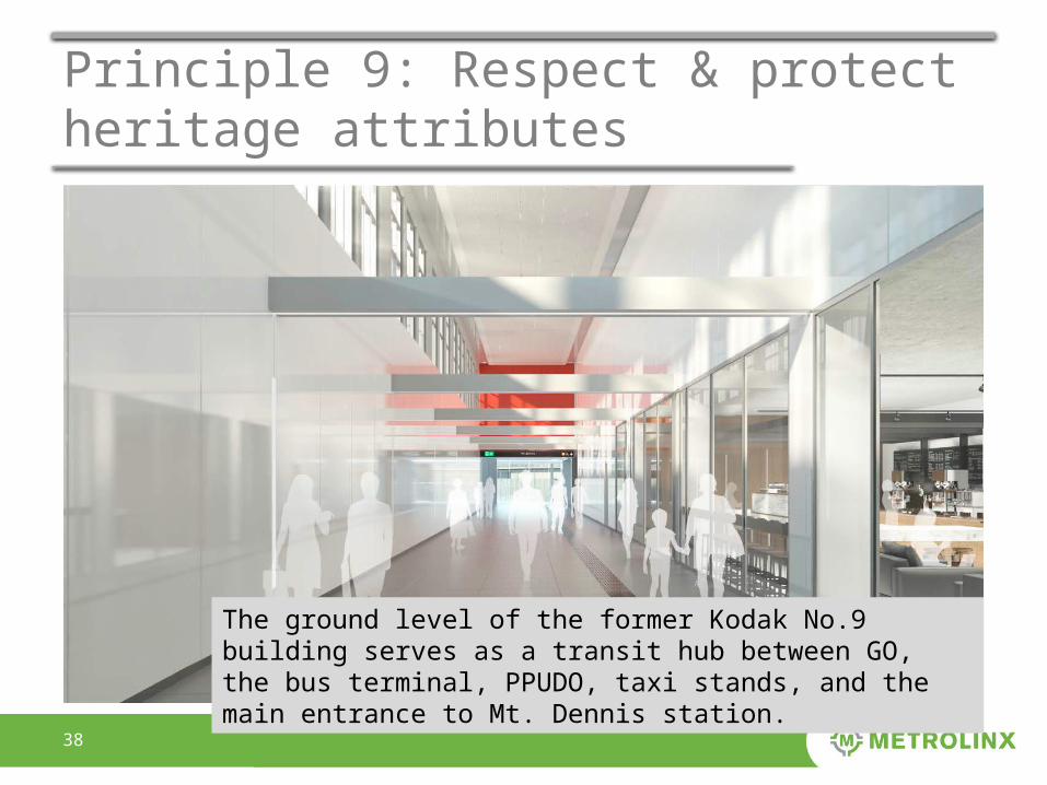
The ground level of the former Kodak No.9 building serves as a transit hub between GO, the bus terminal, PPUDO, taxi stands, and the main entrance to Mt. Dennis station.
3939
Principle 9: Respect & protect heritage attributes
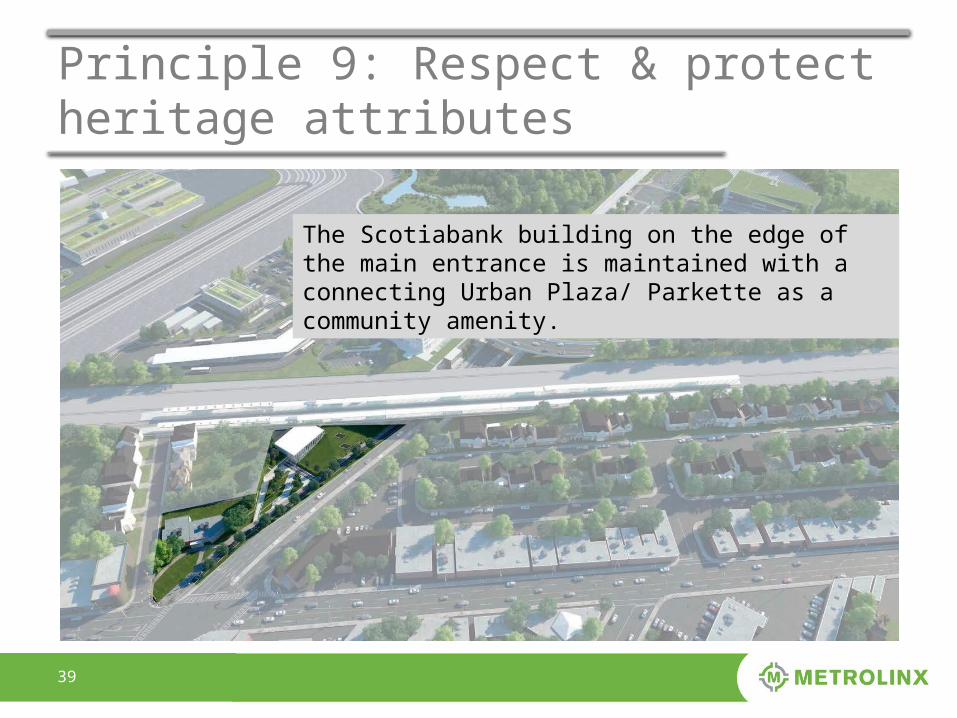
The Scotiabank building on the edge of the main entrance is maintained with a connecting Urban Plaza/ Parkette as a community amenity.
4040
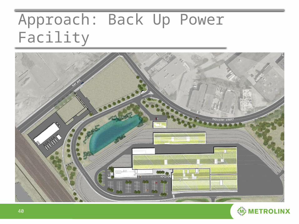
Approach: Back Up Power Facility
4141
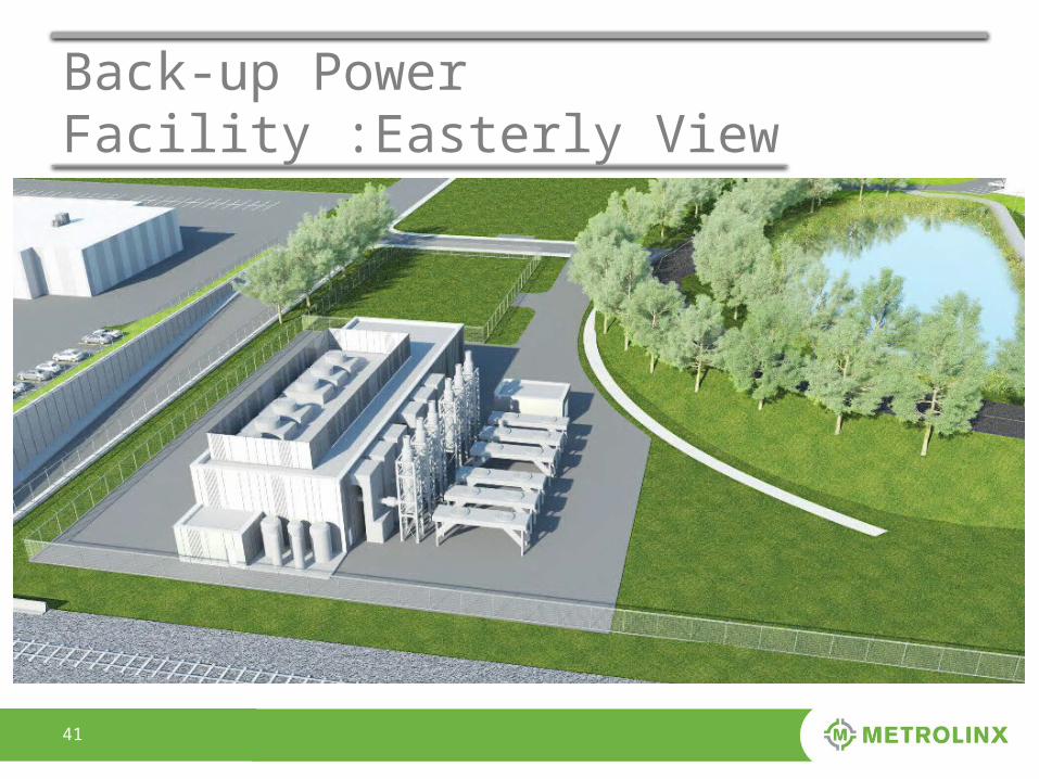
Back-up Power Facility :Easterly View
42
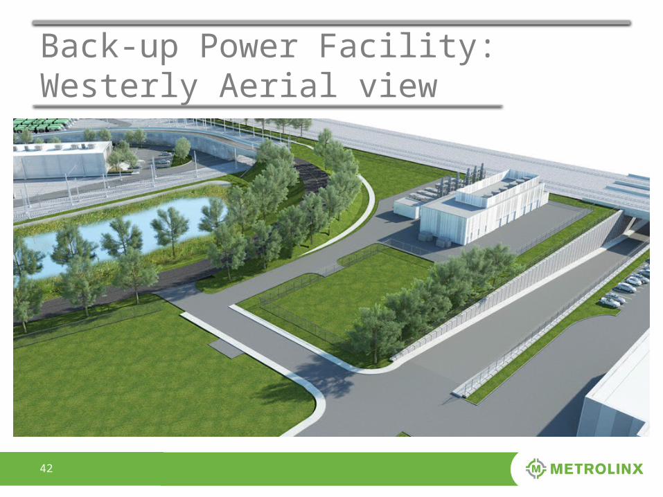
Back-up Power Facility: Westerly Aerial view
4343
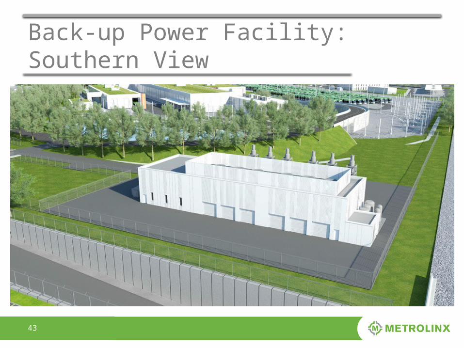
Back-up Power Facility: Southern View
4444
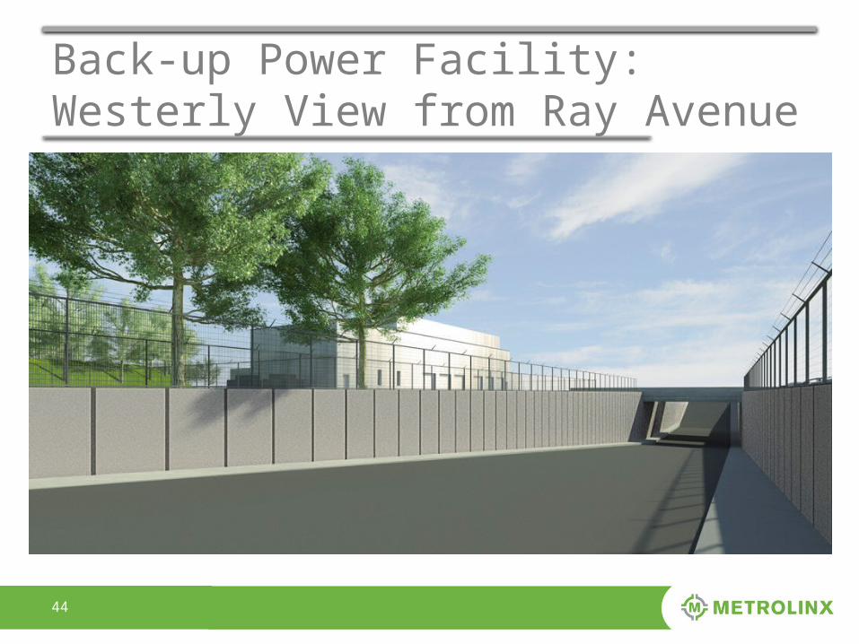
Back-up Power Facility: Westerly View from Ray Avenue
4545
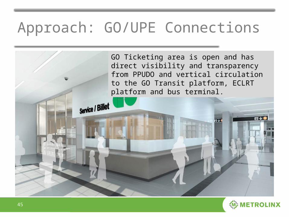
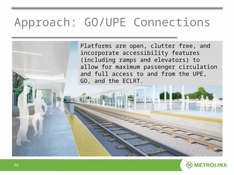
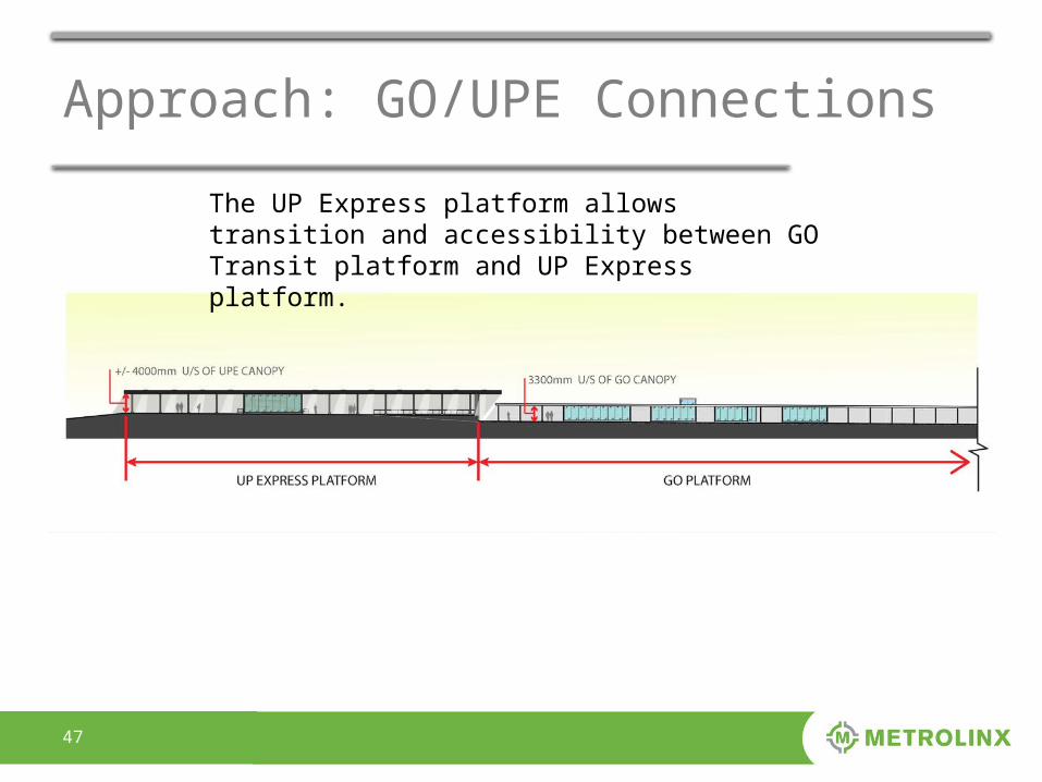
Approach: GO/UPE Connections
GO Ticketing area is open and has direct visibility and transparency from PPUDO and vertical circulation to the GO Transit platform, ECLRT platform and bus terminal.
4646
Approach: GO/UPE Connections
Platforms are open, clutter free, and incorporate accessibility features (including ramps and elevators) to allow for maximum passenger circulation and full access to and from the UPE, GO, and the ECLRT.
4747
Approach: GO/UPE Connections
The UP Express platform allows transition and accessibility between GO Transit platform and UP Express platform.
48


![[XLS] · Web viewwms project management wms implementation service kodak imaglnk scnr 900s_ kodak imaglnk scnr 900d_ kodak imaglnk semiauto fdr kodak imaglnk patch rdr ac](https://img.pdfslide.us/doc/110x75/5ab639c47f8b9a86428d8207/xls-viewwms-project-management-wms-implementation-service-kodak-imaglnk-scnr-900s.jpg)