Embed Size (px)
Citation preview
Data for Planning Purposes
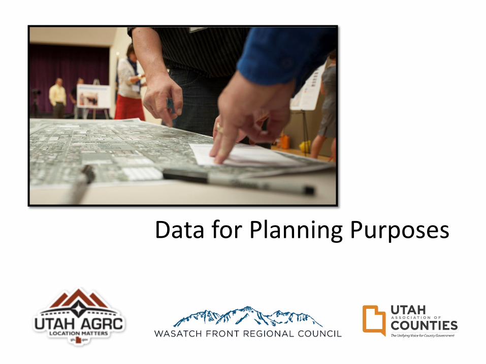
Background:The Value of County-
Stewarded Parcel Ownership GIS Layers
Bert Granberg,Director
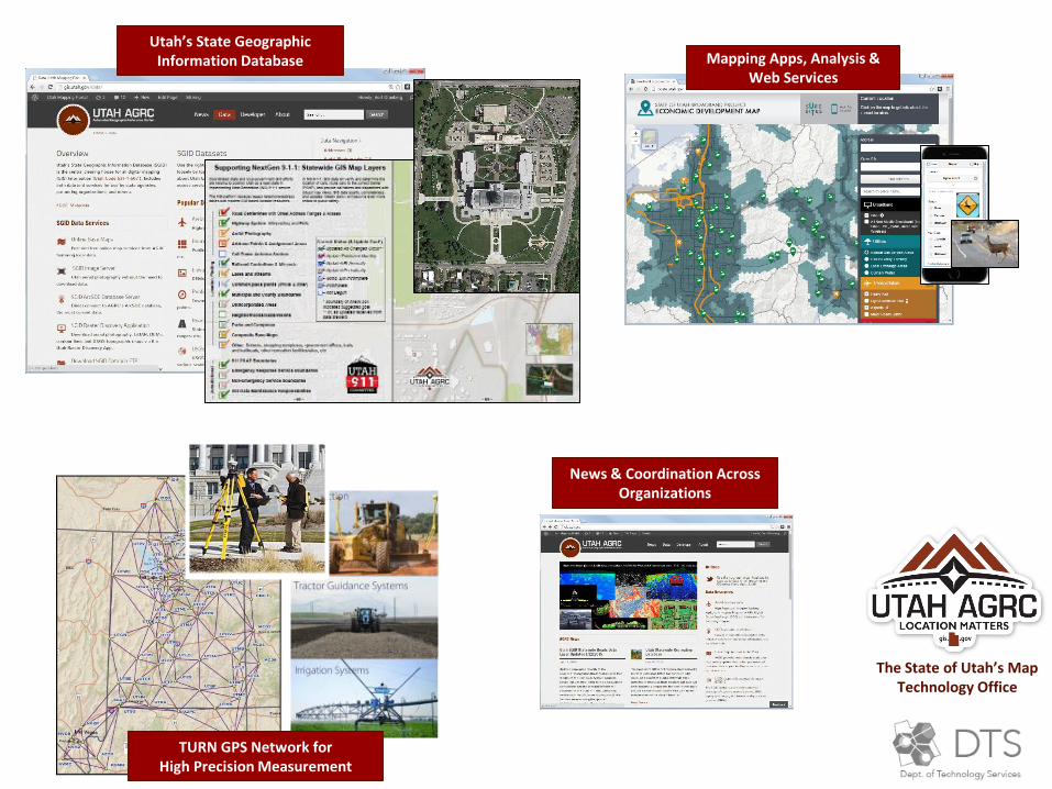
News & Coordination Across Organizations
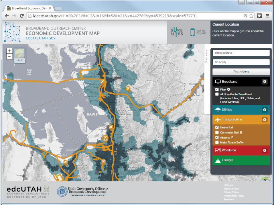
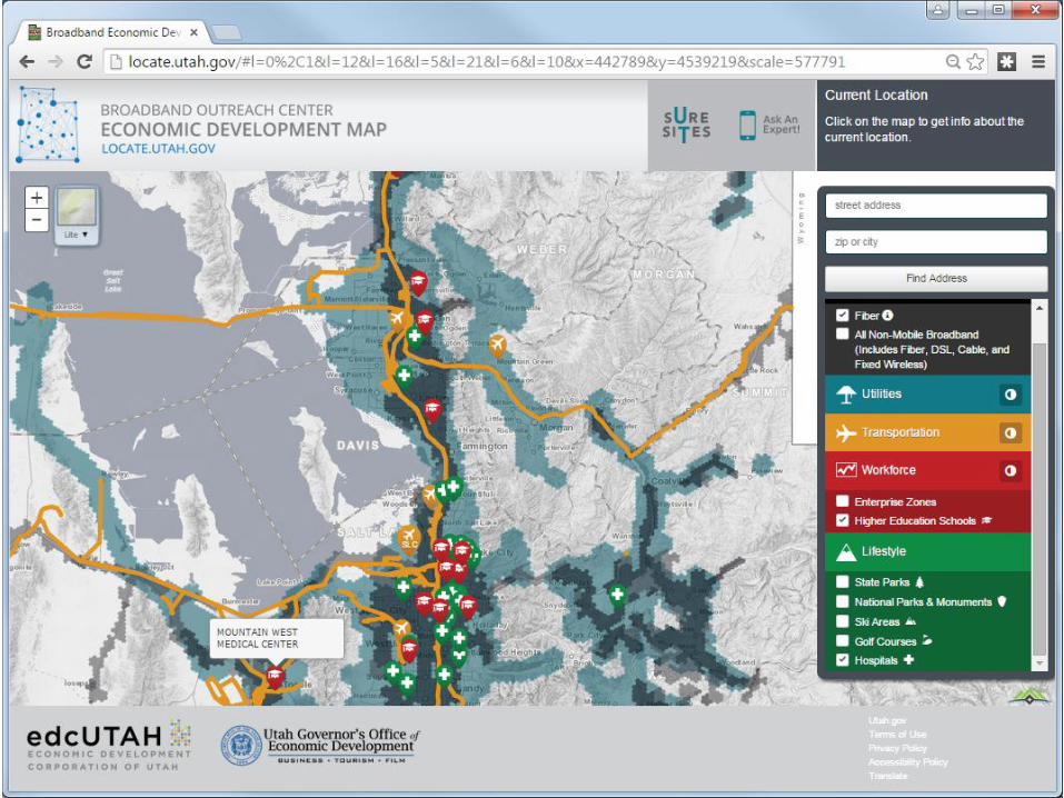
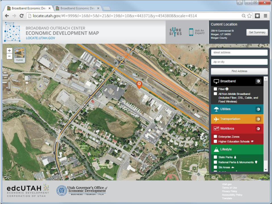
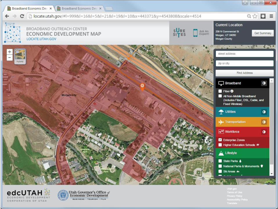
The State of Utah’s Map Technology Office
Utah’s State GeographicInformation Database Mapping Apps, Analysis &
Web Services
TURN GPS Network forHigh Precision Measurement
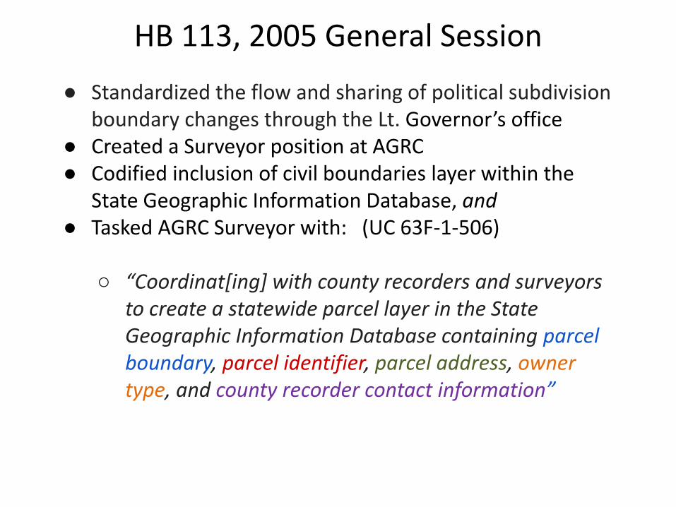
HB 113, 2005 General Session
● Standardized the flow and sharing of political subdivision boundary changes through the Lt. Governor’s office
● Created a Surveyor position at AGRC● Codified inclusion of civil boundaries layer within the
State Geographic Information Database, and● Tasked AGRC Surveyor with: (UC 63F-1-506)
○ “Coordinat[ing] with county recorders and surveyors to create a statewide parcel layer in the State Geographic Information Database containing parcel boundary, parcel identifier, parcel address, owner type, and county recorder contact information”
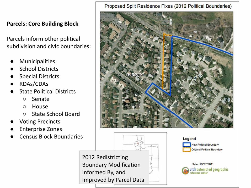
2012 Redistricting Boundary Modification Informed By, and Improved by Parcel Data
Parcels: Core Building Block
Parcels inform other political subdivision and civic boundaries:
● Municipalities● School Districts● Special Districts● RDAs/CDAs● State Political Districts
○ Senate○ House○ State School Board
● Voting Precincts● Enterprise Zones● Census Block Boundaries
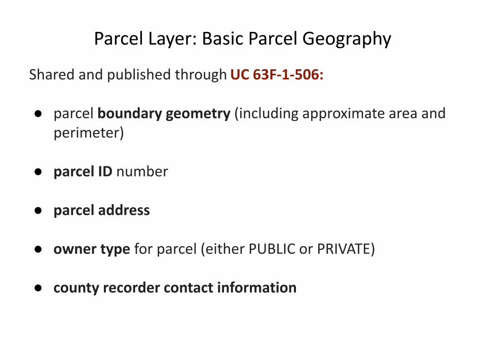
Parcel Layer: Basic Parcel Geography
Shared and published through UC 63F-1-506:
● parcel boundary geometry (including approximate area and perimeter)
● parcel ID number
● parcel address
● owner type for parcel (either PUBLIC or PRIVATE)
● county recorder contact information
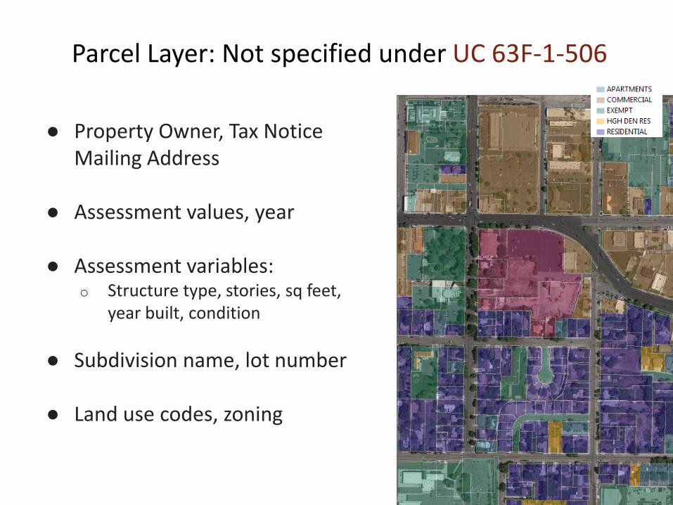
Parcel Layer: Not specified under UC 63F-1-506
● Property Owner, Tax Notice Mailing Address
● Assessment values, year
● Assessment variables:o Structure type, stories, sq feet,
year built, condition
● Subdivision name, lot number
● Land use codes, zoning
De
sire
d U
pd
ate
Sch
ed
ule
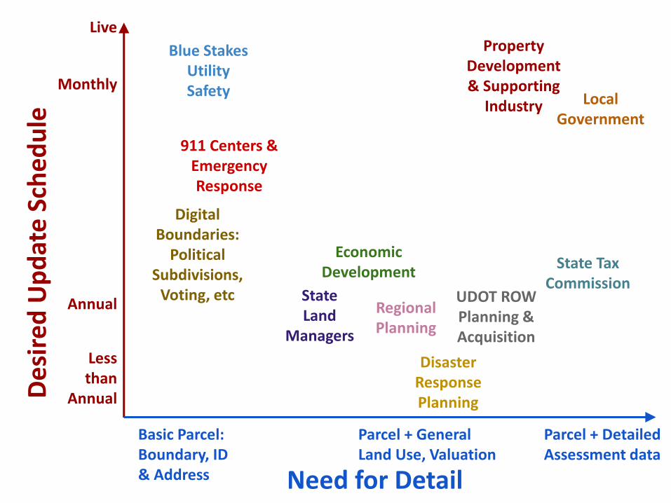
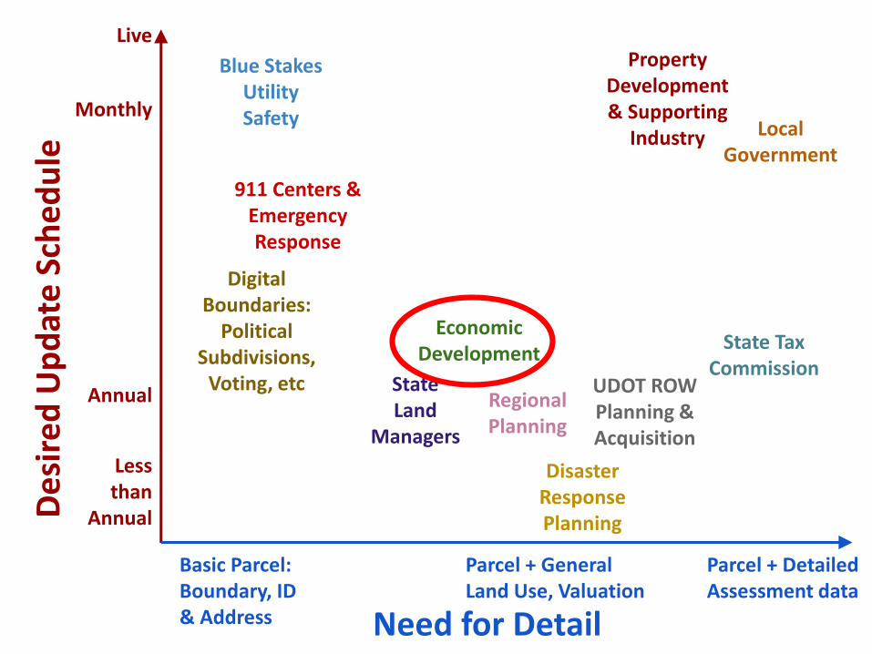
Need for Detail
Live
Less than
Annual
Basic Parcel: Boundary, ID & Address
Parcel + Detailed Assessment data
Property Development & Supporting
Industry Local Government
Disaster Response Planning
EconomicDevelopment
Blue Stakes Utility Safety
Regional Planning
911 Centers & Emergency Response
UDOT ROWPlanning & Acquisition
DigitalBoundaries:
Political Subdivisions,
Voting, etcAnnual
State Land
Managers
State Tax Commission
Parcel + General Land Use, Valuation
Monthly
De
sire
d U
pd
ate
Sch
ed
ule
Need for Detail
Live
Less than
Annual
Basic Parcel: Boundary, ID & Address
Parcel + Detailed Assessment data
Property Development & Supporting
Industry Local Government
Disaster Response Planning
EconomicDevelopment
Regional Planning
UDOT ROWPlanning & Acquisition
DigitalBoundaries:
Political Subdivisions,
Voting, etc
Monthly
State Land
Managers
State Tax Commission
Parcel + General Land Use, Valuation
Blue Stakes Utility Safety
911 Centers & Emergency Response
Annual
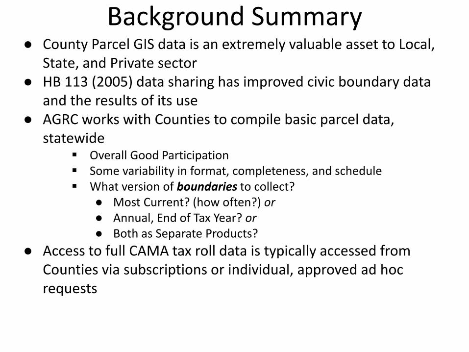
Background Summary● County Parcel GIS data is an extremely valuable asset to Local,
State, and Private sector● HB 113 (2005) data sharing has improved civic boundary data
and the results of its use ● AGRC works with Counties to compile basic parcel data,
statewide Overall Good Participation Some variability in format, completeness, and schedule What version of boundaries to collect?
● Most Current? (how often?) or● Annual, End of Tax Year? or● Both as Separate Products?
● Access to full CAMA tax roll data is typically accessed from Counties via subscriptions or individual, approved ad hoc requests
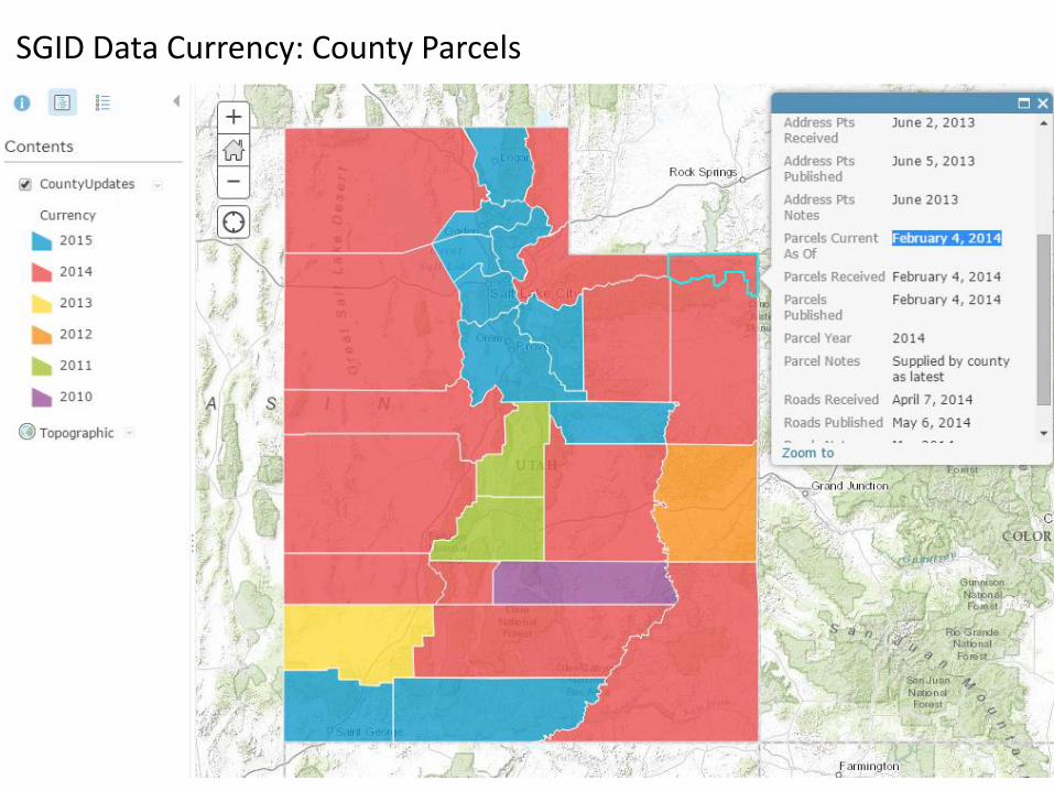
SGID Data Currency: County Parcels

Projecting community impacts and benefits
Envision Tomorrow
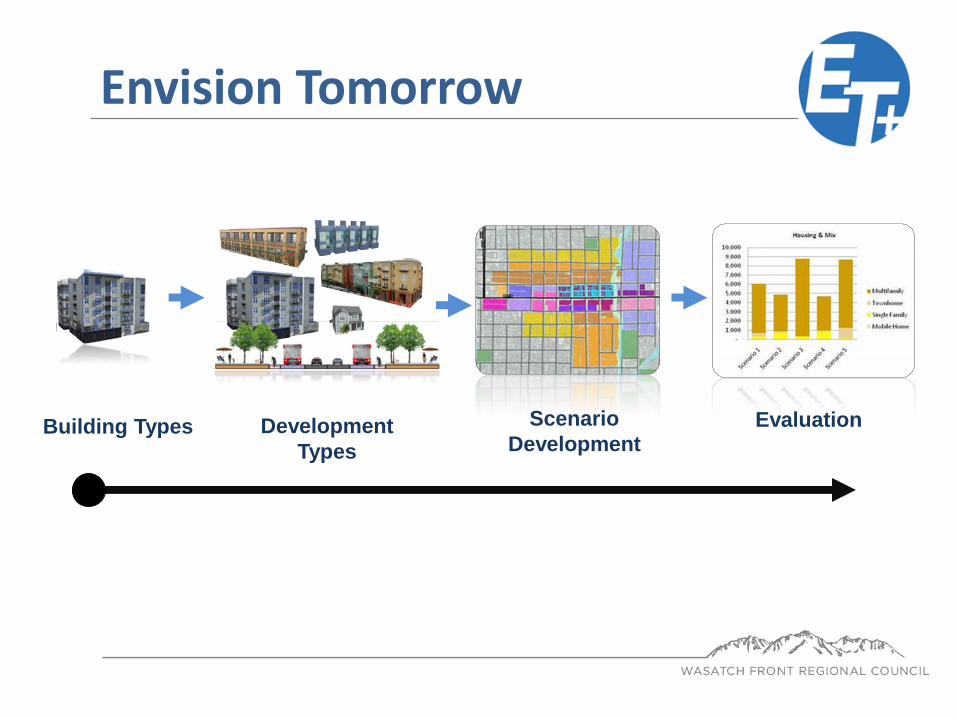
Development
Types
Scenario
DevelopmentEvaluationBuilding Types
Envision Tomorrow
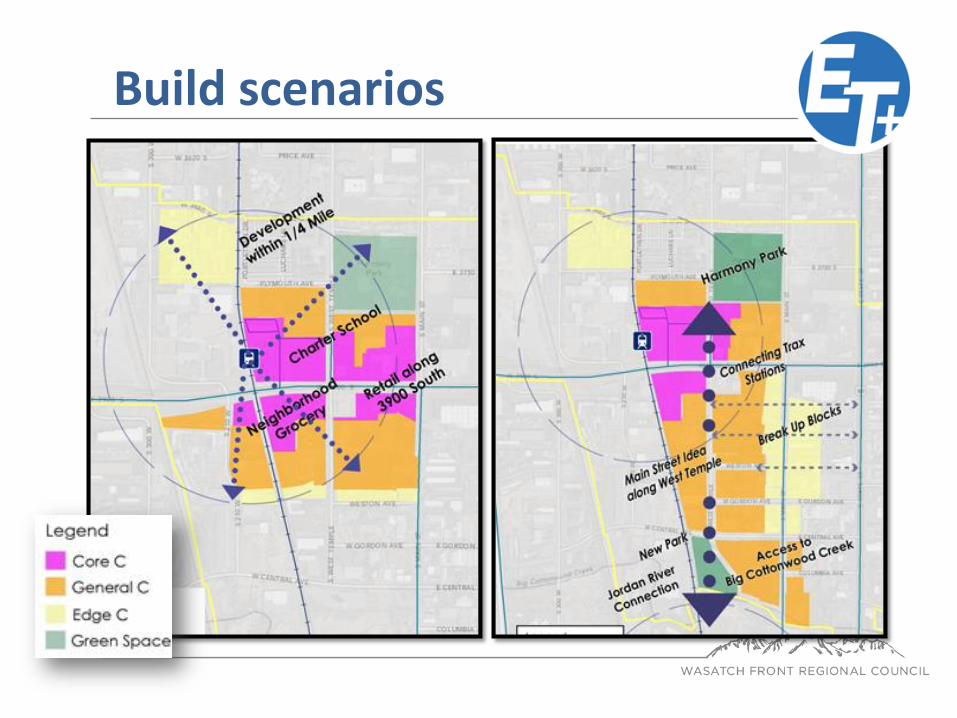
Build scenarios
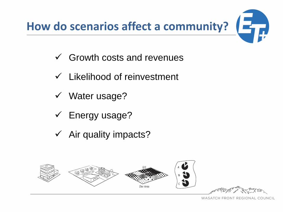
Growth costs and revenues
Likelihood of reinvestment
Water usage?
Energy usage?
Air quality impacts?
How do scenarios affect a community?
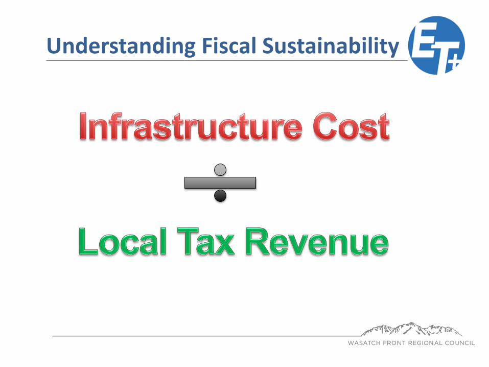
Understanding Fiscal Sustainability

Snow plowing?
Crack sealing?
Resurfacing?
Sealing/ Overlaying?
Street Sweeping?
Curb repair? Sidewalk cracks?
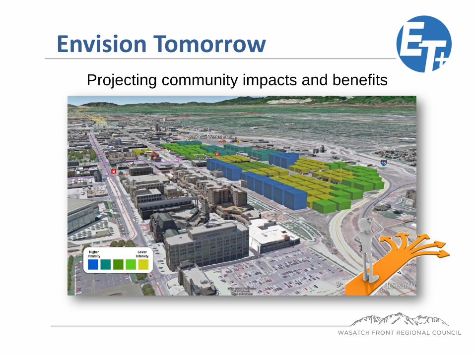
Projecting community impacts and benefits
Envision Tomorrow