Embed Size (px)
Citation preview
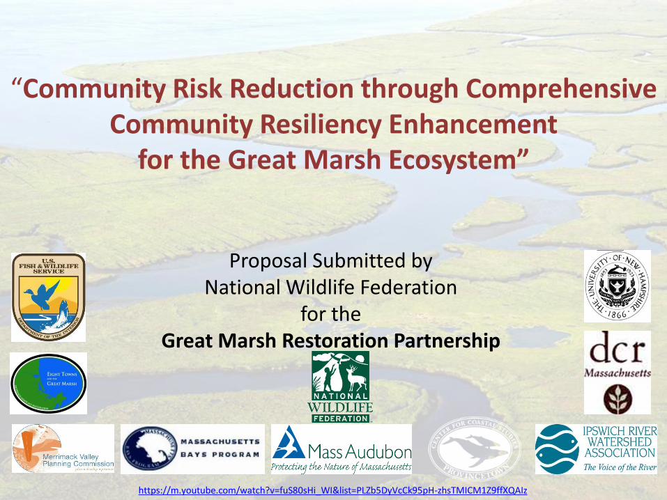
Proposal Submitted by National Wildlife Federation
for the Great Marsh Restoration Partnership
“Community Risk Reduction through Comprehensive Community Resiliency Enhancement
for the Great Marsh Ecosystem”
https://m.youtube.com/watch?v=fuS80sHi_WI&list=PLZb5DyVcCk95pH-zhsTMICM1Z9ffXQAIz
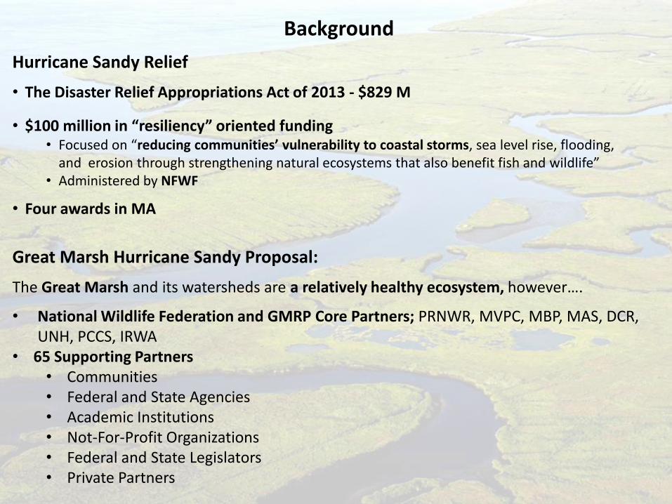
Background
Hurricane Sandy Relief
• The Disaster Relief Appropriations Act of 2013 - $829 M
• $100 million in “resiliency” oriented funding • Focused on “reducing communities’ vulnerability to coastal storms, sea level rise, flooding,
and erosion through strengthening natural ecosystems that also benefit fish and wildlife” • Administered by NFWF
• Four awards in MA
Great Marsh Hurricane Sandy Proposal:
The Great Marsh and its watersheds are a relatively healthy ecosystem, however….
• National Wildlife Federation and GMRP Core Partners; PRNWR, MVPC, MBP, MAS, DCR, UNH, PCCS, IRWA
• 65 Supporting Partners • Communities • Federal and State Agencies • Academic Institutions • Not-For-Profit Organizations • Federal and State Legislators • Private Partners
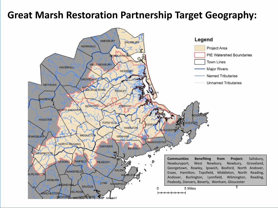
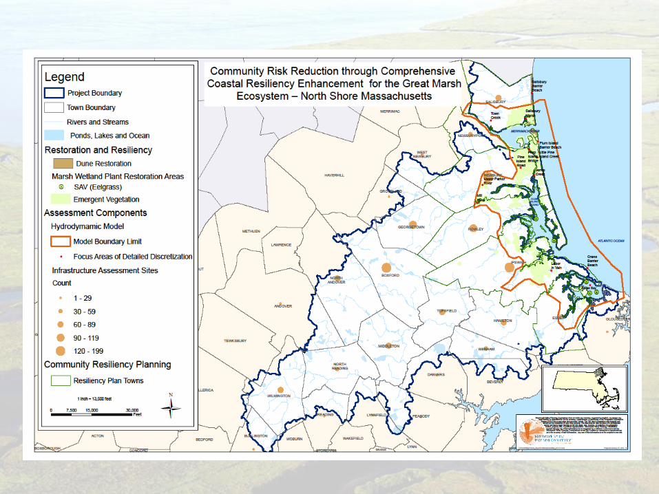
Great Marsh Restoration Partnership Target Geography:
Communities Benefiting from Project: Salisbury, Newburyport, West Newbury, Newbury, Groveland, Georgetown, Rowley, Ipswich, Boxford, North Andover, Essex, Hamilton, Topsfield, Middleton, North Reading, Andover, Burlington, Lynnfield, Wilmington, Reading, Peabody, Danvers, Beverly, Wenham, Gloucester
Gloucester Harbor
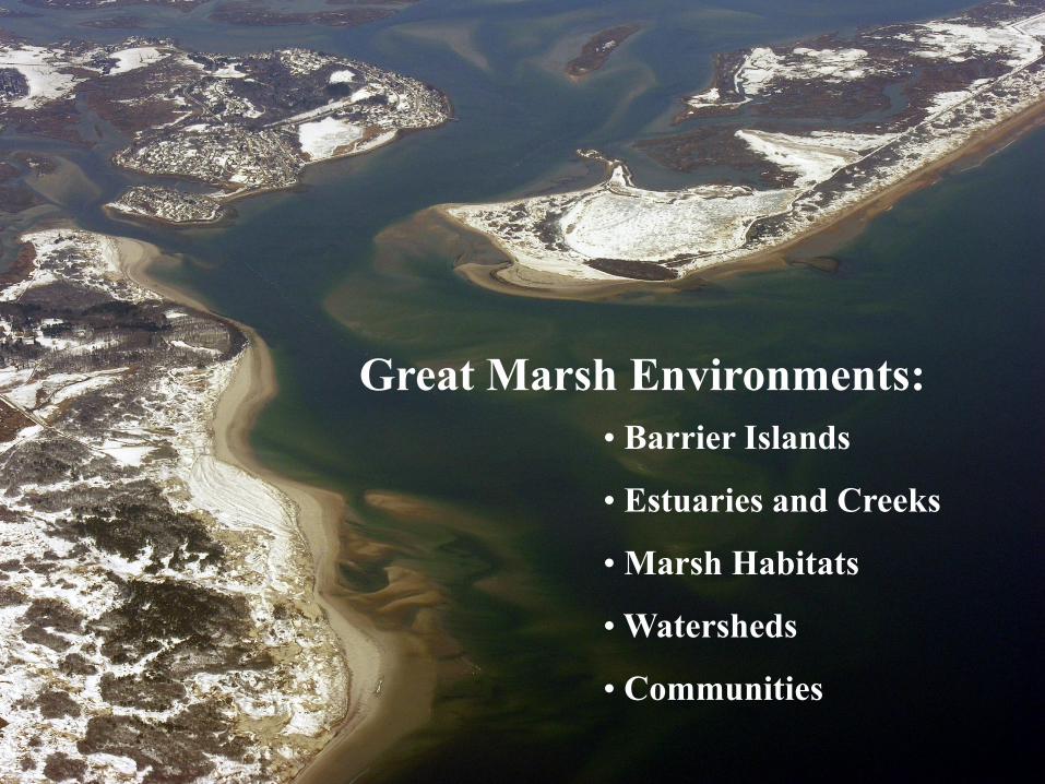
Great Marsh Environments:
• Barrier Islands
• Estuaries and Creeks
• Marsh Habitats
• Watersheds
• Communities
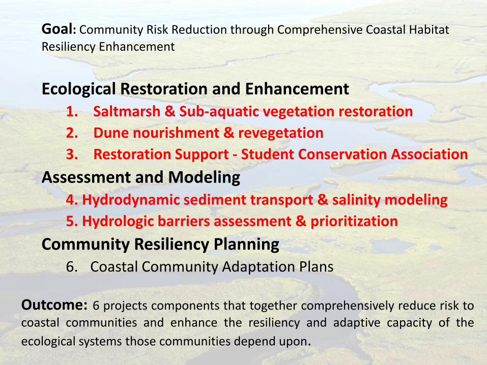
Ecological Restoration and Enhancement 1. Saltmarsh & Sub-aquatic vegetation restoration
2. Dune nourishment & revegetation
3. Restoration Support - Student Conservation Association
Assessment and Modeling 4. Hydrodynamic sediment transport & salinity modeling
5. Hydrologic barriers assessment & prioritization
Community Resiliency Planning 6. Coastal Community Adaptation Plans
Outcome: 6 projects components that together comprehensively reduce risk to coastal communities and enhance the resiliency and adaptive capacity of the
ecological systems those communities depend upon.
Goal: Community Risk Reduction through Comprehensive Coastal Habitat
Resiliency Enhancement
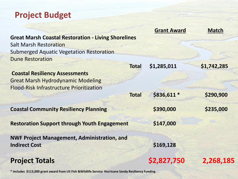
Grant Award Match Great Marsh Coastal Restoration - Living Shorelines Salt Marsh Restoration Submerged Aquatic Vegetation Restoration Dune Restoration Total $1,285,011 $1,742,285 Coastal Resiliency Assessments Great Marsh Hydrodynamic Modeling Flood-Risk Infrastructure Prioritization Total $836,611 * $290,900 Coastal Community Resiliency Planning $390,000 $235,000 Restoration Support through Youth Engagement $147,000 NWF Project Management, Administration, and Indirect Cost $169,128
Project Totals $2,827,750 2,268,185 * Includes $113,000 grant award from US Fish &Wildlife Service Hurricane Sandy Resiliency Funding
Project Budget
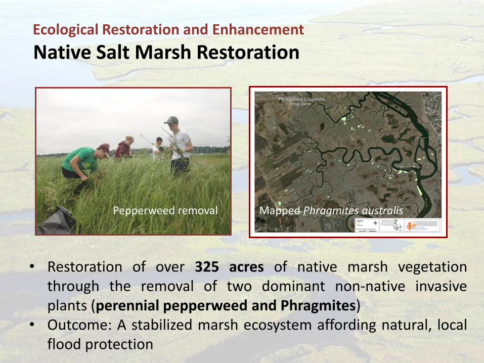
• Restoration of over 325 acres of native marsh vegetation through the removal of two dominant non-native invasive plants (perennial pepperweed and Phragmites)
• Outcome: A stabilized marsh ecosystem affording natural, local flood protection
Pepperweed removal
Native Salt Marsh Restoration Ecological Restoration and Enhancement
Mapped Phragmites australis
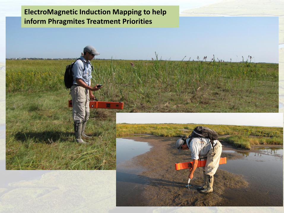
ElectroMagnetic Induction Mapping to help inform Phragmites Treatment Priorities
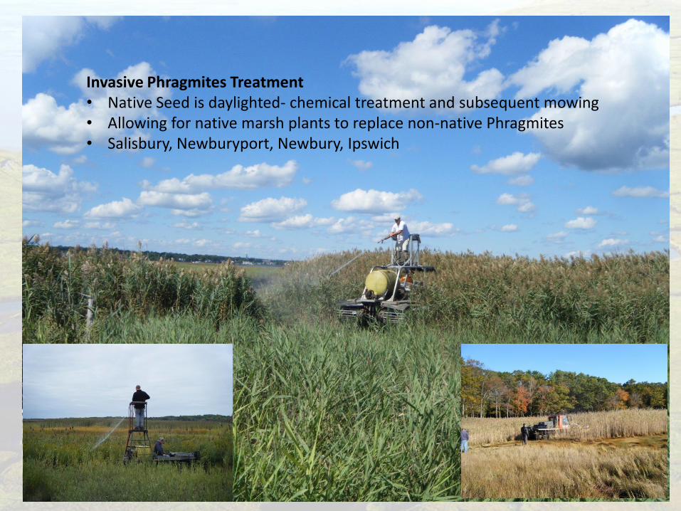
Invasive Phragmites Treatment • Native Seed is daylighted- chemical treatment and subsequent mowing • Allowing for native marsh plants to replace non-native Phragmites • Salisbury, Newburyport, Newbury, Ipswich
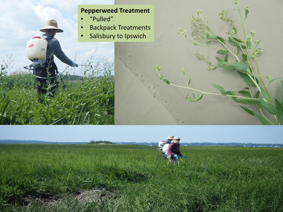
Pepperweed Treatment • “Pulled” • Backpack Treatments • Salisbury to Ipswich
Ecological Restoration and Enhancement
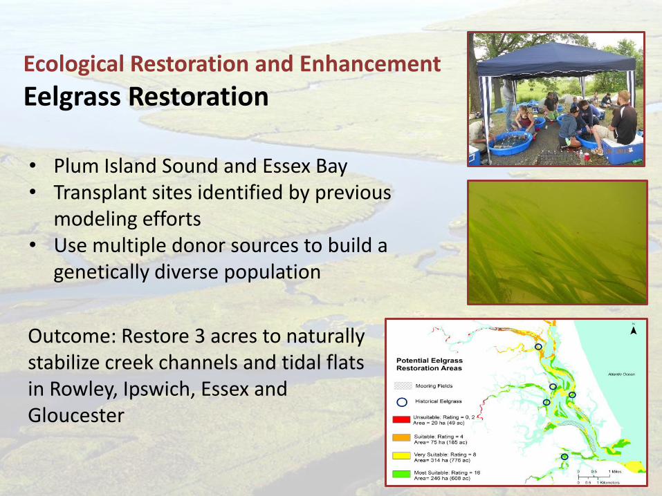
Eelgrass Restoration
• Plum Island Sound and Essex Bay • Transplant sites identified by previous
modeling efforts • Use multiple donor sources to build a
genetically diverse population
Outcome: Restore 3 acres to naturally stabilize creek channels and tidal flats in Rowley, Ipswich, Essex and Gloucester
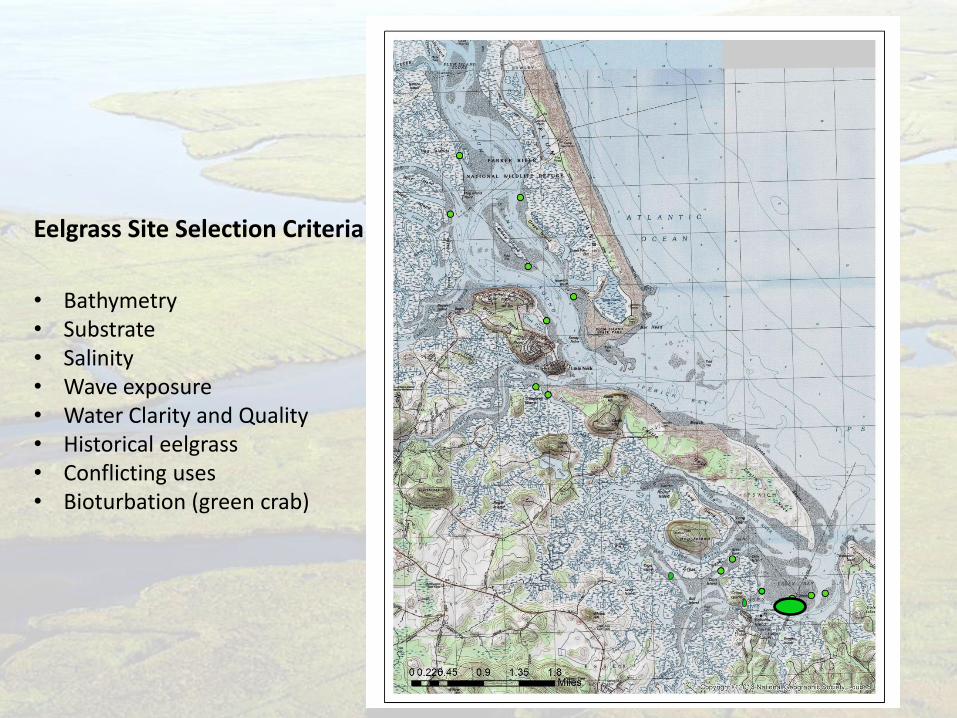
Eelgrass Site Selection Criteria
• Bathymetry • Substrate • Salinity • Wave exposure • Water Clarity and Quality • Historical eelgrass • Conflicting uses • Bioturbation (green crab)
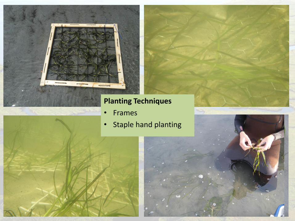
Planting Techniques
• Frames
• Staple hand planting
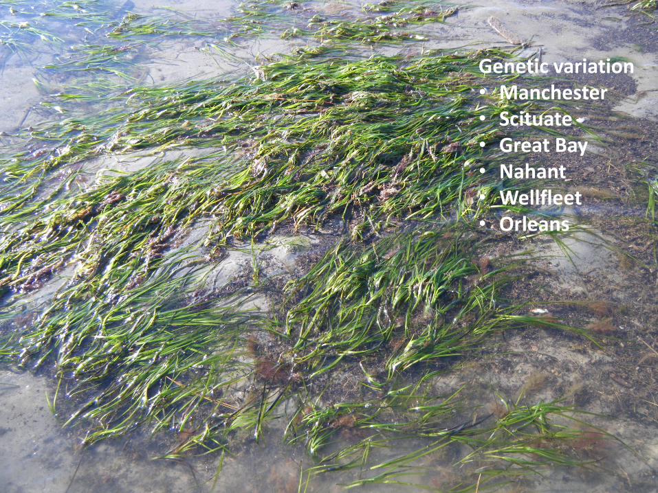
Genetic variation • Manchester • Scituate • Great Bay • Nahant • Wellfleet • Orleans
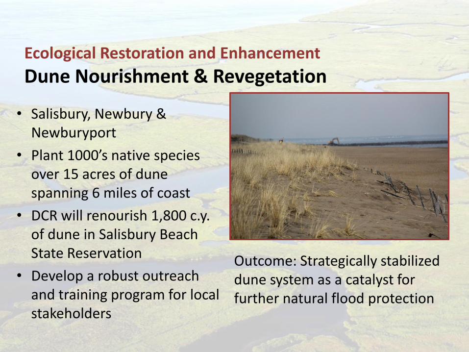
• Salisbury, Newbury & Newburyport
• Plant 1000’s native species over 15 acres of dune spanning 6 miles of coast
• DCR will renourish 1,800 c.y. of dune in Salisbury Beach State Reservation
• Develop a robust outreach and training program for local stakeholders
Ecological Restoration and Enhancement
Dune Nourishment & Revegetation
Outcome: Strategically stabilized dune system as a catalyst for further natural flood protection
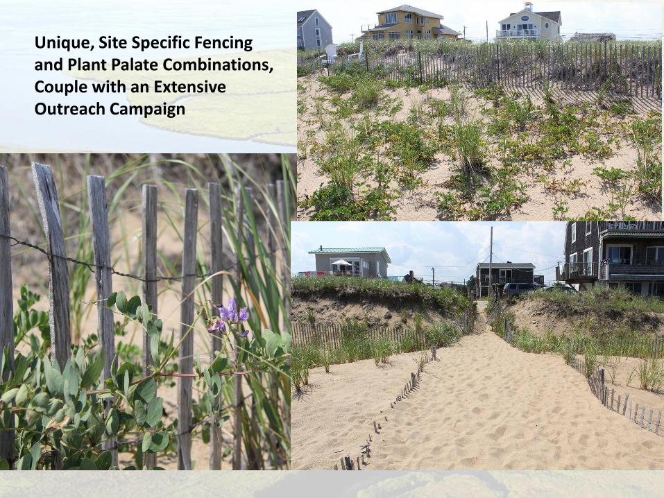
Unique, Site Specific Fencing and Plant Palate Combinations, Couple with an Extensive Outreach Campaign
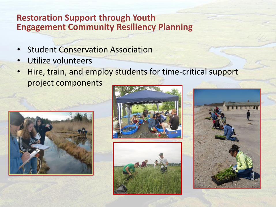
• Student Conservation Association • Utilize volunteers • Hire, train, and employ students for time-critical support
project components
Restoration Support through Youth Engagement Community Resiliency Planning
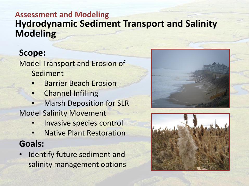
Scope: Model Transport and Erosion of
Sediment • Barrier Beach Erosion • Channel Infilling • Marsh Deposition for SLR
Model Salinity Movement • Invasive species control • Native Plant Restoration
Goals: • Identify future sediment and
salinity management options
Assessment and Modeling Hydrodynamic Sediment Transport and Salinity Modeling
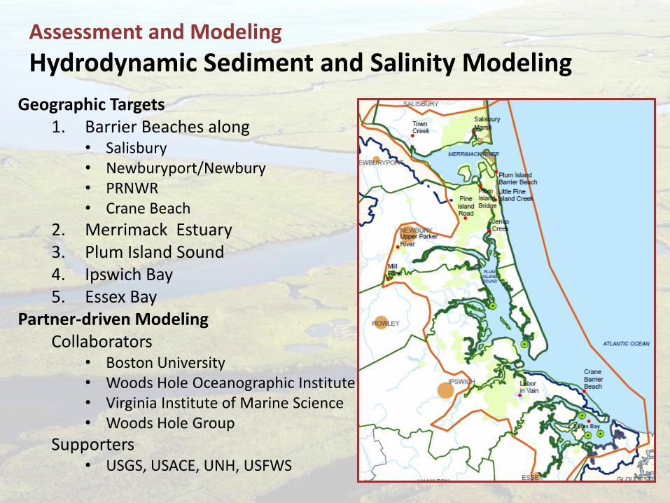
Geographic Targets 1. Barrier Beaches along
• Salisbury • Newburyport/Newbury • PRNWR • Crane Beach
2. Merrimack Estuary 3. Plum Island Sound 4. Ipswich Bay 5. Essex Bay
Partner-driven Modeling Collaborators
• Boston University • Woods Hole Oceanographic Institute • Virginia Institute of Marine Science • Woods Hole Group
Supporters • USGS, USACE, UNH, USFWS
Assessment and Modeling
Hydrodynamic Sediment and Salinity Modeling
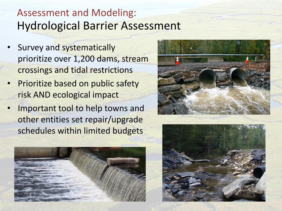
Hydrological Barrier Assessment
• Survey and systematically prioritize over 1,200 dams, stream crossings and tidal restrictions
• Prioritize based on public safety risk AND ecological impact
• Important tool to help towns and other entities set repair/upgrade schedules within limited budgets
Assessment and Modeling:
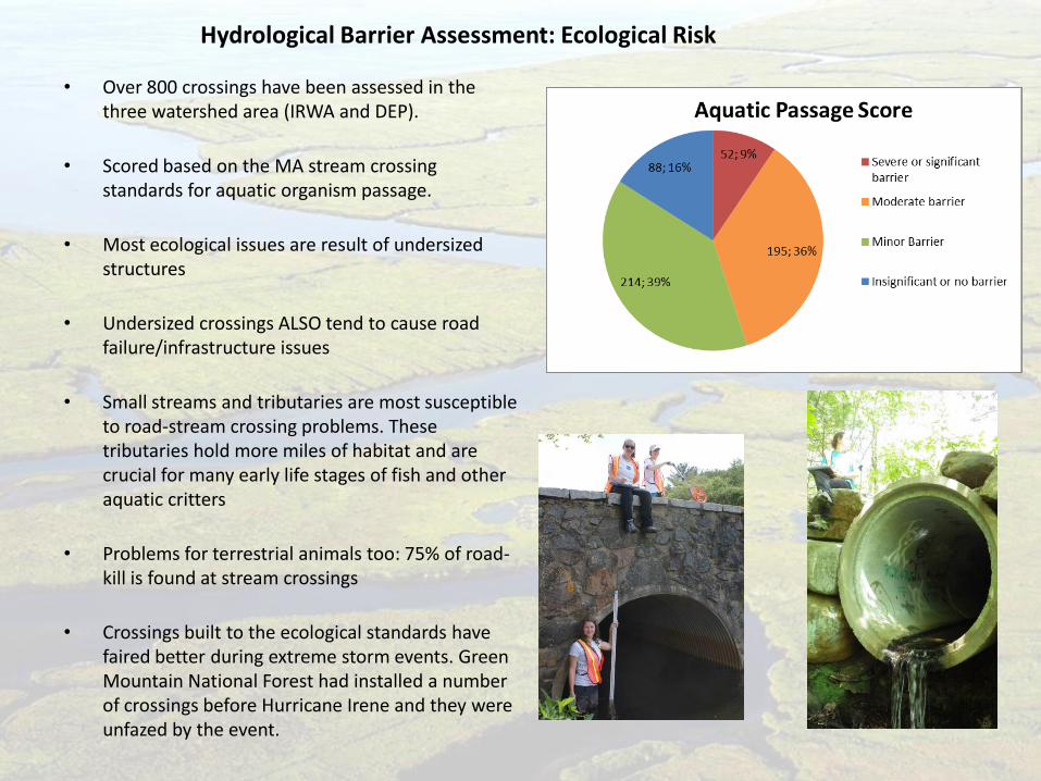
• Over 800 crossings have been assessed in the three watershed area (IRWA and DEP).
• Scored based on the MA stream crossing standards for aquatic organism passage.
• Most ecological issues are result of undersized structures
• Undersized crossings ALSO tend to cause road failure/infrastructure issues
• Small streams and tributaries are most susceptible to road-stream crossing problems. These tributaries hold more miles of habitat and are crucial for many early life stages of fish and other aquatic critters
• Problems for terrestrial animals too: 75% of road-kill is found at stream crossings
• Crossings built to the ecological standards have faired better during extreme storm events. Green Mountain National Forest had installed a number of crossings before Hurricane Irene and they were unfazed by the event.
Hydrological Barrier Assessment: Ecological Risk
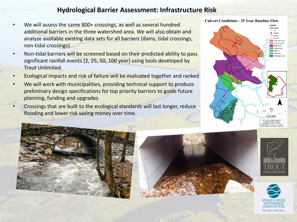
• We will assess the same 800+ crossings, as well as several hundred additional barriers in the three watershed area. We will also obtain and analyze available existing data sets for all barriers (dams, tidal crossings, non-tidal crossings).
• Non-tidal barriers will be screened based on their predicted ability to pass significant rainfall events (2, 25, 50, 100 year) using tools developed by Trout Unlimited.
• Ecological impacts and risk of failure will be evaluated together and ranked
• We will work with municipalities, providing technical support to produce preliminary design specifications for top priority barriers to guide future planning, funding and upgrades
• Crossings that are built to the ecological standards will last longer, reduce flooding and lower risk saving money over time.
Hydrological Barrier Assessment: Infrastructure Risk
Thank You!
Great Marsh Restoration Partnership