Embed Size (px)
Citation preview
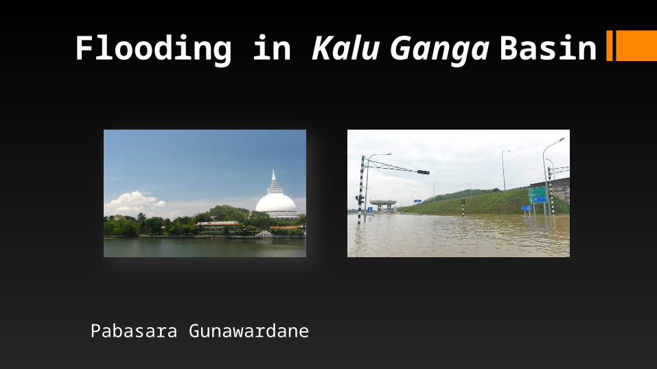
Flooding in Kalu Ganga Basin
Pabasara Gunawardane
OUTLINE
Introduction
Flood Damages
Causes of Floods
Flood Mitigation
Recommendations
INTRODUCTION
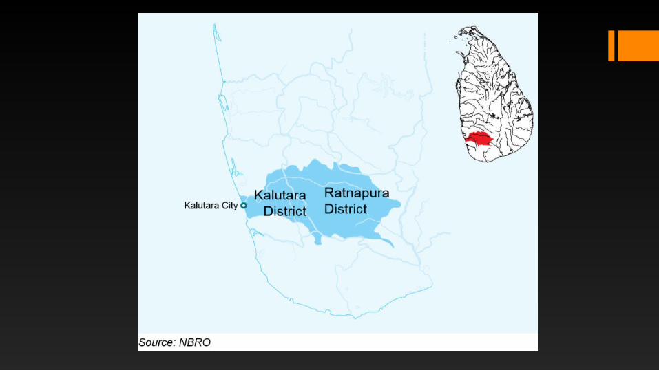
• Kalu Ganga Is the 2nd largest river basin in Sri Lanka
• Covers 2766km2
• Originates from Indikatupana, Sri Pada peak of central highlands(2250m aMSL)• Falls out to the Indian ocean at Kalutara
• Travels 129km
• Catchment area is located in a highest rainfall area of the country
• Flows through Ratnapura, Anguruwatota, Horana, Kalutara
• The average annual rainfall is 4000mm & leads to 4000m3 of annual flow
• Annually discharge 4032 x 106m3 to the ocean
• River basin has steep gradient in upper part & mild gradient in lower part
• Drops to 16m MSL from 2250m within first 36km of the river
• Between Ratnapura & Kalutara 6 major tributaries are joined to the river
• No significant water development projects except drinking water supply projects,minor irrigation projects & Kukule Ganga hydropower plant.
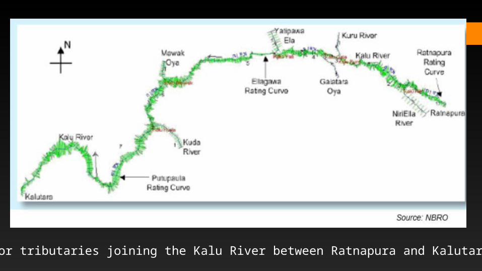
Six major tributaries joining the Kalu River between Ratnapura and Kalutara
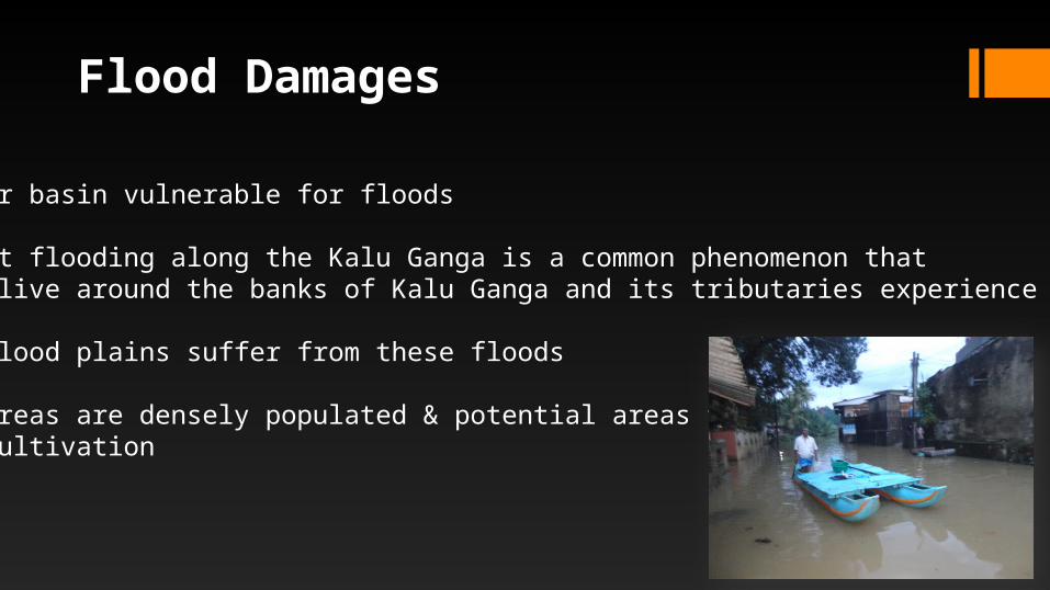
Flood Damages
• A river basin vulnerable for floods
• Frequent flooding along the Kalu Ganga is a common phenomenon that people live around the banks of Kalu Ganga and its tributaries experience every year
• Lower flood plains suffer from these floods
• Lower areas are densely populated & potential areas for paddy cultivation
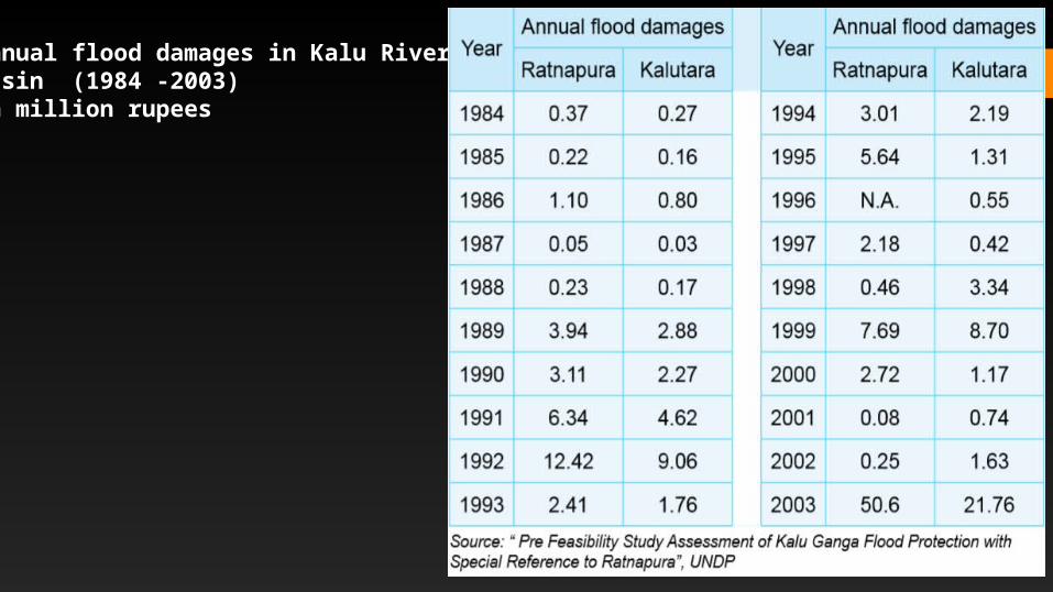
Annual flood damages in Kalu River basin (1984 -2003)In million rupees
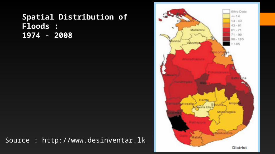
Spatial Distribution of Floods :1974 - 2008
Source : http://www.desinventar.lk
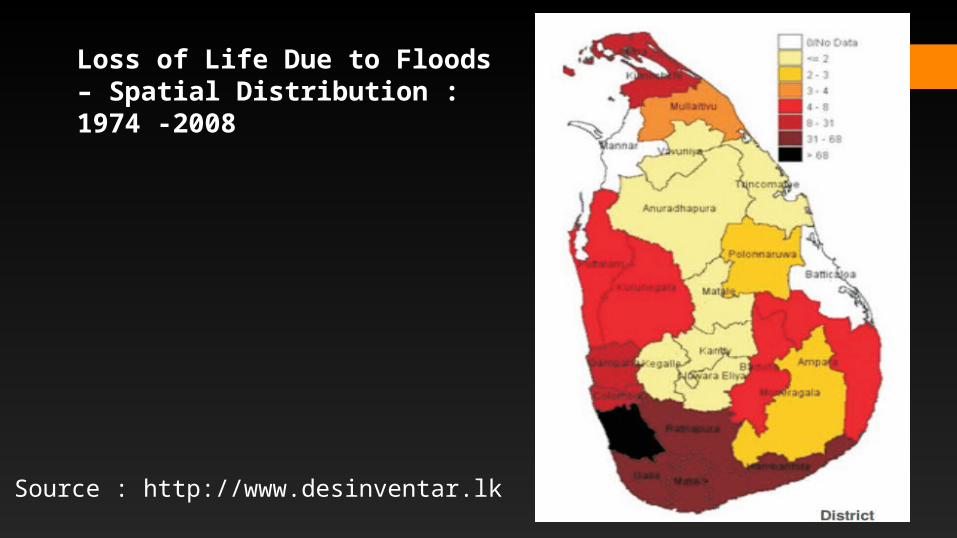
Loss of Life Due to Floods – Spatial Distribution : 1974 -2008
Source : http://www.desinventar.lk
Causes of floods
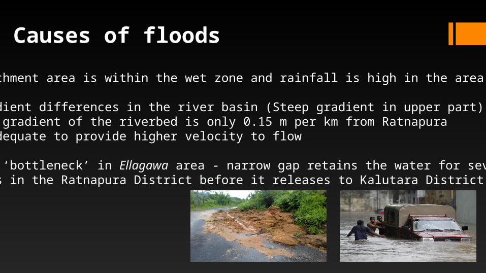
• Catchment area is within the wet zone and rainfall is high in the area
• Gradient differences in the river basin (Steep gradient in upper part)• The gradient of the riverbed is only 0.15 m per km from Ratnapura• Inadequate to provide higher velocity to flow
• The ‘bottleneck’ in Ellagawa area - narrow gap retains the water for several days in the Ratnapura District before it releases to Kalutara District
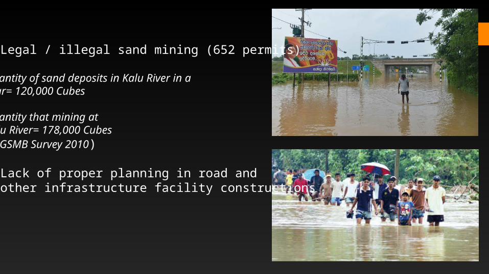
• Legal / illegal sand mining (652 permits)
Quantity of sand deposits in Kalu River in a year= 120,000 Cubes
Quantity that mining at Kalu River= 178,000 Cubes( GSMB Survey 2010)
• Lack of proper planning in road and other infrastructure facility constructions
Flood Mitigation
• Two approaches * Take water away from people – Structural Approach
* Take people away from water – Non structural approach
• Program for Hydro-Meteorological Disaster Mitigation for Secondary Cities in South and South East Asia (PROMISE) recognized Kalutara as a secondary city that suffers annually due to floods and designed program to suit the needs of the city
Flood Mitigation
1. Hazard mapping and vulnerability assessment- The vulnerability of the communities in terms of the geographic location of the city, its infrastructure and livelihoods
2. Kalu Ganga river flood forecasting and warning system
3. Demonstration activities as a measure for disaster preparedness and mitigation
4. Micro credit scheme as a measure of mitigation of flood impacts on the livelihood of urban poor
5. Activities to build the community awareness on flood risk management
Flood Mitigation
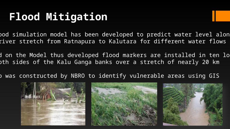
• A flood simulation model has been developed to predict water level along the river stretch from Ratnapura to Kalutara for different water flows in the river
• Based on the Model thus developed flood markers are installed in ten locations on both sides of the Kalu Ganga banks over a stretch of nearly 20 km
• A map was constructed by NBRO to identify vulnerable areas using GIS
Recommendations
• Educating people more about the floods
• Having a proper flood alert system + Meteorological alert system
• Building a series of levees to prevent flood water spilling into low lying areas* Build a bypass canal which will take surplus water around Ratnapura town back to the river preventing the town from getting flooded * Build a reservoir at Malwala several kilometers upstream from the town (2004)
• Diversion of Kalu Ganga to Ruhuna
• Having proper technological construction systems
References• Dr. Ratnasiri Janaka, Flood protection at Ratnapura and taking surplus water to
Ruhuna An alternative scheme, http://www.island.lk/index.php?page_cat=article-details&page=article-details&code_title=39005 (2216 on 22nd Sep 2014)
• Eng. Dias P. P. G, Hydrometric Network & Flood Hydrometric Network & Flood Mitigation, www.itu.int/ITU-D/asp/Events/.../7)%20Irrigation%20Department.pdf (2216 on 22nd Sep 2014)
• Asian Disaster Preparedness Center, Urban Flood Risk Mitigation in Kalutara City, Sri Lanka, www.adpc.net/igo/category/.../2013-qvl8PC-ADPC-Safer_Cities_23.pdf (2216 on 22nd Sep 2014)
• Dr. Nandalal H.K, Flood risk management incorporation, http://www.civil.pdn.ac.lk/acstaff/nandalalhk.html (2301 on 22nd Sep 2014)
• A.D.Ampitiyawatta, Shenglian Guo, Precipitation trends in the Kalu Ganga basin in Sri Lanka, http://www.sljol.info/sljol/index.php/JAS/article/view/1641
• https://www.google.lk/maps/place/Ratnapura/@6.6143317,80.0186043,11830m/data=!3m1!1e3!4m2!3m1!1s0x3ae3beb435df712f:0xc14a5df053ff0561

THANK YOU!!!