Embed Size (px)
Citation preview
03/06/2016
Denis LE ROUX
MINnD Project UC6 « Infrastructure and Environment »Barcelona meeting 02/06/2016
1 >
1. Setec
2. MINnD Project
3. UC6 – « Infrastructures and environment »
4. Software
5. Data organisation
2 >
OVERVIEW
03/06/2016

3 >
1. setec
03/06/2016
1.1. About
An independent global engineering leader
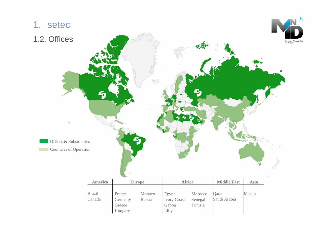
Offices & Subsidiaries
Countries of Operation
America Europe Africa Middle East Asia
BrazilCanada
FranceGermanyGreeceHungary
MonacoRussia
EgyptIvory CoastGabon Libya
MoroccoSenegalTunisia
QatarSaudi Arabia
Macau
1. setec
1.2. Offices
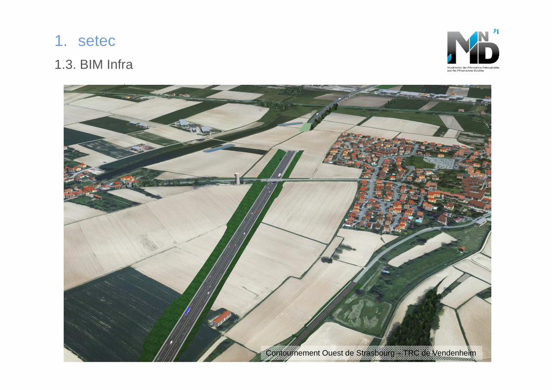
1. setec
1.3. BIM Infra
Contournement Ouest de Strasbourg – TRC de Vendenheim
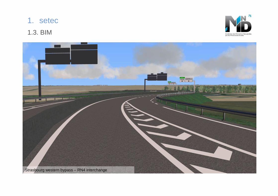
1. setec
1.3. BIM
Strasbourg western bypass – RN4 interchange
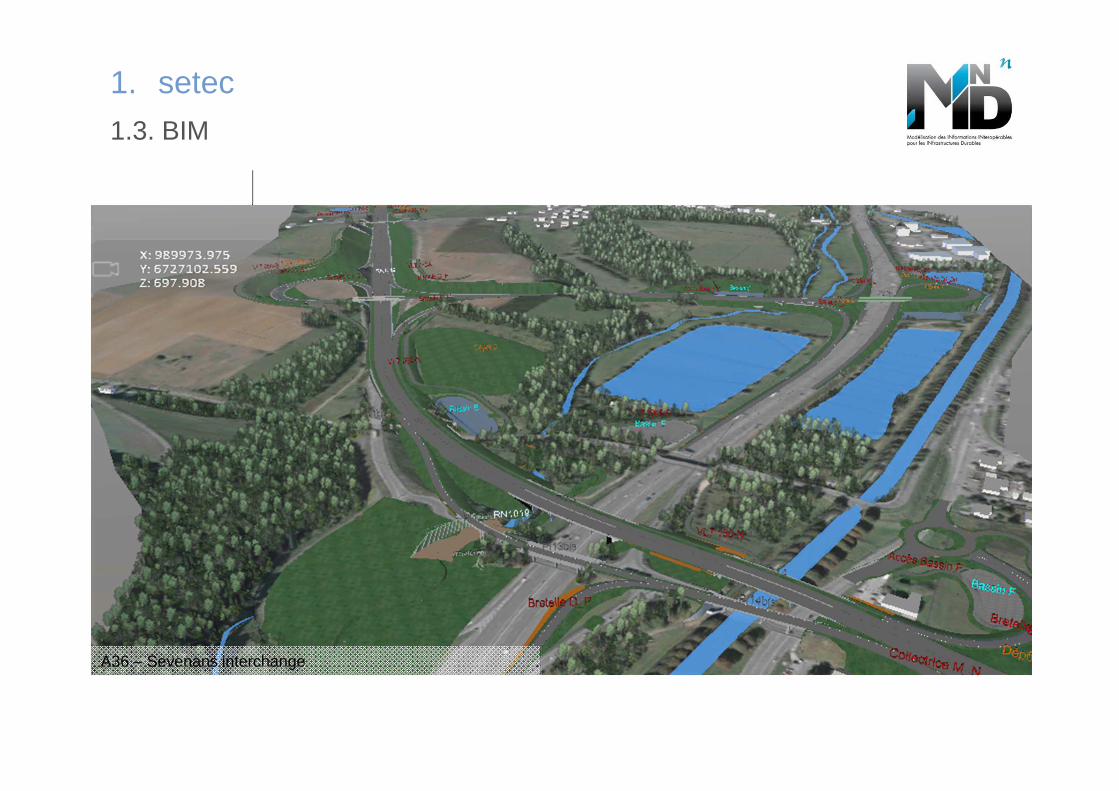
1. setec
1.3. BIM
A36 – Sevenans interchange
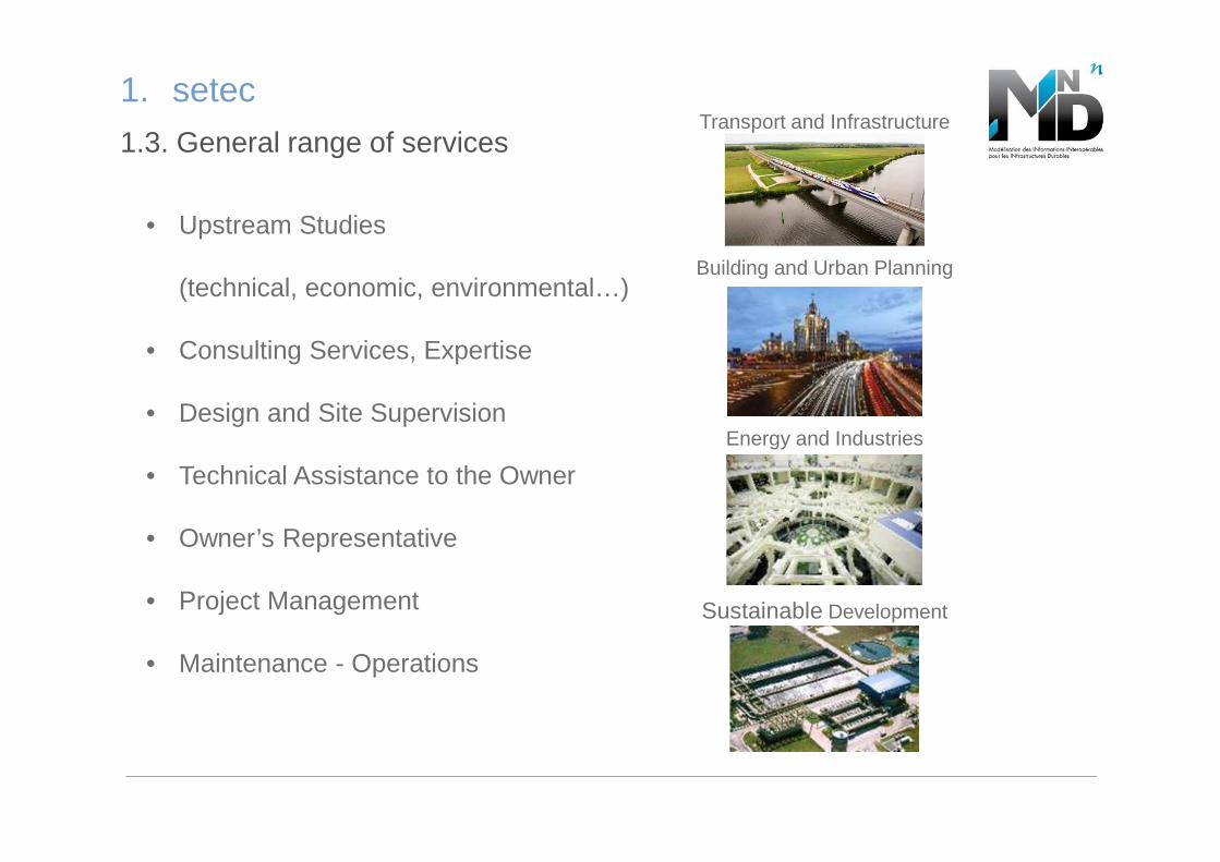
Transport and Infrastructure
Building and Urban Planning
Energy and Industries
Sustainable Development
• Upstream Studies
(technical, economic, environmental…)
• Consulting Services, Expertise
• Design and Site Supervision
• Technical Assistance to the Owner
• Owner’s Representative
• Project Management
• Maintenance - Operations
1. setec
1.3. General range of services
Modélisation des INformations INteropérables pour les
INfrastructures Durables
Interoperable Information Model for Sustainable Infrastructures
2. MINnD Project
10 >
2. MINnD Project
03/06/2016
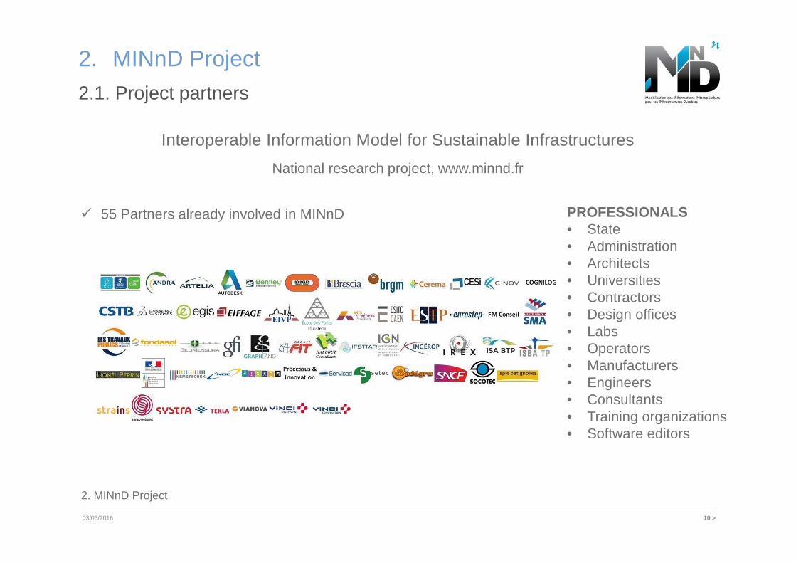
� 55 Partners already involved in MINnD
2.1. Project partners
Interoperable Information Model for Sustainable Infrastructures
National research project, www.minnd.fr
PROFESSIONALS• State• Administration• Architects• Universities• Contractors• Design offices• Labs• Operators• Manufacturers• Engineers• Consultants• Training organizations• Software editors
2. MINnD Project
11 >
2. MINnD Project
03/06/2016 setec
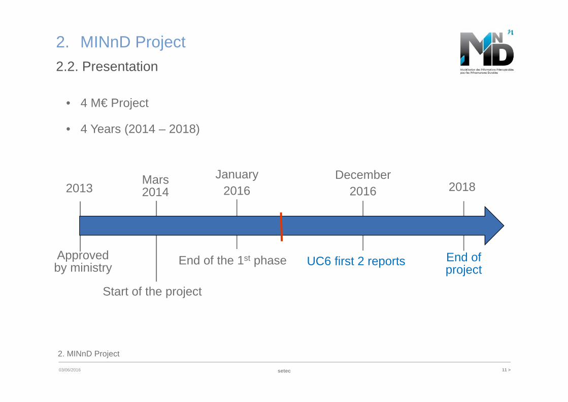
2.2. Presentation
• 4 M€ Project
• 4 Years (2014 – 2018)
Mars2014
Start of the project
January 2016
End of the 1st phase
December2016
UC6 first 2 reports
2018
End of project
2013
Approved by ministry
2. MINnD Project
12 >
2. MINnD Project
6/3/2016 setec
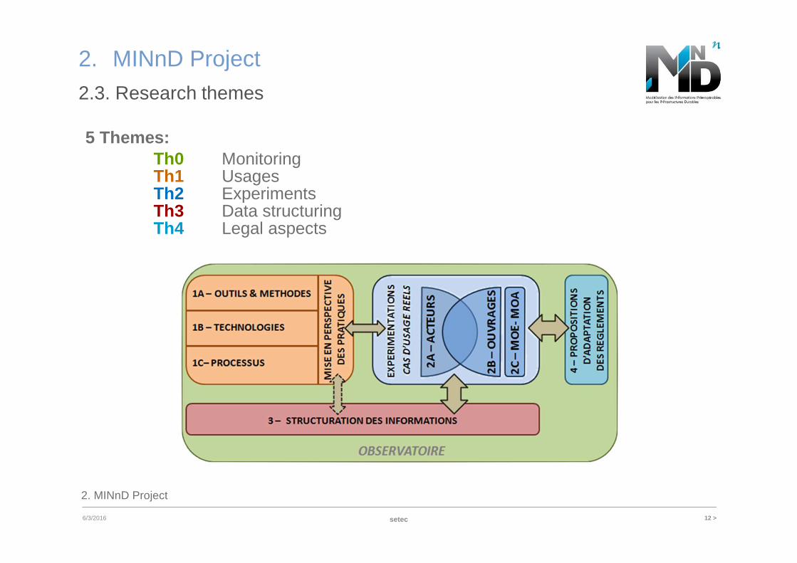
2.3. Research themes
5 Themes:Th0 MonitoringTh1 UsagesTh2 ExperimentsTh3 Data structuringTh4 Legal aspects
2. MINnD Project
13 >
2. MINnD Project
03/06/2016 setec
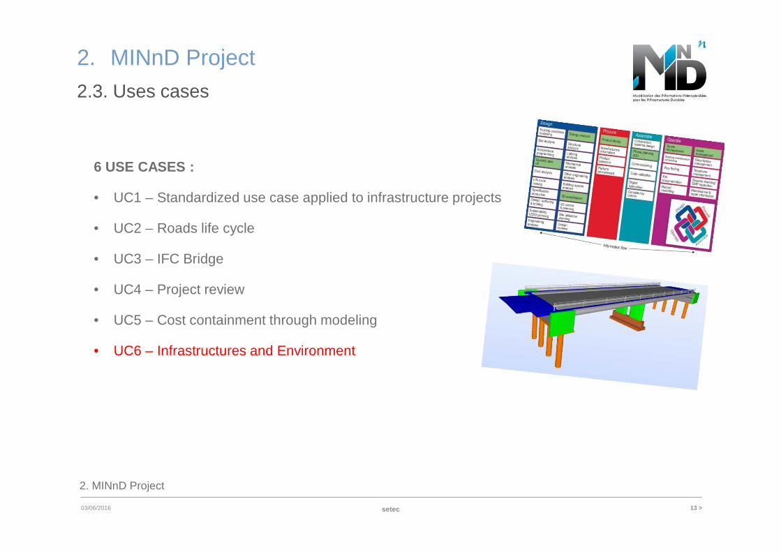
2.3. Uses cases
6 USE CASES :
• UC1 – Standardized use case applied to infrastructure projects
• UC2 – Roads life cycle
• UC3 – IFC Bridge
• UC4 – Project review
• UC5 – Cost containment through modeling
• UC6 – Infrastructures and Environment
3. UC6 – Infrastructure and Environment
14 >
3. UC6 – Infrastructure and Environment
03/06/2016
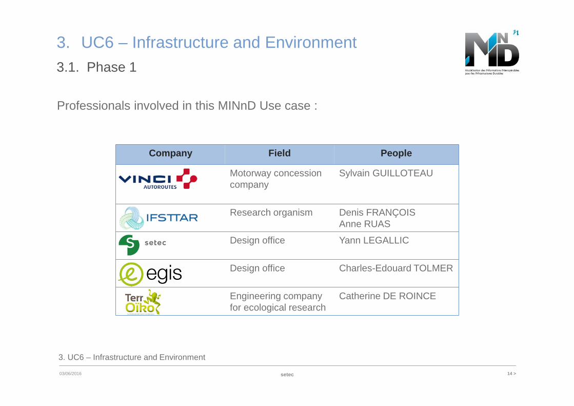
Professionals involved in this MINnD Use case :
setec
3.1. Phase 1
Company Field People
VINCI Motorway concessioncompany
Sylvain GUILLOTEAU
IFSTTAR Research organism Denis FRANÇOISAnne RUAS
SETEC Design office Yann LEGALLIC
EGIS Design office Charles-Edouard TOLMER
TERROIK Engineering company for ecological research
Catherine DE ROINCE
3. UC6 – Infrastructure and Environment
15 >
3. UC6 – Infrastructure and Environment
03/06/2016
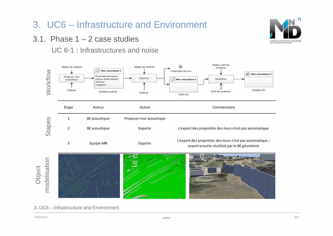
3.1. Phase 1 – 2 case studies
setec
Wor
kflo
wS
tape
s
Obj
ect
mod
elis
atio
nUC 6-1 : Infrastructures and noise
3. UC6 – Infrastructure and Environment
16 >
3. UC6 – Infrastructure and Environment
03/06/2016
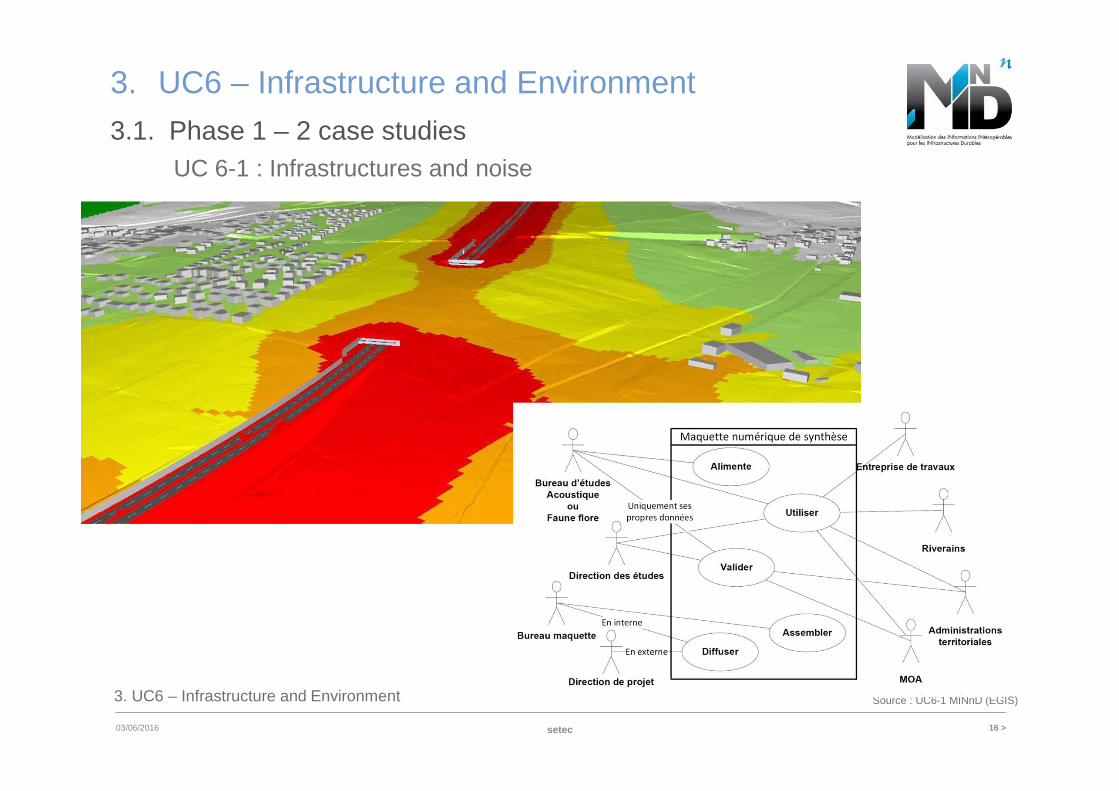
3.1. Phase 1 – 2 case studies
setec
Source : UC6-1 MINnD (EGIS)
UC 6-1 : Infrastructures and noise
3. UC6 – Infrastructure and Environment
17 >
3. UC6 – Infrastructure and Environment
03/06/2016
3.1. Phase 1 – 2 case studies
setec
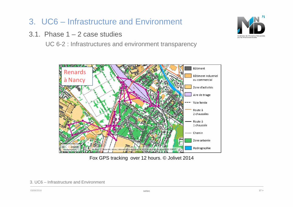
UC 6-2 : Infrastructures and environment transparency
Fox GPS tracking over 12 hours. © Jolivet 2014
3. UC6 – Infrastructure and Environment
18 >
3. UC6 – Infrastructure and Environment
6/3/2016
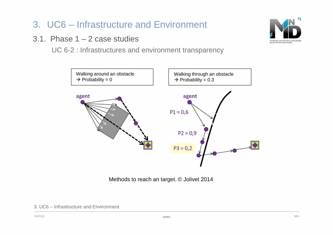
3.1. Phase 1 – 2 case studies
setec
Methods to reach an target. © Jolivet 2014
Walking around an obstacle� Probability = 0
Walking through an obstacle� Probability = 0.3
UC 6-2 : Infrastructures and environment transparency
3. UC6 – Infrastructure and Environment
19 >
3. UC6 – Infrastructure and Environment
03/06/2016
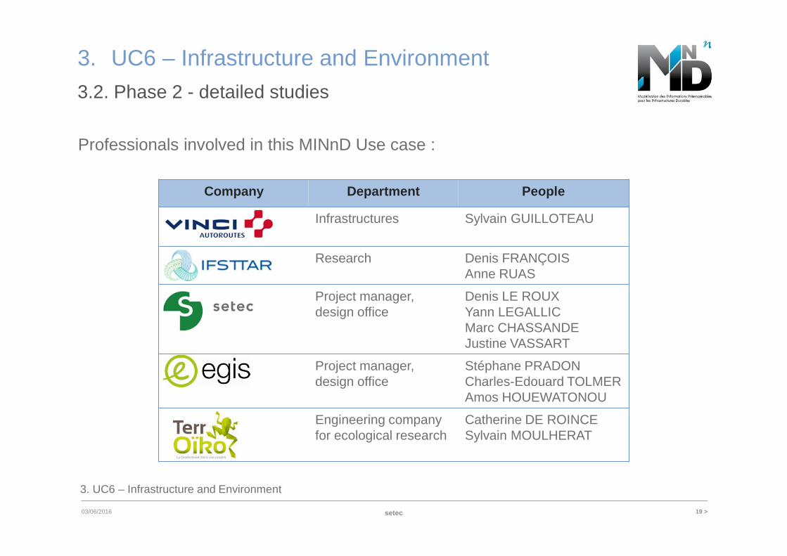
3.2. Phase 2 - detailed studies
setec
Professionals involved in this MINnD Use case :
Company Department People
VINCI Infrastructures Sylvain GUILLOTEAU
IFSTTAR Research Denis FRANÇOISAnne RUAS
SETEC Project manager, design office
Denis LE ROUXYann LEGALLICMarc CHASSANDEJustine VASSART
EGIS Project manager, design office
Stéphane PRADONCharles-Edouard TOLMERAmos HOUEWATONOU
TEROIKO Engineering company for ecological research
Catherine DE ROINCESylvain MOULHERAT
3. UC6 – Infrastructure and Environment
20 >
3. UC6 – Infrastructure and Environment
03/06/2016
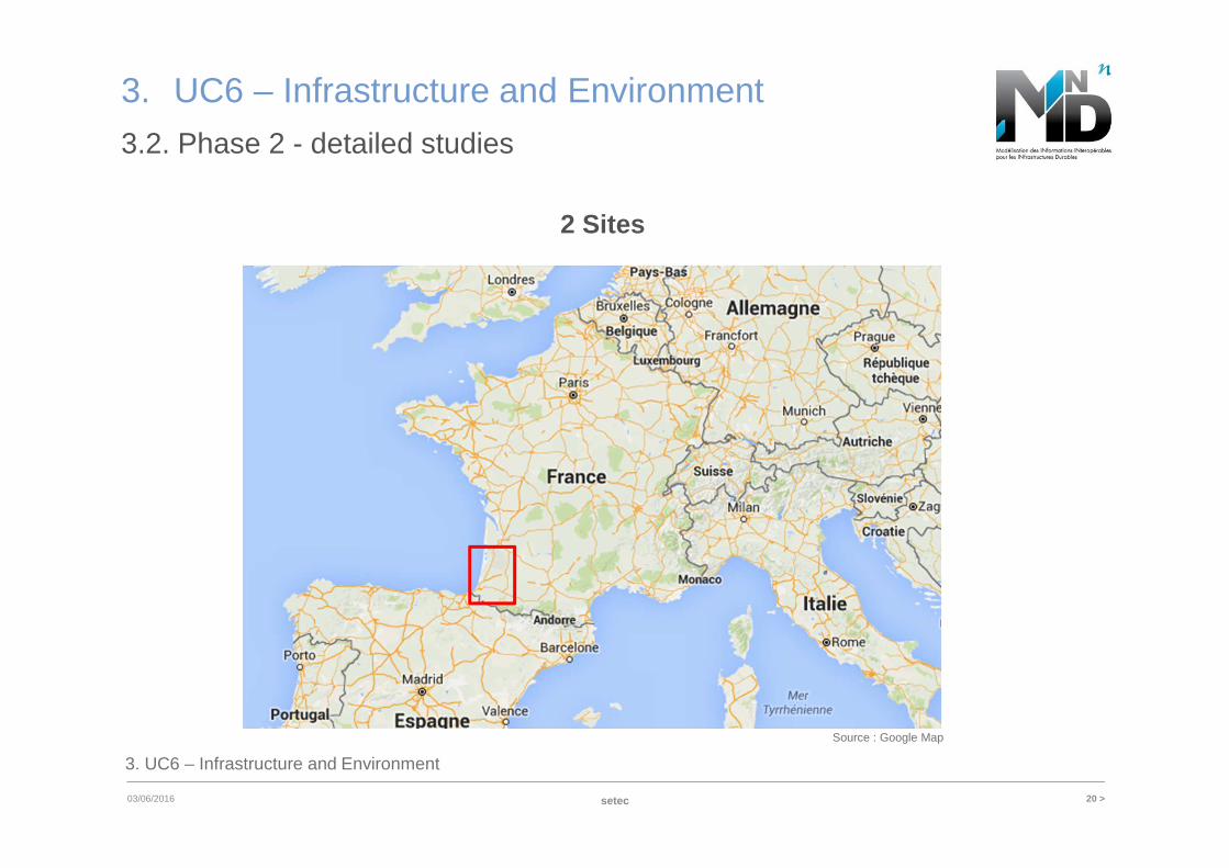
3.2. Phase 2 - detailed studies
Source : Google Map
setec
2 Sites
3. UC6 – Infrastructure and Environment
21 >03/06/2016
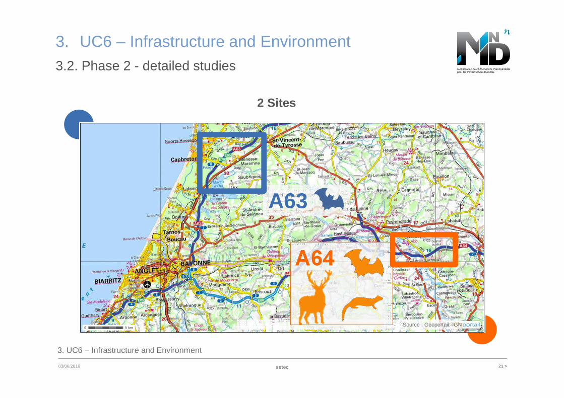
Source : Geoportail, IGN
3. UC6 – Infrastructure and Environment
setec
3.2. Phase 2 - detailed studies
2 Sites
A64
A63
3. UC6 – Infrastructure and Environment
22 >
3. UC6 – Infrastructure and Environment
03/06/2016
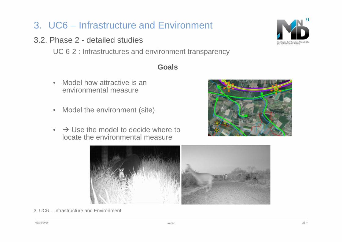
3.2. Phase 2 - detailed studies
setec
• Model how attractive is an environmental measure
• Model the environment (site)
• � Use the model to decide where to locate the environmental measure
UC 6-2 : Infrastructures and environment transparency
Goals
23 >
3. UC6 – Infrastructure and Environment
03/06/2016
3.2. Phase 2 - detailed studies
setec
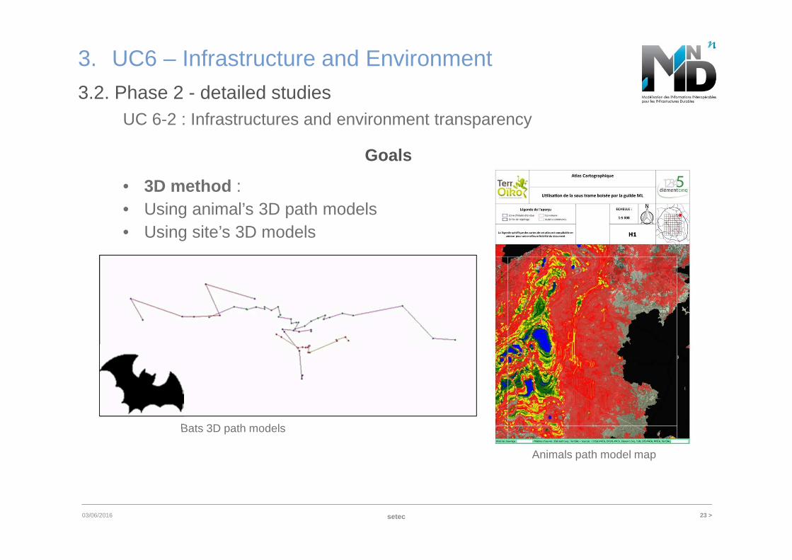
Animals path model map
Bats 3D path models
UC 6-2 : Infrastructures and environment transparency
Goals
• 3D method : • Using animal’s 3D path models• Using site’s 3D models
24 >
3. UC6 – Infrastructure and Environment
6/3/2016
3.2. Phase 2 - detailed studies
setec
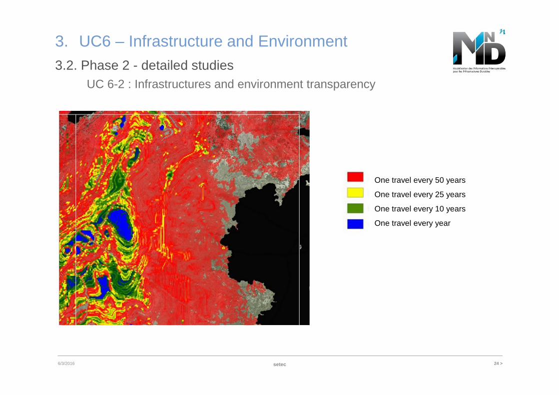
UC 6-2 : Infrastructures and environment transparency
One travel every 50 years
One travel every 25 years
One travel every 10 years
One travel every year
3. UC6 – Infrastructure and Environment
25 >
3. UC6 – Infrastructure and Environment
03/06/2016
3.2. Phase 2 - detailed studies
setec
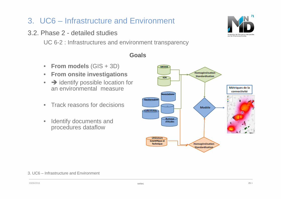
UC 6-2 : Infrastructures and environment transparency
• From models (GIS + 3D) • From onsite investigations• � identify possible location for
an environmental measure
• Track reasons for decisions
• Identify documents and procedures dataflow
Goals
3. UC6 – Infrastructure and Environment
26 >
3. UC6 – Infrastructure and Environment
03/06/2016
3.2. Phase 2 - detailed studies
setec
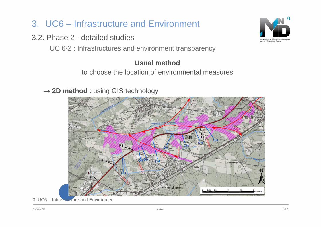
Usual methodto choose the location of environmental measures
→ 2D method : using GIS technology
UC 6-2 : Infrastructures and environment transparency
3. UC6 – Infrastructure and Environment
27 >
3. UC6 – Infrastructure and Environment
03/06/2016
3.2. Phase 2 - detailed studies
setec
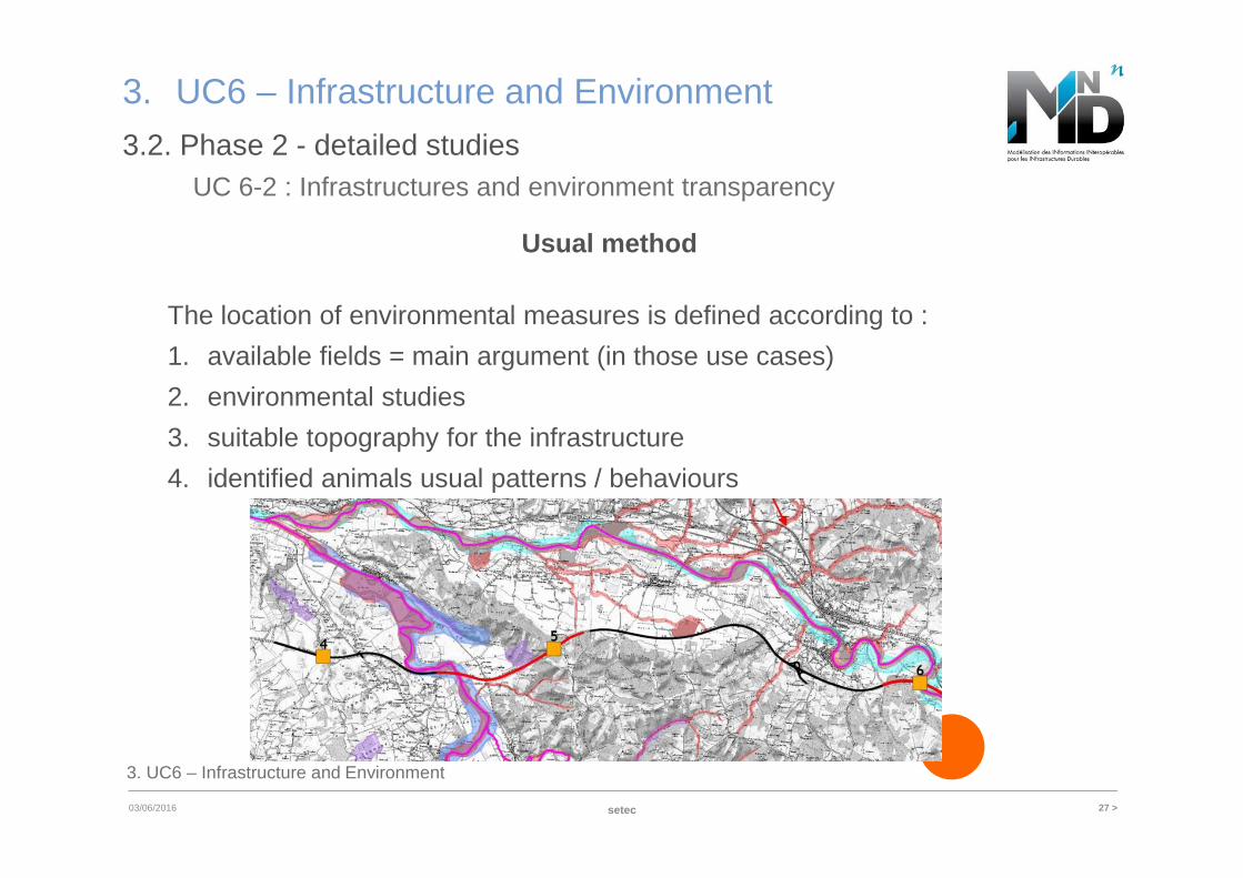
UC 6-2 : Infrastructures and environment transparency
Usual method
The location of environmental measures is defined according to :
1. available fields = main argument (in those use cases)
2. environmental studies
3. suitable topography for the infrastructure
4. identified animals usual patterns / behaviours
28 >03/06/2016
3. UC6 – Infrastructure and Environment
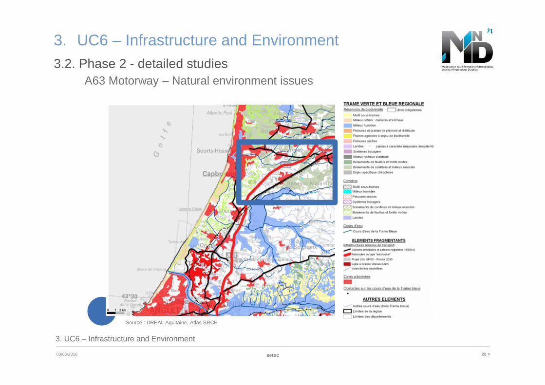
Source : DREAL Aquitaine, Atlas SRCE
3. UC6 – Infrastructure and Environment
setec
3.2. Phase 2 - detailed studiesA63 Motorway – Natural environment issues
29 >03/06/2016
3. UC6 – Infrastructure and Environment
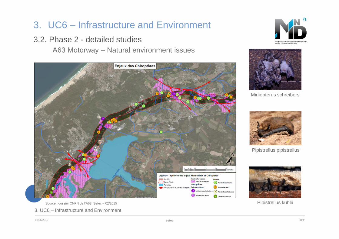
Source : dossier CNPN de l’A63, Setec – 02/2015
Miniopterus schreibersi
Pipistrellus pipistrellus
Pipistrellus kuhlii
3. UC6 – Infrastructure and Environment
setec
3.2. Phase 2 - detailed studiesA63 Motorway – Natural environment issues
30 >03/06/2016
3. UC6 – Infrastructure and Environment
3. UC6 – Infrastructure and Environment
setec
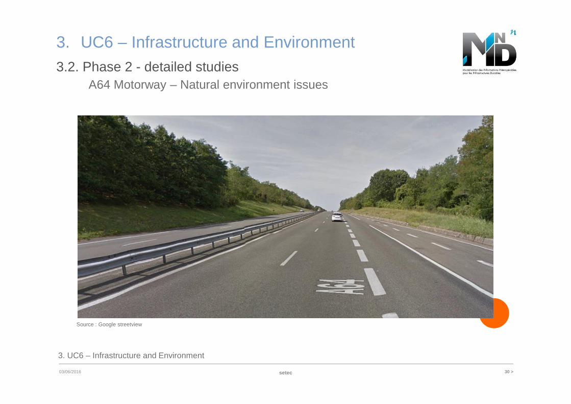
3.2. Phase 2 - detailed studiesA64 Motorway – Natural environment issues
Source : Google streetview
setec 31 >6/3/2016
3. UC6 – Infrastructure and Environment
3. UC6 – Infrastructure and Environment
3.2. Phase 2 - detailed studies
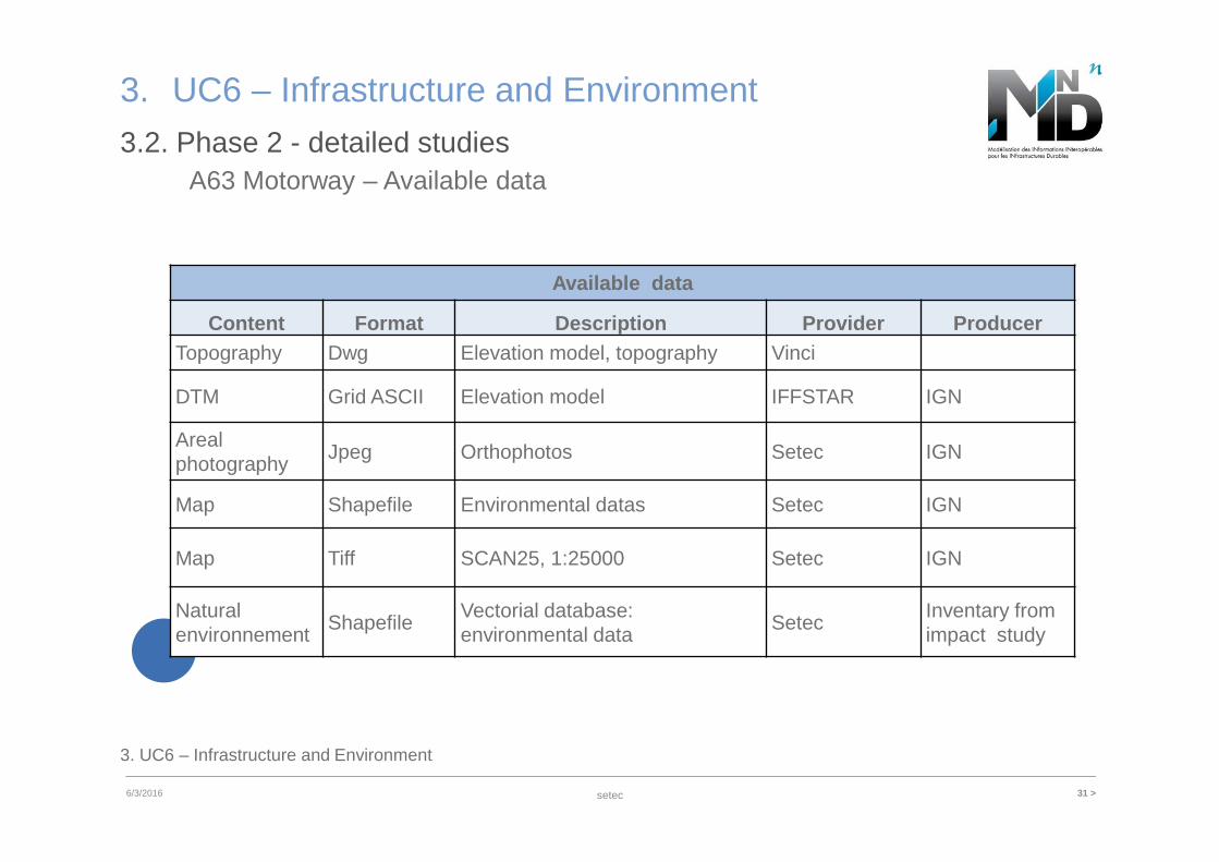
Available data
Content Format Description Provider ProducerTopography Dwg Elevation model, topography Vinci
DTM Grid ASCII Elevation model IFFSTAR IGN
Arealphotography
Jpeg Orthophotos Setec IGN
Map Shapefile Environmental datas Setec IGN
Map Tiff SCAN25, 1:25000 Setec IGN
Natural environnement
ShapefileVectorial database:environmental data
SetecInventary fromimpact study
A63 Motorway – Available data
setec 32 >03/06/2016
3. UC6 – Infrastructure and Environment
3. UC6 – Infrastructure and Environment
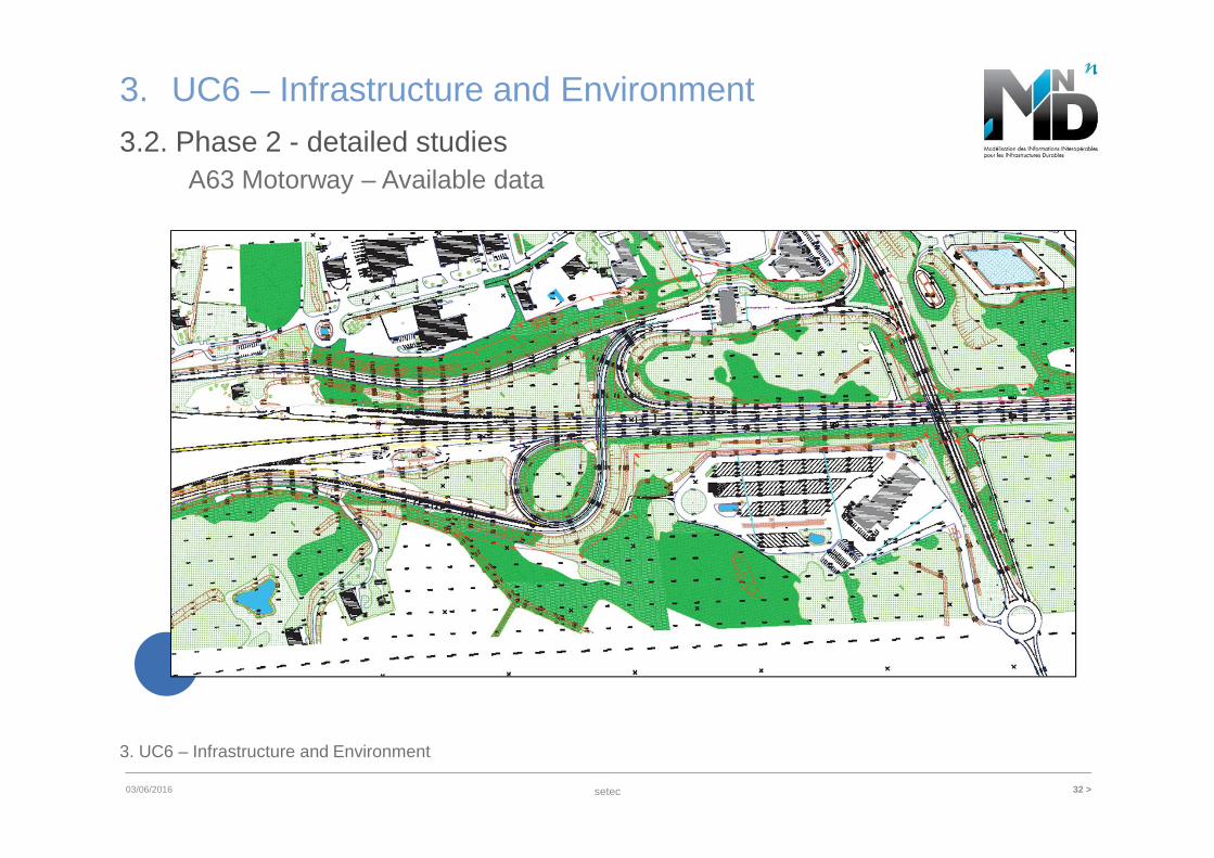
3.2. Phase 2 - detailed studiesA63 Motorway – Available data
setec 33 >03/06/2016
3. UC6 – Infrastructure and Environment
3. UC6 – Infrastructure and Environment
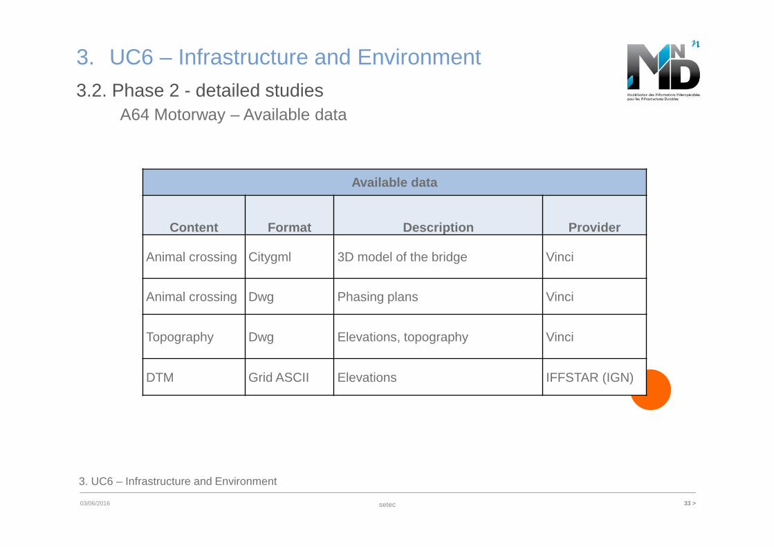
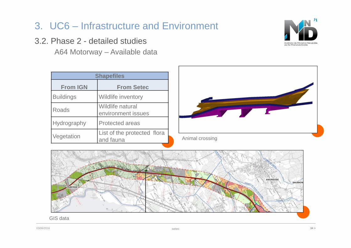
3.2. Phase 2 - detailed studies
Available data
Content Format Description Provider
Animal crossing Citygml 3D model of the bridge Vinci
Animal crossing Dwg Phasing plans Vinci
Topography Dwg Elevations, topography Vinci
DTM Grid ASCII Elevations IFFSTAR (IGN)
A64 Motorway – Available data
setec 34 >03/06/2016
3. UC6 – Infrastructure and Environment
3.2. Phase 2 - detailed studiesA64 Motorway – Available data
Shapefiles
From IGN From Setec
Buildings Wildlife inventory
RoadsWildlife natural environment issues
Hydrography Protected areas
VegetationList of the protected flora and fauna Animal crossing
GIS data
setec 35 >03/06/2016
3. UC6 – Infrastructure and Environment
3.2. Phase 2 - detailed studiesModeling - The Good, the Bad and the Ugly
3. UC6 – Infrastructure and Environment
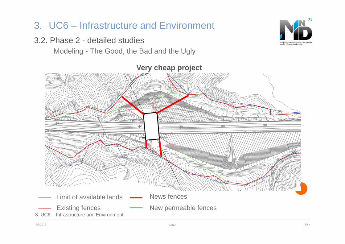
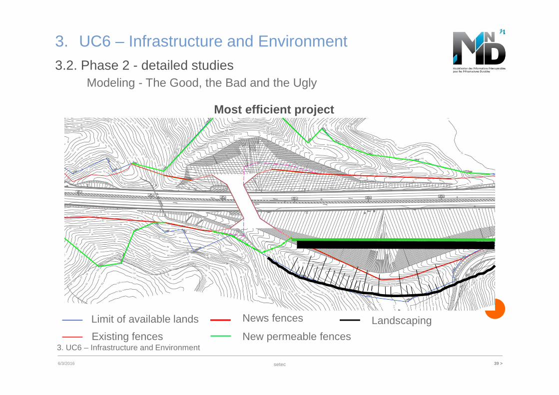
• Three scenarios for fences1. Usual environmental measures project (what have
been applied)2. A very cheap project3. A project defined as the most efficient
• Test the efficiency of models
setec 36 >6/3/2016
3. UC6 – Infrastructure and Environment
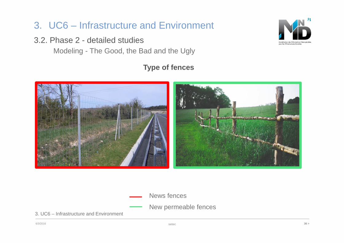
3.2. Phase 2 - detailed studiesModeling - The Good, the Bad and the Ugly
3. UC6 – Infrastructure and Environment
Type of fences
New permeable fences
News fences
setec 37 >6/3/2016
3. UC6 – Infrastructure and Environment
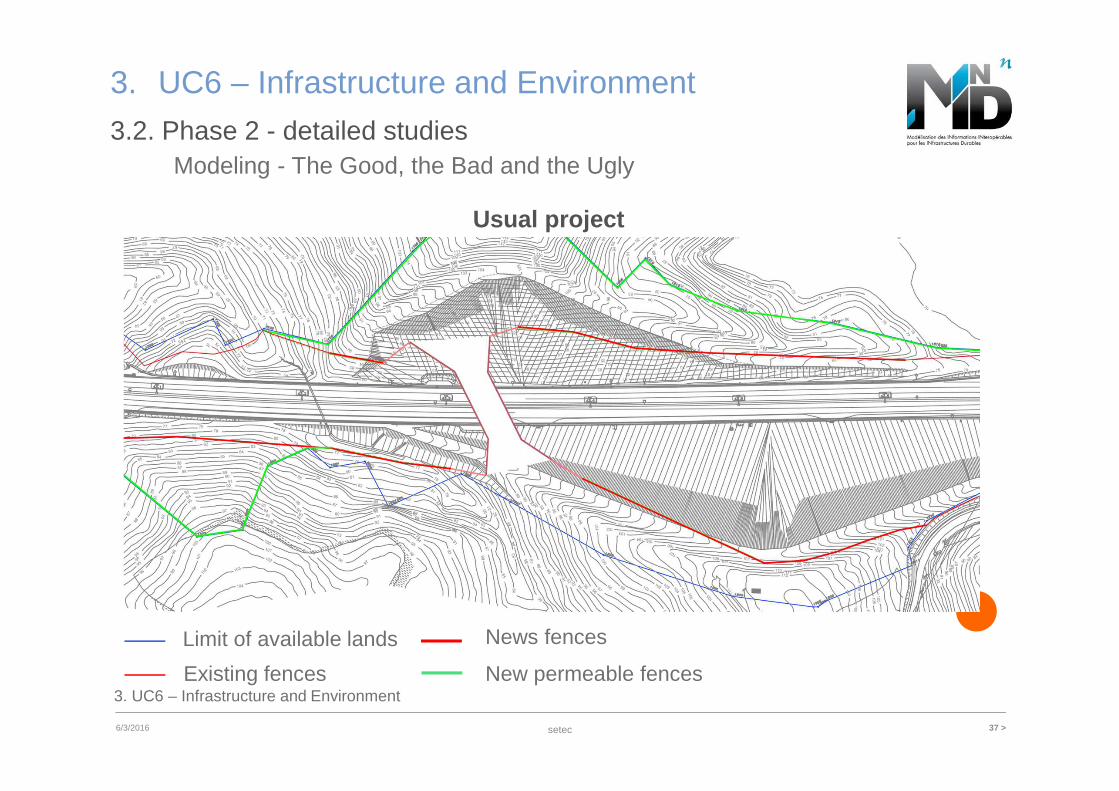
3.2. Phase 2 - detailed studiesModeling - The Good, the Bad and the Ugly
3. UC6 – Infrastructure and Environment
Usual project
Existing fences New permeable fences
Limit of available lands News fences
setec 38 >6/3/2016
3. UC6 – Infrastructure and Environment
3.2. Phase 2 - detailed studiesModeling - The Good, the Bad and the Ugly
3. UC6 – Infrastructure and Environment
Very cheap project
Existing fences New permeable fences
Limit of available lands News fences
setec 39 >6/3/2016
3. UC6 – Infrastructure and Environment
3.2. Phase 2 - detailed studiesModeling - The Good, the Bad and the Ugly
3. UC6 – Infrastructure and Environment
Most efficient project
Existing fences New permeable fences
Limit of available lands News fences Landscaping
setec 40 >6/3/2016
3. UC6 – Infrastructure and Environment
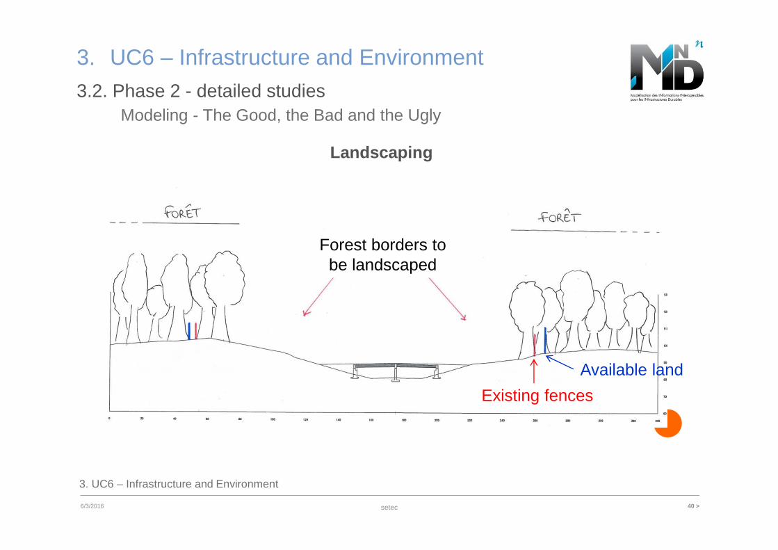
3.2. Phase 2 - detailed studiesModeling - The Good, the Bad and the Ugly
3. UC6 – Infrastructure and Environment
Landscaping
Available land
Existing fences
Forest borders to be landscaped
setec 41 >6/3/2016
3. UC6 – Infrastructure and Environment
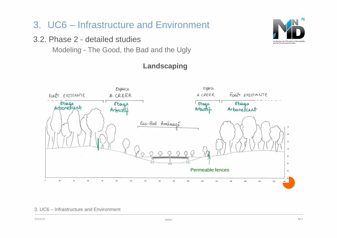
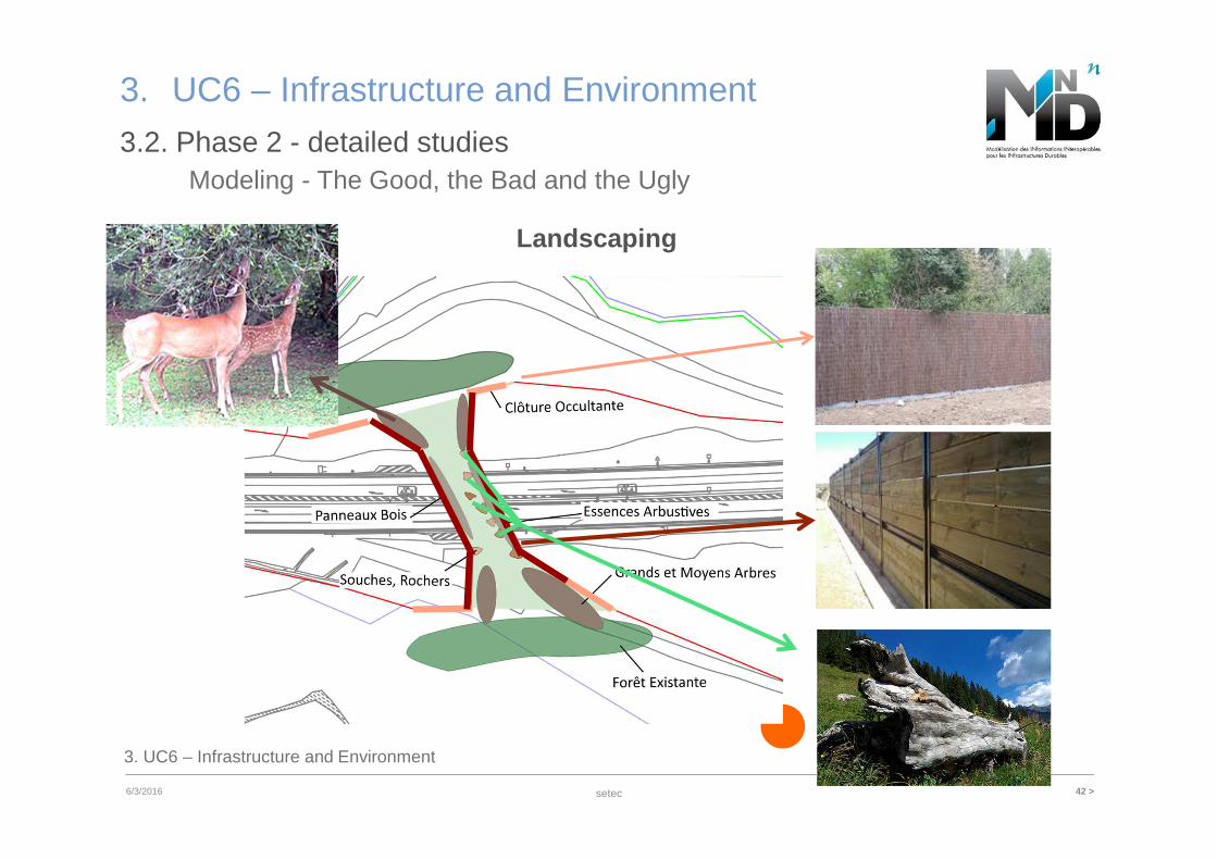
3.2. Phase 2 - detailed studiesModeling - The Good, the Bad and the Ugly
3. UC6 – Infrastructure and Environment
Landscaping
Permeable fences
setec 42 >6/3/2016
3. UC6 – Infrastructure and Environment
3.2. Phase 2 - detailed studiesModeling - The Good, the Bad and the Ugly
3. UC6 – Infrastructure and Environment
Landscaping
setec 43 >03/06/2016
3. UC6 – Infrastructure and Environment
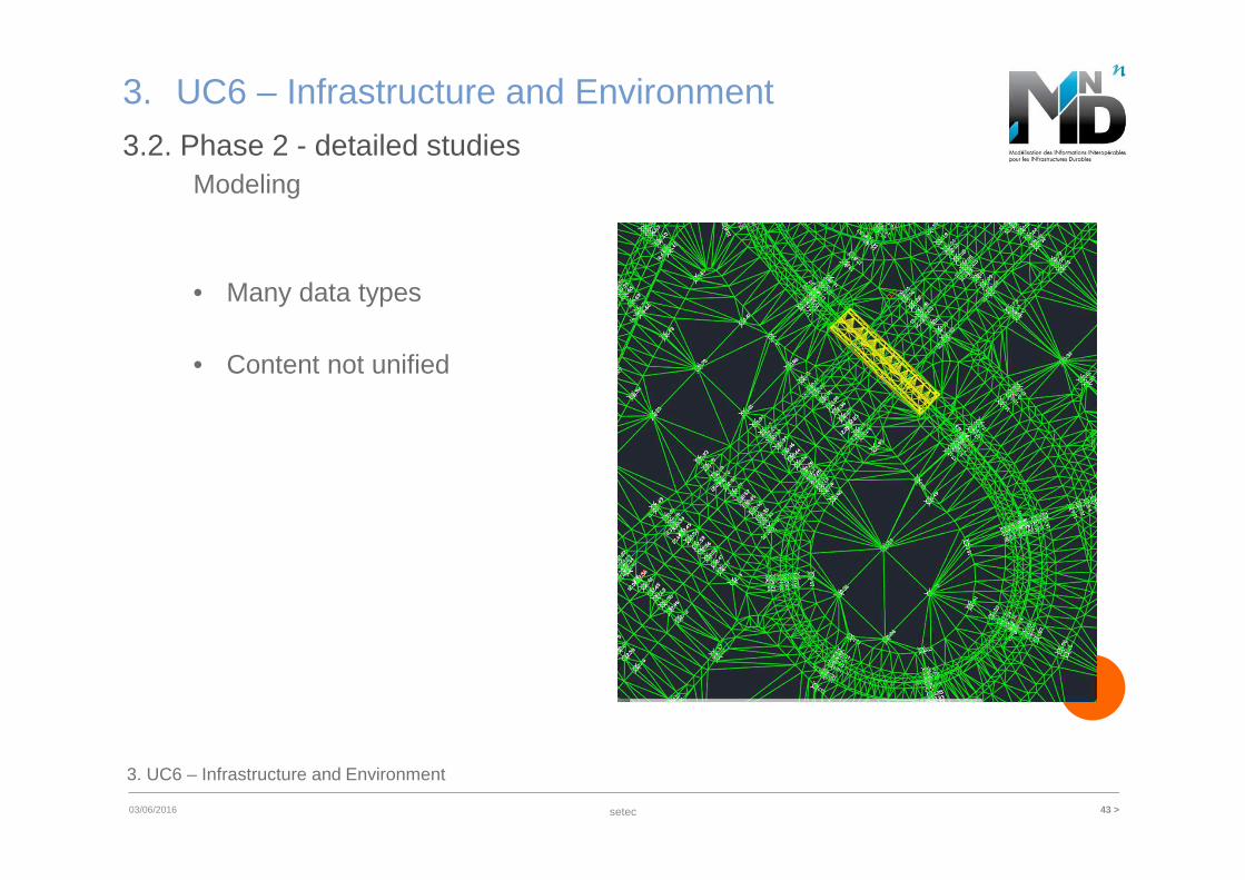
3.2. Phase 2 - detailed studiesModeling
3. UC6 – Infrastructure and Environment
• Many data types
• Content not unified
setec 44 >6/3/2016
4. Software
4. Software
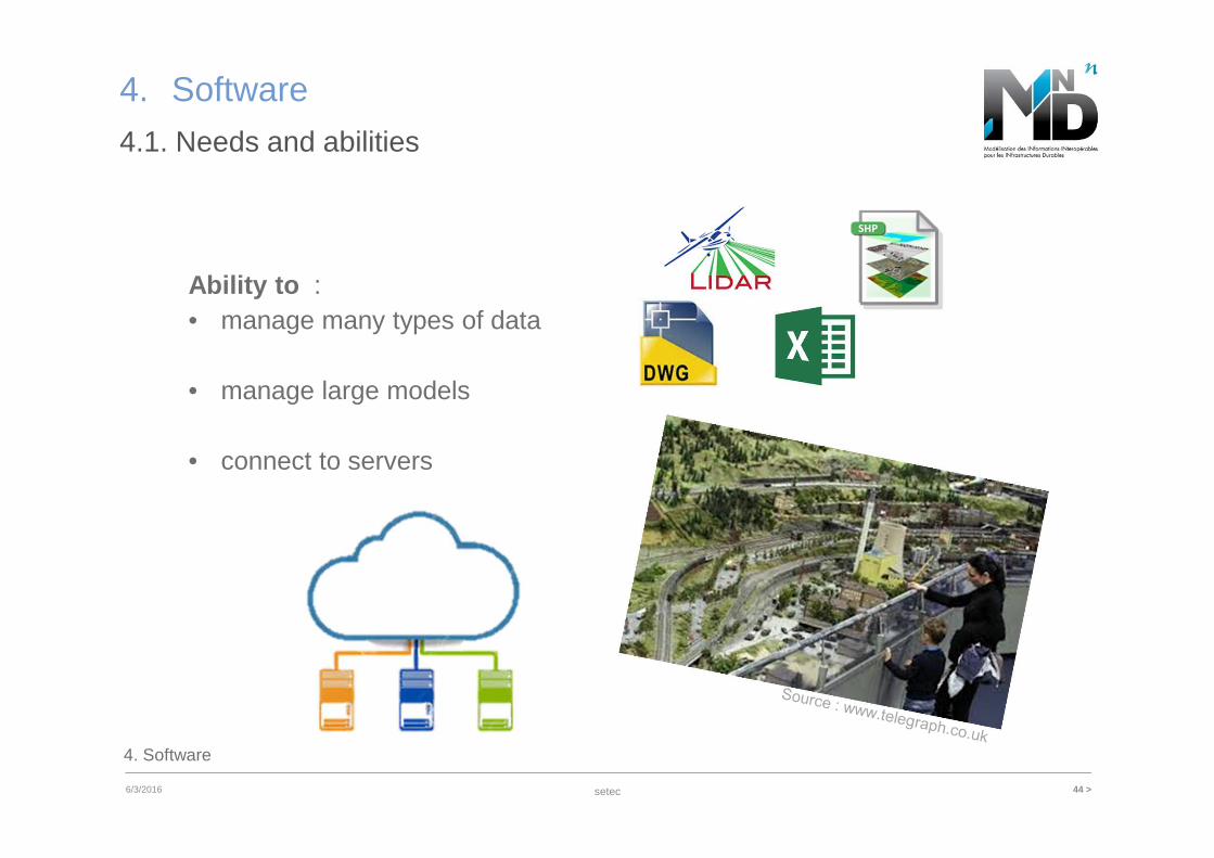
4.1. Needs and abilities
Ability to : • manage many types of data
• manage large models
• connect to servers
setec 45 >6/3/2016
4. Software
4. Software
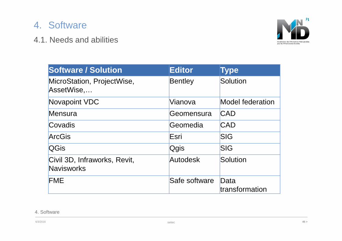
4.1. Needs and abilities
Software / Solution Editor TypeMicroStation, ProjectWise, AssetWise,…
Bentley Solution
Novapoint VDC Vianova Model federation
Mensura Geomensura CAD
Covadis Geomedia CAD
ArcGis Esri SIG
QGis Qgis SIG
Civil 3D, Infraworks, Revit, Navisworks
Autodesk Solution
FME Safe software Data transformation
setec 46 >03/06/2016
4. Software
4. Software
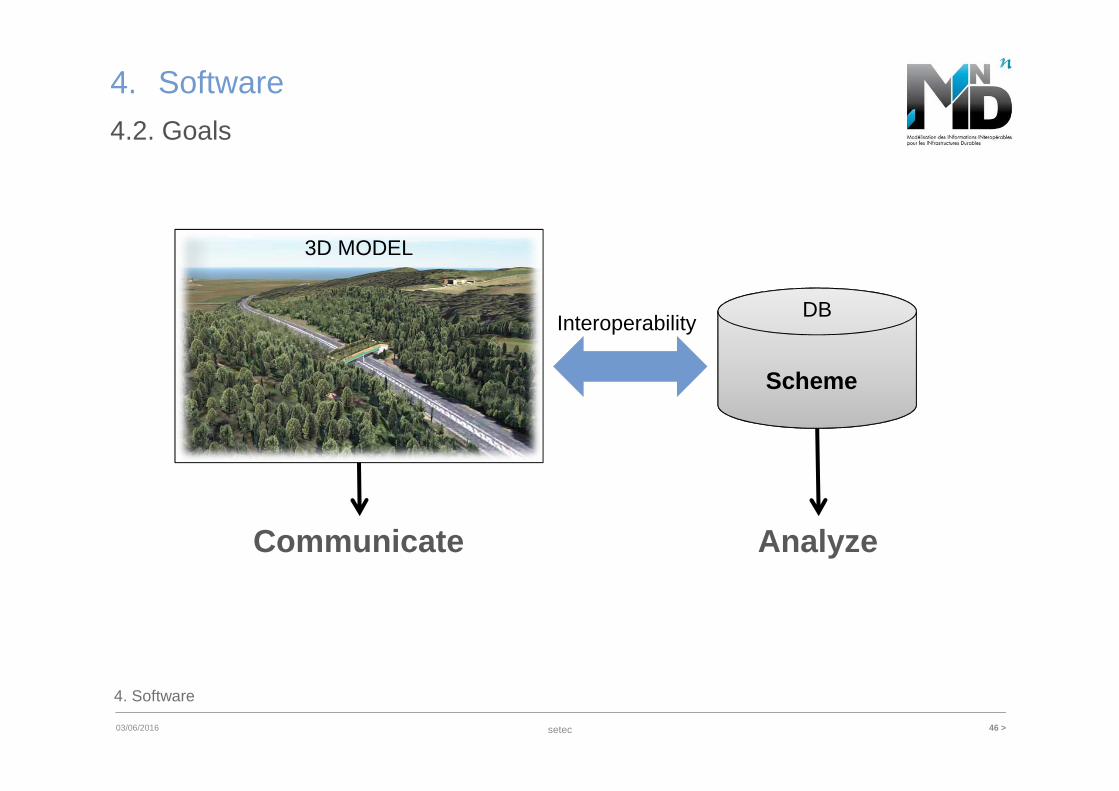
4.2. Goals
DB
3D MODEL
Communicate
Scheme
Analyze
Interoperability
setec 47 >03/06/2016
4. Software
4. Software
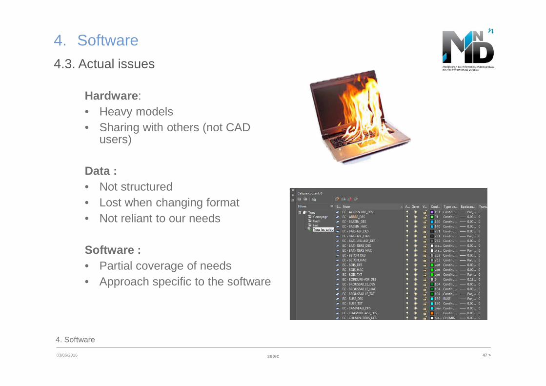
4.3. Actual issues
Hardware: • Heavy models• Sharing with others (not CAD
users)
Data :• Not structured• Lost when changing format• Not reliant to our needs
Software :• Partial coverage of needs• Approach specific to the software
setec 48 >6/3/2016
4. Software
4. Software
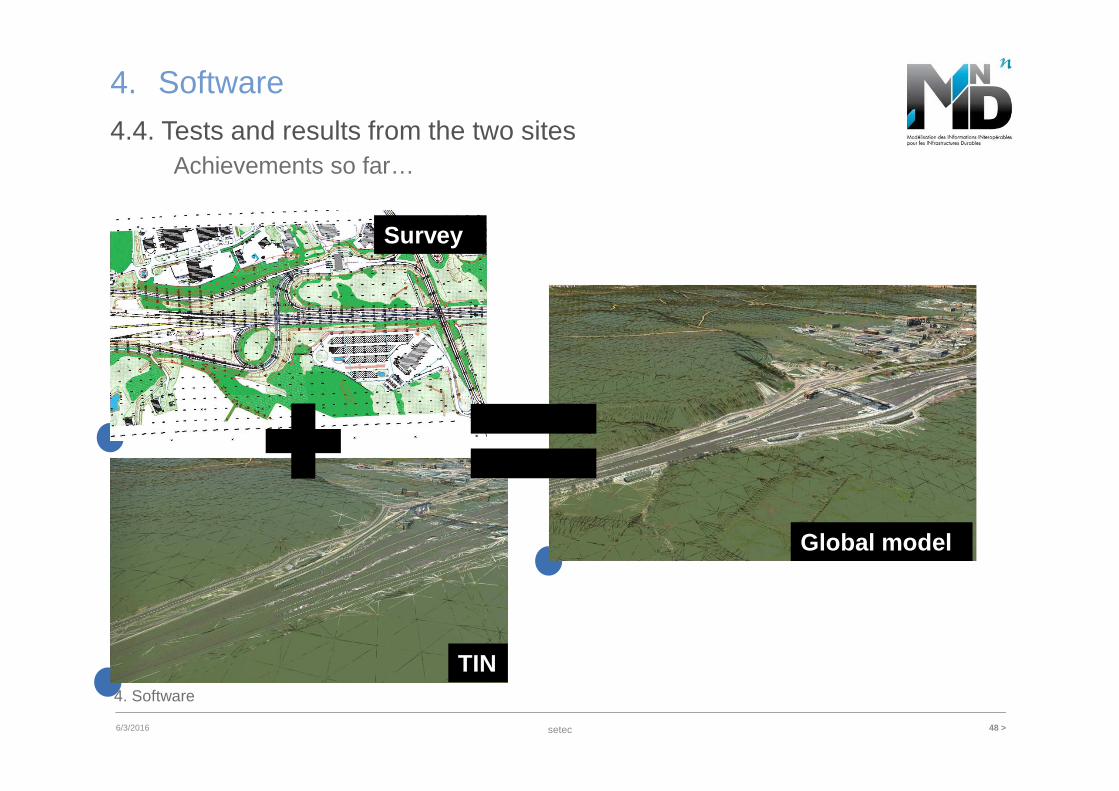
4.4. Tests and results from the two sites
TIN
Survey
Global model
Achievements so far…
setec 49 >03/06/2016
4. Software
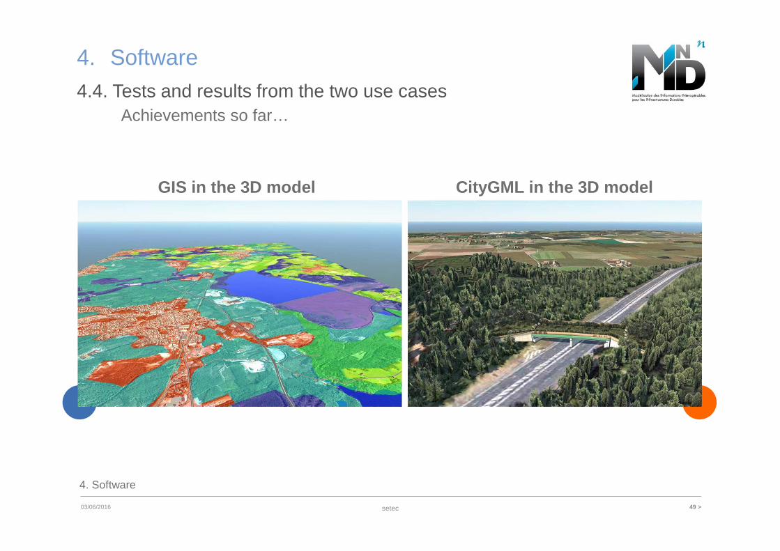
GIS in the 3D model
4. Software
4.4. Tests and results from the two use cases Achievements so far…
CityGML in the 3D model
setec 50 >03/06/2016
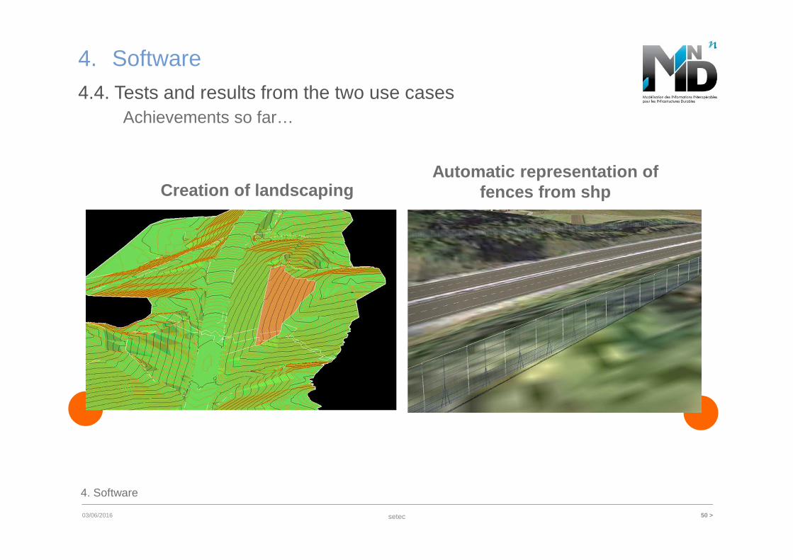
4. Software
Creation of landscaping
4. Software
4.4. Tests and results from the two use cases Achievements so far…
Automatic representation of fences from shp
setec 51 >03/06/2016
5. Data organization
5. Data organization
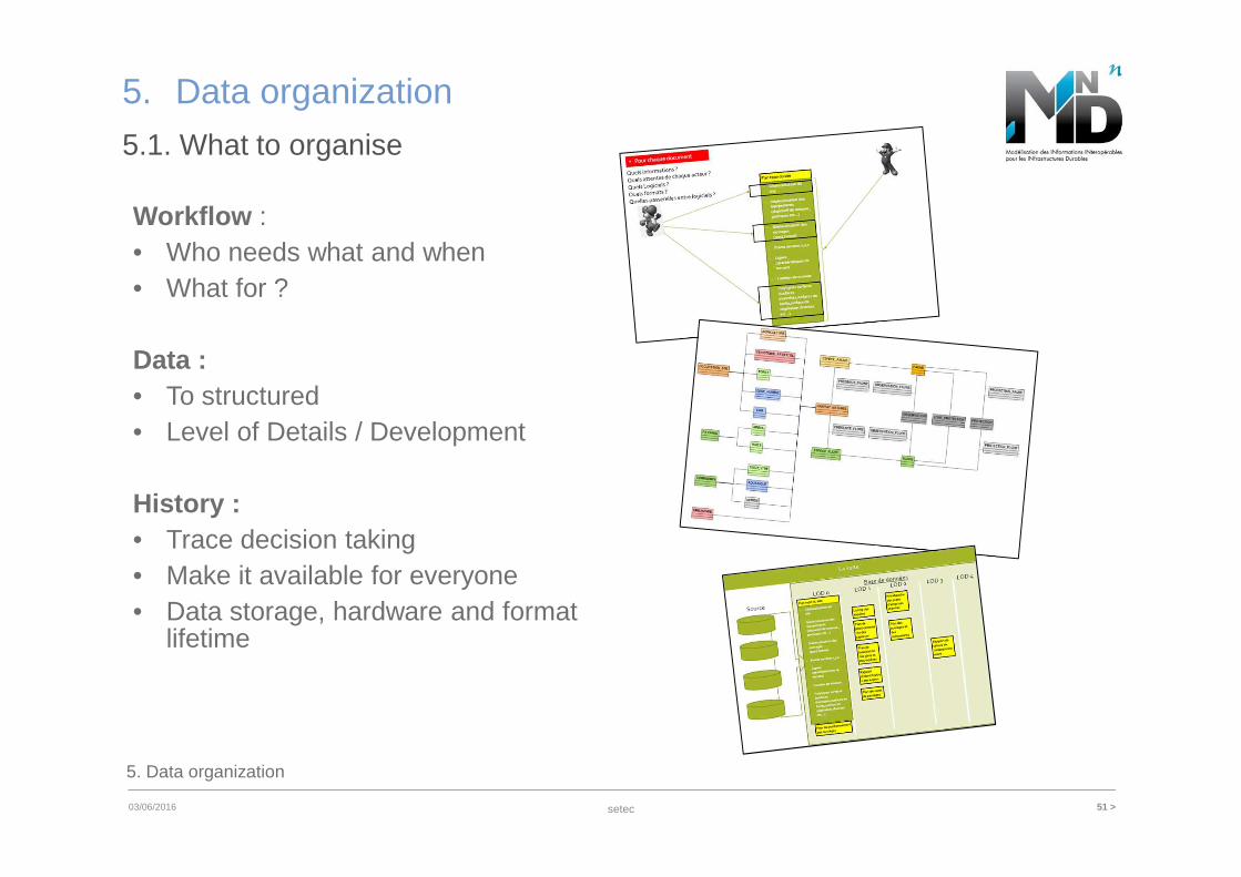
5.1. What to organise
Workflow : • Who needs what and when• What for ?
Data :• To structured• Level of Details / Development
History :• Trace decision taking• Make it available for everyone• Data storage, hardware and format
lifetime
setec 52 >03/06/2016
5. Data organization
5. Data organization
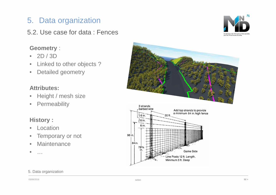
5.2. Use case for data : Fences
Geometry : • 2D / 3D• Linked to other objects ?• Detailed geometry
Attributes:• Height / mesh size• Permeability
History :• Location• Temporary or not• Maintenance• …

www.setec.frSetec
Immeuble Le Crystallin– 191/193, coursLafayette - CS 20087 –69458 Lyon Cedex 06
Thank you to :
Thank you for your attention