Embed Size (px)
Citation preview

MINE SURVEYING
GPS SYSTEM AND ITS APPLICATION IN MINING
PRESENTED BY :
SATYABRATA NAYAK
113MN0487

The Global Positioning System (GPS) is a space-based satellite navigation system that provides location and time information in all weather conditions, anywhere on or near the Earth where there is an unobstructed line of sight to four or more GPS satellites.
• Characteristics of GPS• Free• Precise• Reliable
• Anytime & anywhere
• All weather
• Unlimited user capacity

How GPS Works ………
• SIGNAL TRAVELS AT SPEED OF LIGHT
Uses measurements from 4+ satellitesDistance = travel time x speed of light


Determining GPS Position**
• Suppose the distance from Satellite A to our position is 11,000 miles• At this point we could be located
anywhere on the specified sphere
• Next, let us take another measurement from a second satellite, Satellite B
• Now our position is narrowed down to the intersection of theses two sphere
Satellite A
Satellite B

Satellite A
Satellite BSatellite C
• Taking another measurement from a 3rd satellite narrows our position down even further, to the two points
• These points are located where the 3rd sphere cuts through the the intersection of first two spheres
• So by ranging from 3 satellites we can narrow our position to just two points in space
Determining GPS Position
Satellite A
Satellite B+
+
Satellite C+
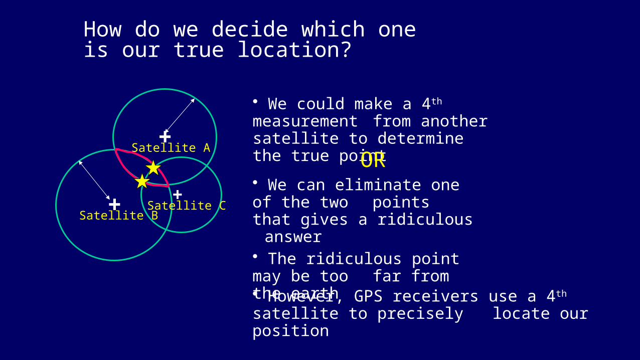
How do we decide which one is our true location?
• We could make a 4th measurement from another satellite to determine the true point
OR• We can eliminate one of the two
points that gives a ridiculous answer
• The ridiculous point may be too far from the earth
• However, GPS receivers use a 4th satellite to precisely locate our position
• Advantages :• The results from the measurement of a single line,usually referred to as a
baseline,will yield not only the distance between the stations at the end of the line but their component parts in the X/Y/Z or Eastings/Northings/Height or latitude/longitude/height directions.
• No line of sight is required.Unlike all other conventional surveying systems a line of sight between the stations in the survey is not required.Each station,however must have a clear view of the sky so that it can ‘see’ the relevant satellites.The advantage here,apart from losing the requirement for intervisibility,is that control no longer needs to be placed on high ground and can be in the same location as the engineering works concerned.
• Most satellite surveying equipment is suitably waterproof and so observations,with current systems,may be taken in any weather,by day or by night.A thick fog won’t hamper the survey operation.
• Satellite surveying can be a one-person operation with significant
savings in time and labour.
• Operators do not need high levels of skill.
• Position may be fixed on land,at sea or in the air.
• Base lines of hundreds of kilometres may be observed thereby
removing the need for extensive geodetic networks of conventional
observations.
• Continuous measurement may be carried out resulting in greatly
improved deformation monitoring.
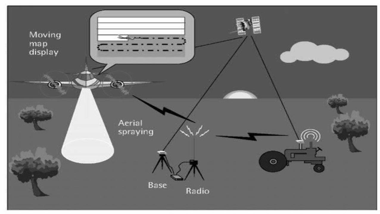

**GPS in mining:• Satellite navigation has proven a significant increasing in productivity
and improved on-site safety in mining activities, e.g., mineral and aggregate extraction with especial incidence in iron ore and coal extraction and transport tasks.
• In open pit mining, accurate GPS and GNSS(Global Navigation Satellite System) is useful for tasks such as machine guidance, grading, dozing, drilling, collision avoidance, surveying, and fleet management.
• GPS can be used for positioning and/or surveying to 2cm accuracy horizontally and 3cm vertically anywhere on the earth's surface. There are 21 satellites currently in orbit with three spares.

• GPS can be used in open cut mining operations as long as the satellites can
be viewed in a direct line of sight. Tests undertaken at two mines, under
worst case conditions, show that GPS works well in most situations.
• Close to highwalls (within 3-4 metres) depending on the positioning of the
satellites at any given time, the GPS system dropped back to two
dimensional fixing, with only three satellites visible. GPS needs four
satellites for a three dimensional fix.
• There are many areas where GPS technology can improve the productivity
of coal mines. So the mining operations related with GPS are given below:
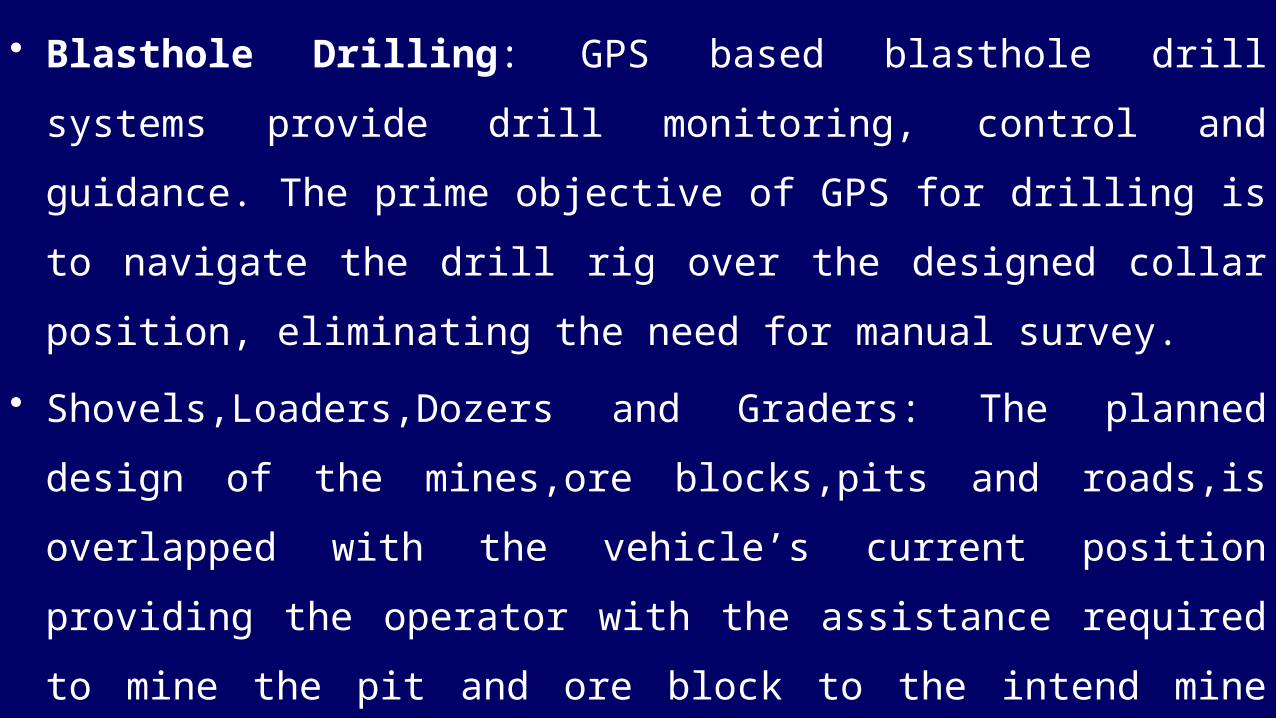
• Blasthole Drilling: GPS based blasthole drill systems provide drill
monitoring, control and guidance. The prime objective of GPS for drilling is to
navigate the drill rig over the designed collar position, eliminating the need for
manual survey.
• Shovels,Loaders,Dozers and Graders: The planned design of the mines,ore
blocks,pits and roads,is overlapped with the vehicle’s current position
providing the operator with the assistance required to mine the pit and ore
block to the intend mine design.The on-board display provides required
assistance by providing visual cues to where are located the ore blocks and
whether the current floor grade is below or above the design floor grade.


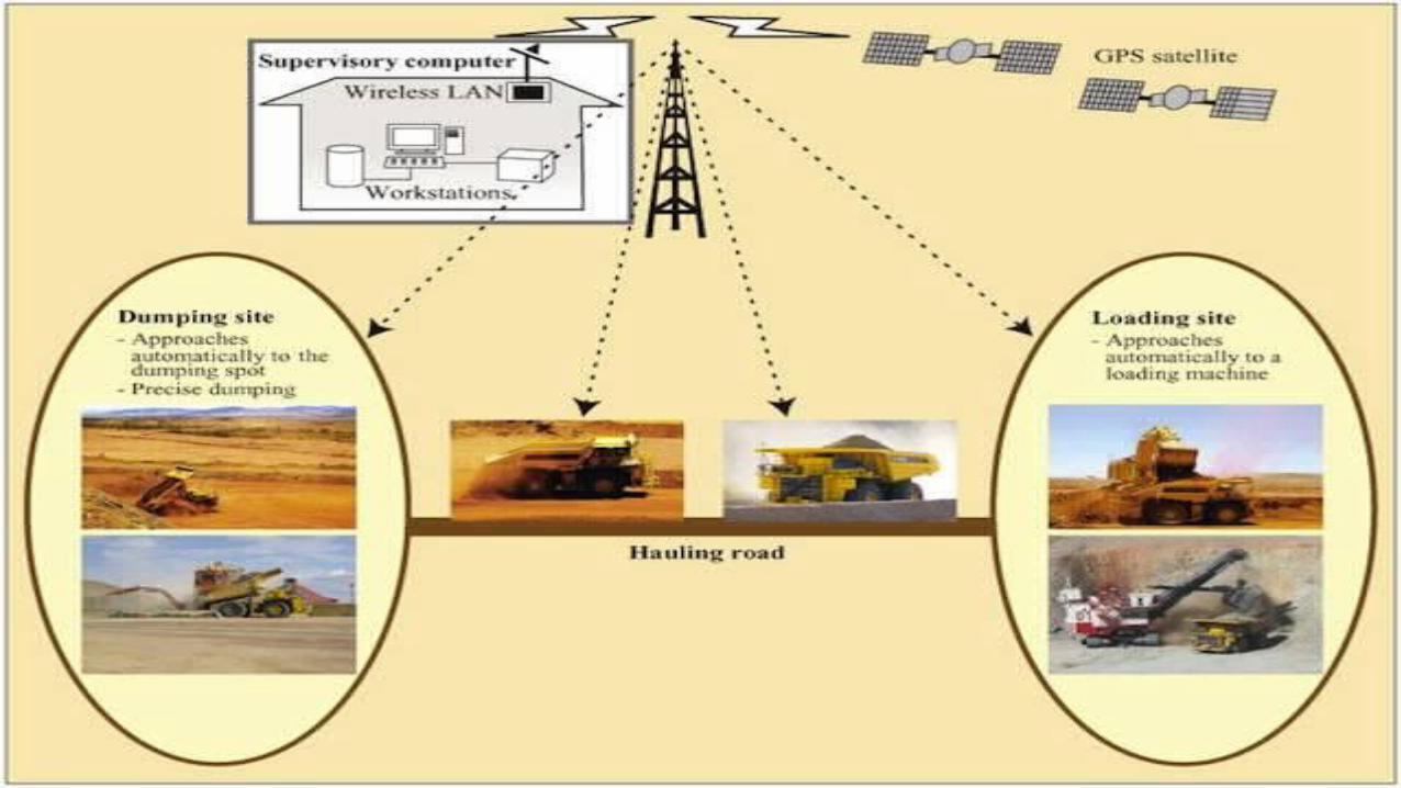
• Vehicle Tracking and Dispatch: The dump trucks’ positions obtained are sent to the central control station,where it is carried the dumping scheduling management.This application determines which material is loaded and sends information and instructions to be followed by the truck drivers,in order to guarantee that the assignments are followed and the materials are correctly collected from the correct ore block and dumped in the correct dumping location.
• GPS surveying: The advantage of using GPS for surveying in open pit mining is that only a single surveyor is required,in opposition to the conventional methods.
• Monitor Drivers and Vehicles: The sensors in the vehicle provide monitoring information of equipment’s,like for instance air preassures.These systems also provide sensors sent to a central control station.This system will allow for rapid intervation in case of problems.
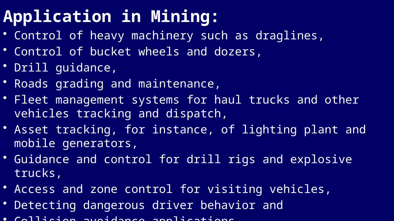
Application in Mining:• Control of heavy machinery such as draglines, • Control of bucket wheels and dozers, • Drill guidance, • Roads grading and maintenance, • Fleet management systems for haul trucks and other vehicles tracking and
dispatch, • Asset tracking, for instance, of lighting plant and mobile generators, • Guidance and control for drill rigs and explosive trucks, • Access and zone control for visiting vehicles, • Detecting dangerous driver behavior and • Collision avoidance applications. • Surveying crews can be reduced

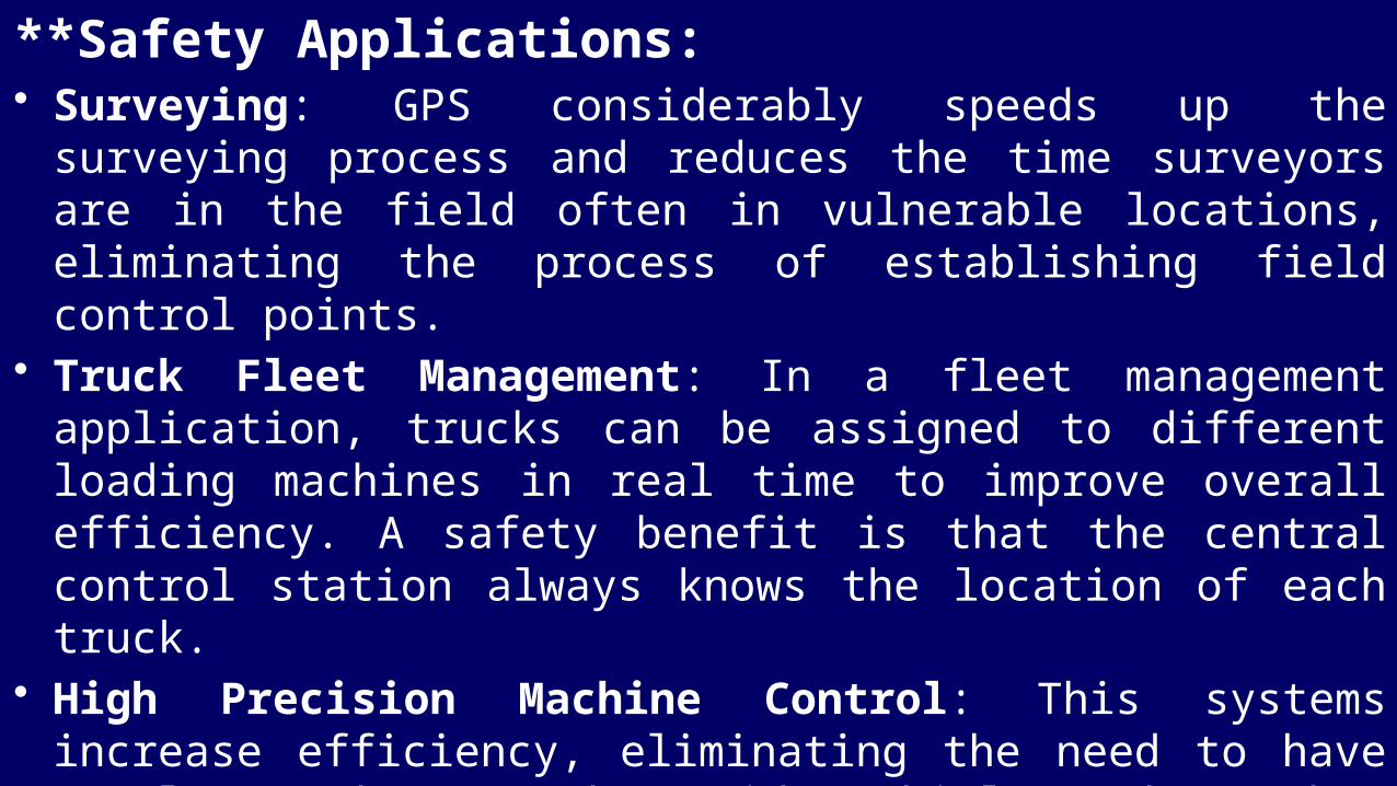
**Safety Applications: • Surveying: GPS considerably speeds up the surveying process and reduces
the time surveyors are in the field often in vulnerable locations, eliminating the process of establishing field control points.
• Truck Fleet Management: In a fleet management application, trucks can be assigned to different loading machines in real time to improve overall efficiency. A safety benefit is that the central control station always knows the location of each truck.
• High Precision Machine Control: This systems increase efficiency, eliminating the need to have people on the ground outside vehicles, where they are most vulnerable to accidents, and the eliminate the need to deploy pegs in the field. Also the recording of events can be useful is accident situations, in order to obtain the causes that lead to the incident .
• Hazard Avoidance: These applications warn the operator of onsite hazards such as machines operating next to each other where the operators don't manage to see other due to terrain orography or voids from older workings. These systems can also be set to automatically broadcast an assistance required signal to the central control station if the device is tilted beyond a preset angle.
• Collision Avoidance: This systems must be included in all mining vehicles, which continuously report their position to the central control station, where the data is analyses and vehicles can be warned, if they are in collision course. This type of architecture requires large bandwidth capabilities and is especially relevant in environments where light and heavy vehicles work side by side.


*****THANK YOU*****