Embed Size (px)
Citation preview
Sensors and Platforms
By
Hamid Ch
Introduction
• Measurement of EM energy are
made by sensors that are attached
to a static or moving platform.
• The sensor platform combination
determines the characteristics of
the resulting image data.
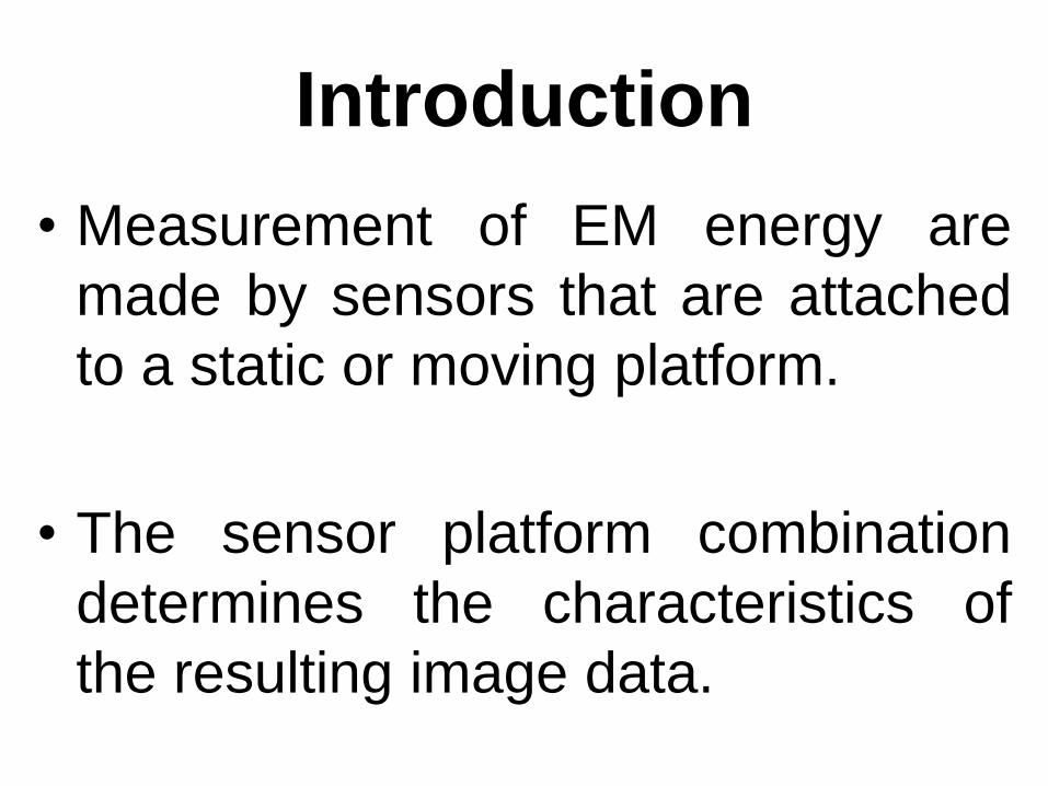
Introduction
• RS relies on the measurement of electromagnetic (EM) energy.
• Most important source of energy at the earth surface is Sun.
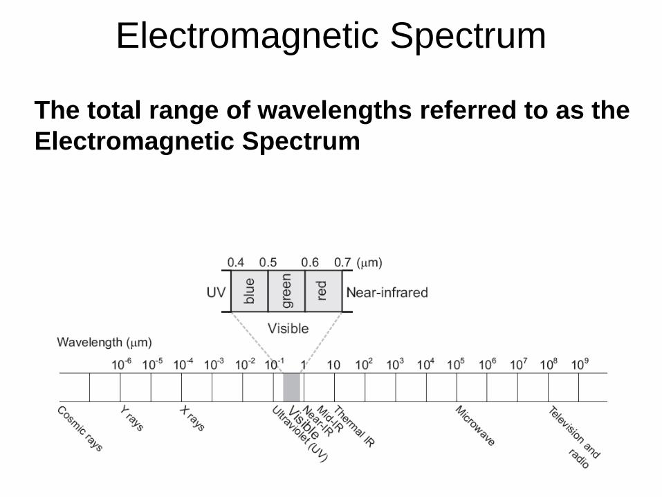
Electromagnetic Spectrum
The total range of wavelengths referred to as the
Electromagnetic Spectrum
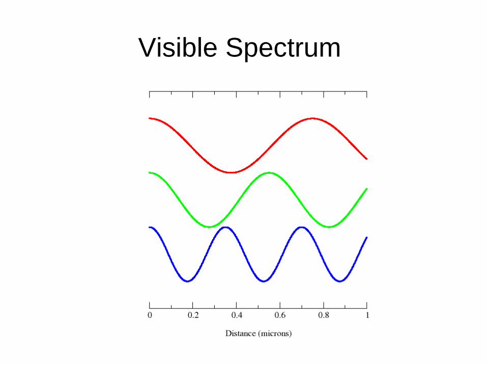
Visible Spectrum
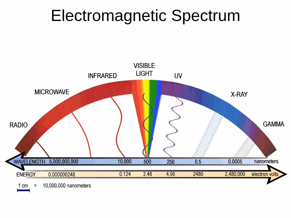
Electromagnetic Spectrum
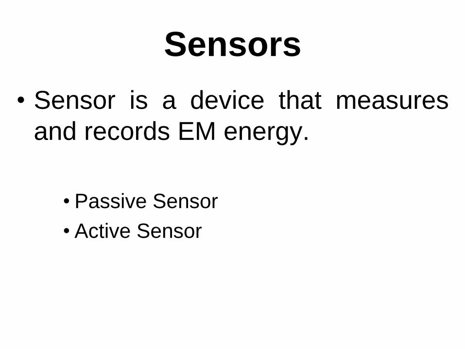
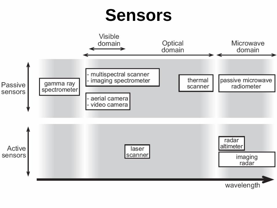
Sensors
• Sensor is a device that measures
and records EM energy.
• Passive Sensor
• Active Sensor
Sensors
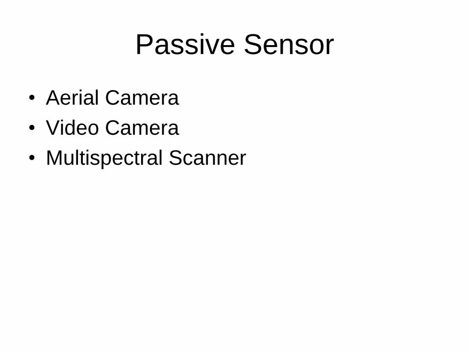
Passive Sensor
• Aerial Camera
• Video Camera
• Multispectral Scanner
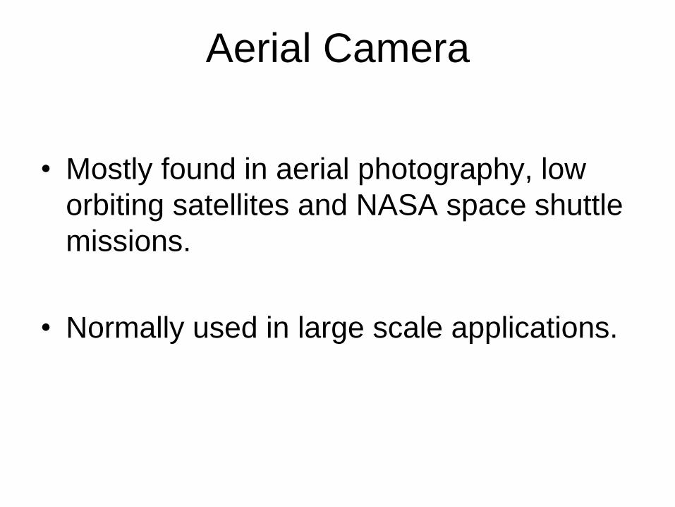
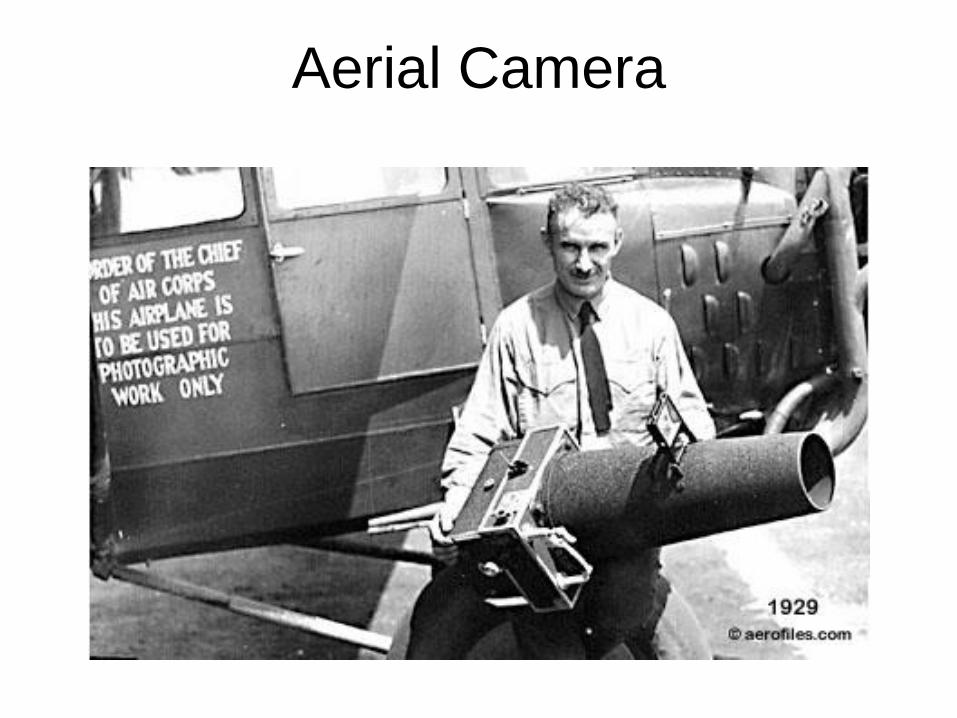
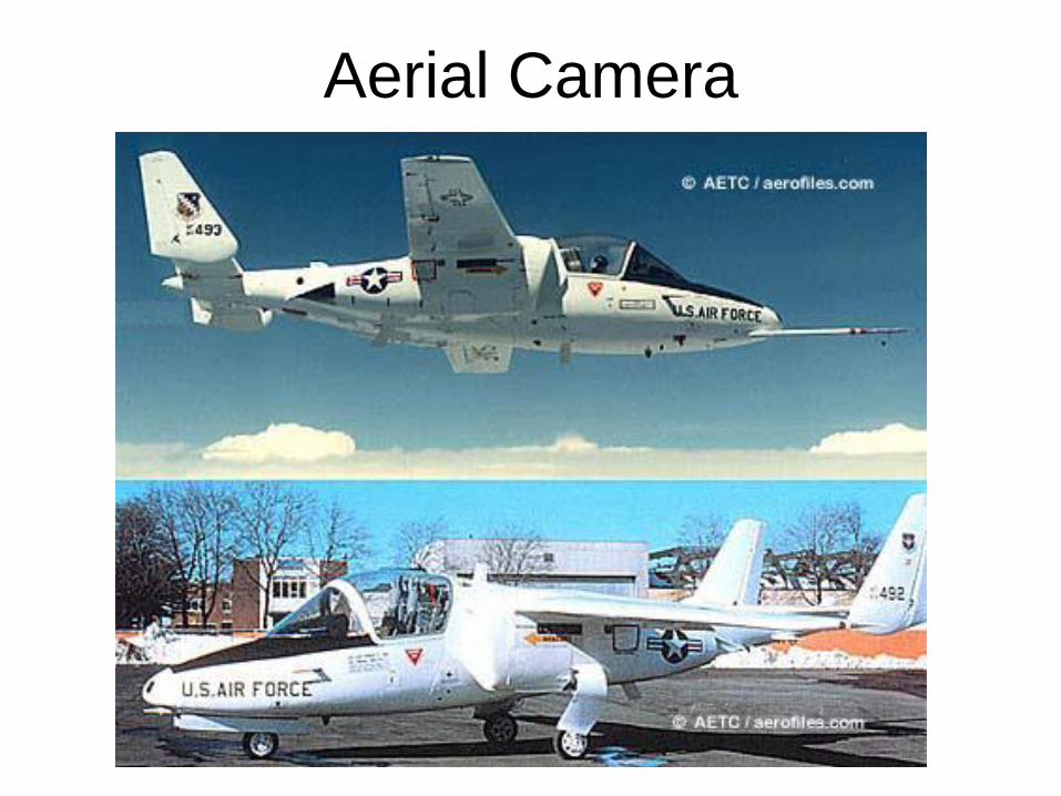
Aerial Camera
• Mostly found in aerial photography, low
orbiting satellites and NASA space shuttle
missions.
• Normally used in large scale applications.
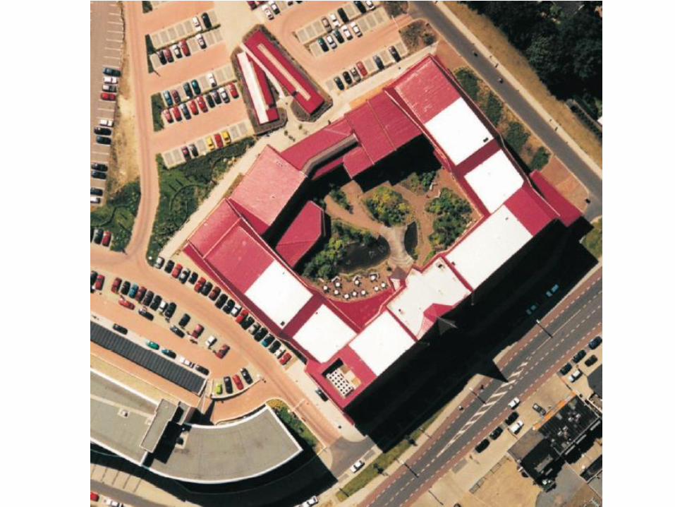
Aerial Camera
Aerial Camera
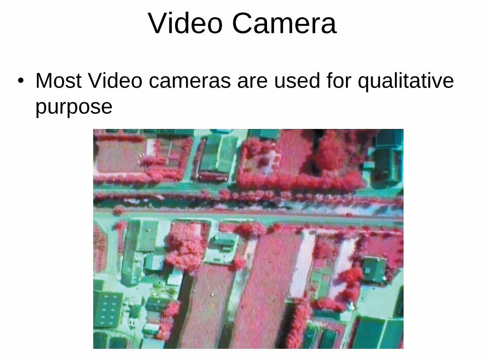
Video Camera
• Most Video cameras are used for qualitative
purpose
• Mutispectral scanners can extend the range of
sensing from 0.3 to approximately 14µm.
• The reason for measuring a number of distinct
wavelength bands is that each band is related
to specific characteristics of the earth surface.
– i.e. reflection characteristics of ‘blue’ light give
information about the mineral composition; &
‘infrared light’ tell something about the type and
health of vegetation.
Multispectral Scanner
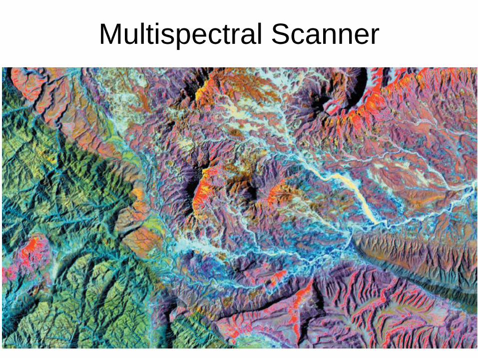
Multispectral Scanner
Active Sensors
• Laser Scanner
• Imaging Radar
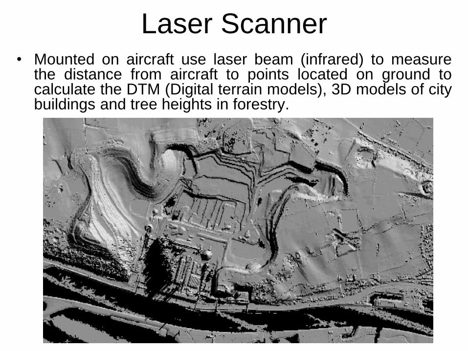
Laser Scanner• Mounted on aircraft use laser beam (infrared) to measure
the distance from aircraft to points located on ground tocalculate the DTM (Digital terrain models), 3D models of citybuildings and tree heights in forestry.
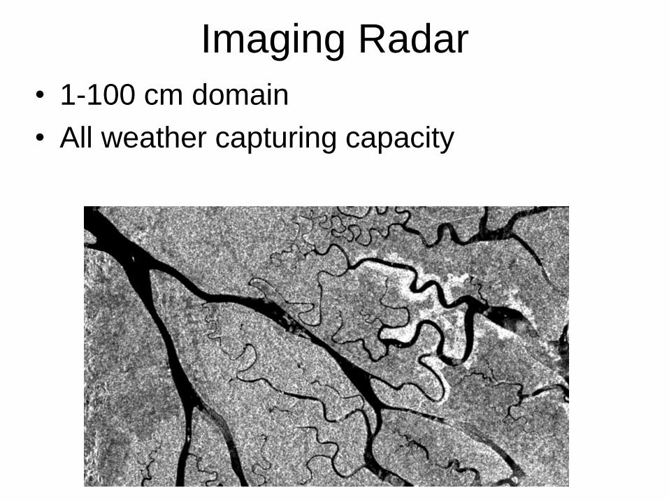
Imaging Radar
• 1-100 cm domain
• All weather capturing capacity
Platforms
• Sensor is mounted on a platform, moving
or static
• Airborne Observations• 100 m to 40 km
• Spaceborne Remote Sensing• 150 – 36,000 km,
• Applications like continuous observation of large
areas or detailed observation of smaller areas.
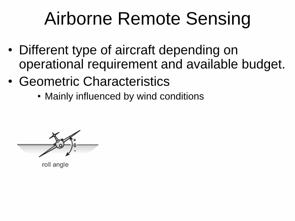
Airborne Remote Sensing
• Different type of aircraft depending on operational requirement and available budget.
• Geometric Characteristics• Mainly influenced by wind conditions
• ‘measurement’ are ‘stored’ on hard copy
material.
• Other sensors, e.g., a scanner, the digital
data can be stored on tape or mass memory
devices.
• Recorded data are only available after the
aircraft has been returned to its base.
Airborne Remote Sensing
Space Born Remote Sensing
• Spaceborne remote sensing is carried out
using sensors that are mounted on satellites.
– Monitoring capabilities of a sensor are to a large
extent determined by the parameters of the
Satellite’s orbit.
• Continuous Monitoring (Meteorology)
• Global Mapping (Land Cover Mapping)
• Selective Mapping (Urban Areas)
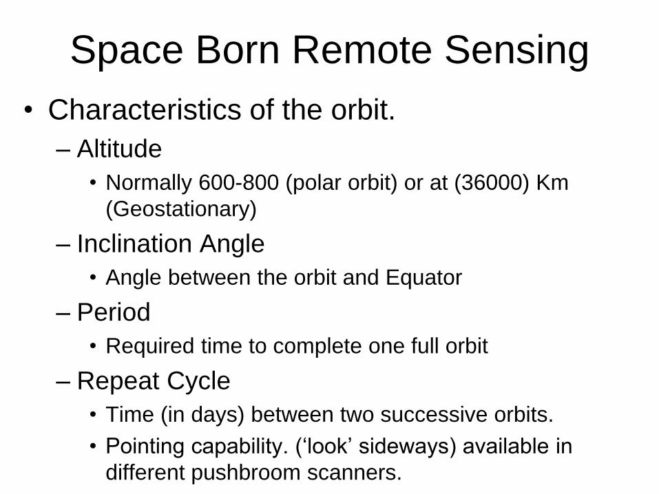
• Characteristics of the orbit.
– Altitude
• Normally 600-800 (polar orbit) or at (36000) Km
(Geostationary)
– Inclination Angle
• Angle between the orbit and Equator
– Period
• Required time to complete one full orbit
– Repeat Cycle
• Time (in days) between two successive orbits.
• Pointing capability. (‘look’ sideways) available in
different pushbroom scanners.
Space Born Remote Sensing
Type of Orbits
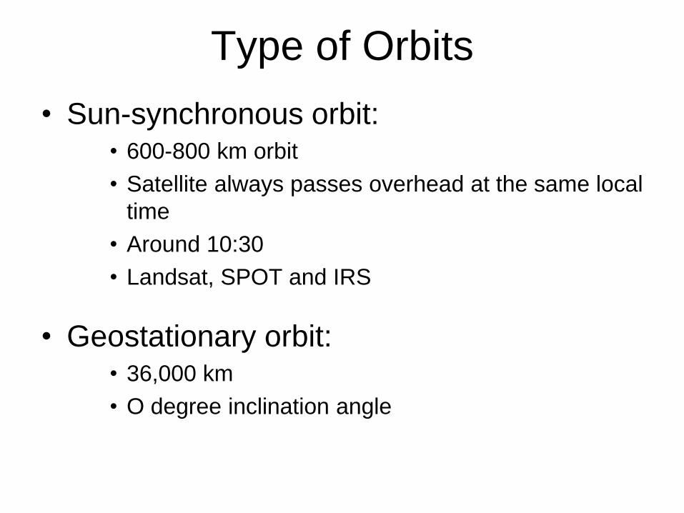
• Sun-synchronous orbit: • 600-800 km orbit
• Satellite always passes overhead at the same local
time
• Around 10:30
• Landsat, SPOT and IRS
• Geostationary orbit:• 36,000 km
• O degree inclination angle
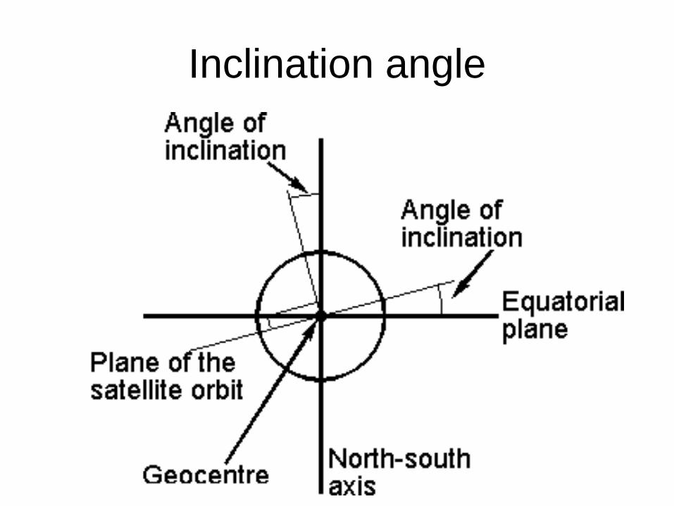
Inclination angle
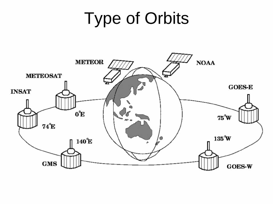
Type of Orbits
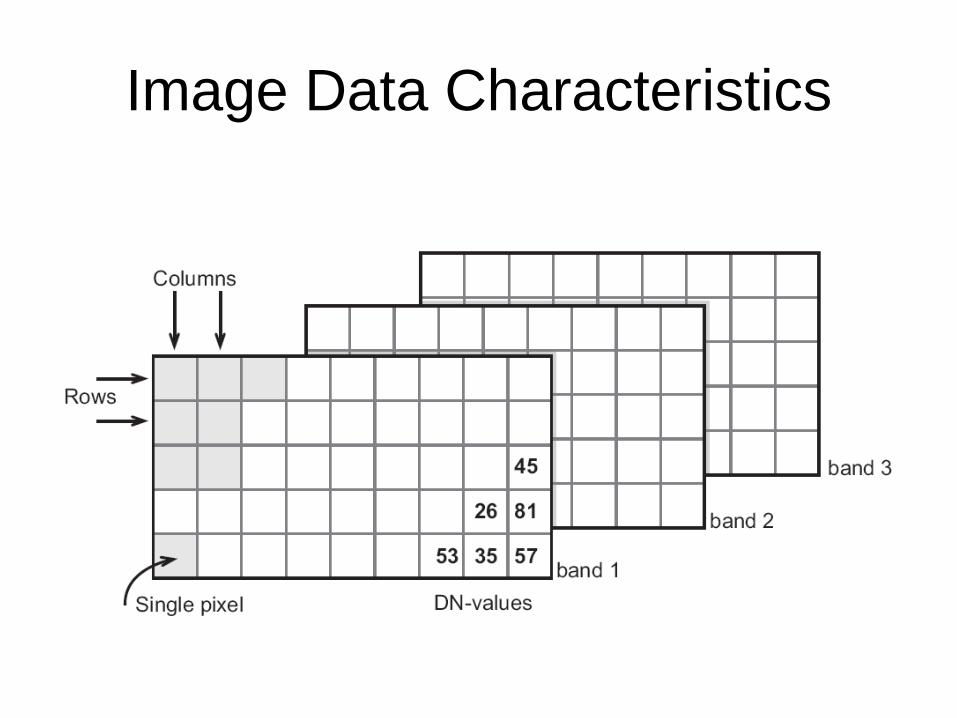
Image Data Characteristics
– Pixel (picture element)
– In general, resolution is defined as the ability of an
entire remote-sensing system, including lens,
antennae, display, exposure, processing, and other
factors, to render a sharply-defined image.
– Resolution of a remote-sensing system is of
different types.
• Spatial (ability to record small adjacent objects in an
image)
• Spectral (different ranges of the EM spectrum)
• Radiometric (quantization level of a sensor)
• Temporal (relating to measured time)
Sensor Platform Characteristics
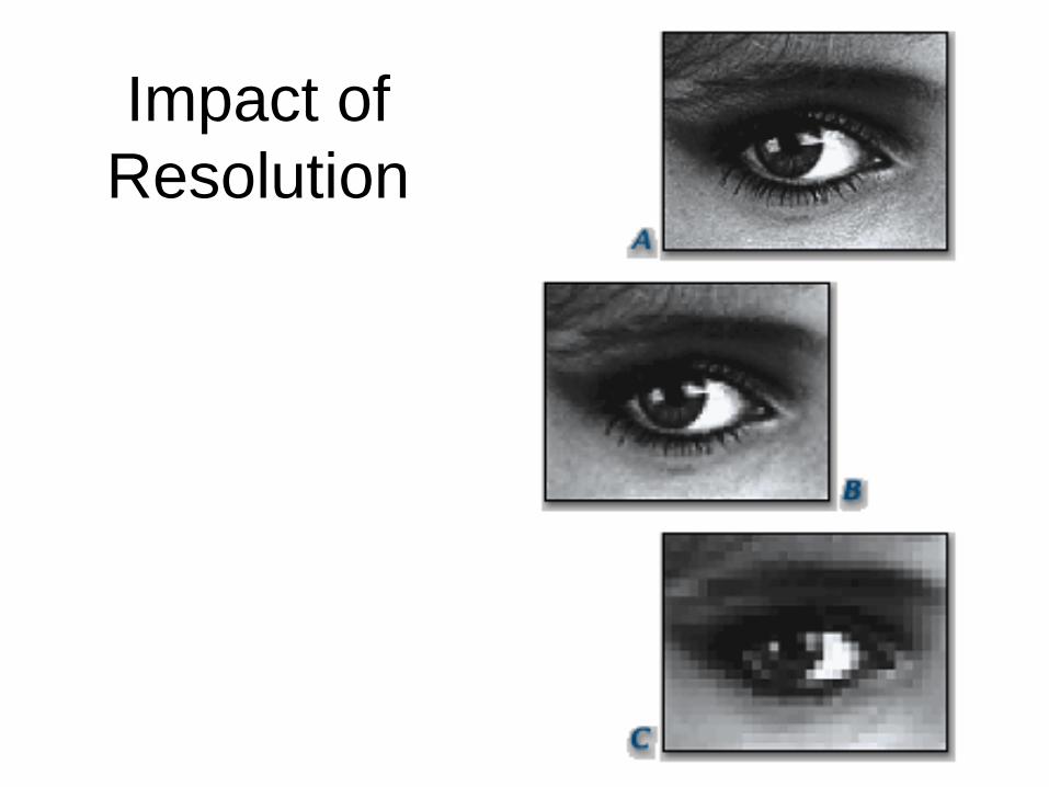
Impact of
Resolution
Image Data Characteristics
• Image Size
• No of Bands
• Quantization
• Ground pixel size
Data Selection Criteria
• Spatio-Temporal Characteristics
• Availability of Image Data
• Cost of Image Data