Embed Size (px)
Citation preview
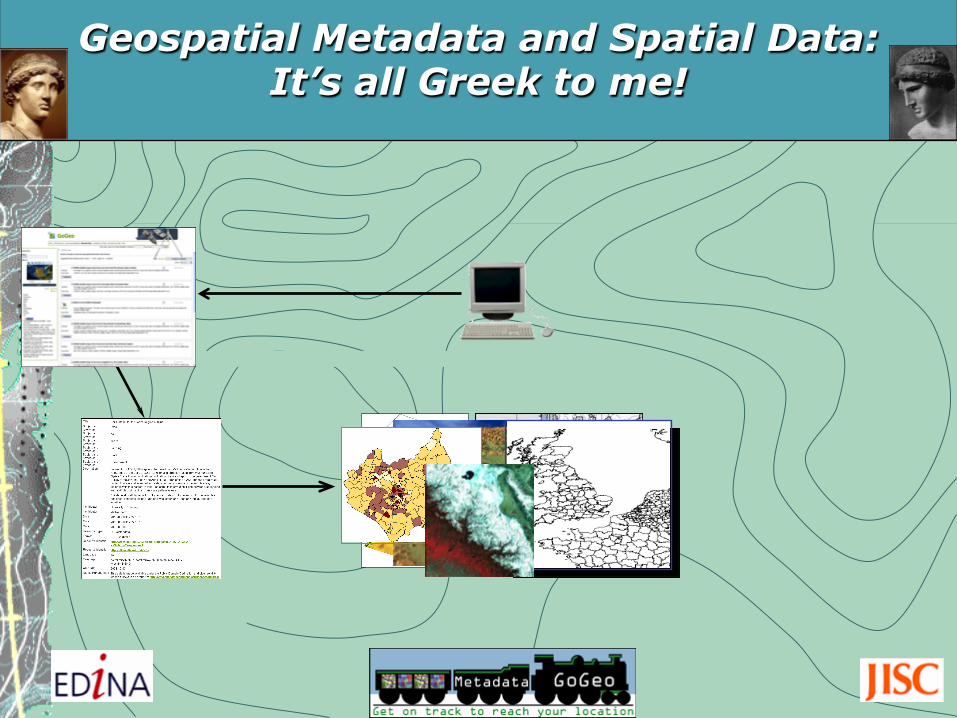
Geospatial Metadata and Spatial Data: It’s all Greek to me!

Programme PRESENTATION SESSION: Ø Background information
Ø Metadata, standards and application profiles (ISO 19115, INSPIRE, UK GEMINI 2.1)
Ø UK Academic Geospatial Metadata Application Profile, Version 2.1 (UK AGMAP 2.1) and guidelines
Ø GoGeo portal and Geodoc Metadata Editor tool
Ø ShareGeo spatial data repositories REFRESHMENTS (15 minute break)
HANDS-ON SESSION: Ø Geodoc Metadata Editor tool, GoGeo portal and ShareGeo Open
spatial data repository

Background Ø three decades of GIS and spatial
data capture technology
Ø considerable cost and time invested in spatial data creation
Ø an eclectic range of academic
disciplines using GIS as a research and teaching tool
Requires a spatial data management, discovery and sharing solution delivered through portal technology and metadata.

So what is METADATA? The word appears to be of Greek and Latin origin……
but metadata represents something completely different…… Photographic Images copyright: Jupiter Images 2006
µετά data
Flickr copyright: By Sergio Calleja http://www.flickr.com/photos/scalleja/761037232/

Photographic Images copyright: Jupiter Images 2006 and it’s not sun and holiday

Represents a documented and ordered summary of information that describes something, in this case, spatial data.
Provides information about the What, Where, When and Why of a spatial dataset. Includes its Ownership and Contact details and Access and Use conditions.
Metadata (data describing data)

What are the ingredients?
Where were ingredients produced?
Who sells the ingredients?
What are the brewing steps?
When does the fermentation process end?
Photographic Images copyright: Jupiter Images 2006
Think of metadata as a recipe for making beer.

metadata
Photographic Images copyright: Jupiter Images 2006

Think of metadata as food product labelling.
What are the ingredients?
What is the nutritional value?
How many calories?
When is the product’s expiry date?
Where was it produced?
Who produced it?

metadata

Where are these datasets’ study areas? When were the data collected? Why were these datasets created?
type of application? spatial reference system?
spatial accuracy? processes or algorithms used?
Who created these datasets?
Can you tell me from any of these files…..
Now think of metadata as spatial data labelling.
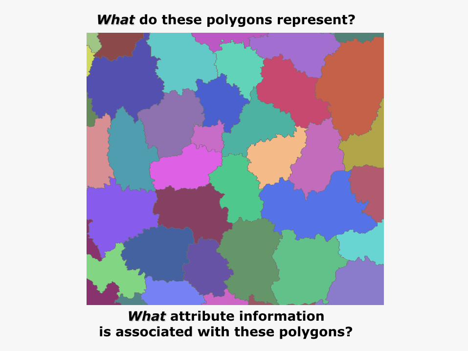
What do these polygons represent?
What attribute information is associated with these polygons?

What do these SOILCLASS
values mean?
What does this attribute mean?

metadata


The importance of geospatial metadata Local spatial data management
Metadata Record
Spatial Dataset Repository
Spatial Dataset
Metadata Directory
Ø maintains an inventory of datasets to reduce time required to re-assess existing datasets for new and future applications;
Ø ensures integrity of existing and new datasets using metadata as a tracking mechanism to monitor changes and edits to datasets.
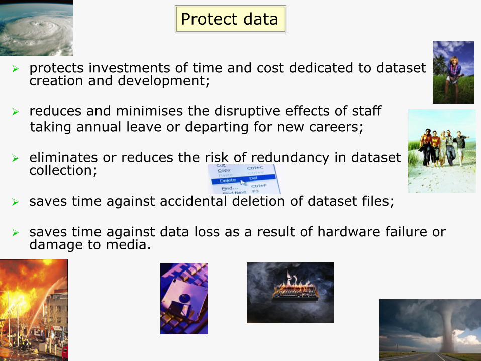
Ø protects investments of time and cost dedicated to dataset creation and development;
Ø reduces and minimises the disruptive effects of staff taking annual leave or departing for new careers;
Ø eliminates or reduces the risk of redundancy in dataset collection;
Ø saves time against accidental deletion of dataset files;
Ø saves time against data loss as a result of hardware failure or damage to media.
Protect data

Geoportal: an interface to run searches to discover metadata records representing spatial data and geo-services on the internet.
Geoportal Metadata Record
Spatial Datasets and Geo-services
Spatial data discovery via a Geoportal
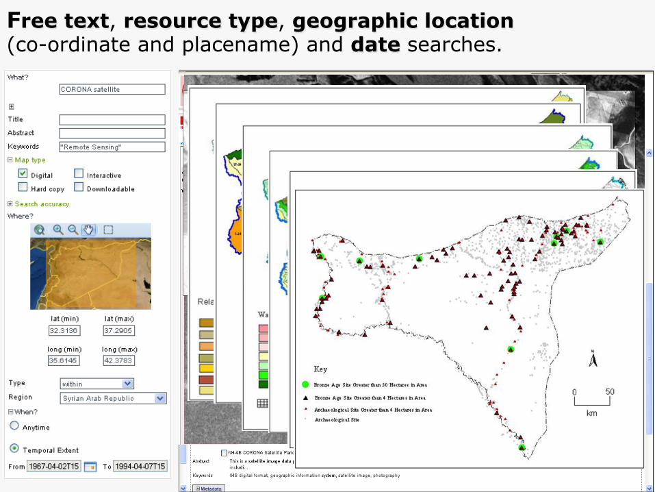
Free text, resource type, geographic location (co-ordinate and placename) and date searches.

Develop new applications

Contours
Raster Map
Draped 3D Model
Create new spatial datasets
© Crown Copyright/database right 2008
© Crown Copyright/database right 2008
© Crown Copyright/database right 2008

Discover
Locate
Access
Use
Publish
Fit for purpose?
Preserve
Re-use data: steps to data immortality

Publish metadata on a geoportal
Ø a repository for you to store and manage your metadata thus savings in cost and time;
Ø use metadata to announce your data and applications;
Ø advertise (and sell?) your spatial datasets to other interested parties in academia and in the private and public sectors; and
Ø metadata in the portal can be referenced and cited for project proposals.

1. Intellectual Property Rights (IPR) 2. residual licensed data rights for derived data 3. concerns over data quality (data creator and user) 4. liability fears 5. trust 6. privacy and security 7. time and cost for data delivery 8. data transformation and harmonisation (scale, positional accuracy
projections, formats) 9. legacy data 10. time and cost to create anonymised data for release 11. time and cost for metadata record (descriptive level) updates 12. infrastructure performance, maintenance & enhancement costs 13. data and software archiving and warehousing issues 14. long-term commitment and investment in the infrastructure 15. revisions to changes in standards 16. confusion about standards compliance and which standard to use
Many concerns remain (metadata and datasets)

Metadata standards
Ø Provide precise specifications to enforce and ensure consistency and interoperability.
Ø Define and describe metadata entities and elements and, classify and group relevant metadata elements with entities.
Ø Assign structure and conditions (obligations, data type, domain).

Dublin Core (ISO 15836)
Dublin Core: 15 elements to facilitate simple resource discovery in a networked environment (e.g. internet or library).
T
Photographic Images copyright: Jupiter Images 2006 - Contributor
- Title
- Date - Description
- Format
- Identifier - Language - Publisher - Rights - Source
- Subject
- Relation
- Coverage - Creator
- Type
Geospatial metadata standards
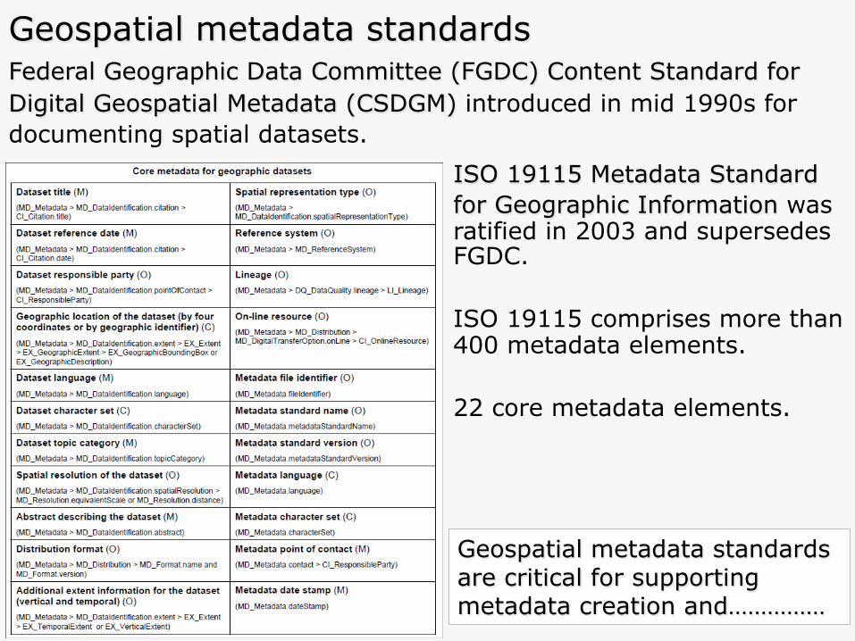
Federal Geographic Data Committee (FGDC) Content Standard for Digital Geospatial Metadata (CSDGM) introduced in mid 1990s for documenting spatial datasets.
Geospatial metadata standards are critical for supporting metadata creation and……………
ISO 19115 Metadata Standard for Geographic Information was ratified in 2003 and supersedes FGDC. ISO 19115 comprises more than 400 metadata elements. 22 core metadata elements.

Other Content
Providers UK Location Programme
Network
Geo-data Gateway
Local GoGeo database
Geoportal
portal interoperability and search capabilities across the internet.
User

Centre for Ecology and Hydrology (CEH)
National Environment Research Council (NERC)
National Soil Resources Institute (NSRI)
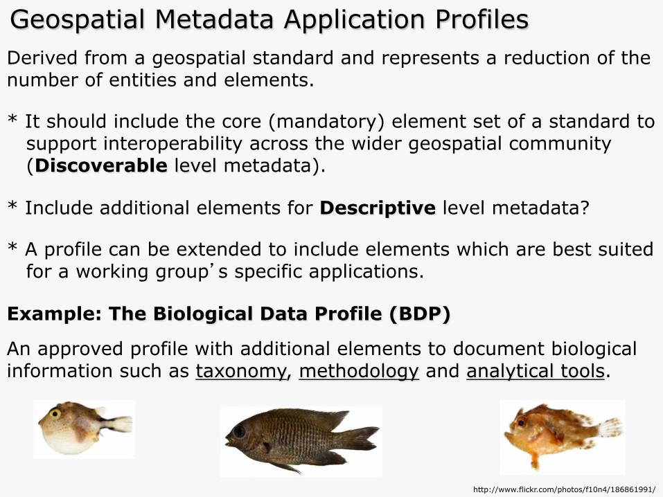
Derived from a geospatial standard and represents a reduction of the number of entities and elements. * It should include the core (mandatory) element set of a standard to support interoperability across the wider geospatial community (Discoverable level metadata). * Include additional elements for Descriptive level metadata? * A profile can be extended to include elements which are best suited for a working group’s specific applications. Example: The Biological Data Profile (BDP)
An approved profile with additional elements to document biological information such as taxonomy, methodology and analytical tools.
http://www.flickr.com/photos/f10n4/186861991/
Geospatial Metadata Application Profiles

Creating application profiles from ISO 19115 ISO 19115 Metadata Standard
ISO 19115 Core Element Set
Application Profiles
Academia (22 + 69= 91)
Public Sector (22 + 43= 65)
Private Sector (22 + 12= 34) 400
elements
22 elements
Environmental Sciences
Specialised APs
* INSPIRE Directive Metadata Guidelines.
* UK GEMINI 2.1, an INSPIRE compliant geospatial metadata standard for the UK geographical information community.
* Marine Environmental Data & Information Network (MEDIN) Metadata Profile.
* UK Academic Geospatial Metadata Application Profile 2.1 (UK AGMAP)
Archaeology
Biological Sciences
Geological Sciences
History
Health Informatics

Infrastructure for Spatial Information
in the European Community (INSPIRE)
*European Commission (EC)
*European Environment Agency (EEA)
*Representatives from
Member States (Mapping/GIS)
INSPIRE Directive Metadata Guidelines

INSPIRE Directive [2007 /2/ EC]
Ø Targets electronic spatial data and services for environmental information.
Ø Aims to create a European Spatial Data Infrastructure (SDI) based on Member States’ infrastructures, to improve interoperability of spatial information.
Ø Data and services to be delivered through European initiatives. Ø INSPIRE Regulations came into force on 31 December 2009 and
applies to England, Northern Ireland and Wales.
Ø Scotland’s Parliament enacted a complementary regulation on the same date.
Ø Public authorities obliged to produce and keep ‘metadata’ current
for describing datasets, dataset series and geo-services.
Ø Includes UK academia (Freedom of Information Act, 2000).

Ø Provide metadata catalogues to reveal what information is available.
Ø Provide online data discovery, view, download and transformation (interoperability) services.
Ø Licensing arrangements to allow for information sharing, access and use in accordance with each State’s regulations.
Ø Set up e-commerce arrangements where charging is applicable.
Ø Introduce monitoring mechanisms to show that information is being made available.
Ø Introduce co-ordination mechanisms to ensure effective operation of the infrastructure.
Ø Comply with the 34 spatial data specifications in three annexes (reference geographies, environmental datasets).
INSPIRE Regulations for member states

INSPIRE spatial data themes and deadlines for creating metadata
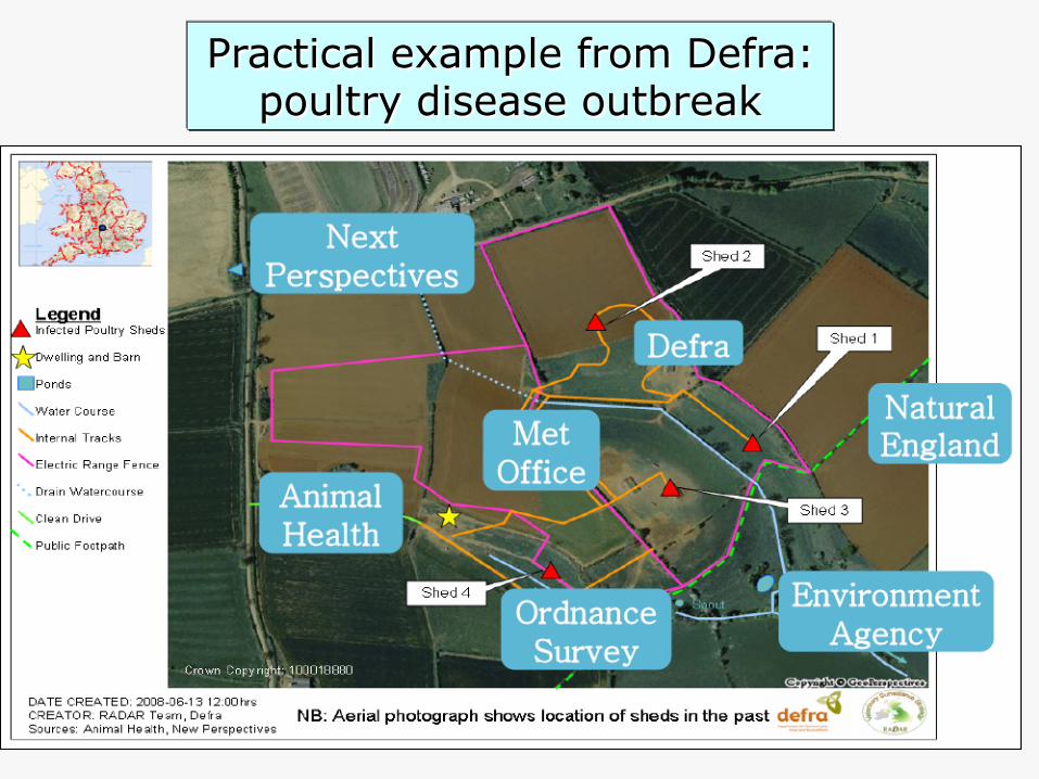
Practical example from Defra: poultry disease outbreak

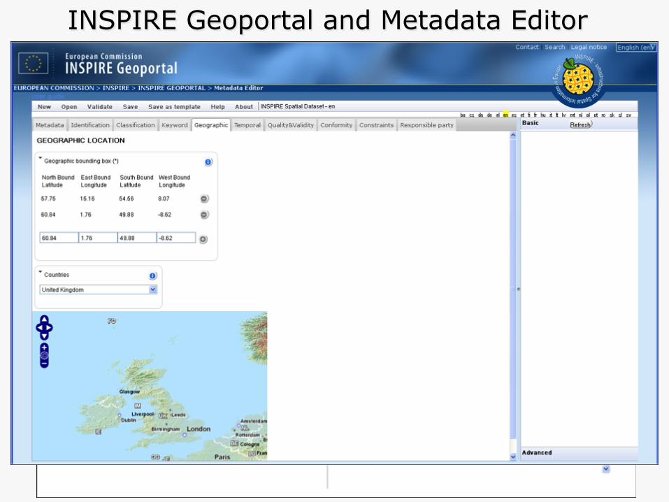
INSPIRE Geoportal and Metadata Editor
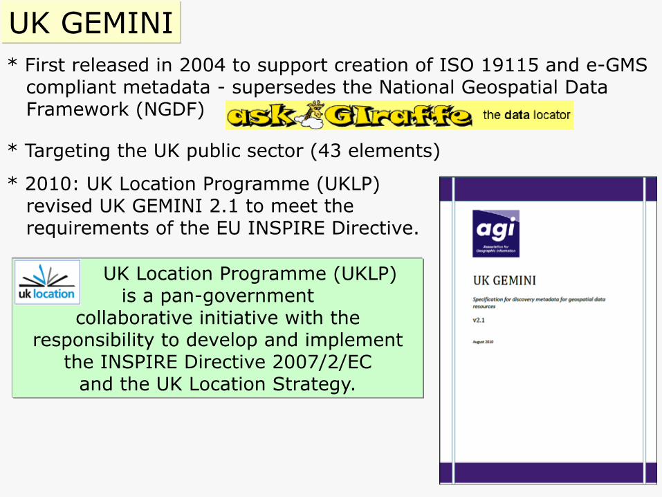
* First released in 2004 to support creation of ISO 19115 and e-GMS compliant metadata - supersedes the National Geospatial Data Framework (NGDF)
* Targeting the UK public sector (43 elements)
* 2010: UK Location Programme (UKLP) revised UK GEMINI 2.1 to meet the requirements of the EU INSPIRE Directive.
UK GEMINI
UK Location Programme (UKLP) is a pan-government
collaborative initiative with the responsibility to develop and implement
the INSPIRE Directive 2007/2/EC and the UK Location Strategy.
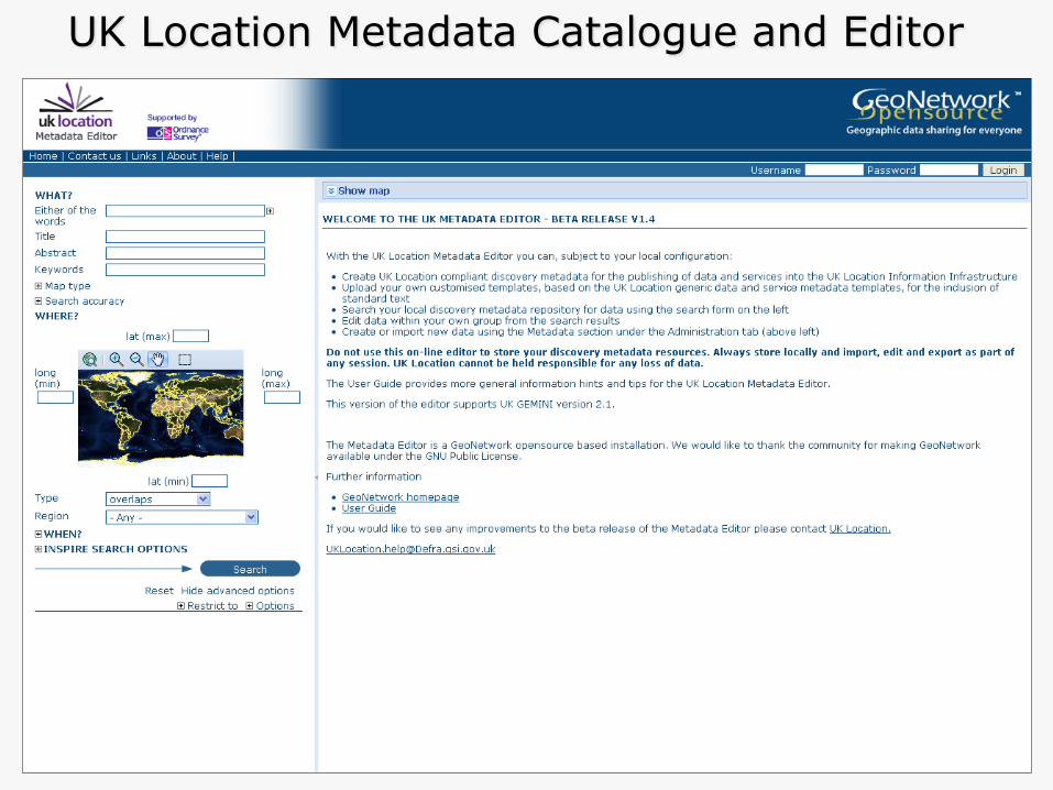
UK Location Metadata Catalogue and Editor

Scottish SDI Discovery Metadata Catalogue

MEDIN Data Discovery Portal and Metadata tools

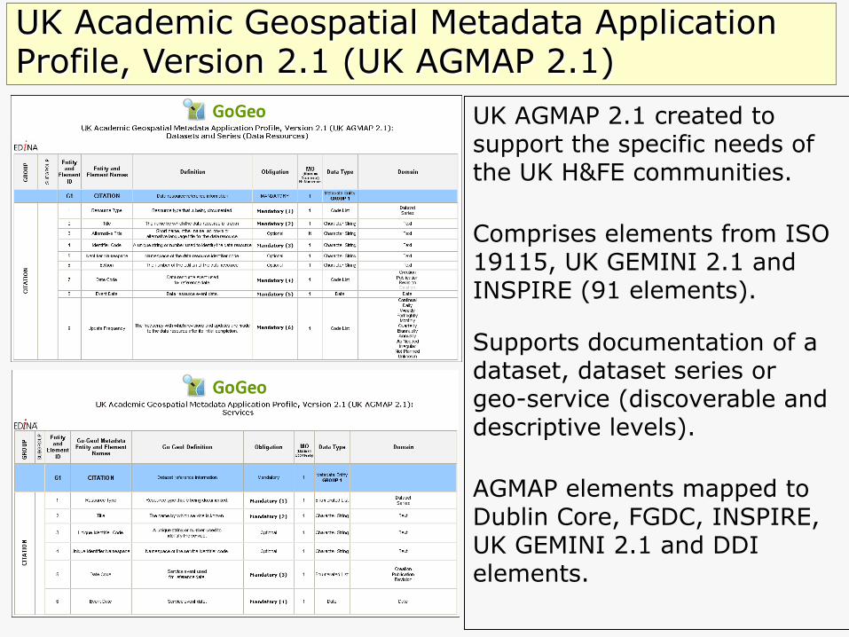
UK Academic Geospatial Metadata Application Profile, Version 2.1 (UK AGMAP 2.1)
UK AGMAP 2.1 created to support the specific needs of the UK H&FE communities.
Comprises elements from ISO 19115, UK GEMINI 2.1 and INSPIRE (91 elements).
Supports documentation of a dataset, dataset series or geo-service (discoverable and descriptive levels).
AGMAP elements mapped to Dublin Core, FGDC, INSPIRE, UK GEMINI 2.1 and DDI elements.

A simple interface designed for UK academia to run queries to discover metadata for spatial datasets, and to locate geographic resources.
GoGeo enables searching by the use of various options including
GoGeo Portal
free text
map type
geographical location
date

GeoNetwork (http://geonetwork-opensource.org/)
GeoNetwork: A standard’s (ISO 19115) based, free and open source catalogue application to manage spatially referenced resources through the web.
Provides metadata editing and search functions as well as an embedded interactive web map viewer.

Most spatial data information is stored in our heads. We need to move it from there to an electronic file.
Metadata Creation
Photographic Images copyright: Jupiter Images 2006

mind reading aliens?
Solutions?
Photographic Images copyright: Planet Vulcan Images, 2606

metadata extraction devices?

Geodoc Metadata Editor Tool

Geodoc design and functionality
* Java-built online tool
* UK federation authentication access
* validation (red fields and status bars)
* text fields
* drop-down lists

Geodoc co-ordinate extent tool Map tool captures co-ordinate values for bounding box elements used to define the extent of a dataset’s study area.

1) collect and process data to create dataset; 2) document dataset to create a metadata record; 3) validate and submit record for review; 4) metadata creator is contacted; and 5) record is published on the GoGeo portal.
1 2 3
Easy steps to the creation and publication of a geospatial metadata record
Photographic Images copyright: Jupiter Images 2006
4
5
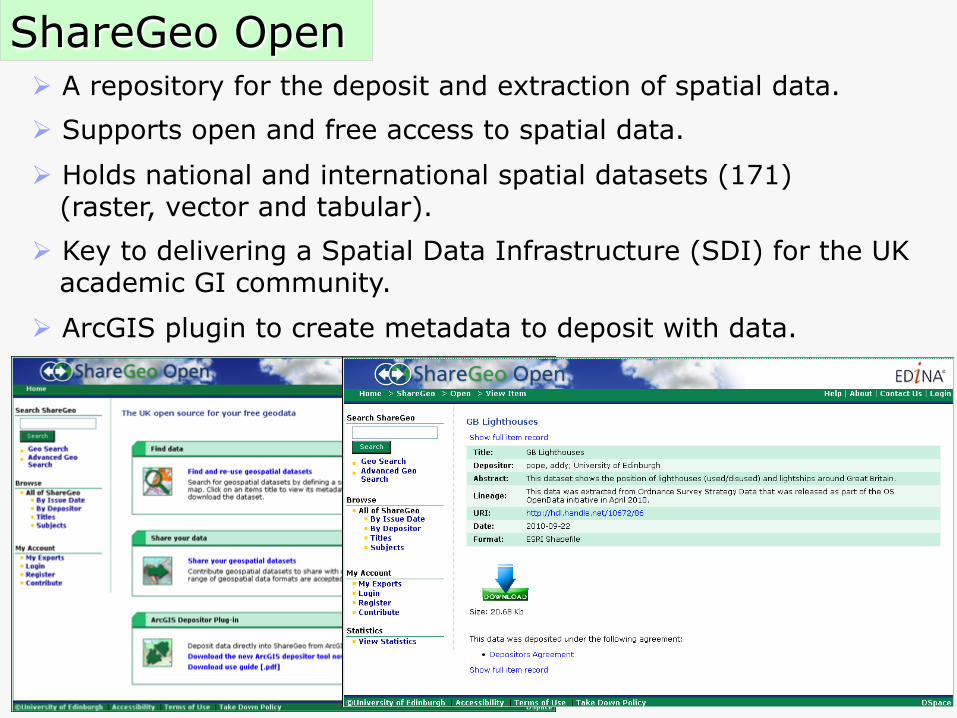
ShareGeo Open
Ø A repository for the deposit and extraction of spatial data.
Ø Supports open and free access to spatial data.
Ø Holds national and international spatial datasets (171) (raster, vector and tabular).
Ø Key to delivering a Spatial Data Infrastructure (SDI) for the UK academic GI community.
Ø ArcGIS plugin to create metadata to deposit with data.
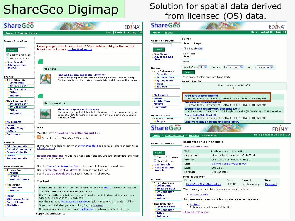
ShareGeo Digimap Solution for spatial data derived from licensed (OS) data.
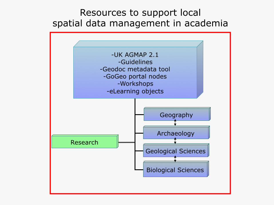
-UK AGMAP 2.1 -Guidelines
-Geodoc metadata tool -GoGeo portal nodes
-Workshops -eLearning objects
Geography
Archaeology
Geological Sciences
Biological Sciences
Research
Resources to support local spatial data management in academia

UK AGMAP 2 Guidelines
Geodoc tadata tool Customised GoGeo Portal
Nodes Training
Geography
Archaeology
Geological Sciences
Biological Sciences
University A
UK AGMAP 2 Guidelines
Geodoc metadata tool Customised GoGeo Portal
Nodes Training
Geography
Archaeology
Geological Sciences
Biological Sciences
University B
UK AGMAP 2 Guidelines
Geodoc metadata tool Customised GoGeo Portal
Nodes Training
Geography
Archaeology
Geological Sciences
Biological Sciences
University C
UK AGMAP 2 Guidelines
Geodoc metadata tool Customised GoGeo Portal
Nodes Training
Geography
Archaeology
Geological Sciences
Biological Sciences
University D
Spatial Data Infrastructure (SDI) for academia
Other resources and portals
Spatial Data Repository
Spatial data
Metadata
Search
Data user
Metadata