Embed Size (px)
Citation preview
Enabling Semantic Search in Geospatial Metadata Catalogue to Support Polar Sciences
Wenwen Li1 and Vidit Bhatia2 1GeoDa Center for Geospatial Analysis and Computation
School of Geographical Sciences and Urban Planning 2Department of Computer Science Ira. Fulton School of Engineering
Arizona State University 10-29-2013
1
Outline
Motivation
Intelligent geospatial data discovery
A knowledge mining approach
Integrated solution for semantic-enabled metadata catalogue
Experimental results
Demo
Conclusion and discussion
2
Towards a ‘CyberPolar’ Community
Studies about polar regions has attracted great attention:
Increasing interest in mining and natural resource exploration
Both poles are sensitive to human activities and global, environmental, and climate changes
Polar regions are key drivers of the Earth climate
“President’s National Strategy for the Arctic Region”
Released in May 2013 by the white house
Overarching stewardship objectives:
“Make decisions using the best available information”
3
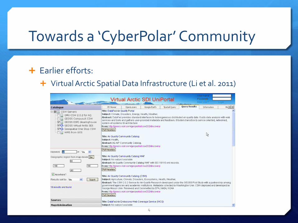
Towards a ‘CyberPolar’ Community
Earlier efforts:
Virtual Arctic Spatial Data Infrastructure (Li et al. 2011)
4
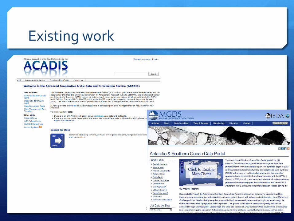
Existing work
5
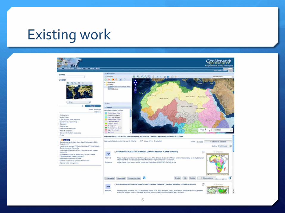
Existing work
6
Problem Statement
Current full-text search cannot address fuzzy search need
“Frozen ground” vs. “Permafrost”.
Gap between the best available data and the most suitable research applications.
A smart mechanism for data discovery is needed to bridge the gap.
7
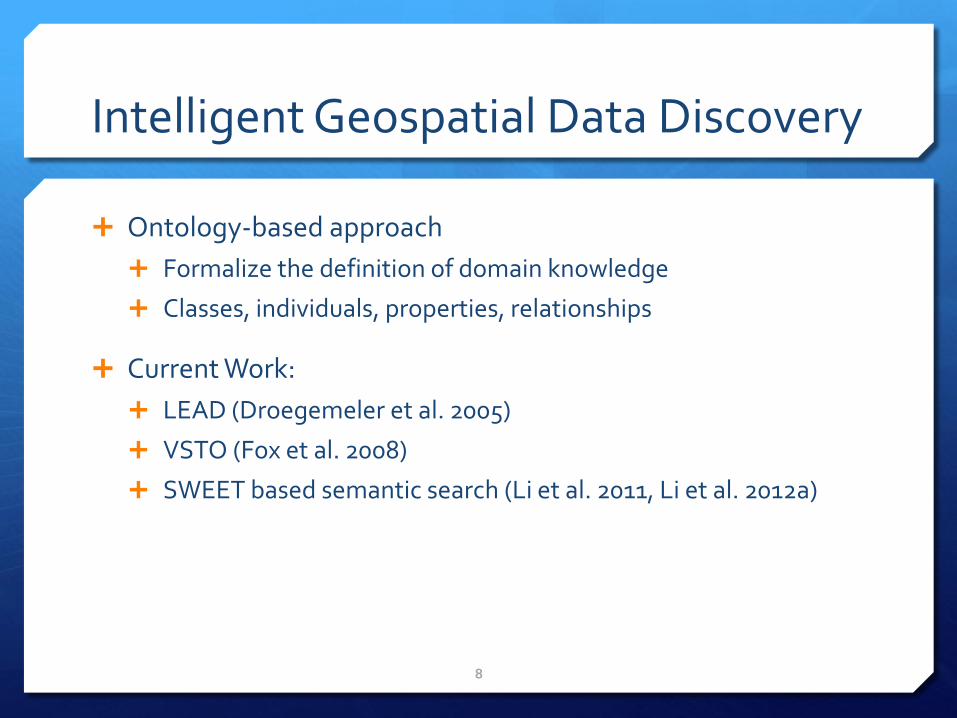
Intelligent Geospatial Data Discovery
Ontology-based approach
Formalize the definition of domain knowledge
Classes, individuals, properties, relationships
Current Work:
LEAD (Droegemeler et al. 2005)
VSTO (Fox et al. 2008)
SWEET based semantic search (Li et al. 2011, Li et al. 2012a)
8
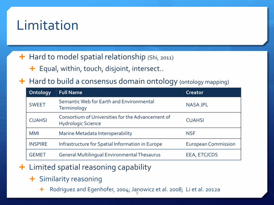
Limitation
Hard to model spatial relationship (Shi, 2011)
Equal, within, touch, disjoint, intersect..
Hard to build a consensus domain ontology (ontology mapping)
Limited spatial reasoning capability
Similarity reasoning
Rodriguez and Egenhofer, 2004; Janowicz et al. 2008; Li et al. 2012a 9
Ontology Full Name Creator
SWEET Semantic Web for Earth and Environmental Terminology
NASA JPL
CUAHSI Consortium of Universities for the Advancement of Hydrologic Science
CUAHSI
MMI Marine Metadata Interoperability NSF
INSPIRE Infrastructure for Spatial Information in Europe European Commission
GEMET General Multilingual Environmental Thesaurus EEA, ETC/CDS
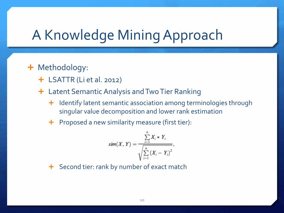
A Knowledge Mining Approach
Methodology:
LSATTR (Li et al. 2012)
Latent Semantic Analysis and Two Tier Ranking
Identify latent semantic association among terminologies through singular value decomposition and lower rank estimation
Proposed a new similarity measure (first tier):
Second tier: rank by number of exact match
10
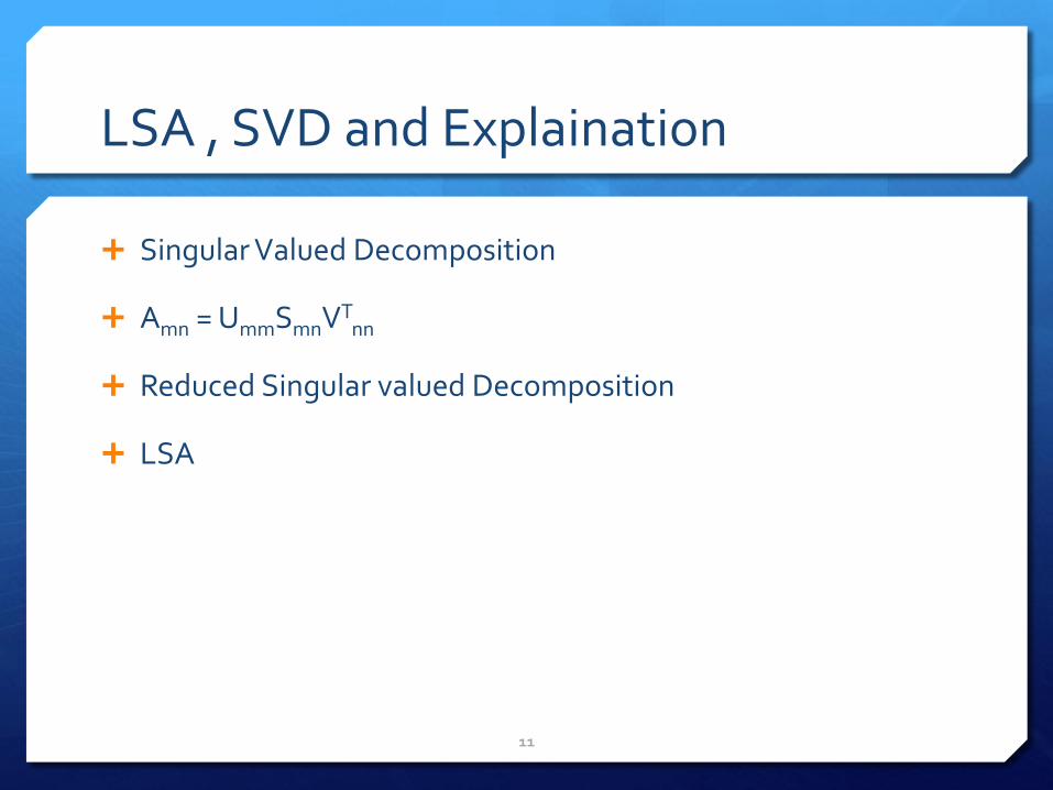
LSA , SVD and Explaination
Singular Valued Decomposition
Amn = UmmSmnVTnn
Reduced Singular valued Decomposition
LSA
11
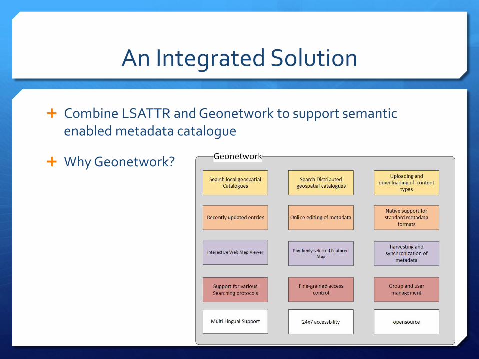
An Integrated Solution
Combine LSATTR and Geonetwork to support semantic enabled metadata catalogue
Why Geonetwork?
12
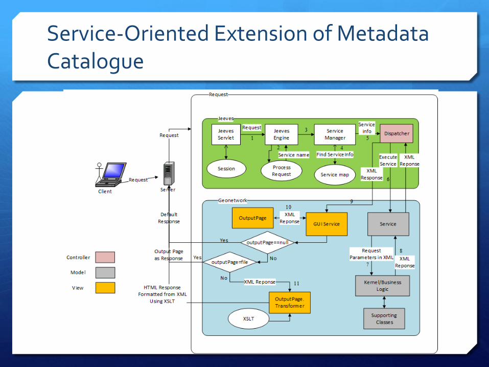
Service-Oriented Extension of Metadata Catalogue
13
14
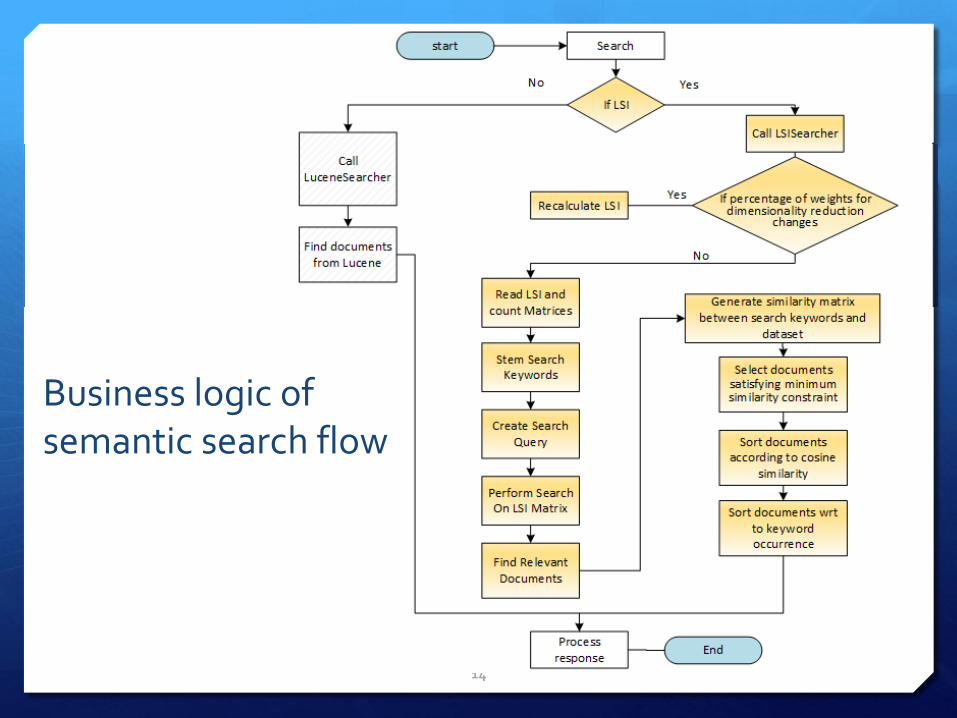
Business logic of semantic search flow
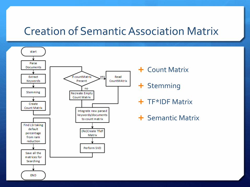
Creation of Semantic Association Matrix
15
Count Matrix
Stemming
TF*IDF Matrix
Semantic Matrix
Demo
16
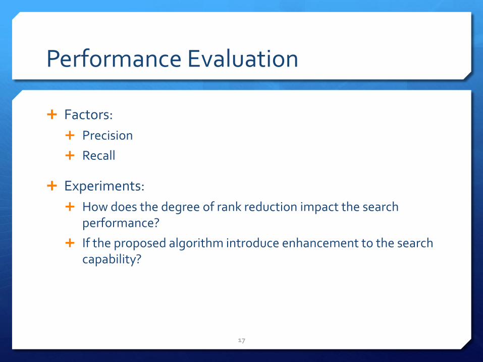
Performance Evaluation
Factors:
Precision
Recall
Experiments:
How does the degree of rank reduction impact the search performance?
If the proposed algorithm introduce enhancement to the search capability?
17
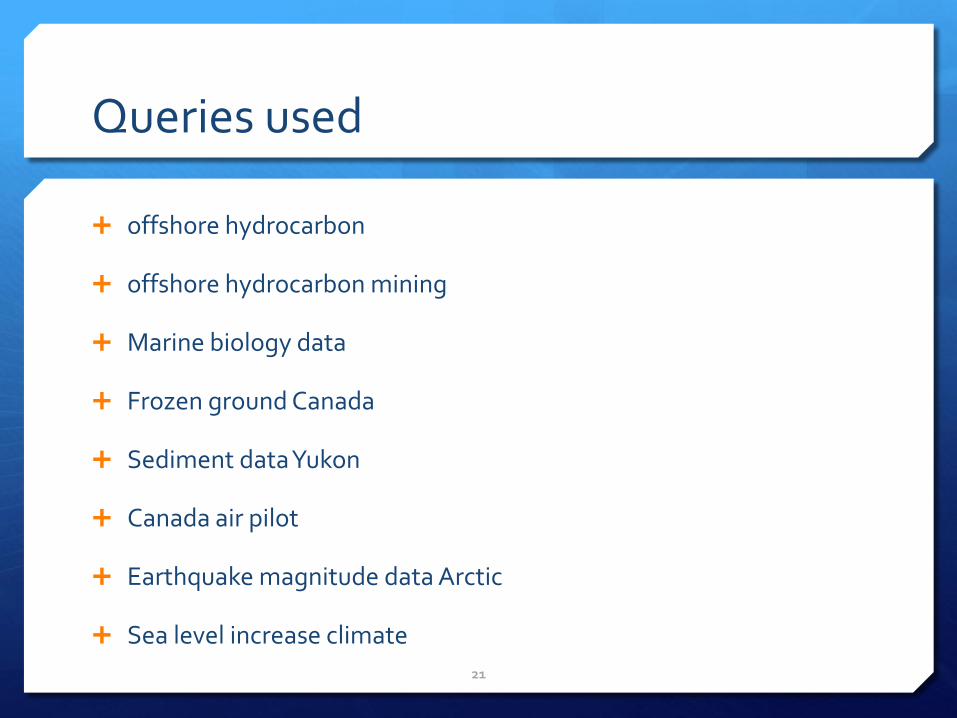
Queries used
offshore hydrocarbon
offshore hydrocarbon mining
Marine biology data
Frozen ground Canada
Sediment data Yukon
Canada air pilot
Earthquake magnitude data Arctic
Sea level increase climate
21
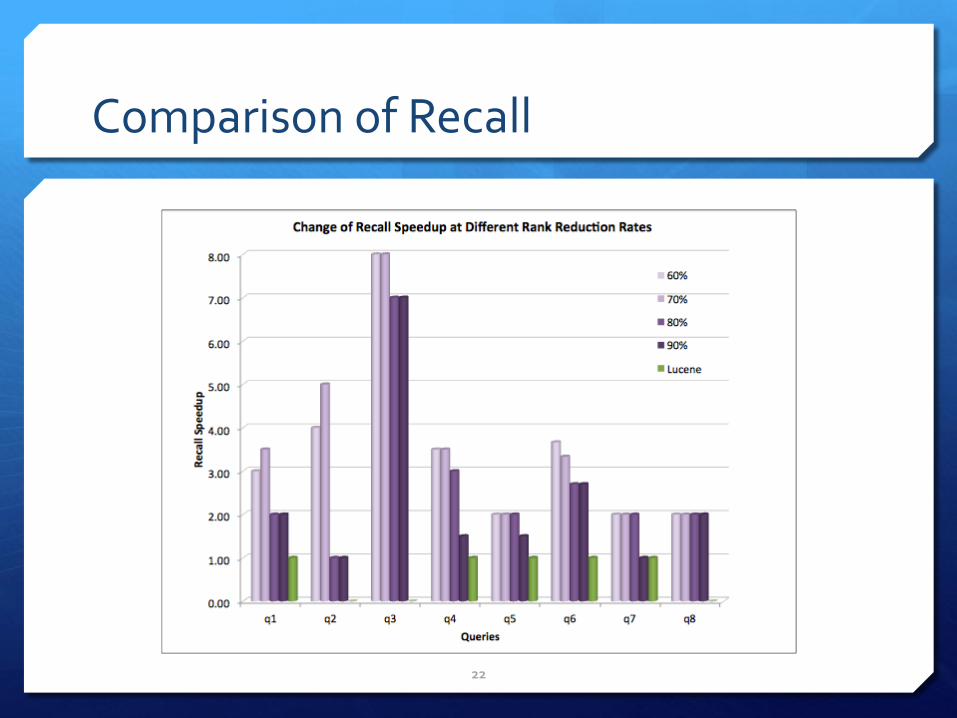
Comparison of Recall
22
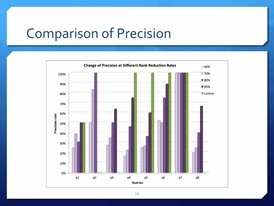
Comparison of Precision
23
Summary
A data mining approach to improve geospatial data discovery
LSA outperforms full-text search
An alternative approach to establish domain ontology to complement the top-down approach
24
Future Work
Investigate the impact of stemming algorithm to the search effectiveness
Further improve the performance of semantic search algorithm to handle big spatial data
25
References
W. Li, Automated Data Discovery, Reasoning and Ranking in Support of Building an Intelligent Geographic Search Engine, Ph.D. Dissertation. George Mason University, August 2010.
W. Li, C. Yang, D. Nebert, R. Raskin and H. Wu, 2011. Semantic-based service chaining for building a virtual Arctic spatial data infrastructure. Computers & Geosciences. 37(11), 1752-1762.
W. Li, R. Raskin and M.F. Goodchild, 2012a. Semantic similarity measurement based on knowledge mining: an artificial neural network approach. International Journal of Geographic Information Science, 26(8), 1415-1435.
W. Li, M.F. Goodchild and R. Raskin, 2012b. Towards geospatial semantic search: exploiting latent semantic relations in geospatial data. International Journal of Digital Earth, DOI:10.1080/17538947.2012.674561.
26
Acknowledgement
National Science Foundation Polar Cyberinfrastructure Program
Dr. Nancy Wiegand for inviting us to share our research outcome
27