Using Spatial ETL in a Multi-Vendor Enterprise
GIS Environment Dennis Beck, PE
President
Agenda
• Introduction
• Multi-vendor architecture problem statement
• Challenges in implementing multi-vendor solutions
• Case study architectures
Proprietary and Confidential
Proprietary and Confidential
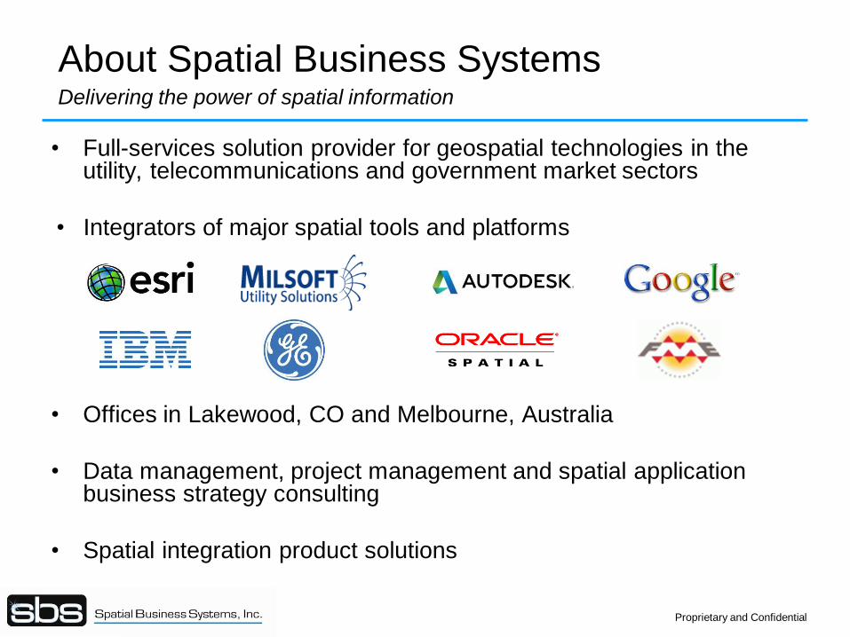
About Spatial Business Systems Delivering the power of spatial information
• Full-services solution provider for geospatial technologies in the utility, telecommunications and government market sectors
• Integrators of major spatial tools and platforms
• Offices in Lakewood, CO and Melbourne, Australia
• Data management, project management and spatial application business strategy consulting
• Spatial integration product solutions
Proprietary and Confidential
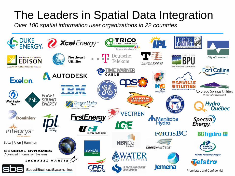
The Leaders in Spatial Data Integration Over 100 spatial information user organizations in 22 countries
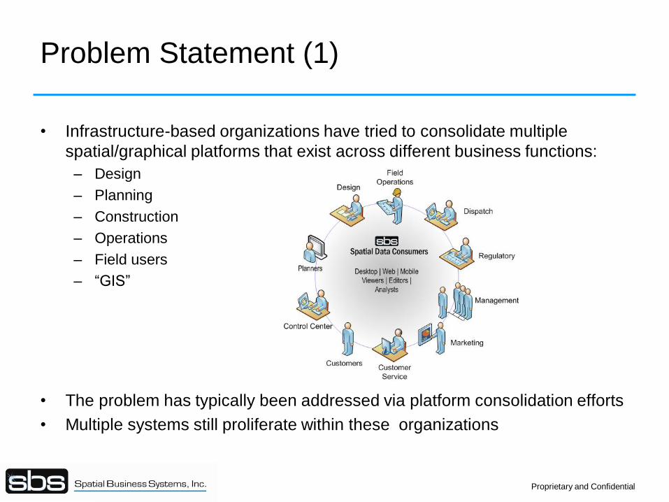
Problem Statement (1)
• Infrastructure-based organizations have tried to consolidate multiple
spatial/graphical platforms that exist across different business functions:
– Design
– Planning
– Construction
– Operations
– Field users
– “GIS”
• The problem has typically been addressed via platform consolidation efforts
• Multiple systems still proliferate within these organizations
Proprietary and Confidential
Problem Statement (2)
• There are multiple reasons why these systems proliferate
– Mergers and acquisitions
– Legacy systems that are hard to migrate
– Specialty, packaged spatial applications
– Unique requirements by different user communities
– Prevalence of CAD
• The problem is continuing, rather than going away
• This is creating new architectures that are focused on
– Data management
– Interoperability
– Well-defined integration points and business controls to ensure data integrity
Proprietary and Confidential
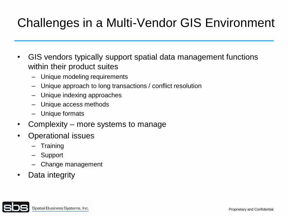
Challenges in a Multi-Vendor GIS Environment
• GIS vendors typically support spatial data management functions
within their product suites
– Unique modeling requirements
– Unique approach to long transactions / conflict resolution
– Unique indexing approaches
– Unique access methods
– Unique formats
• Complexity – more systems to manage
• Operational issues
– Training
– Support
– Change management
• Data integrity
Proprietary and Confidential
Approaches
• Loose coexistence (Business as usual)
• GIS platform as hub (Geo-Centric)
• Database as hub (Database-Centric)
Proprietary and Confidential
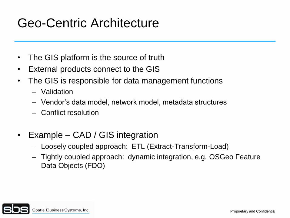
Geo-Centric Architecture
• The GIS platform is the source of truth
• External products connect to the GIS
• The GIS is responsible for data management functions
– Validation
– Vendor’s data model, network model, metadata structures
– Conflict resolution
• Example – CAD / GIS integration
– Loosely coupled approach: ETL (Extract-Transform-Load)
– Tightly coupled approach: dynamic integration, e.g. OSGeo Feature
Data Objects (FDO)
Proprietary and Confidential
Kennedy
Ford
Truman
Roosevelt
Wilson
Washington
Adams Jones Smith
Yale Cornell
Fraiser
Zoe
Varney
Armey Baker Diego Harvard
Merrit
Miller
Regan
Clinton
Eisenhower
Dartmouth
Bradshaw
Lang
Jackson Jefferson
Carter
Franklin
VanBuren
Warren
Lincoln
Jetson
Campbell`
Runner
Pear Grape Orange
Plum
Beet
Carrot
Tomato
Peach
Banana
Apple
Berry
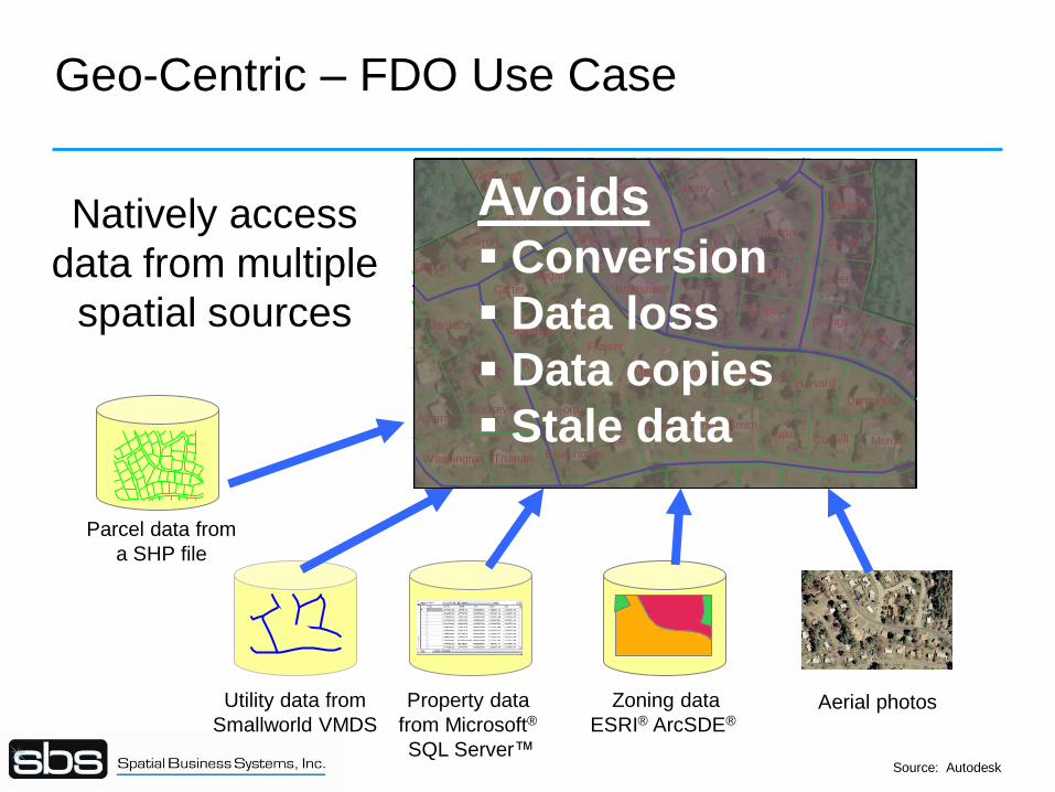
Utility data from
Smallworld VMDS
Property data
from Microsoft®
SQL Server™
Zoning data
ESRI® ArcSDE® Aerial photos
Natively access
data from multiple
spatial sources
Avoids Conversion
Data loss
Data copies
Stale data
Geo-Centric – FDO Use Case
Parcel data from
a SHP file
Source: Autodesk
Database-Centric Architecture
• Database is the source of truth
– Not the GIS vendor’s application database
– Typically a spatially enabled relational database (Oracle, SQL)
• GIS platforms serve application-specific roles
• Spatial ETL exchanging data between systems
• The spatial database environment takes on an added role in
managing spatial data
– Long transactions
– Conflict resolutions
– Metadata management
– Symbology
– Additional spatial capabilities – e.g. network modeling
• Examples: Large investor-owned utilities
Proprietary and Confidential
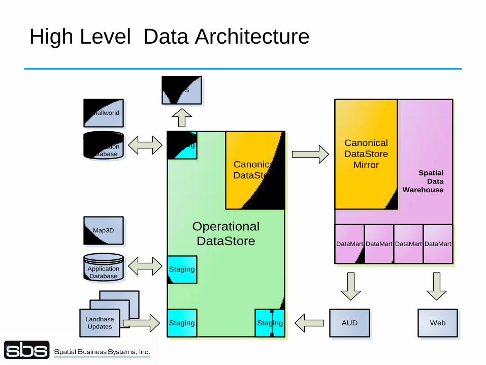
High Level Data Architecture
Smallworld
Map3D
AUD
Application
Database
Application
Database
Operational
DataStore
Spatial
Data
Warehouse
DataMart DataMart DataMart DataMart
Staging
Staging
StagingStagingLandbase
Updates
Landbase
Updates
Canonical
DataStore
Canonical
DataStore
Mirror
DMS
Web
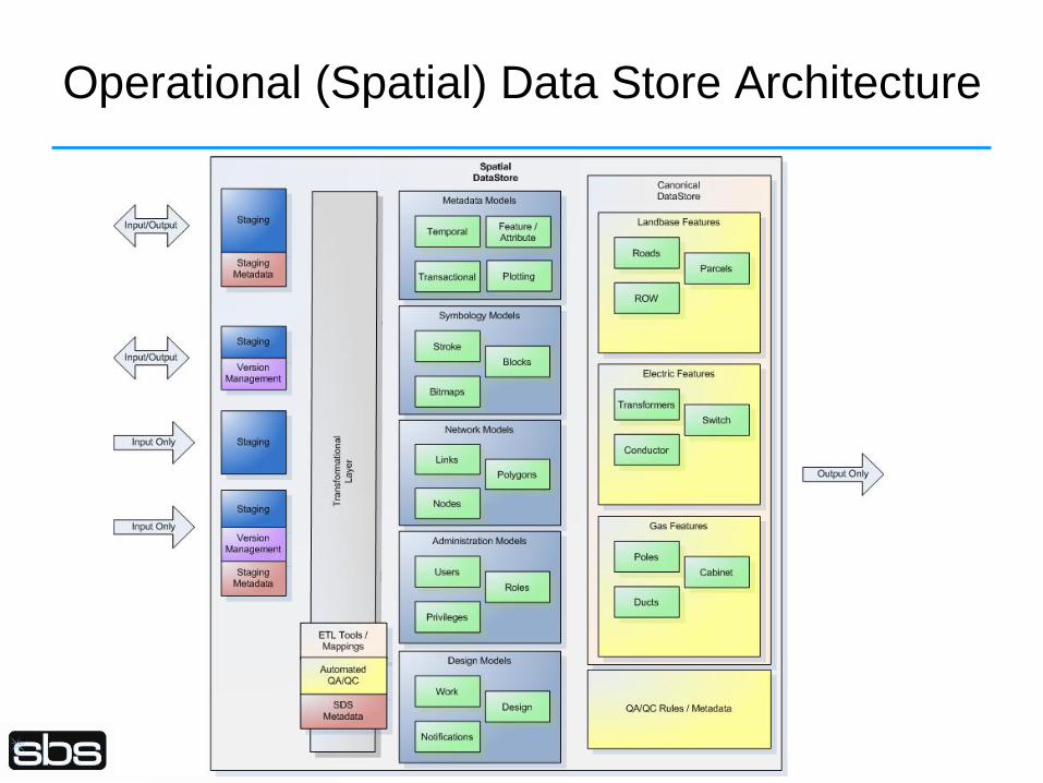
Operational (Spatial) Data Store Architecture
Use of Spatial ETL (Extract-Transform-Load)
• Data model transformation support
– Attribute modification / Feature merging and splitting
– Relationship generation / Topology generation
• Validation
• Error handling with notifications via email, logs, tweets, NT Service logs
• Can support full synchronization with appropriate plug-ins
• Scalability via the use of server-based approaches (e.g. FME Server)
• COTS support, particularly for upgrades
• Web based initiation, interaction and resolution of synchronization
processes
• Flexibility to support current and future format requirements
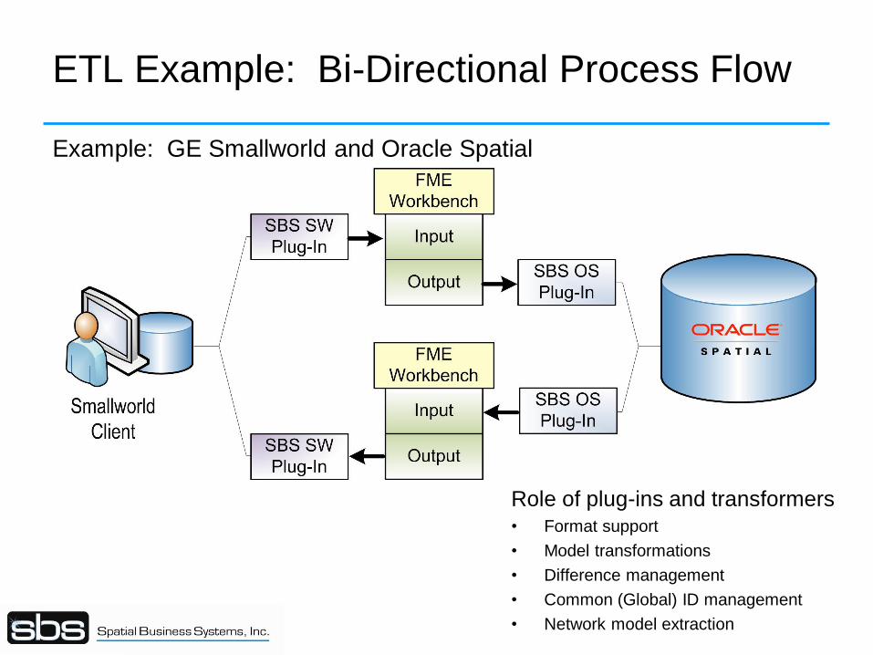
ETL Example: Bi-Directional Process Flow
Example: GE Smallworld and Oracle Spatial
Role of plug-ins and transformers
• Format support
• Model transformations
• Difference management
• Common (Global) ID management
• Network model extraction
Conflict Resolution
• As data is merged and posted between workspaces, the potential for
conflicts in the long transaction data exists
– Such situations occur when two users modify the same feature at the same time, but in
different workspaces.
– In this case merge / post operations may result in overwriting one user’s data in favor of the
other
• Mechanisms must be in place to detect changes
– Oracle Workspace Manager provides tools for comparing changes from different workspaces
and can identify sources of data change conflict
– Change-Data-Capture (CDC) offer alternate mechanisms to identify differences
– Trigger-based approaches are also used
• It is necessary to visualize the changes to support comparison and
resolution of changes via semi-automated or manual processes.
• Conflicts can be identified and resolved in the system, resolution results are
sent to the peer
• Properly designed business processes will help to mitigate most conflicts
Proprietary and Confidential
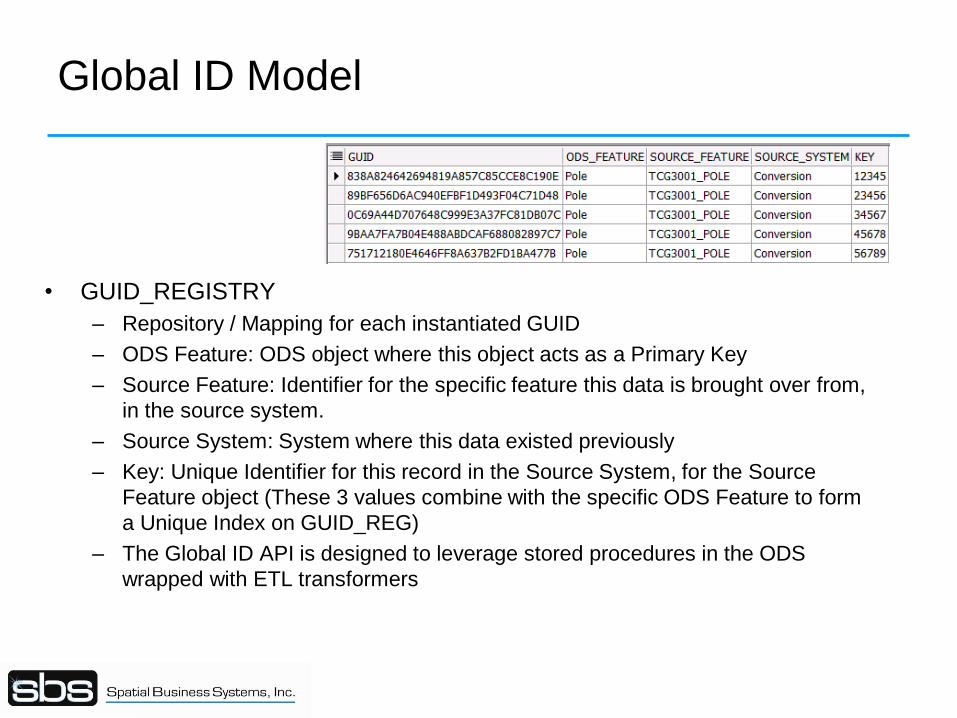
Global ID Model
• GUID_REGISTRY
– Repository / Mapping for each instantiated GUID
– ODS Feature: ODS object where this object acts as a Primary Key
– Source Feature: Identifier for the specific feature this data is brought over from,
in the source system.
– Source System: System where this data existed previously
– Key: Unique Identifier for this record in the Source System, for the Source
Feature object (These 3 values combine with the specific ODS Feature to form
a Unique Index on GUID_REG)
– The Global ID API is designed to leverage stored procedures in the ODS
wrapped with ETL transformers
Other Considerations
• Common validation framework
– Valuable for ensuring consistent representation
– Source system validation may not address all use cases
• Common symbology
– Multiple symbol sets from source applications
– Necessary to persist some in the ODS
– Symbol and Text Stroking used for Web / Thin client deployment
• Converts point and text to multi-linestring with symbol/font/size/orientation embedded
• Implemented via ETL Transformers
– Display scales
• Common network models in the data base – Auto-generated via ETL plug-ins
– Supports externalized application requirements
• Application services
Proprietary and Confidential
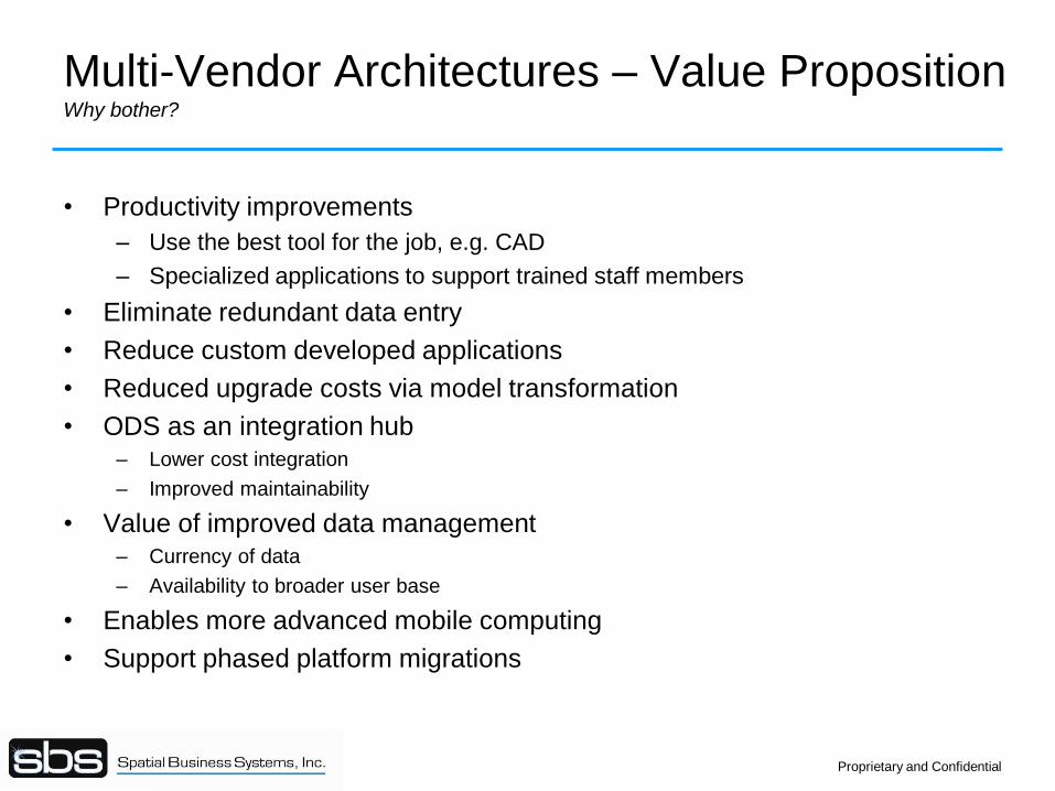
Multi-Vendor Architectures – Value Proposition Why bother?
• Productivity improvements
– Use the best tool for the job, e.g. CAD
– Specialized applications to support trained staff members
• Eliminate redundant data entry
• Reduce custom developed applications
• Reduced upgrade costs via model transformation
• ODS as an integration hub – Lower cost integration
– Improved maintainability
• Value of improved data management
– Currency of data
– Availability to broader user base
• Enables more advanced mobile computing
• Support phased platform migrations
Proprietary and Confidential
Questions ?
Recommended