Embed Size (px)
DESCRIPTION
Slides of the presentation about GeoKettle I made during the 1st rendez-vous OSGeo-Quebec (http://rendez-vous-osgeo-qc.org/2010) at Saguenay, Quebec, Canada on June 15-16, 2010.
Citation preview
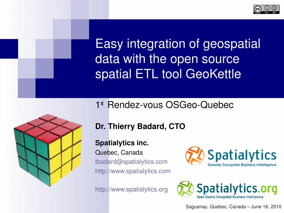
Easy integration of geospatial data with the open source spatial ETL tool GeoKettle
1st Rendezvous OSGeoQuebec
Dr. Thierry Badard, CTO
Spatialytics inc.Quebec, [email protected]://www.spatialytics.com
http://www.spatialytics.org
Saguenay, Quebec, Canada – June 16, 2010
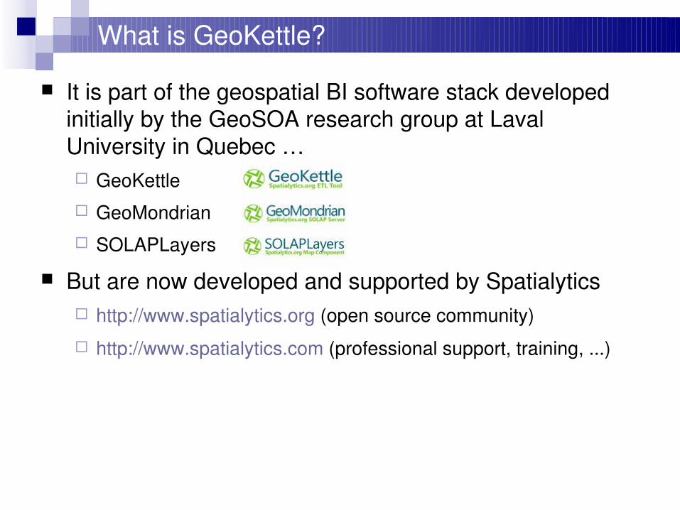
What is GeoKettle?
It is part of the geospatial BI software stack developed initially by the GeoSOA research group at Laval University in Quebec … GeoKettle GeoMondrian SOLAPLayers
But are now developed and supported by Spatialytics http://www.spatialytics.org (open source community)
http://www.spatialytics.com (professional support, training, ...)
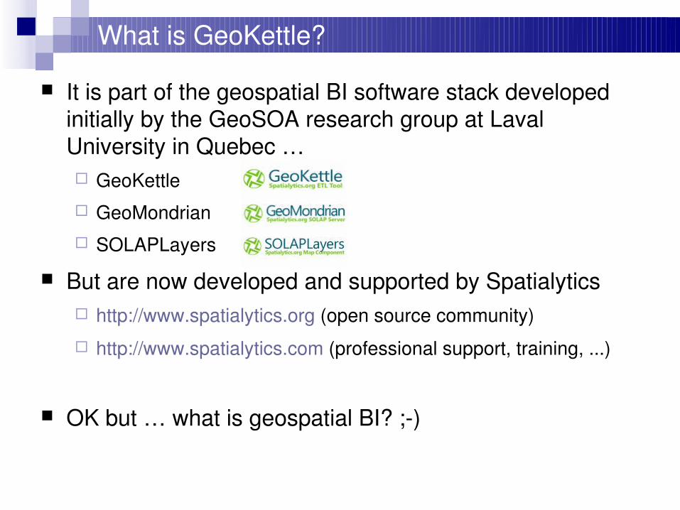
OK but … what is geospatial BI? ;)
As you probably know …
Business Intelligence applications are usually used to better understand historical, current and future aspectsof business operations in a company.
The applications typically offer ways to mine database and spreadsheetcentric data, and produce graphical, tablebased and other types of analytics regarding business operations.
They support the decision process and allow to take more informed decision!
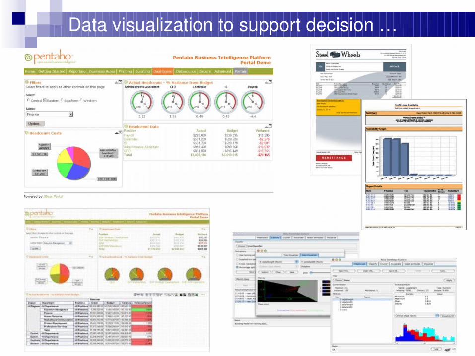
Data visualization to support decision …
As you probably know …
Business Intelligence applications are usually used to better understand historical, current and future aspectsof business operations in a company.
The applications typically offer ways to mine database and spreadsheetcentric data, and produce graphical, tablebased and other types of analytics regarding business operations.
They support the decision process and allow to take more informed decision!
Rely on an architecture with robust components and applications: ETL tools & data warehousing
Online Analytical Processing (OLAP) servers and clients
Reporting tools & dashboards
Data mining
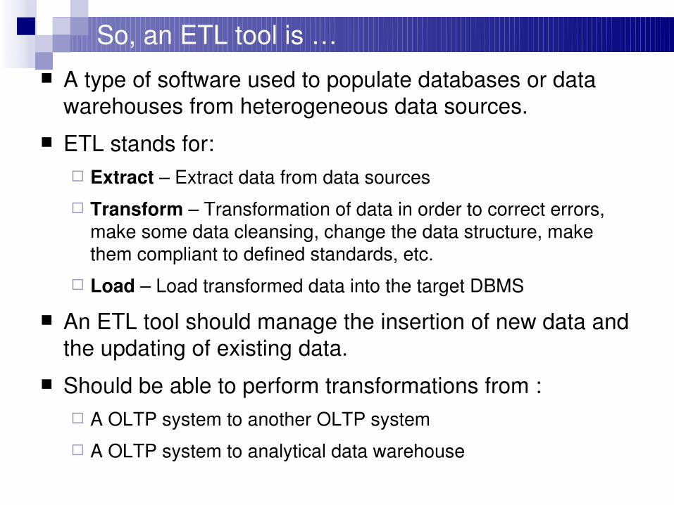
So, an ETL tool is … A type of software used to populate databases or data
warehouses from heterogeneous data sources.
ETL stands for: Extract – Extract data from data sources
Transform – Transformation of data in order to correct errors, make some data cleansing, change the data structure, make them compliant to defined standards, etc.
Load – Load transformed data into the target DBMS
An ETL tool should manage the insertion of new data and the updating of existing data.
Should be able to perform transformations from : A OLTP system to another OLTP system
A OLTP system to analytical data warehouse
Why use an ETL tool?
Automation of complex and repetitive data processing without producing any specific code
Conversion between various data formats Migration of data from a DBMS to another Data feeding into various DBMS Population of analytical data warehouses for
decision support purposes etc.
GeoKettle
GeoKettle is then a "spatiallyenabled" version of Pentaho Data Integration (Kettle)
Kettle is a metadatadriven ETL with direct execution of transformations No intermediate code generation!
Support of several DBMS and file formats DBMS support: MySQL, PostgreSQL, Oracle, DB2, MS SQL
Server, ... (total of 37)
Read/write support of various data file formats: text, Excel, Access, DBF, XML, ...
Numerous transformation steps Support of methods for the updating of DW
GeoKettle
GeoKettle provides a true and consistent integration of the spatial component All steps provided by Kettle are able to deal with geospatial data types
Some geospatial dedicated steps have been added
First release in May 2008: 2.5.220080531
Current stable version: 3.2.0r18820090706
Released under LGPL at http://www.geokettle.org
Used in different organisations and countries: Some ministries, bank, insurance, integrators, …
E.g. GeoETL from Inova is in fact GeoKettle! :)
A growing community of users and developers
GeoKettle
Transformations vs. Jobs: Running in parallel vs. running sequentially
All can be stored in a central repository (database) But each transformation or job could also be saved in a simple
XML file!
Offers different interfaces: Spoon: GUI for the edition of transformations and jobs
Pan: command line interface for running transformations
Kitchen: command line interface for running jobs
Carte: Web service for the remote execution of transformations and jobs
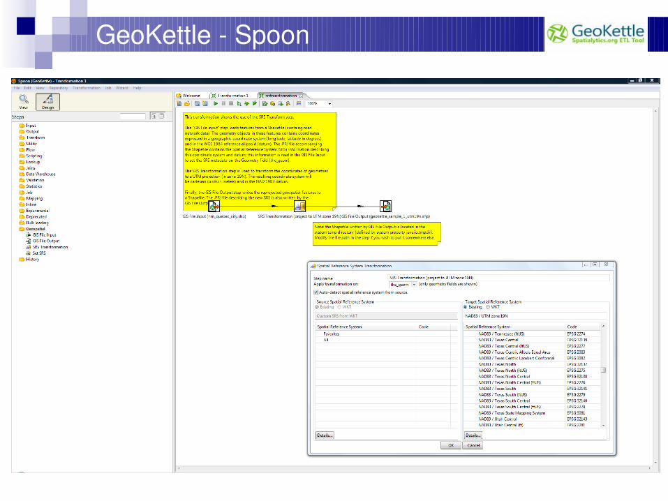
GeoKettle Spoon
GeoKettle
Provides support for: Handling geometry data types (based on JTS)
Accessing Geometry objects in JavaScript
It allows the definition of custom transformation steps by the user (“Modified JavaScript Value” step)
Topological predicates (Intersects, crosses, etc.)
SRS definition and transformations
Input / Output with some spatial DBMS Native support for Oracle, PostGIS and MySQL MS SQL Server 2008 and IBM DB2 can be used but it requires some
tricks
GIS file Input / Output: Shapefile, GML 3, KML 2.2 and OGR support (~33 vector data formats and DBMS)
GeoKettle
GeoKettle releases are aligned with the ones of Pentaho Data Integration (Kettle), GeoKettle then benefits all new features provided by PDI
(Kettle).
Kettle is natively designed to be deployed in cluster and web service environments. It makes GeoKettle a perfect software component to be
deployed as a service (SaaS) in cloud computing environments as those provided by Amazon EC2.
It enables then the scalable, distributed and on demand processing of large and complex volumes of geospatial data in minutes for critical applications and without requiring a company to invest in an expensive IT infrastructure of servers, networks and software.
GeoKettle – Requirements and install
Very simple installation procedure All you need is a Java Runtime Environment
Version 5 or higher
Just unzip the binary archive of GeoKettle ... And let’s go !
Run spoon.sh (UNIX/Linux/Mac) or spoon.bat (Windows)
Need help, please visit our wiki: http://wiki.spatialytics.org
GeoKettle
Demo
GeoKettle
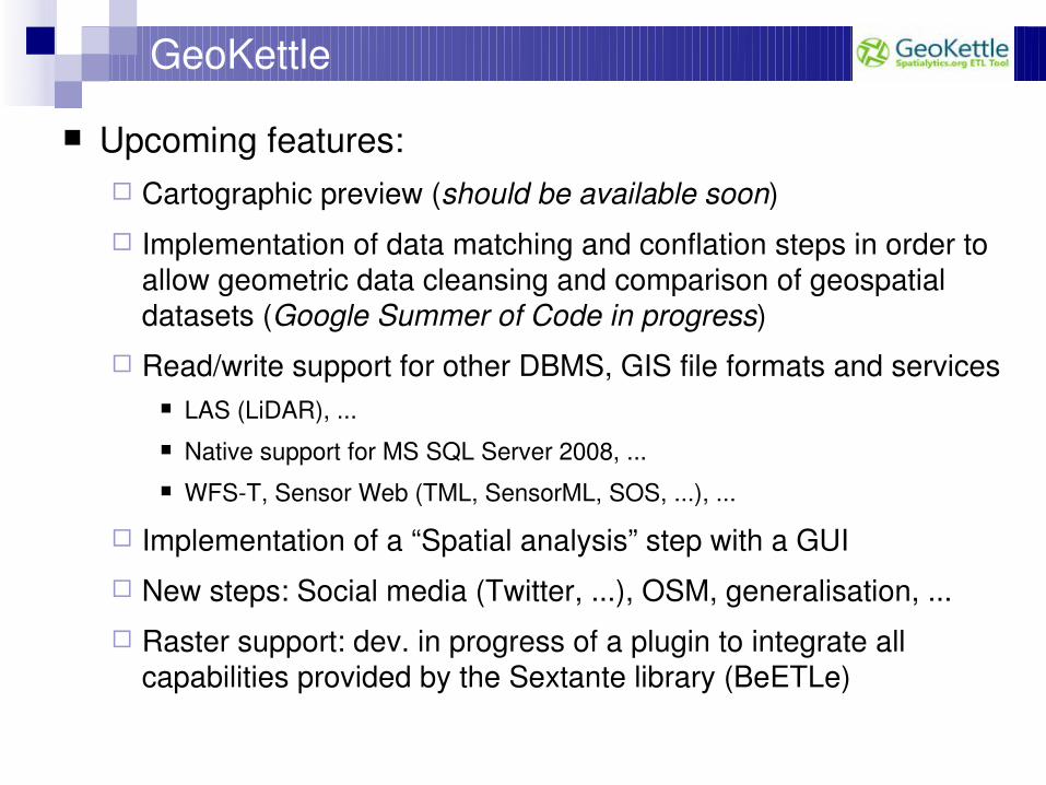
Upcoming features: Cartographic preview (should be available soon)
Implementation of data matching and conflation steps in order to allow geometric data cleansing and comparison of geospatial datasets (Google Summer of Code in progress)
Read/write support for other DBMS, GIS file formats and services LAS (LiDAR), ... Native support for MS SQL Server 2008, ... WFST, Sensor Web (TML, SensorML, SOS, ...), ...
Implementation of a “Spatial analysis” step with a GUI
New steps: Social media (Twitter, ...), OSM, generalisation, ...
Raster support: dev. in progress of a plugin to integrate all capabilities provided by the Sextante library (BeETLe)
Questions?
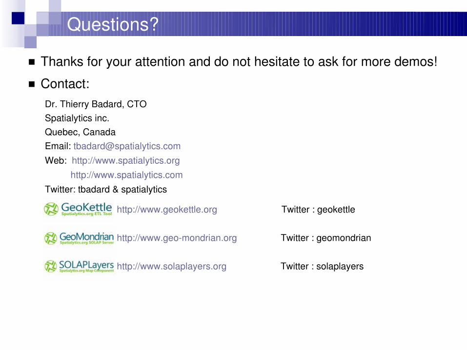
Thanks for your attention and do not hesitate to ask for more demos!
Contact:Dr. Thierry Badard, CTOSpatialytics inc.Quebec, CanadaEmail: [email protected]
Web: http://www.spatialytics.org http://www.spatialytics.com
Twitter: tbadard & spatialytics
http://www.geokettle.org Twitter : geokettle
http://www.geomondrian.org Twitter : geomondrian
http://www.solaplayers.org Twitter : solaplayers