USIBWC San Diego Field Office
Projects Overview
Steve Smullen, Area Operations Manager
March 17, 2016
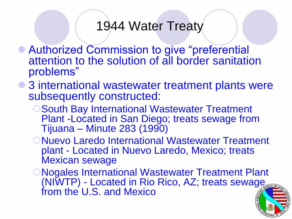
1944 Water Treaty
Authorized Commission to give “preferential attention to the solution of all border sanitation problems”
3 international wastewater treatment plants were subsequently constructed:South Bay International Wastewater Treatment
Plant -Located in San Diego; treats sewage from Tijuana – Minute 283 (1990)
Nuevo Laredo International Wastewater Treatment plant - Located in Nuevo Laredo, Mexico; treats Mexican sewage
Nogales International Wastewater Treatment Plant (NIWTP) - Located in Rio Rico, AZ; treats sewage from the U.S. and Mexico
Tijuana Sanitation
Minute No. 283 (1990)
To address flow of sewage into the U.S. via the
Tijuana River
Mexico to help fund a wastewater treatment
plant in San Diego in lieu of a planned plant in
Tijuana
Secondary treatment level in accordance with
more stringent U.S. standards
Construction of an ocean outfall by the U.S.
South Bay International Wastewater
Treatment Plant
Plant capacity of 25 mgd – advanced primary plant completed 1997
Secondary plant completed April 2011.
Mexico contributes to O & M, approx $1.8M/ year + all solids disposal. O&M cost share is based on treated flow.
Treated effluent discharged 3.5 miles offshore via South Bay Ocean Outfall
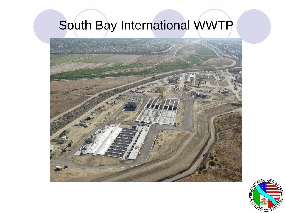
South Bay International WWTP

South Bay Ocean Outfall
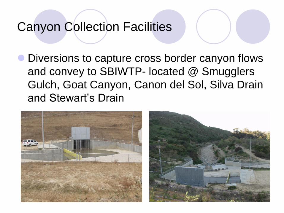
Canyon Collection Facilities
Diversions to capture cross border canyon flows
and convey to SBIWTP- located @ Smugglers
Gulch, Goat Canyon, Canon del Sol, Silva Drain
and Stewart’s Drain
Water Quality
Effluent quality has been consistent since 2012.
SBIWTP and SBOO subject to NPDES Permit issued by CA Regional Water Quality Control Board.
Ocean monitoring compliance done by City of San Diego for IBWC.
Additional secondary clarifiers and a flow equalization basin are planned to accommodate greater peak flows and prevent solids washout.
Contract has been awarded and construction will begin in April or May 2016
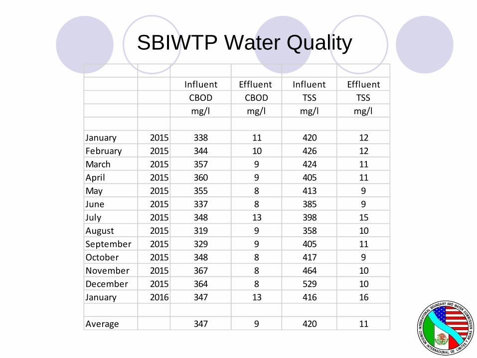
SBIWTP Water Quality
Influent Effluent Influent Effluent
CBOD CBOD TSS TSS
mg/l mg/l mg/l mg/l
January 2015 338 11 420 12
February 2015 344 10 426 12
March 2015 357 9 424 11
April 2015 360 9 405 11
May 2015 355 8 413 9
June 2015 337 8 385 9
July 2015 348 13 398 15
August 2015 319 9 358 10
September 2015 329 9 405 11
October 2015 348 8 417 9
November 2015 367 8 464 10
December 2015 364 8 529 10
January 2016 347 13 416 16
Average 347 9 420 11

Border Wastewater Infrastructure
• IBWC, CESPT (Tijuana Utility)
• Diversions - Pump Station CILA (CESPT),
Canyon Collection Facilities (IBWC)
• Four WWTPs
• SBIWTP (25 mgd) - IBWC, Arturo Herrera (10
mgd) -CESPT, La Morita (6 mgd)-CESPT, San
Antonio de los Buenos (25 mgd) -CESPT
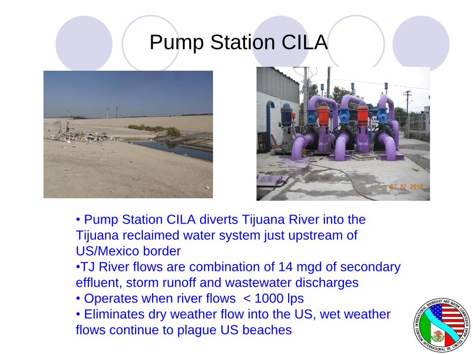
Pump Station CILA
• Pump Station CILA diverts Tijuana River into the
Tijuana reclaimed water system just upstream of
US/Mexico border
•TJ River flows are combination of 14 mgd of secondary
effluent, storm runoff and wastewater discharges
• Operates when river flows < 1000 lps
• Eliminates dry weather flow into the US, wet weather
flows continue to plague US beaches
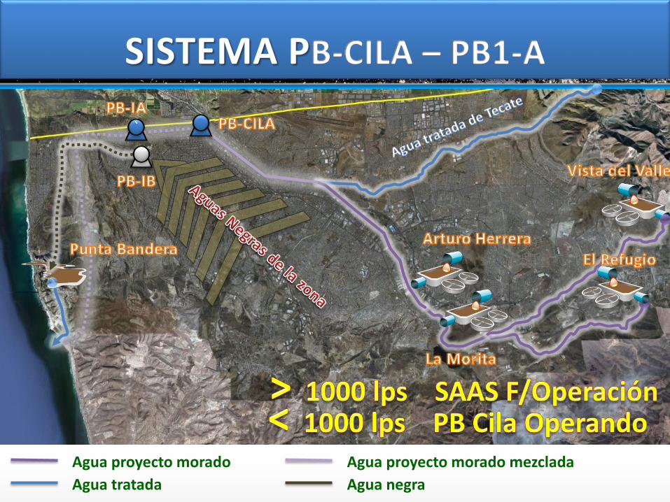
Sistema actual de Alejamiento de Aguas Superficiales
`
Agua proyecto morado
Agua tratada
Agua proyecto morado mezclada
Agua negra
`
Tijuana River Watershed
1,725 square miles, 2/3 in Mexico
River flows north into ocean at Imperial Beach
Morena and Barrett Dams in the U.S. operated
by City of San Diego for water conservation
Carrizo and Rodriguez Dams in Mexico
operated by National Water Commission for
water conservation and flood control
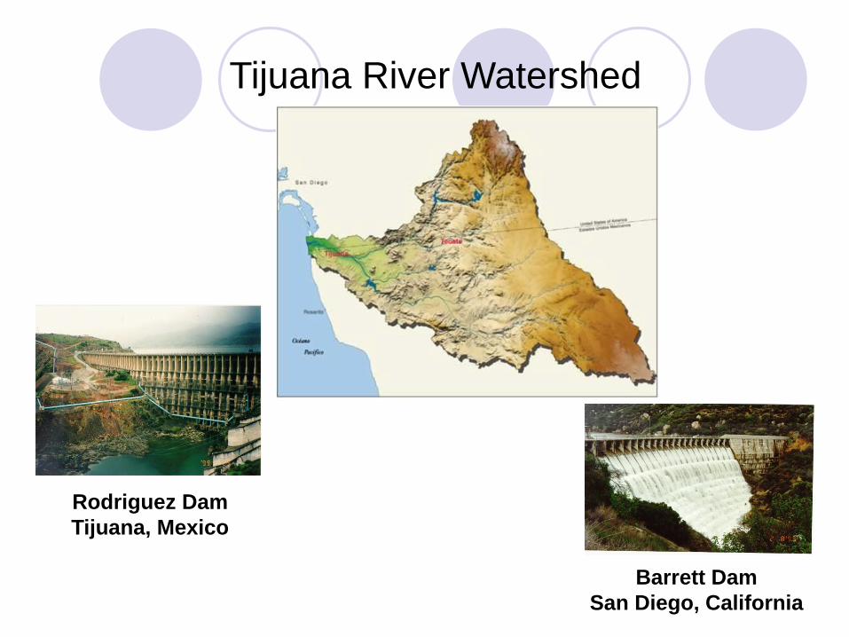
Tijuana River Watershed
Barrett Dam
San Diego, California
Rodriguez Dam
Tijuana, Mexico
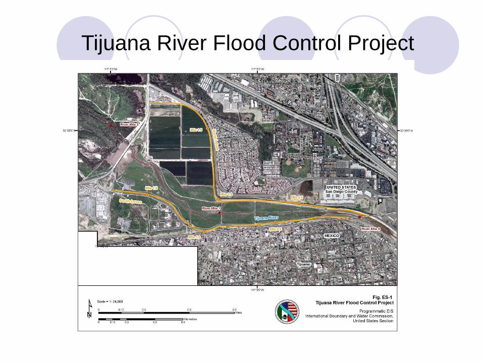
Tijuana River Flood Control Project
Tijuana River Flood Control Project
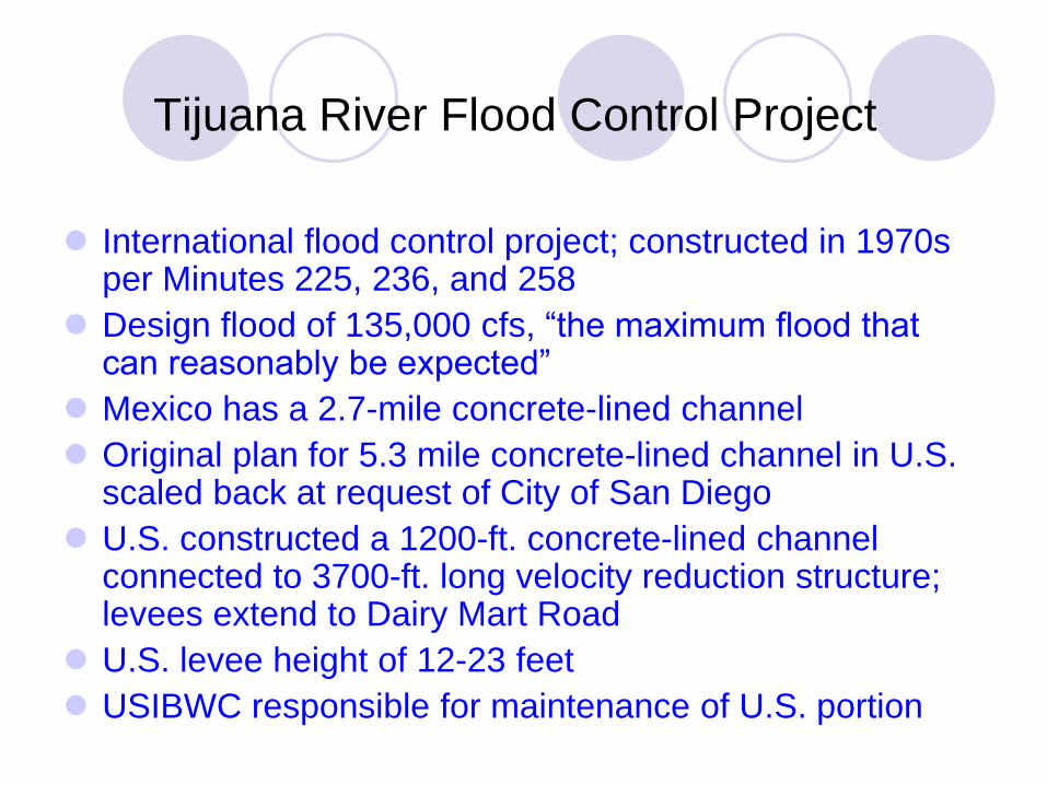
International flood control project; constructed in 1970s per Minutes 225, 236, and 258
Design flood of 135,000 cfs, “the maximum flood that can reasonably be expected”
Mexico has a 2.7-mile concrete-lined channel
Original plan for 5.3 mile concrete-lined channel in U.S. scaled back at request of City of San Diego
U.S. constructed a 1200-ft. concrete-lined channel connected to 3700-ft. long velocity reduction structure; levees extend to Dairy Mart Road
U.S. levee height of 12-23 feet
USIBWC responsible for maintenance of U.S. portion

Tijuana River
Flood Control Project
Channel at international
boundary During Dec. 2008 storm.
Flooding occurred
downstream from IBWC
project.
Tijuana River Valley Recovery Team
Group of 30 member agencies led by RWQCB
Ultimate goal is to implement TMDLs for trash and sediment control in the Tijuana River.
Recovery Strategy (2011): a) Partner with Mexico
b) Understand how water, sediment and trash flow
c) Reduce trash and sediment at source
d) Implement sediment and trash capture devices
e) Fund ongoing and future O&M
f) Involve and inform communities on both sides
g) Protect and enhance natural resources
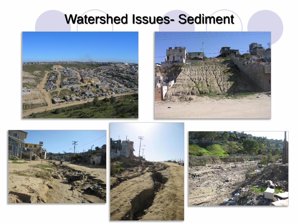
Watershed Issues- Sediment
Solid Waste and Sediment Removal – U.S. Side
Goat Canyon Sediment Basins – CA State Parks –approx. 50,000 CY annually
Main Channel and Lower Smugglers Gulch – City of San Diego
Upper Smugglers Gulch – County of San Diego
Tijuana River Flood Control Project – USIBWC
Solid Waste and Tire Removal - Wildcoast, Surfrider, County and City of San Diego

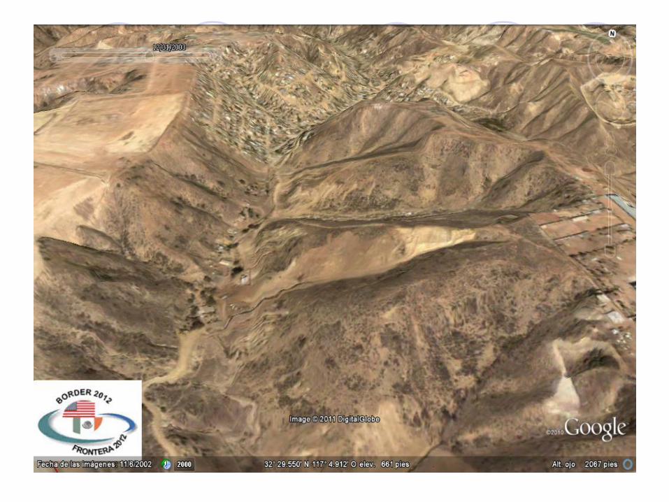
Sediment Basin Construction
Los Laureles Canyon - Mexico
Expansion of Tanque Azteca Sediment
Basins
In Los Laureles Canyon, Nov, 2013
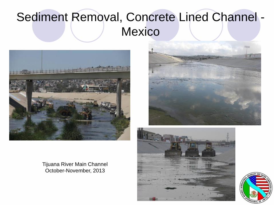
Sediment Removal, Concrete Lined Channel -
Mexico
Tijuana River Main Channel
October-November, 2013

Watershed Issues- Trash
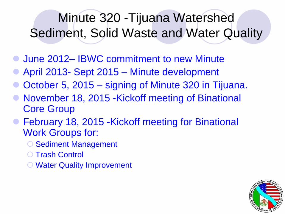
Minute 320 -Tijuana Watershed
Sediment, Solid Waste and Water Quality
June 2012– IBWC commitment to new Minute
April 2013- Sept 2015 – Minute development
October 5, 2015 – signing of Minute 320 in Tijuana.
November 18, 2015 -Kickoff meeting of Binational Core Group
February 18, 2015 -Kickoff meeting for Binational Work Groups for: Sediment Management
Trash Control
Water Quality Improvement
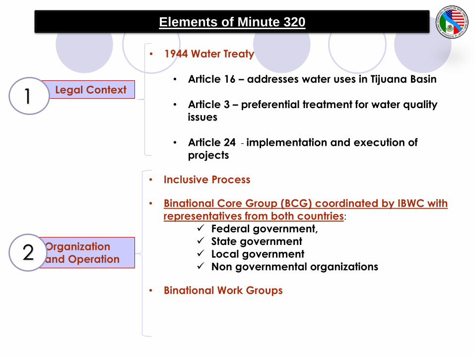
• 1944 Water Treaty
• Article 16 – addresses water uses in Tijuana Basin
• Article 3 – preferential treatment for water qualityissues
• Article 24 - implementation and execution of
projects
• Inclusive Process
• Binational Core Group (BCG) coordinated by IBWC with
representatives from both countries:
Federal government,
State government
Local government
Non governmental organizations
• Binational Work Groups
Elements of Minute 320
• Legal Context
• Organizationand Operation
1
2
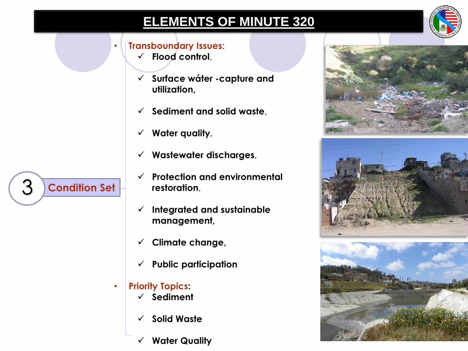
ELEMENTS OF MINUTE 320
Condition Set
• Transboundary Issues:
Flood control,
Surface wáter -capture and utilization,
Sediment and solid waste,
Water quality,
Wastewater discharges,
Protection and environmentalrestoration,
Integrated and sustainable
management,
Climate change,
Public participation
• Priority Topics:
Sediment
Solid Waste
Water Quality
3

1. Cooperative measures.
2. Participants and responsible institutions.
3. Studies, investigations, inventories, maps, models.
4. Short and long term priorities.
5. Operations and maintenance.
6. Implementation process.
7. Costs, funding sources and cost distribution
8. Community information.
9. Monitoring programs.
• BCG Activities
ELEMENTS OF MINUTE 320. BINATIONAL CORE
GROUP(BCG)
4

Minute 320
BWG Feb 18 Meeting – Table of Ideas In general, share data/information on all topics
For water quality Joint Monitoring Programs for coastal waters – Playas and IB
Operation and maintenance of PB CILA
Control of runoff in the Tijuana River
Integral water reuse program
Sediment Source identification & control
Control of construction and land development practices
Binational program for removal of sediment from river
Study on lands available for sediment disposal
Solid Waste Surveillance and inspection program
Better solid waste removal from canyons, streams
Environmental education
Integral solid waste program -Tecate and Tijuana
Proper disposal of tires

Port of Entry Boundary Line Delineation
Completed Tecate and Otay Mesa in August 2012
Minute 302 identifies responsibilities for each Section
Trial at southbound lane using thermoplastic – solid line with “Mexico/USA” lettering on each side
Fabricated bronze buttons with US /Mexico raised letters.
Long term solution is to more permanent solution such as concrete (colored) strip with recessed lettering
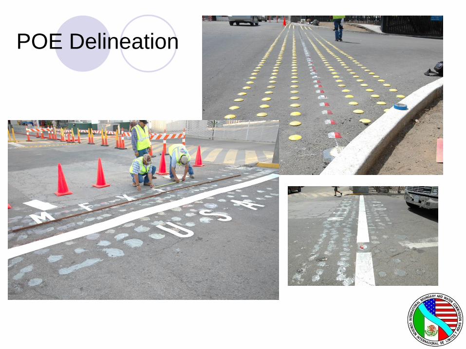
POE Delineation
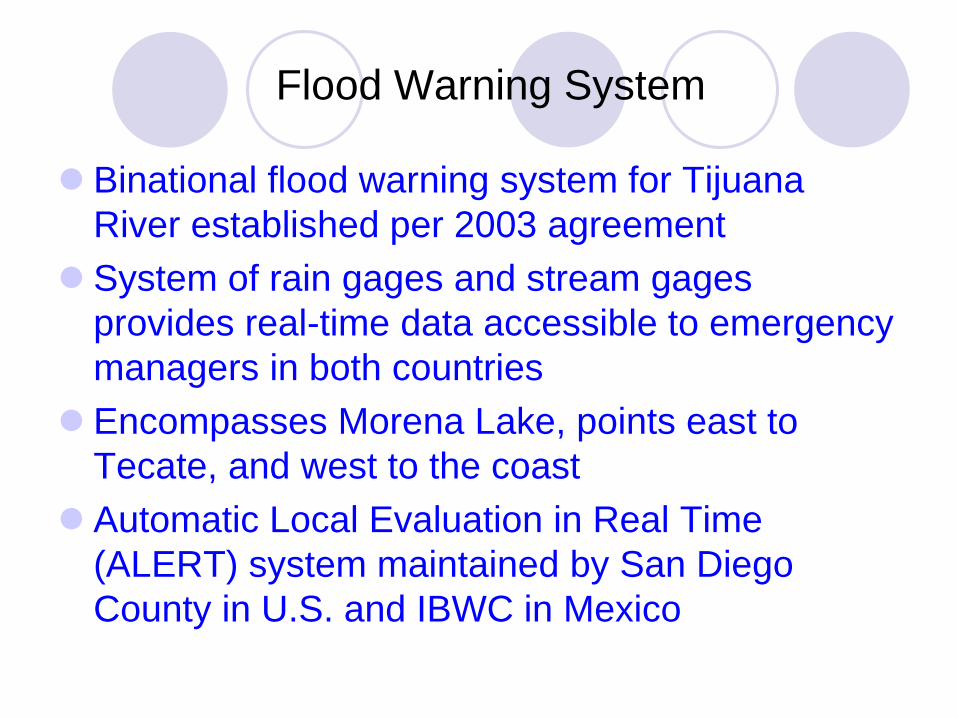
Flood Warning System
Binational flood warning system for Tijuana
River established per 2003 agreement
System of rain gages and stream gages
provides real-time data accessible to emergency
managers in both countries
Encompasses Morena Lake, points east to
Tecate, and west to the coast
Automatic Local Evaluation in Real Time
(ALERT) system maintained by San Diego
County in U.S. and IBWC in Mexico
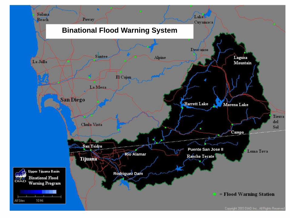
Binational Flood Warning System
Rio Alamar
Puente San Jose II
Rodriguez Dam

Rain and Stream Gages Locations in
United States and Mexico
Raingages: Campo, Loma Tova, Rancho
Tecate, Marron Valley, Potrero County Park,
Puente San Jose II, Rio Alamar at Toll
Bridge, Rodriguez Dam
Streamgages: Campo Creek, Cottonwood
Creek, Marron Valley, Puente San Jose II,
Tijuana River at US/Mexico border, Rio
Alamar, Rodriguez Dam
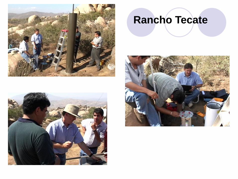
Rancho Tecate

Puente San Jose II
(Tecate)

Rodriguez Dam

INTERNATIONAL BOUNDARY AND WATER COMMISSION,
UNITED STATES AND MEXICO
UNITED STATES SECTION
www.ibwc.gov
(619) 662-7600
Recommended