2015.02.20 1
Tunnelling and Underground
Construction Technology
Akos TOTH

2015.02.20 2
Lecturers: Dr. Akos TOTHDr. Tibor HORVATHDr. Gyula GRESCHIK
Project AssistantsDr. Akos WOLF
Objectives:
To acquire in-depth knowledge of underground space and underground construction technologies, including planning, construction methods, safety, and environmental considerations.Exam: Oral Presentation
Course Information

2015.02.20 3
Akos TOTH
2014 – DB ProjektBau2013 – self employed2010 – EPFL LMR PhD2006 – Bamco2000 – BUTE, civil eng.
Email:[email protected]
Skype: akos084
Course Information

2015.02.20 4
Literature:
- Széchy Károly - The Art of Tunnelling- Hoek, Brown - Underground Excavations in Rock - Hoek's corner -
https://www.rocscience.com/education/hoeks_corner- Bruland - Hard Rock Tunnel Boring- Maidl, Thewes - Handbook of Tunnel Engineering
Parts I and II- Grundbau-Taschenbuch, 7.Auflage,
Teil 1 Geotechnische Grundlagen- Betonkalender 2014, including Eurocode 7
Course Information
2015.02.20 5
Tunnelling and Underground
Construction Technology
Course Lectures
Part 1 – Introduction, Planning and Geological
Investigation

2015.02.20 6
Introduction
Global Demand of Space
Above Ground and Underground Space
Types of Underground Space
Prospects of Underground Construction

2015.02.20 7
Global Demand of Space
Space Demanded by Global Population Growth and Urbanisation
Spaces are demanded for living, leisure, infrastructures, transport, storage, and other functions.
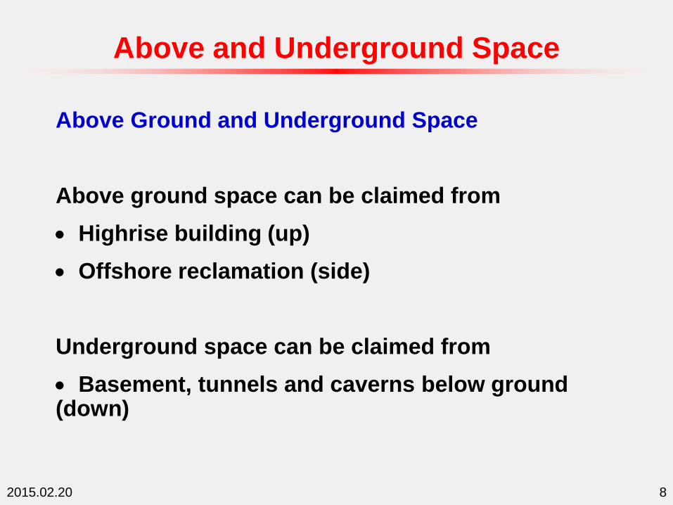
2015.02.20 8
Above and Underground Space
Above Ground and Underground Space
Above ground space can be claimed from
Highrise building (up)
Offshore reclamation (side)
Underground space can be claimed from
Basement, tunnels and caverns below ground (down)

2015.02.20 9
Types of Underground Space
Types of Underground Space
Underground space can be in the forms of:
Transportation (metro, road, rail, passage)
Distribution (power, water, sewage)
Storage (water, goods, energy, car parks)
Recreation and commercial (sport, zoos, shopping)
Education (library, test gallery)
Industry (factory and workshop, office)
Defence (control centre, military installation)
And many others

2015.02.20 10

2015.02.20 11
Prospects
European Vision of Underground Construction in 2030
“Free above ground space for the use of the citizens, taking infrastructures underground.”
“Underground construction will be safe and with no impact on the environment.”
--European Construction Technology Platform, 2006

2015.02.20 12
Prospects
Tunnelling Activities in Europe by 2030:
2100 km new tunnel,
Over 500 tunnels to be refurbished,
Tunnelling a major European industry, involving 450,000 people.

2015.02.20 13
Prospects
Laboratoire de Mécanique des Roches − LMR
TB
MT
BM
Length
Volume
D&
BD
&B
Tunnelling in
Switzerland

2015.02.20 14
Prospects
European Vision of Underground Construction 2030Break-through:
2010 – Self learning equipment (equipment making automatic modification during construction);
Cost efficient large diameter tunnels;
Intelligent lining system (automatic modification of lining with ground condition).
2020 – Breakthrough in rock cutting technology (e.g., laser cutting);
Complete knowledge of geological conditions (transparent ground);
Universal tunnel boring machine.
2015.02.20 15
Prospects
European Vision of Underground Construction 2030Break-through:
2030 – No environmental impact (complete waste reuse and no air and water pollution);
Complete knowledge of underground facilities behaviour;
Similar cost for underground and above ground infrastructures;
No workers inside tunnel during construction (totally automated remotely controlled tunnel construction work).

2015.02.20 16
Prospects
Environmental integration during underground construction.
Architecture and environment in underground space utilisation.
Underground Science Park, Singapore
Safety and Environment

2015.02.20 17
Underground Construction
Technology
Course Lectures
Part 1 – Introduction, Planning and Geological
Investigation

2015.02.20 18
Underground Space Planning
Underground Space Planning Considerations
Integrated Geo-Planning Process
Above Ground and Underground Space Integration
Master Planning and Application of GIS

2015.02.20 19
Planning Considerations
Underground Space Planning Considerations
Underground space planning involves social, economic, environmental and engineering procedures. Engineering planning will have to consider and balance engineering feasibility, geologic and ground conditions, environmental constrains, economic viability, social and political needs.

2015.02.20 20
Underground Space Planning Procedures
Typically, planning process involves stepwise screening:
Step 1. Screening to eliminate areas/routes where regulatory or legal constrains prohibit tunnel and underground space development.
Step 2. Screening to remaining areas/routes to select suitable locations for a particular tunnel and underground space applications.
Planning Considerations
2015.02.20 21
Step 3. Screening to select locations/routes with suitable hydrogeologic features with consideration of tunnel and underground space application.
Step 4. Screening of geomechanical and engineering properties of the subsurface ground to match design criteria to site the tunnel.
Planning Considerations

2015.02.20 22
Planning procedure should be coordinated, ideally, to be incorporated with the overall national/city planning. A typical planning procedure involves several parties, for example, for underground infrastructure development,
(i) Planning studies and procedures co-ordinated by the developing agency (e.g., city transport authority), with engagement of the city planning authority.
(ii) Site identification, feasibility study, project plan and development proposal by developer to the developing agency.
Planning Considerations

2015.02.20 23
(iii) Feasibility study, project proposal and design examined by the city engineering office and city planning authority, and other relevant authorities, such as environment office.
(iv) On approval co-ordinated by the city engineering office and city planning authority, implementation of the project.
(v) At completion, appraisal and approval by city engineering office for operation licence.
Planning Considerations
2015.02.20 24
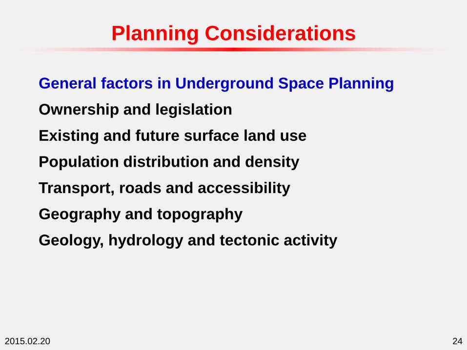
General factors in Underground Space Planning
Ownership and legislation
Existing and future surface land use
Population distribution and density
Transport, roads and accessibility
Geography and topography
Geology, hydrology and tectonic activity
Planning Considerations
2015.02.20 25
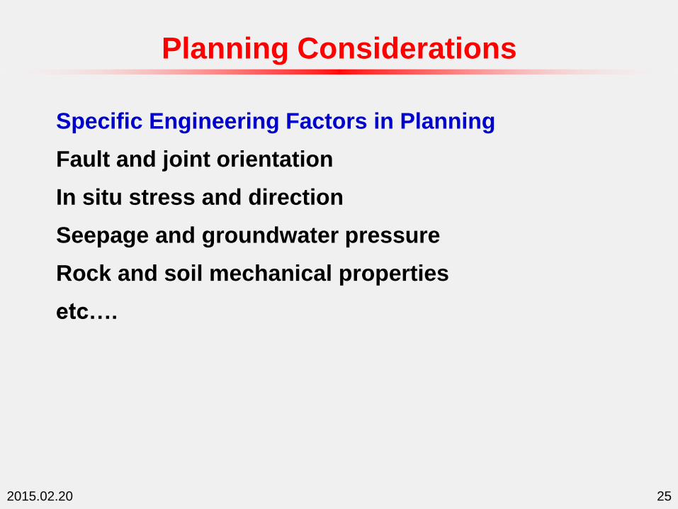
Specific Engineering Factors in Planning
Fault and joint orientation
In situ stress and direction
Seepage and groundwater pressure
Rock and soil mechanical properties
etc….
Planning Considerations

2015.02.20 26
Requirements for Specific Underground Facilities
Planning Considerations
Tunnel Type Specific Geological Information Required
Highway tunnels Generally large-size tunnels; clear span width affects general
behaviour.
Usual flexibility in alignment and grade. Investigation should
support optimisation of tunnel location, length, grade, etc. Portals
usually need special exploration to determine most economical
location to place portal.
Rail tunnels Less flexible in choice of horizontal and vertical alignment; may not
be able to easily avoid adverse geological features or difficult portal
locations by moving alignment. Need to explore for all potential
adverse features.
Rapid transit
tunnels
Need data to design protection of adjacent features and to estimate
potential settlement and groundwater inflow.
Need to investigate one or more corridors as easily in program as
possible to avoid expensive adverse geologic and/or environmental
conditions.
Can benefit strongly from phased exploration approach.

2015.02.20 27
Integrated Geo-Planning Process
Geology and Planning Process
Subsurface geology is a major factor in underground space planning. It influences site/route, size and shape, excavation and support method of a specific underground space project.

2015.02.20 28
Integrated Geo-Planning Process
Geology Exploration at Planning Stage
At this stage, geological exploration is to aid the decision of whether the tunnel is feasible or better choice, and the alignment of the tunnel.
The above the decision is not just rely on geology, but also many other social, economic and environmental factors, including, e.g., integration with surface development. Geological factor is to ascertain the decision and to assist the definition of the alignment.

2015.02.20 29
Integrated Geo-Planning Process
Geology Exploration at Planning Stage
A thorough literature review, collection of all the existing geological information from all the possible sources is a must. Previous works would have left with lots of geological information of the ground. Some justification and reinterpretation may be needed. Review should include the following:• Geological or geotechnical map of the area• Topographic map of the area• Surface plan, existing structures• Plan of existing subsurface structures• Geological and geotechnical information of the subsurface materials

2015.02.20 30
Integrated Geo-Planning Process
Geology Exploration at Planning Stage
In areas where uncertainty exists, exploration should be carried out:• Geophysical exploration, mainly seismic, radar or gravity• Exploratory drilling and sampling• Simple laboratory testing
With the aid of exploration, an approximate ground profile can be prepared to indicate the ground condition at along tunnel alignment and at tunnel elevation. Tunnel alignment and elevation may be modified if he ground conditions are not favourable.

2015.02.20 31
Integrated Geo-Planning Process
Interactive Geo-Planning Process
Engineering planning is a continuous process incorporating revealed geological information. Each project has its own primarily considerations in relation to geology.
With revealed geological information from exploration, planning will be constantly examined to achieve the most technically feasible and economically viable solution.

2015.02.20 32
Integrated Geo-Planning Process
Geo-Planning for Long Deep Mountain Tunnels
Institutional Planning
Positions of end points A and B: They are more or less fixed to make the connections (horizontal and vertical positions).
Usage and volume: High speed rail and expected train volume, dimension can be determined.
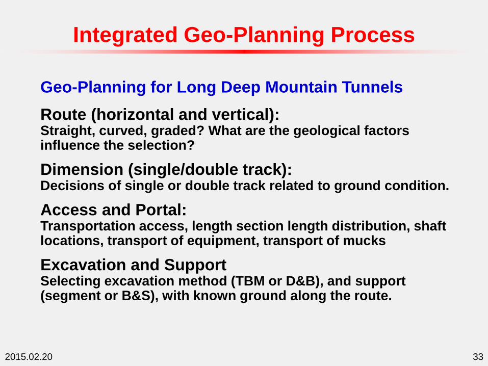
2015.02.20 33
Integrated Geo-Planning Process
Geo-Planning for Long Deep Mountain Tunnels
Route (horizontal and vertical):Straight, curved, graded? What are the geological factors influence the selection?
Dimension (single/double track):Decisions of single or double track related to ground condition.
Access and Portal:Transportation access, length section length distribution, shaft locations, transport of equipment, transport of mucks
Excavation and SupportSelecting excavation method (TBM or D&B), and support (segment or B&S), with known ground along the route.
2015.02.20 34
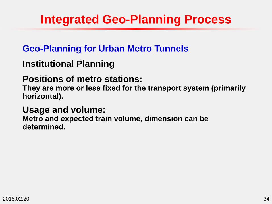
Integrated Geo-Planning Process
Geo-Planning for Urban Metro Tunnels
Institutional Planning
Positions of metro stations: They are more or less fixed for the transport system (primarily horizontal).
Usage and volume: Metro and expected train volume, dimension can be determined.

2015.02.20 35
Integrated Geo-Planning Process
Geo-Planning for Urban Metro Tunnels
Route (horizontal and vertical):Limited flexibility horizontally. Usually curved and graded. Are geological factors influence the selection?
Dimension (single/double track):Decisions of single or double track related to ground condition.
Access and Portal:Transportation access, shaft locations, transport of equipment, transport of mucks.
Excavation and SupportSelecting excavation method (TBM or conventional), and support (segment), with known ground condition along the route.

2015.02.20 36
Integrated Geo-Planning Process
Geo-Planning for Oil and Gas Storage Caverns
Institutional Planning
General locations: General location is planning for logistical reasons.
Usage and volume: Total volume fixed, but not cavern dimensions.

2015.02.20 37
Integrated Geo-Planning Process
Geo-Planning for Oil and Gas Storage Caverns
Location and Siting:Specific locations, mostly governed by geology.
Geometrical configuration:Orientation, dimension, depth and separation. governed by ground conditions.
Access and Portal:Transportation access, shaft locations, transport of equipment, transport of mucks.
Excavation and SupportSelecting excavation method (D&B, sequence), and support (B&S), with known ground condition at site.

2015.02.20 38
Above and Underground Integration
Influence of Above Ground on Underground Space Development
Surface access to UG space
Existing AG structures restrict UG development
UG restricts future AG development
Connectivity of AG and UG facilities

2015.02.20 39
Above and Underground Integration
Integrating Above and Underground Facilities
UG basement car parks with AG offices and shops
UG metro station with AG commercial centres
Combined AG and UG museums and libraries
UG links for shopping districts
UG oil storage with AG refinery factory
….

2015.02.20 40
Master Planning and Application of GIS
Master Plan of Urban Underground Space
Master planning is particularly important for urban development due the limited land area. Master planning will optimise the use of space, both above and under ground, and also optimise the integration with urban feature and environment.

2015.02.20 41
Geographic Information System (GIS)
A geographic information system (GIS) combines layers of information about a place to give you a better understanding of that place. What layers of information you combine depends on your purpose – finding the best location for a new store, analyzing environmental damage, viewing similar crimes in a city to detect a pattern, and so on. (from GIS.com web site).
GIS layers can also extended to subsurface, and therefore gives the possibility using GIS for underground space planning.
Master Planning and Application of GIS

2015.02.20 42
Use of GIS for Underground Space Master Planning
Master Planning and Application of GIS

2015.02.20 43
Use of GIS for Tunnel Route Selection
With data input from geological exploration (boreholes and geophysical surveys) , GIS is able to interpret the geological features in 3D. GIS can give various cross section (vertical and horizontal) profiles for tunnel alignment plan.
Hazard mapping is also possible with GIS, so the alignment can be selected in consideration of environment and hazards.
Master Planning and Application of GIS

2015.02.20 44
Underground Construction
Technology
Course Lectures
Part 1 – Introduction, Planning and Geological
Investigation

2015.02.20 45
Geological Exploration
Need of Geological Exploration
Geological Information for Tunnelling
Geological Exploration Methods
Geological Sections and Profiles
Investigation Techniques for Mountain Tunnels

2015.02.20 46
Input from geological exploration in tunnelling (I):
• Developing sufficient understanding of regional geology and hydrogeology for project design and construction;
• Defining the physical characteristics of the materials that will govern the behaviour of the tunnel;
• Helping define the feasibility of the project and alerting the engineer and contractor to conditions that may arise during construction for the preparation of contingency plans;
Need of Geological Exploration

2015.02.20 47
Input from geological exploration in tunnelling (II):
• Providing data for selecting alternative excavation and support methods and, where project status permits, determining the most economical alignment and depth;
• Providing specific rock, soil, and hydrogeologic design parameters;
• Minimising uncertainties of physical conditions for the bidder;
• Improving the safety of the work;
Need of Geological Exploration

2015.02.20 48
Input from geological exploration in tunnelling (III):
• Predicting how the ground and groundwater will behave when excavated and supported by various methods;
• Establishing a definitive design condition (geotechnical basis for the bid) so a "changed condition" can be fairly determined and administered during construction;
• Providing specific data needed to support the preparation of cost, productivity, and schedule estimates for design decisions, and for cost estimates by the owner and bidders.
Need of Geological Exploration
2015.02.20 49
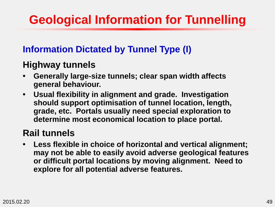
Information Dictated by Tunnel Type (I)
Highway tunnels
• Generally large-size tunnels; clear span width affects general behaviour.
• Usual flexibility in alignment and grade. Investigation should support optimisation of tunnel location, length, grade, etc. Portals usually need special exploration to determine most economical location to place portal.
Rail tunnels
• Less flexible in choice of horizontal and vertical alignment; may not be able to easily avoid adverse geological features or difficult portal locations by moving alignment. Need to explore for all potential adverse features.
Geological Information for Tunnelling

2015.02.20 50
Information Dictated by Tunnel Type (II)
Rapid transit tunnels
• Need data to design protection of adjacent features and to estimate potential settlement and groundwater inflow.
• Need to investigate one or more corridors as easily in program as possible to avoid expensive adverse geologic and/or environmental conditions.
• Can benefit strongly from phased exploration approach.
Geological Information for Tunnelling
2015.02.20 51
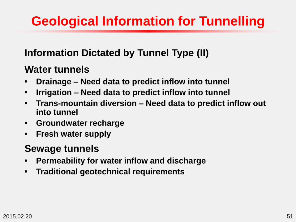
Information Dictated by Tunnel Type (II)
Water tunnels
• Drainage – Need data to predict inflow into tunnel
• Irrigation – Need data to predict inflow into tunnel
• Trans-mountain diversion – Need data to predict inflow out into tunnel
• Groundwater recharge
• Fresh water supply
Sewage tunnels
• Permeability for water inflow and discharge
• Traditional geotechnical requirements
Geological Information for Tunnelling

2015.02.20 52
Geological Exploration Methods
Principle Elements of Investigation (I)
Investigation has generally the following methods:
(a) Literature review – review all the existing information, including maps and photographs.
(b) Reconnaissance – general appreciation and surface mapping.
(c) Geophysical survey – fast and low cost subsurface exploration, commonly used methods include seismic refraction, seismic reflection, electrical resistivity, eletromagnetic, and radar.
2015.02.20 53
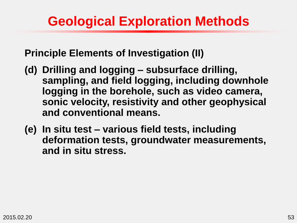
Principle Elements of Investigation (II)
(d) Drilling and logging – subsurface drilling, sampling, and field logging, including downhole logging in the borehole, such as video camera, sonic velocity, resistivity and other geophysical and conventional means.
(e) In situ test – various field tests, including deformation tests, groundwater measurements, and in situ stress.
Geological Exploration Methods

2015.02.20 54
Principle Elements of Investigation (III)
(f) Laboratory test – tests of soil/rock samples, such as strength, deformation modulus, consolidation, swelling, durability, creep, hardness and abrasive properties;
(g) Model test – small to full scale physical model for detailed features;
(h) Tunnel monitoring – monitoring deformation, stress and groundwater during and after construction.
Detail list in Table 2.2.1a.
Geological Exploration Methods

2015.02.20 55
Methods and Techniques of Geological Exploration:
Literature Review and Photographic Studies
Field Reconnaissance and Recognition
Geophysical Exploration
Borehole Drilling, Sampling and Logging
Downhole and In Situ Testing
Laboratory Testing
Trial Excavation
Construction Monitoring
Geological Exploration Methods
2015.02.20 56
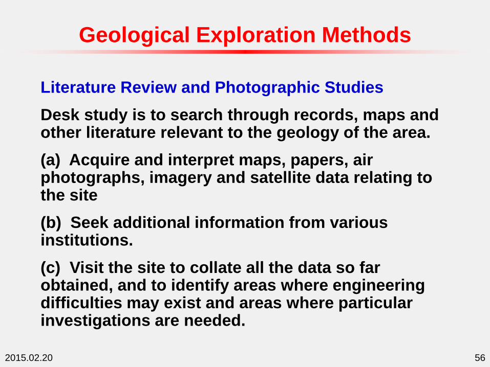
Literature Review and Photographic Studies
Desk study is to search through records, maps and other literature relevant to the geology of the area.
(a) Acquire and interpret maps, papers, air photographs, imagery and satellite data relating to the site
(b) Seek additional information from various institutions.
(c) Visit the site to collate all the data so far obtained, and to identify areas where engineering difficulties may exist and areas where particular investigations are needed.
Geological Exploration Methods

2015.02.20 57
(d) Compile a report recording the geological and geotechnical data.
The proposed engineering works at the site should be considered, to ensure investigation suiting both the geology and the engineering.
Aerial photographs provides useful information on the larger scale geological features such as faults, bedding planes and continuous joint sets. The photographs will give information on position, length and continuity of these features. Structural mapping can be performed from the photographs.
Geological Exploration Methods

2015.02.20 58
Field Reconnaissance and Recognition
Field reconnaissance commences with a preliminary survey to confirm the basic geology of the region and the site, and geological mapping of structures and material types, as well as some simple tests may be undertaken.
Geological mapping of surface outcrops usually furnishes the fundamental information on site conditions, and is often the basis for many subsequent engineering decisions such as relocation of the structure, or the need for rock reinforcement, as well as the type of structure that will be built.
Geological Exploration Methods

2015.02.20 59
Field Investigation – Geophysical Exploration
Seismic
refraction
Measures velocities of
induced seismic wave
travelling in soil and
bedrocks.
For all rock types, land or
water. Determine stratum
depths and characteristic
velocities,
Seismic
reflection
Measures average velocity
of seismic wave travelling
between the surface and a
reflecting surface, to
calculate depths to
lithological changes.
Primarily sedimentary
rocks and offshore.
Measures depth and
continuity of rock layers.
Indicates discontinuities
and stratigraphic
conditions.
Electrical
resistivity
Measures relative electrical
resistivities of rocks
Locates ore bodies,
aquifers, gravel deposits,
and bedrock profiles.
Geological Exploration Methods

2015.02.20 60
Electro-
magnetic
Measures amplitude and
phase angle of
electromagnetic field. Point
coverage
Mainly used for aquifer
location.
Magneto-
meter
Measures total magnetic
intensities in gammas.
Point coverage, measures
field intensity
Discloses presence of
local metallic bodies.
Detects faults and igneous
intrusion.
Graviti-
meter
Measures total density of
rocks. Coverage is
spherical around point
Measures lateral change
of rock types. Locates
cavities, faults, domes,
intrusions.
Radar
probing
profiling
Measures electromagnetic
wave VHF energy
Provides subsurface
profile. Used to locate
buried pipe, bedrock,
boulders.
Geological Exploration Methods
2015.02.20 61
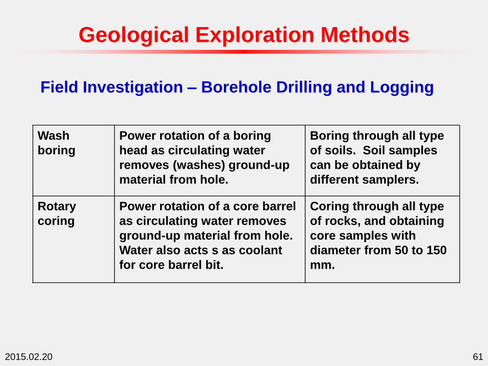
Field Investigation – Borehole Drilling and Logging
Wash
boring
Power rotation of a boring
head as circulating water
removes (washes) ground-up
material from hole.
Boring through all type
of soils. Soil samples
can be obtained by
different samplers.
Rotary
coring
Power rotation of a core barrel
as circulating water removes
ground-up material from hole.
Water also acts s as coolant
for core barrel bit.
Coring through all type
of rocks, and obtaining
core samples with
diameter from 50 to 150
mm.
Geological Exploration Methods

2015.02.20 62
Wire-line
coring
As rotary coring. Core
samples obtained by inner
barrel retrieved by a wire-line
through drilling rod.
As rotary coring. Fast
and Efficient for deep
coring on land and
offshore.
Percussion
drilling
Power chopping of material by
heavy bits. Slurry is removed
by bailers or sand pumps.
Making hole in any rock
material. Useful for
probing cavities.
Horizontal
direction
drilling
As wire-line rotary coring.
Coring inclination can be
change to horizontal. A
direction change device is
used to control the direction.
Deep coring through all
type of rocks, and
obtaining samples.
Coring in inclined and
horizontal direction.
Geological Exploration Methods
2015.02.20 63
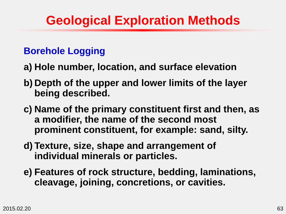
Borehole Logging
a) Hole number, location, and surface elevation
b) Depth of the upper and lower limits of the layer being described.
c) Name of the primary constituent first and then, as a modifier, the name of the second most prominent constituent, for example: sand, silty.
d) Texture, size, shape and arrangement of individual minerals or particles.
e) Features of rock structure, bedding, laminations, cleavage, joining, concretions, or cavities.
Geological Exploration Methods
2015.02.20 64
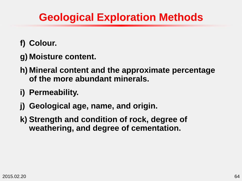
f) Colour.
g) Moisture content.
h) Mineral content and the approximate percentage of the more abundant minerals.
i) Permeability.
j) Geological age, name, and origin.
k) Strength and condition of rock, degree of weathering, and degree of cementation.
Geological Exploration Methods

2015.02.20 65
l) Consistency and degree of compactness of fine materials as very soft, soft, medium, stiff, very stiff, and hard. Describe degree of compactness of coarse grained soils as very loose, loose, medium, dense, and very dense.
m) Unified Soil Classification Symbol.
n) SPT count and the test elevation or depth.
o) Other field tests, results and describe each test.
Geological Exploration Methods

2015.02.20 66
p) Miscellaneous information, such as any drilling difficulties, core and sample recovery and reasons for any losses, type and mixture of drilling mud used to prevent caving or sample loss, loss of drilling fluid, and any other information that may help in interpreting the subsurface condition.
q) Water levels, the static water level and the date of measurement.
Geological Exploration Methods
2015.02.20 67
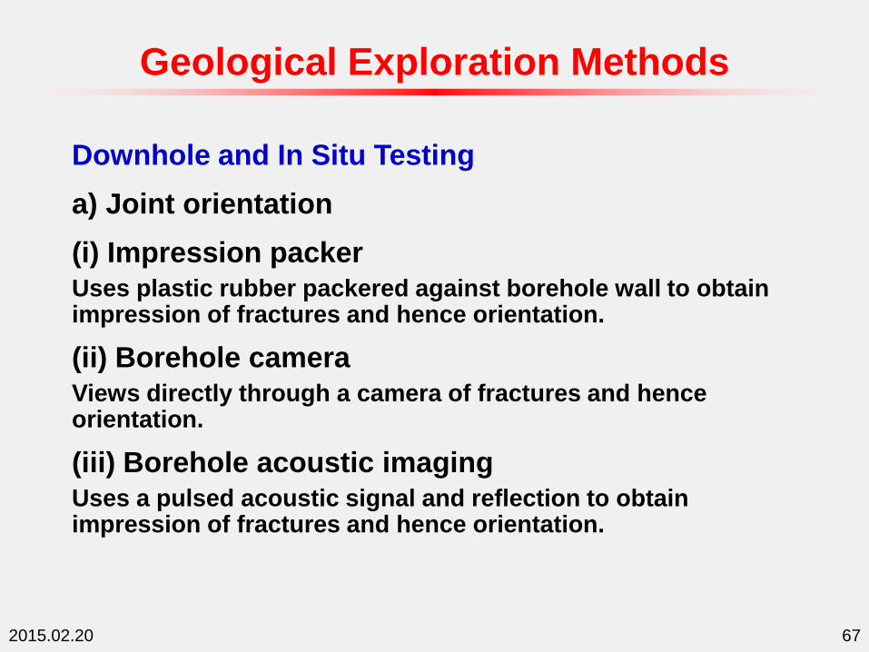
Downhole and In Situ Testing
a) Joint orientation
(i) Impression packer
Uses plastic rubber packered against borehole wall to obtain impression of fractures and hence orientation.
(ii) Borehole camera
Views directly through a camera of fractures and hence orientation.
(iii) Borehole acoustic imaging
Uses a pulsed acoustic signal and reflection to obtain impression of fractures and hence orientation.
Geological Exploration Methods
2015.02.20 68
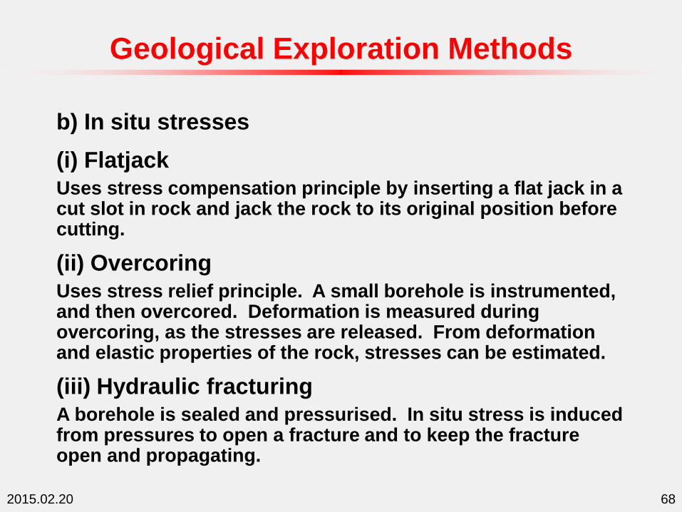
b) In situ stresses
(i) Flatjack
Uses stress compensation principle by inserting a flat jack in a cut slot in rock and jack the rock to its original position before cutting.
(ii) Overcoring
Uses stress relief principle. A small borehole is instrumented, and then overcored. Deformation is measured during overcoring, as the stresses are released. From deformation and elastic properties of the rock, stresses can be estimated.
(iii) Hydraulic fracturing
A borehole is sealed and pressurised. In situ stress is induced from pressures to open a fracture and to keep the fracture open and propagating.
Geological Exploration Methods

2015.02.20 69
c) In situ modulus
(i) Dilatometer
Inserts dilatometer and measure deformation with applied pressure.
(ii) Pressuremeter
Inserts pressuremeter in a borehole and measure deformation with applied pressure.
(iii) Plate load test
Applies load at a plate normal to rock surface and measure deformation with load.
(iv) P- and S-wave velocities
Measures P- and S-wave velocities and hence dynamics elastic and shear moduli.
Geological Exploration Methods

2015.02.20 70
d) Groundwater
(i) Piezometer
Measures groundwater level and change.
(ii) Packer permeability
Measures permeability of a packered section. Usually applies 5 different pressures.
(iii) Falling and rising head
Uses falling or rising of water head to measure the permeability.
Geological Exploration Methods

2015.02.20 71
d) Groundwater
(iv) Constant head
Pumps in or out water in a borehole to maintain constant water head, and measures permeability.
(v) Pumped well
Uses pumping wall and observation walls for large scale pumping tests.
Geological Exploration Methods

2015.02.20 72
Laboratory Testing (I)
Mineralogy: Petrography
Physical: Density (dry, saturated or natural), porosity, water content, sonic velocity
Weathering: Visual examination, rock-soil ratio, petrography
Strength: Point load, uniaxial compression, triaxial compression, direct tensile, Brazilian tensile, shear strength
Geological Exploration Methods
2015.02.20 73
Laboratory Testing (II)
Modulus: Uniaxial compression, triaxial compression, sonic velocity
Durability: Slake durability,
Swelling: Swelling index test
Permeability: Falling head, constant head
Joint properties: Normal stiffness, shear strength, permeability
Geological Exploration Methods

2015.02.20 74
Trial Excavation
Various geological features and properties of the ground an be verified by trial excavation, e.g., experimental shafts and tunnels. In site tests can also be performed during the trail excavation.
Geological Exploration Methods
2015.02.20 75
Construction Monitoring
Detailed assessment of geological features as exposed during actual construction through regular and systematic inspection and mapping of the tunnel face.
Monitoring measurements during construction, e.g., displacement and settlement are used to back calculate ground properties to compare with predicted ground conditions.
Geological Exploration Methods
2015.02.20 76
Limitation of Geological Exploration
• Engineering properties change with a wide range of conditions, such as time, season, rate and direction of loading, sometimes drastically.
• Groundwater is the most difficult condition/parameter to predict and the most troublesome during construction.
• Even comprehensive exploration programs recover a tiny drill core volume compared to the excavated volume of the tunnel (<0.0005%).
Geological Exploration Methods

2015.02.20 77
Geological Section along Tunnel Route
Geological Sections and Profiles

2015.02.20 78
Key Information in Geological Section
Major Information
• Rock formation types
• Geological structures
• Elevation and distance chainage
Specific Information
• Strength (UCS)
• Mineral content (quartz)
• Rock mass quality (RQD, RMR, Q)
• Water flow (flow rate, pressure, permeability)
• Other information relevant to construction
Geological Sections and Profiles

2015.02.20 79
Scales of Geological Section
For public use
• Generally very large scale with suitable size.
For engineering use
• Horizontal scale: 1:2000 (urban tunnels) to 1:5000 mountain tunnels
• Vertical scale: 1:500, generally is 1:5 to 1:10 to horizontal
Geological Sections and Profiles

2015.02.20 80
Special Challenges for Mountain Tunnels
• High cover of tunnel
• Unknown stress situation for the tunnel
• Potentially high in situ temperature
• Cover combined of quaternary deposits and rocks
• Restrictions for access
• Increased efforts for investigations
Investigation for Mountain Tunnels

2015.02.20 81
Selection of Tunnel Alignment
– Project criteria • Portals
• Required slope of the tunnel
• Internal pressure / rock stress required
– Intermediate adit tunnels• required for project layout
• required for construction
– Geological criteria• Minimum rock cover
• Orientation to major structures
Investigation for Mountain Tunnels

2015.02.20 82
Basic Requirements – Investigation from Surface
– Geological surface mapping
• Lithology / borders
• Geological structures, bedding schistosity, orientations
• Rock mass description – visual
– Studies of aerial photos and satellite photos
• Lineaments
• Major geological structures
• Quaternary deposits
Investigation for Mountain Tunnels

2015.02.20 83
Hydrogeological Investigations
– Survey of rivers: annual flow monitoring
– Survey of springs: annual flow monitoring
– Groundwater level: annual level monitoring
– Chemical water analysis
– Restrictions by protected areas for groundwater resources
– Groundwater temperature
Investigation for Mountain Tunnels

2015.02.20 84
Basic Requirements – Investigation Underground
– Portal area
• Investigation drillings
• Geophysical investigations
• Investigation tunnel
– Along the tunnel alignment
• Investigation drillings
• Geophysical investigations
• Pilot tunnel
Investigation for Mountain Tunnels

2015.02.20 85
Basic Requirements – Excavation and Support (I)
– Rock mass Classification • Rock Mass Rating RMR
• Q-System
• Geological Strength Index GSI
– Temporary support• Stability required
• Relevant time (time interval to final lining)
• Specific requirements – aggressiveness of ground water
Investigation for Mountain Tunnels

2015.02.20 86
Basic Requirements – Excavation and Support (II)
– Permanent lining• Long term stability required
• Special requirements by the project
• Durability of lining
Investigation for Mountain Tunnels
2015.02.20 87
Basic Requirements for Laboratory Testing
– Drill and blast method
• Rock strength
• Rock abrasivity, drillability index
– TBM excavation method
• Rock strength, rock boreability index
• Rock abrasivity, cutter life index
• Rock mineralogy
• Rock anisotropy
Investigation for Mountain Tunnels
Recommended

![IEB 1011 Engineering Mathematics I - HS-KARLSRUHE · Schmidt: Grundlagen der Geotechnik, Teubner Verlag Schulze/Simmer: Grundbau, Teuber Verlag Smoltzyk [Herausgeber]: Grundbautaschenbuch,](https://img.pdfslide.us/doc/110x75/5fd744c057076d47816c9d44/ieb-1011-engineering-mathematics-i-hs-karlsruhe-schmidt-grundlagen-der-geotechnik.jpg)


![Eindhoven University of Technology MASTER De resterende ...De resterende (geotechnische) draagkracht van bestaande houten funderingspalen. [vi] Abstract The bearing capacity of a wooden](https://img.pdfslide.us/doc/110x75/602dfb6d2c374a4da936c34f/eindhoven-university-of-technology-master-de-resterende-de-resterende-geotechnische.jpg)


![Course title: Engineering Mathematics I · • Schmidt: Grundlagen der Geotechnik, Teubner Verlag • Schulze/Simmer: Grundbau, Teuber Verlag • Smoltzyk [Herausgeber]: Grundbautaschenbuch,](https://img.pdfslide.us/doc/110x75/5fd744be57076d47816c9d3d/course-title-engineering-mathematics-i-a-schmidt-grundlagen-der-geotechnik.jpg)