1
DRAFT Decision Notice Big Red Timber Management Analysis
Environmental Assessment
USDA Forest Service
Medicine Bow-Routt National Forests &
Thunder Basin National Grassland
Hahns Peak/Bears Ears Ranger District
Routt County, Colorado
Summary The USDA Forest Service (USFS), Hahns Peak/Bears Ears Ranger District, plans to manage
approximately 1764 acres of forest lands in the Big Red Timber analysis area. This proposal is
brought forward to advance the goals, objectives and desired conditions outlined in the Routt
National Forest Land and Resource Management Plan 1997 Revision which is incorporated here
by reference, and is hereinafter referred to as the Forest Plan. The primary intent of the Big Red
Timber Management Analysis Project is to utilize silviculture, timber harvest and other forestry
related practices to manage merchantable timber stands which have been significantly affected
by mountain pine beetle, Dendroctonus ponderosae. This project was analyzed in the Big Red
Timber Management Analysis Environmental Assessment, which is incorporated here by
reference, and is hereinafter referred to as the EA. Based upon my review of the two alternatives
being considered in the EA, the Proposed Action and a No Action Alternative, I have decided to
implement Alternative 1, the Proposed Action.
Purpose and Need As described in the EA, the purpose of this project is to advance the goals, objectives and desired
conditions outlined in the Forest Plan by capturing marketable forest product values through
timber harvest before the deterioration to assist in the need to:
Manage mountain pine beetle affected timber stands to create optimum conditions for
regeneration1, diversity2, vigor and resiliency3.
Reduce the development of large continuous high hazard fuel conditions associated with
widespread mountain pine beetle tree mortality.
Protect public/private property and safety of forest users through management of beetle
affected timber stands.
Utilize opportunities associated with silvicultural and timber management methods to
benefit other forest uses and resources.
1/ Assurance of natural regeneration or reforestation treatments if needed (FSM 2470).
2/Diversity in vegetation composition relative to proportions within the landscape and structural diversity relating to variation in
sizes, shapes and pattern (heterogeneity) of landscape (vegetation) elements (Forest Plan EIS Glossary 5).
3/Ability of ecological systems to absorb disturbances while retaining the same basic ways of function, and the capacity to adapt
to stress and change (FSM 2470, FSM 2020)

2
Project Location
The analysis area for the Big Red Timber Management Analysis is located on the Hahns
Peak/Bears Ears Ranger District of the Medicine Bow-Routt National Forests and Thunder Basin
National Grassland in Routt County, Colorado. It is located approximately 19 road miles north of
Clark, Colorado on USFS administered land (Appendix A, Figure 1). The legal description is
Township (T) 10 North (N), Range (R) 85 West (W) Sections 1, 2, 3, and 4; T11N R85W
Sections 13, 14, 23, 24, 25, 26, 27, 28, 32, 33, 34, 35, and 36; and T11N R84W Sections 16, 17,
18, 19, 20, 29, 30, 31, and 32. The general area is commonly referred to as Big Red Park.
Public Involvement The proposal has been available online in the USFS Schedule of Proposed Actions since 1
January, 2015 for the Medicine Bow-Routt National Forest. On 19 July, 2015 a Legal Notice
initiating public scoping, a 30 day public comment period, was published in the newspaper of
record; Steamboat Pilot & Today. Simultaneously the Notice of Proposed Action (NOPA) was
mailed or emailed directly to 89 individuals and non-governmental organizations (Appendix A of
the EA). The USFS provided the proposal to or consulted directly with Federal, Tribal, State,
and local agencies (Appendix B of the EA). The proposal was also made available through
internet links established on the Medicine Bow-Routt National Forests & Thunder Basin
National Grassland external website.
An inter-disciplinary team (IDT) of resource specialist (Appendix C of the EA) was convened to
assist in determination of affects and/or other considerations associated with the proposal. Four
public comment letters were received during public scoping. The IDT considered public
comments, and provided responses (Appendix D of the EA). The IDT identified additional site
specific needs, reduced acres and adjusted or added design criteria, all of which helped refine the
Proposed Action. The Proposed Action, Proposed Action Map and design criteria are provided
below under Selected Alternative, Appendix A and Appendix B respectively.
Decision and Rationale Based upon my review of all alternatives analyzed in the EA, I have decided to implement
Alternative 1, the Proposed Action. As described in the EA, this alternative would move forest
condition toward objectives, goals and desired future conditions described in the Forest Plan, and
would meet the Purpose and Need.
In making my decision to select the Proposed Action, I considered how the alternatives in the EA
would meet or would not meet the stated Purpose and Need for Action. I considered internal and
external comments as described above. I considered the Finding of No Significant Impact,
which is incorporated here by reference (FONSI; IX of the EA). I made my decision based on
the best available science and other information available; information disclosed in the Forest
Plan, the EA, and the project record; and I have considered applicable laws, regulations, and
policy. My rationale for selecting the Proposed Action Alternative versus the No Action
Alternative follows. Supporting documentation can be found in the EA and the respective
resource reports which are included in the project record.
Proposed Action - Alternative 1 (Selected Alternative): Under this alternative, the USFS would
authorize timber management actions on approximately 1765 acres of forested lands. The

3
Proposed Action would foster a long-term benefit to multiple resources and would move forest
condition toward objectives, goals and desired future conditions described in the Forest Plan.
When compared to the No Action Alternative the Proposed Action Alternative would better meet
the Purpose and Need for Action in the following way:
Mountain pine beetle affected timber stands would be managed to create optimum
conditions for regeneration1, diversity2, vigor and resiliency3. This alternative would
expedite the establishment of the next forest by focusing on optimum conditions to meet
multiple resource needs such as habitat and timber stand production, while providing for
resiliency through diversity, as per the silvicultural prescriptions designed to meet these
various needs.
Hazardous fuel loads would be reduced within the analysis area. Under this alternative,
significant fuel loads would be removed, reducing fire intensity levels and fuel continuity
within the analysis area.
The reduction of hazardous trees through the removal of dead deteriorating lodgepole
pine would result in safer recreation access, improved public safety, and protection of
forest roads, trail heads, trials, fences, camp sites, and other infrastructure.
Existing marketable forest product values would be captured before wood products
deteriorate.
Other benefits of the project would include decommissioning and relocating roads and
trails, which is consistent with Road Resource Management Objectives (RRMO’s).
All of the key issues identified in the Purpose and Need for Action would be addressed.
No Action - Alternative 2: Under this alternative, no silvicultural treatments or other actions
would occur under this decision. As compared to the Proposed Action, the No Action Alternative
would not meet the Purpose and Need for the following reasons:
No mountain pine beetle affected timber stands would be managed to create optimal
conditions for regeneration, diversity and resiliency. Silvicultural techniques to expedite
regeneration and diversity of the next forest stand would not occur.
Hazard fuel conditions in the analysis area would not be reduced through silvicultural
treatments. Overstory will continue to fall, increasing the dead fuel loading and
ultimately changing the potential fire behavior characteristics of a fire event. Fires in this
environment will have the potential to become severe and of high intensity. Managing
fire in this environment can be extremely difficult.
Opportunities to improve safety conditions for forest users would be lost. Removal of
overhead safety hazards in the form of deteriorating dead trees would not occur creating
safety concerns and potential future limitation on access to high use recreation areas due
to falling trees.
Forest products would not be utilized and values to potentially capture would not be
captured and the wood products would continue to decrease as deterioration increased.
This alternative would not assist in supporting market demand.
None of the key issues identified in the Purpose and Need for Action would be addressed.
Selected Alternative (Alternative 1 - Proposed Action)
Approximately 1764 acres of forested stands affected by mountain pine beetle would be treated
through silvicultural treatments (Tables 1). Treatment descriptions for the Proposed Action are
provided below, whereas project maps and project design criteria are provided in Appendix A

4
and B respectively. Design criteria would be implemented as part of the Proposed Action and
are intended to reduce or eliminate issues or effects from management activities.
It is important to note, that if approved, the entirety of some stands will be treated; while only
portions of others may be treated. Slight variants to the even and uneven-aged silvicultural
methods identified below may be used for site specific needs relating to wildlife habitat,
hydrologic concerns, silviculture, fuels or other resource requirements that may be present or
present themselves over the course of implementation. This is due in part, but not limited to the
following: best management practices, appropriate silvicultural adaptations, market variables,
unique features discovered, internal and external input, opportunities to enhance other resources
and/or basic vegetation management variations at time of implementation.
Treatment Descriptions
Rx1: Clearcutting with Reserves (364 Acres): This type of silvicultural harvest treatment is
applied when the existing condition is such that all merchantable trees have been removed in one
operation to regenerate a typically even-aged stand. In this setting all merchantable lodgepole
pine trees and other species would be removed in order to create an exposed microclimate
favorable for natural regeneration of lodgepole pine and other early-seral species; or to release a
fully stocked stand of advanced reproduction, which in this setting is typically sub-alpine fir
below the mostly dead over-story. Depending on management objectives, a clearcut may or may
not have reserve trees left to attain goals other than regeneration. These goals may be retention
of character trees, wildlife trees and other reserve trees or groups as necessary or required. Post-
harvest site preparation by scarification and/or slash treatment will be required when
regeneration is not present. Piling and burning or pile removal of the slash may occur. When the
primary source of regeneration is advance reproduction that already exists within the stand to be
treated, the preferred term would be over-story removal, which generally describes the condition
(stocked) and implementation technique (over-story removal) for most of these stands (FSM
2470.05).
Rx1a: Clearcutting with Reserves & Removal of Subalpine Fir (758 Acres): This prescription is
similar in all aspects to Rx1, but includes additional actions to remove multiple layers of
subalpine fir trees during the site preparation step. Without these steps, these stands will steadily
transition to multi-layered stands dominated by mid- or late-seral species components (subalpine
fir) with very limited lodgepole pine or other species. The stands selected for this treatment
occur on good upland lodgepole pine sites, exhibit conditions that appear more prone to support
pine regeneration then other stands in the area and would also support potential diversification by
supplemental planting of Englemann spruce if desired or needed. In general these stands may
provide an opportunity through management for species diversification within the project area as
a whole, where most stands would be dominated by subalpine fir.
Rx1b: Two-Aged Clearcutting with Reserves (388 Acres): This prescription features
opportunities to enhance lynx habitat and/or provide for even aged management in stands that
exhibit mixed conditions that would be similar to both Rx1 and/or Rx1a and could be treated
successfully in either of those scenarios. To feature lynx habitat and promote the diversity that
may be present at smaller stand scales, Rxb1 provides for opportunities where needed to meet
both habitat and timber management needs. This would include stands where advanced spruce
regeneration/multi-aged classes are common and where perpetuating these attributes through
improvement cutting is desired. Additionally where even-aged lodgepole pine forest types exist,
this prescription would allow for even aged harvesting and site preparation to regenerate
openings with lodgepole pine and its natural associates. The stands associated with Rx1b are

5
typically stratified-mixed stands, comprising a roughly balanced horizontal patch-mosaic of two
distinct conditions as follows: 1) Even-aged lodgepole pine forest type with its natural associates,
and 2) multi-layered, multi-age-class subalpine fir and spruce component, non-uniformly
distributed.
Rx2: Salvage Cutting and Irregular Group Regeneration (254 Acres): These are intermediate
cuttings to remove all bark beetle-attacked dead or dying trees and live lodgepole pine and other
species at risk of windthrow while retaining a present multi-layered, multi-age-class subalpine
fir/spruce component, the continued development of which is desired. This is intended in part to
conserve and culture winter habitat and populations of the snowshoe hare, an essential winter
prey of the Canada lynx, a federally listed threatened species. In conjunction, the treatment is
designed to add another age-class of mixed species regeneration, non-uniformly distributed, in
both small canopy gaps and irregular larger openings that salvage logging will create. Long-term
future production of sawtimber or wood biomass in these areas will be served by continuing
irregular uneven-aged group harvest practices at intervals over time if so desired.
All Prescriptions: Table 1 provides a list of timber stands and which timber prescription would
occur within each unit.
Table 1. Proposed Action Stand Information
Stand Number Prescriptions *Acres Stand Number Prescriptions *Acres 1 1A 26.39 27 2 6.59
2 1A 31.88 28 1 15.45
3 1 62.99 29 1 11.07
4 1A 28.09 30 1A 168.77
5 1A 48.96 31 1 33.81
6 1A 12.29 32 1A 49.33
7 1 61.94 33 1A 8.23
8 1B 58.11 34 1A 52.11
9 1B 65.59 35 1B 63.92
10 1A 8.92 36 1A 38.86
11 1A 12.75 37 1A 5.73
12 1A 97.03 38 1A 31.28
13 1A 12.29 39 1 18.84
14 1 32.28 40 2 79.42
15 2 5.26 41 1B 61.49
16 2 11.36 42 1B 49.43
17 1A 20.77 43 1A 29.58
18 1A 10.21 44 2 23.83
19 1A 22.41 45 1B 39.44
20 2 5.89 46 1 2.39
21 1A 42.10 47 1 17.87
23 2 38.59 48 1 5.41
24 2 11.01 49 2 14.52
25 1B 50.41 50 2 15.40
26 1 101.76 51 2 42.18
Total Acres: 1764 *Area is displayed in 1/100th acres for stand level information and in whole numbers for more broad scale analysis. Treatment
acres may vary up to 5% due to rounding, mapping discrepancies and to ensure feasibility of implementation.
Transportation
The existing transportation system would be utilized to provide general access to treatment
units. Most National Forest System Roads (NFSRs) within the project area would be improved
through maintenance and/or reconstruction activities to allow for project implementation and to
stabilize problem areas in order to maintain or improve hydrological conditions. Approximately
7.5 miles of temporary road may be needed off existing system roads to access units. Primary

6
temporary roads have been identified on the Proposed Action Maps located in Appendix B,
Figures 2 and 3. Additional short temporary roads/spurs will be needed, generally off system
roads to access unit landings. All temporary roads will be closed by re-contouring, slashing and
seeding after use. Although no new specified roads are anticipated there may be a need to
provide an engineered road prism in some locations. These would be previewed by appropriate
specialist prior to design. If access routes are identified that require additional control measures
or engineered road prisms, it would be on limited basis and equate to approximately 1 mile or
less.
Opportunities associated with silviculture and timber harvest activities would benefit other forest
uses and resources. Due to the type of silvicultural practices proposed, entailing a single entry,
there are opportunities for road maintenance or decommissioning projects to occur since the next
harvest entry would not occur until well into the future. In particular, an opportunity exists
through this analysis to assure road resource management objectives are being met for roads
within the project area. Under this decision, roads that will be decommissioned included 0.82
miles of NFSR 498.1; 1.79 miles of NFSR 520.1 just past the Hare Trail Head (trail #1199.1) to
its terminus; 0.32 miles of NFSR 402.1, just past the Farewell Trail (trail #1203.1) to its
terminus. In addition, 0.20 miles of NFSR 505.1c and 0.08 miles of NFSR 500.1I would be
relocated and the original template decommissioned.
Post-Harvest Activities
In most circumstances associated with this project, the primary silvicultural prescriptions will
ensure regeneration of the stands through natural seeding, suckering or the existing reproduction
Reliance on artificial regeneration methods may occur when the natural sequence of events
and/or environmental conditions fail to regenerate the stands within five years or earlier.
Artificial methods may include mechanical site preparation in non-stocked openings or where
diversification is desired. Site preparation includes scarification as needed to disturb grass and
sod root zone, exposing (not displacing) mineral soil while crushing any remaining pine tops and
incorporating seed typically accomplished with a dozer or similar equipment. Site preparation
may create slash piles that will be burned or removed. Log landings will be scarified and seeded.
Additionally, infill planting to attain desired stocking levels (150 trees/acre) or as desired for
compositional diversification may occur.
Additional Activities
Benefits to safety and fuels management will occur, simply by removing the dead overstory
component in areas near trailheads, roads, and dispersed camping locations. Recreational trails
in the area have the potential to benefit from well-planned vegetation management and dual
efficiencies. Timber harvest activities and associated skid trails and temporary roads will be
design in concert with recreation needs in these areas too potentially realize dual benefits if
feasible.
More specifically, National Forest System Trails (NFST) 1155.1 (Ellis), NFST 1203.1A (Ellis
Connector), NFST 1203.1 (Farewell Trail), NFST 1204.1 (Manzaneras), NFST 1149.1, NFST
1203.1b (Kids Loop) and NFST 1204.1 may see minor relocation of some sections to a more
sustainable locations. No relocation will occur outside stand boundaries as shown on the
Proposed Action Map in Appendix B, Figures 2 and 3.
Design Criteria Associated with the Proposed Action
The ID Team assigned to this project identified design criteria to reduce or prevent issues or
effects resulting from management activities. Design criteria include best management practices

7
watershed conservation practices, and site specific design criteria that supplement Forest Plan
standards and guidelines and other environmental protections required by laws and regulations.
Project design criteria are included in Appendix B of this decision notice and become part of the
proposed action.
Other Alternatives Considered As described in the EA, I considered two alternatives; the Proposed Action and the effects of
taking no action. Although comment letters received did not lead to analysis of another
alternative, comments were used to modify and improve the Proposed Action as described above
in Public Involvement.
Alternative 2 (No Action): Under this alternative, the Big Red Timber Management Analysis
Project would not be implemented. For the Big Red Timber Management Area Analysis project,
taking no action would not meet the Purpose and Need for the project as described above in the
Decision and Rationale.
Findings Required by Other Laws and Regulations This decision is consistent with the intent of Forest Plan goals and objectives outlined in the
Routt National Forest Land & Resource Management Plan 1997 Revision (Forest Plan; p. 1-1
and 1-2). The project was designed in conformance with land and resource management plan
standards and incorporates appropriate land and resource management plan guidelines for
geographic areas and management areas as described below.
Geographic Areas
The Big Red Timber Management Analysis is located within the Little Snake Geographic Area
(GA). The desired condition for this GA is to maintain aspen, lodgepole pine, spruce/fir, along
with shrubs, grass and forbs as the dominant cover types (Forest Plan; p. 3-50). Additionally a
variety of tree sizes and seral stages will be present. Damage by insect, disease, and wildfire will
be locally restricted (Forest Plan; p. 3-50).
Management Areas
The decision is also consistent with the Forest Plan Management Area (MA) guidance described
below. Three MAs represent the analysis area including: MA 5.13-Forest Products, MA 5.11-
General Forest & Rangelands, Forest Vegetation Emphasis and MA 4.3-Dispersed Recreation.
Silvicultural treatment areas located within all three MAs as shown below in Tables 2 and on the
Propose Action Maps in Appendix A, Figures 2 and 3. MA Desired Condition and applicable
standards and guidelines are provided below.
Table 2. Treatment Acres within MAs
Treatment Type (Rx) Rx1 Rx1a Rx1b Rx2 Rx Acres per MA
MA 4.3 2.77 121.20 32.11 0.15 156 (8%)
MA 5.11 122.33 85.12 39.52 26.87 274 (15%)
MA 5.13 238.70 551.60 316.76 227.03 1334 (77%)
Total Acres 364 758 388 254 1764 (100%)
MA 5.13 – Forest Products: The majority of treatments (77%) are proposed within MA 5.13;
these areas are managed to produce commercial wood products where the desired condition is to

8
manage vegetation composition and structure for a mosaic of ages and heights for a sustained
yield of forest products (Forest Plan; p. 2-44). The following Forest Plan MA standard applies:
Standard: Use a full range of biologically appropriate silvicultural practices to emphasize
the production of sawtimber (Forest Plan; p. 2-45).
MA 5.11 – General Forest & Rangeland, Forest Vegetation Emphasis: Additional treatments
(15%) are proposed within MA 5.11; these areas are managed to provide wildlife habitat along
with forest products, livestock forage, and recreation where the desired future condition is to
maintain vegetation composition and structure in a range of successional stages to meet wildlife,
range and timber objectives (Forest Plan; p. 2-39). The following Forest Plan MA standard
applies:
Standard: Use a full range of biologically appropriate silvicultural practices to emphasize
the production of sawtimber (Forest Plan; p. 2-40).
MA 4.3 – Dispersed Recreation: Treatments (8%) may occur within 4.3 MA; where timber
management practices will enhance undeveloped recreation opportunities. The desired future
condition in this MA is to attain a vegetation composition and structure to meet recreational
objectives identified for the area (Forest Plan; p. 2-36). The following Forest Plan MA standard
and guideline applies:
Standard: Use only vegetation management practices necessary to meet resource
objectives other than wood production (Forest Plan; p. 2-37).
Guideline: Focus pest management activities and methods on enhancing or protecting
recreation opportunities (Forest Plan; p. 2-37).
Finding of No Significant Impact
As the responsible official, I am responsible for evaluating the effects of the project relative to
the definition of significance established by the Council of Environmental Quality (CEQ)
Regulations (40 CFR 1508.13). I have reviewed and considered the EA and documentation
included in the project record, and I have determined that the Proposed Action will not have a
significant effect on the quality of the human environment. As a result, no environmental impact
statement was prepared. I have also determined that the Proposed Action is in compliance with
all laws and regulations including Executive Orders 11988 and 11990 dealing with floodplains
and wetlands, the National Historic Preservation Act, and the Endangered Species Act. My
rationale for a finding of no significant impact on the quality of the human environment can be
found in the Finding of No Significant Impact (FONSI), which is incorporated here by reference
(Section IX of the EA).
Administrative Review and Objection Opportunities On 3 July, 2016, a Legal Notice was published in the newspaper of record, Steamboat Pilot &
Today, initiating a 45 day opportunity to object. This decision is subject to objection pursuant to
Federal regulations at 36 CFR 218, “Project Level Predecisional Administrative Review
Process.” Objections, including attachments, must be in writing and filed (regular mail, fax, e-
mail, hand-delivery, express delivery, or messenger service) with the Objection Reviewing
Officer (§218.8) within 45 days following the date of publication of a legal notice announcing
the opportunity to object in the Steamboat Pilot & Today. The publication date (3 July, 2016) of

9
the legal notice in the newspaper of record is the exclusive means for calculating the time to file
an objection (§218.5 (c)). Those wishing to object should not rely upon dates or timeframe
information provided by any other source. It is the objector’s responsibility to ensure timely
filing (218.9).
Issues raised in objections must be based on previously submitted specific written comments
regarding the proposed project or activity and attributed to the objector, unless the issue is based
on new information that arose after the opportunities to comment (218.8 (c)). Only those who
submitted timely, specific written comments during the formal comment period in July-August
2015 may file an objection (218.5(a)). Objections must meet content requirements of 36 CFR
218.8(d), including objector’s name and address, signature or verification of authorship,
identification of the project , and a description of those aspects of the project addressed by the
objection, including specific issues, suggested remedies, and supporting reasons for the
Reviewing Officer to consider. Any decision on this project will not be appealable under 36 CFR
215.11 or any other authority. The objection shall be sent to:
USDA Forest Service, Region 2
Rocky Mountain Region
Attn.: Objection Reviewing Officer
740 Simms Street
Golden, CO 80401-4720
Hours: Mon-Fri 8:00 a.m. – 4:30 p.m., excluding holidays
Fax: 303-275-5134
Email: [email protected]
(Acceptable formats for electronic objections are: rtf, pdf, doc, or docx
How to Find Project Information Project information, including copies of the EA, Resource Specialist Reports, FONSI, and Draft
Decision Notice, is available on the Forest Web site at: http://www.fs.fed.us/nepa/fs-usda-
pop.php/?project=45673. For additional information concerning this decision contact: Mark
Cahur, Timber Management Assistant & Planner, at the Hahns Peak/Bears Ears Ranger District
Office, 925 Weiss Drive, Steamboat Springs, CO 80487. Mr. Cahur may also be reached by
phone at (970) 870-2214 or by e-mail at [email protected].
Implementation Date If no objection is received, implementation of the decision may begin on, but not before, the 5th
business day following the close of the objection filing period (§ 218.12( c)(2)). If an objection
is received, implementation may occur immediately following the close of the objection
resolution period (§218.12(a)).
DRAFT ONLY XXXX
Chad Stewart, District Ranger Date
Hahns Peak/Bears Ears Ranger District
Medicine Bow-Routt National Forests & Thunder Basin National Grassland

10
Appendix A – Maps of the Analysis Area
Figure 1. Project Vicinity Map

11
Figure 2. Proposed Action Map (Westside of Analysis Area)

12
Figure 3. Proposed Action Map (Eastside of Analysis Area)

13
Appendix B – Design Criteria for the Proposed Action
Project design criteria by resource area are included in this appendix and are included as part of the
proposed action.
Aquatic Resources
If specific impacts to threatened, endangered, and Region 2 sensitive species (TES)
and/or their habitats are identified, management may be adjusted as necessary to reduce
those impacts through working with the biologists or botanists. Timing restrictions may
also need to be applied. The TES species of interest include goshawks, raptors, pygmy
shrews, amphibians, and rare plants.
If contracts are used for implementation, final contract provisions relating to aquatic
wildlife resource protections, whether these needs are disclosed or not within this EA
and/or Decision Notice, would be the decision of the responsible aquatics biologist and/or
the district line officer.
Botanical
Botany Avoidance Areas are identified and will be protected by site specific measures,
contractual requirements or avoided.
Delineate a 100 ft. buffer around known occurrences of R2 sensitive and local concern
plant species and flag for avoidance.
Avoid any loss of rare wetlands such as fens and springs.
Where appropriate, revegetate project area with native species to reduce risk of invasive
species establishment and work with forest botanist to identify appropriate species for
planting.
Establish effective ground cover on disturbed sites to prevent accelerated on-site soil loss
and sediment delivery to streams. Restore ground cover using certified native plants as
practicable to meet revegetation objectives. Avoid persistent or invasive exotic plants.
Fell trees away from identified buffered populations.
Limit operations in buffered population areas to hand and/or non-ground disturbing
mechanical equipment. Unless identified as a fuel hazard, trees felled in buffered areas
would be left on site
Do not place or burn slash piles or broadcast burn slash in buffered areas.
Keep all slash out of perennial and intermittent stream courses, and all riparian areas and
wetlands. Do not accumulate slash in ephemeral stream courses.
Landings should be located in upland areas to minimize the potential for slash piles and
burning of slash to affect protected stream courses.
If contracts are used for implementation, final contract provisions relating to botanical
resource protections, whether these needs are disclosed or not within this EA and/or
Decision Notice, will be the decision of the responsible botanist and/or the district line
officer.
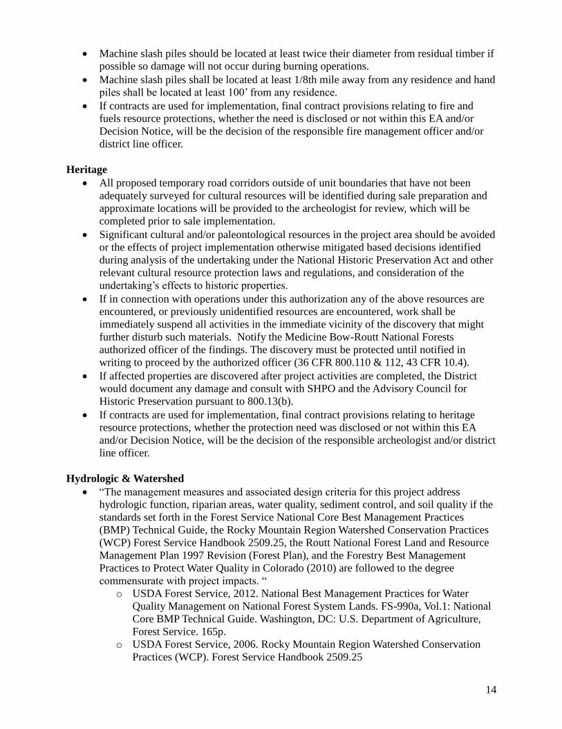
Fire & Fuels
Restrict slash piles to approximately 7068 ft³ or current Colorado Air Pollution Control
Division (CAPD) specifications (smoke permit limits efficient burning to a maximum
pile size of approximately (45’x20’x15’). For exemptions consult fire management
officer.
Burning in high moisture conditions will reduce the potential of an escaped fire. Follow
all applicable pile burn requirements specified in the CAPCD smoke permit and/or Routt
Zone programmatic pile burn plan.
14
Machine slash piles should be located at least twice their diameter from residual timber if
possible so damage will not occur during burning operations.
Machine slash piles shall be located at least 1/8th mile away from any residence and hand
piles shall be located at least 100’ from any residence.
If contracts are used for implementation, final contract provisions relating to fire and
fuels resource protections, whether the need is disclosed or not within this EA and/or
Decision Notice, will be the decision of the responsible fire management officer and/or
district line officer.
Heritage
All proposed temporary road corridors outside of unit boundaries that have not been
adequately surveyed for cultural resources will be identified during sale preparation and
approximate locations will be provided to the archeologist for review, which will be
completed prior to sale implementation.
Significant cultural and/or paleontological resources in the project area should be avoided
or the effects of project implementation otherwise mitigated based decisions identified
during analysis of the undertaking under the National Historic Preservation Act and other
relevant cultural resource protection laws and regulations, and consideration of the
undertaking’s effects to historic properties.
If in connection with operations under this authorization any of the above resources are
encountered, or previously unidentified resources are encountered, work shall be
immediately suspend all activities in the immediate vicinity of the discovery that might
further disturb such materials. Notify the Medicine Bow-Routt National Forests
authorized officer of the findings. The discovery must be protected until notified in
writing to proceed by the authorized officer (36 CFR 800.110 & 112, 43 CFR 10.4).
If affected properties are discovered after project activities are completed, the District
would document any damage and consult with SHPO and the Advisory Council for
Historic Preservation pursuant to 800.13(b).
If contracts are used for implementation, final contract provisions relating to heritage
resource protections, whether the protection need was disclosed or not within this EA
and/or Decision Notice, will be the decision of the responsible archeologist and/or district
line officer.
Hydrologic & Watershed
“The management measures and associated design criteria for this project address
hydrologic function, riparian areas, water quality, sediment control, and soil quality if the
standards set forth in the Forest Service National Core Best Management Practices
(BMP) Technical Guide, the Rocky Mountain Region Watershed Conservation Practices
(WCP) Forest Service Handbook 2509.25, the Routt National Forest Land and Resource
Management Plan 1997 Revision (Forest Plan), and the Forestry Best Management
Practices to Protect Water Quality in Colorado (2010) are followed to the degree
commensurate with project impacts. “
o USDA Forest Service, 2012. National Best Management Practices for Water
Quality Management on National Forest System Lands. FS-990a, Vol.1: National
Core BMP Technical Guide. Washington, DC: U.S. Department of Agriculture,
Forest Service. 165p.
o USDA Forest Service, 2006. Rocky Mountain Region Watershed Conservation
Practices (WCP). Forest Service Handbook 2509.25

15
o USDA Forest Service, 1997. Routt National Forest Land and Resource
Management Plan 1997 Revision
o Forestry Best Management Practices to Protect Water Quality in Colorado. Fort
Collins, Colo.: Colorado State Forest Service, 2010. Print.
Locations of all specified roads, stream crossings, and new temporary roads not analyzed
in the proposed action will be approved on site by a hydrologist. Additionally, use
hardened fords rather than culverts for stream crossings, outslope roads with rolling dips
and/or waterbars, and ensure adequate road drainage for all weather conditions.
Keep skid trails, landings, and slash piles out of the Water Influence Zone (WIZ) except
when approved by a hydrologist. Note – the water influence zone (WIZ) is the land adjacent to streams, lakes, and wetlands where vegetation plays a key
role in sustaining the structure, function, and processes of aquatic ecosystems. The WIZ includes the geomorphic
floodplain, riparian ecosystem, and inner gorge. As a non-site-specific rule of thumb, its minimum horizontal distance
(taken from the top of each bank) is 100 feet or the average height of the mature dominant late-seral vegetation,
whichever is greater.
When no longer needed, immediately close all temporary roads, spurs, landings, and skid
trails by re-contouring, scarifying, slashing, and seeding as necessary so hillslope
hydrology is restored.
Unit 12 - Restrict mechanical equipment within the WIZ and access timber off of NFSR
509.
Unit 13 - Restrict mechanical equipment outside of established treatment stand
boundaries and minimize the number of skid trails and landings within treatment stand.
Units 15, 23, 26 - Restrict mechanical equipment near unstable cliff walls
Units 27, 51 - Restrict mechanical equipment within the WIZ
Unit 34 - Restrict mechanical equipment within the WIZ and Restrict mechanical
equipment near unstable cliff walls
If contracts are used for implementation, final contract provisions relating to hydrologic
resource protections, whether the need was disclosed or not within this EA and/or
Decision Notice, will be the decision of the responsible hydrologist and/or district line
officer.
Rangeland
Locate and use weed free project staging areas e.g., landing areas.
Avoid or minimize all types of travel through weed infested areas, or restrict to those
periods when spread of seed or propagules are least likely. If questions arise consult
noxious weed coordinator.
Remove mud, dirt, and plant parts from equipment before moving it into a project area.
Clean all equipment before leaving a sale unit/units if operating in areas infested with
weeds. A population of yellow toadflax currently exists in Unit 1. Two additional
populations are known to exist along FSR 550 which would be used as a transportation
route for equipment and logging trucks. It is not anticipated that operations would have
any negative effect on the populations along FSR 550.
Minimize soil disturbance to the extent practical. Where logging activity creates bare
ground, re-establish vegetation to prevent establishment of weeds.
Inspect ground disturbing operations in noxious weed infested areas for at least three to
five growing seasons following completion of the project. For on-going projects,
continue to monitor until reasonable certainty is obtained that no weeds have occurred.
Provide for follow-up treatments based on inspection results.
Abide by provision RO-C6.223 and/or B6.22 (protection of fences) in Big Red analysis
area. A private inholding in Big Red Park is fenced along units 45, 47, and 26. Trees

16
should be logged up to the private land fence where practicable to prevent further damage
to the fence from falling trees.
The fences along the private property are the property of the land owner and will not be
cut, moved, or altered in any manner without prior consultation and approval of the land
owner.
If contracts are used for implementation, final contract provisions relating to rangeland
resource protections, whether the need was disclosed or not within this EA and/or
Decision Notice, will be the decision of the responsible rangeland manager and/or district
line officer.
Recreation
Work with recreation staff, and/or landscape architect to improve current travel
management. Coordinate layout of skid trails and temporary roads to prevent “road
creep” after sale closure, by designing natural or man-made barriers. Utilize new routes
as opportunities for dispersed site replacement away from water zones.
Closure of temp roads, skid trails and any other travel corridors purposefully or not
developed by logging activities will be closed in the timber contract or post sale activities
to include trust fund allocations by methods determined to be effective by the recreation
staff and/or line officer.
During sale layout, work with recreation/trails staff on specific tactics to accomplish trial
management objectives (TMO). Review trails and trailheads within units for either
protection or relocation within the timber sale unit to meet existing TMO for those trails.
Take advantage of this opportunity to improve poor trail location. If protection, identify
in the timber sale contract (PI). If trails or trailheads are not to be protected, identify
alternate routes to meet the TMO’s and rehabilitate closed segment to previous grade.
Trails and trailheads within identified logging units need to be protected or improved in
the timber sale contract, especially if impacted – rehabilitated to previous grade, profile
and drainage per the approved trail management objectives. During sale layout, work
with recreation/trails staff on specific tactics to accomplish trial management objectives.
If not feasible, identify alternate routes to maintain the recreational opportunity.
Allow recreation/trails staff to provide input on temporary road and skid trail locations,
where enhancements to the trails system may result from implementation.
Allow recreation specialists to identify segments of trail not to protect within units, and
replaced with segments in more desirable locations within the timber sale units.
Operations – close and sign trails in units where operations are occurring. Limit
operations to confined areas (e.g. operating in only one subdivision at a time) to minimize
impacts to OHV users. Prohibit operations during the first weekend of the four Colorado
Big Game Hunting Seasons, and prohibit hauling during the July 4th Holiday and Labor
Day weekends.
Units 1 and 8 are in the vicinity of the Ellis North Trailhead, and “Kid’s Trail” (NFST
1203.1B). Coordinate with recreation, trails and landscape architect on the long term
management of this trailhead.
Winter Operations – No winter plowing north on NFSR 550 from the junction with
NFSR 500 due to groomed snowmobile trail system. NFSR 550 and 500 are groomed
snowmobile routes. During the LSN analysis, the District and Steamboat Lake
Snowmobile Club identified alternate snowmobile routes, this assessment can be re-used
in the analysis. If this occurs, alternate routes will need to cross plowed roads at
designated locations, safety plan including signs will be necessary. Berms will need to
be pushed back on plowed roads to allow from snowmobile crossing.

17
If winter plowing is feasible as defined by the district recreation staff for the portion of
NFSR 550 from County Road 129 to the junction of NFSR 500, then temporary
replacement routes will need to be approved if feasible. Include mitigation and signing
requirements in the timber sale contract as a responsibility of the purchaser with
coordination of recreation staff.
District recreation staff and district line officer only will dictate whether any winter
operations will be included in any particular contract.
Outfitter and Guides – The District has outfitter and guides who use these routes to
access their operations. Allow access to the Hare and other trailheads if access is closed
to the general public. Permit Administrators may be able to work with permittees for
alternate routes, but if not feasible, allow access regardless of timber activity.
Keep temp roads and/or skid trails open into Unit 45 or any other unit as determined by
district recreation staff for dispersed camping activities to offset impacts of this project.
If contracts are used for implementation, final contract provisions relating to recreation
resource protections, whether the need was disclosed or not within this EA and/or
Decision Notice, will be the decision of the responsible recreation staff and/or district line
officer.
Soils
“The management measures and associated design criteria for this project address
hydrologic function, riparian areas, water quality, sediment control, and soil quality if the
standards set forth in the Forest Service National Core Best Management Practices
(BMP) Technical Guide, the Rocky Mountain Region Watershed Conservation Practices
(WCP) Forest Service Handbook 2509.25, the Routt National Forest Land and Resource
Management Plan 1997 Revision (Forest Plan), and the Forestry Best Management
Practices to Protect Water Quality in Colorado (2010) are followed to the degree
commensurate with project impacts. “
o USDA Forest Service, 2012. National Best Management Practices for Water
Quality Management on National Forest System Lands. FS-990a, Vol.1: National
Core BMP Technical Guide. Washington, DC: U.S. Department of Agriculture,
Forest Service. 165p.
o USDA Forest Service, 2006. Rocky Mountain Region Watershed Conservation
Practices (WCP). Forest Service Handbook 2509.25
o USDA Forest Service, 1997. Routt National Forest Land and Resource
Management Plan 1997 Revision
o Forestry Best Management Practices to Protect Water Quality in Colorado. Fort
Collins, Colo.: Colorado State Forest Service, 2010. Print.
Keep heavy equipment out of streams, swales, and lakes, except to cross at designated
points, build crossings, or do restoration work, or if protected by at least 1 foot of packed
snow or 2 inches of frozen soil.
Locate new concentrated-use sites outside the WIZ if practicable and outside riparian
areas and wetlands. Armor or reclaim existing sites in the WIZ to prevent detrimental
soil and bank erosion.
It is recommended that temporary roads and main skid trails, unless needed for post-
harvest activities, be recontoured and stabilized by ground cover such as but not limited
to seeding, mulching, slash cover, and/or other suitable means to any degree determined
by ranger district staff to reduce and dissipate concentrated overland flows.
Do not excavate earth material from, or store excavated earth material in, any stream,
swale, lake, wetland, or WIZ.

18
If contracts are used for implementation, final contract provisions relating to soils
resource protections, whether the need was disclosed or not within this EA and/or
Decision Notice, will be the decision of the responsible soils scientist and/or district line
officer.
Transportation
Road closure devices, including gates, barriers, slash or other devices needed to prohibit
or eliminate use, would be located on the ground to provide the most effective means of
accomplishing the desired travel management strategy. Keep heavy equipment out of
streams, swales, and lakes, except to cross at designated points, build crossings, or do
restoration work, or if protected by at least 1 foot of packed snow or 2 inches of frozen
soil.
Physical closures, such as slash, stumps, rocks and revegetation are to be used to
eliminate use. Earthen barriers may be used when there is not adequate material available
for slash, stumps or rock closures. This may be done after activities, to allow use of a
road by the purchaser, or as funds become available. Closure gates may be utilized where
administrative access is needed.
Whenever possible, roads shall be relocated or constructed out of draw bottoms to
improve drainage and protect soil and water resources. Abandoned roadbeds shall be
revegetated and returned to as natural a state as possible.
All temporary roads used to access harvest units would be closed after management
activity is completed.
Where sod has effectively stabilized existing roadbeds, efforts would be made to
minimize disturbance to the sod layer during maintenance and reconstruction activities.
Unauthorized routes used for temporary access would be decommissioned.
Dust control, if necessary, may be done with water, magnesium chloride, calcium
chloride, or equivalent.
Route verification would be held prior to road contract preparation, to show Forest and
District Specialists the location and design of planned relocation, realignment and new
construction to ensure the road would not have additional adverse effects on resources.
If contracts are used for implementation, final contract provisions relating to transportation
resource protections, whether the need was disclosed or not within this EA and/or Decision
Notice, will be the decision of the responsible engineer and/or district line officer.
Visual Resource
The shape and pattern of harvest units should be designed to complement and maintain
the landscape character of the analysis area. Permit boundaries of harvest units to locate
adjacent to edges of aspen stands to create natural appearing edges.
Retain natural features such as rock outcrops, young healthy trees, understory trees of
lodgepole pine, aspen and spruce/fir, sagebrush, juniper and other shrubs, forbs and
grasses in the immediate foreground (approximately 25 to100 feet from edges of road) of
NFSRs 500.1, 505.1, 520.1 and NFSTs 1149, 1155, 1199, 1203 and 1204, dispersed camp
sites and trailheads to minimize visual impacts. Heavy logging residues shall be removed
and stumps shall be cut as close as possible to the ground in the immediate foreground
(approx. 25 to 100 feet) of the abovementioned roads, trail and trailhead. It is acceptable
to have light logging residues (small twigs, broken branches, etc.) to remain on the
ground if it does not attract the attention of Forest visitors. Beyond the immediate
foreground, lop and scatter slash evenly. Burn slash piles after the completion of
treatments.

19
Recontour and scarify temporary roads to be closed and decommissioned after the project
completion as to restore to the desired landscape character. Reseed closed roads if
needed as determined by the botanist and soil scientist. When using rocks as barrier,
rocks should be buried as least 1/3 in the ground as to look natural.
Revegetate disturbed soils on landings, burned slash pile sites and skid trails with native
seed mixture after the completion of treatments to reduce visual contrast.
If contracts are used for implementation, final contract provisions relating to visual
resource protections, whether the need was disclosed or not within this EA and/or
Decision Notice, will be the decision of the responsible landscape architect and/or district
line officer.
Wildlife
Retain on average 1 existing ‘hard’ snag per acre within all treatment units.
o Distribute snags singly or in groups of up to 32 trees (equivalent to 1 snag/acre x
32 acres). Leaving a mixture of single snags (occasionally) as well as snag
groups would be the most desirable result and should be placed in the locations of
rare plant species identified as also needing protection. Retain all ‘soft’ (i.e.,
rotten, decay class 3 to 5) snags unless they are a safety hazard. Applicable to the
entire treatment unit within the project area.
o Retain coarse woody debris to the extent practicable within all treatment units.
o Retain some existing deadfalls (whole trees) or logs (portions of tree boles)
measuring >16 inches in diameter and that are >20 feet in length. To effectively
“retain” this material in place on the site during harvest operations, use standing
leave (non-included timber) or wildlife reserve trees (snags and live character
trees) to shield the deadfall or log from mechanical damage or displacement.
Applicable to the entire unit within the project area.
Retain lynx habitat exclusion zones- Applies to Rx1b: Two-Aged Clearcutting with
Reserves and Rx2: Salvage Cutting and Irregular Group Regeneration
o Avoid pockets of advanced regeneration that is dense horizontal cover with
greater than 35% lateral cover that is available to snowshoe hares in winter (≥5 ft.
in height) as described in the Southern Rockies Lynx Amendment.
o This design criteria can be lumped with the other retention design criteria; snag,
live character, or coarse woody debris to maximize retention areas and for ease of
logging operations.
Retain live ‘character’ trees- Applies to mixed conifer stands, since lodgepole pine have
experienced high mortality.
o Retain on average 2-4 live character trees (>10 DBH and 25 feet tall) per acre.
Character trees are defined in the Routt National Forest LMP (1997 Revision) as
live trees that are broken at the top, have mechanical damage or genetic defect.
They serve as replacement snags. Live trees should be retained singly or in
groups of up to 32 trees (equivalent to 4 live trees/acre x 8 acres).
o Paint all live retention trees with an identifiable wildlife tree (“W”) marking.
Protect newly discovered Northern goshawk nests, raptor nests, and other TES species
habitats or sites identified after the award of the timber sale contract.
o Pursuant to TS contract standard provisions and upon discovery of a new TES
wildlife species nesting or breeding site, suspend any active logging or other
contract operations underway in the immediate vicinity until a wildlife biologist
assesses the situation and determines appropriate action(s).

20
o Discovery of a Northern goshawk nest in a treatment unit would modify any
planned silvicultural prescriptions to conserve key elements of nesting habitat.
Where treatments are proposed within a 3/8-mile radius of a known goshawk nest
site, a wildlife biologist will delineate three 30-acre nesting habitat protection
areas. Trees within the nest stands and/or reserve nest stands shall not be marked
for removal.
o Discovery of a raptor nest in a treatment unit would modify any planned
silvicultural prescriptions to conserve key elements of nesting habitat. Where
treatments are proposed within a 3/8-mile radius of a known raptor nesting site, a
wildlife biologist will delineate no more than one 30-acre nesting habitat
protection area. The size of a nest stand protection area is dependent upon the
species and nesting area (e.g., small owl species is typically no more than 5
acres). Trees within the nest stand shall not be marked for removal
o If a Northern goshawk or raptor nest is discovered, a seasonal restriction will be
applied to all logging operations. This criterion is for the Northern goshawk but
may be reduced for other species if determined appropriate by a wildlife biologist.
Prohibit all logging-related operations or activities, including log haul, within ¼-
mile of an active raptor nest between March 15 and September 15. Use of
National Forest roads, otherwise open to unrestricted public vehicle use, is
specifically exempted from this seasonal control. A wildlife biologist must
determine nesting status (active or inactive) for each year during sale
implementation.
o If contracts are used for implementation, final contract provisions relating to
wildlife resource protections, whether the need was disclosed or not within this
EA and/or Decision Notice, will be the decision of the responsible biologist
and/or district line officer.
In accordance with Federal civil rights law and U.S. Department of Agriculture (USDA) civil rights regulations and
policies, the USDA, its Agencies, offices, and employees, and institutions participating in or administering USDA
programs are prohibited from discriminating based on race, color, national origin, religion, sex, gender identity
(including gender expression), sexual orientation, disability, age, marital status, family/parental status, income
derived from a public assistance program, political beliefs, or reprisal or retaliation for prior civil rights activity, in
any program or activity conducted or funded by USDA (not all bases apply to all programs). Remedies and
complaint filing deadlines vary by program or incident.
Persons with disabilities who require alternative means of communication for program information (e.g., Braille,
large print, audiotape, American Sign Language, etc.) should contact the responsible Agency or USDA’s TARGET
Center at (202) 720-2600 (voice and TTY) or contact USDA through the Federal Relay Service at (800) 877-8339.
Additionally, program information may be made available in languages other than English.
To file a program discrimination complaint, complete the USDA Program Discrimination Complaint Form, AD-
3027, found online at http://www.ascr.usda.gov/complaint_filing_cust.html and at any USDA office or write a letter
addressed to USDA and provide in the letter all of the information requested in the form. To request a copy of the
complaint form, call
(866) 632-9992. Submit your completed form or letter to USDA by:
(1) mail: U.S. Department of Agriculture
Office of the Assistant Secretary for Civil Rights
1400 Independence Avenue, SW
Washington, D.C. 20250-9410;
(2) fax: (202) 690-7442; or
(3) email: [email protected]
USDA is an equal opportunity provider, employer, and lender.
Recommended