Journal of Young Scientist, Volume IV, 2016 ISSN 2344 - 1283; ISSN CD-ROM 2344 - 1291; ISSN Online 2344 - 1305; ISSN-L 2344 – 1283
173
ROMANIAN CADASTRE-FROM WISH TO ACHIEVEMENT
Teodora MOTOCESCU1
Scientific Coordinator: Prof. PhD. Eng. Raluca Margareta MANEA 1
1University of Agronomic Sciences and Veterinary Medicine of Bucharest, Faculty of Land
Reclamation and Environmental Engineering, 59 Mărăşti Blvd, District 1, 011464, Bucharest, Romania, Phone: +4021.318.25.64, Fax: + 4021.318.25.67, Email: [email protected]
Corresponding author email: [email protected]
Abstract This paper aims to highlight the evolution of cadastre mainly through a comparative between Romanian cadastre against the German .It is well known that Germany occupies a leading technology and methods of land measurements..Along with this our country belongs to Permanent Committee on Cadastre in the European Union. With a history of about 150 years both Germany and Romania have gone through different phases of technology. At the moment Romania is in full process of national cadastral measurements, given that only 20% of the cadastral approx 40mil are measured, although modern cadastre appearance was registered since 1933.With a long history of land registration in Germany it is a proven fact that a good working system of security of land tenure is very important for a developed society. Investments in land and buildings are very difficult or even impossible without a land registration system. Lessons learned during the reunification process in Germany and the establishment of a market driven economy in the former socialist part of the country. The re-introduction of a cadastral system in the new states was a big task for the surveying professionals in the public and the private sector. Why should Romania invest to follow the German example? Is the technology used by the cadastre workers expired or do we need new ways of exploiting resources? Key words: cadastre, history, comparative, land measurements. . INTRODUCTION Although in the past 25 years, in Romania there were fundamental changes in land structure, general cadastre of agricultural land has not been done for over 50 years. Last cadastre made before 1989 do not have today no value, because they have targeted agricultural land owned collective farms and state farms set up in the 50s and disbanded after 1990, when these lands were returned to their former owners. At the moment, the situation in the area does not look too good: in total assets, 40 million (8 million in urban areas and 32 million in rural areas) are recorded only 7.4 million, 36 million in urban areas and 3.8 million in rural areas. On the other hand, as a result of mistakes made in the process of restitution or heirs of doubt about many records, especially land, are superimposed on the same area appearing two or more owners. All these issues will be clarified, the documents will be corrected, so the land registers and the notary, according to the law Germany’s tradition in cadastre is more
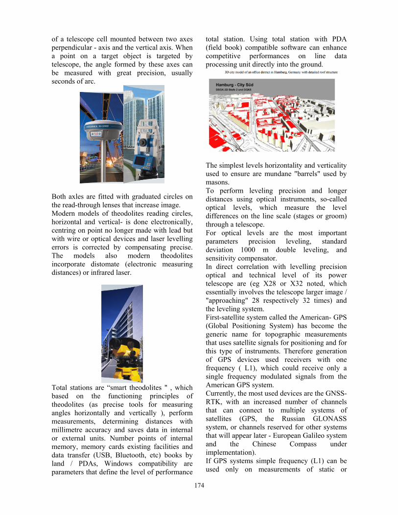
than 150 years old. During the last three decades of the 20th century the analogue maps and records were digitised. Both digital cadastral maps and digital records are stored in separate systems. Since 1997 the Working Group of the Surveying Authorities of the States of the Federal Republic of Germany (AdV) has been developing a model of an integrated Official Cadastral Information System called ALKIS®. This system is the first one world-wide described by using ISO standard UML (Unified Modelling Language). The leading GIS companies will develop the software and distribute it to the authorities. MATERIALS AND METHODS Theodolites are precise tools for measuring angles horizontally and vertically. Theodolites are mainly used for making topographic weighed but have been adapted to be used for other purposes in various fields such as meteorology, astronomy, construction and aerospace technologies. A theodolite consists
174
of a telescope cell mounted between two axes perpendicular - axis and the vertical axis. When a point on a target object is targeted by telescope, the angle formed by these axes can be measured with great precision, usually seconds of arc.
Both axles are fitted with graduated circles on the read-through lenses that increase image. Modern models of theodolites reading circles, horizontal and vertical- is done electronically, centring on point no longer made with lead but with wire or optical devices and laser levelling errors is corrected by compensating precise. The models also modern theodolites incorporate distomate (electronic measuring distances) or infrared laser.
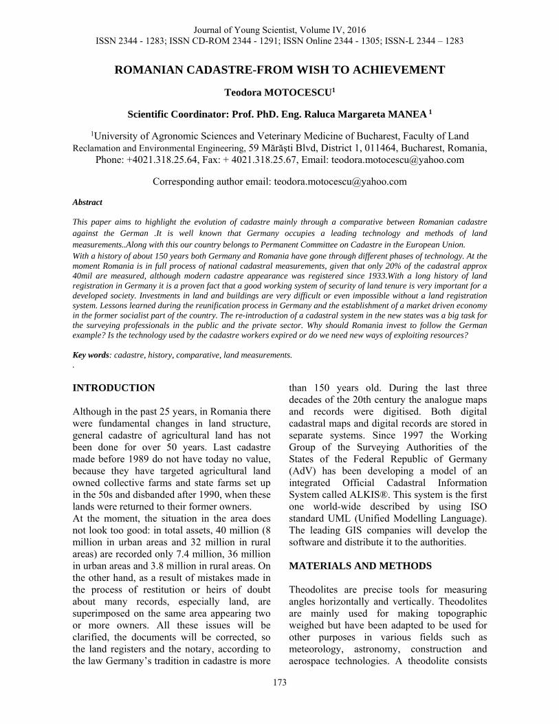
Total stations are “smart theodolites " , which based on the functioning principles of theodolites (as precise tools for measuring angles horizontally and vertically ), perform measurements, determining distances with millimetre accuracy and saves data in internal or external units. Number points of internal memory, memory cards existing facilities and data transfer (USB, Bluetooth, etc) books by land / PDAs, Windows compatibility are parameters that define the level of performance
total station. Using total station with PDA (field book) compatible software can enhance competitive performances on line data processing unit directly into the ground.
The simplest levels horizontality and verticality used to ensure are mundane "barrels" used by masons. To perform leveling precision and longer distances using optical instruments, so-called optical levels, which measure the level differences on the line scale (stages or groom) through a telescope. For optical levels are the most important parameters precision leveling, standard deviation 1000 m double leveling, and sensitivity compensator. In direct correlation with levelling precision optical and technical level of its power telescope are (eg X28 or X32 noted, which essentially involves the telescope larger image / "approaching" 28 respectively 32 times) and the leveling system. First-satellite system called the American- GPS (Global Positioning System) has become the generic name for topographic measurements that uses satellite signals for positioning and for this type of instruments. Therefore generation of GPS devices used receivers with one frequency ( L1), which could receive only a single frequency modulated signals from the American GPS system. Currently, the most used devices are the GNSS-RTK, with an increased number of channels that can connect to multiple systems of satellites (GPS, the Russian GLONASS system, or channels reserved for other systems that will appear later - European Galileo system and the Chinese Compass under implementation). If GPS systems simple frequency (L1) can be used only on measurements of static or
175
kinematic results are to be obtained after a post-processing of data recorded in the field, GNSS-RTK can be used both in measurements of static and kinematic and the measurements in real time, so-called RTK (real time Kinematic). To determine in real time with centimeter accuracy of the coordinates of the points needed as GPS devices GNSS RTK corrections from the stations to receive landline. This is done either by radio UHF from its own base (in this mode requiring two devices - base and rover), or use modems GSM to connect to the internet for receiving RTK corrections from fixed stations permanent existing many countries (ROMPOS for Romania). GSM modules Internet works with GSM cards from local mobile operators. Lasers are devices used primarily for builders, plumbers, decorators, architects for checking alignments horizontality or vertically using one or more laser beams that sets out the level / alignment onto the surface wanted by dots or lines. RESULTS AND DISCUSSIONS The Land registration system in Germany is a duplex system. The legal situation of each parcel is described in the land register called "Grundbuch". The geometric description of all boundaries in the Automated Cadastral Map (ALK), field records and textual records in the Automated Property Register (ALB) are in the hand of the cadastral authorities. Only Grundbuch and cadastre in combination give a complete overview about legal and de facto land tenure. Both registers must be constantly updated and kept in correspondence with each other (DVW 1993).
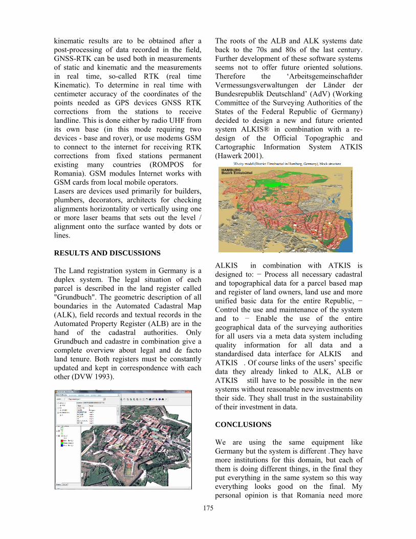
The roots of the ALB and ALK systems date back to the 70s and 80s of the last century. Further development of these software systems seems not to offer future oriented solutions. Therefore the ‘Arbeitsgemeinschaftder Vermessungsverwaltungen der Länder der Bundesrepublik Deutschland’ (AdV) (Working Committee of the Surveying Authorities of the States of the Federal Republic of Germany) decided to design a new and future oriented system ALKIS® in combination with a re-design of the Official Topographic and Cartographic Information System ATKIS (Hawerk 2001).
ALKIS� in combination with ATKIS is designed to: − Process all necessary cadastral and topographical data for a parcel based map and register of land owners, land use and more unified basic data for the entire Republic, − Control the use and maintenance of the system and to − Enable the use of the entire geographical data of the surveying authorities for all users via a meta data system including quality information for all data and a standardised data interface for ALKIS� and ATKIS�. Of course links of the users’ specific data they already linked to ALK, ALB or ATKIS� still have to be possible in the new systems without reasonable new investments on their side. They shall trust in the sustainability of their investment in data. CONCLUSIONS We are using the same equipment like Germany but the system is different .They have more institutions for this domain, but each of them is doing different things, in the final they put everything in the same system so this way everything looks good on the final. My personal opinion is that Romania need more
176
implication by the all sides, the citizens and the government too if we all attend for a cadastre of our country. Everybody wants to sell or buy houses, the first needing for that is a good plan of the land we want to buy or sell. We can learn from Germans, from their program ALKIS.
REFERENCES http://www.eurocadastre.org A.N.C.P.I. https://www.fig.net www.esri.com .
Recommended