John Pereira, Deputy Director Office of Projects, Planning, and Analysis (OPPA)
National Environmental Satellite, Data, and Information Service (NESDIS)
March 16, 2016
NOAA Satellite Plans 2016 Tropical Cyclone Operations and Research Forum
2
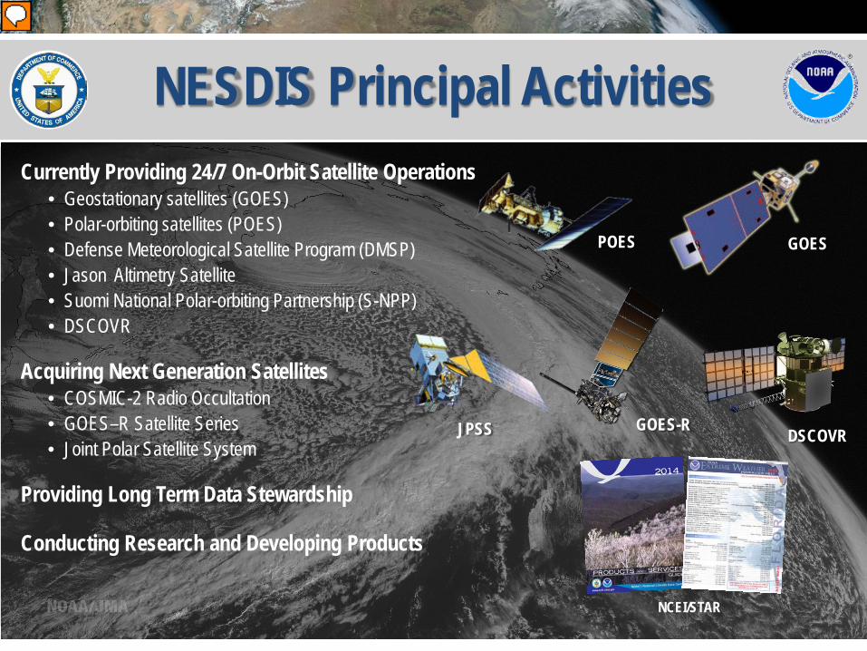
NESDIS Principal Activities Currently Providing 24/7 On-Orbit Satellite Operations
• Geostationary satellites (GOES) • Polar-orbiting satellites (POES) • Defense Meteorological Satellite Program (DMSP) • Jason Altimetry Satellite • Suomi National Polar-orbiting Partnership (S-NPP) • DSCOVR
Acquiring Next Generation Satellites • COSMIC-2 Radio Occultation • GOES–R Satellite Series • Joint Polar Satellite System
Providing Long Term Data Stewardship
Conducting Research and Developing Products
GOES POES
JPSS GOES-R DSCOVR
NCEI/STAR
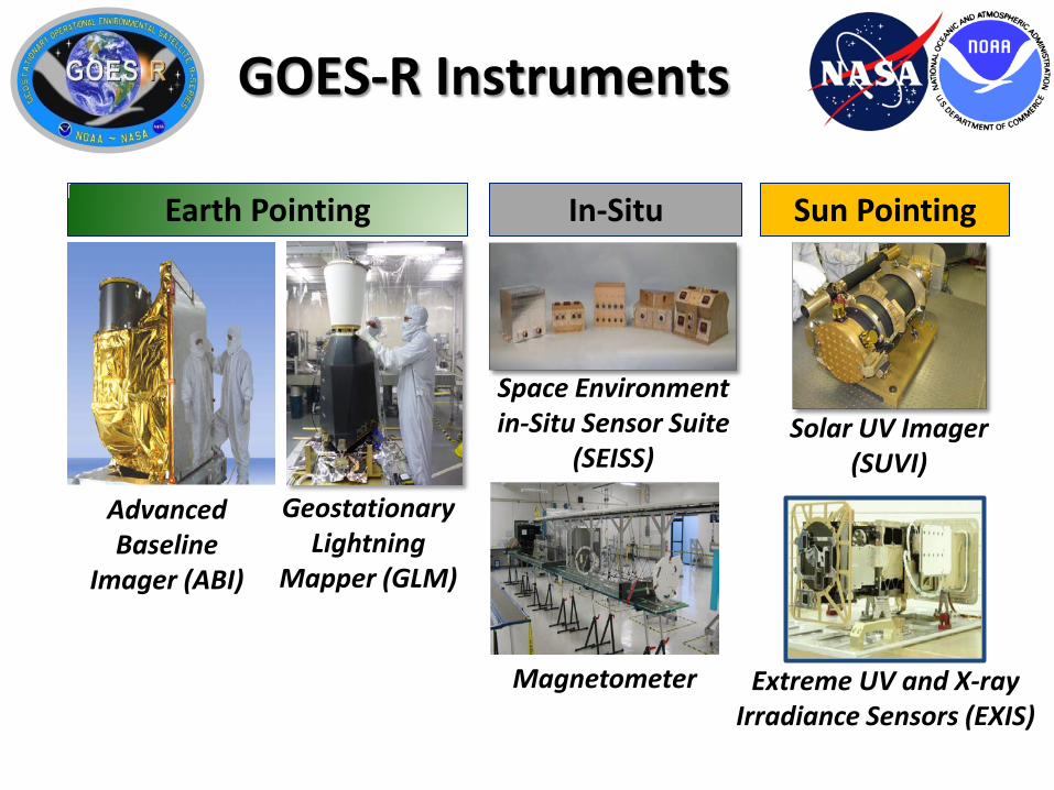
GOES-R Instruments Lightning Mapping
Space Weather Monitoring
Solar Imaging
Advanced Baseline
Imager (ABI)
Geostationary Lightning
Mapper (GLM)
Magnetometer Extreme UV and X-ray Irradiance Sensors (EXIS)
Earth Pointing Sun Pointing In-Situ
Space Environment in-Situ Sensor Suite
(SEISS) Solar UV Imager
(SUVI)
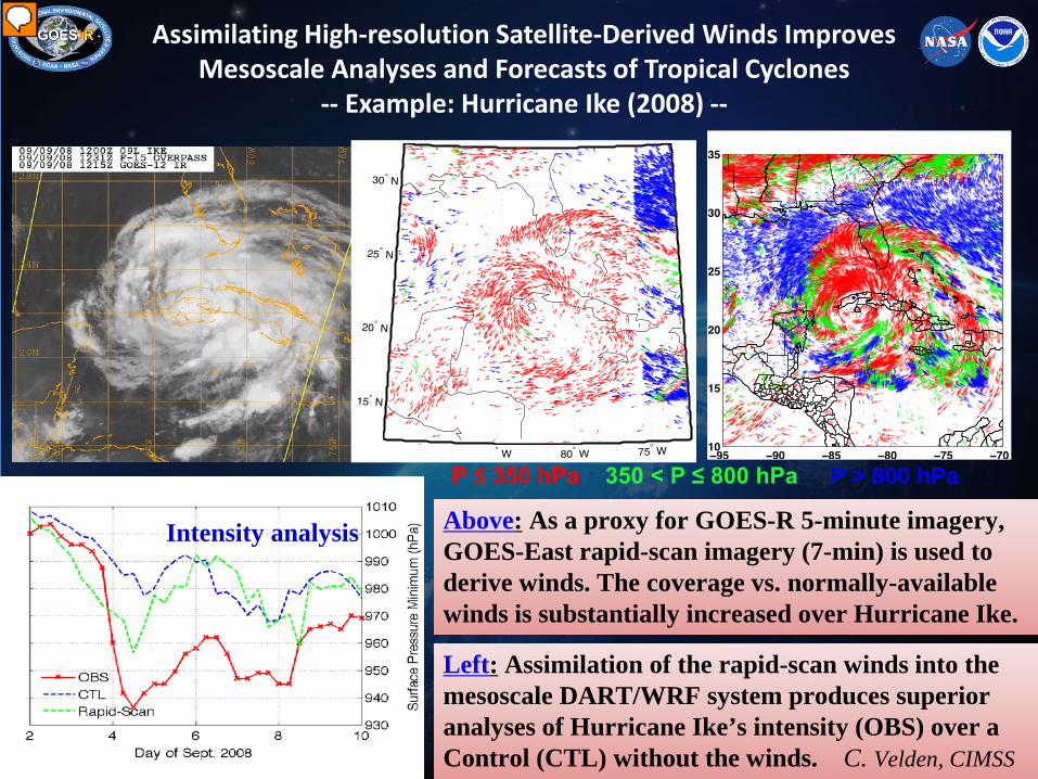
Assimilating High-resolution Satellite-Derived Winds Improves Mesoscale Analyses and Forecasts of Tropical Cyclones
-- Example: Hurricane Ike (2008) --
P ≤ 350 hPa 350 < P ≤ 800 hPa P > 800 hPa
Intensity analysis
Left: Assimilation of the rapid-scan winds into the mesoscale DART/WRF system produces superior analyses of Hurricane Ike’s intensity (OBS) over a Control (CTL) without the winds. C. Velden, CIMSS
Above: As a proxy for GOES-R 5-minute imagery, GOES-East rapid-scan imagery (7-min) is used to derive winds. The coverage vs. normally-available winds is substantially increased over Hurricane Ike.
6 6
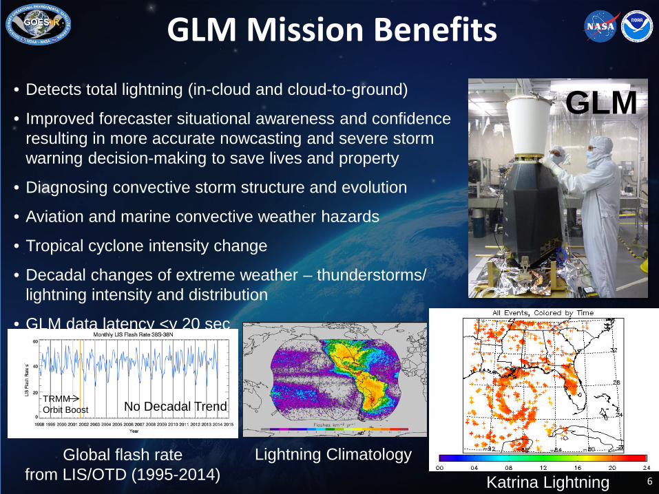
GLM Mission Benefits • Detects total lightning (in-cloud and cloud-to-ground)
• Improved forecaster situational awareness and confidence resulting in more accurate nowcasting and severe storm warning decision-making to save lives and property
• Diagnosing convective storm structure and evolution
• Aviation and marine convective weather hazards
• Tropical cyclone intensity change
• Decadal changes of extreme weather – thunderstorms/ lightning intensity and distribution
• GLM data latency <y 20 sec
Global flash rate from LIS/OTD (1995-2014) Katrina Lightning
Lightning Climatology
No Decadal Trend TRMM Orbit Boost
GLM
www.jpss.noaa.gov
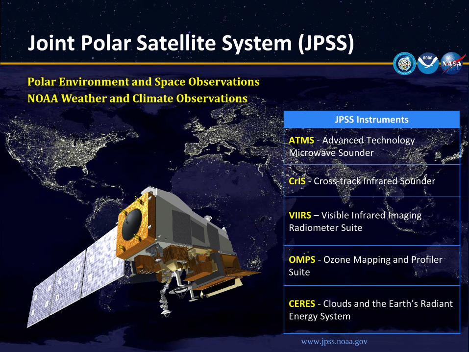
Polar Environment and Space Observations NOAA Weather and Climate Observations
Joint Polar Satellite System (JPSS)
JPSS Instruments
ATMS - Advanced Technology Microwave Sounder
CrIS - Cross-track Infrared Sounder
VIIRS – Visible Infrared Imaging Radiometer Suite
OMPS - Ozone Mapping and Profiler Suite
CERES - Clouds and the Earth’s Radiant Energy System
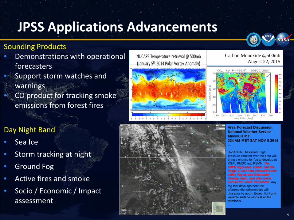
JPSS Applications Advancements
9
Sounding Products • Demonstrations with operational
forecasters • Support storm watches and
warnings • CO product for tracking smoke
emissions from forest fires Day Night Band • Sea Ice • Storm tracking at night • Ground Fog • Active fires and smoke • Socio / Economic / Impact
assessment
Carbon Monoxide @500mb August 22, 2015
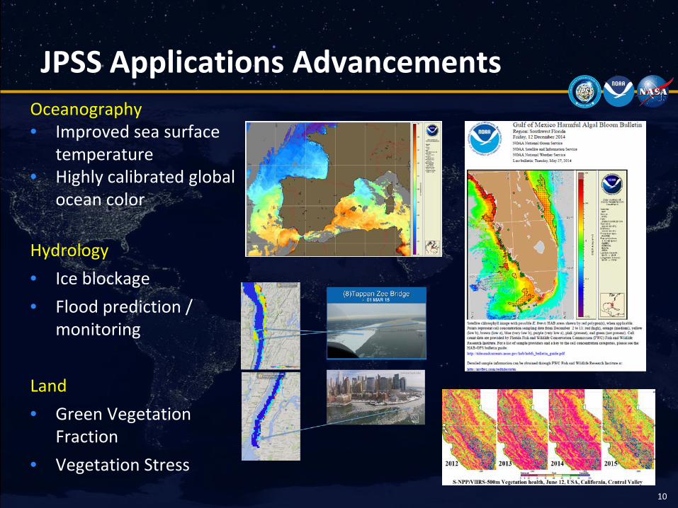
JPSS Applications Advancements
10
Oceanography • Improved sea surface
temperature • Highly calibrated global
ocean color
Hydrology • Ice blockage • Flood prediction /
monitoring
Land • Green Vegetation
Fraction • Vegetation Stress
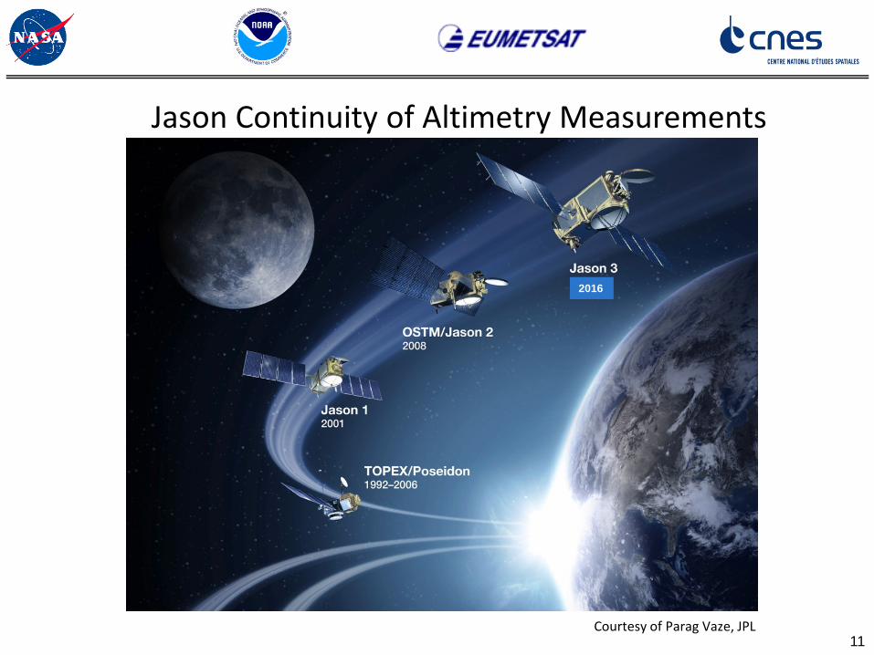
11 Courtesy of Parag Vaze, JPL
Jason Continuity of Altimetry Measurements
2016
12
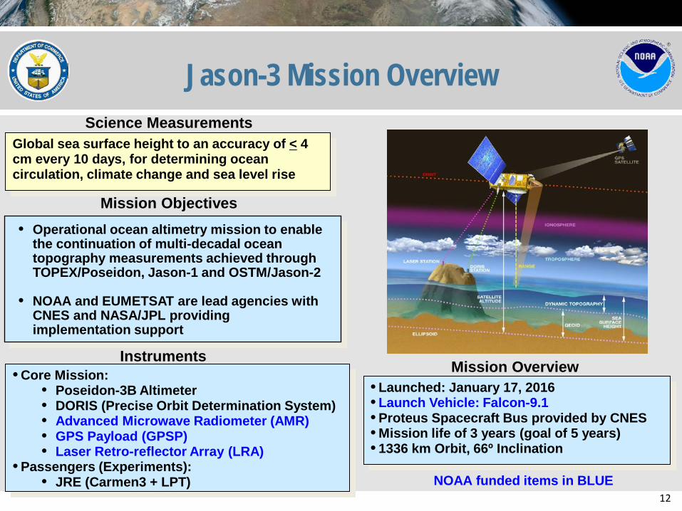
Jason-3 Mission Overview
Instruments • Core Mission:
• Poseidon-3B Altimeter • DORIS (Precise Orbit Determination System) • Advanced Microwave Radiometer (AMR) • GPS Payload (GPSP) • Laser Retro-reflector Array (LRA)
• Passengers (Experiments): • JRE (Carmen3 + LPT)
Science Measurements Global sea surface height to an accuracy of < 4 cm every 10 days, for determining ocean circulation, climate change and sea level rise
Mission Objectives
Mission Overview • Launched: January 17, 2016 • Launch Vehicle: Falcon-9.1 • Proteus Spacecraft Bus provided by CNES • Mission life of 3 years (goal of 5 years) • 1336 km Orbit, 66º Inclination
• Operational ocean altimetry mission to enable the continuation of multi-decadal ocean topography measurements achieved through TOPEX/Poseidon, Jason-1 and OSTM/Jason-2
• NOAA and EUMETSAT are lead agencies with CNES and NASA/JPL providing implementation support
NOAA funded items in BLUE
N A T I O N A L O C E A N I C A N D A T M O S P H E R I C A D M I N I S T R A T I O N
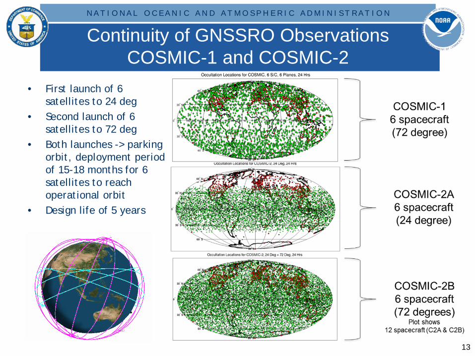
Continuity of GNSSRO Observations COSMIC-1 and COSMIC-2
• First launch of 6 satellites to 24 deg
• Second launch of 6 satellites to 72 deg
• Both launches -> parking orbit, deployment period of 15-18 months for 6 satellites to reach operational orbit
• Design life of 5 years
13
14
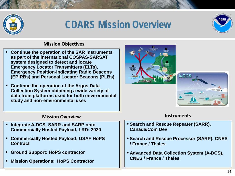
CDARS Mission Overview
Instruments
• Search and Rescue Repeater (SARR), Canada/Com Dev
• Search and Rescue Processor (SARP), CNES / France / Thales
• Advanced Data Collection System (A-DCS), CNES / France / Thales
Mission Objectives
Mission Overview • Integrate A-DCS, SARR and SARP onto
Commercially Hosted Payload, LRD: 2020
• Commercially Hosted Payload: USAF HoPS Contract
• Ground Support: HoPS contractor
• Mission Operations: HoPS Contractor
• Continue the operation of the SAR instruments as part of the international COSPAS-SARSAT system designed to detect and locate Emergency Locator Transmitters (ELTs), Emergency Position-Indicating Radio Beacons (EPIRBs) and Personal Locator Beacons (PLBs)
• Continue the operation of the Argos Data Collection System obtaining a wide variety of data from platforms used for both environmental study and non-environmental uses
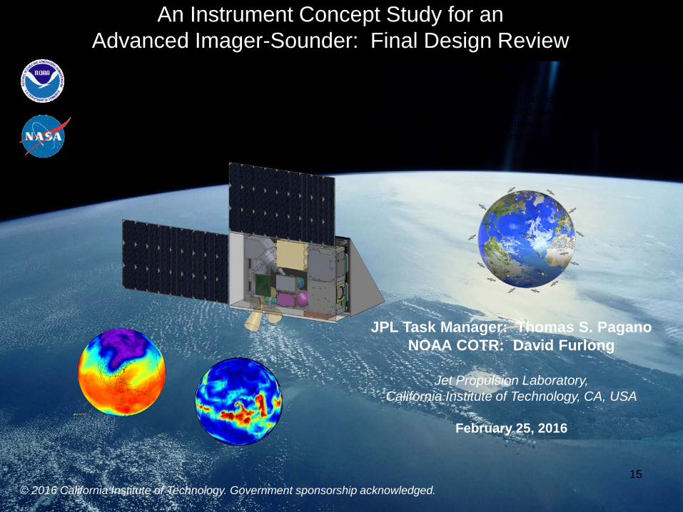
An Instrument Concept Study for an Advanced Imager-Sounder: Final Design Review
15
Sponsor: The National Oceanographic and Atmospheric Administration (NOAA) Performed by: The NASA Jet Propulsion Laboratory
“The Goal of the study is to quantify the ability to meet the Cross-track Infrared Sounder performance requirements on a CubeSat platform.”
© 2016 California Institute of Technology. Government sponsorship acknowledged.
JPL Task Manager: Thomas S. Pagano NOAA COTR: David Furlong
Jet Propulsion Laboratory,
California Institute of Technology, CA, USA
February 25, 2016
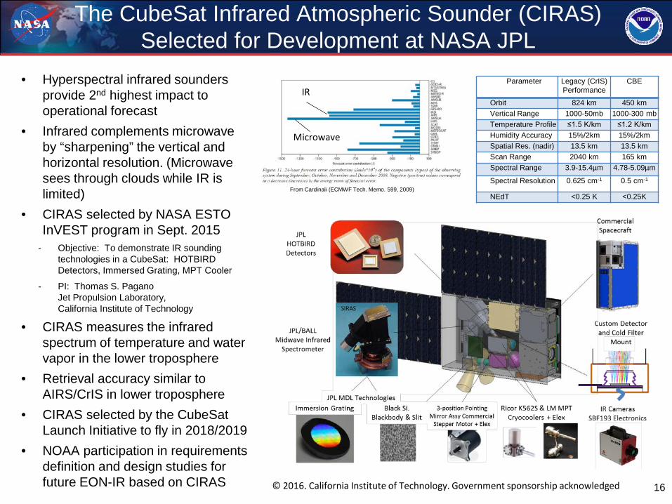
The CubeSat Infrared Atmospheric Sounder (CIRAS) Selected for Development at NASA JPL
• Hyperspectral infrared sounders provide 2nd highest impact to operational forecast
• Infrared complements microwave by “sharpening” the vertical and horizontal resolution. (Microwave sees through clouds while IR is limited)
• CIRAS selected by NASA ESTO InVEST program in Sept. 2015
- Objective: To demonstrate IR sounding technologies in a CubeSat: HOTBIRD Detectors, Immersed Grating, MPT Cooler
- PI: Thomas S. Pagano Jet Propulsion Laboratory, California Institute of Technology
• CIRAS measures the infrared spectrum of temperature and water vapor in the lower troposphere
• Retrieval accuracy similar to AIRS/CrIS in lower troposphere
• CIRAS selected by the CubeSat Launch Initiative to fly in 2018/2019
• NOAA participation in requirements definition and design studies for future EON-IR based on CIRAS 16
From Cardinali (ECMWF Tech. Memo. 599, 2009)
IR
Microwave
Parameter Legacy (CrIS) Performance
CBE
Orbit 824 km 450 km Vertical Range 1000-50mb 1000-300 mb Temperature Profile ≤1.5 K/km ≤1.2 K/km Humidity Accuracy 15%/2km 15%/2km Spatial Res. (nadir) 13.5 km 13.5 km Scan Range 2040 km 165 km Spectral Range 3.9-15.4µm 4.78-5.09µm
Spectral Resolution 0.625 cm-1 0.5 cm-1
NEdT <0.25 K <0.25K
© 2016. California Institute of Technology. Government sponsorship acknowledged
17
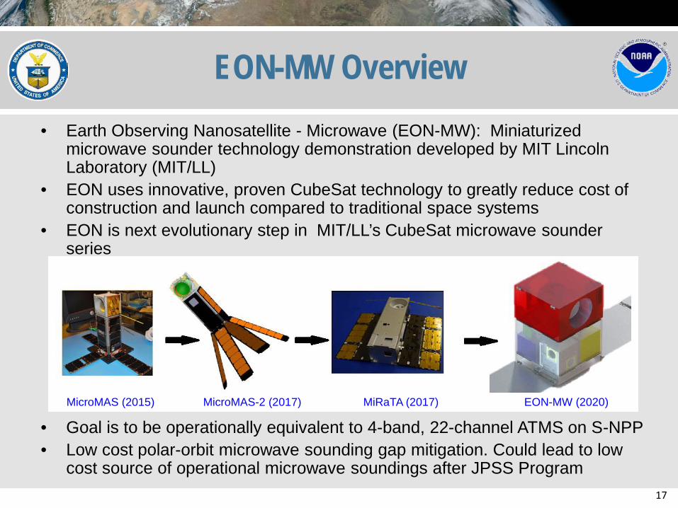
EON-MW Overview • Earth Observing Nanosatellite - Microwave (EON-MW): Miniaturized
microwave sounder technology demonstration developed by MIT Lincoln Laboratory (MIT/LL)
• EON uses innovative, proven CubeSat technology to greatly reduce cost of construction and launch compared to traditional space systems
• EON is next evolutionary step in MIT/LL’s CubeSat microwave sounder series
• Goal is to be operationally equivalent to 4-band, 22-channel ATMS on S-NPP • Low cost polar-orbit microwave sounding gap mitigation. Could lead to low
cost source of operational microwave soundings after JPSS Program
MicroMAS (2015) MicroMAS-2 (2017) MiRaTA (2017) EON-MW (2020)
18
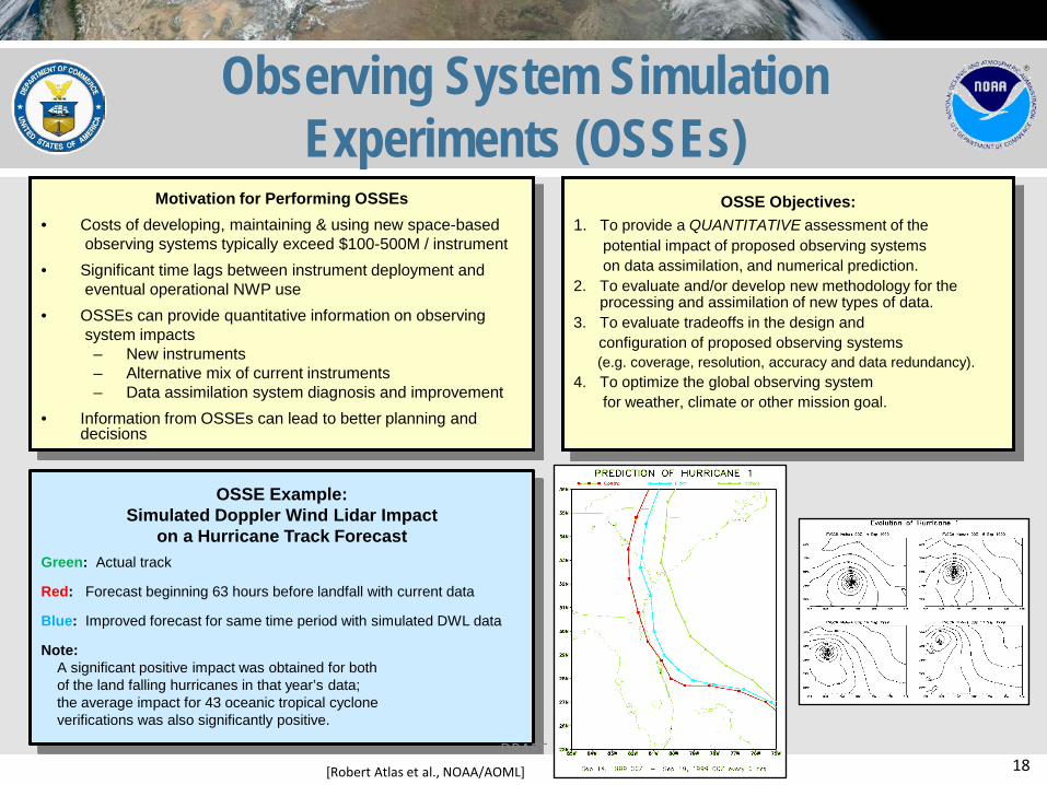
OSSE Example: Simulated Doppler Wind Lidar Impact
on a Hurricane Track Forecast
Green: Actual track
Red: Forecast beginning 63 hours before landfall with current data
Blue: Improved forecast for same time period with simulated DWL data
Note: A significant positive impact was obtained for both of the land falling hurricanes in that year’s data; the average impact for 43 oceanic tropical cyclone verifications was also significantly positive.
Observing System Simulation Experiments (OSSEs)
Motivation for Performing OSSEs
• Costs of developing, maintaining & using new space-based observing systems typically exceed $100-500M / instrument
• Significant time lags between instrument deployment and eventual operational NWP use
• OSSEs can provide quantitative information on observing system impacts
– New instruments – Alternative mix of current instruments – Data assimilation system diagnosis and improvement
• Information from OSSEs can lead to better planning and decisions
OSSE Objectives:
1. To provide a QUANTITATIVE assessment of the potential impact of proposed observing systems on data assimilation, and numerical prediction. 2. To evaluate and/or develop new methodology for the
processing and assimilation of new types of data. 3. To evaluate tradeoffs in the design and configuration of proposed observing systems (e.g. coverage, resolution, accuracy and data redundancy). 4. To optimize the global observing system for weather, climate or other mission goal.
[Robert Atlas et al., NOAA/AOML] DRAFT
19
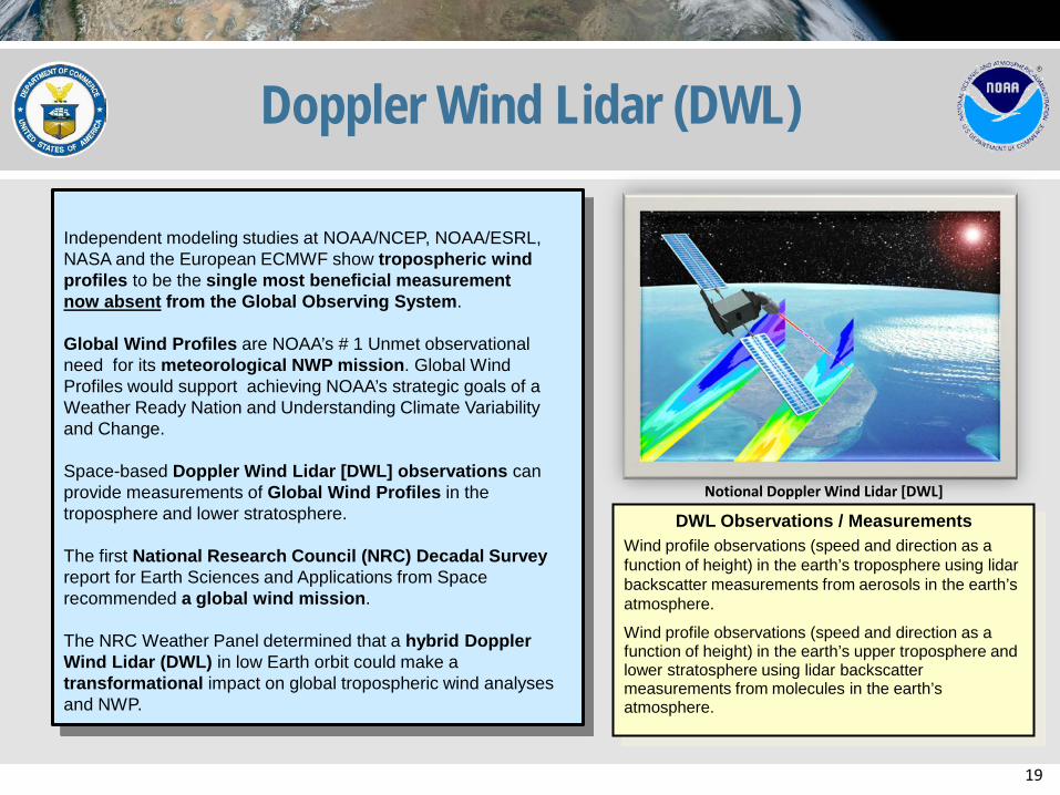
Doppler Wind Lidar (DWL)
Independent modeling studies at NOAA/NCEP, NOAA/ESRL, NASA and the European ECMWF show tropospheric wind profiles to be the single most beneficial measurement now absent from the Global Observing System. Global Wind Profiles are NOAA’s # 1 Unmet observational need for its meteorological NWP mission. Global Wind Profiles would support achieving NOAA’s strategic goals of a Weather Ready Nation and Understanding Climate Variability and Change. Space-based Doppler Wind Lidar [DWL] observations can provide measurements of Global Wind Profiles in the troposphere and lower stratosphere. The first National Research Council (NRC) Decadal Survey report for Earth Sciences and Applications from Space recommended a global wind mission. The NRC Weather Panel determined that a hybrid Doppler Wind Lidar (DWL) in low Earth orbit could make a transformational impact on global tropospheric wind analyses and NWP.
Notional Doppler Wind Lidar [DWL]
DWL Observations / Measurements Wind profile observations (speed and direction as a function of height) in the earth’s troposphere using lidar backscatter measurements from aerosols in the earth’s atmosphere.
Wind profile observations (speed and direction as a function of height) in the earth’s upper troposphere and lower stratosphere using lidar backscatter measurements from molecules in the earth’s atmosphere.
20 NATIONAL CENTERS FOR ENVIRONMENTAL INFORMATION
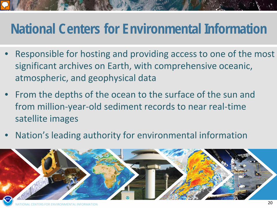
National Centers for Environmental Information • Responsible for hosting and providing access to one of the most
significant archives on Earth, with comprehensive oceanic, atmospheric, and geophysical data
• From the depths of the ocean to the surface of the sun and from million-year-old sediment records to near real-time satellite images
• Nation’s leading authority for environmental information
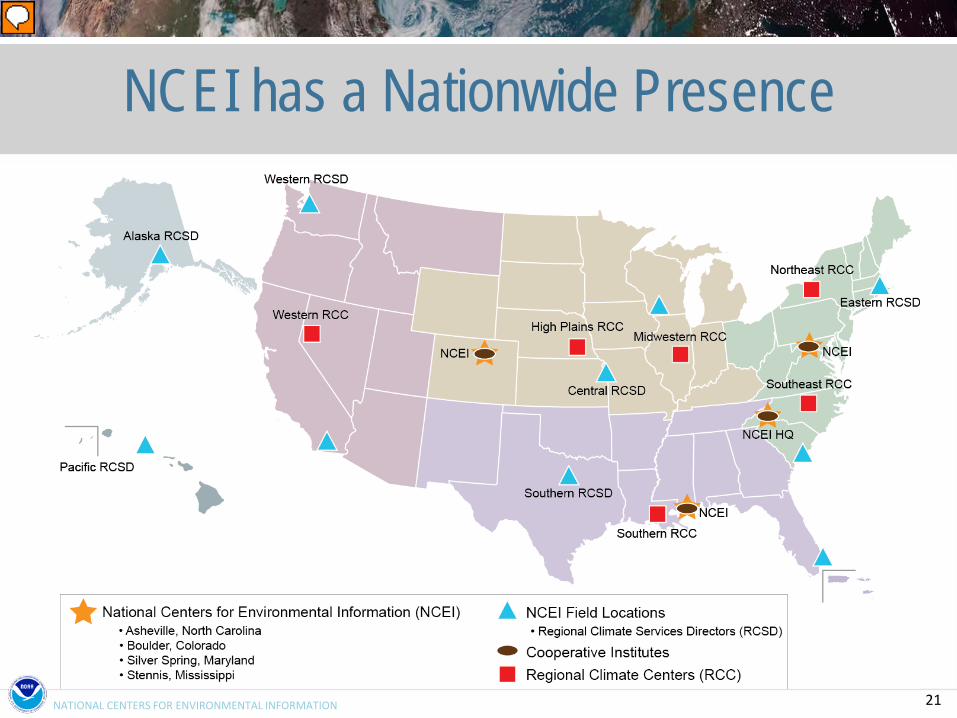
21 NATIONAL CENTERS FOR ENVIRONMENTAL INFORMATION
NCEI has a Nationwide Presence
22
Thank you!
Recommended