Long-Range Lightning Applications
Nicholas W. S. Demetriades
Vaisala, Tucson Operations
©Vaisala | date | Ref. code | Page 2
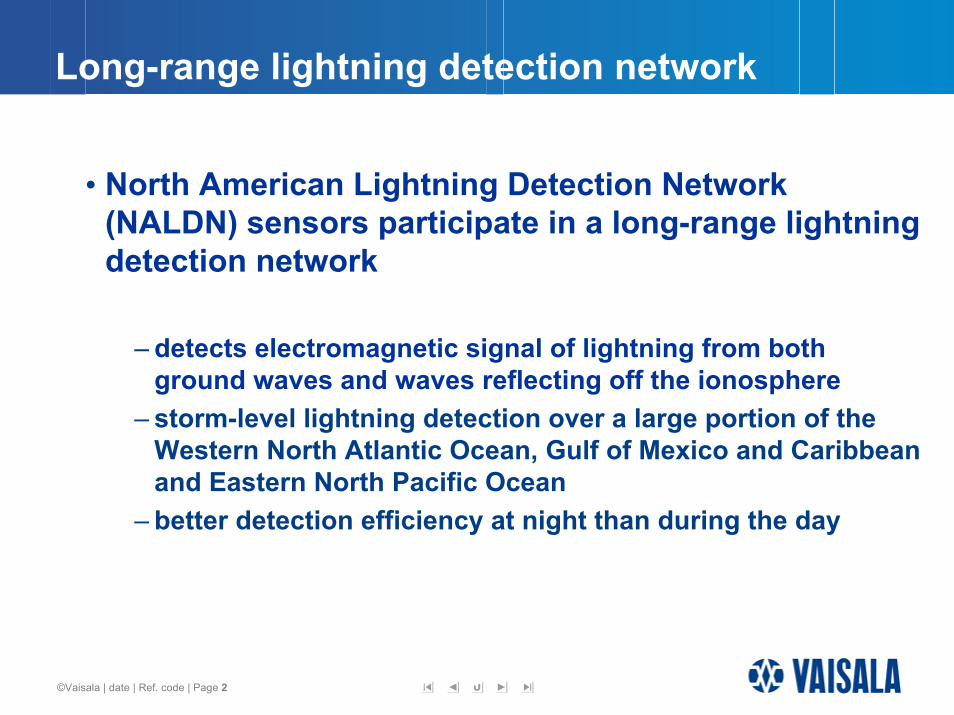
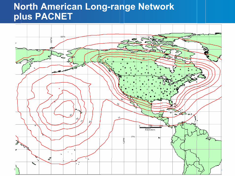
Long-range lightning detection network
• North American Lightning Detection Network (NALDN) sensors participate in a long-range lightning detection network
– detects electromagnetic signal of lightning from both ground waves and waves reflecting off the ionosphere
– storm-level lightning detection over a large portion of the Western North Atlantic Ocean, Gulf of Mexico and Caribbean and Eastern North Pacific Ocean
– better detection efficiency at night than during the day
©Vaisala | date | Ref. code | Page 3
North American Long-range Network plus PACNET
©Vaisala | date | Ref. code | Page 4
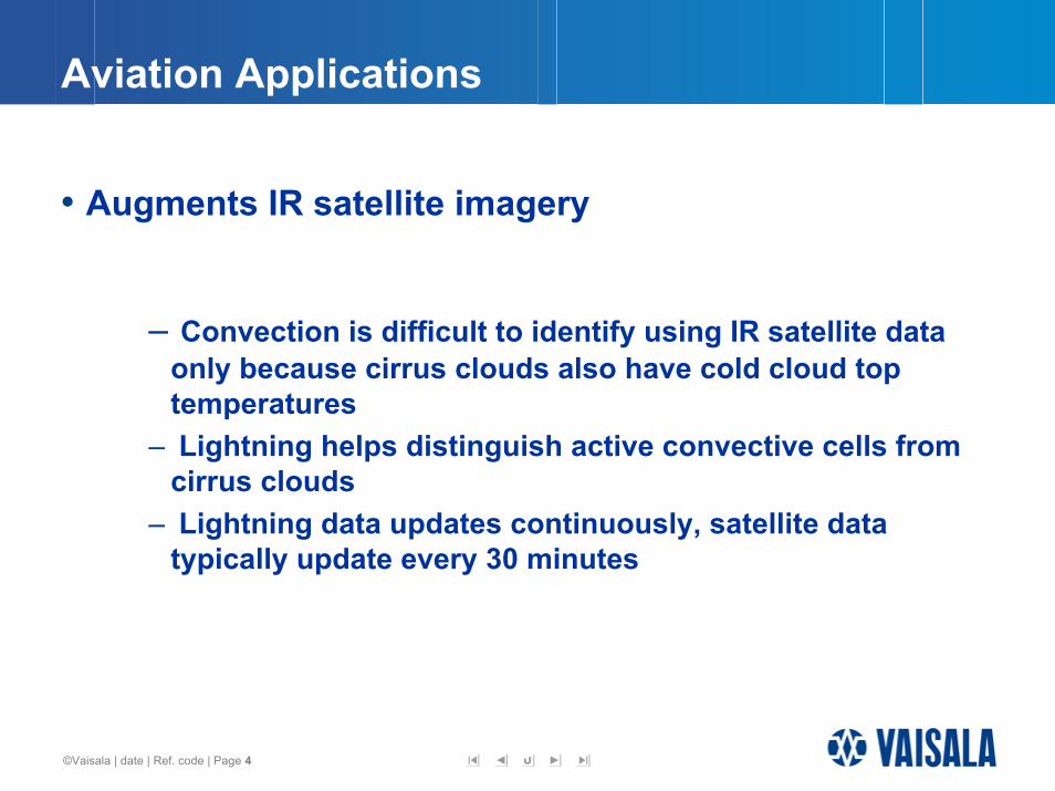
Aviation Applications
• Augments IR satellite imagery
– Convection is difficult to identify using IR satellite data only because cirrus clouds also have cold cloud top temperatures
– Lightning helps distinguish active convective cells from cirrus clouds
– Lightning data updates continuously, satellite data typically update every 30 minutes
©Vaisala | date | Ref. code | Page 5
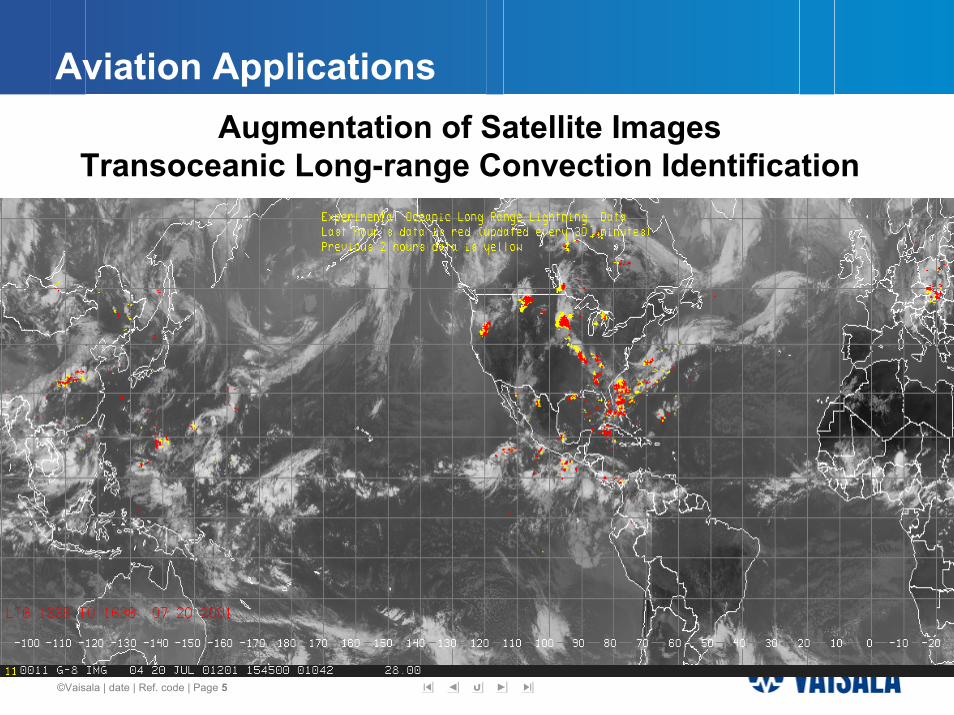
Aviation ApplicationsAugmentation of Satellite Images
Transoceanic Long-range Convection Identification
©Vaisala | date | Ref. code | Page 6
Forecasting extratropical cyclone intensity
• Lightning data assimilation into numerical weather prediction models
– Several case studies have shown substantial improvement inextratropical cyclone intensity and track forecasts due to lightning data assimilation into the MM5 model
©Vaisala | date | Ref. code | Page 7
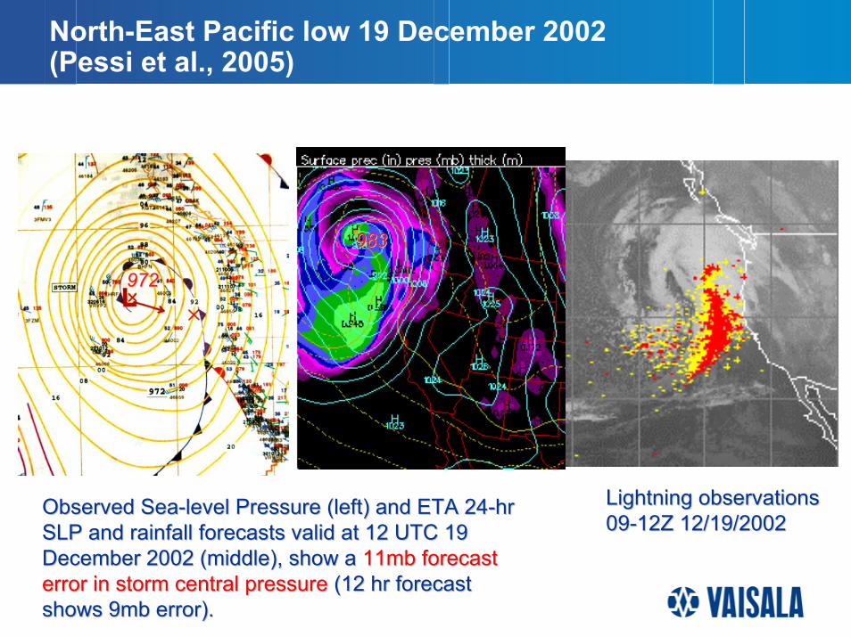
North-East Pacific Low 19 December 2002North-East Pacific low 19 December 2002 (Pessi et al., 2005)
983983
972972
Lightning observations Lightning observations 0909--12Z 12/19/200212Z 12/19/2002
Observed SeaObserved Sea--level Pressure (left) and ETA 24level Pressure (left) and ETA 24--hr hr SLP and rainfall forecasts valid at 12 UTC 19 SLP and rainfall forecasts valid at 12 UTC 19 December 2002 (middle), show aDecember 2002 (middle), show a 11mb forecast 11mb forecast error in storm central pressureerror in storm central pressure (12 hr forecast (12 hr forecast shows 9mb error).shows 9mb error).
©Vaisala | date | Ref. code | Page 8
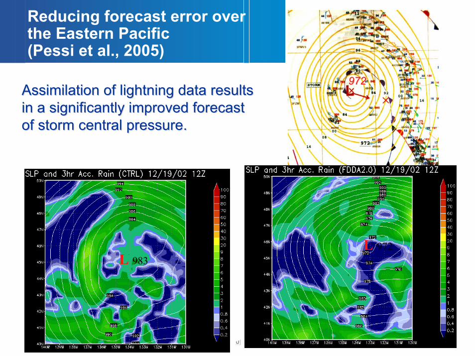
972972
L 972L 983
Assimilation of lightning data results Assimilation of lightning data results in a significantly improved forecast in a significantly improved forecast of storm central pressure.of storm central pressure.
Reducing forecast error over the Eastern Pacific (Pessi et al., 2005)
©Vaisala | date | Ref. code | Page 9
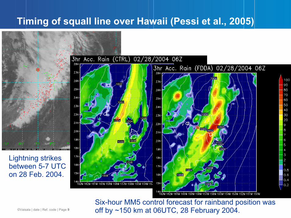
Timing of Squall Line Over HawaiiTiming of squall line over Hawaii (Pessi et al., 2005)
Six-hour MM5 control forecast for rainband position was off by ~150 km at 06UTC, 28 February 2004.
*
**
Lightning strikes between 5-7 UTC on 28 Feb. 2004.
©Vaisala | date | Ref. code | Page 10
Nowcasting (and Forecasting) extratropical cyclone precipitation amounts
• Cold front convection
– Excessive lightning activity associated with a cold front is an indication that deep tropical moisture is available to be entrained into the cold sector of a storm
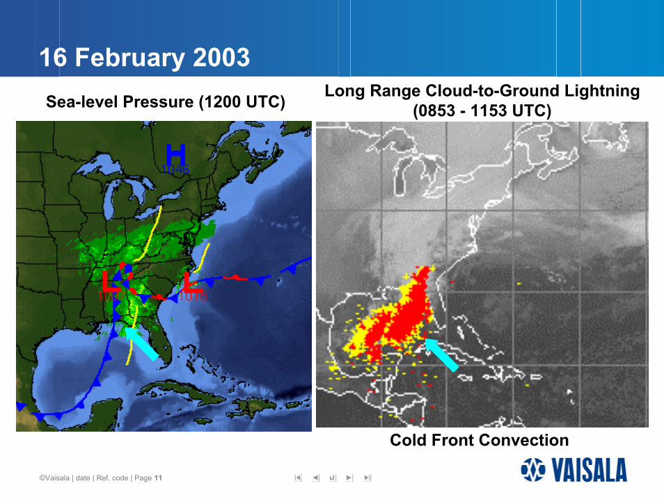
©Vaisala | date | Ref. code | Page 11
16 February 2003Long Range Cloud-to-Ground Lightning
(0853 - 1153 UTC)Sea-level Pressure (1200 UTC)
Cold Front Convection
©Vaisala | date | Ref. code | Page 12
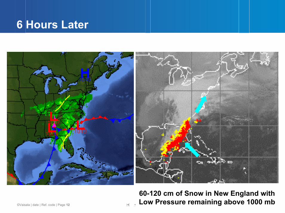
6 Hours Later6 Hours Later
60-120 cm of Snow in New England with Low Pressure remaining above 1000 mb
Recommended