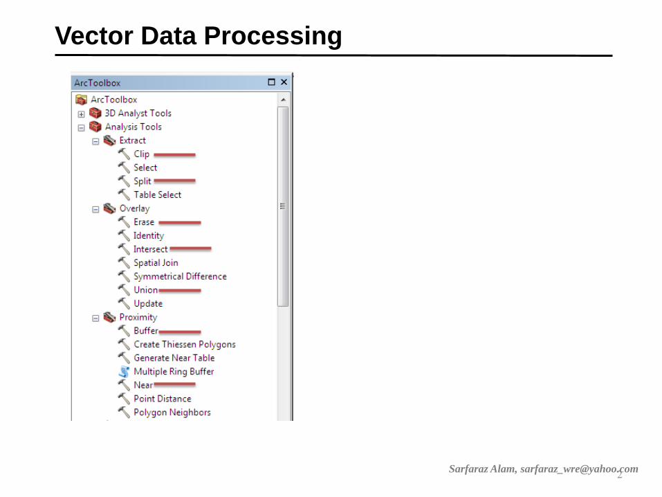
Vector data processing and
Coordinate System
1
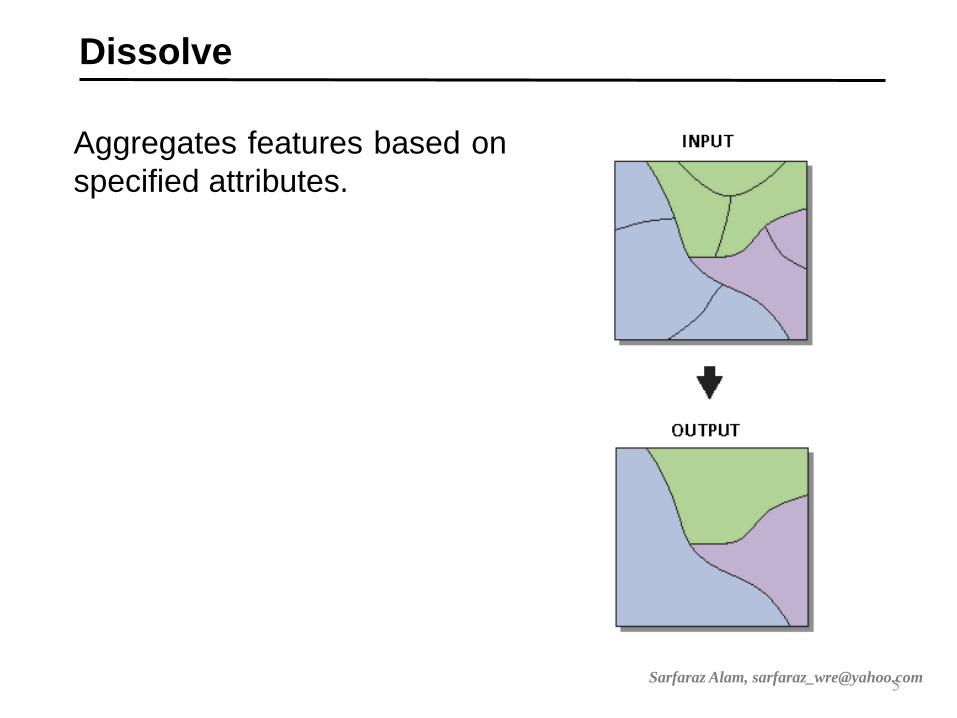
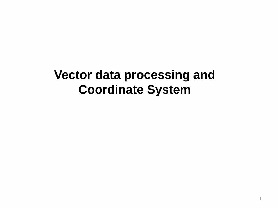
Union
Computes a geometric
union of the input
features.
All features and their
attributes will be written to
the output feature class.
3 Sarfaraz Alam, [email protected]

Erase
Creates a feature class by
overlaying the Input
Features with the polygons of
the Erase Features.
Only those portions of the
input features falling outside
the erase features outside
boundaries are copied to the
output feature class.
4 Sarfaraz Alam, [email protected]

Intersection
Computes a geometric
intersection of the input
features.
Features or portions of
features which overlap in
all layers and/or feature
classes will be written to
the output feature class.
6 Sarfaraz Alam, [email protected]
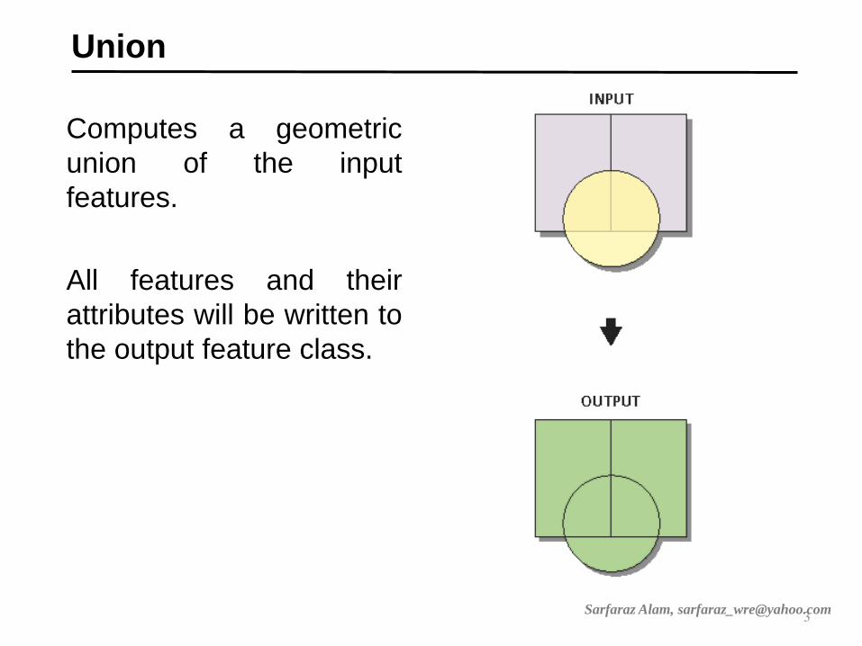
Split
Splitting the Input Features
creates a subset of multiple
output feature classes.
The Split Field's unique values
form the names of the output
feature classes. These are
saved in the target workspace
7 Sarfaraz Alam, [email protected]

Clip
Extracts input features that overlay
the clip features.
Use this tool to cut out a piece of
one feature class using one or more
of the features in another feature
class as a cookie cutter.
8 Sarfaraz Alam, [email protected]
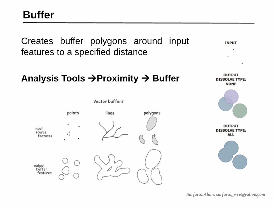
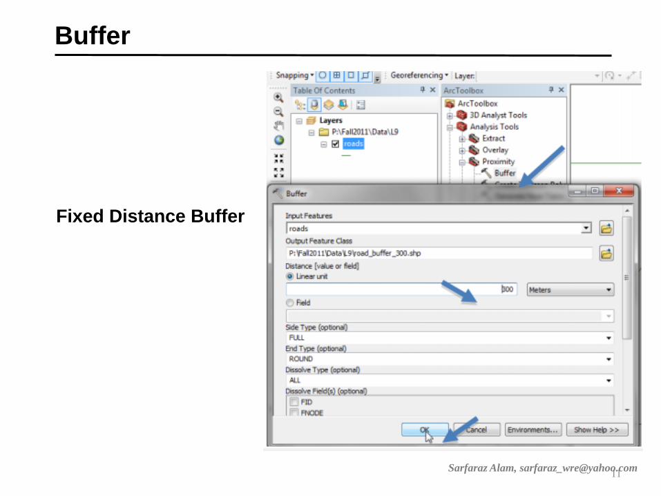
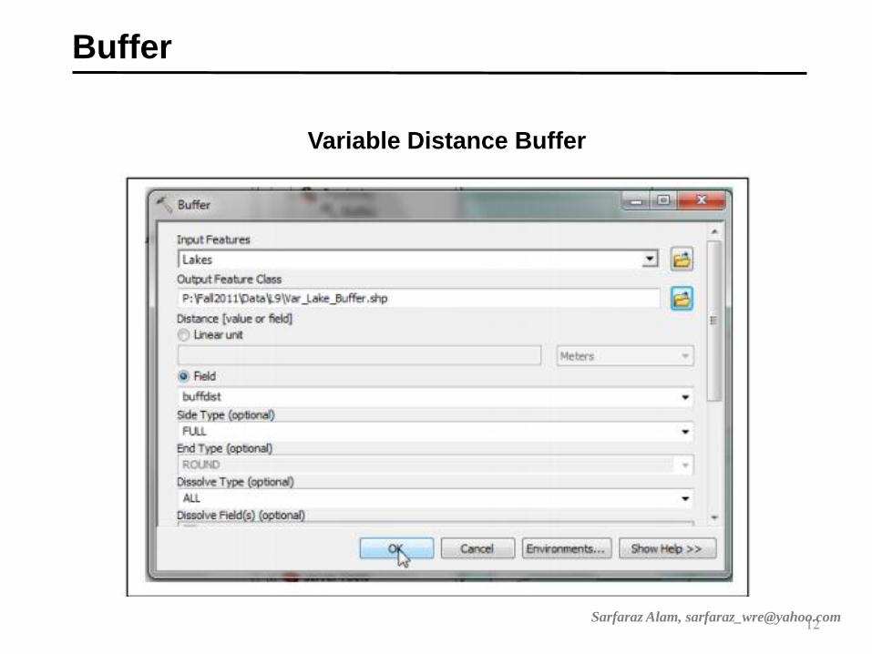
Buffer
Creates buffer polygons around input
features to a specified distance
Analysis Tools Proximity Buffer
9 Sarfaraz Alam, [email protected]
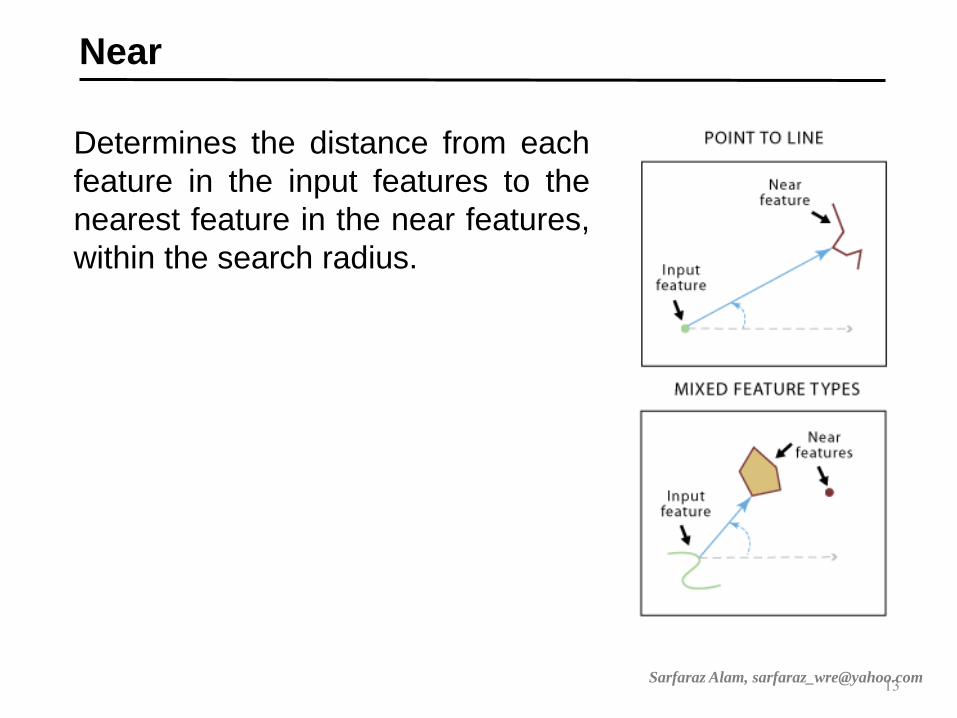
Near
Determines the distance from each
feature in the input features to the
nearest feature in the near features,
within the search radius.
13 Sarfaraz Alam, [email protected]
Coordinate system
15

Fig: Shape of
the Earth
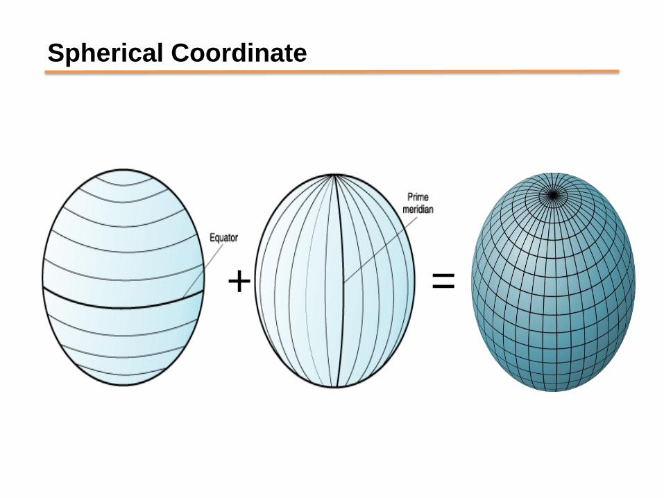
Spherical Coordinate
+ =
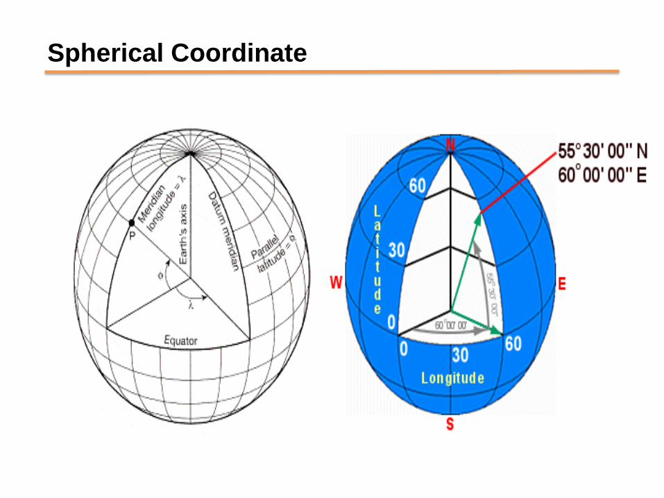
Spherical Coordinate
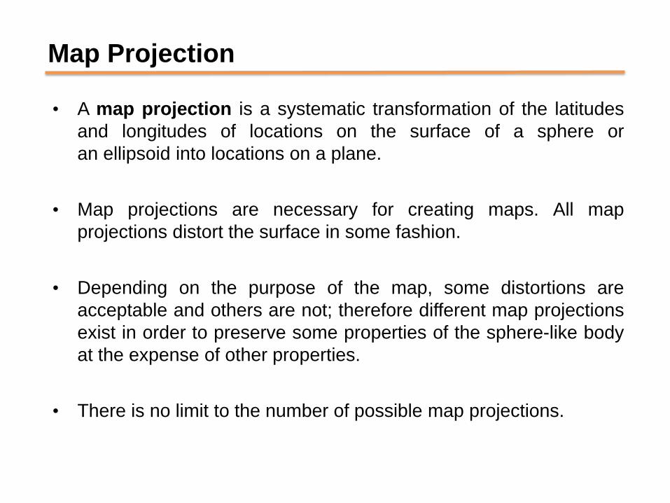
Map Projection
• A map projection is a systematic transformation of the latitudes
and longitudes of locations on the surface of a sphere or
an ellipsoid into locations on a plane.
• Map projections are necessary for creating maps. All map
projections distort the surface in some fashion.
• Depending on the purpose of the map, some distortions are
acceptable and others are not; therefore different map projections
exist in order to preserve some properties of the sphere-like body
at the expense of other properties.
• There is no limit to the number of possible map projections.

Types of Map Projection
Map projections are classified in several ways
• Based on geometrical model of projection
• Based on orientation
• Based on pattern of deformation
Fig: Transformation From 3 dimension to 2
dimension

Classification based on geometrical model of projection
•Azimuthal Projection
•Cylindrical Projection
•Conical Projection
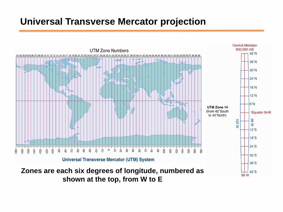
Universal Transverse Mercator projection
Zones are each six degrees of longitude, numbered as
shown at the top, from W to E
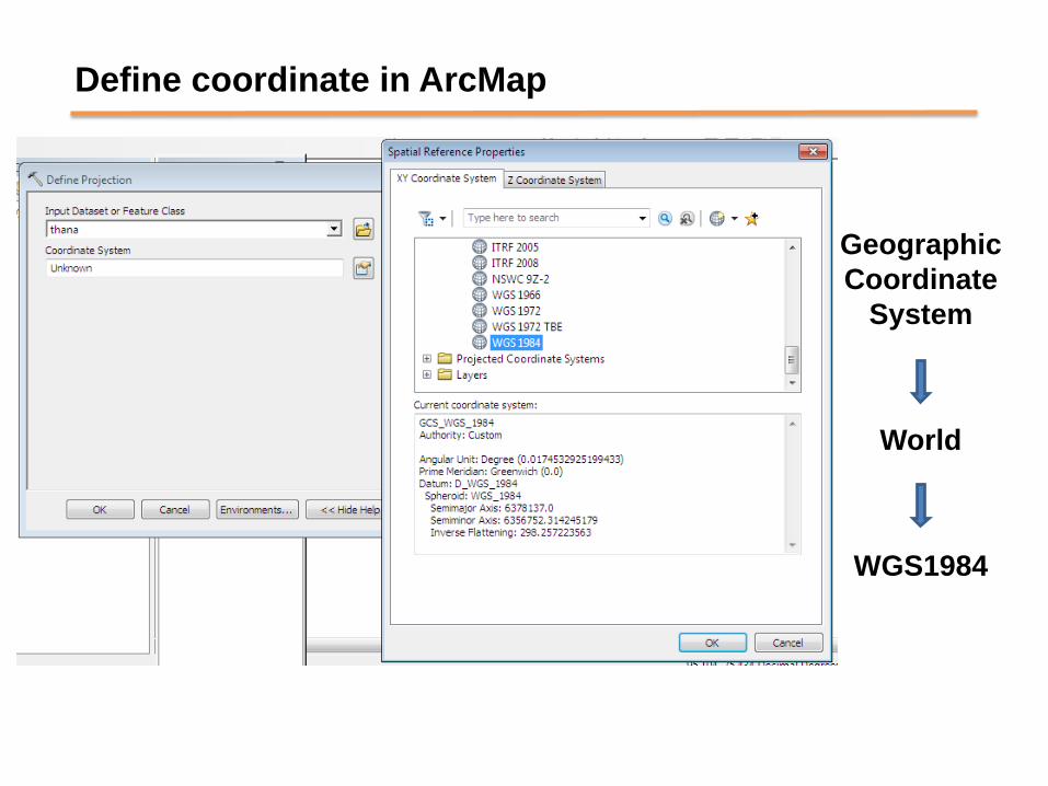
Define coordinate in ArcMap
Geographic
Coordinate
System
World
WGS1984
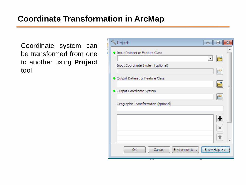
Coordinate Transformation in ArcMap
Coordinate system can
be transformed from one
to another using Project
tool
Class Work
25

Thank you
26
Recommended