DynusT (Dynamic Urban Systems in Transportation)

Recent Projects
IH corridor improvement (North Carolina, 2003-present)
IH tolling and congestion pricing (ELP, TX-2003-present)
IH work zone planning (ELP, TX-2004) Evacuation operational Planning
(HOU, TX, 2007, Baltimore, MD, 2005, Knoxville, TN, 2003)
Downtown improvement (ELP, TX, 2004)
ICM AMS modeling (Bay Area, CA, 2006-present)

On-going Efforts Military deployment transportation
improvement in Guam (PB, FHWA) Interstate highway corridor
improvement (TTI, TxDOT, ELP MPO) Value pricing (ORNL, FHWA; SRF,
Mn/DOT, TTI, TxDOT) Evacuation operational planning (UA,
ADOT; LSU, LDOT; Noblis, FHWA; Univ. of Toronto)
Integrated Corridor Management modeling (CS, FHWA)
Bay area regional modeling (CS, MTC) Florida turnpike system traffic and
evacuation analysis (FDOT Turnpike)

What DynusT Represents?
Regional Operational Planning Capability Regional - area larger than corridor Operational - traffic flow dynamics
sensitive to signals, road configurations Planning - short-term impact and long-
term equilibrium Enabled by
Mesoscopic Traffic Simulation Dynamic Traffic Assignment (DTA) Micro-meso-micro integration

What is Mesoscopic Traffic Simulation? Not as detailed as microscopic models,
but is as capable of high-fidelity traffic simulation of an entire region

What is Dynamic Traffic Assignment? A method to predict/estimate how trip-makers
may shift to other routes or departure time in response to: Congestion Pricing Controls Incidents Improvements
Understand how individual travel decisions impact an entire region, by Time of day Origin-Destination (OD) zones Transportation modes

How Trip-makers Adapt to Congestion

Macro-Meso-Micro Integration
Analyze Ingress/Egress
points for weaving
Meso MicroMacro
Estimate toll lane usage and revenue
Proposed toll lanes

Macro-Meso-Micro Integration
Macro Travel
Demand Models (TDM)
Micro e.g. VISSIM

Visualizing the Model’s Results
- An Example

I-95S AM commuting traffic impacted by
spillback from 495W
Applying toll on 495 ramp may improve
traffic on both 495W and 95S

A “What-if” Pricing Scheme
Variable toll on I-95 S to I-495 W ramp Toll increases with congestion level Morning peak period (5AM - 11AM)
LOV 89% HOV 11%
Value of Time: $10/hour Pricing
Distance based tolls: $0.25 /mile $2 for through traffic
Peak-period tolls: 7AM - 9AM Dimensions of impacts
Departure time Route Both

Peak Spreading Due to Value Pricing Change of departure time due to pricing
0
2000
4000
6000
8000
10000
12000
5:00
5:30
6:00
6:30
7:00
7:30
8:00
8:30
9:00
9:30
10:0
0
10:3
0
Time
# o
f V
ehic
les
Gen
erat
ed
Base Case
Peak Spreading

A Regional View (DynusT Animation)
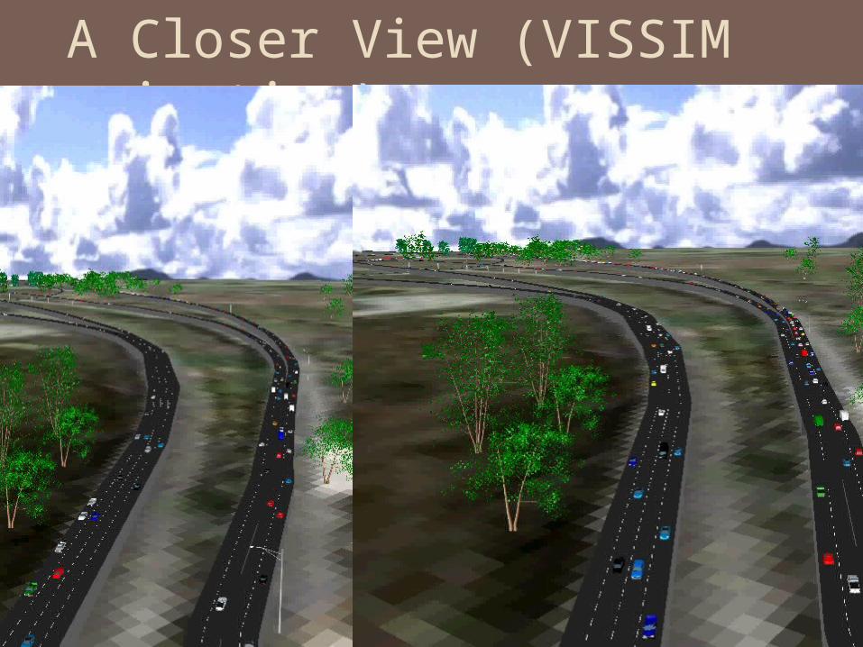
A Closer View (VISSIM animation)

Addressing Diversion Tolling may cause diversion on alternative routes
and/or other transportation modes Turnkey solution package needed to improve the
capacity to which the traffic may be diverted Signal optimization, information provision, transit
operation, peak spreading

A Low-Hanging Fruit Strategy – Optimize Signal

Other Freeway Operations Scenarios/Strategies Dynamic message signs
Congestion warning Mandatory detour Speed advisory
Information strategies Pre-trip information In-vehicle information
Incident Work zone Managed lanes
Truck only Truck restriction

Resource Considerations
Initial TDM import and conversion 100+ hrs
Data collection and model calibration 300+ hrs
Scenario analysis and reporting 400+ hrs
Total man-hours 800+
Budget 1,000 - 1,500 hours; including learning

How to Get Started
Capacity building Training workshop – agency and consultants
Establish baseline and future datasets Allow 12-18 months with sufficient budget Will be a valuable asset for many future
applications Save $$$ for agency in the long-run
Lesson learned from Minneapolis collapse Plan ahead and get the model built We are ready to act when needs arise
Recommended