Transcript

Brief Synopsis of ProjectHickahala Creek

•Hickahala Creek Pipeline Protection Project at milepost 347.64 Tate County, Senatobia, MS

Designed by Submar, Inc and River Research and Design, Inc.Installed, & Monitored by:

Submar Incorporated 805 Dunn St., Houma, LA

www.R2D-ENG.com | www.Submar.com


Hickahala Creek Pipeline Protection Project at milepost 347.64 Tate County, Senatobia, MS (Looking across and downstream in this view)


                        Looking Upstream - September 2001 - Pipeline Exposed 10 Feet


                        Looking Upstream - September 2002 - Pipeline Exposed 25 Feet


                        Looking Upstream - March 2003 - Pipeline Exposed 50 Feet


                        Looking Downstream - March 2003 - Pipeline Exposed 50 FeetMain stream force & thalweg of stream aimed underneath exposed pipe; note other pipeline exposed.


Looking Upstream - March 2003 - Long Straight ReachThornton Creek (tributary stream; bottom left) feeding into Hickahala Creek (top right)


                        Looking Upstream - April 2003 “and the news is not good"


                        Looking Upstream - the entire stream is trying to flow underneath the pipeline


                        Looking Downstream (standing Upstream) - August 2003Typical Tourist on Safari in Mississippi


                        Note Pipe Tie-Down Structure


July 2003 After May Flood (overbank, picture looking away from stream) Floodwaters Carry Sand 1000 Feet into Farmer's Field


                        August 2003 - Aerial Photos - *Note* Upstream Straight Stretch (bottom right)

Pipe Exposed on Overbank, Large Sand Splay in Farmers Field (top right)


Looking Downstream - April 2003 Pipe is Vulnerable to Impact from the Next Large Floating Tree. Bank is a mess

(technical term)


                        September 5th, 2003 Portable Cofferdams used to Dewater the site for Pipeline Recoating; The Green Portion of the Pipeline is New, Pipe was Cut, and New Section Installed at a Lower Elevation


Pre-tested Pipe


Hickahala Creek Conceptual Drawings - Total Mats (182)


Looking Upstream into Tributary

Widening Channel to Accommodate LPSTP


The Key Trench is a Thing of Beauty!


From Key Looking Downstream in Tributary Toward Hickahala Creek - September 17th, 2003 - Fresh LPSTP


Looking Upstream into Tributary

Longitudinal Peaked Stone Toe Protection (LPSTP)


                        LPSTP Under Construction

Looking Downstream - September 17th, 2003


                        September 17th, 2003

Mat Installation


September 17th, 2003Installing Mat


Looking Across and Upstream - September 22nd, 2003High Water Event During Construction


High Water Event During Construction

September 22nd, 2003


                        September 26th, 2003

*Note* Bank Paving (left), LPSTP (5 tons/ft; middle), Key (right)


                        September 26th, 2003

*Note* Bank Paving (left), & LPSPT (right)


September 27th, 2003 - Mat Installation Complete


                        Looking Upstream - September 30th 2003

Installation Complete


Project Completed


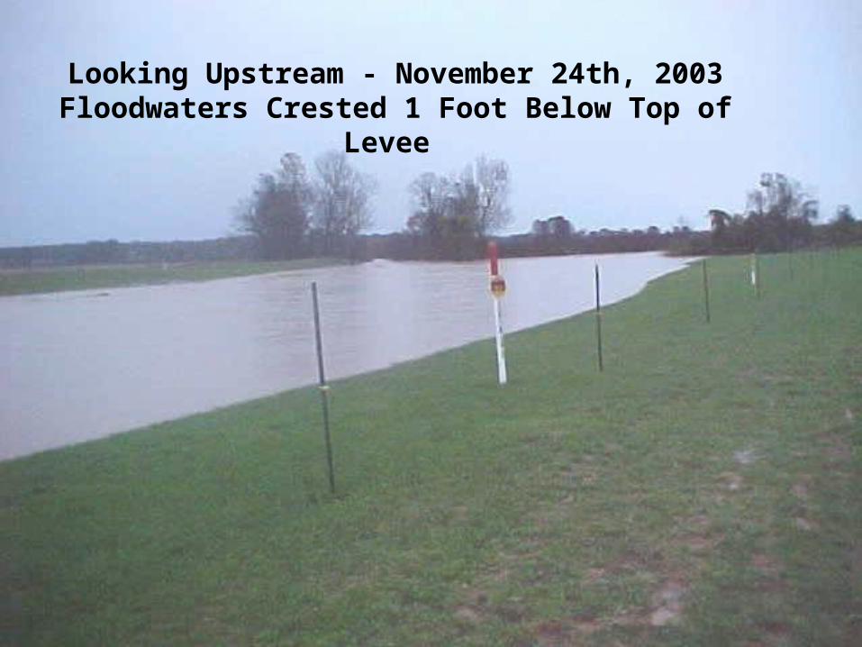
Looking Upstream - November 24th, 2003Floodwaters Crested 1 Foot Below Top of Levee


Before


After


Looking Upstream - February 5th 2004 - Flood


February 5th, 2004 FloodFlow Left to Right


Recommended