Embed Size (px)
Citation preview
Earthquake Hazards in the Central U.S.Brian BlakeCentral U.S. Earthquake Consortium
MEMA SAR Planning MeetingJuly 24, 2013
Senatobia, Mississippi
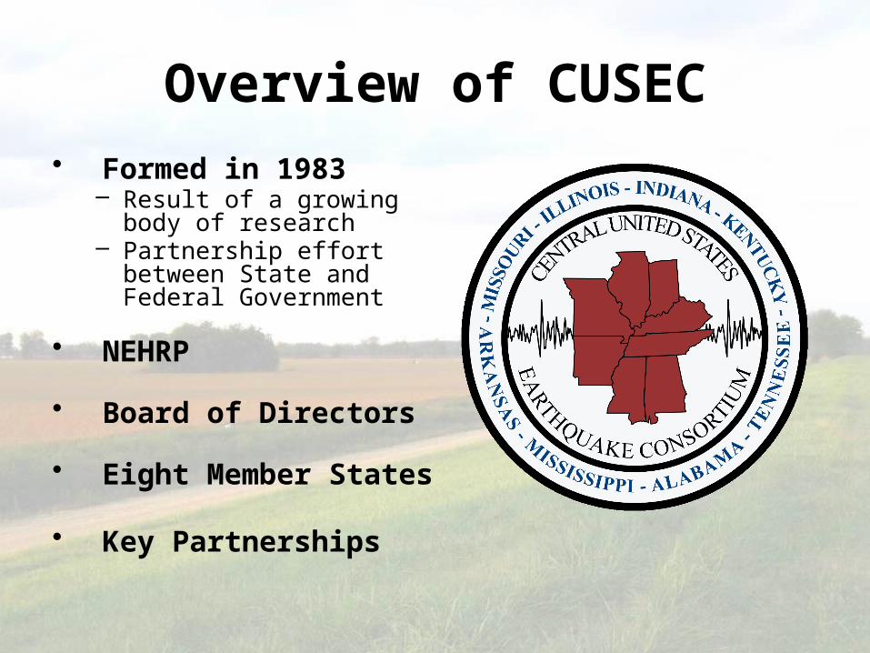
Overview of CUSEC• Formed in 1983
– Result of a growing body of research
– Partnership effort between State and Federal Government
• NEHRP
• Board of Directors
• Eight Member States
• Key Partnerships
Presentation Overview
• Earthquake Hazards & Scenario
• Earthquake Considerations for SAR
• CAPSTONE-14 Exercise
Terminology
• Epicenter
• Magnitude vs. Intensity
• Amplification
• Liquefaction
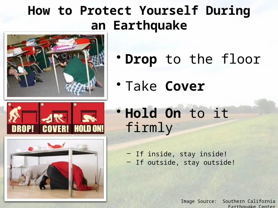
• Drop to the floor
• Take Cover
• Hold On to it firmly
– If inside, stay inside!– If outside, stay outside!
How to Protect Yourself During an Earthquake
Image Source: Southern California Earthquake Center
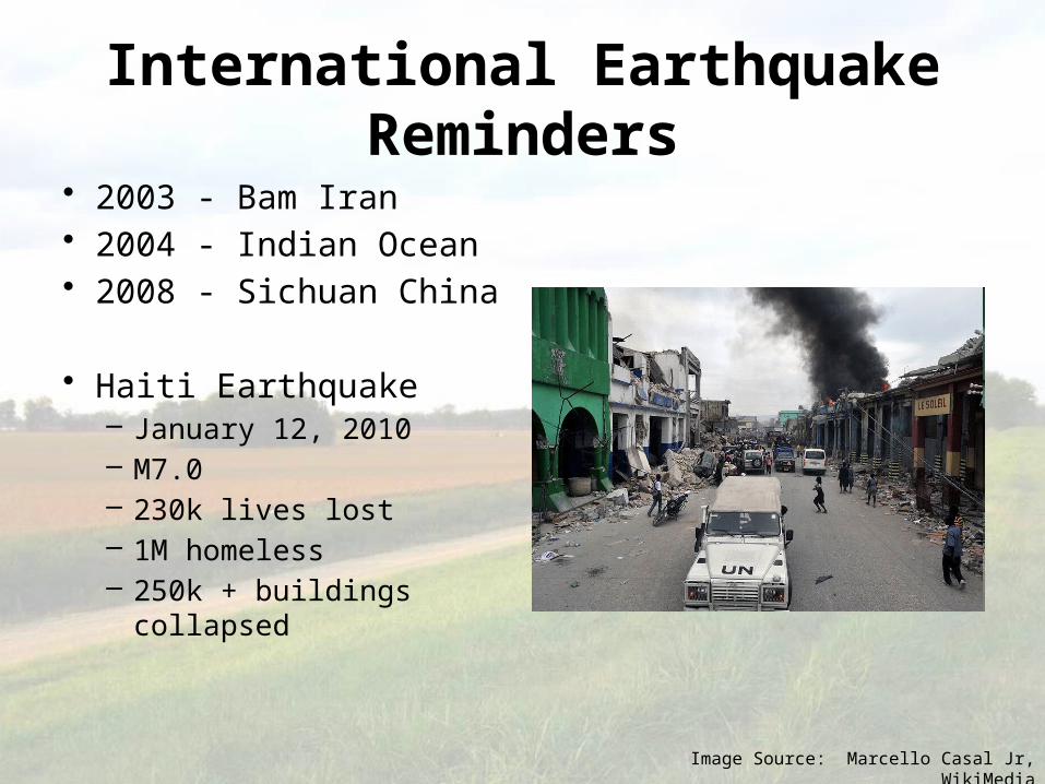
International Earthquake Reminders• 2003 - Bam Iran• 2004 - Indian Ocean • 2008 - Sichuan China
• Haiti Earthquake – January 12, 2010– M7.0– 230k lives lost– 1M homeless– 250k + buildings collapsed
Image Source: Marcello Casal Jr, WikiMedia
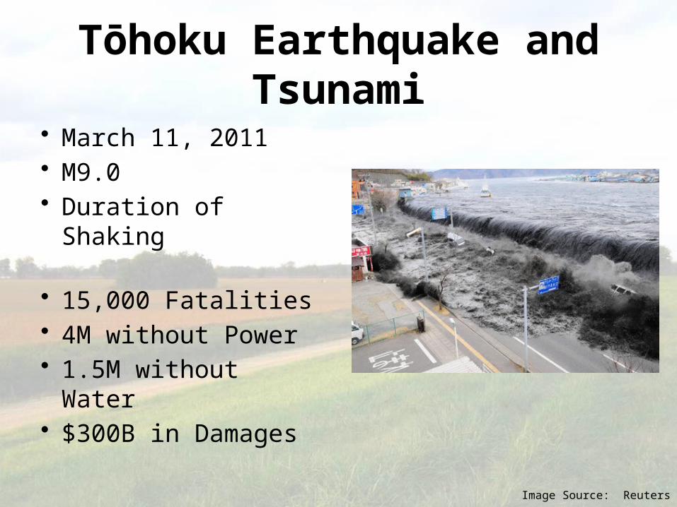
Tōhoku Earthquake and Tsunami
• March 11, 2011• M9.0• Duration of Shaking
• 15,000 Fatalities• 4M without Power• 1.5M without Water• $300B in Damages
Image Source: Reuters
Map Source: US Geological Survey
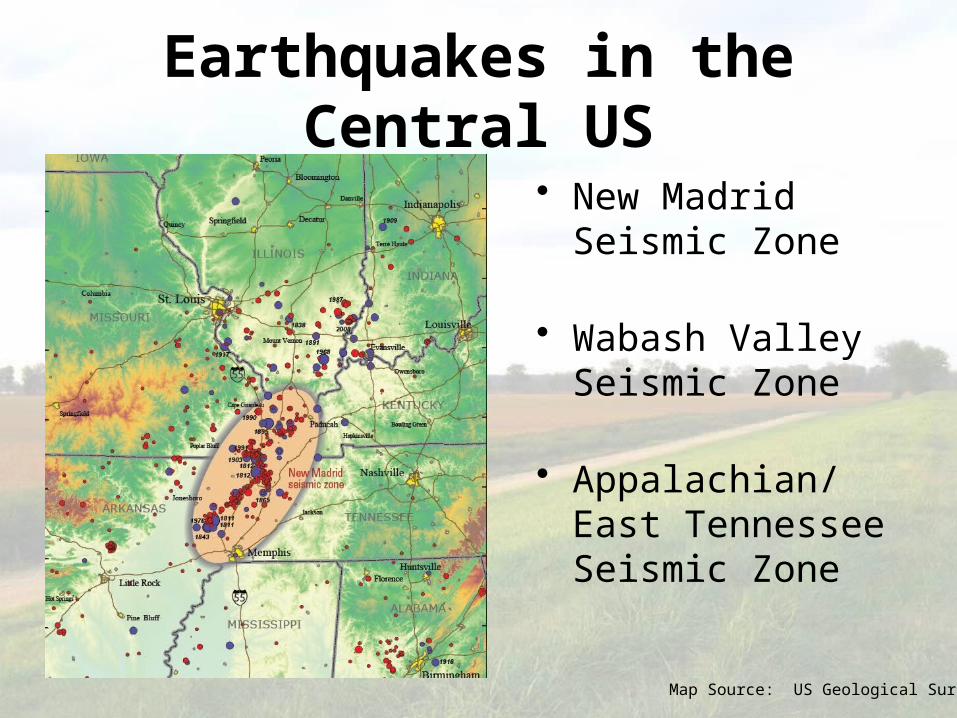
Earthquakes in the Central US
• New Madrid Seismic Zone
• Wabash Valley Seismic Zone
• Appalachian/East Tennessee Seismic Zone
Map Source: US Geological Survey
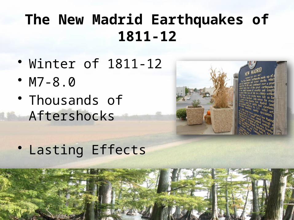
The New Madrid Earthquakes of 1811-12
• Winter of 1811-12• M7-8.0• Thousands of Aftershocks
• Lasting Effects
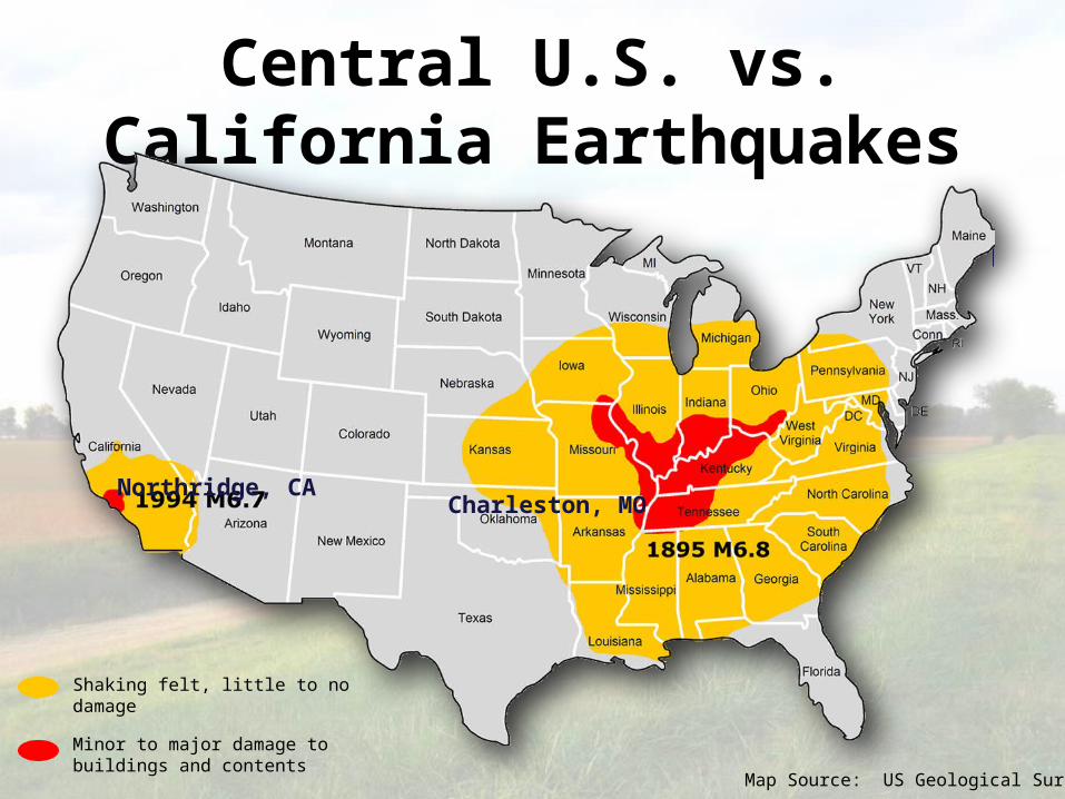
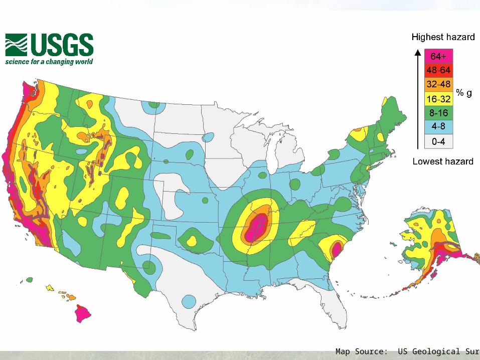
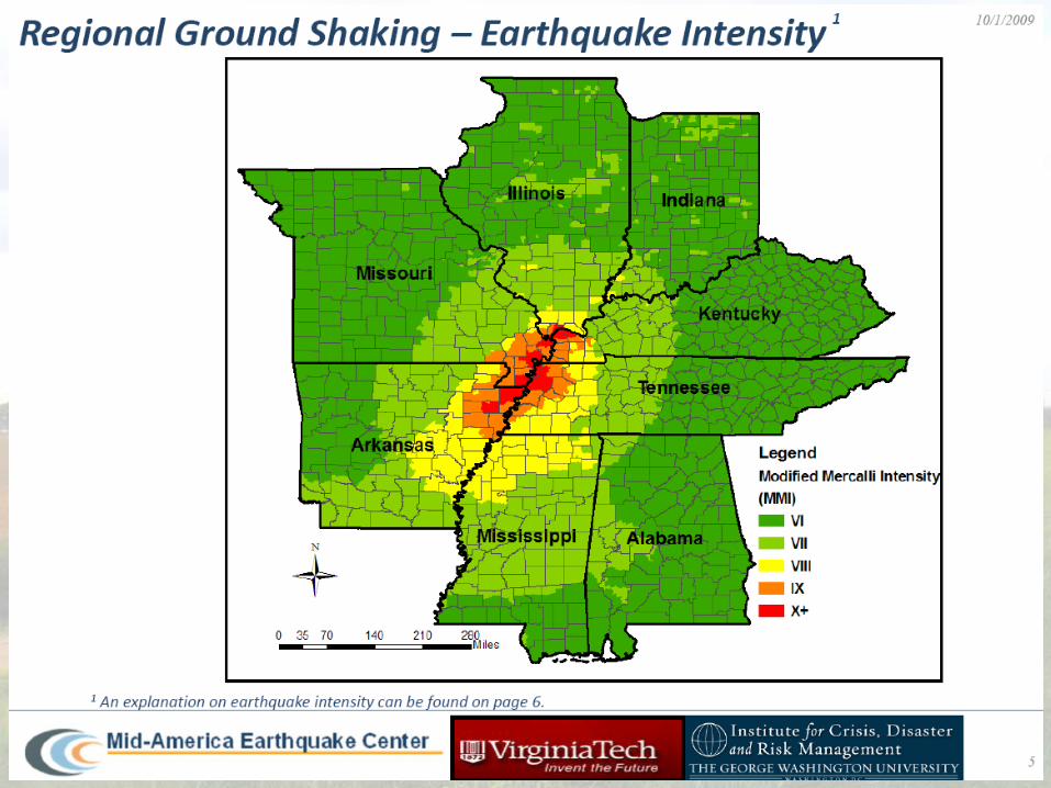
Central U.S. vs. California Earthquakes
Map Source: US Geological Survey
Shaking felt, little to no damage
Minor to major damage to buildings and contents
Northridge, CACharleston, MO
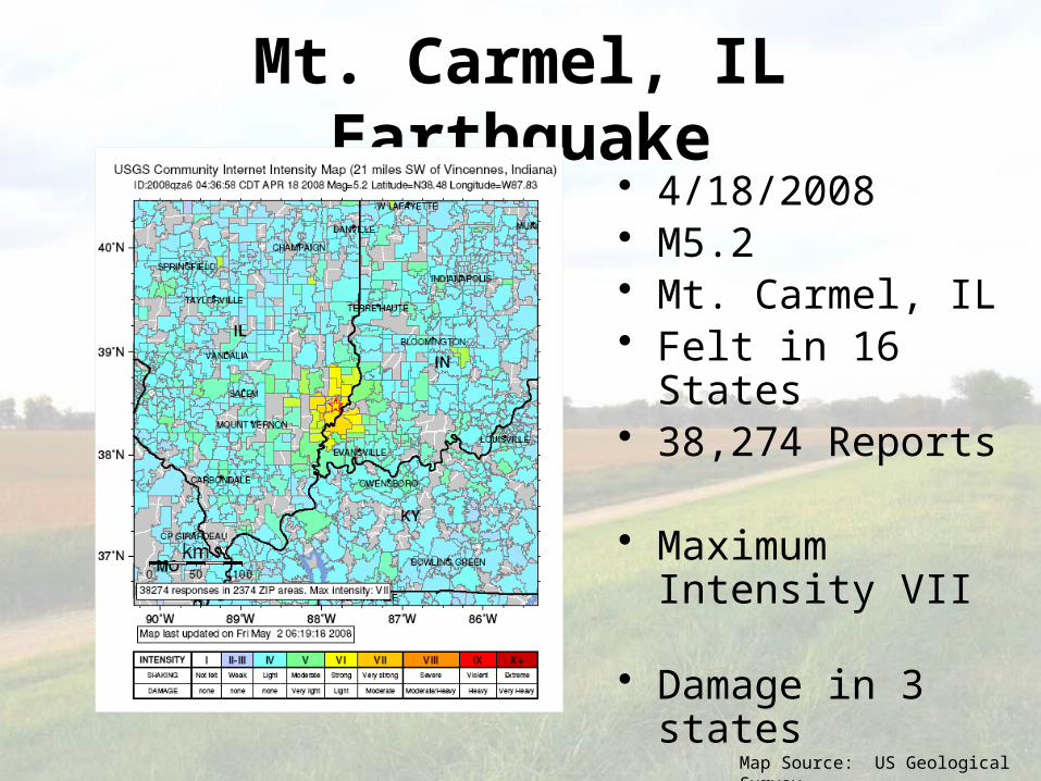
Mt. Carmel, IL Earthquake• 4/18/2008 • M5.2• Mt. Carmel, IL• Felt in 16 States• 38,274 Reports
• Maximum Intensity VII
• Damage in 3 states
Map Source: US Geological Survey
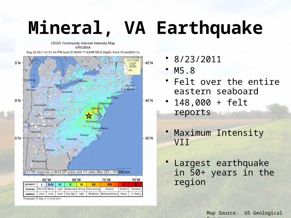
Mineral, VA Earthquake
• 8/23/2011• M5.8• Felt over the entire
eastern seaboard• 148,000 + felt reports
• Maximum Intensity VII
• Largest earthquake in 50+ years in the region
Map Source: US Geological Survey
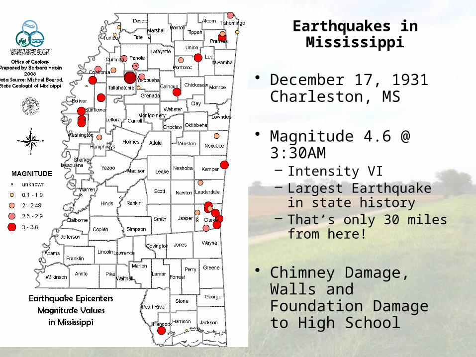
Earthquakes in Mississippi
• December 17, 1931Charleston, MS
• Magnitude 4.6 @ 3:30AM– Intensity VI– Largest Earthquake in
state history– That’s only 30 miles from
here!
• Chimney Damage, Walls and Foundation Damage to High School
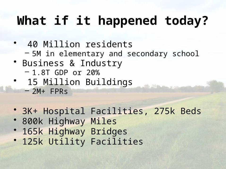
What if it happened today? • 40 Million residents
– 5M in elementary and secondary school • Business & Industry
– 1.8T GDP or 20%• 15 Million Buildings
– 2M+ FPRs
• 3K+ Hospital Facilities, 275k Beds• 800k Highway Miles• 165k Highway Bridges • 125k Utility Facilities
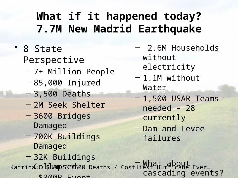
What if it happened today?7.7M New Madrid Earthquake
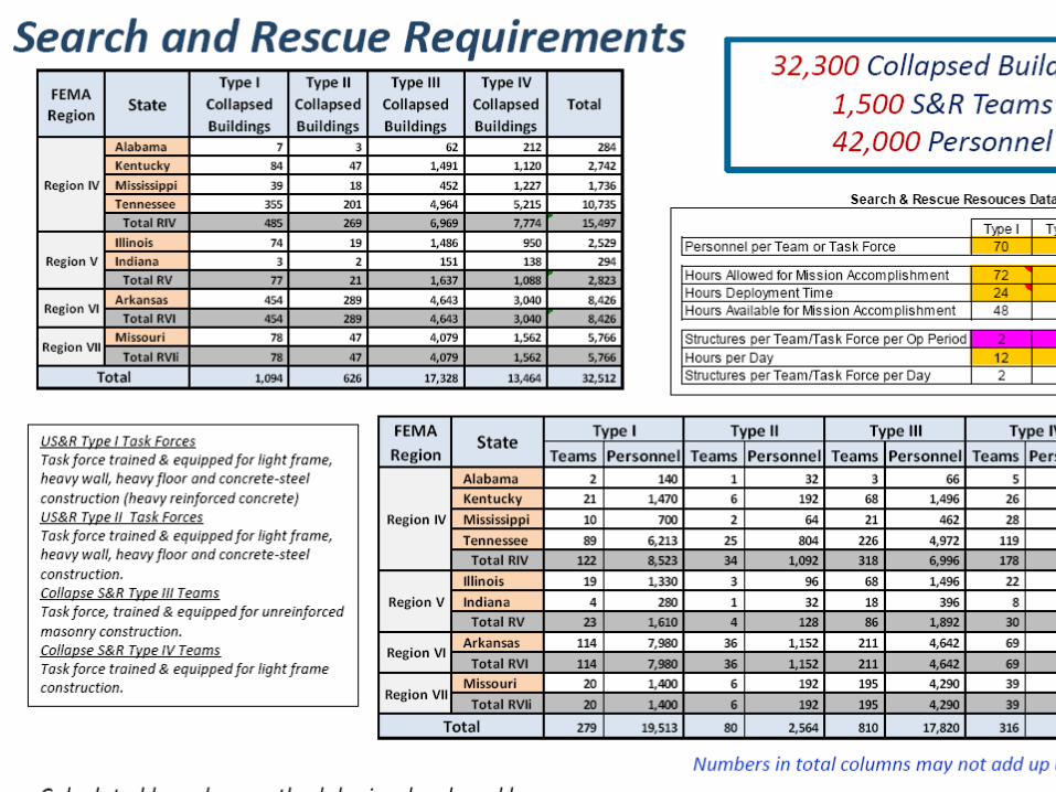
• 8 State Perspective– 7+ Million People– 85,000 Injured– 3,500 Deaths– 2M Seek Shelter– 3600 Bridges Damaged– 700K Buildings Damaged– 32K Buildings Collapsed– $300B Event
– 2.6M Households without electricity
– 1.1M without Water– 1,500 USAR Teams
needed – 28 currently– Dam and Levee failures
– What about cascading events?
Katrina: $88B / 2500 Deaths / Costliest Hurricane Ever…
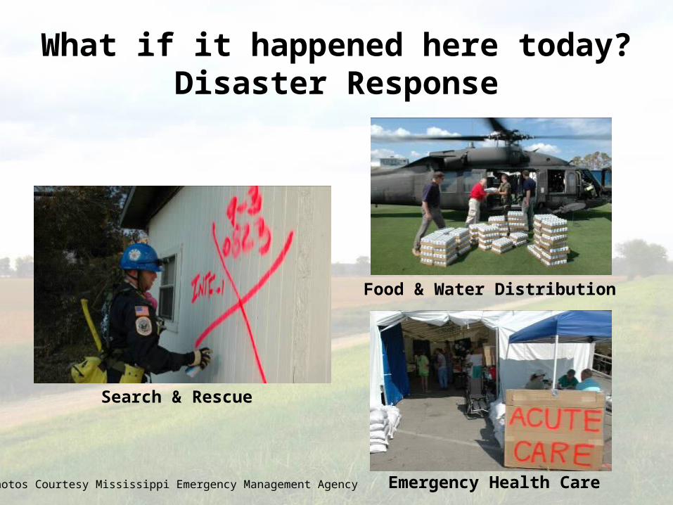
What if it happened here today?Disaster Response
Search & Rescue
Emergency Health Care
Food & Water Distribution
Photos Courtesy Mississippi Emergency Management Agency
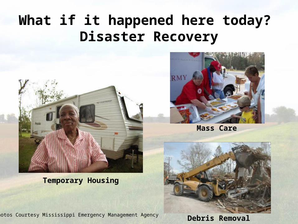
What if it happened here today? Disaster Recovery
Temporary Housing
Mass Care
Debris RemovalPhotos Courtesy Mississippi Emergency Management Agency

The stage is set…
• Last significant earthquake in 1895
• High percentage of structures built with no seismic considerations
• Low level of understanding / belief
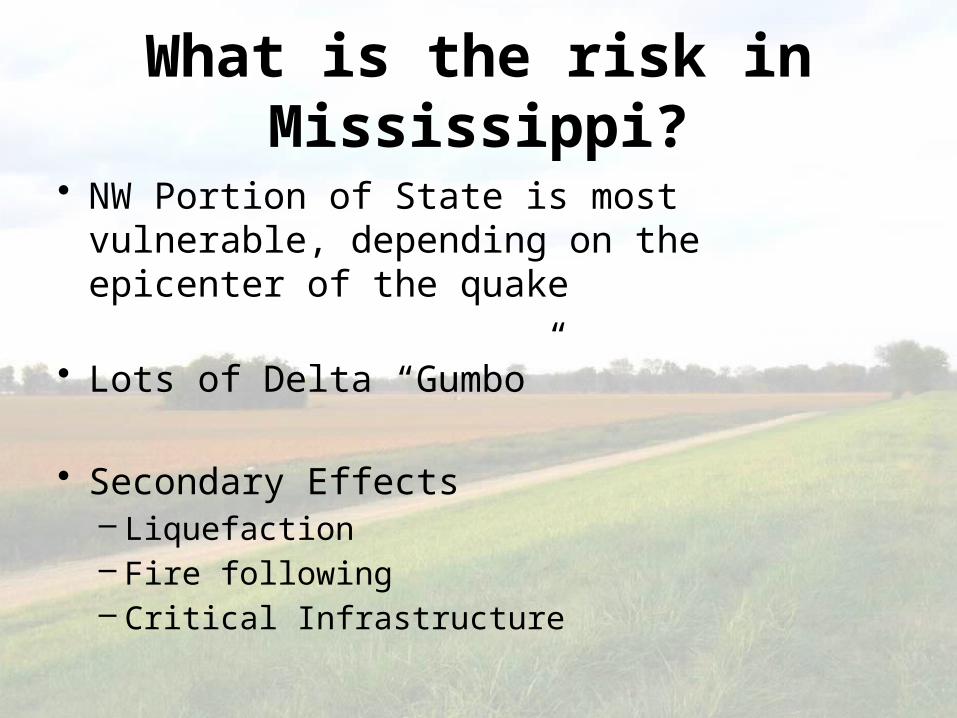
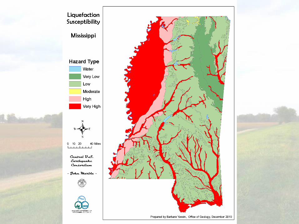
What is the risk in Mississippi?
• NW Portion of State is most vulnerable, depending on the epicenter of the quake
• Lots of Delta “Gumbo”
• Secondary Effects– Liquefaction– Fire following– Critical Infrastructure