Embed Size (px)
Citation preview

IDAHOGEOLOGICAL SURVEYSINCE 1919, SERVING THE STATE THROUGH GEOLOGIC RESEARCH
Putting down roots in ear thquake countr y
Your handbookfor ear thquakes
in Idaho

Contents
Idaho is “Earthquake Country” ...............................................................................2
Idaho and the Intermountain West are Seismically Active .....................................3In All Parts of Idaho, Our History Reveals Earthquakes Hazards ............................5Idaho Faces a Dual Earthquake Threat ...................................................................6The Intermountain Seismic Belt in Southeastern Idaho .........................................8The Central Idaho Seismic Zone ...........................................................................10The Western Idaho Seismic Zone .........................................................................11The Lewis and Clark Zone: A Seismic Threat to North Idaho .................................13Most Earthquake Damage is Caused by Shaking .................................................14Earthquakes Also Cause Damage in Other Ways ..................................................16
Response of Buildings to Earthquakes .................................................................18The ABCs of Seismic Building Codes ....................................................................19Your Life Could Change Unexpectedly in the Next Quake ....................................20Your Financial Situation Could Be Affected by a Quake ........................................22
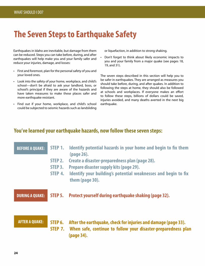
The Seven Steps to Earthquake Safety.................................................................24STEP 1—Identify Potential Hazards in Your Home and Begin to Fix Them ..........26STEP 2—Create a Disaster-Preparedness Plan ....................................................28STEP 3—Prepare Disaster Supply Kits ................................................................29STEP 4—Identify Your Building’s Potential Weaknesses and Begin to Fix Them ..30STEP 5—Protect Yourself During Earthquake Shaking ........................................32STEP 6—After the Earthquake, Check for Injuries and Damage ..........................33STEP 7—When Safe, Continue to Follow Your Disaster-Preparedness Plan ........34
A Review of Money Matters: Financial Impacts of Earthquakes ...........................35Earthquake Information on the Web ...................................................................36Glossary ..............................................................................................................37
Why Should I Care?—Idaho is Your Home
Introduction
Why Should I Prepare?—Big Quakes will Affect You
What Should I Do?—7 Steps to Earthquake Safety
What Else Should I Know?
Any use of trade, product, or firm names in this publica-tion is for descriptive purposes only and does not imply endorsement by the State of Idaho or U.S. Government.
Printed by the Idaho Bureau of Homeland Security, 2009
For additional copies, email:[email protected]
This report and any updates are available at:http://www.bhs.idaho.gov/ or http://www.idahogeol-ogy.org/
Manuscript approved for publication, September, 2009
This document is adapted from the Utah and California editions of“Putting Down Roots in Earthquake Country.” The Utah version can be downloaded at http://geology.utah.gov/online/pdf/eq_handbook.pdf. The San Francisco version can be downloaded at http://www.earthquakecountry.info/roots/.
Disclaimer: The suggestions and illustrations included in this document are intended to improve earthquake awareness and preparedness; however, they do not guarantee the safety of an individual or a structure. The writers, contributors, and sponsors of this handbook do not assume liability for any injury, death, property damage, or other effect of an earthquake.
This document was prepared under a grant from FEMA’s National Preparedness Directorate, U.S. Department of Homeland Security. Points of view or opinions expressed in this document are those of the authors and do not necessarily represent the official position or policies of FEMA’s National Preparedness Directorate or the U.S. Department of Homeland Security.
Prepared by the Idaho Geological Survey and Idaho Bureau of Homeland Security
Contributors: Idaho Geological Survey – Bill Phillips and Roy Breckenridge; University of Idaho – Ken Sprenke; Idaho Bureau of Homeland Security – Robert Feeley and David Jackson
Reviewed by: Michael Stickney, Director Earthquake Studies Office, Montana Bureau of Mines and Geology, Montana Tech of the University of Montana, Butte, MT; Kathleen M Haller, Research Geologist, Earthquake Hazards Program, U.S. Geological Survey, Denver, CO
Production, design, and illustration by: Bill Phillips and Scott Riener (IGS and UI) based on template for the Utah and San Francisco Bay Region versions of this handbook. Cover: Drake-Cooper
Other illustrators: Todd Connor (pages 23, 24, 30).

My Fellow Idahoans,The State of Idaho is situated in earthquake country, and large portions of our state are vulnerable to significant seismic risk. Putting Down Roots in Earthquake Country: Your Handbook for Earthquakes in Idaho, is intended to raise awareness about earthquakes and to provide information, as well as insight, into how we can protect ourselves, our families, homes and busi-nesses before, during and after a significant seismic event.
This handbook includes an overview of how earthquakes affect Idaho and can impact our livelihoods. It provides historical information on the mag-nitude and location of earthquakes going back to the early days of Idaho statehood. This document provides valuable information about what your insurance might cover, costs you might incur, and types of federal assistance available for post-earthquake recovery. There is a glossary of terms that will assist you with understanding earthquakes, how they happen and the impact they can have on you.
Earthquakes are a fact of life in Idaho. They always will be. Our state’s natu-ral beauty is a testament to the powerful geologic forces under our feet. The booklet provides a useful reference that all Idahoans can use to be prepared when the next earthquakes occurs – including information on structural and non-structural retrofits, developing a disaster-preparedness plan and what to do after the earthquake.
It is our hope that this handbook is widely distributed through all channels and is used in educational curricula, public forums and regulatory oversight. Thank you to the many agencies that have contributed to this publication. Please feel free to provide comments or suggestions for improvement
As Always – Idaho, “Esto Perpetua”
C. L. “Butch” OtterGovernor, State of Idaho
1
2
Idaho is “Earthquake Country”This handbook provides information about the threat posed by earthquakes in the Idaho region, and explains how you can prepare for, survive, and recover from these inevitable events. If you live or work in Idaho, you need to know why you should be concerned about earthquakes, what you can expect during and after an earthquake, and what you need to do beforehand to be safe and protect your property.
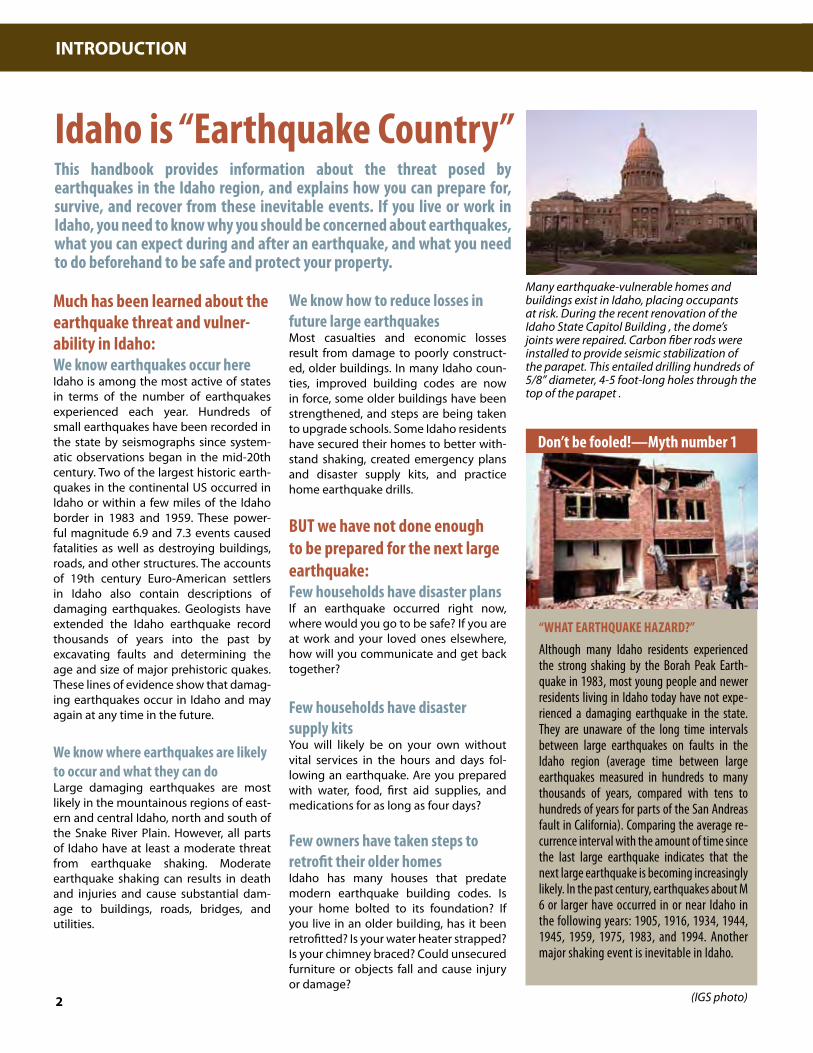
Many earthquake-vulnerable homes and buildings exist in Idaho, placing occupants at risk. During the recent renovation of the Idaho State Capitol Building , the dome’s joints were repaired. Carbon fiber rods were installed to provide seismic stabilization of the parapet. This entailed drilling hundreds of 5/8” diameter, 4-5 foot-long holes through the top of the parapet .
INTRODUCTION
“WHAT EARTHQUAKE HAZARD?”Although many Idaho residents experienced the strong shaking by the Borah Peak Earth-quake in 1983, most young people and newer residents living in Idaho today have not expe-rienced a damaging earthquake in the state. They are unaware of the long time intervals between large earthquakes on faults in the Idaho region (average time between large earthquakes measured in hundreds to many thousands of years, compared with tens to hundreds of years for parts of the San Andreas fault in California). Comparing the average re-currence interval with the amount of time since the last large earthquake indicates that the next large earthquake is becoming increasingly likely. In the past century, earthquakes about M 6 or larger have occurred in or near Idaho in the following years: 1905, 1916, 1934, 1944, 1945, 1959, 1975, 1983, and 1994. Another major shaking event is inevitable in Idaho.
Much has been learned about the earthquake threat and vulner-ability in Idaho:We know earthquakes occur hereIdaho is among the most active of states in terms of the number of earthquakes experienced each year. Hundreds of small earthquakes have been recorded in the state by seismographs since system-atic observations began in the mid-20th century. Two of the largest historic earth-quakes in the continental US occurred in Idaho or within a few miles of the Idaho border in 1983 and 1959. These power-ful magnitude 6.9 and 7.3 events caused fatalities as well as destroying buildings, roads, and other structures. The accounts of 19th century Euro-American settlers in Idaho also contain descriptions of damaging earthquakes. Geologists have extended the Idaho earthquake record thousands of years into the past by excavating faults and determining the age and size of major prehistoric quakes. These lines of evidence show that damag-ing earthquakes occur in Idaho and may again at any time in the future.
We know where earthquakes are likely to occur and what they can doLarge damaging earthquakes are most likely in the mountainous regions of east-ern and central Idaho, north and south of the Snake River Plain. However, all parts of Idaho have at least a moderate threat from earthquake shaking. Moderate earthquake shaking can results in death and injuries and cause substantial dam-age to buildings, roads, bridges, and utilities.
We know how to reduce losses in future large earthquakesMost casualties and economic losses result from damage to poorly construct-ed, older buildings. In many Idaho coun-ties, improved building codes are now in force, some older buildings have been strengthened, and steps are being taken to upgrade schools. Some Idaho residents have secured their homes to better with-stand shaking, created emergency plans and disaster supply kits, and practice home earthquake drills. BUT we have not done enough to be prepared for the next large earthquake:Few households have disaster plansIf an earthquake occurred right now, where would you go to be safe? If you are at work and your loved ones elsewhere, how will you communicate and get back together?
Few households have disaster supply kitsYou will likely be on your own without vital services in the hours and days fol-lowing an earthquake. Are you prepared with water, food, first aid supplies, and medications for as long as four days?
Few owners have taken steps to retrofit their older homesIdaho has many houses that predate modern earthquake building codes. Is your home bolted to its foundation? If you live in an older building, has it been retrofitted? Is your water heater strapped? Is your chimney braced? Could unsecured furniture or objects fall and cause injury or damage?
Don’t be fooled!—Myth number 1
(IGS photo)

Idaho and the Intermountain West are Seismically ActiveGeologic evidence shows that movement on the faults in and around Idaho can cause earthquakes of magnitude 6.5 to 7.5, with potentially catastrophic effects. However, it can be difficult to use this knowl-edge to make us safer in our daily lives. Should we care only if we live along known faults, or are other places in Idaho also dangerous?
This section (pages 2-17) describes where earth-quakes occur in the Idaho region and explains how earthquakes shake the ground and cause damage in other ways, such as liquefaction and landslides. Technical terms used throughout this pamphlet are explained in the Glossary (page 37).
Stretching of the Crust Produces Movement on FaultsMost earthquakes occur on faults that form the boundaries of Earth’s tectonic plates. Idaho is not on a plate boundary, but many faults in the state can produce large earthquakes. Tectonic forces within the western part of the North American plate combine with high heat flow from the underlying mantle to stretch the crust in a northeast-southwest direction. In response to this stretching, the rigid crust breaks and shifts along faults, and the fault movement produces earthquakes.
Intermountain Seismic BeltMost earthquakes in Idaho occur along a belt of seismicity called the Intermountain Seismic Belt that extends from the northwest corner of Montana, along the Idaho-Wyoming border, through Utah, and into southern Nevada. Along most of its length, the Intermountain Seismic belt straddles the boundary between the extending Basin and Range Province to the west and more stable parts of North America to the east. In Idaho, the Yellowstone Hotspot has interacted with the Basin and Range to create a more complicated pattern of earthquakes and mountain building called the Yellowstone Tectonic Parabola (p. 3). As a result, a major branch of the Intermountain Seismic Belt extends from the Yellowstone area westward across central Idaho. This zone includes at least eight major active faults and has been the site of numerous earthquake swarms and seismic events including the two largest historic earthquakes in the Intermountain West.
Horizontal extension creates normal faultsHorizontal extension creates normal faults. Stretching, or horizontal extension, of the crust produces a type of dipping (or inclined) fault called a “normal” fault. The movement of normal faults is characterized by the crust above the fault plane moving down relative to the crust below the fault plane. This up/down movement differs from movement on strike-slip faults like the San Andreas in California, where the crust on one side of the fault slides horizontally past the crust on the other side. Earthquakes in Idaho can be generated by movement on a variety of different types of faults, but the faults that are considered capable of generating large surface-faulting earthquakes are mainly normal faults.
For more information on faults and the Intermountain Seismic Belt go to:http://www.iris.edu/gifs/animations/faults.htm | http://earthquake.usgs.gov/regional/imw/ http://www.idahogeology.org/DrawOnePage.asp?PageID=73
Coast RangeBasin and Range Province Rocky Mountains
Crust
MantleUpwelling
Heat
Fault Scarp
Normal FaultsPACIFIC PLATE NORTH AMERICAN PLATE
3
IDAHO IS YOUR HOME

Fault scarp formationIn a large normal-faulting earthquake, the amount of vertical movement is sufficient to rupture and offset the ground surface, producing a steep break, known as scarp. Geologic evidence shows that individual prehistoric earthquakes on such normal faults produced scarps 3 to 14 feet high. Similar-sized scarps formed during historical surface faulting earthquakes. A world-famous example is the 21 mile-long scarp formed during the 1983 magnitude 6.9 Borah Peak earthquake near Challis. Over time, repeated movement on a normal fault eventually pro-duces mountains on the uplifted crustal block and a basin on the down-dropped block. In the photo, the Borah Peak fault scarp separates the Lost River Range in the background from the Lost River valley. (USGS photo by H.E. Malde).
Geologic information from fault scarpsThe historical record of earthquakes in Idaho is less than 100 years old. Geologists have extended this record thousands of years into the past by excavating trenches across fault scarps. Trenches pro-vide information on the timing and size of prehistoric large mag-nitude earthquakes. This figure shows two trenches dug along the Lost River fault zone. Trench A was dug in 1976, prior to the 1983 Borah Peak magnitude 6.9 earthquake. It shows a complex fracture system called a graben created by a prehistoric earthquake. Trench B was dug at the same location in 1984 after the 1983 earthquake. The amount of slip and style of fracturing was similar in both events, suggesting that the magnitude of the prehistoric event was also about 6.9 (USGS images).
The Yellowstone Tectonic ParabolaThe Yellowstone Tectonic Parabola is a region of earthquakes, active faulting, and topographic uplift surrounding the east-ern Snake River Plain. The eastern Snake River Plain formed as the North American continent passed over a stationary plume or “hotspot” of hot rock rising from the earth’s mantle. This plume is called the “Yellowstone hotspot” because it is presently located in the Yellowstone National Park area. Beginning along the Oregon-Nevada-Idaho border about 14.5 million years ago and continuing as recently as 600,000 years ago in Yellowstone, the hotspot melted crustal rocks passing over it, creating huge volumes of magma that erupted to form explosive rhyolite calderas. These calderas are progressively younger to the northeast because of the continuous movement of the North American continent over the hotspot. The pattern of earthquake activity in eastern and central Idaho seems to be related to interac-tions between the hotspot and Basin and Range extension. Geologists divide the region into five tectonic belts based on historical earthquake activity and the age and amount of movement on prehistoric faults. Within the Snake River Plain, earthquake activity is very low. Earthquake activity increases and faults become younger away from the Plain, culminating in a band of youthful active faults that forms the tectonic parabola on the east. Faulting and earthquakes in western and northern Idaho are not well-explained by the Yellowstone tectonic parabola model.
Coeur d’Alene
Lewiston
McCall
Boise
Twin Falls
Pocatello
Idaho Falls
Northern IntermountainSeismic Belt
Central Idaho Seismic Zone
Intermountain Seismic Belt
14.5
10.2
10.8
12.5
6.6-4.5
10.2 Rhyolite caldera with age of eruption (million years)
Tectonic BeltsI Holocene and future faultingII Major Holocene fautlsIII Major Pleistocene faultsIV Major Tertiary faultsV Inactive Snake River Plain
I
II
III
IVV
III
III
Ketchum
Yellowstone2-0.6
Western Idaho Seismic Zone
4
WHY SHOULD I CARE?

NORTHERN INTERMOUNTAINSEISMIC BELT
NORTHERN NEVADAEARTHQUAKES
CENTRAL WASHINGTONEARTHQUAKES
CENTRAL IDAHOSEISMIC ZONE
INTERMOUNTAINSEISMIC BELT
SNAKE RIVER PLAIN
ASEISMIC AREA
LEWIS AND CLARK ZONE
1872
2001
1936
1918
1994
1978
1988
1935
1925
20051947 1959
19751999
1926
1913
20051977
1944
1945
1947
1905
1975
19091934
1914
1994
2008
1915
1942
1960
1962
1884
1916
1984
1969 1983
Wells
1963
MAGNITUDE4 5 6 7
Earthquakes Strongly Felt in Idaho Magintudes (M) without decimals are approximate
1872 M7.4 Lake Chelan, WA Largest quake in Washington State; felt strongly in north Idaho.1884 M6 Bear Lake Valley The earthquake damaged houses considerably in Paris, Idaho.1905 M6 SW Idaho or NE Nevada Considerable damage at Shoshone, Idaho.1913 M5 Adams County Broke windows and dishes.1914 M6 Utah-Idaho state line Intensity VII; between Ogden, Utah and Montpelier, Idaho.1915 M7.75 Pleasant Valley, NV Considerable damage in southwest Idaho a hundred miles from epicenter.1916 M6 North of Boise Boise residents rushed into the street; chimneys fell.1918 M5 North Idaho Widely felt near Sandpoint.1925 M6.6 SW Montana Felt throughout Idaho.1926 M4 North Idaho Felt at Avery and Wallace.1927 M5 Connor Creek On Idaho-Oregon border west of Cascade.1934 M6.6 Hansel Valley, UT Largest Utah event on record; 20 miles south of Idaho border. 2 fatalities.1935 M6.25 Helena, MT Extensive damage. Multiple large events felt throughout Idaho. 4 fatalities.1936 M6.4 Walla Walla, WA Damaging earthquake; widely felt in Idaho.1942 M5 Sandpoint area Cracked plaster; rock fall onto railroad tracks.1944 M6 Central Idaho Knocked people to ground in Custer County.1944 M4 Lewiston area Widely felt in northern Idaho.1945 M6 Central Idaho Epicenter near Clayton. Slight damage in Idaho City and Weiser.1947 M6.25 Southwest Montana Epicenter in Gravelly range10 miles north of Idaho border.1947 M5 Central Idaho? Several large cracks formed in a well-constructed brick building.1959 M7.3 Hebgen Lake, MT Major event, extensive fault scarps. 20 miles from Idaho. 29 fatalities. 1960 M5 Soda Springs Foundations and plaster cracked. 1962 M5.7 Cache valley Heavily damaged older buildings.1963 M5 Clayton Plaster cracked and windows broken.1969 M5 Ketchum Cement floors cracked.1975 M6.1 NW Yellowstone Widely felt in Yellowstone region.1975 M6.1 Pocatello Valley Some 520 homes damaged in Ridgedale and Malad City.1977 M4.5 Cascade Drywall, foundations cracked. Ceiling beams separated.1978 M4 Flathead Lake, MT Felt in northwest Idaho.1983 M6.9 Borah Peak Major event, 21 mile surface scarp, 11 buildings destroyed, 2 fatalities.1984 M5 Challis Largest of many Borah Peak aftershocks.1988 M4.1 Cooper Pass Montana border northeast of Mullan.1994 M5.9 Draney Peak Remote area on Wyoming border. One injury from falling flower pot.1994 M3.5 Avery area Rare north Idaho event centered near Hoyt Mountain.1999 M5.3 Lima, MT In Red Rock valley just north of Idaho border.2001 M4 Spokane, WA At least 75 felt events at shallow depth beneath the city.2005 M5.6 Dillon, MT Felt across Idaho.2005 M4 Alpha Swarm Four events of M 4, thousands of smaller tremors south of Cascade.2008 M6.0 Wells, NV Felt strongly throughout southern Idaho.
In All Parts of Idaho, Our History Reveals Earthquakes Hazards
Strongly felt historical earthquakes in the Idaho areaThe historical record demonstrates that earthquakes can occur throughout Idaho including the pan-handle area between Coeur d’Alene and Sandpoint. Most earthquakes felt by Idaho residents have occurred within the Yellowstone Tectonic Parabola. Notable exceptions include large earthquakes in northern Nevada, eastern Washington, and western Montana. The 2008 magnitude 6.0 Wells, Nevada earthquake was felt by thousands in Boise, Twin Falls, and Pocatello. Because large earthquakes are felt over hundreds of miles, the locations of some early events not recorded by seismographs are uncertain. These include the Shoshone (1905) and Boise (1916) events.
5
IDAHO IS YOUR HOME

Idaho Faces a Dual Earthquake Threat
Threat 2 (time scale of tens of years): More frequent, moderate-size earthquakes that do not cause surface faulting. Events of magnitude M 3 to M 4 in our region often occur in swarms over many days as occurred in Spokane in 2001 and in Alpha (near Cascade, Idaho) in 2005. These swarms can be extremely unsettling to residents. If multiple moderate earthquakes (M 5 to M 6) occur under an urban area, as happened in Helena, Montana in 1935 considerable damage can result.
Threat 1 (time scale of hundreds to thousands of years): Infrequent, large surface-faulting earthquakes (M 6.5 to 7.5) on mapped active faults in central and southeast Idaho. These catastrophic events, such as the 1983 M 6.9 Borah Peak , the 1959 M 7.3 Hebgen Lake, and the 1934 Hansel Valley earthquakes, can result in fatalities and major damage to structures
Earthquake damage to the Custer Hotel in Mackay, Idaho caused by the 1983 M 6.9 Borah Peak earthquake . (IGS photo)
Moderate earthquakes can cause devastating damage to older masonry buildings. This photo shows a roof fall that occurred during the 2008 M 6.0 earthquake in Wells, Nevada. Earthquakes of this magnitude can occur anywhere in Idaho. (NBMG photo.)
Typical results of moderate earthquake shaking in Idaho: foundations fail and brick chimneys topple. (IGS and NBMG photos).
Reported Earthquake MagnitudesThe magnitude reported for an earthquake can be a source of confu-sion. First, there are several different definitions of magnitude used by seismologists. The most common are Richter magnitude, measured from the maximum amplitude observed on a carefully calibrated seismograph, and moment magnitude, related to the total energy released in the earthquake. For a given earthquake, these magnitudes may be slightly different. Richter magnitude is most often quoted in news releases and in many earthquake catalogs. Second, magnitudes and locations reported initially for earthquakes are sometimes later revised. This generally results from the use of preliminary or incom-plete information. As additional data become available, magnitudes and locations are refined and updated. For example, the Hebgen Lake (1959) and Borah Peak (1983) earthquakes were initially given magni-tudes of 7.5 and 7.3. At present, these events are given magnitudes of 7.3 and 6.9 by the USGS. Finally, earthquakes not recorded by modern seismographs are sometimes assigned magnitudes. These magni-tudes are based upon statistical correlations between the length and displacement of fault scarps and the magnitudes of historical events. For more information see http://earthquake.usgs.gov/learning/top-ics/measure.php.
6
WHY SHOULD I CARE?

Sandpoint
Spokane Coeur d’Alene
Lewiston
McCall
Idaho Falls
Boise
Twin Falls
Challis
Salmon
Pocatello
Helena
WA
OR
NV
MT
UT
WYINL
Hundreds of earthquakes have been located in the Idaho region by seismologists. This map shows 3692 epicenters recorded between 1973 and 2009. Of these, 1225 were within Idaho’s borders. On aver-age, there are about 33 earthquakes per year within Idaho’s borders. This average is distorted by the many aftershocks that occur after large earthquakes. For example, there were 22 earthquakes in 1981-82, the year before the 1983 Borah Peak event. Aftershocks raised the yearly total to 87 in 1983-84 and 161 in 1984-85. The number of small earthquakes (magnitude less than 3) is greatly under-reported in Idaho because of limited seismic monitoring.
Recorded seismicity of the Idaho region
Idaho Earthquake Statistics 1973-2009
Number of events 1225Magnitude 1-2 2Magnitude 2-3 380Magnitude 3-4 739Magnitude 4-5 83Magnitude 5-6 5Magnitude 6-7 2
Data Source: USGS/NEIC(PDE) earthquake catalog.
7
IDAHO IS YOUR HOME

The Intermountain Seismic Belt in Southeastern IdahoThe mountains and valleys of southeastern Idaho lie within the Intermountain Seismic Belt and tectonic belts II and III of the Yellowstone Tectonic Parabola (p. 3). This is one of the most earth-quake prone regions of Idaho. Paris and the Bear Lake Valley expe-rienced strong shaking and damage in 1884 from a magnitude 6 earthquake. In 1934, the largest historic Utah earthquake (Hansel Valley magnitude 6.6) occurred just 20 miles south of the Idaho border. In 1975, the second largest historic Idaho earthquake struck the Pocatello Valley west of Malad City. This magnitude 6.1 event damaged 520 homes. Finally, in 1994, the magnitude 5.9 Draney Peak earthquake occurred along the Wyoming-Idaho bor-der. For these reasons, the residents of Malad City, Preston, Paris, Montpelier, and Soda Springs are very familiar with the rumbling of earthquakes.
The Bear Lake fault zone is recognized as one of the most active in Idaho. The Cache fault hosted the 1962 magnitude 5.7 Richmond earthquake on the Utah-Idaho border. One of the most danger-ous faults in southeast Idaho is the northernmost segment of the
Wasatch fault near Malad City. The Wasatch is one of the longest and most active normal faults in the world. This fault extends from central Utah 240 miles north to within 30 miles of Pocatello. Geologic studies indicate that magnitude 7 earthquakes occur on Wasatch fault segments every 300-400 years and that the most recent major earthquake occurred about 350 years ago. Although the activity of the Wasatch fault appears to decrease northward from Utah, a magnitude 6 or 7 event is possible on the Malad seg-ment. In the event of such an earthquake, Pocatello will experi-ence high intensity shaking and probable damage.
The Grand Valley fault system extends 85 miles from Star Valley, Wyoming into the valley of the South Fork Snake River in Idaho. The southernmost faults in Star Valley are the youngest, with recurrent motion over the past 10,000 years. Fault activity appears to lessen northward into Idaho and fault structures near Rexburg are probably inactive. The Palisades Dam and reservoir are located adjacent to the Grand Valley fault. Dams and reservoirs present special risks in earthquake-prone regions. Although carefully designed and operated to withstand earthquake damage, failure of the Palisades Dam during the spring when reservoir levels are high would cause extensive flood damage to downstream com-munities and infrastructure. Large multi-year economic losses to Idaho’s agricultural economy would likely occur because of the key role that Palisades Dam plays in regional irrigation programs. Ground shaking from earthquakes on the Grand Valley and nearby Teton faults could also threaten the dam by generating large land-slides into the reservoir, producing potentially damaging waves.
This seismic image was collected near the center of Bear Lake in the southeastern corner of Idaho. The profile shows normal faults, caused by regional extension, cutting lake bottom sediments that are probably less than 15,000 years old. The faults are related to the adjacent East Bear Lake fault (USGS image).
W E0 1 km
30
50
70
App
roxi
mat
e de
pth
(m)
View of the Palisades Dam and Reservoir. Constructed in 1957, the Palisades Dam is 240 feet high and 2100 feet long. It dams the South Fork of the Snake River 18 miles west of the Idaho-Wyoming border. The reservoir is operated to supply about 670,000 acres of irrigated land in southern Idaho, generate about 177,000 kilowatts of hydroelectric power, and control floods. The trace of the Grand Valley fault zone is about 2.5 miles northeast of the dam (Bonneville Power Administration photo).
8
WHY SHOULD I CARE?

Teto
n Fa
ult
Grand Valley Fault
W. Bear Lake Fault
E. Bear Lake Fault
Wasatch Fault
HanselValle
yFault
Grand Valley Fault
Pocatello ValleyFault
Cache Fault
Rexburg
IdahoFalls
Blackfoot
Pocatello
AmericanFalls Dam
PalisadesDam
Soda Springs
Montpelier
Paris
Preston
MaladCity
INL
Map of southeastern Idaho showing the location of major faults and historical earthquakes (Source: USGS Quaternary fault and fold database and USGS/NEIC (PDE) earthquake catalog).
9
IDAHO IS YOUR HOME

The mountainous area of Idaho north of the Snake River Plain between Yellowstone Park and the Sawtooth Mountains lies within the Central Idaho Seismic Zone (also called the Centennial Tectonic Belt). It is contained within the northern arm of the Yellowstone Tectonic Parabola. The zone is approximately 200 miles long by 50 to 100 miles wide and is characterized by rug-ged basin and range topography and the highest elevations in Idaho. The zone contains high levels of earthquake activity and at least 6 major active faults (from east to west, Madison, Centennial, Beaverhead, Lemhi, Lost River, and Sawtooth).
Except for portions of the Lost River fault, which ruptured in the Borah Peak earthquake of 1983, the prehistoric earthquake histo-ries of faults in the Central Idaho Seismic Zone are not well known. Much of the research conducted was used to estimate risks posed to the nuclear facilities of the adjacent Idaho National Laboratory. This research shows that ground-rupturing earthquakes larger than magnitude 6 have occurred at least several times over the past 15,000 years along all the active faults. In at least a general way, activity along the faults appears to increase toward the north or northwest, away from the Snake River Plain.
The two largest historical earthquakes in the northern Rocky Mountains occurred in the region on August 17,1959 at Hebgen Lake (magnitude 7.3) and on October 28, 1983 at Borah Peak (magnitude 6.9). Both were accompanied by surface rupture and extensive earthquake aftershocks. The Hebgen Lake earthquake demonstrated the deadly effects of seismically-generated rock falls and landslides in mountainous country. The largest landslide fell into the canyon of the Madison River, killing at least 26 people, and creating a large lake. Three others were killed in the region by falling boulders. The man-made Hebgen Dam narrowly sur-vived overtopping by large water waves (seiche) created by the earthquake.
The Borah Peak earthquake created a spectacular 21 mile-long fault scarp. Other notable effects include water fountains and sand boils, increase or decrease in flow of water in springs, and fluctuations in well water levels. The earthquake caused the deaths of two children in Challis, and an estimated $26.7 million (2008 dollars) in damage in the Challis-Mackay area. Most prop-erty damage occurred in Challis and Mackay, where 11 commer-cial buildings and 39 private houses sustained major damage and 200 houses sustained minor to moderate damage. The Borah Peak earthquake was felt in parts of Montana, Nevada, Oregon, Utah, Washington, Wyoming, and in parts of the provinces of Alberta, British Columbia, and Saskatchewan, Canada (p. 15).
McCall
Boise
Ketchum
Salmon
Challis
Cascade
Long ValleySquaw
Creek
Lemhi
Lost River
Borah Peak
Centennial
Beaverhead
Sawtooth
Western Snake
River Plain
Mad
ison
Rexburg
Idaho Falls
Grand Valley
Teto
n
Hebgen Lake
Yellowstone National Park
INL
Central Idaho Seismic Zone
Western Idaho Seismic Zone
The Central Idaho Seismic Zone
10
WHY SHOULD I CARE?
The largest historical earthquake in the Intermountain Seismic Belt was the August 1959 magnitude 7.3 Hebgen Lake earthquake in Montana. Landslides triggered by the shaking submerged Highway 287 (USGS photo).

Western Idaho Seismic ZoneA geologically distinct region called the Western Idaho Seismic Zone lies between McCall and Boise. It is characterized by prominent N-S trending basins and ranges that contrast strikingly with surrounding regions. A complex suture zone between accreted terranes and the ancient North American tectonic plate underlies the region and may influence the orientation of faults. Major north-south trending active faults in the Western Idaho Seismic Zone include the Long Valley fault zone and the Squaw Creek fault. The Squaw Creek fault is about 25 miles north of Boise, Idaho’s largest urban region (p. 12).
The Long Valley fault zone is notable for earthquake swarms. During a swarm, thou-sands of small shallow earthquakes occur over several weeks to months within a region of a few tens of square miles. The latest swarm began in September 2005 and contin-ued for several months. The earthquakes, five with magnitudes as high as 4, were centered in Alpha, about 10 miles south of Cascade at the southern end of the Long Valley fault zone. The events were widely felt and caused concern in the local population as some swarms develop into stronger events capable of significant building damage. About 10 % of major earthquakes in the western United States are preceded by foreshock swarms.
11
IDAHO IS YOUR HOME
Location of the 2005 Alpha earthquake swarm. The location of the largest earthquakes (magnitudes 2 to 4) are shown by green dots (IGS image).
View of Cascade Dam and West Mountain at Cascade, Idaho in the Western Idaho Seismic Zone. The Long Valley Fault extends along the far shore of the Cascade Reservoir. Normal faulting has dropped the floor of the valley several thousand feet. The area has experienced several swarms of thousands of small earthquakes, most recently in the fall of 2005 (U.S. Bureau of Reclamation photo).
Long Valley Fault Zone
Council
New Meadows
Cascade
Alpha
Donnelly
McCall
95
55

Is Boise at Risk from Earthquakes?
12
WHY SHOULD I CARE?
The tips of active faults are within 25 miles of Boise. Urban areas are shown in black (IGS image).
Weiser
Payette
Ontario
Emmett
Caldwell
Nampa
Boise
Squa
w C
reek
Fau
lt
Big
Flat
Fau
lt
Jake
s Cre
ek F
ault
Black Canyon Dam
Boise River
Snake River
Payette River
Boise is located at the northern margin of the Western Snake River Plain. Numerous northwest-trending faults are present but these faults do not appear active based upon geomorphic expression and the age of the sediments they cut. The Boise metro area has several features which may make it especially vulnerable to strong earthquake ground shaking. Three dams impound the Boise River above the city. Earthquake-induced damage to the dams could cause flooding in the city and downstream communities. Irrigation canals above the city could fail during an earthquake sending water into the city. During irrigation season, the water table along parts of the Boise River floodplain rises to within a few feet of the ground surface. Earthquake shaking could cause liquefaction of these sediments and damage to buildings and roads built upon them.
Boise is threatened with earthquake shaking from the north. The Squaw Creek, Big Flat, and Jakes Creek faults are active structures that extend to within 25 miles of Boise, close enough to cause significant damage to the city and surround-ing urban areas in the event of a magnitude 6 or 7 earthquake. The Squaw Creek fault has geologic evi-dence for movement as recently as 7600 years ago. The southern tip of the Squaw Creek fault is close to the Black Canyon Dam on the Payette River. Failure or damage of this dam could cause flooding in Emmett.

The Lewis and Clark Zone is a megashear in the earth’s crust, up to 30 miles wide, which cuts some 240 miles through north Idaho and northwestern Montana. Geologic studies have shown that the North American plate has been sheared along this zone repeatedly over the past billion years. The most obvious manifestation of the zone is a set of en echelon valleys that follow brittle fault zones across the grain of the northern Rocky Mountains from Helena through Missoula, Montana to Coeur d’Alene, Idaho . These valleys provided a natural transportation corridor through the mountains used in part by Lewis and Clark in 1806 and the Mullan Trail of the 1850s, and today by Interstate 90.
Along the Lewis and Clark Zone in Idaho, many mining-related seismic events, called rockbursts, have occurred. Rockbursts are spontaneous, violent fractures of rock in deep mines. The sizable magnitudes of some rockbursts, their dominant horizontal strain direction, along with their location within the Lewis and Clark Zone suggest that tectonic stress release may be involved in this mining-related seismicity.
The destructive 1935 magnitude 6. 25 and 6 Helena Valley earthquakes occurred near the eastern end of the Lewis and Clark Zone in Montana. The possibility that the western end of the zone is also capable of such large earthquakes, creates a considerable earthquake shaking hazard for the residents of Wallace, Kellogg, Coeur d’Alene, Rathdrum, Sandpoint and surrounding communities.
The Lewis and Clark Zone: A Seismic threat to North Idaho
ANCIENT FAULT LINES
HOPE FAULT
OSBURN FAULT SYSTEM
ST JOE FAULT
SPOKANESWARM
2001
SILVER VALLEYMANY MINING RELATED EVENTS
Bonners Ferry
Sandpoint
Rathdrum
Spokane
St Maries
Coeur d’Alene
Kellogg
Wallace
13
IDAHO IS YOUR HOME
In the eastern Lewis and Clark Zone, the city of Helena, Montana suffered through a devastating series of several hundred earthquake shocks in the month of October, 1935 including three damaging earthquakes on October 12th, 18th, and the 31st. Previous to this cluster of tremors there had been little recorded seismic activity in the area of Helena. The photo shows damage to the Bryant Elementry School after the October 31st aftershock. (Montana Historical Society and Bureau of Mines and Geology photo).
Rockbursts are a cause of great concern in the mining industry. They are due in part to the same tectonic stresses that cause natural earthquakes. Research over the years into new mining methods by the National Institute Occupational Safety and Health (NIOSH) has greatly reduced the threat of rockbursts to miners in the Silver Valley of Idaho. (NIOSH photo).

Most Earthquake Damage is Caused by ShakingThe intensity of shaking that a building or structure will experience during an earthquake is highly variable, but generally depends on three main factors:
• The magnitude of the earthquake—in general, the larger the quake, the stronger the shaking and the larger the area affected.
• The distance from the earthquake—the closer to the source of the earth-quake, the stronger the shaking.
• The type of ground material beneath the structure—soils may amplify or change characteristics of the shaking relative to hard bedrock.
Se
ismic waves
Thick, soft soil
Bedrock
Consolidated soil & bedrock
Strong shakingLight-moderate damage
Severe shakingModerate-heavy damage
Violent shakingHeavy damage
Thin, stiff soil
FAULT
FAULT RUPTURE
RANGE
EARTHQUAKEEPICENTER
Site effect: 12
3
Amplified low-frequency ground motions (tall buildings affected)
Amplified high-frequency ground motions (short buildings affected)
Bedrock does not amplify or prolong ground motions
1
2
3
AMPLIFICATION OF EARTHQUAKE SHAKING
Simulatedseismograph response:
Generalized cross section in a basin-range topography, showing the response to seismic waves generated during an earthquake. Earthquakes generate seismic waves at a wide variety of frequencies, and certain frequency waves may be amplified by local soil conditions.
• Areas with thick, soft, clayey soil amplify low-frequency seismic waves, yielding slow rolling-type shaking that can damage tall buildings and long-span overpasses.
• Areas with thin, stiff (e.g., sandy and gravelly) soil over bedrock amplify high-frequency seismic waves, which yield vigorous ground vibrations that cause more damage to short (1-2 story) buildings, such as houses.
U.S. Geological Survey National Seismic Hazard MapsThese maps display earthquake ground motions for various probability levels across the United States. Hazard maps are applied in building codes, insurance rates, risk assessments, and other public policy. The Idaho map shows peak ground motions forecast over a 50 year time period with a 10% chance of the motions being greater than shown. Warm colors show regions of high ground motion. The map patterns correspond closely to the location of the Intermountain Seismic Belt and known active faults. Map users may specify the time period and probability, as well as the type of ground motion.
Source: Utah Geological Survey
For more information on National Seismic Hazard Maps see http://earthquake.usgs.gov/research/hazmaps/products_data/).
14
WHY SHOULD I CARE?
Peak Horizontal Acceleration (%g) with 10% Probability Exceedence over 50 years. County boundaries and cites (dark polygons) in Idaho are shown (Data Source: USGS).

The Modified Mercalli Intensity ScaleThe Mercalli Intensity Scale is the basis for the U.S. evaluation of seismic intensity. Unlike earthquake magnitude, which indicates the energy a quake expends, intensity denotes how strongly an earthquake affects a specific place. It has 12 divisions, using Roman numerals from I to XII:
I. Not felt except by a very few under especially favorable circumstances.
II. Felt only by a few persons at rest, especially on upper floors of buildings. Delicately suspended objects may swing.
III. Felt quite noticeably indoors, especially on upper floors of buildings, but many people do not recognize it as an earth-quake. Standing motor cars may rock slightly. Vibration like passing truck. Duration estimated.
IV. During the day felt indoors by many, outdoors by few. At night some awakened. Dishes, windows, and doors dis-turbed; walls make creaking sound. Sensation like heavy truck striking building. Standing motorcars rock noticeably.
V. Felt by nearly everyone; many awakened. Some dishes, windows, etc., broken; a few instances of cracked plaster; unstable objects overturned. Disturbance of trees, poles, and other tall objects sometimes noticed. Pendulum clocks may stop.
VI. Felt by all; many frightened and run outdoors. Some heavy furniture moved; a few instances of fallen plaster or dam-aged chimneys. Damage slight.
VII. Everybody runs outdoors. Damage negligible in buildings of good design and construction slight to moderate in well built ordinary structures; considerable in poorly built or badly designed structures. Some chimneys broken. Noticed by persons driving motor cars.
VIII. Damage slight in specially designed structures; considerable in ordinary substantial buildings, with partial collapse; great in poorly built structures. Panel walls thrown out of frame structures. Fall of chimneys, factory stacks, columns, monu-ments, walls. Heavy furniture overturned. Sand and mud ejected in small amounts. Changes in well water. Persons driving motor cars disturbed.
IX. Damage considerable in specially designed structures; well-designed frame structures thrown out of plumb; great in substantial buildings, with partial collapse. Buildings shifted off foundations. Ground cracked conspicuously. Underground pipes broken.
X. Some well-built wooden structures destroyed; most mason-ry and frame structures destroyed with foundations; ground badly cracked. Rails bent. Landslides considerable from river banks and steep slopes. Shifted sand and mud. Water splashed over banks.
XI. Few, if any (masonry), structures remain standing. Bridges destroyed. Broad fissures in ground. Underground pipelines completely out of service. Earth slumps and land slips in soft ground. Rails bent greatly.
XII. Damage total. Waves seen on ground surfaces. Lines of sight and level distorted. Objects thrown upward into the air.
Magnitude or Intensity?Magnitude is a measure of the energy released in an earthquake—a single value that depends on the area of fault rupture and amount of slip. For example, the 1983 Borah Peak earthquake had a magnitude of 6.9. Because of the nature of the known faults in Idaho, the largest expected earthquake is M 7.5.
Intensity is a measure of the strength of ground shaking at a particular place, and varies by location, proximity to the source of the earthquake, and type of material underlying the site. The intensity scale ranges from barely felt (I) to total destruction (XII). At intensity VII, poorly built structures can be considerably damaged, commonly resulting in casualties. Near the epicenter of the Borah Peak earthquake, the intensity reached IX; however, in Boise, intensity levels were about VI.
52ᵒ
48ᵒ
44ᵒ
40ᵒ
106ᵒ112ᵒ116ᵒ120ᵒ124ᵒ 104ᵒ
IDAHO
Calgary
Vancouver
Seattle Spokane
Portland
Edmonton
Boise
Salt Lake City
Prince George
RenoRedding
Saskatoon
Miles City
WASHINGTON
NEVADA
MONTANA
WYOMING
UTAH
CALIFORNIA
OREGON Pocatello
Mackay Jackson
Pendleton
III-IV
V
V
VI
VI
VI
VI
VII-IXII-III
II-III
II-III
III-IV
Map showing the shaking in Modified Mercalli Intensity scale units of the 1983 Borah Peak earthquake (USGS image).
15
IDAHO IS YOUR HOME

Although most earthquake damage is caused by shaking, other damaging effects of quakes can be just as devastating. For example, in the 1959 magnitude 7.3 Hebgen Lake earthquake, the greatest damage was caused by a massive landslide.
(Photo from U.S. Forest Service Miscellaneous Publication 907)
Earthquakes Also Cause Damage in Other Ways
Earthquakes often damage roads and bridges, hindering rescue and recovery efforts and causing accidents. Water and sewer pipeline breaks can result in contamination of surface and ground water, and cause “sinkholes” that under-mine roads and buildings. Damage to natural gas and electrical distribution systems can cause fires and major service outages. Damage to petroleum pipelines can cause oil spills. The photo below shows damage to a Santa Monica freeway bridge in Los Angeles in the 1994 magnitude 6.7 Northridge earthquake. This bridge was similar in construction to older bridges along Idaho freeways.
Damaged infrastructure
Earthquake damage can cause releases of hazardous materials from refineries and other chemical storage and distri-bution systems, research and industrial laboratories, manufacturing plants, and railroad tank cars. The photo above shows a train derailment in the 1994 Northridge earthquake that released sulfuric acid from a tanker car.
Hazardous materials
Earthquakes in urban areas are often followed by destructive fires because gas lines break, electrical shorts ignite fires, damaged water tanks and broken pipes limit water for firefighting, and clogged roads and collapsed bridges prevent access for firefighters. The photo above is an aerial view of Balboa Boulevard in Granada Hills in the 1994 Northridge earthquake showing street flooding, flames due to a broken natural gas line, and burned homes.
Fires
In a large earthquake,surface faulting on normal faults causes ground disruption, subsidence and tilting. Near Hebgen Lake in Montana, the barn shown below was damaged when the Red Canyon fault moved in the 1959 Hebgen Lake earthquake.
Surface rupture and subsidence
Earthquakes can make dams fail and generate waves (seiches) many feet high that flood shorelines and wash over dams. Hebgen Lake Dam, shown below, was damaged by ground shaking, and was also overtopped numerous times as waves sloshed back and forth in Hebgen Lake following the 1959 magnitude 7.3 earthquake in Montana.
(Los Angeles Times photo by Lacy Atkins )
(Photo courtesy of UGS) (USGS Photo)
(photo by Gail Fisher, Los Angeles Times )
Dam failures and seiches
16
WHY SHOULD I CARE?

Earthquakes can trigger damaging landslides and rockfalls. In Challis, during the 1983 Borah Peak earth-quake this house narrowly missed destruction when a boulder—called the “Halloween rock” fell from a ridge above town. The 8-foot-high boulder bounced over the house, grazed the front porch, and landed in the front yard.
Earthquake shaking can cause certain soils to behave like a liquid and lose their ability to support structures. The highest potential for liquefaction is in low-lying areas in saturated, loose, sandy soils and poorly compacted artificial fill. The photo shows liquifaction-related damage caused by the 1959 Hebgen Lake earthquake.
Liquefaction
“IDAHO ISN’T CALIFORNIA”True, Idaho is not California. However, many earthquakes are recorded and located each year in the Idaho region. Most of these earthquakes are small and not felt. However, since 1884, over 20 shocks have caused damage in Idaho. California certainly has more “wake-up calls,” where major earthquakes, which cause fatalities and major structural damage, typically occur once or twice per decade. Scientific studies indicate that
such large events occur in and near Idaho about every 25 years. These are high-energy earthquakes of about magnitude 7. They cause considerable ground disruption at the fault line. Within tens of miles of the epicenter there is a high potential for major structural damage and casualties. In Idaho, the many seismically vulnerable buildings increase the damage potential. Idaho is due for its next “Big One”—and, unfortunately, is a lot like California in this regard.
Don’t be fooled!—Myth number 2
How Likely is a “Big One”?
Earthquake Event Annual Likelihood
Magnitude 7 in Idaho Major surface-faulting 1 in 25
Intensity VII in Boise Considerable damage 1 in 100
Intensity VIII in Boise Great damage
1 in 200
Source: IGS publication “Seismic Intensities in Idaho”
Reality Check(for comparing to the chance of a “Big One”)
Cause of Death Your Annual Risk
Heart disease 1 in 450
Cancer 1 in 530
Stroke 1 in 2,100
Motor-vehicle accident 1 in 6,500
Idaho earthquake 1 in 1,650,000
Source: Centers for Disease Control and Prevention, causes of death in the U.S. in 2005. The Idaho earthquake statistic is based on the 32 fatalities in the three largest quakes that occurred in or very close to Idaho in the last 75 years.
Landslides and Rockfalls (USGS Photo)
(IGS photo by Roy Breckenridge)
17
IDAHO IS YOUR HOME

Response of Buildingsto Earthquakes A building’s “skeleton” or structure is most important for protecting
the lives and safety of its occupants. But so-called “nonstructural” elements such as bookcases, shelves, ceiling tiles, and light fixtures often fall to the floor or hurtle across rooms during earthquakes, injuring and possibly killing occupants. Such problems can be antici-pated and addressed before an earthquake. Just as buildings should be designed and braced for earthquakes, nonstructural components require similar consideration.
In addition to buildings, virtually all structures are susceptible to damage from an earthquake. Dams, bridges, pipelines, storage tanks, and roadways are other structures that can be damaged by an earthquake’s forces.
These infrastructure elements are often taken for granted and only after an earthquake are they viewed as critical components, neces-sary for maintaining our standard of living. The infrastructure we rely upon can be fragile in ways we may not understand until after it is damaged or disabled in an earthquake.
Much like an automobile on a winding roadway, buildings sway to the effects of earthquakes. Foundations connect structures to the ground, and they play a very important role in determining how much force a building can resist. Engi-neers study this critical interface and may choose to “cush-ion” the effect by using special foundation designs.
The soil underlying buildings is an important ingredient in determining the effects of earthquakes on structures.
• Soft,clayeysoilstendtoincreasethemotionattheground surface and thereby amplify the effects on buildings and structures.
• Rockdoesn’tchangethemotionnearlyasmuchassoil,so shaking is more predictable.
A building’s configuration and height also play an important role in determining the effects an earthquake will have on its performance.
• Squareorrectangularbuildingstypicallyperformbetterthan irregular-shaped buildings.
• Tallbuildingsrespondbyswayingbackandforth.
• Shortstructuresarejarredfromsidetosideastheearthquake releases its force at the ground surface.
The materials from which a building is constructed help determine how it performs during an earthquake.
•Steelandwoodareconsideredflexibleor“ductile”andtend to absorb the energy.
•Concreteandmasonryaremore“rigid”andcantransfertheground motion directly into the structure.
Earthquakes shake buildings from the ground up, and an important consideration for performance is the length of time the ground shakes. The longer the ground shakes, the more likely the structure will be unable to resist the effects. Building materials can resist temporary “overstress,” but when stretched beyond their limits, will break, much like a paper clip bent back and forth will eventually break.
Unreinforced Masonry BuildingsOne building type of particular concern in Idaho is masonry constructed without steel reinforcement. Unreinforced masonry buildings were popular when the state was first set-tled and continued to be built into the 1970s.
Bricks are created from clay which is burned in ovens at high temperatures. This material was both readily available here and familiar to the early settlers.
Many residences, in addition to commercial buildings, are unreinforced masonry buildings and were constructed without knowledge of how these structures performed in earthquakes. Unfortunately, experience now shows this is one of the most dangerous building types and evidence of its poor perfor-mance in earthquakes throughout the world is well docu-mented.
WHY SHOULD I PREPARE?
18

Seismic building codes increase building integrity and help ensure the future safety of communities. These codes are designed to protect lives, but not to ensure buildings are undamaged or usable after an earthquake. Seismic codes are intended to protect people inside buildings by preventing collapse and allowing safe evacuation. Structures built according to the current code should resist minor earthquakes undamaged, resist moderate earthquakes without significant structural damage, and resist severe earthquakes without collapse.
A moderate earthquake that does not significantly damage a building still can seriously hurt or kill people. Buildings contain items such as light fixtures, heating ducts, windows, and suspended ceilings that can fall on people or block escape routes. The exteriors of buildings also can pose hazards to people walking by or exiting, including falling bricks, parapets, window glass, or other facades.
Steel-frame tall buildings and newer wood-frame short buildings are usually (but not always) the safest structure types. Exceptions to these generalizations are due to variables such as the configuration of the building, the quality of construction and inspection, the design of connections, and the manner in which seismic waves strike a particular site.
Building codes provide minimum design and construction requirements for protecting lives. However, some structures with high occupancy, critical-response services (fire, police, hospitals), and vulnerable populations (schools, nursing homes) should be built above minimum requirements. Building codes use importance factors for designing above these minimum requirements. It also is important to protect utilities and infrastructure since damage to these critical structures leads to more deaths, larger economic loss, greater social disruption, and slower response to earthquakes.
The ABCs of Seismic Building Codes
Damage to Interstate 5 in 1994 Northridge, California, earthquake. (Photo courtesy of FEMA)
The seismic provisions of building codes are based on earthquake hazard maps (example at right) which show the probabilities of certain levels of earthquake shaking in particular areas. The code requirements reflect the fact that some places are more likely than others to have strong earthquakes. Idaho has areas with a high likelihood of strong earthquakes, similar to states along the West Coast. In Idaho, seismic codes made substantial improvements in construction as early as the mid-1970s. Buildings constructed prior to this time may be seismically unsafe. However, buildings constructed in the 1980s would also not be as seismically safe as buildings constructed under today’s seismic codes. To keep up with the current state of the art in seismic design, building codes are revised every three years to incorporate new knowledge.
Map showing the ground-shaking hazard in the United States.
Source: USGS National Seismic Hazard Maps
BIG QUAKES WILL AFFECT YOU
19

WHY SHOULD I PREPARE?
20
Your Life Could Change Unexpectedly in the Next Quake
Where will your family be?• Your children may be at school,
day care, or other activities.
• Family members may be at work or commuting.
• Pets may run away or be injured.
Will you have medical services?
• The 911 emergency system will likely be overloaded.
• Hospitals and other medical facilities may be damaged.
• Emergency rooms and trauma centers may be overwhelmed.
• Assisted living, critical care, and other health services such as dialysis may not be operational.
Pets are not allowed in most emergency shelters. Do you have a plan to feed and care for your animals after an earthquake?
Failure of fluorescent light fixtures in the Dawson Elementary School Library during the 1983 Coalinga, California, earthquake. (Earthquake Engineering Research Institute photo)
Will you be able to get home?
• Road damage and closures may restrict your ability to travel by car.
• Public transportation, including buses, TRAX, trains, and airports may experience closures or interruptions in service.
• Commute times may be dramatically increased.
This hospital in Sylmar, California, had to be demolished after the 1971 magnitude 6.7 San Fernando earthquake. (Photo courtesy of USGS)
The 1989 magnitude 6.9 Loma Prieta earthquake caused this section of the San Francisco-Oakland Bay Bridge to collapse. (Photo courtesy of USGS)

BIG QUAKES WILL AFFECT YOU
21
Will you be able to stay in
your home?
• Your home may be damaged and unsafe to live in.
• Your personal property may be damaged or destroyed.
• Construction materials and labor for repairs will be in limited supply and costs will increase.
• Rebuilding scams may be common.• Availability of rental housing may
be limited due to damage and high demand.
This porch on a wood-frame house failed during the 1989 magnitude
6.9 Loma Prieta earthquake. The “red tag” indicates that this home is
unsafe and must not be entered or occupied. (Photo courtesy of USGS)
How Will Voluntary Agencies Help?
After a damaging earthquake, Voluntary Organizations Active in Disaster (VOADs) will help in the following ways:• Opening and operating
emergency shelters.• Providing food at shelters
and feeding locations and through mobile distribution.
• Obtaining and delivering other needed items such as water, baby supplies, and blankets.
• Assisting with the immediate mental-health needs of those affected.
• Providing for basic health needs at shelters and other locations.
• Helping with initial recovery through casework and referrals to other agencies and partners.
• Providing blood and blood products.
For more information go to:http://idavoad.org
Can you live without the services you rely on?
Where will you get your water, food, medicines, and gasoline after an earthquake? (Photo courtesy of USGS)
• Water may be in short supply. • Natural gas and electric power may be out for days
or weeks.• Garbage and sewage services may be interrupted.• Telephone, Internet, cell phone, and wireless
communications may be overloaded or unavailable.• Mail service may be disrupted or delayed.• Gasoline may be in short supply, and rationing may
be necessary.• Bank operations may be disrupted, limiting access to
cash, ATMs, or online banking.• Grocery, drug, and other retail stores may be closed
or unable to restock shelves.
How will your job be affected?
• Businesses may sustain damage and disruption—many small businesses require a long time to reopen or do not survive disasters.
• Your income may be affected—payroll checks or direct deposits may be delayed.
• Your workplace may become a temporary shelter for you or others.
• Supplies and deliveries will be interrupted.
This business in Santa Cruz, California, was nearly destroyed in the 1989 magnitude 6.9 Loma Prieta earthquake. (Photo courtesy of USGS)

WHY SHOULD I PREPARE?
22
Your Financial Situation Could Be Affected by a QuakeAid may not be available immediately following a major disaster. Without proper planning, the financial impact of an earthquake on you and your family could be devastating. Although many things are out of your control after a quake, your ability to recover financially depends on a number of factors that you can control. Prepare and follow a financial disaster recovery plan and you will be more likely to recover successfully. Consider the following:
Will you have money, food, and medicine?
• Bank operations may be disrupted, limiting access to cash, ATMs, or online banking.
• Food, drug, and other retail stores where you shop may be closed or unable to restock shelves.
• You are still responsible for your existing debts, such as mortgage, lease, car, and credit-card payments.
• You may not have access to important financial records.
• Your assets are at risk without sufficient earthquake insurance.
• If you have earthquake insurance and experience loss, begin working with your insurer to file a claim as quickly as possible.
Will your insurance cover your losses?
This store was temporarily closed
following the 2001 magnitude
6.8 Nisqually, Washington,
earthquake. (Photo courtesy of The
Olympian, Olympia, Wash.)
This bank was damaged in the Nisqually Washington, earthquake, requiring customers to seek services elsewhere. (Photo courtesy of The Olympian, Olympia, Wash.)
• Homeowner’s and renter’s insurance policies do not cover losses related to earthquakes.
• A separate earthquake insurance policy is one way to help protect your home, in addition to seismic retrofitting.
• Earthquake insurance also helps with additional living expenses in the days and weeks after earthquakes.
• Relatively few Idaho homeowners have earthquake insurance.
“HOMEOWNER’S INSURANCE WILL COVER ANY DAM-AGE TO MY HOME OR BELONGINGS CAUSED BY AN EARTHQUAKE.”
Most residential property insurance policies do not cover damage resulting from earthquakes. A separate earthquake insurance policy is one way to protect your home and the in-vestments you have made in personal belongings. Investi-gate your options carefully to ensure that your assets are suf-ficiently protected.
Don’t be fooled!—Myth number 3

BIG QUAKES WILL AFFECT YOU
23
Does your small business have a recovery plan?
• A business disaster-recovery plan will make your business better able to survive in a post-disaster environment.
• Although physical assets can be replaced, emotional and social changes that affect businesses and their customers may remain long after a disaster.
• Businesses may not return to their previous revenue levels after a disaster; however, some businesses such as construction are likely to be in great demand following an earthquake.
What types of federal assistance may be available?
• Federal disaster-relief programs are designed to help you get partly back on your feet but not to replace everything you lose.
• The Department of Homeland Security’s Federal Emergency Management Agency (FEMA) is responsible for responding to, planning for, and reducing the effects of disasters.
• After the president signs a major disaster declaration, FEMA cooperates with other agencies, such as the Small Business Administration (SBA), in providing disaster relief.
• For disaster relief, low-interest loans are made available through the SBA to eligible individuals, homeowners, and businesses to repair or replace damaged property and personal belongings not covered by insurance.
• The maximum SBA personal-property loan is $40,000, and the maximum SBA real-property loan for primary home repair is $200,000.
• FEMA disaster grants for emergency home repairs and tempo-rary rental assistance are available to individuals and house-holds.
• The average FEMA grant is less than $15,000 (the maximum is $28,800)—not enough to rebuild a home.
• The Farm Service Agency offers loans to assist agricultural busi-nesses.
These small businesses in Santa Cruz, California, were heavily damaged in the 1989 magnitude 6.9 Loma Prieta earthquake, but both eventually reopened. (Photo courtesy of USGS)
This home in the Santa Cruz Mountains collapsed in the Loma Prieta earthquake. (Photo courtesy of USGS)
Useful Web sites
Ready Your Business: http://www.bhs.idaho.gov/Pages/
Preparedness/Business.aspx
Business Disaster Planning: http://www.cdc.gov/niosh/topics/emres/
business.html
Business Preparedness Information: http://www.ready.gov/business/
WHAT SHOULD I DO?
24
The Seven Steps to Earthquake Safety
Earthquakes in Idaho are inevitable, but damage from them can be reduced. Steps you can take before, during, and after earthquakes will help make you and your family safer and reduce your injuries, damage, and losses:
• First and foremost, plan for the personal safety of you and your loved ones.
• Look into the safety of your home, workplace, and child’s school—don’t be afraid to ask your landlord, boss, or school’s principal if they are aware of the hazards and have taken measures to make these places safer and more earthquake resistant.
• Find out if your home, workplace, and child’s school could be subjected to seismic hazards such as landsliding
or liquefaction, in addition to strong shaking.
• Don’t forget to think about likely economic impacts to you and your family from a major quake (see pages 18, 19, and 31).
The seven steps described in this section will help you to be safer in earthquakes. They are arranged as measures you should take before, during, and after quakes. In addition to following the steps at home, they should also be followed at schools and workplaces. If everyone makes an effort to follow these steps, billions of dollars could be saved, injuries avoided, and many deaths averted in the next big earthquake.
You’ve learned your earthquake hazards, now follow these seven steps:
BEFORE A QUAKE: STEP 1. Identify potential hazards in your home and begin to fix them (page 26).
STEP 2. Create a disaster-preparedness plan (page 28).STEP 3. Prepare disaster supply kits (page 29).STEP 4. Identify your building’s potential weaknesses and begin to fix
them (page 30).
DURING A QUAKE:
AFTER A QUAKE:
STEP 5. Protect yourself during earthquake shaking (page 32).
STEP 6. After the earthquake, check for injuries and damage (page 33).STEP 7. When safe, continue to follow your disaster-preparedness plan
(page 34).
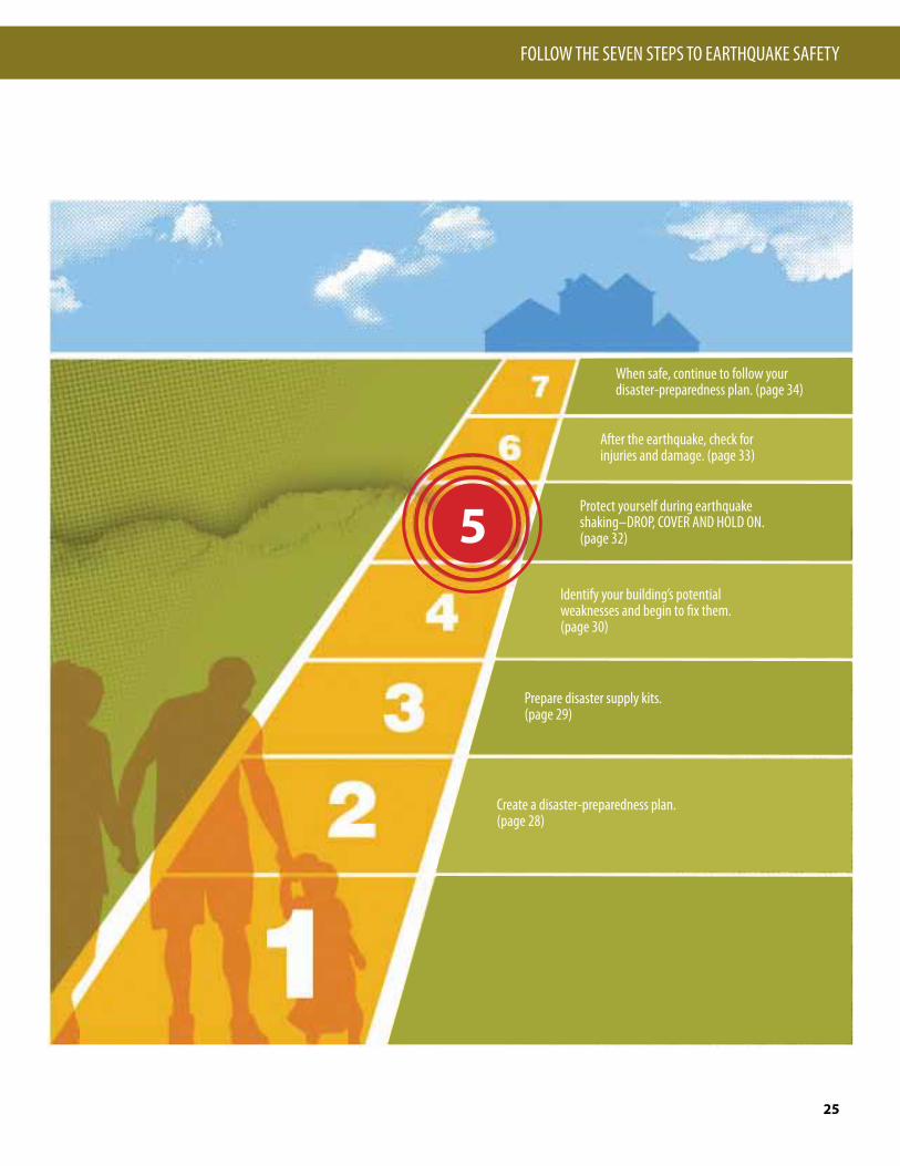
FOLLOW THE SEVEN STEPS TO EARTHQUAKE SAFETY
25
page 28
page 29
When safe, continue to follow your disaster-preparedness plan. (page 34)
After the earthquake, check for injuries and damage. (page 33)
Protect yourself during earthquake shaking–DROP, COVER AND HOLD ON. (page 32)
Identify your building’s potential weaknesses and begin to fix them.(page 30)
Prepare disaster supply kits.(page 29)
Create a disaster-preparedness plan.(page 28)
5

STEP 1The first step to earthquake safety is to look around your home and identify all unsecured objects that might fall during shaking.
START NOW by moving heavy furniture, such as bookcases, away from beds, couches, and other places where people sit or sleep. Also make sure that exit paths are clear of clutter.
Simple and inexpensive things that you can do now will help reduce injuries and protect belongings in a quake. Most hardware and home-improvement stores carry earthquake-safety straps, fasteners, and adhesives that you can easily use to secure your belongings.
The following tips describe simple solutions to situations in your home that could be dangerous during earthquake shaking. If these have not yet been done in your home, take action now:
Collectibles and other loose objects can become dangerous projectiles.
o Hold collectibles, pottery, and lamps in place by using removable earthquake putty, museum wax, or quake gel.
Tall, top-heavy furniture, such as bookcases and entertainment centers, may fall and injure you.
o Store heavy items and breakables on lower shelves.
o Secure both top corners of tall furniture into a wall stud, not just to the drywall.
o Flexible-mount fasteners, such as nylon straps, allow furniture independent movement from the wall, reducing strain on studs.
Identify Potential Hazards in Your Home and Begin to Fix Them
Hanging objects
Objects on open shelves and tabletops
Art and other heavy objects hung on walls may fall, and glass in pictures and mirrors may shatter.
o Place only soft art, such as unframed posters or rugs and tapestries, above beds or sofas.
o Hang mirrors, pictures, and other hanging objects on closed hooks.
oCheck the boxes!
WHAT SHOULD I DO?
26
“QUAKE INJURIES ARE ALL FROM COLLAPSING BUILDINGS.”
Many people think that all injuries in earthquakes are caused by collapsing buildings. Actually, most injuries in quakes are from objects that break or fall on people. For example, in the 1994 magnitude 6.7 Northridge earthquake, 55 percent of quake-related injuries were caused by falling objects, such as televisions, pictures and mirrors, and heavy light fixtures.
Don’t be fooled!—Myth number 4

Unsecured water heaters may fall over, rupturing rigid water and gas connections.
o Water heaters should be anchored to wall studs or masonry with metal straps and lag screws. Kits are available at hardware stores and home centers.
o If not already done, have a plumber install flexible (corrugated) copper water connectors.
Flexible gas connector
Flexible water connectors
Glassware and china may crash to the floor if cabinet doors are unsecured. Gas appliances can shift, rupturing their gas connections.
o Secure all cabinet doors, especially those overhead, to help prevent contents from falling out during quakes. Use latches designed for child-proofing or earthquake or boat safety.
o Secure refrigerators and other major appliances to walls using earthquake appliance straps.
Water and gas pipes
Water heaters
In the kitchen
In the garage or utility room
Home electronics
Water or gas pipes anywhere in your home can break. Water leaks can cause extensive damage, and gas leaks are a major fire hazard.
o Have a plumber evaluate, replace, and properly secure rusted or worn water and gas pipes.
o If not already done, have a plumber replace rigid gas connections to water heaters, stoves, dryers, and other gas appliances with flexible (corrugated) stainless-steel gas connectors (see below).
o Excess-flow gas-shutoff valves for individual appliances, which stop gas flow in case of a catastrophic leak, are also now available for use with flexible connectors.
Items stored in garages and utility rooms can fall, causing injuries, damage, and hazardous spills or leaks.
o Move flammable or hazardous materials to low areas that are secure.
o Ensure that items stored above or beside vehicles cannot fall, damaging or blocking them.
Large electronic devices may fall, causing injuries and damage. They are also costly to replace.
o Secure TVs, stereos, computers, and microwave ovens with flexible nylon straps and buckles for easy removal and relocation.
For more information on making your home safer in earthquakes go to: www.ready.idaho.gov (will be live by October 2009)
BEFORE A QUAKE
FOLLOW THE SEVEN STEPS TO EARTHQUAKE SAFETY
27

STEP 2
WHAT SHOULD I DO?
28
Will everyone in your household know how to react during and after strong earthquake shaking? To be ready for the quakes that are certain to happen in Idaho, it is important that your family have a disaster-preparedness plan. Hold occasional earthquake “drills” to practice your plan. Share your disaster plan with your neighbors and discuss key points with babysit-ters, house sitters, and house guests. Your plan should include most of the following:
In a strong earthquake, individual survival skills will be crucial:
o Practice "DROP, COVER, AND HOLD ON." (See STEP 5, page 32)
o Identify safe spots in every room, such as under sturdy desks and tables.
o Learn how to protect yourself no matter where you are when an earthquake strikes. (See STEP 5, page 32)
Doing the following will enable you to help your family and others after a strong quake:
o Keep shoes and a working flashlight next to each bed. o Teach everyone in your household to use emergency
whistles and (or) to knock three times repeatedly if trapped. Rescuers searching collapsed buildings will be listening for sounds.
o Identify the needs of household members and neighbors with special requirements or situations, such as use of a wheelchair, walking aids, special diets, or medication.
o Take a Red Cross first aid and CPR (cardiopulmonary resuscitation) training course. Learn who in your neighborhood is trained in first aid and CPR.
o Know the locations of utility shutoffs and keep needed tools nearby. Know how to turn off the gas, water, and electricity to your home. Only turn off the gas if you smell or hear leaking gas. (See STEP 6, page 29)
o Get training from your local fire department in how to properly use a fire extinguisher.
o Install smoke alarms and test them monthly. Change the battery once a year, or sooner if the alarm emits a
"chirping" sound (low-battery signal). o Check with your fire department to see if there is a
Community Emergency Response Team (CERT) in your area. If not, ask how to start one.
Don’t wait until the next earthquake to do the following:
o Locate a safe place outside of your home for your family to meet after the shaking stops.
o Establish an out-of-area contact person who can be called by everyone in the household to relay information.
o Provide all family members with a list of important contact phone numbers.
o Determine where you might live if your home cannot be occupied after an earthquake or other disaster (ask friends or relatives).
o Learn about the earthquake plan developed by your children’s school or day care, and keep your children's school emergency release cards current.
o Keep copies of insurance policies, financial records, and other essential documents in a secure location, such as with your household disaster kit. Include a household inventory (a list and photos or video of your belongings).
Create a Disaster-Preparedness Plan
Your family may be sleeping when the next strong quake hits Idaho. After the shaking stops, the lights may be out and broken glass and other dangerous debris may litter the floor, making it unsafe to walk barefoot. Keep a flashlight and a pair of sturdy shoes secured to or within reach of everyone’s bed. A good way to do this is to use a drawstring bag tied to a bedpost at the head of the bed for each occupant.(Photo courtesy USGS)
Plan NOW to be safe during an earthquake
Plan NOW to respond after an earthquake
Plan NOW to communicate and recover after an earthquake

STEP 3
BEFORE A QUAKE
FOLLOW THE SEVEN STEPS TO EARTHQUAKE SAFETY
29
Everyone in your family should have their own personal disaster kits. These kits are collections of supplies they may need when a quake strikes.
Personalize these kits and keep them where they can easily be reached—at home, in the car, at work or school. A backpack or other small bag is best for these kits so that they can be easily carried in an evacuation. Include the following items:
o Medications, a list of prescriptions, copies of medical insurance cards, doctors’ names and contact information.
o Medical consent forms for dependents. o First aid kit and handbook. o Spare eyeglasses, personal hygiene supplies, and
sturdy shoes. o Bottled water. o Whistle (to alert rescuers to your location). o Emergency cash. o Personal identification. o List of emergency contact phone numbers. o Snack foods high in calories. o Emergency lighting—light sticks and (or) a working
flashlight with extra batteries and light bulbs (hand-powered flashlights are also available).
o Comfort items, such as games, crayons, writing materials, and teddy bears.
Electrical, water, transportation, and other vital systems can be disrupted for several days or more after a large earthquake. Emergency response agencies and hospitals will likely be overwhelmed and unable to provide you with immediate assistance.
To help your family cope after a strong earthquake, store a household disaster kit in an easily accessible safe location. This kit, which complements your personal disaster kits, should be in a large portable watertight container and should hold at least a 3- to 5-day supply of the following items:
o Drinking water (minimum one gallon per person per day). o First aid supplies, medications, and essential hygiene items,
such as soap, toothpaste, and toilet paper. o Emergency lighting—light sticks and (or) a working
flashlight with extra batteries and light bulbs (hand-powered flashlights are also available).
o A hand-cranked or battery-operated radio (and spare batteries).
o Canned and packaged foods and cooking utensils, including a manual can opener.
o Items to protect you from the elements, such as warm clothing, sturdy shoes, extra socks, blankets, and perhaps even a tent.
o Heavy-duty plastic bags for waste and to serve other uses, such as tarps and rain ponchos.
o Work gloves and protective goggles. o Pet food and pet restraints. o Copies of vital documents, such as insurance policies and
personal identification. Note: Replace perishable items like water, food, medications, and
batteries on a yearly basis.
For more information on safety, preparedness, and disaster kits, go to:Ready Idaho www.ready.idaho.govIdaho Power www.idahopower.com/AboutUs/Safety/default.cfmAvista Utilitieswww.avistautilities.com/safety/Pages/default.aspxReady Americawww.ready.gov/america/index.html
Prepare Disaster Supply Kits
A Special Note About ChildrenBefore the next earthquake, spend time with your kids to discuss what might occur. Involve them in developing your disaster plan, preparing disaster kits (ask them what game or toy they want to include), and practicing “DROP, COVER, AND HOLD ON.”
In the days after a quake, kids need extra contact and support. They may be frightened and under great stress, and aftershocks won’t let them forget the experience. Parents may have to leave children with others in order to deal with the emergency, and this can be scary. Whenever possible, include your children in the earthquake recovery process.Resources for kids to learn about disaster preparedness:
http://www.fema.gov/kids/http://earthquake.usgs.gov/4kids/
(Photo courtesy of American Red Cross)
Personal disaster kits Household disaster kit

STEP 4 Identify Your Building’s Potential Weaknesses and Begin to Fix Them
Use the following quiz to see if your home is likely to be so badly damaged in a future earthquake that people might be injured or that it would be unsafe to occupy. If your home scores above 17 on the quiz, you probably should have a structural engineer evaluate it unless it has been strengthened in the last few years. The engineer will check to see if your home is strong enough to keep you and your family reasonably safe in an earthquake by looking for the following:
• Is your house properly connected to the foundation?
• Is there plywood on the exterior walls of your house?
• Are there anchors attaching the roof and floor systems to the walls?
• Is your house constructed out of unreinforced masonry?
• Do you have large openings like a garage door that may require better bracing?
The following quiz will help you to determine the adequacy of your house in resisting a seismic event. Once you have identified the areas requiring retrofitting, prioritize how and when to fix them, and get started. Local building departments and the Structural Engineers Association of Idaho are excellent resources.
Structural-Safety Quiz for Homes and Other Buildings
1. When was your home built?
o Before 1970 = 6 points o 1970 – 1980 = 3 points o After 1980 = 1 point
2. How many stories and what style is your home?
o 2 or more stories above grade with stepped floors, split levels, or large openings in floors = 5 points
o 2 or more stories above grade with flat floors, no steps in the floor, and no large openings in floors = 3 points
o 1 story rambler above grade = 1 point
3. What is the construction material of the exterior walls?
o Unreinforced masonry bearing walls = 7 points o Wood or reinforced masonry with full height brick veneer = 3 points
o Wood or reinforced masonry = 1 point
4. What are the foundation walls constructed from?
o Stacked rock or brick, with basement = 5 points o Stacked rock or brick, no basement = 3 point o Concrete, with or without basement = 1 point o Slab on grade, no basement = 0 points
5. Where is your house located? (see map, page 14)
Total points = __________
If your home scores 17 or more points on the quiz, you probably should have an engineer, architect, or contractor evaluate it.
EXAMPLES:
1. 1958, 1 story, unreinforced masonry, concrete foundation, Boise: 6+1+7+1+8 = 23
2. 1995, 2 story (flat), wood (brick veneer), concrete foundation, Pocatello: 1+3+3+1+8 = 16
3. 2006, 2 story (large openings), wood, slab on grade, Ketchum: 1+5+1+0+3 = 10
1 pt 3 pts 5 pts 8 pts
WHAT SHOULD I DO?
30
“WE HAVE GOOD BUILDING CODES, SO WE MUST HAVE SAFE BUILDINGS.”
The best building code in the world does nothing for buildings built before the code was enacted. Although building codes used in Idaho have strict seismic provisions, many older buildings, particularly unreinforced masonry buildings, have not been “retrofitted” to meet updated codes. Retrofitting—fixing problems in older buildings—is the responsibility of a building’s owner.
Don’t be fooled!—Myth number 5
Is your house, condo, or apartment strong enough to withstand an earthquake?

On October 28, 1983, two girls, ages 6 and 7, were killed by falling debris from a parapet (a wall-like barrier at the edge of a roof ) on a business in Challis, Idaho, as they walked to school. Challis is about 13 miles north of the epicenter of the 1983 Borah Peak earthquake (magni-tude 6.9). Photos 1 and 2 were taken of damaged buildings from this earth-quake in the nearby town of Mackay, Idaho. These deaths were the first caused by an earthquake in the United States since 65 people were killed in the San Fernando earthquake in California on February 9, 1971.
The 1962 Cache Valley earthquake (mag-nitude 5.7) is another example of falling debris from parapets. Arrows in photo 3 show the path of bricks that tumbled from the parapet of a drugstore onto the roof of the City Cafe in Lewiston, Utah. Luckily this cafe in Lewiston was not open when the earthquake occurred (see photo 4). Photo 5 shows damage to an unreinforced masonry building in the 2008 magnitude 6 Wells, Nevada, earth-quake.
The bracing of parapets, creating strong wall-to-roof connections, and bracing or elimination of other roof appendages (chimneys and cornices) are among the simplest and most cost-effective seismic upgrades that can be made to a build-ing.
The figures at left show how to brace parapets and chimneys. These figures are based on a State of Utah publication titled “The Utah Guide for the Seismic Improvement of Unreinforced Masonry Buildings” and may be viewed online at http://homelandsecurity.utah.gov/haz-ards/earthquake.htm.
(Photos 1 and 2 by O. Kasteler, courtesy of the Deseret News; photos 3 and 4 courtesy of the Salt Lake Tribune; photo 5 courtesy of Craig dePolo, Nevada Bureau of Mines and Geology)
1
2
3
4
5
BEFORE A QUAKE
FOLLOW THE SEVEN STEPS TO EARTHQUAKE SAFETY
31
Parapet Hazards

STEP 5 Protect Yourself During Earthquake Shaking
The previous pages have concentrated on getting you ready for future earthquakes in Idaho, but what should you do when the shaking starts?
• DROP, COVER, AND HOLD ON. If you are not near a desk or table, drop to the floor against an interior wall and protect your head and neck with your arms.
• Avoid exterior walls, windows, hanging objects, mirrors, tall furniture, large appliances, and cabinets filled with heavy objects.
• Do not go outside until well after the shaking stops!
In bedHold on and stay there, protecting your head with a pillow. You are less likely to be injured staying where you are. Broken glass on the floor can cause injuries; be sure to put shoes on before stepping on the floor.
In a high-rise buildingDROP, COVER, AND HOLD ON. Avoid windows. Do not use elevators. Do not be surprised if sprinkler systems or fire alarms activate.
At workDROP, COVER, AND HOLD ON. Know your workplace’s earthquake safety plan and put it into action. When safe, move to a specified meeting location.
In a public building or theaterDROP, COVER, AND HOLD ON if possible. If in a theater seat, duck down and protect your head and neck with your arms. Don’t try to leave until the shaking is over. Then walk out slowly, watching for fallen debris or anything that could fall on you in aftershocks.
Move to a clear area if you can do so safely; avoid buildings, power lines, trees, and other hazards. Always assume fallen power lines are live.
Near tall buildingsWindows, facades, and architectural details are often the first parts of a building to collapse. Get away from this danger zone when shaking starts. Take refuge in a safe building or an open space.
DrivingWhen able, safely pull over to the side of the road, stop, and set the parking brake. Avoid overpasses, bridges, power lines, signs, trees, and other things that might collapse or fall on the vehicle. Stay inside the vehicle until the shaking is over. If a power line falls on the vehicle, stay inside until a trained person removes the hazard.
In a stadiumStay at your seat and protect your head and neck with your arms. Don’t try to leave until the shaking is over. Then exit slowly, avoiding debris and watching for anything that could fall in aftershocks.
Below a damDams can fail during a major earthquake. Catastrophic failure is unlikely, but if you are downstream from a dam, you should know flood-zone information and have prepared an evacuation plan. For more information on dams in Idaho, go to: www.idwr.idaho.gov/WaterManagement/StreamsDams/DamSafety/dams.htm
If you are indoors...If you are outdoors...
If you are indoors, when you feel strong earthquake shaking, drop to the floor, take cover under a sturdy desk or table, and hold on to it firmly until the shaking stops.
(Photo courtesy of USGS)
WHAT SHOULD I DO?
32
“THE TRIANGLE OF LIFE SURVIVAL METHOD IS THE BEST METHOD TO USE INSIDE A BUILDING TO SURVIVE AN EARTHQUAKE.” False. The best survival method inside a building is to Drop, Cover, and Hold On under a table, desk, or chair, rather than trying to get into a survivable void next to a large, bulky object as advocated by the Triangle of Life method. The Drop, Cover, and Hold On survival method protects individuals from objects falling from walls and shelves. It also provides a level of protection from structural failures. If a table or desk is not available, sit down with your back against an interior wall, using your hands and arms to protect your head and neck.
Don’t be fooled!—Myth number 6
DURING A QUAKE

STEP 6 After the Earthquake, Check for Injuries and Damage
Once earthquake shaking has stopped, fol-low your disaster preparedness plans (see Step 2, page 24). Most importantly:
NOTE: The manual in your first aid kit and the front pages of your telephone book have instructions on first aid measures.• Check yourself for serious injuries
before helping others. Protect your mouth, nose, and eyes from dust.
• If a person is bleeding, put direct pres-sure on the wound. Use clean gauze or cloth, if available.
• If a person is not breathing, adminis-ter rescue breathing.
• If a person has no pulse, begin CPR (cardiopulmonary resuscitation).
• Do not move seriously injured per-sons, unless they are in immediate danger of further harm.
• Cover injured persons with blankets or additional clothing to keep them warm.
• Fire—If possible, put out small fires in your home or neighborhood immedi-ately. Call for help, but don’t wait for the fire department.
• Gas leaks—Turn off the gas only if you suspect a leak because of broken pipes or detect the odor or sound of leaking natural gas. Use a manual gas shut-off wrench to close your main gas valve by turning it counterclock-wise. Don’t turn gas back on by your-self—wait for the gas company! (Your telephone book has information on this topic.)
• Damaged electrical wiring—Shut off power at the main breaker switch if there is any damage to your home wiring. Leave the power off until the damage is repaired! (Your telephone book also has information on this topic.)
• Downed utility lines—If you see downed power lines, consider them energized and keep yourself and oth-ers well away from them. Never touch downed power lines or any objects in contact with them!
• Falling items—Beware of heavy items tumbling off shelves when you open closet and cupboard doors.
• Spills—Use extreme caution; when in doubt, leave your home. Spilled med-icines, drugs, or other relatively non-toxic substances can be cleaned up. Potentially harmful materials, such as bleach, lye, garden chemicals, paint, and gasoline or other flammable liq-uids should be isolated or covered with an absorbent material, such as dirt or cat litter.
• Damaged masonry—Stay away from brick chimneys and walls. They may be weakened and could topple dur-ing aftershocks. Don’t use a fireplace with a damaged chimney, as this could start a fire or trap toxic gases in your home.
If your home is structurally unsafe or threatened by a fire or other secondary disaster, you need to evacuate. However, shelters may be overcrowded and ini-tially lack basic services, so do not leave home just because utilities are out of ser-vice or your home and its contents have
suffered moderate damage. If you evacuate, tell a neighbor and your family point-of-contact where you are going. Take the following, if possible, when you evacuate:
Bring to a shelter: o Personal disaster supply kits (see
STEP 3, page 25). o Supply of water, food, and snacks. o Blanket, pillow, and air mattress or
sleeping pad. o Change of clothing and a jacket. o Towel and washcloth. o Diapers, formula, food, and other
supplies for infants. o A few family pictures or other small
comfort items, such as dolls or teddy bears for children.
o Personal identification and copies of household and health insurance information.
o Books and games (especially for chil-dren).
However, do not bring• Pets (service animals for people with
disabilities are allowed—bring food for them).
• Large quantities of unnecessary cloth-ing or other personal items.
• Valuables that might be lost, stolen, or take up needed space.
AFTERSHOCKGo back to STEP 5
Check for injuries
Check for damage causing hazardous conditions
If your home is seriously damaged
If you suspect a gas leak, use a manual
gas shut-off wrench.
AFTER A QUAKE
FOLLOW THE SEVEN STEPS TO EARTHQUAKE SAFETY
33

STEP 7 When Safe, Continue to Follow Your Disaster-Preparedness Plan
Once you have met your and your family’s immediate needs after the next strong Utah earthquake, continue to follow your disaster-preparedness plan (see Step 2, page 24).
In the days following a damaging quake, pay special attention to the following:
Safety first• Do not re-enter your home until you
know it is safe.• Be sure there are no gas leaks at your
home before using open flames (lighters, matches, candles, or grills) or operating any electrical or mechanical device that could create a spark (light switches, generators, chain saws, or motor vehicles).
• Check for chemical spills, faulty elec-trical wiring, and broken water lines. Water in contact with faulty wiring is a shock hazard.
• Unplug broken or toppled light fixtures or appliances. These could start fires when electricity is restored.
• Never use the following indoors: camp stoves, kerosene or gas lanterns or heaters, gas or charcoal grills, or gas generators, as these can release deadly carbon monoxide gas or be a fire hazard in aftershocks.
Be in communication• Turn on your portable or car radio and
listen for information and safety advi-sories.
• Place all phones back on their cradles.• Call your out-of-area contact, tell
them your status, and then stay off the phone—emergency responders need the phone lines for life-saving commu-nications.
• Check on your neighbors.
Check your food and water supplies• If power is off, plan meals so as to use
up refrigerated and frozen foods first. If you keep the door closed, food in your freezer may be good for a couple of days.
• If your water is off, you can drink from water heaters, melted ice cubes, or canned vegetables. Avoid drinking the water from swimming pools or hot tubs; use it to fight fires.
• This is a time of transition. Although aftershocks may continue, you will now work toward getting your life, your home and family, and your rou-tines back in order. Emotional care and recovery are just as important as healing physical injuries and rebuilding a home. Make sure your home is safe to occupy and not in danger of collapse in aftershocks. If you were able to remain in your home or return to it after a few days, you will have a variety of tasks to accomplish while re-establishing routines:
Tasks• If your gas was turned off, you will need
to arrange for the gas company to turn it back on.
• If the electricity went off and then came back on, check your appliances and electronic equipment for damage.
• If water lines broke, look for water damage.
• Locate or replace critical documents that may have been misplaced, dam-aged, or destroyed.
• Contact your insurance agent or com-pany to begin your claims process.
• Contact the Federal Emergency Man-agement Agency (FEMA) to find out about financial assistance. For FEMA
teleregistration, call 1-800-621-FEMA (3362).
• If you cannot live at your home, set up an alternative mailing address with the post office.
The American Red Cross offers immediate emergency assistance with housing needs. The Red Cross also supports shelter operations prior to a presidential declara-tion of a federal disaster.
Once a presidential declaration has been issued, FEMA may activate the Assistance for Individuals and Households Program. This program includes: • Home-repair cash grants; the maximum
federal grant available is $28,800 for all individual and family assistance.
• Housing assistance in the form of reimbursement for short-term lodging expenses at a hotel or motel.
• Rental assistance for as long as 18 months in the form of cash payment for a temporary rental unit or a manu-factured home.
• If no other housing is available, FEMA may provide mobile homes or other temporary housing.
The first days after the quake
The first weeks after the earthquake
If you can’t stay in your home
FEMA mobile homes being set up in Port Char-lotte, Florida, to provide temporary housing for victims of Hurricane Charley (August 2004). Nearly a year after the storm, these trailers were still being used. (Photo courtesy of FEMA)
WHAT SHOULD I DO?
34 AFTER A QUAKE
AFTERSHOCKGo back to
STEP 5
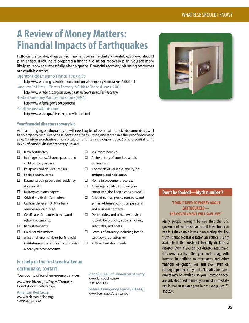
A Review of Money Matters:Financial Impacts of EarthquakesFollowing a quake, disaster aid may not be immediately available, so you should plan ahead. If you have prepared a financial disaster recovery plan, you are more likely to recover successfully after a quake. Financial recovery planning resources are available from:·Operation Hope Emergency Financial First Aid Kit: http://www.ncua.gov/Publications/brochures/EmergencyFinancialFirstAidKit.pdf·American Red Cross—Disaster Recovery: A Guide to Financial Issues (2003): http://www.redcross.org/services/disaster/beprepared/FinRecovery/·Federal Emergency Management Agency (FEMA): http://www.fema.gov/about/process·Small Business Administration: http://www.sba.gov/disaster_recov/index.html
Your financial disaster recovery kitAfter a damaging earthquake, you will need copies of essential financial documents, as well as emergency cash. Keep these items together, current, and stored in a fire-proof document safe. Consider purchasing a home safe or renting a safe deposit box. Some essential items in your financial disaster recovery kit are:
o Birth certificates.
o Marriage license/divorce papers and
child custody papers.
o Passports and driver’s licenses.
o Social security cards.
o Naturalization papers and residency
documents.
o Military/veteran’s papers.
o Critical medical information.
o Cash, in the event ATM or bank
services are disrupted.
o Certificates for stocks, bonds, and
other investments.
o Bank statements.
o Credit card numbers.
o A list of phone numbers for financial
institutions and credit card companies
where you have accounts.
o Insurance policies.
o An inventory of your household
possessions.
o Appraisals of valuable jewelry, art,
antiques, and heirlooms.
o Home improvement records.
o A backup of critical files on your
computer (also keep a copy at work).
o A list of names, phone numbers, and
e-mail addresses of critical personal
and business contacts.
o Deeds, titles, and other ownership
records for property such as homes,
autos, RVs, and boats.
o Powers of attorney, including health-
care powers of attorney.
o Wills or trust documents.
For help in the first week after an earthquake, contact:Your county office of emergency services
www.bhs.idaho.gov/Pages/Contact/CountyCoordinators.aspx
American Red Cross:www.redcrossidaho.org 1-800-853-2570
Idaho Bureau of Homeland Security:www.bhs.idaho.gov 208-422-3033
Federal Emergency Agency (FEMA):www.fema.gov/assistance
WHAT ELSE SHOULD I KNOW?
35
“I DON’T NEED TO WORRY ABOUT EARTHQUAKES—
THE GOVERNMENT WILL SAVE ME!”
Many people wrongly believe that the U.S. government will take care of all their financial needs if they suffer losses in an earthquake. The truth is that federal disaster assistance is only available if the president formally declares a disaster. Even if you do get disaster assistance, it is usually a loan that you must repay, with interest, in addition to mortgages and other financial obligations you still owe, even on damaged property. If you don’t qualify for loans, grants may be available to you. However, these are only designed to meet your most immediate needs, not to replace your losses (see pages 22 and 23).
Don’t be fooled!—Myth number 7

Earthquake Information on the WebAfter an earthquake, knowing more about what just happened can reduce fears and help you understand what to expect next. Online earthquake information products include:
Location and magnitude of recent earthquakesWithin 1 to 2 minutes of a large earthquake (greater than about magnitude 4) , its location and magnitude are available at:http://earthquake.usgs.gov/
“Did You Feel It?”—Tell us what you felt!Personal experiences of the effects of an earth-quake are very valuable to scientists. When you have felt a quake, please report your observations by using a quick survey found on the U.S. Geological Survey “Did You Feel It?” Web site athttp://earthquake.usgs.gov/dyfi/.When you fill out the survey, your observations of actual damage and shaking are combined with those of other people who felt the earthquake. The quake’s shaking intensities, derived from these observations, are displayed by ZIP code on a “Community Internet Intensity Map.” No personal information is collected and your anonymity is preserved.
Who monitors Idaho earthquakes?
Unlike most western US states, Idaho lacks a state seismic network. Earthquakes are monitored by the USGS, the state networks of Montana and Utah, the Yellowstone Volcano Observatory, BYU-Idaho, and the University of Idaho. The Idaho National Laboratory also operates a network. Because of the low density of seismographs in the state and the lack of a state seismologist, Idaho earthquakes of magnitude 3.5 or less are sometimes poorly located or reported after delays of hours to days.
Community Internet Intensity Map (“Did You Feel It?”) for the February 21, 2008, magnitude 6.0 earthquake in Wells, Nevada. Light ground shaking was reported across southern Idaho. More than 1870 people reported their observations on this earthquake online.
WHAT ELSE SHOULD I KNOW?
36
Map of the September 22, 2003, Rathdrum Prairie, magnitude 3.3 earthquake. Maps such as this are placed on the USGS Earthquake Hazards website following detected earthquakes. They give the location, depth, and magnitude of the earthquake.

Glossary
WHAT ELSE SHOULD I KNOW?
37
Aftershocks. Earthquakes that follow the largest shock of an earthquake sequence. They are smaller than the “mainshock” and can occur over a period of weeks, months, or years. In general, the larger the mainshock, the larger and more numerous the aftershocks and the longer they will continue.
Crust. Earth’s outermost layer consisting of rigid oceanic and continental tectonic plates.
Epicenter. The point on Earth’s surface above where an earthquake begins at depth in Earth’s crust.
Fault. A fracture or crack along which the two sides slide past one another.
Fault rupture. The area of Earth through which fault movement occurrs during an earthquake. For large quakes, the section of the fault that ruptures may be several hundred miles in length. Ruptures may or may not extend to the ground surface.
Fault scarp. Topographic expression of faulting caused by displacement of the land surface by fault movement.
Fault segment. A part of a fault that is thought to rupture independently of other parts of the fault. One or more segments may rupture in a single earthquake.
Foreshock. An earthquake that precedes the largest quake (“mainshock”) of an earthquake sequence. Foreshocks may occur seconds to weeks before the mainshock. Not all mainshocks are preceded by foreshocks.
Intensity. A measure of ground shaking describing the local severity of an earthquake in terms of its effects
on Earth’s surface and on humans and their structures. The Modified Mercalli Intensity scale, which uses Roman numerals, is one way scientists measure intensity.
Landslide. A mass movement of soil, mud, and (or) rock down a slope.
Liquefaction. The process that occurs when an earthquake shakes wet sandy soil until it behaves like a liquid, allowing sand to “boil up” to the surface, buildings to sink, or sloping ground to move.
Magnitude (M). A number that represents the size of an earthquake, as determined from seismographic observations. An increase of one unit of magnitude (for example, from 4.6 to 5.6) corresponds approximately to a thirty-fold increase in energy released (by definition, a two-unit increase in magnitude —for example, from 4.7 to 6.7—represents a thousand-fold increase in energy). Quakes smaller than magnitude 2.5 generally are not felt by humans.
Mainshock. The largest quake of an earthquake sequence, possibly preceded by smaller foreshocks and commonly followed by aftershocks.
Mantle. The layer of heated viscous rock between Earth’s crust and core.
Normal fault. An inclined fault along which the upper side moves downward relative to the lower side. Idaho’s Lost River fault is a good example.
Parapet. A wall-like barrier at the edge of a roof.
Retrofit. Strengthening an existing structure to improve its resistance to the effects of earthquakes.
Seiche. Waves “sloshing” in a lake as a result of earthquake ground shaking. Waves caused by landsliding into a reservoir or displacement of the lake bed are termed a surge.
Seismic hazard. The potential for damaging effects caused by earthquakes. The level of hazard depends on the magnitude and frequency of likely quakes, the distance from the fault that could cause quakes, and geologic conditions at a site.
Seismic risk. The chance of injury, damage, or loss resulting from seismic hazards. There is no risk, even in a region of high seismic hazard, if there are no people or property that could be injured or damaged by a quake.
Seismograph. A sensitive instrument that detects and records seismic waves generated by an earthquake.
Strike-slip fault. A generally near-vertical fault along which the two sides move horizontally past each other. The most famous example is California’s San Andreas fault.
Surface faulting (surface fault rupture). Propagation of an earthquake-generating fault rupture to the surface, displacing the surface and forming a fault scarp.
Tectonic plate. Earth’s outer shell is composed of large, relatively strong “plates” that move relative to one another. Movements on the faults that define plate boundaries produce most earthquakes.
Tectonic subsidence. Downdropping and tilting of a basin floor on the downdropped side of a fault during an earthquake.

GUS S
Why should I care? (pages 1-17)
Earthquakes & Idaho: http://earthquake.usgs.gov/regional/states/index.php?regionID=12Overview of Fault Movement in the Western United States: http://earthquake.usgs.gov/regional/imw/imw_bnr_faults/Recent Earthquakes in Idaho: http://neic.usgs.gov/neis/last_event_states/states_idaho.html Idaho Geological Survey: www.idahogeology.orgUnited States Geological Survey Earthquake Hazards Program: http://earthquake.usgs.gov/
Why should I prepare? (pages 18-23) and What should I do? (pages 24-34)
American Red Cross: http://redcrossidaho.org Federal Emergency Management Agency: www.fema.gov Structural Engineers Association of Idaho: www.seaidaho.orgUnited States Department of Homeland Security: www.ready.gov/businessIdaho Bureau of Homeland Security: www.bhs.idaho.gov
What else should I know?(pages 35-37)
Did you feel it? – Report it!: http://earthquake.usgs.gov/dyfi/
O N L I N E R E S O U R C E S
F U N D I N G O R G A N I Z AT I O N S