Embed Size (px)
Citation preview
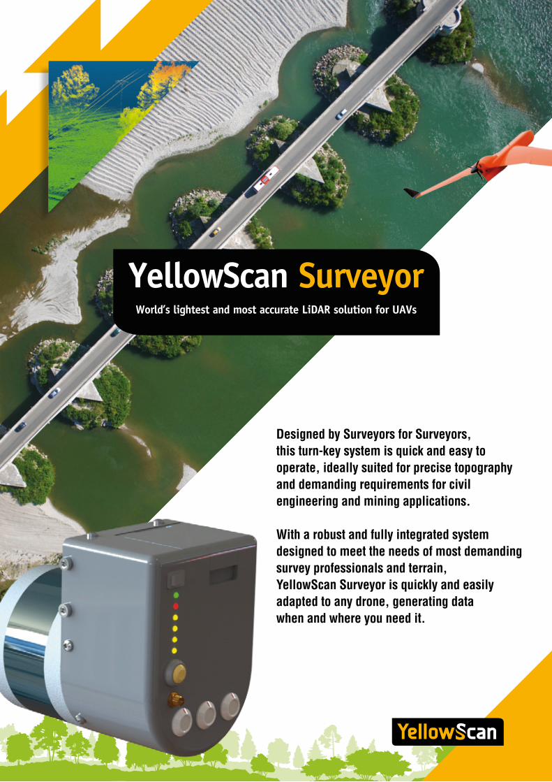
YellowScan Surveyor World’s lightest and most accurate LiDAR solution for UAVs
Designed by Surveyors for Surveyors, this turn-key system is quick and easy to operate, ideally suited for precise topography and demanding requirements for civil engineering and mining applications.
With a robust and fully integrated system designed to meet the needs of most demanding survey professionals and terrain, YellowScan Surveyor is quickly and easily adapted to any drone, generating data when and where you need it.
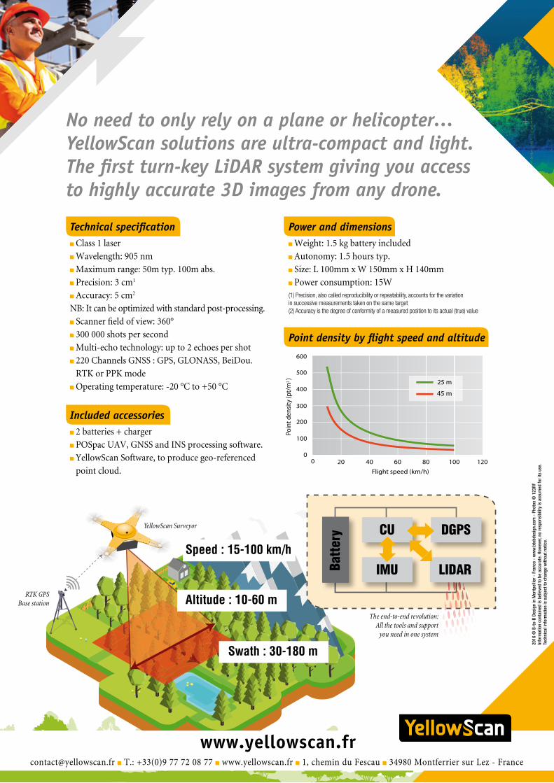
Technical specification Class 1 laser
Wavelength: 905 nm
Maximum range: 50m typ. 100m abs.
Precision: 3 cm1
Accuracy: 5 cm2
NB: It can be optimized with standard post-processing.
Scanner field of view: 360°
300 000 shots per second
Multi-echo technology: up to 2 echoes per shot
220 Channels GNSS : GPS, GLONASS, BeiDou.
RTK or PPK mode
Operating temperature: -20 °C to +50 °C
Included accessories 2 batteries + charger
POSpac UAV, GNSS and INS processing software.
YellowScan Software, to produce geo-referenced
point cloud.
No need to only rely on a plane or helicopter…YellowScan solutions are ultra-compact and light. The first turn-key LiDAR system giving you access to highly accurate 3D images from any drone.
RTK GPS Base station
YellowScan Surveyor
Altitude : 10-60 m
Swath : 30-180 m
Speed : 15-100 km/h
[email protected] T.: +33(0)9 77 72 08 77 www.yellowscan.fr 1, chemin du Fescau 34980 Montferrier sur Lez - France
2016
© B
-to-
B De
sign
in M
ontp
ellie
r - F
ranc
e -
ww
w.b
tobd
esig
n.co
m -
Pho
tos
© 1
23RF
Info
rmat
ion
cont
aine
d is
bel
ieve
d to
be
accu
rate
. How
ever
, no
resp
onsi
bilit
y is
ass
umed
for i
ts u
se.
Tech
nica
l inf
orm
atio
n is
sub
ject
to c
hang
e w
ithou
t not
ice.
Power and dimensions Weight: 1.5 kg battery included
Autonomy: 1.5 hours typ.
Size: L 100mm x W 150mm x H 140mm
Power consumption: 15W(1) Precision, also called reproducibility or repeatability, accounts for the variation in successive measurements taken on the same target(2) Accuracy is the degree of conformity of a measured position to its actual (true) value
Point density by flight speed and altitude
DGPSCU
IMUBatt
ery
LIDAR
The end-to-end revolution: All the tools and support
you need in one system