Embed Size (px)
Citation preview

For more information, visit www.avid.com/worldmapper
Customize your mapsWith WorldMapper, you can modify the appearance of any Bing or Blue Marble map for your needs using the intuitive editing and compositing tools. Go from a one-color flat street map to a multi-colored 3D globe with just a few simple clicks. Change labeled locations on any map. You can also save different map layouts for later reuse.
Enhance your graphics Illustrate flight paths and trip routes clearly by building object-oriented animations along a timeline. Zoom in on street locations and structures of interest using the Magnifying Glass tool and Bird’s Eye View, which provide impressive 45° site visuals—without leaving the overview position of the map. The Mini Map locator enables you to maintain your current overview, even when the visualization dives deeper into the map. Plus, you can bookmark location data in the library for easy retrieval and reuse.
Highlight geographical locationsIntegrate political information quickly and easily with the WorldMapper library, which contains all national and interstate borders. Change the color of countries and regions for greater emphasis. Adapt the map’s color and outlines to
the layout concept. You can even edit the look and content of a chosen country’s borders—for example, to adapt the layout or visualize shifts in ownership claims. All edited borders are saved as copies so the original can still be accessed.
You can also automate the display of location data by simply moving a graphic on the map. WorldMapper reads the current coordinates, based on the location of the graphic element, retrieves the location information from external data sources, and then updates the display. This enables you to dynamically update information—such as the country, state, or city name—by merely moving an object.
Select your specsChoose your desired video format, codec, clip size, bitrate, aspect ratio, and other specifications for your project at hand. WorldMapper supports all standard video formats used by TV broadcasters worldwide. You can even customize your codec configuration. And once your sequence is ready for final delivery, you can render and export it as a still image or video clip for playout. Or use it as a template in your control system.
Integrate your newsroomThese days, journalists need to do more than just write stories to report the news. They also need to find creative ways to enrich their storytelling to captivate and grow their audience. WorldMapper provides easy newsroom
WorldMapperEasy-to-use map-based story creation tool
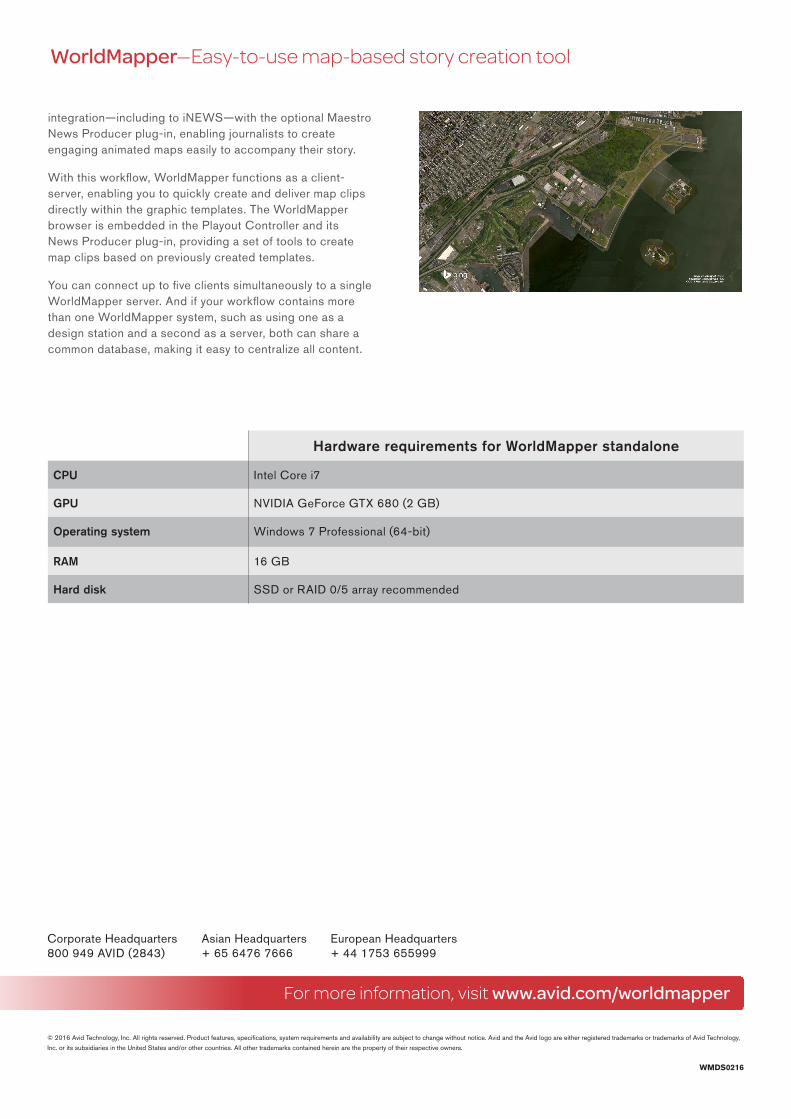
Create exciting map-driven animated clips to get your viewer’s attention and further illustrate your news stories. Working in conjunction with Microsoft’s Bing Maps and NASA’s Blue Marble mapping services, WorldMapper makes it easy to convey location information using existing high-resolution satellite, aerial, and street map imagery. Create impressive flyovers. Enhance clips with text, images, and highlighted routes. And animate any object to create highly captivating stories quickly.
For more information, visit www.avid.com/worldmapper
© 2016 Avid Technology, Inc. All rights reserved. Product features, specifications, system requirements and availability are subject to change without notice. Avid and the Avid logo are either registered trademarks or trademarks of Avid Technology,
Inc. or its subsidiaries in the United States and/or other countries. All other trademarks contained herein are the property of their respective owners.
Corporate Headquarters Asian Headquarters European Headquarters 800 949 AVID (2843) + 65 6476 7666 + 44 1753 655999
WMDS0216
integration—including to iNEWS—with the optional Maestro News Producer plug-in, enabling journalists to create engaging animated maps easily to accompany their story.
With this workflow, WorldMapper functions as a client-server, enabling you to quickly create and deliver map clips directly within the graphic templates. The WorldMapper browser is embedded in the Playout Controller and its News Producer plug-in, providing a set of tools to create map clips based on previously created templates.
You can connect up to five clients simultaneously to a single WorldMapper server. And if your workflow contains more than one WorldMapper system, such as using one as a design station and a second as a server, both can share a common database, making it easy to centralize all content.
Hardware requirements for WorldMapper standalone
CPU Intel Core i7
GPU NVIDIA GeForce GTX 680 (2 GB)
Operating system Windows 7 Professional (64-bit)
RAM 16 GB
Hard disk SSD or RAID 0/5 array recommended
WorldMapper—Easy-to-use map-based story creation tool