Embed Size (px)
Citation preview
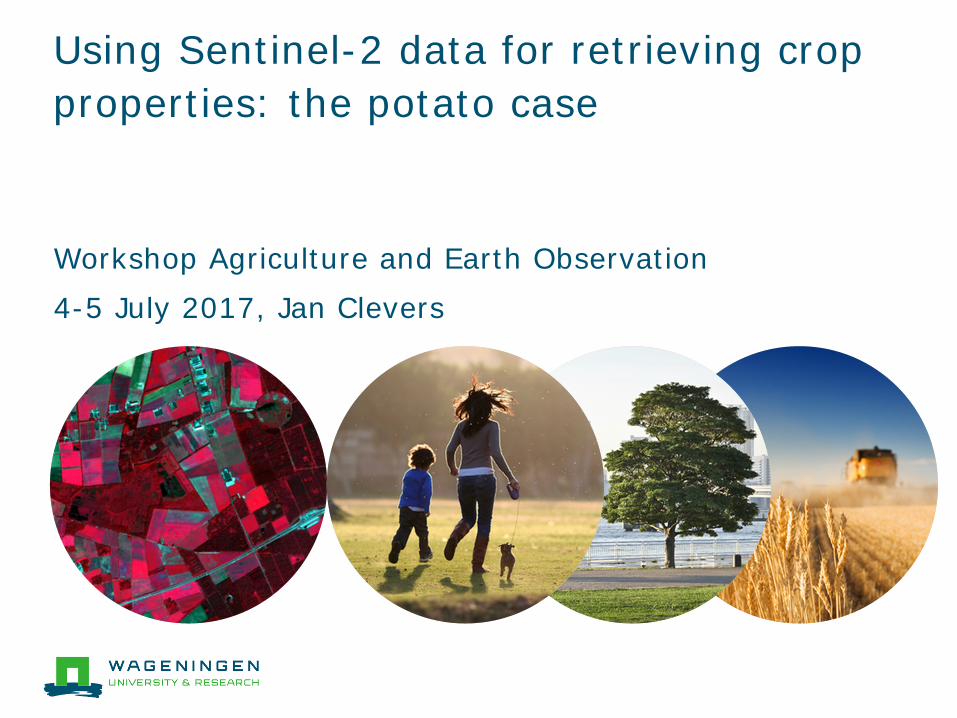
Using Sentinel-2 data for retrieving crop properties: the potato case
Workshop Agriculture and Earth Observation 4-5 July 2017, Jan Clevers
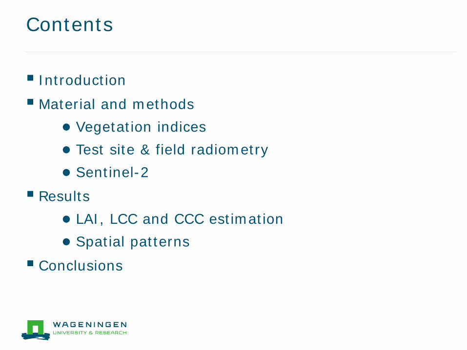
Contents
Introduction Material and methods
● Vegetation indices ● Test site & field radiometry ● Sentinel-2
Results ● LAI, LCC and CCC estimation ● Spatial patterns
Conclusions
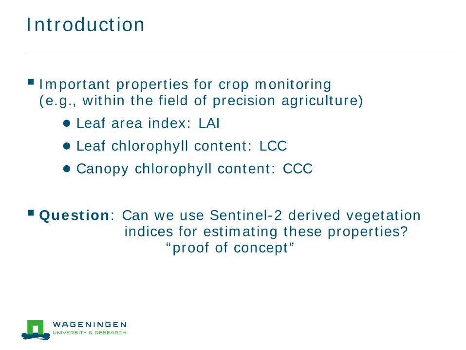
Introduction
Important properties for crop monitoring (e.g., within the field of precision agriculture) ● Leaf area index: LAI ● Leaf chlorophyll content: LCC ● Canopy chlorophyll content: CCC
Question: Can we use Sentinel-2 derived vegetation indices for estimating these properties? “proof of concept”
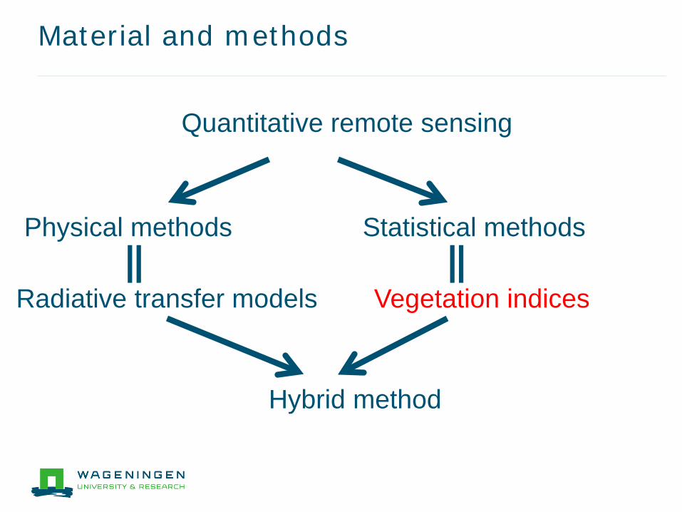
Material and methods
Quantitative remote sensing
Physical methods Statistical methods
Vegetation indices Radiative transfer models
Hybrid method
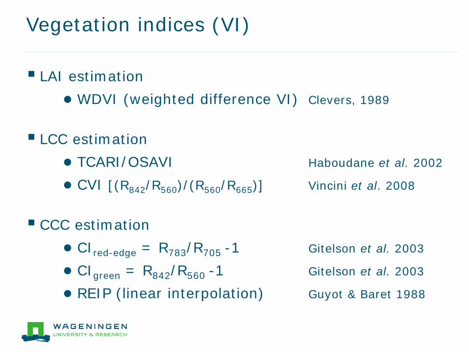
Vegetation indices (VI)
LAI estimation ● WDVI (weighted difference VI) Clevers, 1989
LCC estimation ● TCARI/OSAVI Haboudane et al. 2002
● CVI [(R842/R560)/(R560/R665)] Vincini et al. 2008
CCC estimation ● CIred-edge = R783/R705 -1 Gitelson et al. 2003
● CIgreen = R842/R560 -1 Gitelson et al. 2003
● REIP (linear interpolation) Guyot & Baret 1988
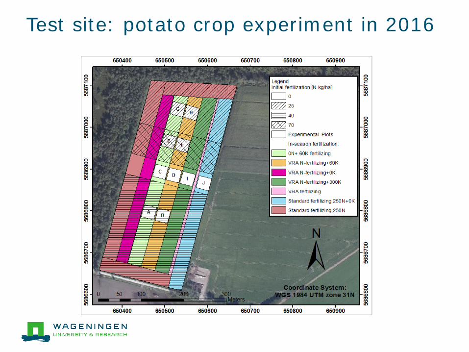
Test site: potato crop experiment in 2016
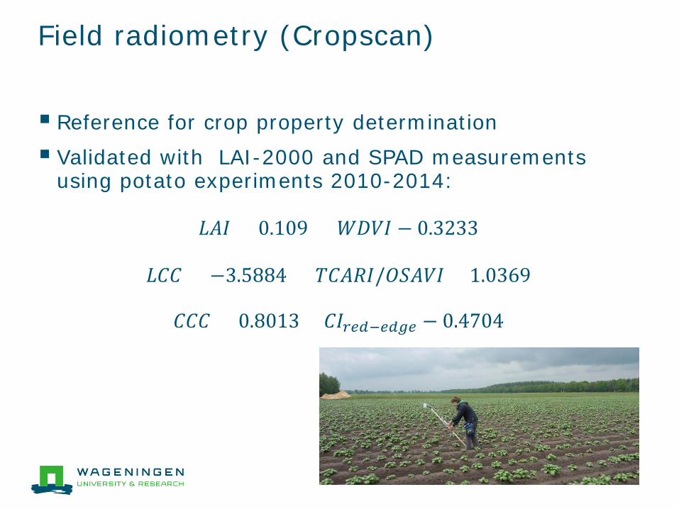
Field radiometry (Cropscan)
Reference for crop property determination Validated with LAI-2000 and SPAD measurements
using potato experiments 2010-2014:
𝐿𝐿𝐿𝐿𝐿𝐿 = 0.109 × 𝑊𝑊𝑊𝑊𝑊𝑊𝐿𝐿 − 0.3233
𝐿𝐿𝐿𝐿𝐿𝐿 = −3.5884 × 𝑇𝑇𝐿𝐿𝐿𝐿𝑇𝑇𝐿𝐿/𝑂𝑂𝑂𝑂𝐿𝐿𝑊𝑊𝐿𝐿 + 1.0369
𝐿𝐿𝐿𝐿𝐿𝐿 = 0.8013 × 𝐿𝐿𝐿𝐿𝑟𝑟𝑟𝑟𝑟𝑟−𝑟𝑟𝑟𝑟𝑒𝑒𝑟𝑟 − 0.4704
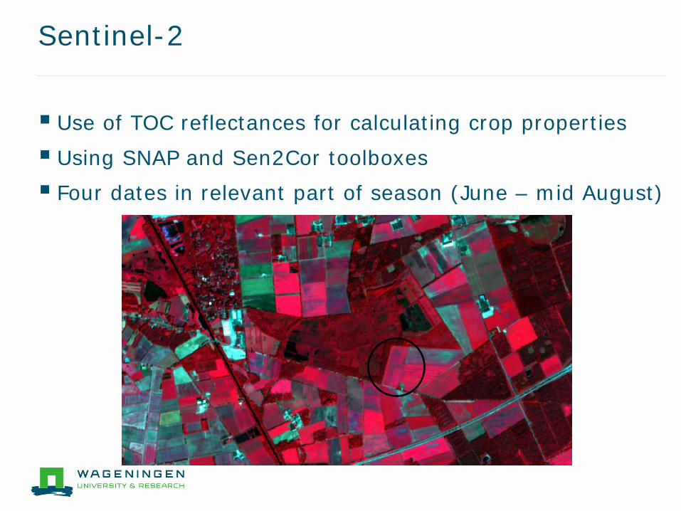
Sentinel-2
Use of TOC reflectances for calculating crop properties Using SNAP and Sen2Cor toolboxes Four dates in relevant part of season (June – mid August)
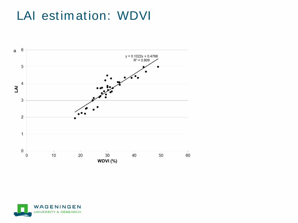
LAI estimation: WDVI
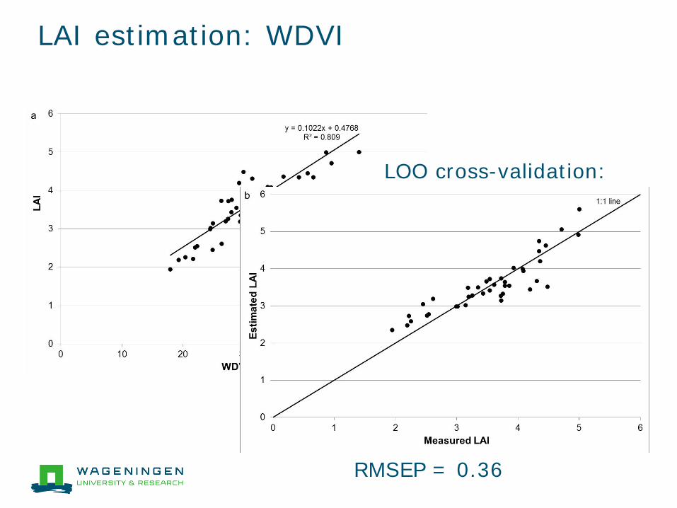
LAI estimation: WDVI
LOO cross-validation:
RMSEP = 0.36
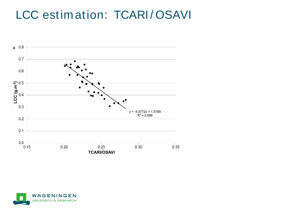
LCC estimation: TCARI/OSAVI
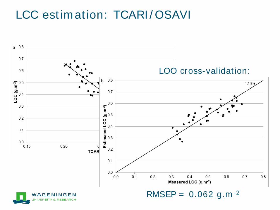
LCC estimation: TCARI/OSAVI
LOO cross-validation:
RMSEP = 0.062 g.m-2
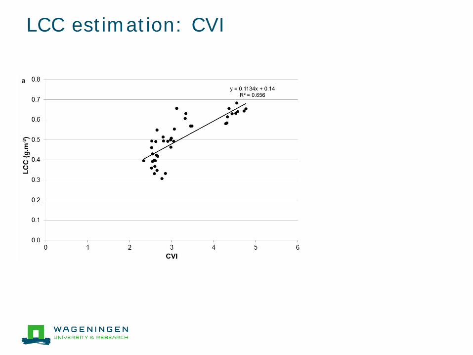
LCC estimation: CVI
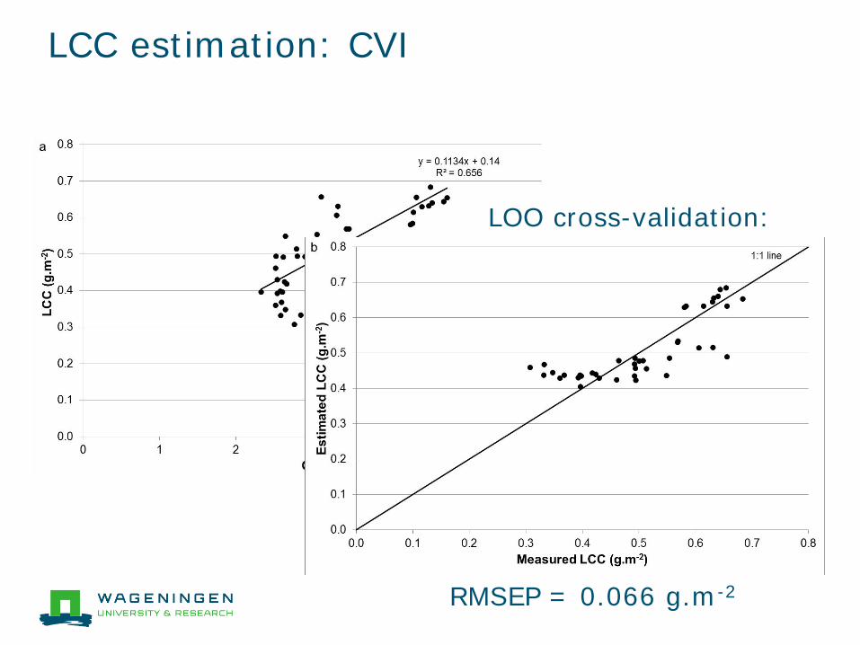
LCC estimation: CVI
LOO cross-validation:
RMSEP = 0.066 g.m-2
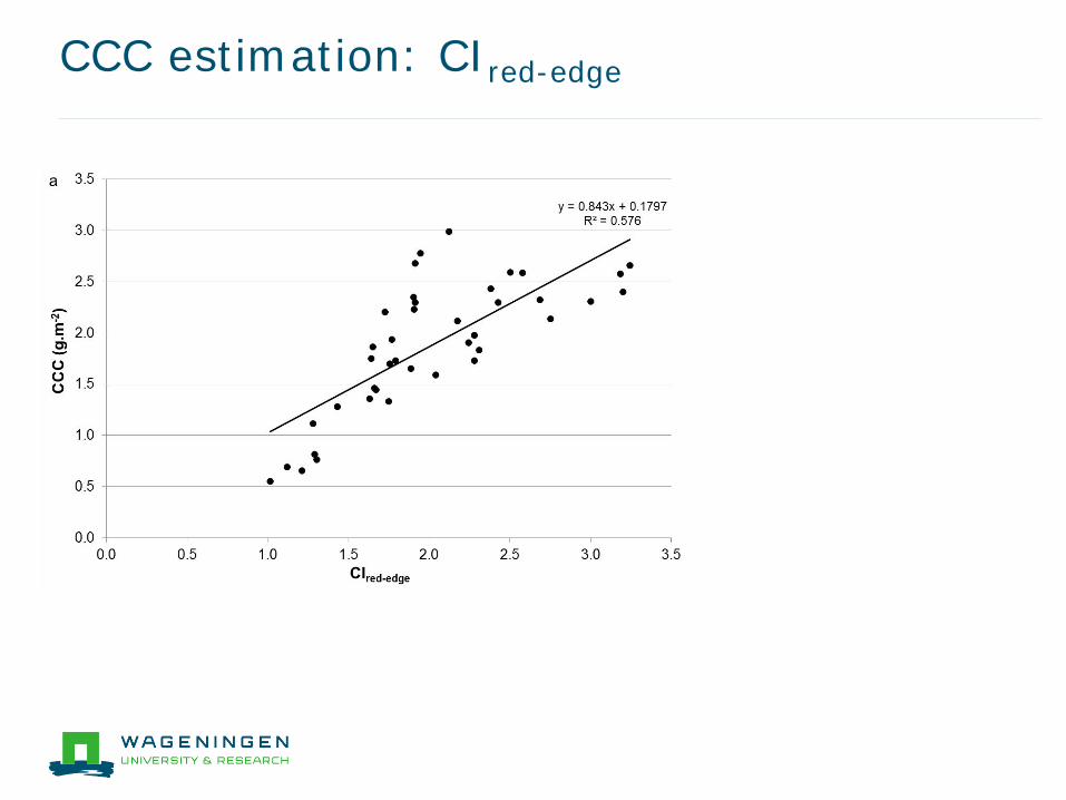
CCC estimation: CIred-edge
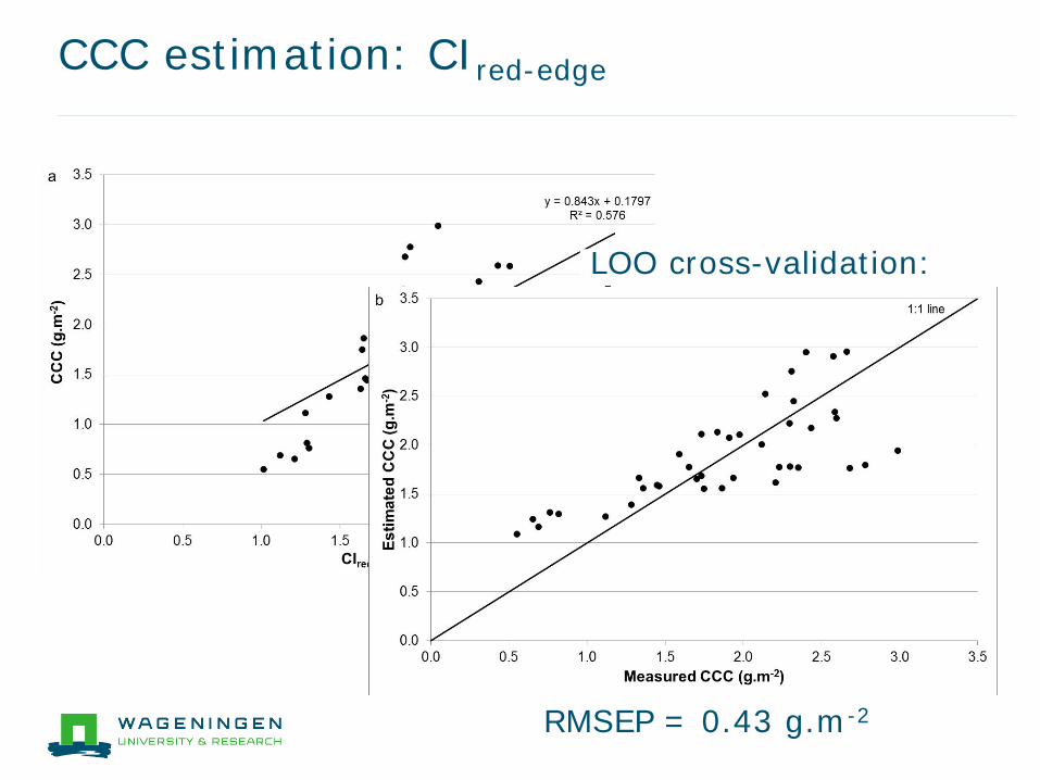
CCC estimation: CIred-edge
LOO cross-validation:
RMSEP = 0.43 g.m-2
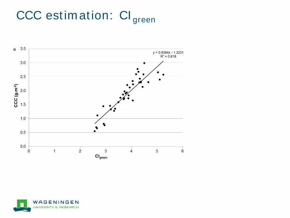
CCC estimation: CIgreen
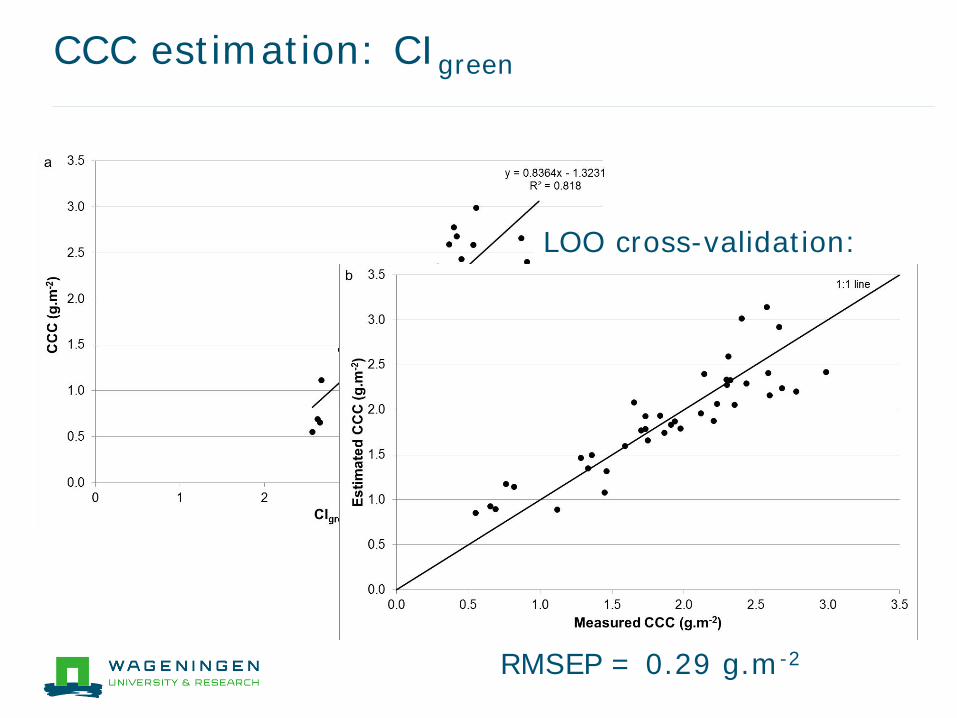
CCC estimation: CIgreen
LOO cross-validation:
RMSEP = 0.29 g.m-2
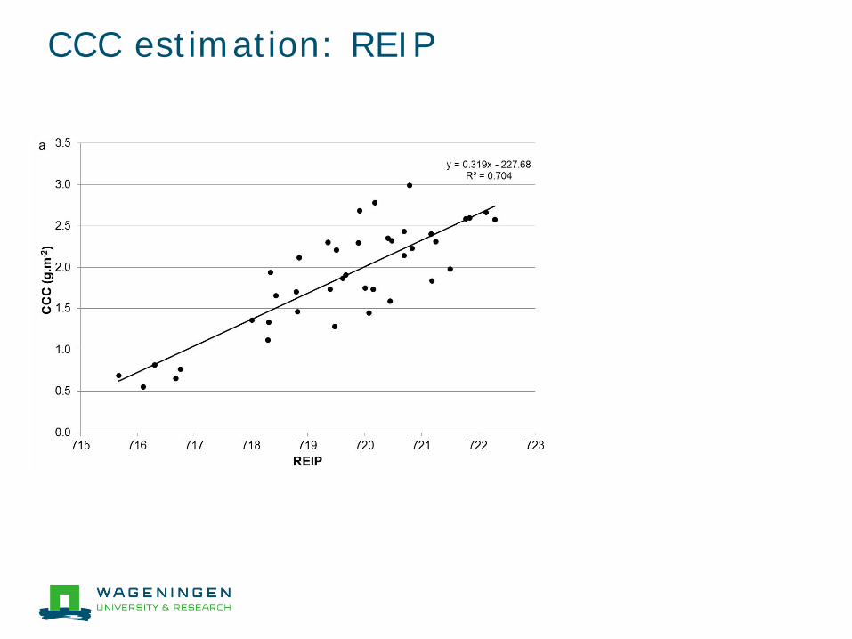
CCC estimation: REIP
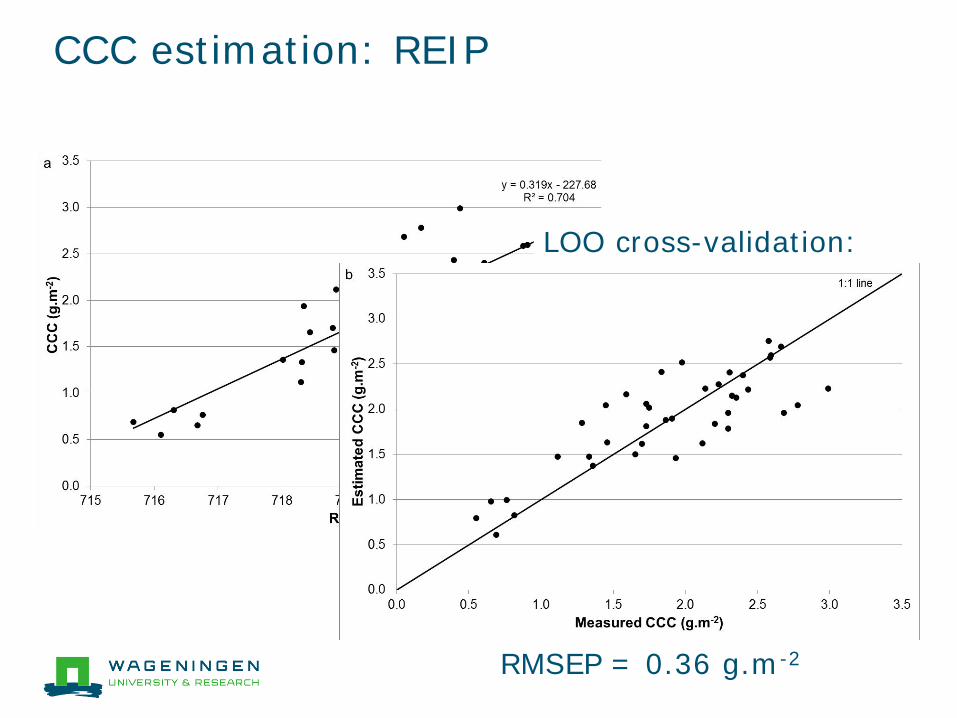
CCC estimation: REIP
LOO cross-validation:
RMSEP = 0.36 g.m-2
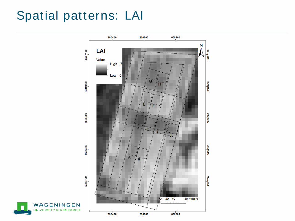
Spatial patterns: LAI

Spatial patterns: LCC
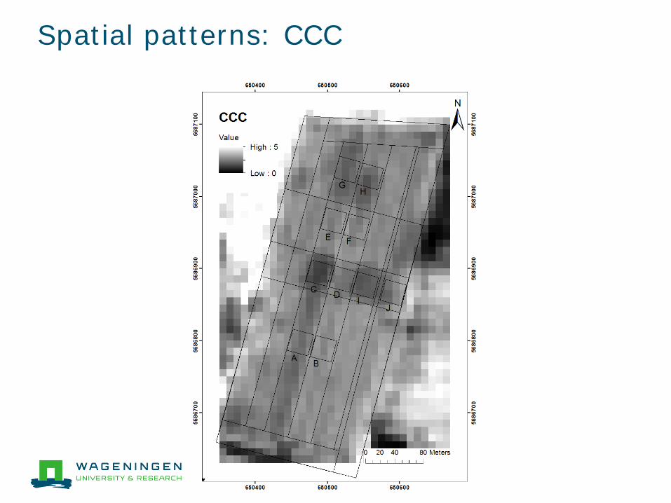
Spatial patterns: CCC
Conclusions
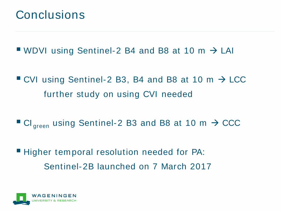
WDVI using Sentinel-2 B4 and B8 at 10 m LAI
CVI using Sentinel-2 B3, B4 and B8 at 10 m LCC
further study on using CVI needed CIgreen using Sentinel-2 B3 and B8 at 10 m CCC
Higher temporal resolution needed for PA: Sentinel-2B launched on 7 March 2017
Thank you for your attention
Questions?
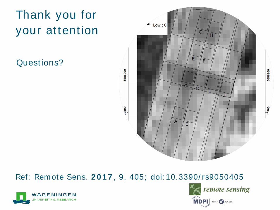
Ref: Remote Sens. 2017, 9, 405; doi:10.3390/rs9050405