Embed Size (px)
Citation preview
April 23, 2014 | JHS 210 Elizabeth Blackwell| 6:00 - 8:30 PM
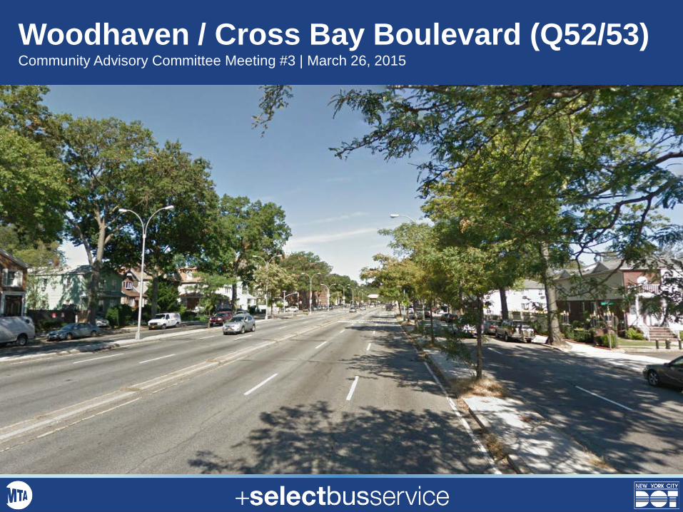
Woodhaven / Cross Bay Boulevard (Q52/53) Community Advisory Committee Meeting #3 | March 26, 2015
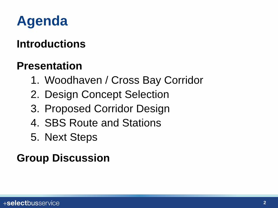
Agenda Introductions
Presentation 1. Woodhaven / Cross Bay Corridor 2. Design Concept Selection 3. Proposed Corridor Design 4. SBS Route and Stations 5. Next Steps
Group Discussion
2
Woodhaven / Cross Bay Corridor
3
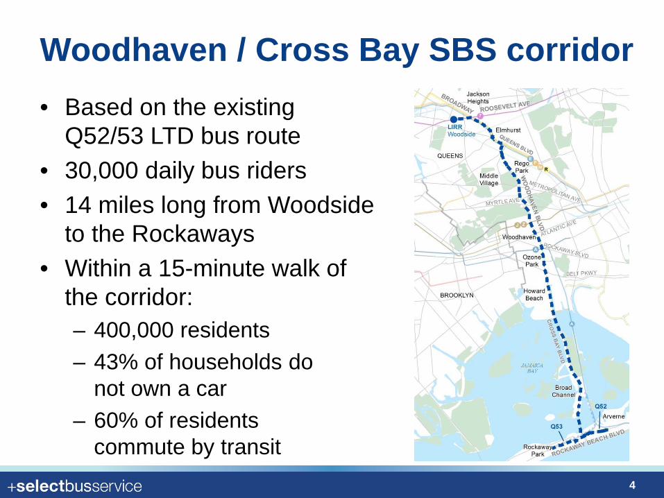
Woodhaven / Cross Bay SBS corridor • Based on the existing
Q52/53 LTD bus route • 30,000 daily bus riders • 14 miles long from Woodside
to the Rockaways • Within a 15-minute walk of
the corridor: – 400,000 residents – 43% of households do
not own a car – 60% of residents
commute by transit
4
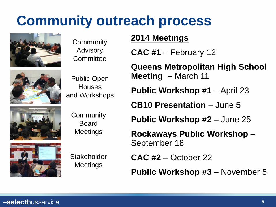
Community outreach process Community
Advisory Committee
Public Open Houses
and Workshops
Stakeholder Meetings
Community Board
Meetings
2014 Meetings CAC #1 – February 12
Queens Metropolitan High School Meeting – March 11
Public Workshop #1 – April 23
CB10 Presentation – June 5
Public Workshop #2 – June 25
Rockaways Public Workshop – September 18
CAC #2 – October 22
Public Workshop #3 – November 5
5
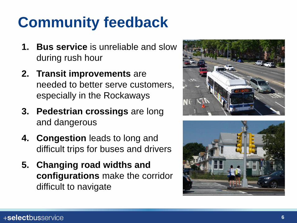
Community feedback 1. Bus service is unreliable and slow
during rush hour
2. Transit improvements are needed to better serve customers, especially in the Rockaways
3. Pedestrian crossings are long and dangerous
4. Congestion leads to long and difficult trips for buses and drivers
5. Changing road widths and configurations make the corridor difficult to navigate
6
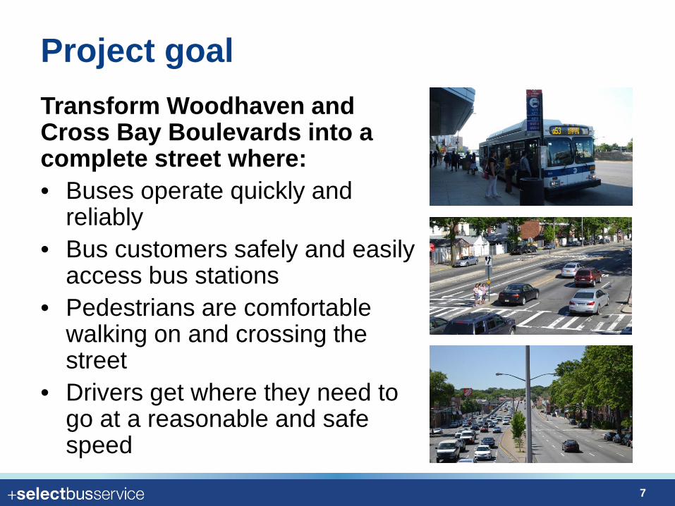
Project goal Transform Woodhaven and Cross Bay Boulevards into a complete street where: • Buses operate quickly and
reliably • Bus customers safely and easily
access bus stations • Pedestrians are comfortable
walking on and crossing the street
• Drivers get where they need to go at a reasonable and safe speed
7
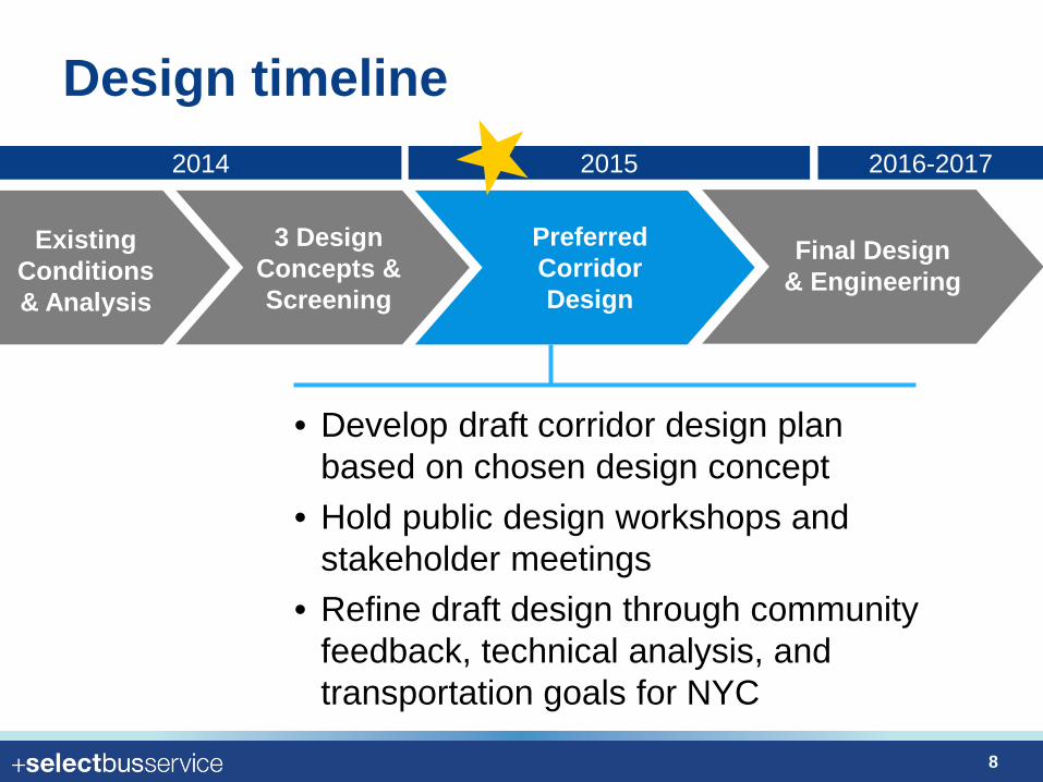
Design timeline
Existing Conditions& Analysis
3 Design Concepts & Screening
Preferred Corridor Design
Final Design & Engineering
2014 2016-2017 2015
• Develop draft corridor design plan based on chosen design concept
• Hold public design workshops and stakeholder meetings
• Refine draft design through community feedback, technical analysis, and transportation goals for NYC
8
Design Concept Selection
9
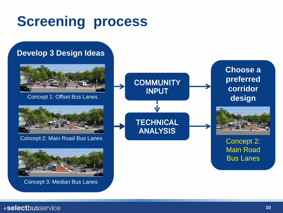
Screening process
COMMUNITY INPUT
Develop 3 Design Ideas
TECHNICAL ANALYSIS
Choose a preferred corridor design Concept 1: Offset Bus Lanes
Concept 2: Main Road Bus Lanes
Concept 3: Median Bus Lanes
Concept 2: Main Road Bus Lanes
10
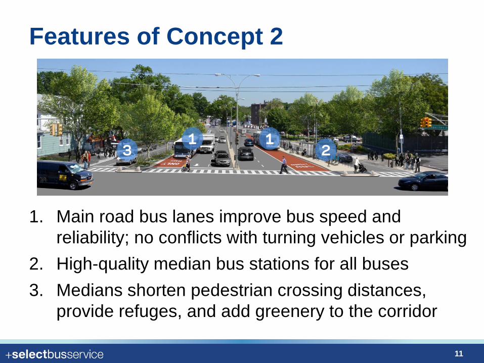
Features of Concept 2
1. Main road bus lanes improve bus speed and reliability; no conflicts with turning vehicles or parking
2. High-quality median bus stations for all buses 3. Medians shorten pedestrian crossing distances,
provide refuges, and add greenery to the corridor
1 2 3
1
11
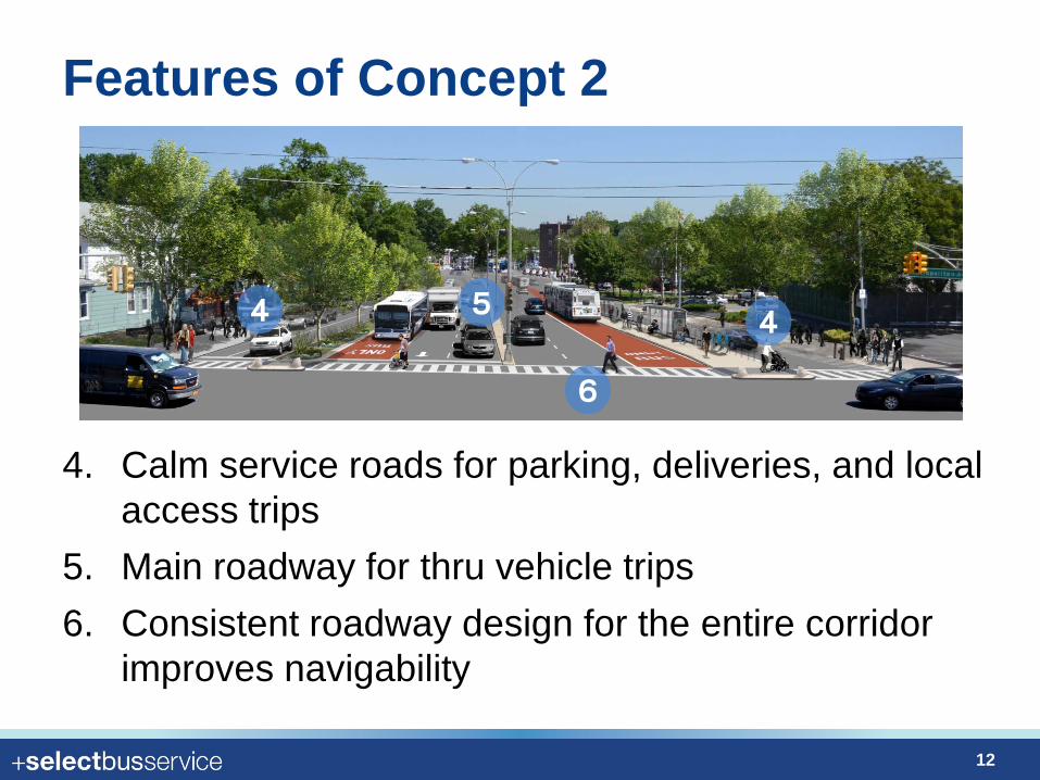
Features of Concept 2
4. Calm service roads for parking, deliveries, and local access trips
5. Main roadway for thru vehicle trips 6. Consistent roadway design for the entire corridor
improves navigability
4 5
6
4
12
Screening – community input
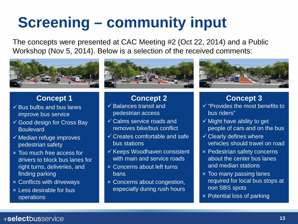
Concept 1 Bus bulbs and bus lanes
improve bus service Good design for Cross Bay
Boulevard Median refuge improves
pedestrian safety × Too much free access for
drivers to block bus lanes for right turns, deliveries, and finding parking
× Conflicts with driveways × Less desirable for bus
operations
Concept 2 Balances transit and
pedestrian access Calms service roads and
removes bike/bus conflict Creates comfortable and safe
bus stations Keeps Woodhaven consistent
with main and service roads × Concerns about left turns
bans × Concerns about congestion,
especially during rush hours
Concept 3 “Provides the most benefits to
bus riders” Might have ability to get
people of cars and on the bus Clearly defines where
vehicles should travel on road × Pedestrian safety concerns
about the center bus lanes and median stations
× Too many passing lanes required for local bus stops at non SBS spots
× Potential loss of parking
The concepts were presented at CAC Meeting #2 (Oct 22, 2014) and a Public Workshop (Nov 5, 2014). Below is a selection of the received comments:
13
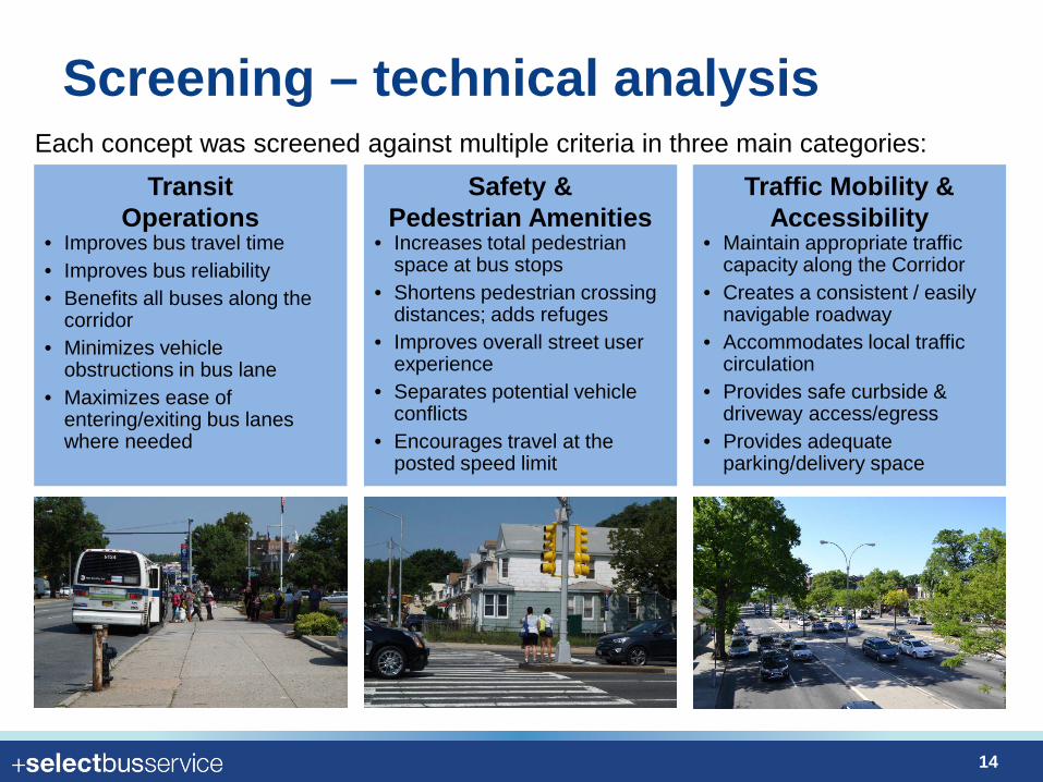
Screening – technical analysis
Transit Operations
• Improves bus travel time • Improves bus reliability • Benefits all buses along the
corridor • Minimizes vehicle
obstructions in bus lane • Maximizes ease of
entering/exiting bus lanes where needed
Safety & Pedestrian Amenities
• Increases total pedestrian space at bus stops
• Shortens pedestrian crossing distances; adds refuges
• Improves overall street user experience
• Separates potential vehicle conflicts
• Encourages travel at the posted speed limit
Traffic Mobility & Accessibility
• Maintain appropriate traffic capacity along the Corridor
• Creates a consistent / easily navigable roadway
• Accommodates local traffic circulation
• Provides safe curbside & driveway access/egress
• Provides adequate parking/delivery space
Each concept was screened against multiple criteria in three main categories:
14
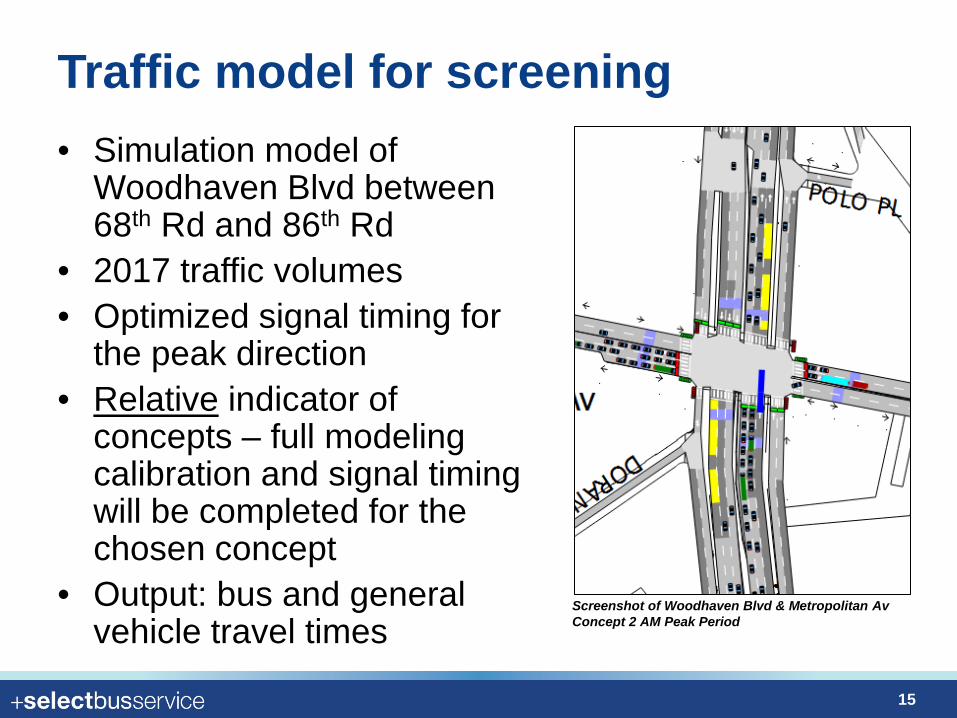
Traffic model for screening • Simulation model of
Woodhaven Blvd between 68th Rd and 86th Rd
• 2017 traffic volumes • Optimized signal timing for
the peak direction • Relative indicator of
concepts – full modeling calibration and signal timing will be completed for the chosen concept
• Output: bus and general vehicle travel times
Screenshot of Woodhaven Blvd & Metropolitan Av Concept 2 AM Peak Period
15
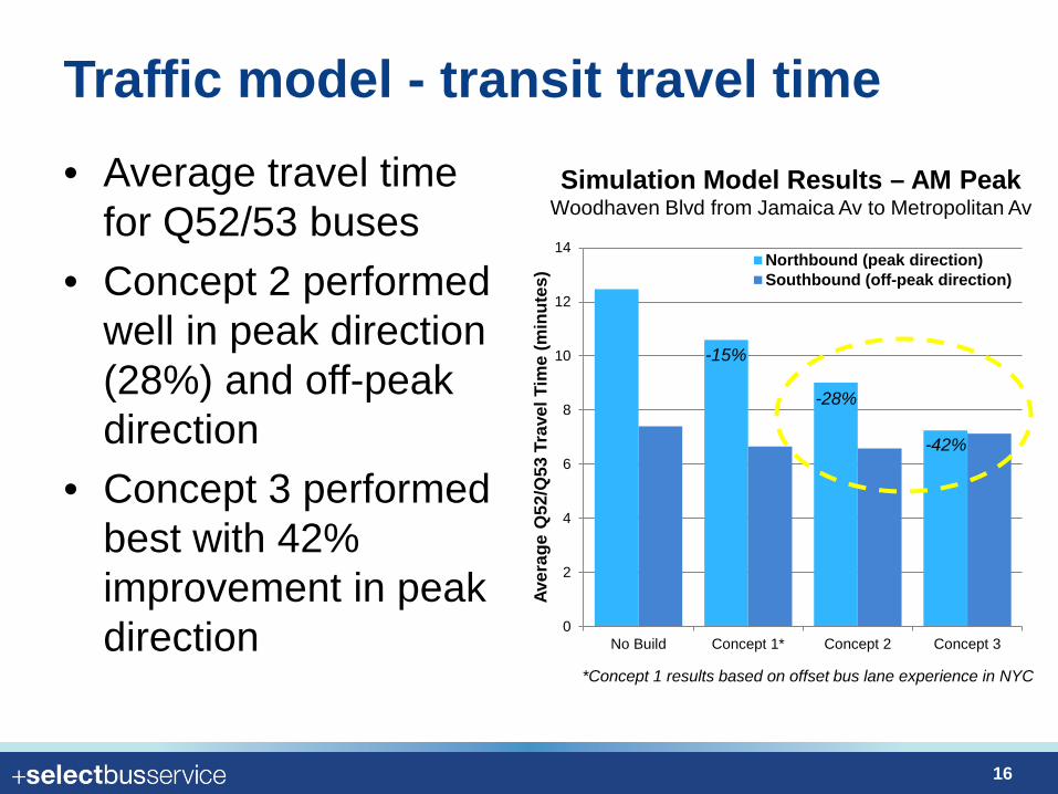
Traffic model - transit travel time • Average travel time
for Q52/53 buses • Concept 2 performed
well in peak direction (28%) and off-peak direction
• Concept 3 performed best with 42% improvement in peak direction
Simulation Model Results – AM Peak Woodhaven Blvd from Jamaica Av to Metropolitan Av
0
2
4
6
8
10
12
14
No Build Concept 1* Concept 2 Concept 3
Aver
age
Q52
/Q53
Tra
vel T
ime
(min
utes
) Northbound (peak direction)Southbound (off-peak direction)
*Concept 1 results based on offset bus lane experience in NYC
-28%
-15%
-42%
16
0
2
4
6
8
10
12
14
No Build Concept 1* Concept 2 Concept 3
Aver
age
Vehi
cle
Trav
el T
ime
(min
utes
)
Northbound (peak direction)Southbound (off-peak direction)
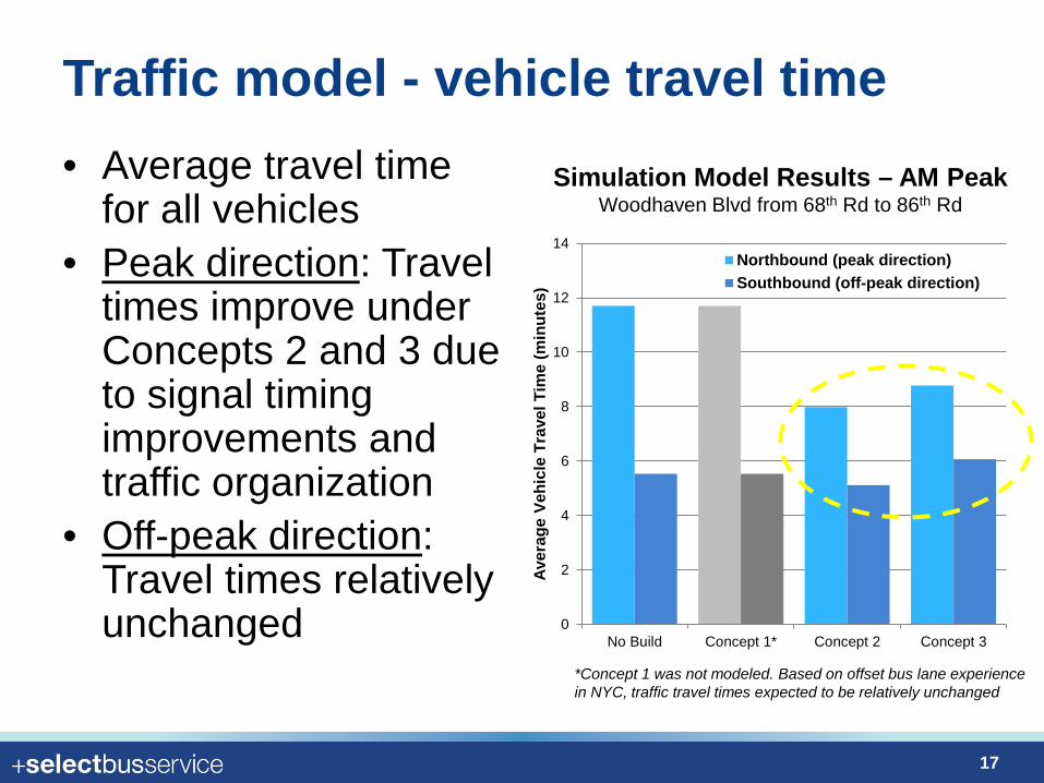
Traffic model - vehicle travel time • Average travel time
for all vehicles • Peak direction: Travel
times improve under Concepts 2 and 3 due to signal timing improvements and traffic organization
• Off-peak direction: Travel times relatively unchanged
Simulation Model Results – AM Peak Woodhaven Blvd from 68th Rd to 86th Rd
*Concept 1 was not modeled. Based on offset bus lane experience in NYC, traffic travel times expected to be relatively unchanged
17
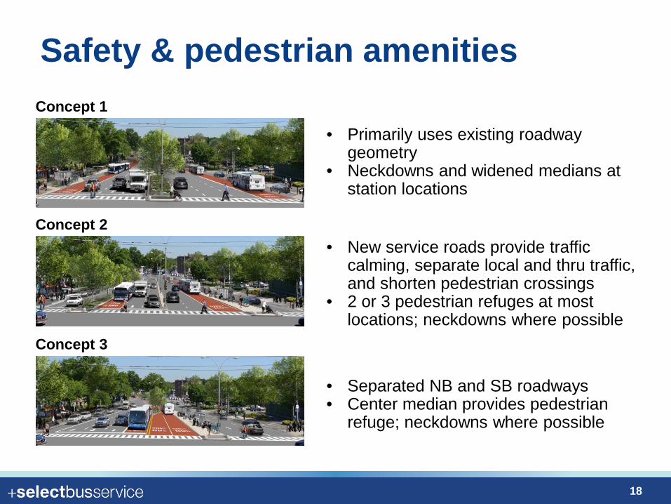
Safety & pedestrian amenities
• Primarily uses existing roadway geometry
• Neckdowns and widened medians at station locations
• New service roads provide traffic calming, separate local and thru traffic, and shorten pedestrian crossings
• 2 or 3 pedestrian refuges at most locations; neckdowns where possible
• Separated NB and SB roadways • Center median provides pedestrian
refuge; neckdowns where possible
Concept 1
Concept 2
Concept 3
18
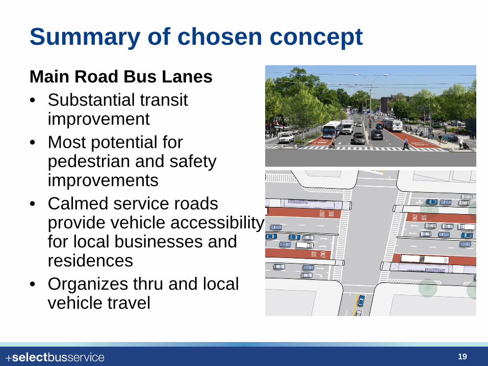
Summary of chosen concept Main Road Bus Lanes • Substantial transit
improvement • Most potential for
pedestrian and safety improvements
• Calmed service roads provide vehicle accessibility for local businesses and residences
• Organizes thru and local vehicle travel
19
Proposed Corridor Designs
20
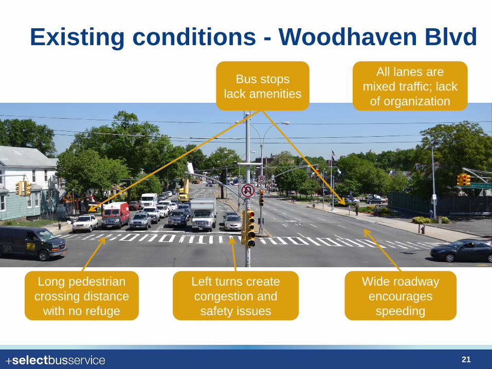
Existing conditions - Woodhaven Blvd
Long pedestrian crossing distance
with no refuge
All lanes are mixed traffic; lack
of organization
Wide roadway encourages
speeding
Bus stops lack amenities
Left turns create congestion and safety issues
21
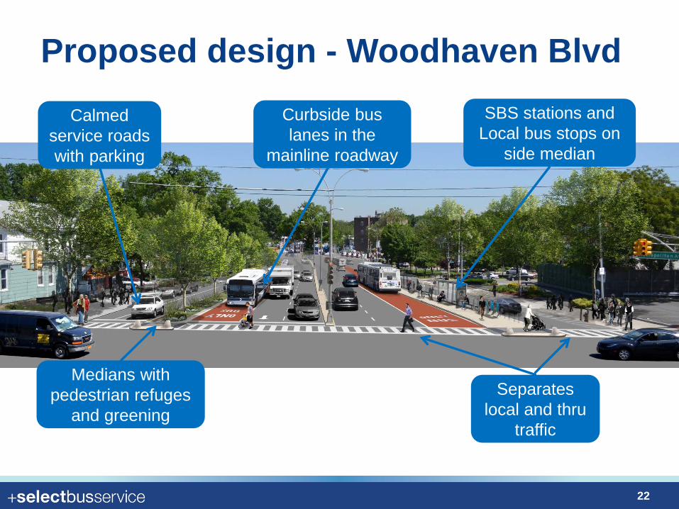
Proposed design - Woodhaven Blvd Curbside bus lanes in the
mainline roadway
Calmed service roads with parking
SBS stations and Local bus stops on
side median
Medians with pedestrian refuges
and greening Separates
local and thru traffic
22
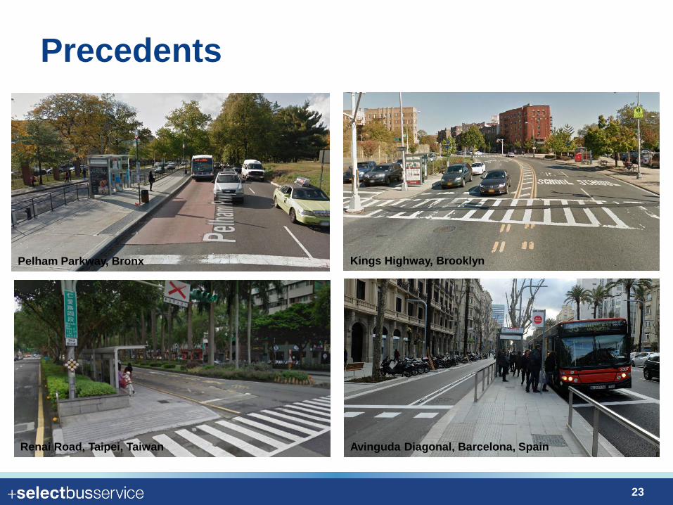
Precedents
Pelham Parkway, Bronx Kings Highway, Brooklyn
Avinguda Diagonal, Barcelona, Spain Renai Road, Taipei, Taiwan
23
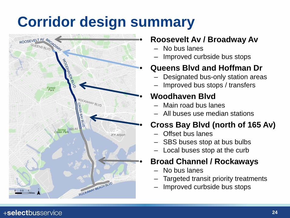
Corridor design summary • Roosevelt Av / Broadway Av
– No bus lanes – Improved curbside bus stops
• Queens Blvd and Hoffman Dr – Designated bus-only station areas – Improved bus stops / transfers
• Woodhaven Blvd – Main road bus lanes – All buses use median stations
• Cross Bay Blvd (north of 165 Av) – Offset bus lanes – SBS buses stop at bus bulbs – Local buses stop at the curb
• Broad Channel / Rockaways – No bus lanes – Targeted transit priority treatments – Improved curbside bus stops
24
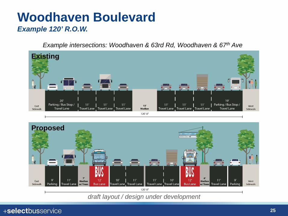
Woodhaven Boulevard Example 120’ R.O.W.
Existing
Proposed
Example intersections: Woodhaven & 63rd Rd, Woodhaven & 67th Ave
draft layout / design under development
25
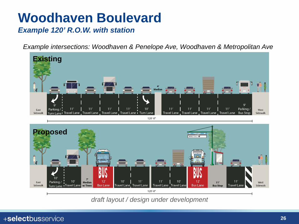
Woodhaven Boulevard Example 120’ R.O.W. with station
Existing
Proposed
Example intersections: Woodhaven & Penelope Ave, Woodhaven & Metropolitan Ave
draft layout / design under development
26
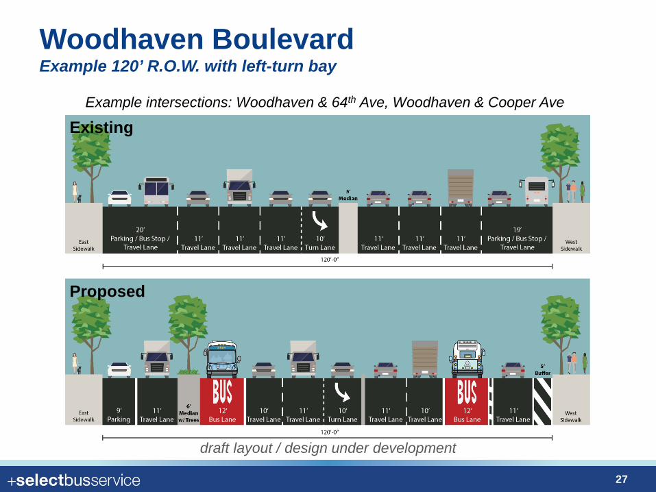
Woodhaven Boulevard Example 120’ R.O.W. with left-turn bay
Existing
Proposed
Example intersections: Woodhaven & 64th Ave, Woodhaven & Cooper Ave
draft layout / design under development
27

Woodhaven Boulevard Example 160’ R.O.W.
Existing
Proposed
Example intersections: Woodhaven & 86th Road
draft layout / design under development
28
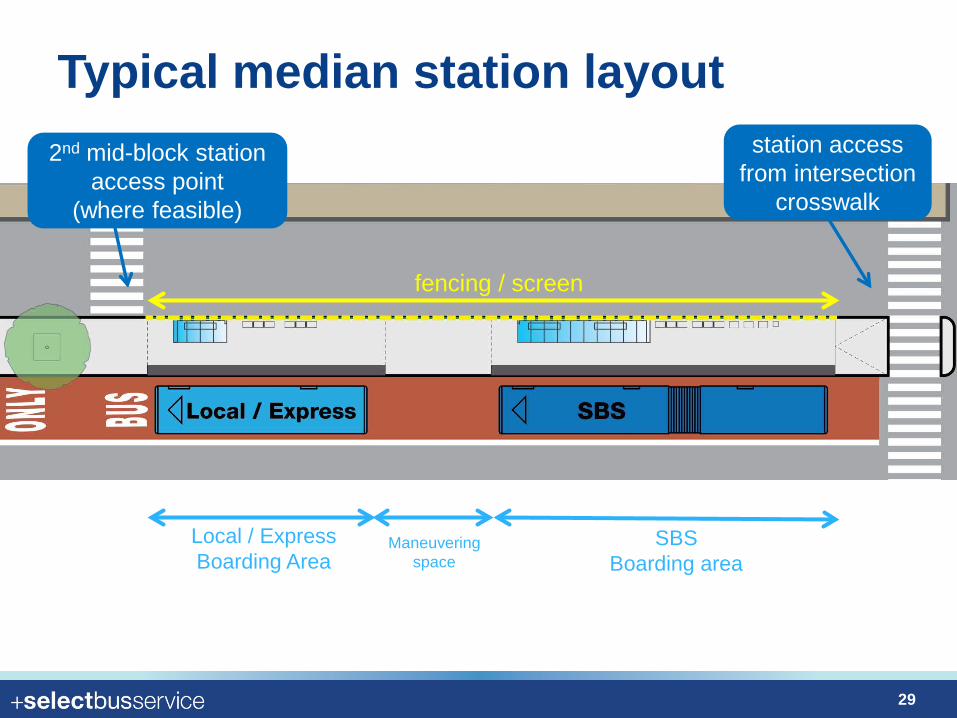
Typical median station layout 2nd mid-block station
access point (where feasible)
station access from intersection
crosswalk
Local / Express Boarding Area
Maneuvering space
SBS Boarding area
fencing / screen
29
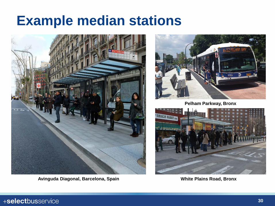
Example median stations
Avinguda Diagonal, Barcelona, Spain
Pelham Parkway, Bronx
White Plains Road, Bronx
30
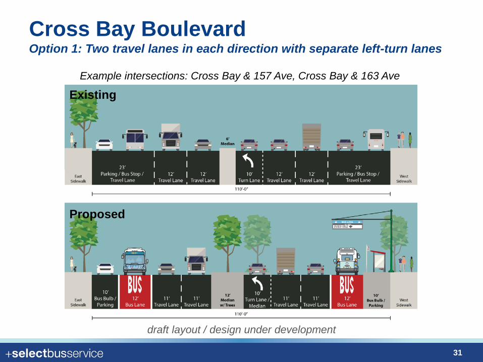
Cross Bay Boulevard Option 1: Two travel lanes in each direction with separate left-turn lanes
Example intersections: Cross Bay & 157 Ave, Cross Bay & 163 Ave
Existing
Proposed
draft layout / design under development
31
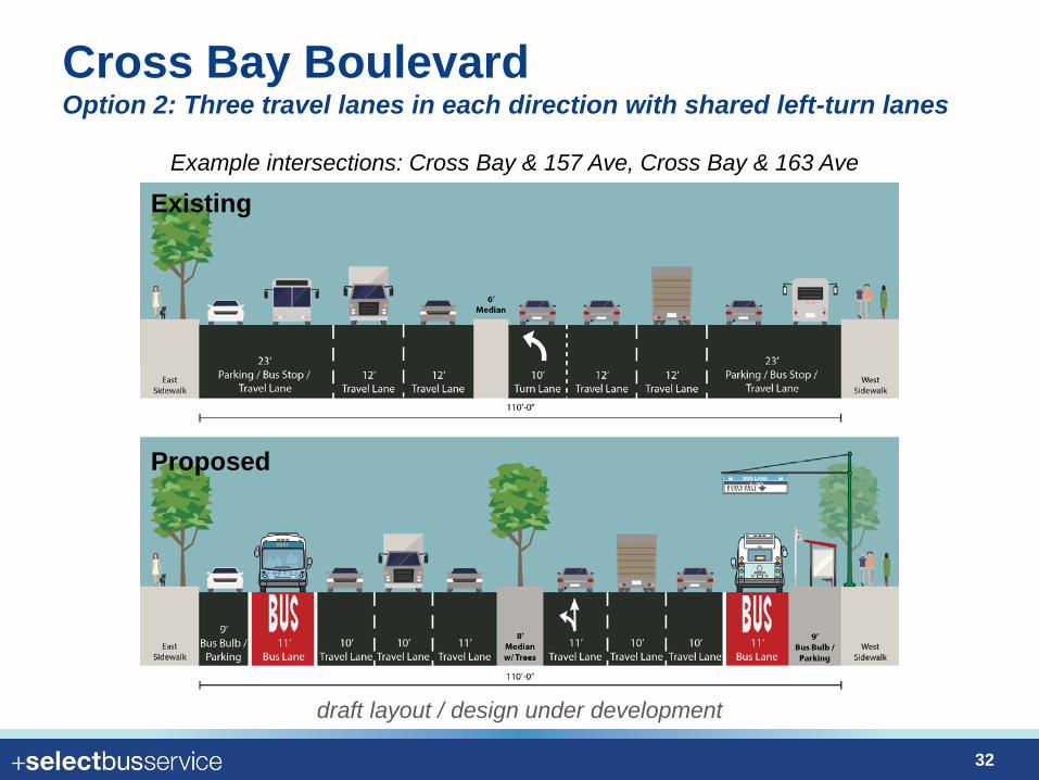
Cross Bay Boulevard Option 2: Three travel lanes in each direction with shared left-turn lanes
Existing
Proposed
Example intersections: Cross Bay & 157 Ave, Cross Bay & 163 Ave
draft layout / design under development
32
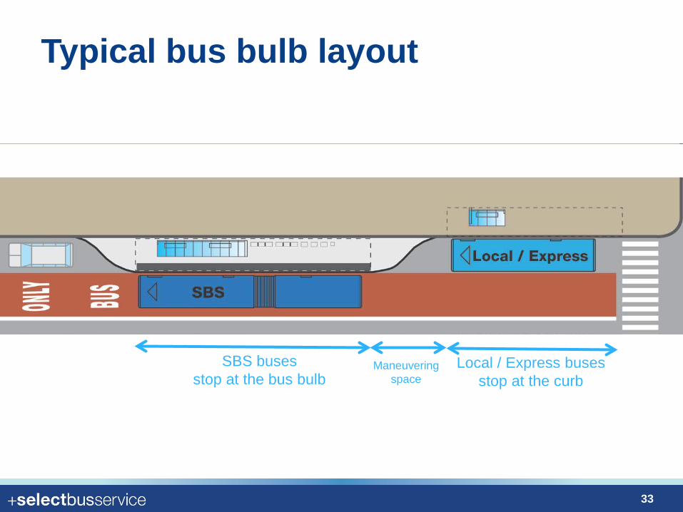
Typical bus bulb layout
Local / Express buses stop at the curb
Maneuvering space
SBS buses stop at the bus bulb
33
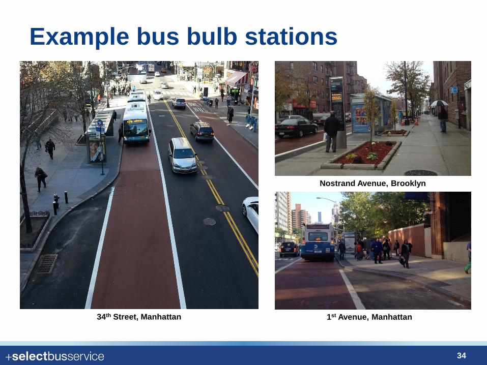
Example bus bulb stations
34th Street, Manhattan
Nostrand Avenue, Brooklyn
1st Avenue, Manhattan
34
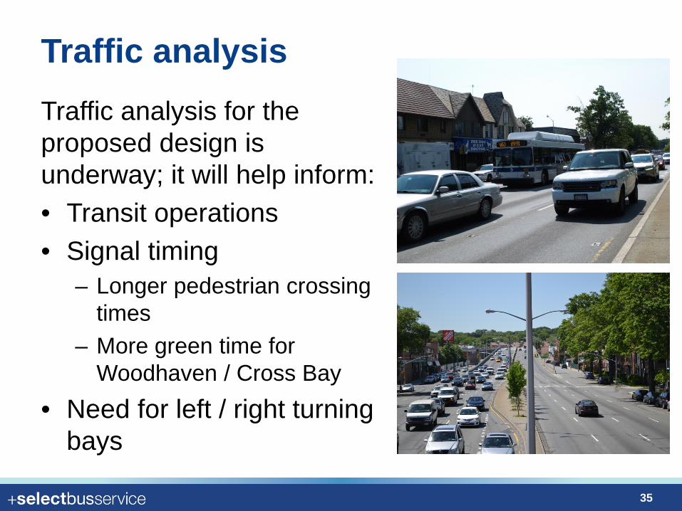
Traffic analysis Traffic analysis for the proposed design is underway; it will help inform: • Transit operations • Signal timing
– Longer pedestrian crossing times
– More green time for Woodhaven / Cross Bay
• Need for left / right turning bays
35
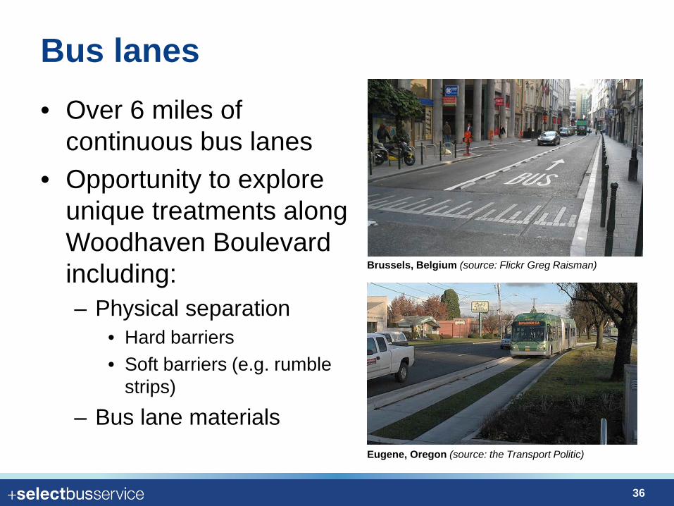
Bus lanes • Over 6 miles of
continuous bus lanes • Opportunity to explore
unique treatments along Woodhaven Boulevard including: – Physical separation
• Hard barriers • Soft barriers (e.g. rumble
strips)
– Bus lane materials
Brussels, Belgium (source: Flickr Greg Raisman)
Eugene, Oregon (source: the Transport Politic)
36
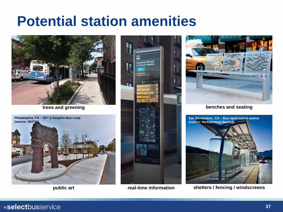
Potential station amenities
real-time information shelters / fencing / windscreens
San Bernardino , CA – Bus rapid transit station (source: Architectural Record)
Philadelphia, PA – 33rd & Dauphin Bus Loop (source: SEPTA)
public art
benches and seating trees and greening
37
SBS Route and Stations
38
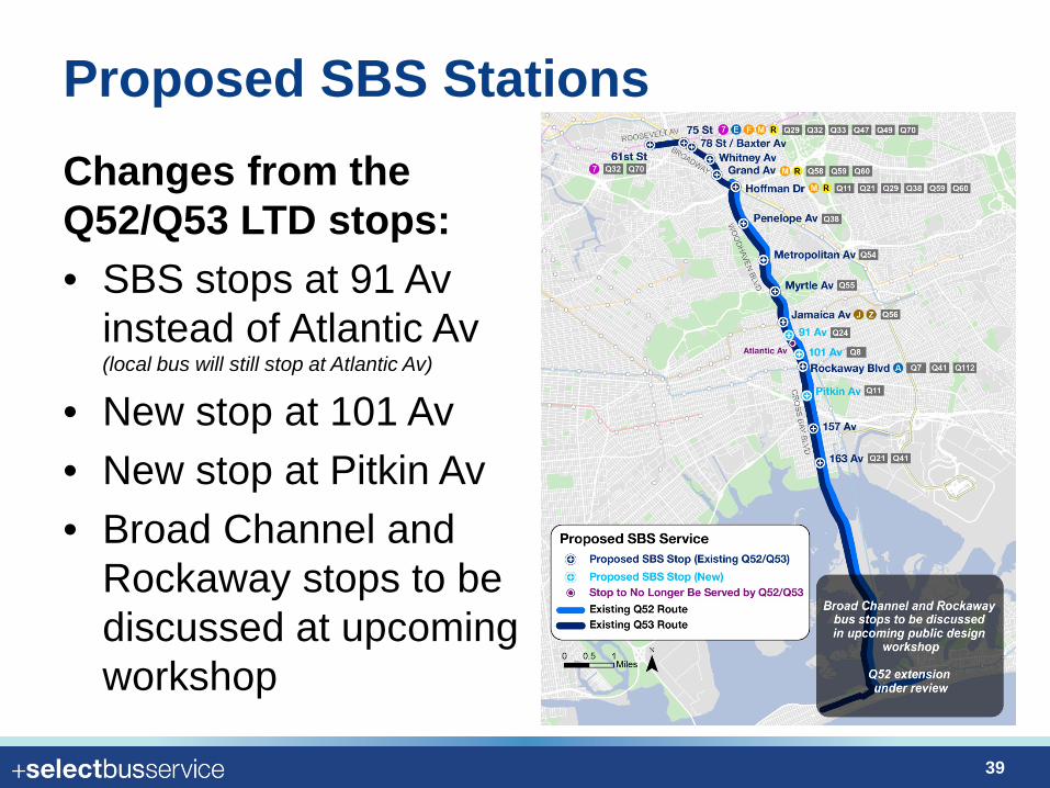
Proposed SBS Stations Changes from the Q52/Q53 LTD stops: • SBS stops at 91 Av
instead of Atlantic Av (local bus will still stop at Atlantic Av)
• New stop at 101 Av • New stop at Pitkin Av • Broad Channel and
Rockaway stops to be discussed at upcoming workshop
39
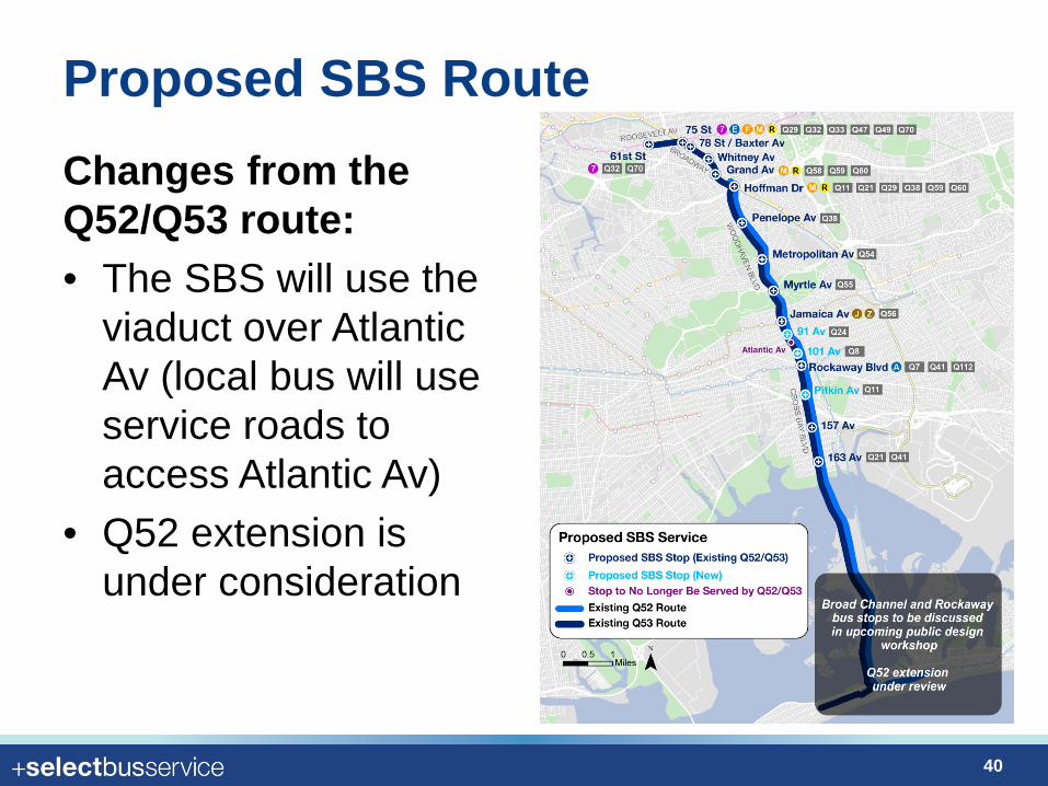
Proposed SBS Route Changes from the Q52/Q53 route: • The SBS will use the
viaduct over Atlantic Av (local bus will use service roads to access Atlantic Av)
• Q52 extension is under consideration
40
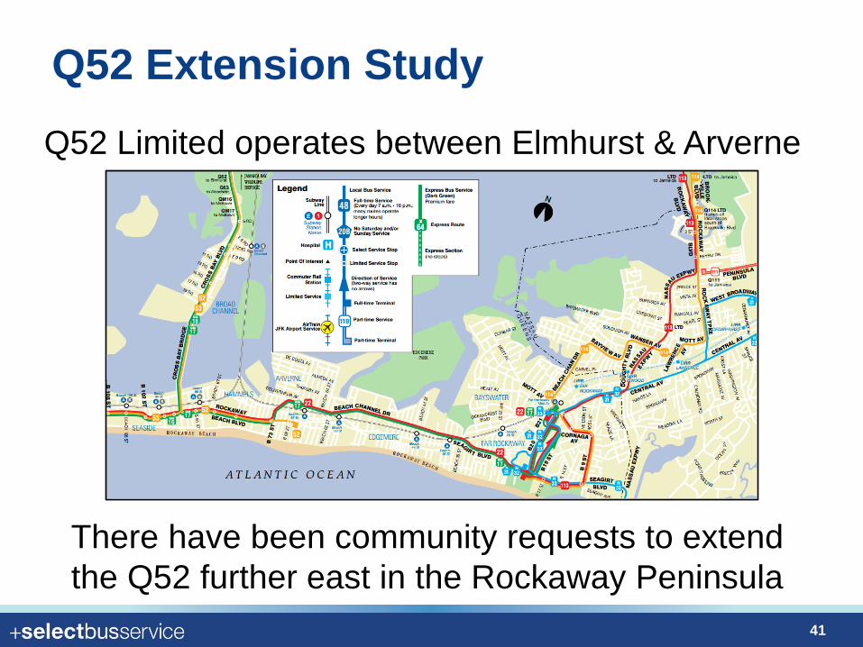
Q52 Extension Study Q52 Limited operates between Elmhurst & Arverne
There have been community requests to extend the Q52 further east in the Rockaway Peninsula
41
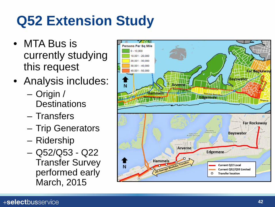
Q52 Extension Study • MTA Bus is
currently studying this request
• Analysis includes: – Origin /
Destinations – Transfers – Trip Generators – Ridership – Q52/Q53 - Q22
Transfer Survey performed early March, 2015
42
Next Steps
43
Next steps • Today: Discuss selected concept and gather initial
feedback to refine design plans for upcoming public workshops
• April 2015: Present draft corridor design plans at a series of public design workshops
• Summer 2015: Refine design plans based on community feedback and further technical review
• Fall 2015: Transfer project to NYC Department of Design and Construction for Final Design and engineering
44
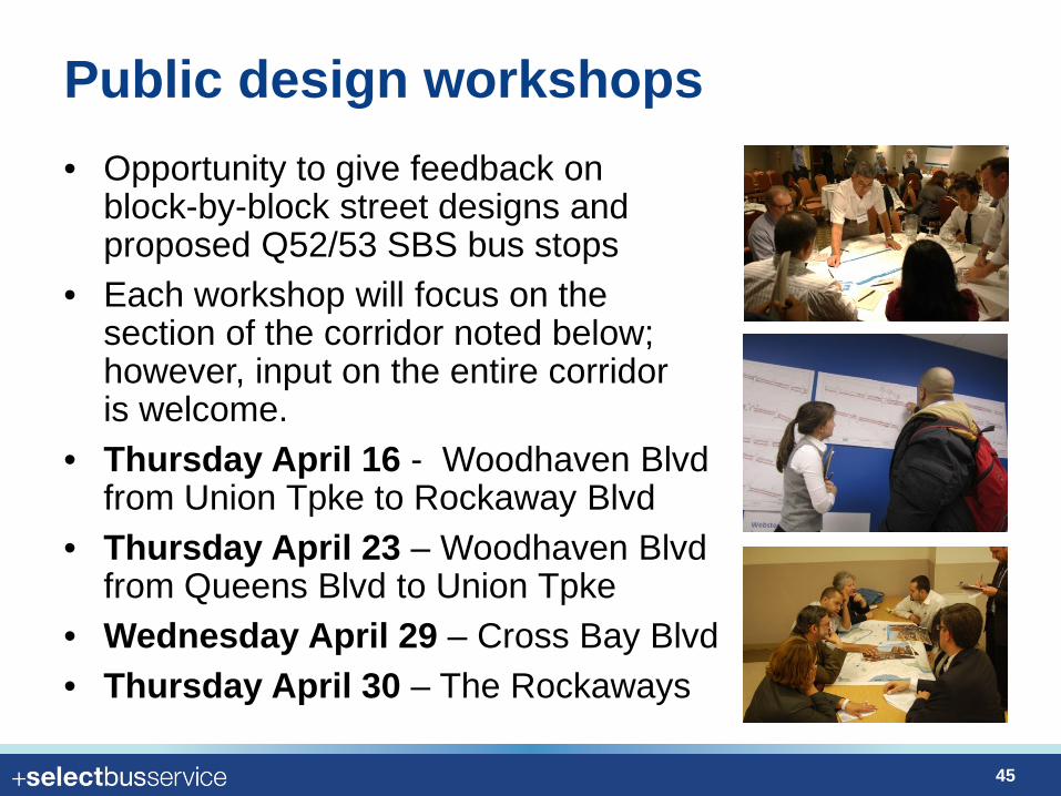
Public design workshops • Opportunity to give feedback on
block-by-block street designs and proposed Q52/53 SBS bus stops
• Each workshop will focus on the section of the corridor noted below; however, input on the entire corridor is welcome.
• Thursday April 16 - Woodhaven Blvd from Union Tpke to Rockaway Blvd
• Thursday April 23 – Woodhaven Blvd from Queens Blvd to Union Tpke
• Wednesday April 29 – Cross Bay Blvd • Thursday April 30 – The Rockaways
45
April 23, 2014 | JHS 210 Elizabeth Blackwell| 6:00 - 8:30 PM
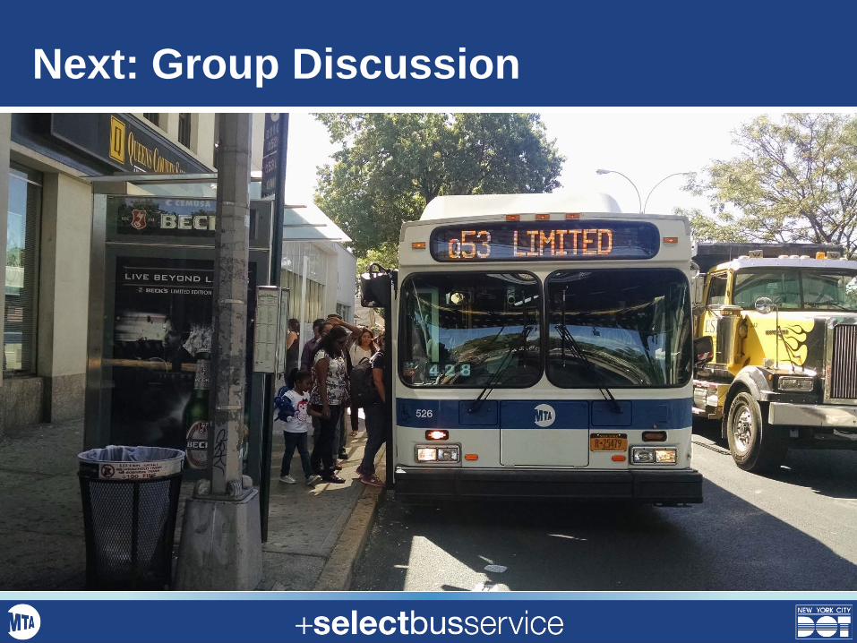
Next: Group Discussion