Embed Size (px)
Citation preview
www.ijecs.in
International Journal Of Engineering And Computer Science ISSN:2319-7242
Volume - 3 Issue - 8 August, 2014 Page No. 7793-7797
Mr.Sagar D. Solanki, IJECS Volume 3 Issue 8 August, 2014 Page No.7793-7797 Page 7793
Wireless Sensor Network For Landslide Assessment
Mr.Sagar D. Solanki, Mr. Ankit Suthar
PG Student, E&C Department,
A. D. Patel Institute of Technology.
New VallabhVidhya Nagar, Gujarat, India.
E-mail:[email protected]
Asst. Pro f., E&C Department,
A. D. Patel Institute of Technology.
New VallabhVidhya Nagar, Gujarat, India. E-mail:[email protected]
Abstract — Natural disasters are increasing worldwide due to the global warming and climate change. We are focusing on Landslides
disaster. However, this disaster is largely unpredictable and occurs within very short spans of time. Therefore technology has to be
developed to capture relevant signals with minimum monitoring delay. Wireless Sensors are one of the cutting edge technologie s that can quickly respond to rapid changes of data and send the sensed data to a data analysis centre in areas where cabling is inappropriate.
The heart of this project lies with the use of a GSM + Zigbee + Sensor. Every sensor has Zigbee Tx mounted on it. When landslides
happens sensor sense that and transfer data through router to the coordinator. Coordinator has GSM + Zigbee Rx. Coordinator
receives it and this information is transmitted by GSM to the Control centre. GSM in the Control centre receives this and transfer this
information via GSM to rescue team. We also check the status of sensor by sending message. Monitoring Landslides is very helpful to protect people and avoid accident. Because of landslides many accident occur on highway, hill station and railway track. So with the
help of this system we can warn the main centre about where the landslides happen. We also check the status of tunnels and landslides
prone area.
Keywords - GSM, PIC microcontroller, ZigBee Technology, Wireless sensor network.
I. INTRODUCTION
Natural d isasters are becoming more severe. One important
reason is the results of global warming around the world
causing many of the disasters. To carefully protect people in
these areas, we need a monitoring and alarm system. In many
events such as landslides and water flooding, they can be
warned by a raised alarm within in a specified period.
There are many natural d isasters happen like Flood,
Earthquake, Tsunami, and Landslide. We are focusing on
Landslides. India faces landslides every year with a large
threat to human life causing annual loss of US $400 million.
From the survey found that most landslide prone area in
India are:
1. Western Himalayas (Uttar Pradesh, Uttaranchal, Himachal
Pradesh and Jammu & Kashmir).
2. Eastern & N.E Himalayas (West Bengal, Sikkim and
Arunachal Pradesh).
3. Naga-Arakkan Mountain belt (Nagaland, Manipur,
Mizoram and Tripura).
4. Western Ghats including Nilgiris (Maharashtra, Goa,
Karnataka, Kerala & Tamil Nadu).
5. Plateau margins in the Peninsular India and Meghalaya in
NE India.
6. Konkan Railway tunnel.
In konkan railway there are 1998 Bridges (179-Major; 1819-
minor) and 92 tunnels, More than 1000 cuttings in the track
and Landslides a common problem due to excessive rainfall.
So when tunnel like this Landslide happens it can block the
tunnels and train accident occurs.
II. PREVIOUS WORK
Zhang [1] distributed some sensor nodes on the hillside; they
construct used Zigbee protocol for wireless data collection.
This design combines GSM wireless communication
technology and wireless sensor network, it have completed the
work from the system solution to the whole p rocess of
software and hardware design. The result proves that each
node works stably and the status of network communication is
good. This design can collects the depth of water in the
mountain and the slope angle of the hillside, and provides the
monitoring center with warning informat ion in time, so related
departments can take effective measures rapidly to protect
people’s lives and properties.
Gu Aihua [4] designs a wireless sensor network (WSN) to
adapt the request of mountain torrent disaster early-warn ing
system. The sensor node collects the information such as soil
water content, permeability coefficient, displacement and
rainfall, etc. To realize real-time data storage and process, the
Mr.Sagar D. Solanki, IJECS Volume 3 Issue 8 August, 2014 Page No.7793-7797 Page 7794
gathering node receives the real-time data and sent it to
informat ion center through GPRS networks. This system is
cost effective solution other than wire communication.
When the disaster happen, general communication methods,
e.g., cell phone, may not work well due to the damage of
communicat ion in frastructure or restriction of usage of
communicat ion resources. How to let users quickly confirm
safety is a critically important problem after a disaster.
Therefore, Junbo[3] p ropose a design of safety confirmat ion
system integrating WSN and smart phones. Users can input
messages using smart phones and the messages are sent
through WSN built based on sensor nodes mounted on smart
phones.
III. PRAPOSED SYSTEM
Figure 1: System blockdiagram
Figure 1 shows the system overview. The working of this
system can be explained with following steps:
1. Every Acceleration sensor has Zigbee Tx.
2. When landslides happens sensor sense that and transfer
data through router to the coordinator.
3. Coordinator has GSM+Zigbee Rx.
4. Coordinator receives it and this information is transmitted
by GSM to the Control centre.
5. GSM in the Control centre receives this and transfer this
informat ion via GSM to rescue team.
6. We can also check the status of sensor by sending
message.
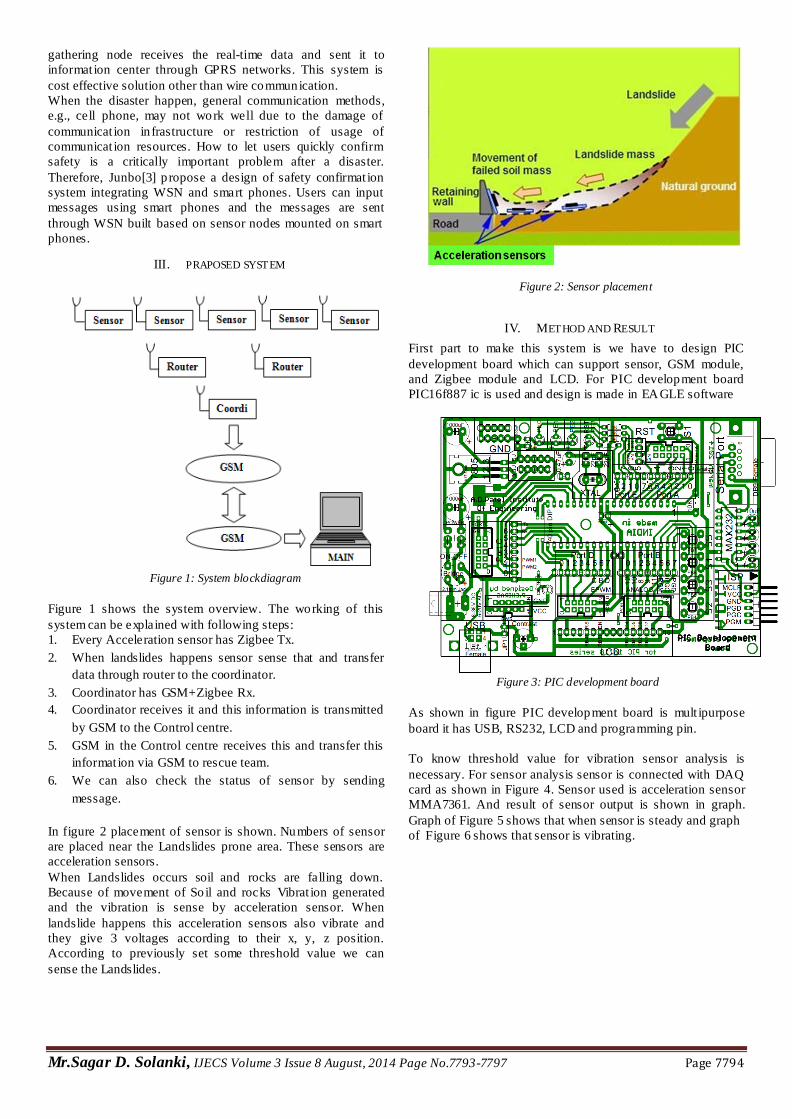
In figure 2 placement of sensor is shown. Numbers of sensor
are placed near the Landslides prone area. These sensors are
acceleration sensors.
When Landslides occurs soil and rocks are falling down.
Because of movement of So il and rocks Vibrat ion generated
and the vibration is sense by acceleration sensor. When
landslide happens this acceleration sensors also vibrate and
they give 3 voltages according to their x, y, z position.
According to previously set some threshold value we can
sense the Landslides.
Figure 2: Sensor placement
IV. METHOD AND RESULT
First part to make this system is we have to design PIC
development board which can support sensor, GSM module,
and Zigbee module and LCD. For PIC development board
PIC16f887 ic is used and design is made in EAGLE software
Figure 3: PIC development board
As shown in figure PIC development board is mult ipurpose
board it has USB, RS232, LCD and programming pin.
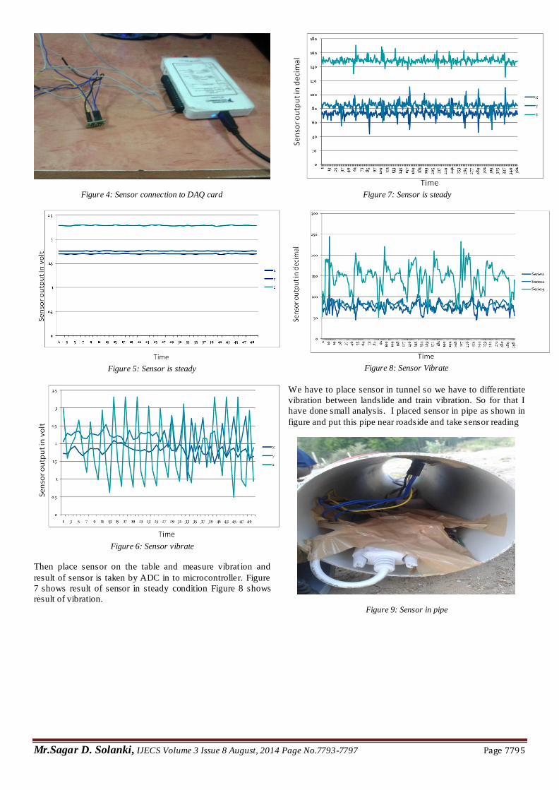
To know threshold value for vibration sensor analysis is
necessary. For sensor analysis sensor is connected with DAQ
card as shown in Figure 4. Sensor used is acceleration sensor
MMA7361. And result of sensor output is shown in graph.
Graph of Figure 5 shows that when sensor is steady and graph
of Figure 6 shows that sensor is vibrating.
Mr.Sagar D. Solanki, IJECS Volume 3 Issue 8 August, 2014 Page No.7793-7797 Page 7795
Figure 4: Sensor connection to DAQ card
Figure 5: Sensor is steady
Figure 6: Sensor vibrate
Then place sensor on the table and measure vibrat ion and
result of sensor is taken by ADC in to microcontroller. Figure
7 shows result of sensor in steady condition Figure 8 shows
result of vibration.
Figure 7: Sensor is steady
Figure 8: Sensor Vibrate
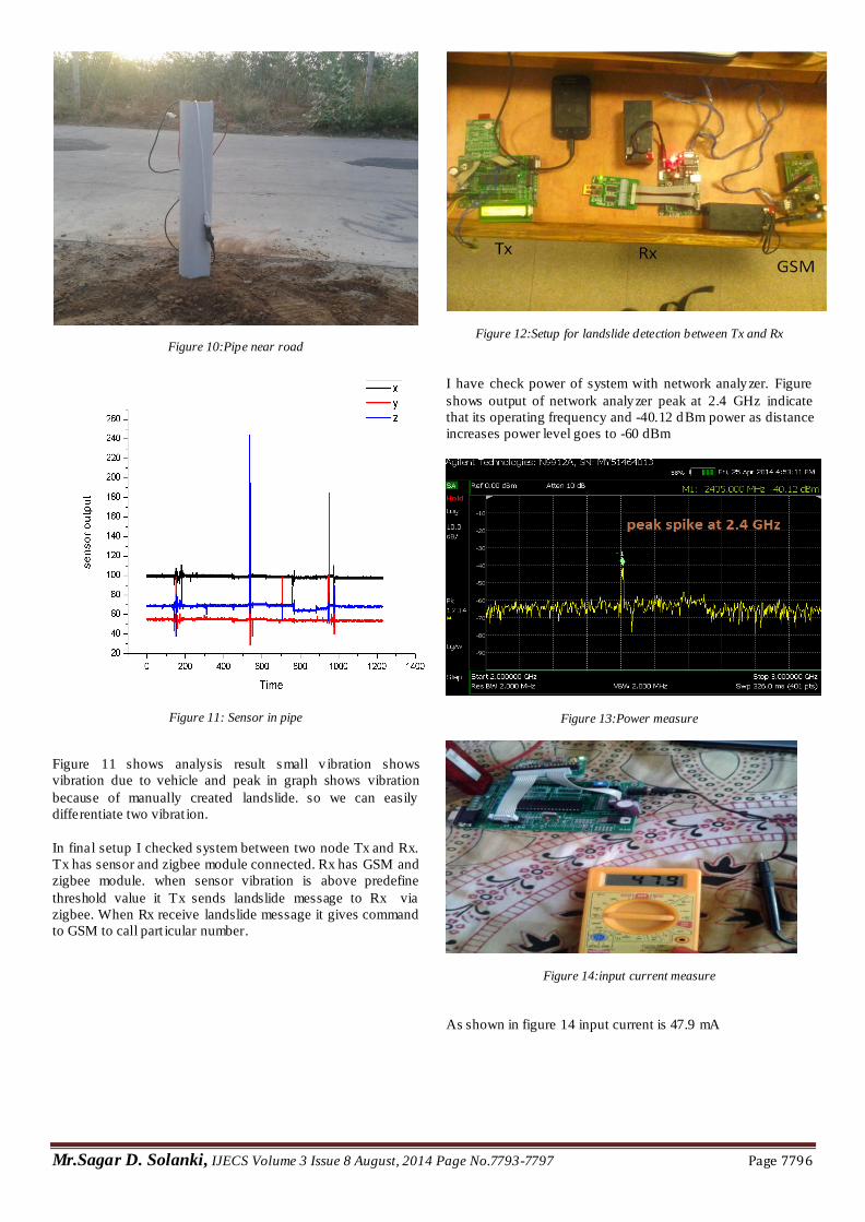
We have to place sensor in tunnel so we have to differentiate
vibration between landslide and train vibration. So for that I
have done small analysis. I placed sensor in pipe as shown in
figure and put this pipe near roadside and take sensor reading
Figure 9: Sensor in pipe
Mr.Sagar D. Solanki, IJECS Volume 3 Issue 8 August, 2014 Page No.7793-7797 Page 7796
Figure 10:Pipe near road
Figure 11: Sensor in pipe
Figure 11 shows analysis result small v ibration shows
vibration due to vehicle and peak in graph shows vibration
because of manually created landslide. so we can easily
differentiate two vibrat ion.
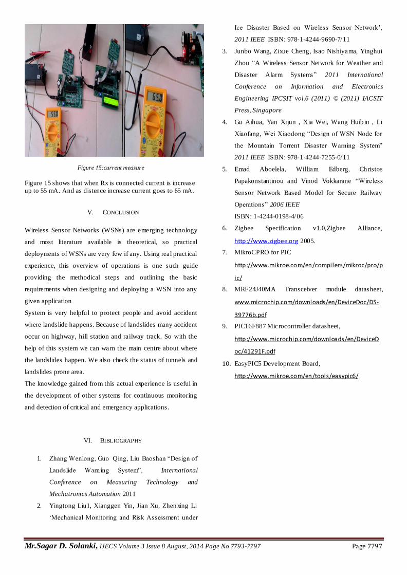
In final setup I checked system between two node Tx and Rx.
Tx has sensor and zigbee module connected. Rx has GSM and
zigbee module. when sensor vibration is above predefine
threshold value it Tx sends landslide message to Rx via
zigbee. When Rx receive landslide message it gives command
to GSM to call part icular number.
Figure 12:Setup for landslide detection between Tx and Rx
I have check power of system with network analyzer. Figure
shows output of network analyzer peak at 2.4 GHz indicate
that its operating frequency and -40.12 dBm power as distance
increases power level goes to -60 dBm
Figure 13:Power measure
Figure 14:input current measure
As shown in figure 14 input current is 47.9 mA
Mr.Sagar D. Solanki, IJECS Volume 3 Issue 8 August, 2014 Page No.7793-7797 Page 7797
Figure 15:current measure
Figure 15 shows that when Rx is connected current is increase
up to 55 mA. And as distence increase current goes to 65 mA.
V. CONCLUSION
Wireless Sensor Networks (WSNs) are emerging technology
and most literature available is theoretical, so practical
deployments of WSNs are very few if any. Using real pract ical
experience, this overview of operations is one such guide
providing the methodical steps and outlining the basic
requirements when designing and deploying a WSN into any
given application
System is very helpfu l to p rotect people and avoid accident
where landslide happens. Because of landslides many accident
occur on highway, hill station and railway track. So with the
help of this system we can warn the main centre about where
the landslides happen. We also check the status of tunnels and
landslides prone area.
The knowledge gained from this actual experience is useful in
the development of other systems for continuous monitoring
and detection of crit ical and emergency applications.
VI. BIBLIOGRAPHY
1. Zhang Wenlong, Guo Qing, Liu Baoshan “Design of
Landslide Warn ing System”, International
Conference on Measuring Technology and
Mechatronics Automation 2011
2. Yingtong Liu1, Xianggen Yin, Jian Xu, Zhenxing Li
‘Mechanical Monitoring and Risk Assessment under
Ice Disaster Based on Wireless Sensor Network’,
2011 IEEE ISBN: 978-1-4244-9690-7/11
3. Junbo Wang, Zixue Cheng, Isao Nishiyama, Yinghui
Zhou “A Wireless Sensor Network for Weather and
Disaster Alarm Systems” 2011 International
Conference on Information and Electronics
Engineering IPCSIT vol.6 (2011) © (2011) IACSIT
Press, Singapore
4. Gu Aihua, Yan Xijun , Xia Wei, Wang Huib in , Li
Xiaofang, Wei Xiaodong “Design of WSN Node for
the Mountain Torrent Disaster Warning System”
2011 IEEE ISBN: 978-1-4244-7255-0/11
5. Emad Aboelela, William Edberg, Christos
Papakonstantinou and Vinod Vokkarane “Wireless
Sensor Network Based Model for Secure Railway
Operations” 2006 IEEE
ISBN: 1-4244-0198-4/06
6. Zigbee Specification v1.0,Zigbee Alliance,
http://www.zigbee.org 2005.
7. MikroCPRO for PIC
http://www.mikroe.com/en/compilers/mikroc/pro/p
ic/
8. MRF24J40MA Transceiver module datasheet,
www.microchip.com/downloads/en/DeviceDoc/DS-
39776b.pdf
9. PIC16F887 Microcontroller datasheet,
http://www.microchip.com/downloads/en/DeviceD
oc/41291F.pdf
10. EasyPIC5 Development Board,
http://www.mikroe.com/en/tools/easypic6/