Embed Size (px)
Citation preview

Why are the Great Alaskan Tidewater Glaciers Advancing During the MWP
- Controls on Tidewaters
- Relevance to SLR
- The chronology of advance and Medieval Climate along GOA
- Possible reasons
GSA - Houston 2008
Acknowledgements: The College of Wooster, NSF, NPS, NGS, Keck Geology Consortium, USGS and INSTAAR for the great photos.
Greg Wiles, Dan Lawson, Tom Lowell, Dave Barclay
Pfeffer, 2007

Wrangell/ St. Elias Mountains
Kenai Mountains
ChugachMountains
50 km
Wrangell-St. Elias
Gulf of Alaska
Locations - Southern Alaska
Kenai
Peninsula
Alaska

Why is Sea Level Rising? - the top 3 reasons
1
2*
3
IPCC - AR4
1961-2003
1993-2003
Meier et al., 2007
QuickTime™ and a decompressor
are needed to see this picture.
Most of the Ice from Small Glaciers is in Alaska

QuickTime™ and a decompressor
are needed to see this picture.
Columbia Bay (T. Pfeffer)(Pfeffer et al., 2008)

Northwestern Glacier - Kenai Fjords National Park
McCarty
Northwestern
McCarty

Columbia Glacier has undergone 15 km of retreat since ~1982.

Field (1941) Molnia (2004)
Glacier Bay National Park and Preserve - Muir Glacier

Tidewater Glacier Cycle (Post, 1975)

QuickTime™ and a decompressor
are needed to see this picture.
= sediment
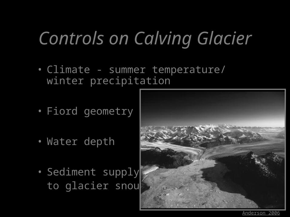
Controls on Calving Glacier
• Climate - summer temperature/ winter precipitation
• Fiord geometry
• Water depth
• Sediment supply to glacier snout
Anderson 2006
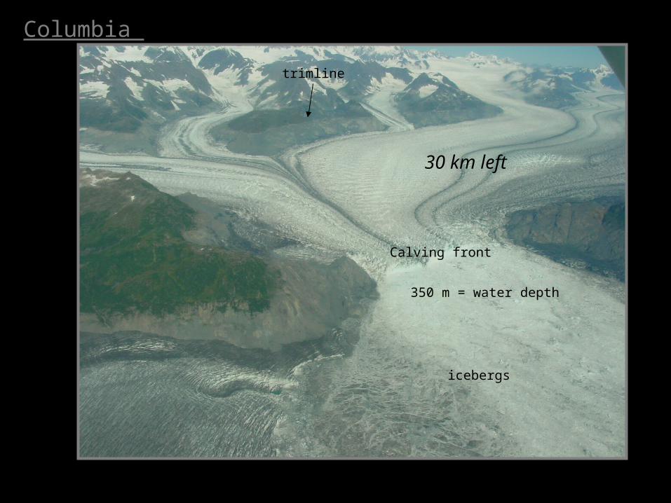
30 km left
350 m = water depth
trimline
Calving front
icebergs
Columbia


Dendrochronology and Dendroclimatology

Forest Glacial History
ForestResponse

Columbia Bay - Kill Site
AD 1770
AD 1810

500 750 1000 1250 1500 1750 2000
Columbia Glacier Calendar Dates
Year AD
N = 430
Crossdated logs and Land-terminating record
MWP
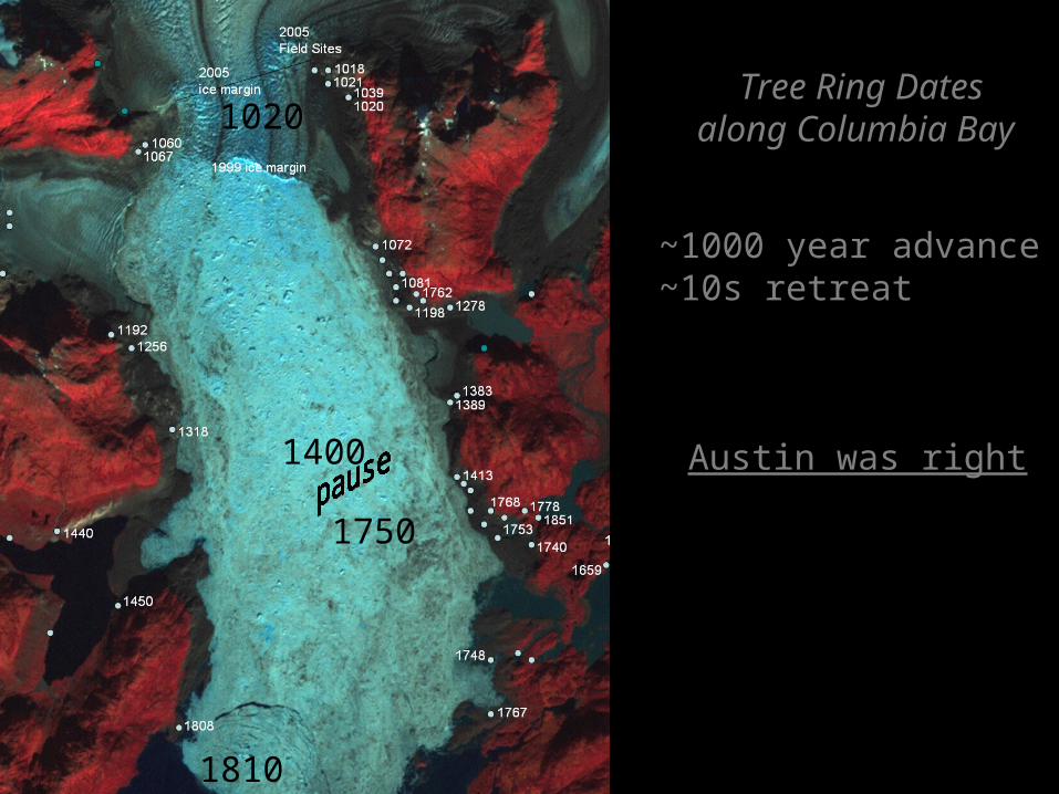
Tree Ring Datesalong Columbia Bay
~1000 year advance~10s retreat
1020
1400
1810
1750
Austin was right
QuickTime™ and a decompressorare needed to see this picture.
QuickTime™ and a decompressor
are needed to see this picture.
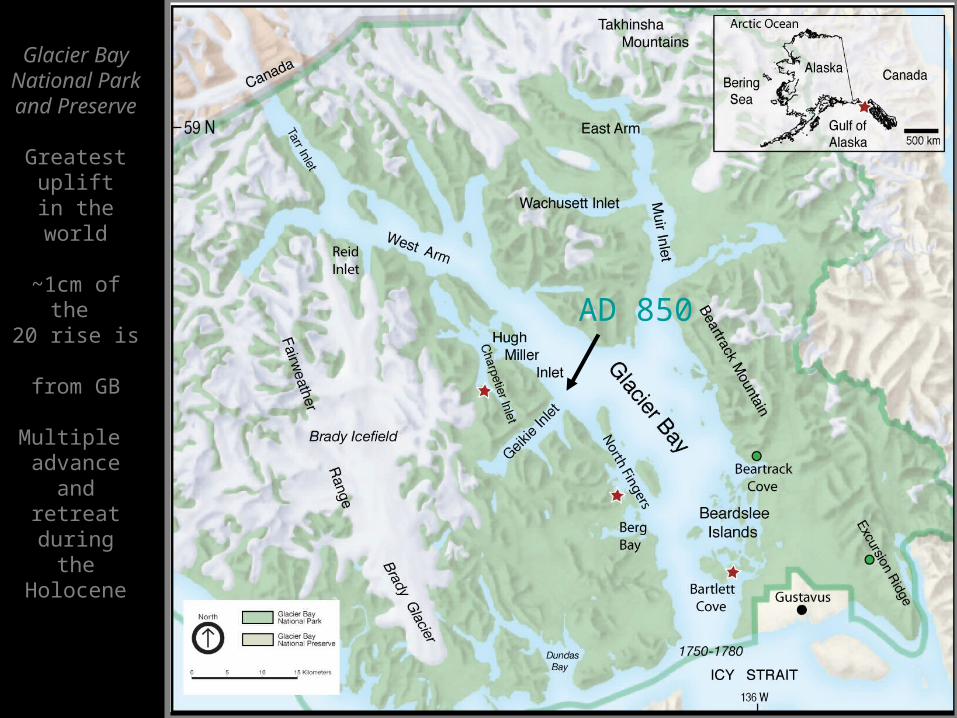
Glacier BayNational Parkand Preserve
Greatest upliftin the world
~1cm of the 20 rise is from GB
Multiple advance andretreat duringthe Holocene
AD 850

QuickTime™ and a
decompressorare needed to see this picture.

Multiproxy Comparisons
Glaciers = Summer Temperature 800 1000 1200 1400 1600 1800 2000
mean RW (mm)
0.5
1.0
1.5
2.0
Calendar Years
800 1000 1200 1400 1600 1800 2000
No. of series0
100
200
300
400
Sub-fossilLiving
Coastal Alaska RCS chronology
?
TR Indices
MWPLIA

QuickTime™ and a decompressor
are needed to see this picture.
Structure of the Warming
Decadal variabilityIs strong
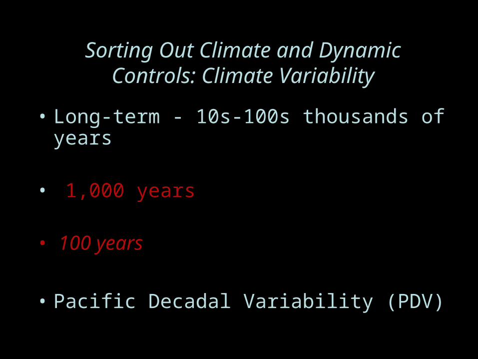
Sorting Out Climate and DynamicControls: Climate Variability
• Long-term - 10s-100s thousands of years • 1,000 years
• 100 years
• Pacific Decadal Variability (PDV)

Columbia Glacier and
Summer Temperature
800 1000 1200 1400 1600 1800 2000
mean RW (mm)
0.5
1.0
1.5
2.0
Calendar Years
800 1000 1200 1400 1600 1800 2000
No. of series0
100
200
300
400
Sub-fossilLiving
Coastal Alaska RCS chronology
advance
pause at
midfiord?
advanceadvance

Tidewater Glacier Cycle (Post, 1975)

QuickTime™ and a decompressor
are needed to see this picture.

Tidewater Glaciers GSA Houston 2008
Alaska tidewater glaciers continue to lose mass and flux to the sea
During the MWP many were advancing - forced by tributary valleysediment contributions along with increased precipitation and decadal variability
Sorting out the dynamic and climatic controls over century to millennia is ongoing but it may be related to precipitation as it affects sediment flux
Pfeffer - Columbia Bay