Embed Size (px)
Citation preview
Wetland Protection
Planning & Process
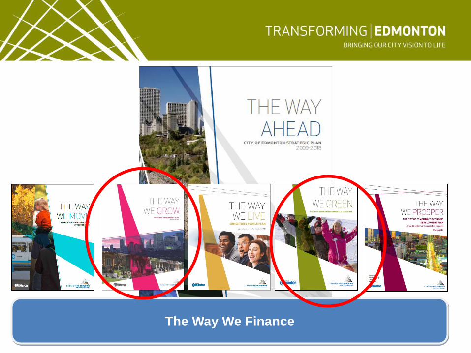
The Way We Finance
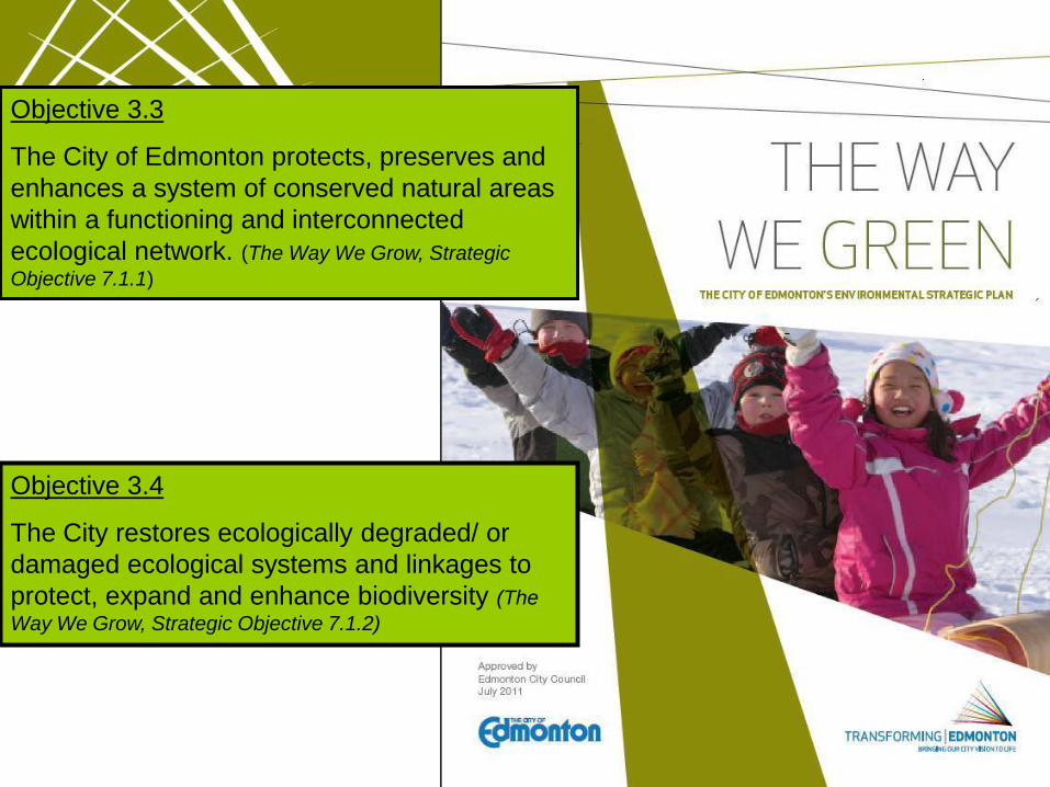
Objective 3.3
The City of Edmonton protects, preserves and
enhances a system of conserved natural areas
within a functioning and interconnected
ecological network. (The Way We Grow, Strategic
Objective 7.1.1)
Objective 3.4
The City restores ecologically degraded/ or
damaged ecological systems and linkages to
protect, expand and enhance biodiversity (The
Way We Grow, Strategic Objective 7.1.2)
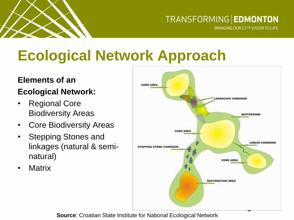
Ecological Network Approach
Elements of an
Ecological Network:
• Regional Core
Biodiversity Areas
• Core Biodiversity Areas
• Stepping Stones and
linkages (natural & semi-
natural)
• Matrix
Source: Croatian State Institute for National Ecological Network
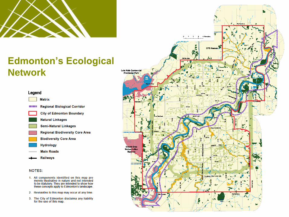
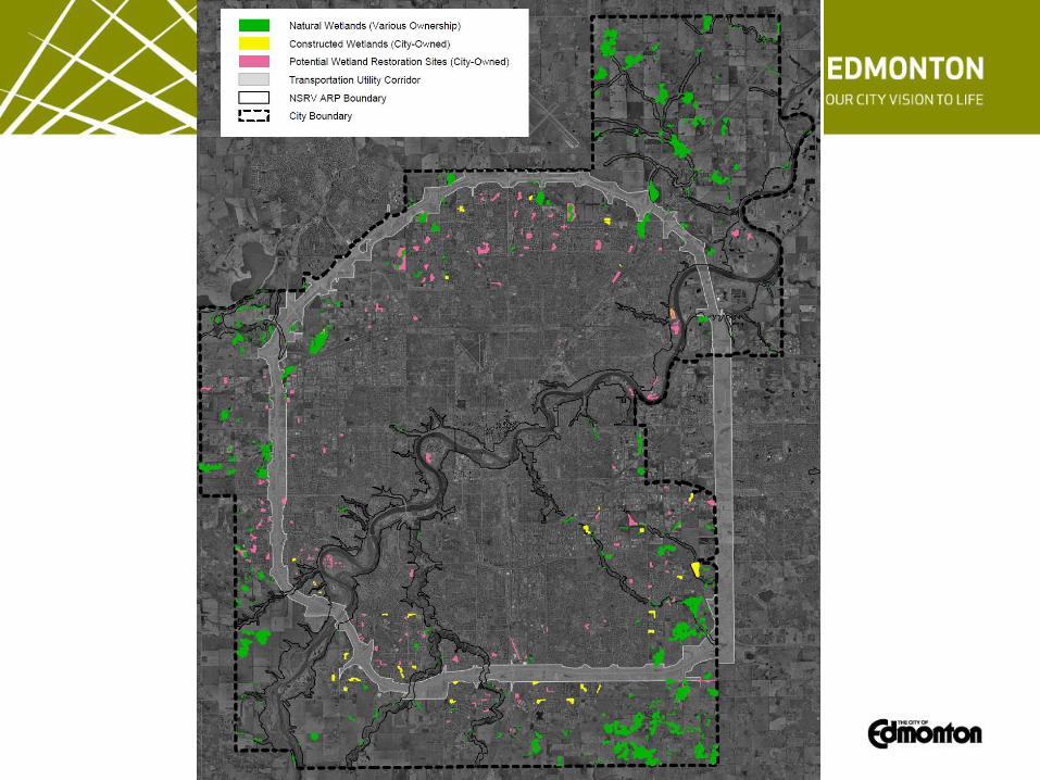
Edmonton’s Ecological
Network
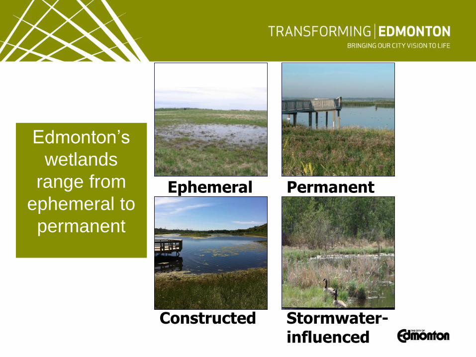
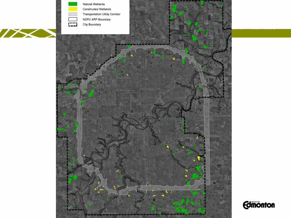
Edmonton’s
wetlands
range from
ephemeral to
permanent
Ephemeral Permanent
Stormwater-influenced
Constructed
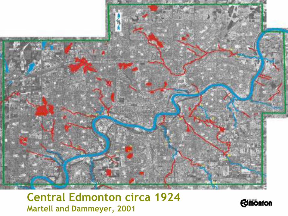
Central Edmonton circa 1924 Martell and Dammeyer, 2001
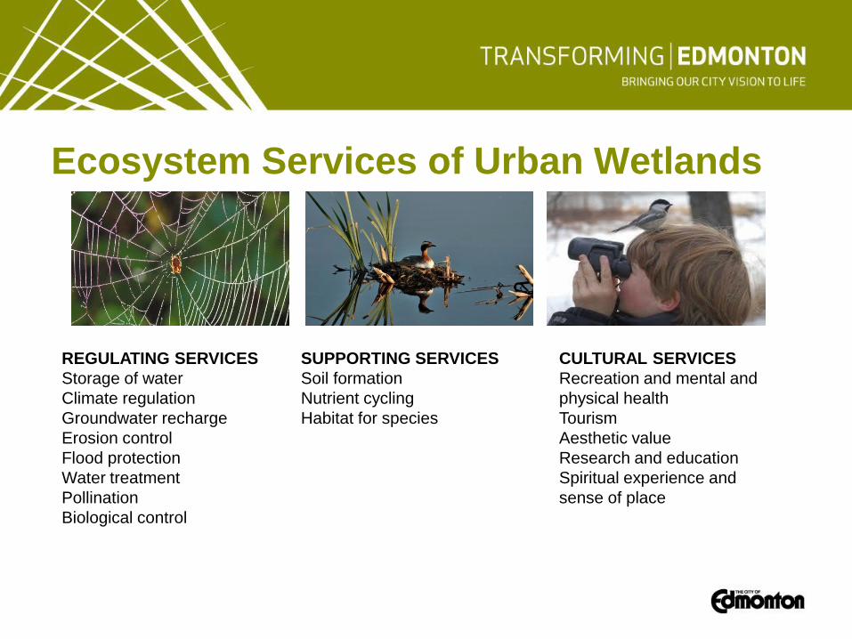
Ecosystem Services of Urban Wetlands
REGULATING SERVICES
Storage of water
Climate regulation
Groundwater recharge
Erosion control
Flood protection
Water treatment
Pollination
Biological control
SUPPORTING SERVICES
Soil formation
Nutrient cycling
Habitat for species
CULTURAL SERVICES
Recreation and mental and
physical health
Tourism
Aesthetic value
Research and education
Spiritual experience and
sense of place
Way We Grow/Green Policy
Objective 3.5 The City protects, manages and
integrates natural wetlands into new and
existing developments as key assets in
Edmonton’s ecological network (The Way We
Grow, Strategic Objective 7.2.11).
3.5.1 Cooperates with the Government of Alberta
to actively support and complement its Wetland
Policy through the following actions (The Way
We Grow, Policy 7.2.1.1):
• In partnership with the Province, the Capital
Region Board, and adjacent municipalities,
develop a comprehensive plan for wetland
conservation and the integration of wetlands
into the urban environment.
• Where appropriate, acquire wetlands,
riparian areas, and buffers according to the
Municipal Government Act definition of
environmental reserve.
• Where privately held wetlands cannot be
protected through other means, encourage their
dedication through conservation easements.
• Work with land owners to see that
compensation required by the Province as
a result of the alteration or destruction of
wetlands is carried out within city
boundaries.
Way We Grow/Green Policy
3.5.2 Will dedicate permanent, semi-permanent, and
seasonal wetlands (i.e., Class III, IV, and V Wetlands in
the Stewart and Kantrud system) and all peatlands as
Environmental Reserve upon subdivision of land.
3.5.3 Requires compensation within the borders of the
city for wetland drainage or alteration (in full or part) for
all non-ephemeral wetlands (i.e., Class II, III, IV, and V
wetlands in the Stewart and Kantrud system) and all
peatlands in the form restoration or construction of a
similarly functioning wetland.
Environmental Reserve
664(1) Subject to section 663, a subdivision authority may require the owner of a parcel of land that is the subject of a proposed subdivision to provide part of that parcel of land as environmental reserve if it consists of
(a) a swamp, gully, ravine, coulee or natural drainage course,
(b) land that is subject to flooding or is, in the opinion of the subdivision authority, unstable, or
(c) a strip of land, not less than 6 metres in width, abutting the bed and shore of any lake, river, stream or other body of water for the purpose of
(i) preventing pollution, or
(ii) providing public access to and beside the bed and shore.
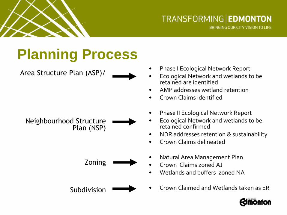
Planning Process
• Phase I Ecological Network Report • Ecological Network and wetlands to be
retained are identified • AMP addresses wetland retention • Crown Claims identified • Phase II Ecological Network Report • Ecological Network and wetlands to be
retained confirmed • NDR addresses retention & sustainability • Crown Claims delineated • Natural Area Management Plan • Crown Claims zoned AJ • Wetlands and buffers zoned NA • Crown Claimed and Wetlands taken as ER
Area Structure Plan (ASP)/
Neighbourhood Structure Plan (NSP)
Zoning
Subdivision
Improving the Process
• Consistent messaging
• Rural South East wetland mapping
• Coordination with AESRD early in the planning
process
• Quarterly meetings with AESRD and Drainage
Services staff
• Phase II Ecological Network TOR
• Initiated an Ecosite Mapping Project
Next Steps
• Follow through on workshop outcomes
• Early dialogue with proponents and AESRD
• Continued coordination with Drainage Services – Ensure Area Master Plans (AMP) and Neighbourhood
Design Reports (NDR) address sustainability of wetlands
• Complete Ecosite Mapping (2015)
• Wetland Restoration Agency (2014-2015)
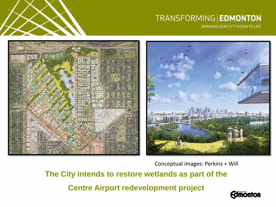
The City intends to restore wetlands as part of the
Centre Airport redevelopment project
Conceptual images: Perkins + Will