Embed Size (px)
Citation preview
Welcome to GEOG 070Intro to Geographic
InformationAutumn Session - 2005
Instructor: Gregory Taff
Autumn 2005 Gregory Taff 2
Lesson 1: Intro to Geographic Information

Autumn 2005 Gregory Taff 3
###
# ## ### # ### # ### # #### # # ### ### ## ### ### # ### # ## # ### ### # ## ### ### # # ## ### ### ## # # ### ## ## # ## ### ### ## ## # ### ## ## #### ## ## # ## ## ## #### # ## # ## # #### #### ## ### ## #
## ### #
# #### # ##### ## # #
# ### ##
#
##
#
#
#
#
# ##
#
#
#
#
Geography = Place names only?
Autumn 2005 Gregory Taff 4
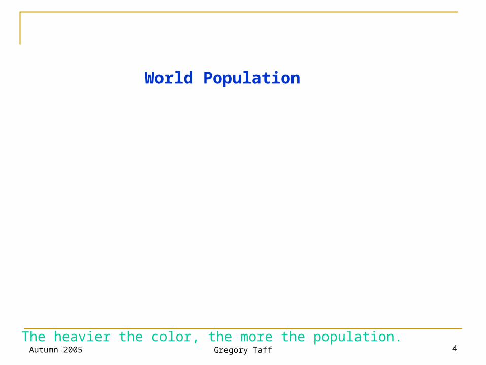
World Population
The heavier the color, the more the population.
Autumn 2005 Gregory Taff 5
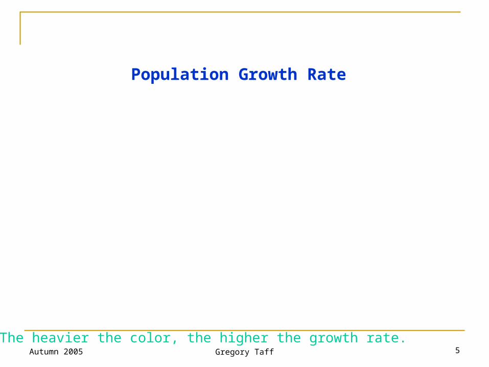
Population Growth Rate
The heavier the color, the higher the growth rate.
Autumn 2005 Gregory Taff 6
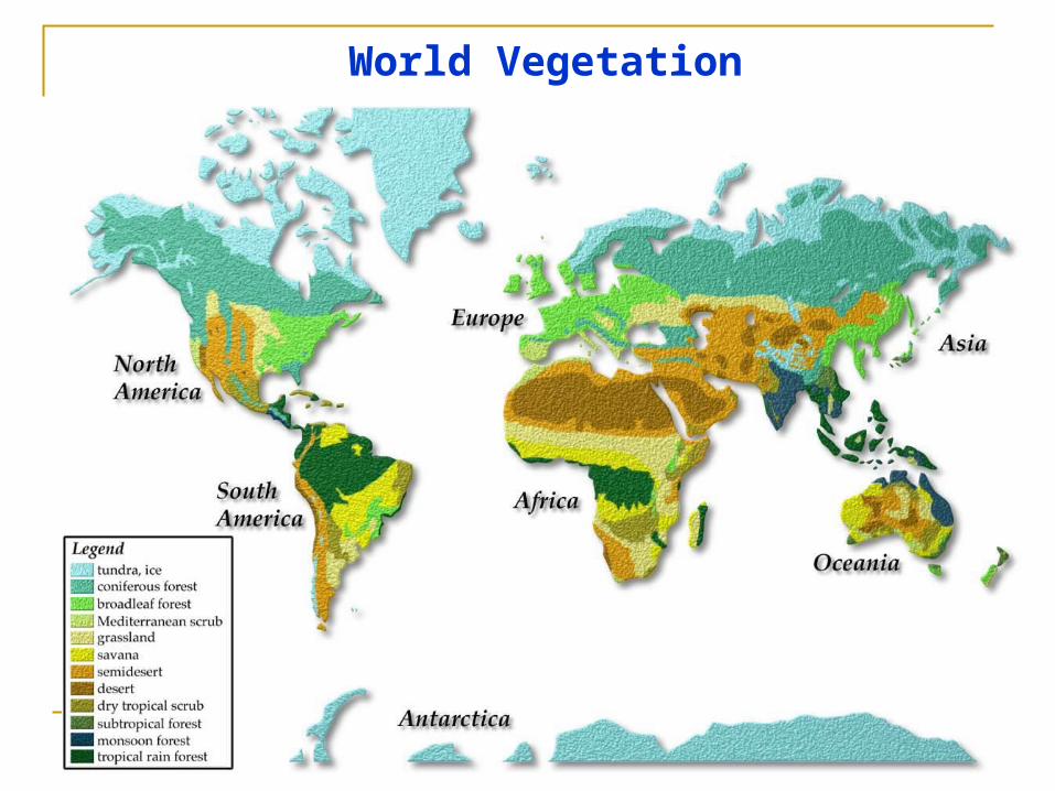
World Vegetation
Autumn 2005 Gregory Taff 7
Intro to Geographic Information
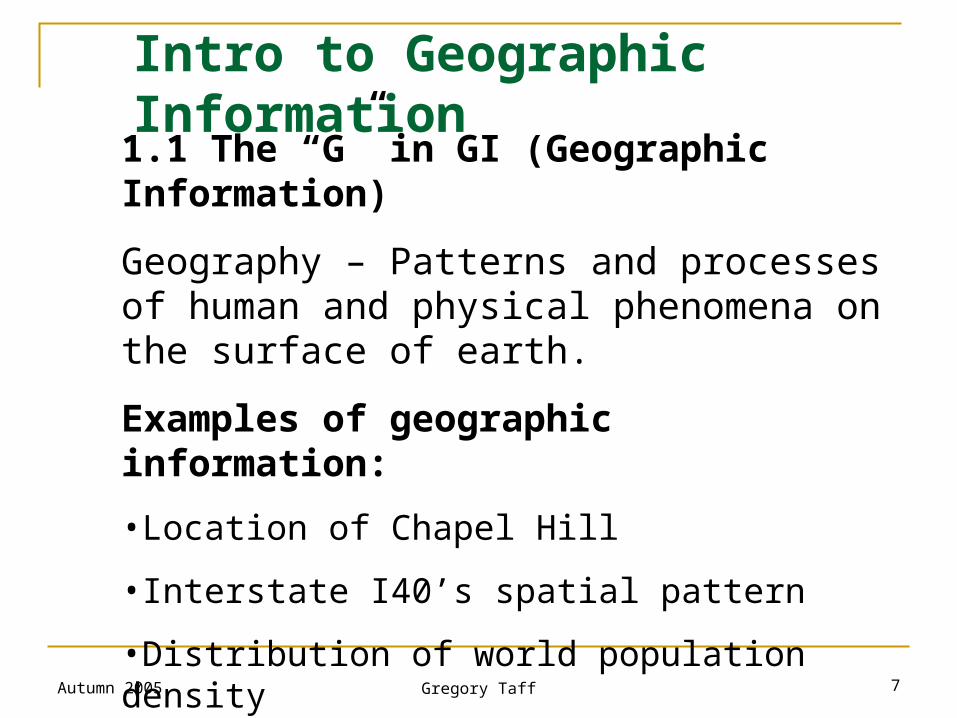
1.1 The “G” in GI (Geographic Information)
Geography – Patterns and processes of human and physical phenomena on the surface of earth.
Examples of geographic information:
•Location of Chapel Hill
•Interstate I40’s spatial pattern
•Distribution of world population density
•Urban sprawl/development of Raleigh over 100 years.
Autumn 2005 Gregory Taff 8
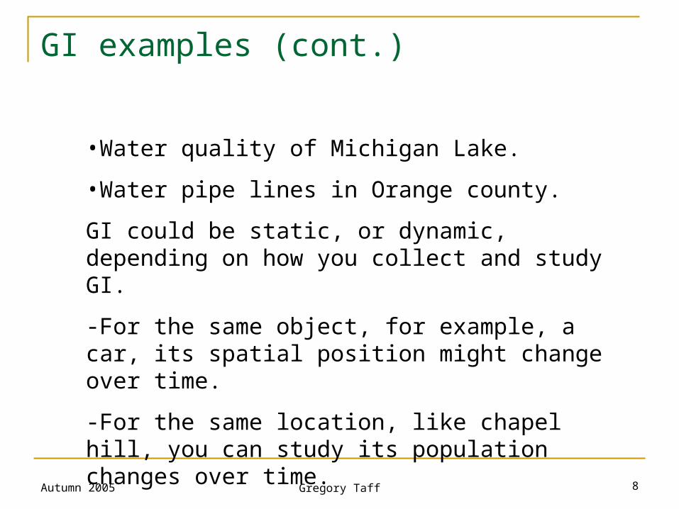
GI examples (cont.)
•Water quality of Michigan Lake.
•Water pipe lines in Orange county.
GI could be static, or dynamic, depending on how you collect and study GI.
-For the same object, for example, a car, its spatial position might change over time.
-For the same location, like chapel hill, you can study its population changes over time.
Autumn 2005 Gregory Taff 9
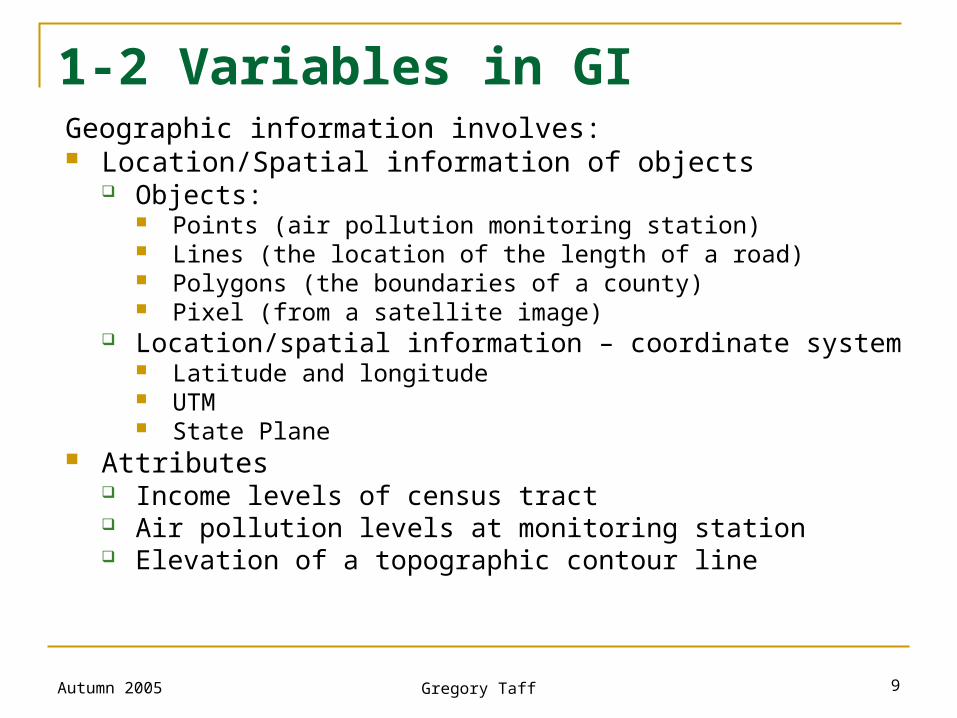
1-2 Variables in GIGeographic information involves: Location/Spatial information of objects
Objects: Points (air pollution monitoring station) Lines (the location of the length of a road) Polygons (the boundaries of a county) Pixel (from a satellite image)
Location/spatial information – coordinate system Latitude and longitude UTM State Plane
Attributes Income levels of census tract Air pollution levels at monitoring station Elevation of a topographic contour line
Autumn 2005 Gregory Taff 10
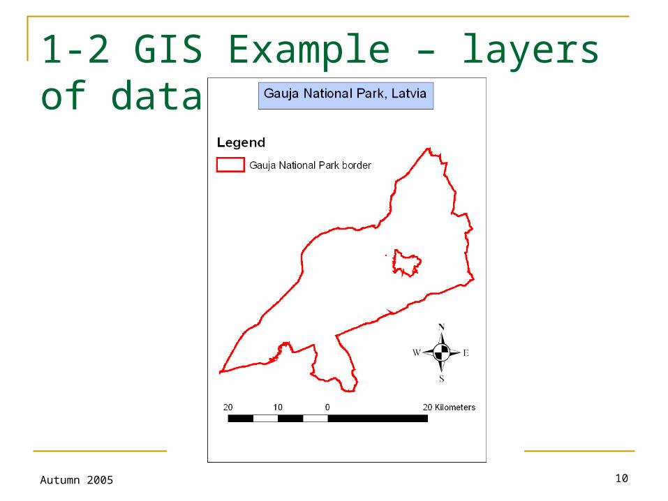
1-2 GIS Example – layers of data
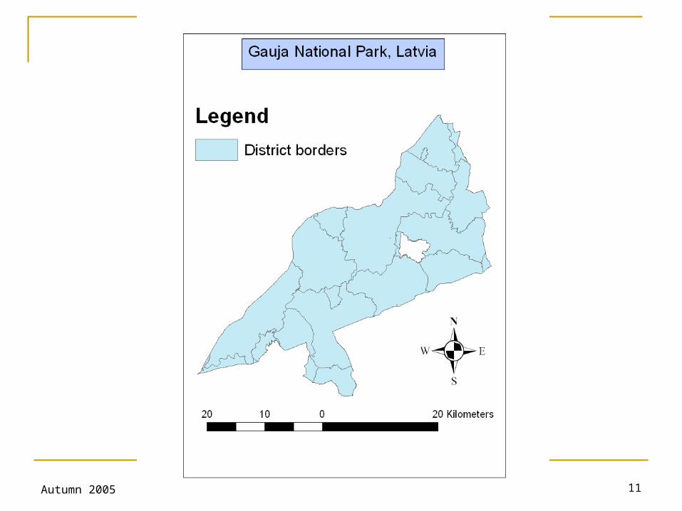
Autumn 2005 Gregory Taff 11
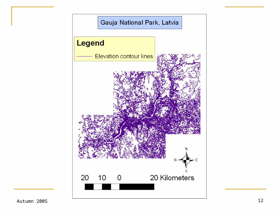
Autumn 2005 Gregory Taff 12
Autumn 2005 Gregory Taff 13
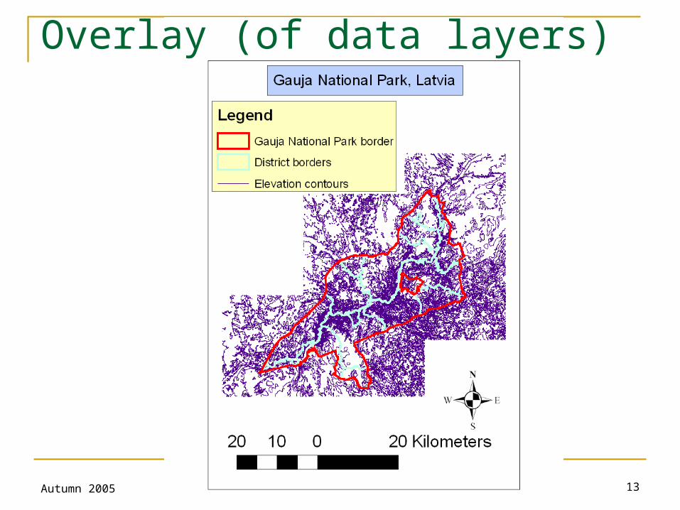
Overlay (of data layers)
Autumn 2005 Gregory Taff 14
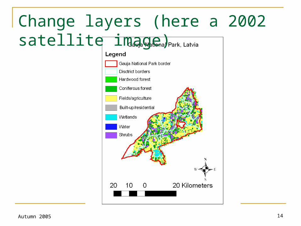
Change layers (here a 2002 satellite image)
Autumn 2005 Gregory Taff 15
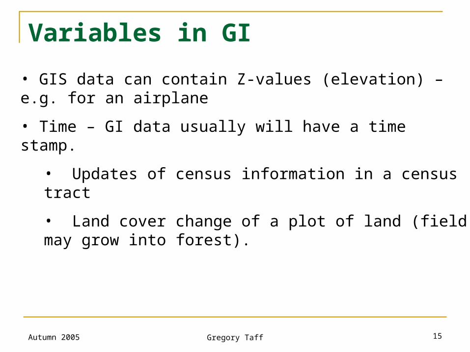
Variables in GI
• GIS data can contain Z-values (elevation) – e.g. for an airplane
• Time – GI data usually will have a time stamp.
• Updates of census information in a census tract
• Land cover change of a plot of land (field may grow into forest).
Autumn 2005 Gregory Taff 16
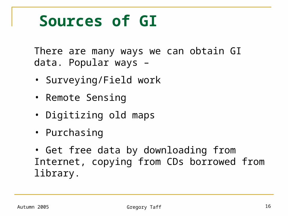
Sources of GI
There are many ways we can obtain GI data. Popular ways –
• Surveying/Field work
• Remote Sensing
• Digitizing old maps
• Purchasing
• Get free data by downloading from Internet, copying from CDs borrowed from library.
Autumn 2005 Gregory Taff 17
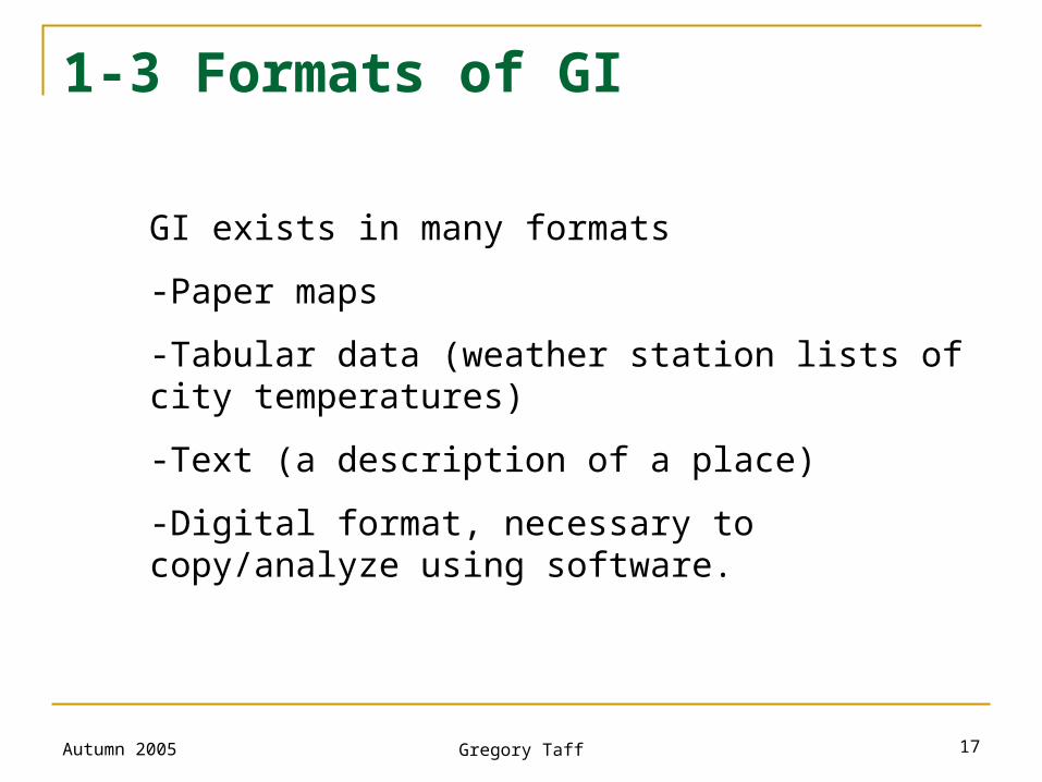
1-3 Formats of GI
GI exists in many formats
-Paper maps
-Tabular data (weather station lists of city temperatures)
-Text (a description of a place)
-Digital format, necessary to copy/analyze using software.
Autumn 2005 Gregory Taff 18
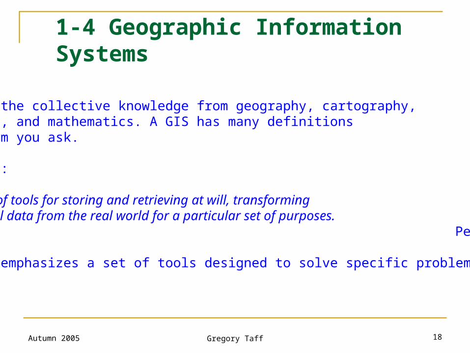
What is GIS? GIS is built on the collective knowledge from geography, cartography, computer science, and mathematics. A GIS has many definitions depending on whom you ask. GIS as a Toolbox:
GIS is a powerful set of tools for storing and retrieving at will, transforming and displaying spatial data from the real world for a particular set of purposes. Peter Burrough, 1986
This definition emphasizes a set of tools designed to solve specific problems.
1-4 Geographic Information Systems
Autumn 2005 Gregory Taff 19
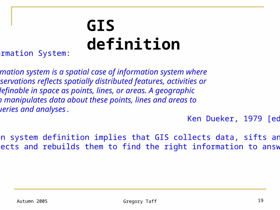
GIS as an Information System: A geographic information system is a spatial case of information system where the database of observations reflects spatially distributed features, activities or events, which are definable in space as points, lines, or areas. A geographic information system manipulates data about these points, lines and areas toretrieve data for queries and analyses. Ken Dueker, 1979 [edited by Taff].
The information system definition implies that GIS collects data, sifts and sorts them, and selects and rebuilds them to find the right information to answer a question.
GIS definition
Autumn 2005 Gregory Taff 20
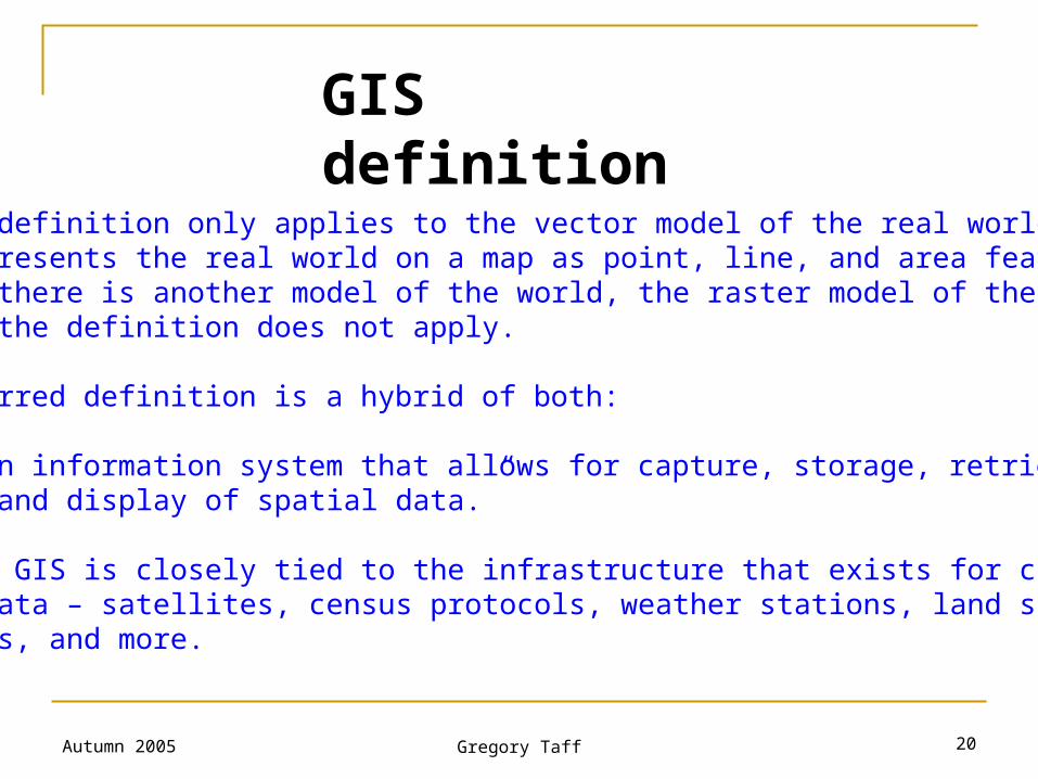
Dueker’s definition only applies to the vector model of the real world, which represents the real world on a map as point, line, and area features. In fact, there is another model of the world, the raster model of the world, to which the definition does not apply. My preferred definition is a hybrid of both: “GIS is an information system that allows for capture, storage, retrieval, analysis and display of spatial data.”
Note that GIS is closely tied to the infrastructure that exists for creating spatial data – satellites, census protocols, weather stations, land survey techniques, and more.
GIS definition
Autumn 2005 Gregory Taff 21
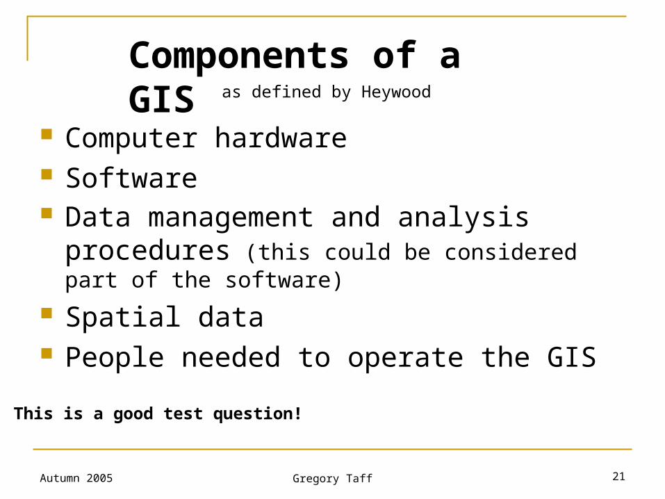
Computer hardware Software Data management and analysis procedures
(this could be considered part of the software)
Spatial data People needed to operate the GIS
Components of a GISas defined by Heywood
This is a good test question!
Autumn 2005 Gregory Taff 22
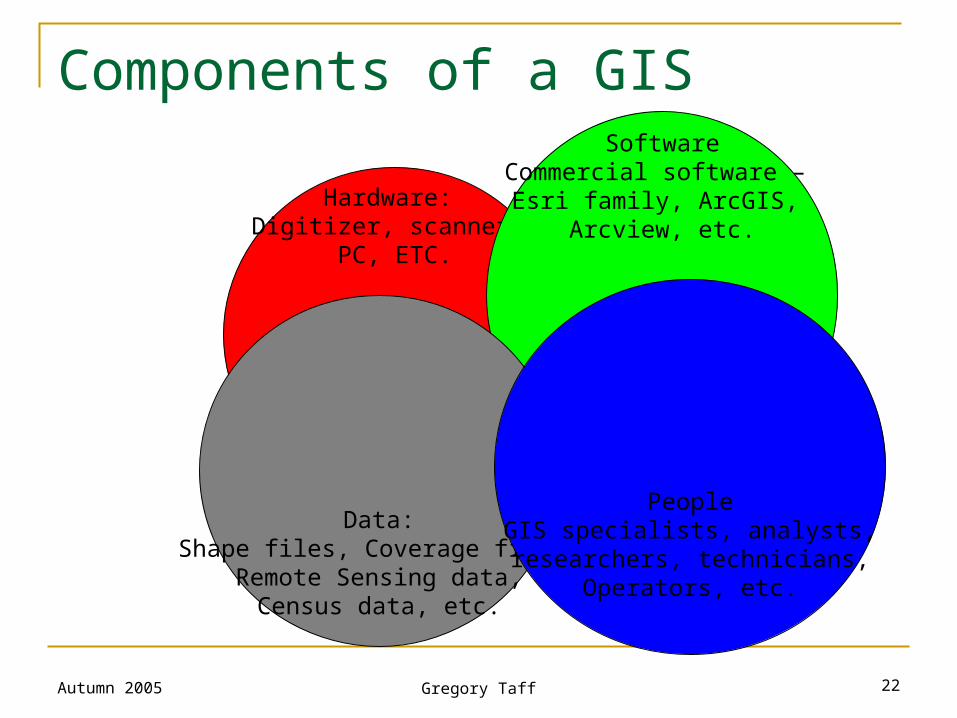
Hardware: Digitizer, scanner,
PC, ETC.
SoftwareCommercial software –
Esri family, ArcGIS, Arcview, etc.
Data:Shape files, Coverage files,
Remote Sensing data,Census data, etc.
PeopleGIS specialists, analysts,researchers, technicians,
Operators, etc.
Components of a GIS
Autumn 2005 Gregory Taff 23
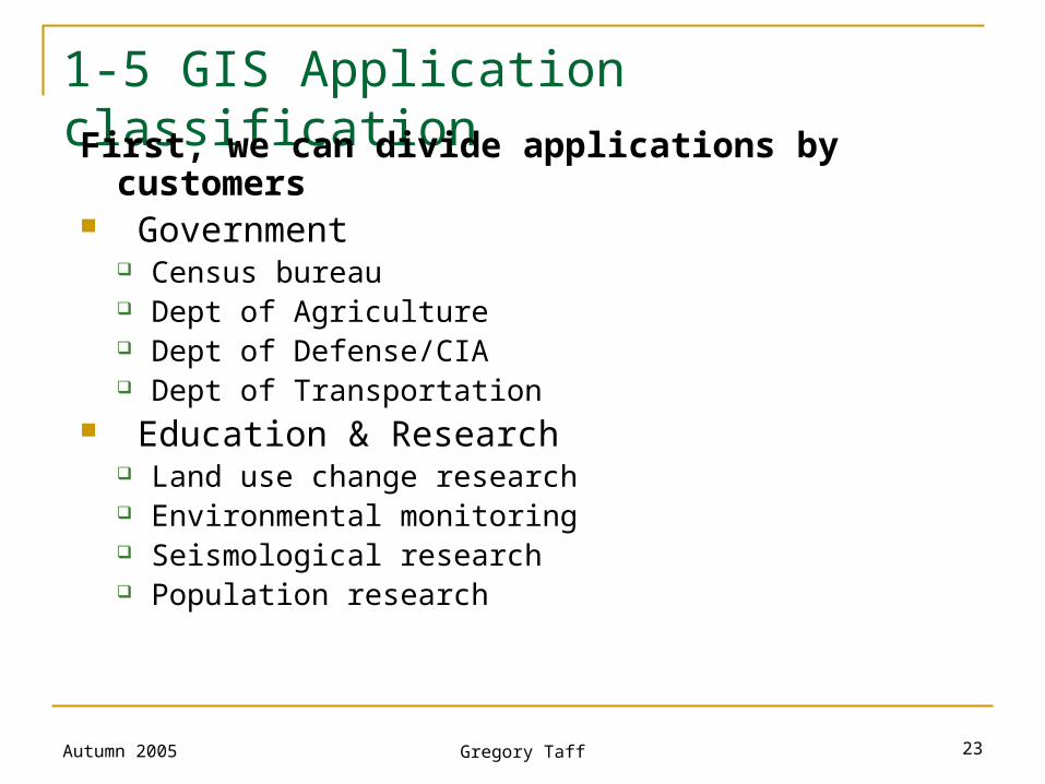
1-5 GIS Application classification
First, we can divide applications by customers Government
Census bureau Dept of Agriculture Dept of Defense/CIA Dept of Transportation
Education & Research Land use change research Environmental monitoring Seismological research Population research
Autumn 2005 Gregory Taff 24
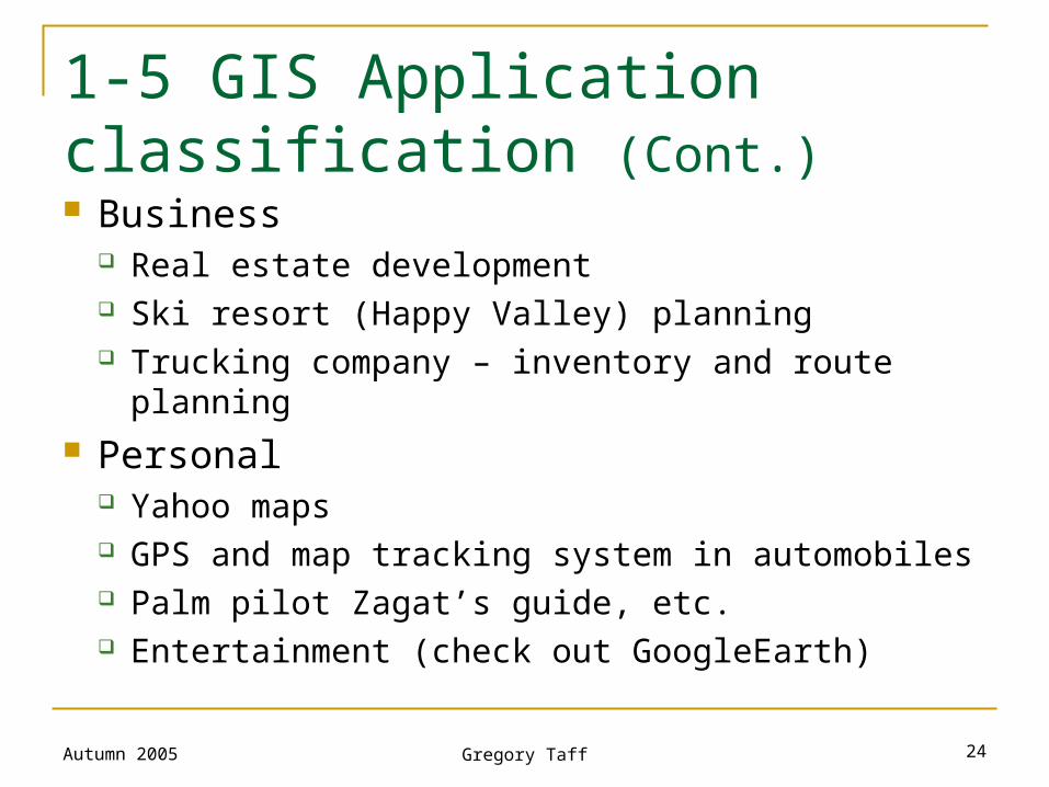
Business Real estate development Ski resort (Happy Valley) planning Trucking company – inventory and route planning
Personal Yahoo maps GPS and map tracking system in automobiles Palm pilot Zagat’s guide, etc. Entertainment (check out GoogleEarth)
1-5 GIS Application classification (Cont.)
Autumn 2005 Gregory Taff 25
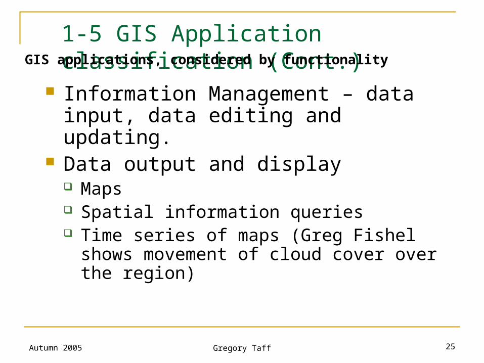
1-5 GIS Application classification (Cont.)
Information Management – data input, data editing and updating.
Data output and display Maps Spatial information queries Time series of maps (Greg Fishel shows
movement of cloud cover over the region)
GIS applications, considered by functionality
Autumn 2005 Gregory Taff 26
1-5 GIS Application classification (Cont.)
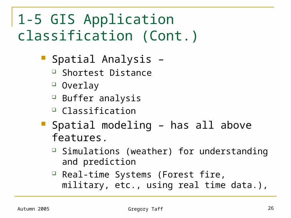
Spatial Analysis – Shortest Distance Overlay Buffer analysis Classification
Spatial modeling – has all above features. Simulations (weather) for understanding and
prediction Real-time Systems (Forest fire, military, etc., using
real time data.),
Autumn 2005 Gregory Taff 27
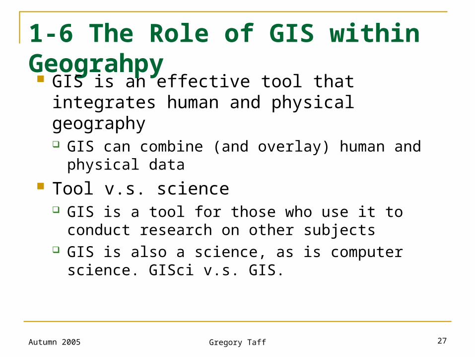
1-6 The Role of GIS within Geograhpy GIS is an effective tool that integrates human
and physical geography GIS can combine (and overlay) human and physical
data Tool v.s. science
GIS is a tool for those who use it to conduct research on other subjects
GIS is also a science, as is computer science. GISci v.s. GIS.
Autumn 2005 Gregory Taff 28
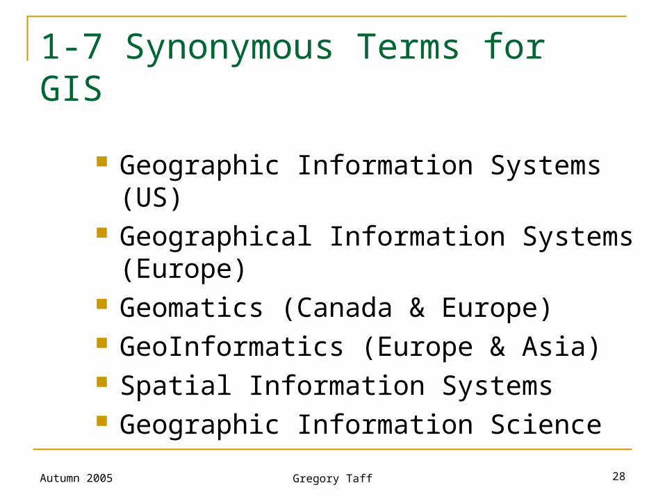
1-7 Synonymous Terms for GIS
Geographic Information Systems (US) Geographical Information Systems (Europe) Geomatics (Canada & Europe) GeoInformatics (Europe & Asia) Spatial Information Systems Geographic Information Science
Autumn 2005 Gregory Taff 29
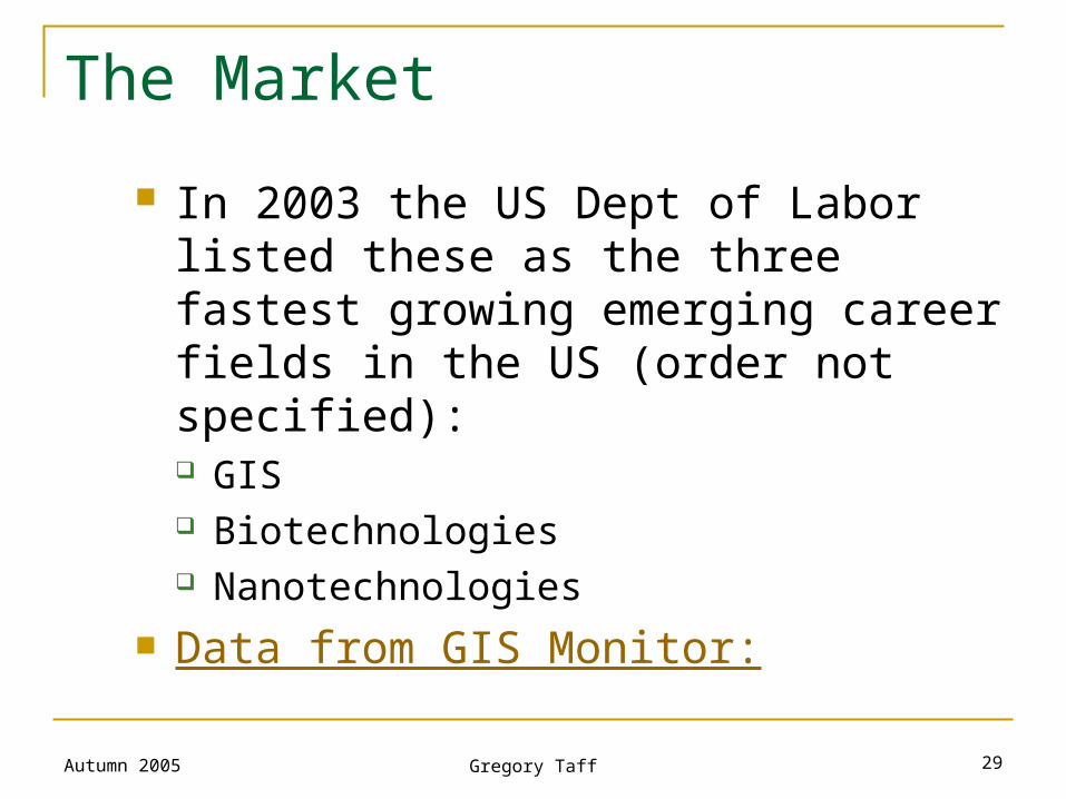
The Market
In 2003 the US Dept of Labor listed these as the three fastest growing emerging career fields in the US (order not specified): GIS Biotechnologies Nanotechnologies
Data from GIS Monitor:
Autumn 2005 Gregory Taff 30
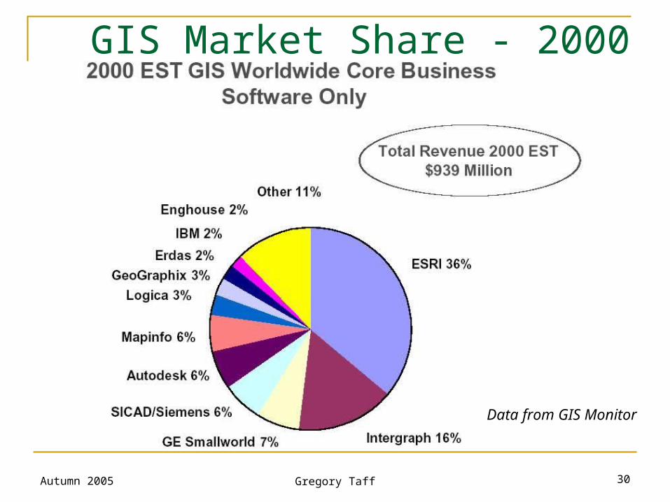
GIS Market Share - 2000
Data from GIS Monitor
Autumn 2005 Gregory Taff 31
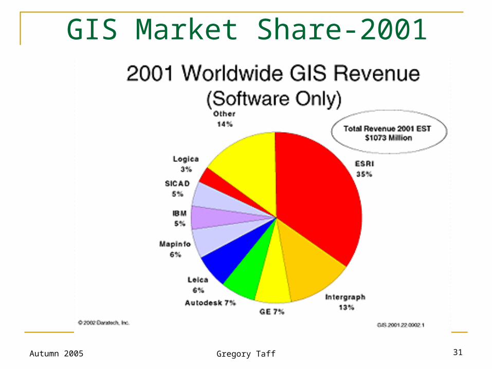
GIS Market Share-2001
Autumn 2005 Gregory Taff 32
Geographic information systems – cont.
GIS internet resources:
Try googling “GIS”, you will find a lot of GIS related websites. Some examples:
1. Network newsgroup GIS-L (comp.infosystems.gis)
2. USGS (Geological Survey)’s brochure Geographic Information Systems (http://www.usgs.gov/research/gis/title.html)
3. News services – www.gismonitor.com, www.spatialnews.com, www.giscafe.com, www.geoplace.com.