Embed Size (px)
Citation preview

INTERNATIONAL JOURNAL ON SMART SENSING AND INTELLIGENT SYSTEMS, VOL. 6, NO. 5, DECEMBER 2013
WEIGHTED HYBRID LOCALIZATION SCHEME FOR IMPROVED NODE POSITIONING IN WIRELESS SENSOR
NETWORKS
Prima Kristalina, Wirawan, Gamantyo Hendrantoro
Department of Electrical Engineering
Institut Teknologi Sepuluh Nopember
Surabaya, Indonesia
Emails: [email protected]; [email protected]; [email protected]
Submitted: July 12, 2013 Accepted: Nov. 1, 2013 Published: Dec. 16, 2013
Abstract- Localization schemes have a significant role in wireless sensor networks. During random
deployment in an untouched area, the nodes have to be capable of self-management to determine their
position. Received Signal Strength (RSS) and DV-Hop, are two different schemes that each have
environment or hop dependency problem. Hybrid localization scheme, called H-Loc, is a combination
of RSS and DV-Hop method. This scheme is proposed to make the selection of distance determination
process based on the proximity of nodes position. The weighted least square is proposed as a refining of
DV-Hop scheme’s position calculated process. Simulation results show that the proposed scheme has
the capability of improving the accuracy of node positioning up to 3.4 %.
Index terms: DV-Hop, H-Loc Scheme, localization, weighted least square
1986

Prima Kristalina, Wirawan, Gamantyo Hendrantoro, WEIGHTED HYBRID LOCALIZATION SCHEME FOR IMPROVED NODE POSITIONING IN WIRELESS SENSOR NETWORKS
I. INTRODUCTION
Localization technique is required to determine the position of nodes in wireless sensor networks.
This technique is needed for the sensor nodes that have the capability on distributed self-
configuration [1]. Each node has to be able to send and receive information from the other nodes,
and estimate its position relative to the vicinity nodes [2]. A node position can determine the
location of phenomena observed.
Location scheme in wireless sensor networks relies on determination of distance among nodes.
The distance can be obtained by measuring the signal (range-based) or without any measurement
(range-free). The range-based scheme is usually taken by the strength of the signal received
(RSS), time of arrival (TOA) and time difference of arrival (TDOA) which can be retrieved from
the propagation of radio, acoustic, seismic, infrared and also sonic waves [3]. Meanwhile, the
range-free scheme that does not use range measurement is done by considering the proximity of
the node with its references, such as averaging of the closest node reference (centroid) or
rendering a node position around a triangle formed by the reference nodes around (Approximate
Point In Triangle/(APIT), or by calculating the number of hops, as proposed in DV-Hop [4].
Range based schemes have a high accuracy in determining the distance, but have an extravagant
cost. Whereas the range-free can only retrieve a coarse estimated distance, but are cost-efficient.
Weighted Least Square Method could be used to minimize the estimated node position error in
localization. There are two different approaches to implementing this method: first, it can be used
to minimize the difference between the estimated and the actual distance [5] and second, it is to
minimize the error position of nodes estimated by the various kinds of calculation position
schemes [6], [7].
In the real application, nodes are deployed randomly. The random deployment is yielding a
variety of nodes position. Some nodes are close each other and the other is far away. This means
that using only one kind of distance measurement is not an efficient way. Motivated from this
condition, we propose a combination of range-based and range-free method to obtain the
estimated distance from a pair of nodes. The refinement process to obtain the accuracy of
estimated distance is proposed as the second algorithm.
1987

INTERNATIONAL JOURNAL ON SMART SENSING AND INTELLIGENT SYSTEMS, VOL. 6, NO. 5, DECEMBER 2013
Our first proposed scheme, called a Hybrid Localization scheme (H-Loc) has been proposed in
the previous work [8] as the combination of DV-Hop and RSS-based method. The aim of this
scheme is to make the selection between them for distance determination process. As we know,
RSS-based technique only determines the distance depend on the signal received directly from
transmitting node. This technique has a dependency with reference node’s power transmit. On the
other side DV-Hop technique determines the distance between two involved nodes by calculating
hop count between them. This technique is suitable done on multi hop connection. Thus, by
combining these schemes yield a flexible method in the distance determination process. The
selection is run by sensor node as follows: when the transmitted signal from the reference could
be achieved directly by the node, the Received Signal Strength (RSS) scheme is employed,
otherwise, DV-Hop is chosen.
The second proposed scheme is exploiting the least squares of error between the estimated and
expected distance. The variance of errors will be used as a weighted factor in the least square
solution. The weighted least square method using minimization of error variances is applied to
the DV-Hop method in order to enhance the accuracy level of estimated node position. Although
there are many researchers have been working to do the weighting for DV-Hop algorithm to
obtain the accuracy on estimated distance, but only few of them apply the weighted least squares
on it. The second proposed scheme is a solution to refine the estimated distance determined by H-
Loc algorithm. After refining process, sensor node calculates its position using multilateration
scheme. The whole process, start from distance determination to calculation process are
developed in each sensor node. Therefore, this system implies a distributed processing system.
The contribution of this paper is combining two schemes of distance measurement in distributed
sensor nodes to make the flexibility in determining the estimated distance between reference
nodes and them. Weighted least square is subjected to the estimated distance in order to reach the
closest form of the actual one.
The rest of the paper is organized as follows: section II reviews the related works on distance
measurement schemes and weighted least square method, section III describes the proposed
algorithms, section IV explains the performance and evaluation of the proposed algorithms by
simulation and experimental results and section V draws the conclusion.
1988

Prima Kristalina, Wirawan, Gamantyo Hendrantoro, WEIGHTED HYBRID LOCALIZATION SCHEME FOR IMPROVED NODE POSITIONING IN WIRELESS SENSOR NETWORKS
II. RELATED WORKS
There have been many localization algorithms for wireless sensor networks proposed by some
previous researchers. The papers of them are distinguished into two schemes of distance
measurements. Received Signal Strength represented a range-based scheme, which is based on
the signal receiving by the sensor node as the distance parameter to the other particular node. The
environmental condition was the biggest issue found within the researchers in this field, [9], [10].
Those papers applied the Maximum Likelihood, log normal or the weighted least square to
minimize the effect of environmental condition, so the accurate distance between nodes could be
obtained.
In the range free scheme, some researchers focused on DV-Hop algorithm. This algorithm was
firstly announced by [11], to estimate the sensor node position based on its reference node
position coordinate and hop information between the node mentioned and its reference node. The
weighted factors in the hop size calculation from the reference nodes were proposed by [12],
[13], [14], [15] to obtain the optimal distance between nodes. The weighting scheme for
proximity, irregularity signal sending degree, the parameter of correction from the empiric data,
the asymmetric factor of node position in distributing process, were briefly discussed to obtain an
optimal distance. Some version of research employed hybrid localization scheme [12], [13], [14],
[15]. They combined RSSI-AOA, Bounding Box-DV-Hop, DV-Distance-Centroid and RSS-
RTT. The combination used the same measuring scheme, either the same range based scheme or
the same range free scheme. The main purpose of these combinations was improving the
estimated distance obtained by the available measuring scheme. The weighted least square
scheme was suggested by [7], [16]. In the first paper, the standard hyperbolic and circular
positioning was refined using weighted least squares in linear form, whereas the second paper
proposed weighted nonlinear least squares. Both papers aforementioned employed the weighted
least square scheme for RSS-based node positioning system. In this paper, we explore the
variance error between distance obtained by range-free scheme - represented by DV-Hop
algorithm, and actual distance. The variance, hereinafter, is applied as a weighted factor in in
determining the accuracy of estimated distance
1989

INTERNATIONAL JOURNAL ON SMART SENSING AND INTELLIGENT SYSTEMS, VOL. 6, NO. 5, DECEMBER 2013
III. PROPOSED ALGORITHM
In this part, we are going to explain the proposed schemes, called the hybrid localization (H-Loc)
scheme for the selection of distance determination process on the side of sensor node, and the
weighted least square scheme in DV-Hop algorithm (DV-WLS) to refine the accuracy of
estimated distance.
A. Hybrid Localization Scheme (H-Loc)
A couple of nodes in a network are said to be connected if both of them are able to communicate
each other using a particular link. In wireless sensor networks, connectivity between sensor nodes
is seen as the relation between a vertex and edge. The node is considered to be the vertex and the
communication link between nodes is the edge. Thus, the connected network implies the
presence of connectivity in a graph between a couple of nodes that able to have a link of single or
multi-hop communication line in the graph system [17]. Connectivity scheme between nodes
usually has a strong relation to the coverage area of the node itself. A node is able to
communicate with the other nodes, or it could be connected to other nodes, if the coverage area
of this node could reach the other nodes. The coverage area is closely related to energy
consumption. In wireless sensor networks, energy consumption problem becomes a really
important problem to be noted, taking into account that sensor nodes could only obtain a limited
amount of power supply from the battery [18]. The behavior of a node in communicating with the
other nodes becomes a consideration in determining the distance between them. The easier the
node is connected to another node, the smaller the distance and the bigger the coverage area
between them. On the other hand, degree of connectivity is inversely proportional with coverage
area and distance. A hop, i.e. the number of jumps of an information packet are propagated from
sending node to the receiving node. A node is said to be easily connected and has a large degree
of connectivity if it only needs one hop to reach the destination node. This is called a single hop
connection. Meanwhile, the node has a small degree of connectivity with other node if it needs
multiple hops to go to other nodes, this is called a multi hop connection. Hybrid localization
scheme (H-Loc) that we suggested [8] accommodates the reasons above, taking advantage of
coverage area that is reachable by the sensor nodes. This scheme presents the choice as follows:
the reference nodes broadcast two kinds of information. The first is the signal strength and the
other is information packet. If the coverage area of reference node cannot reach the sensor node,
1990

Prima Kristalina, Wirawan, Gamantyo Hendrantoro, WEIGHTED HYBRID LOCALIZATION SCHEME FOR IMPROVED NODE POSITIONING IN WIRELESS SENSOR NETWORKS
then the range-free scheme will be selected by the sensor nodes, otherwise, they will select RSS-
based scheme. These schemes work on the distance determining phase, which is the first phase
of localization scheme that aims to get the estimated distance between sensor nodes and its
reference nodes. In the H-Loc scheme, every sensor node has the ability to receive signal strength
and hop amount, i.e. hop count and hop size, which is transmitted by each reference node.
Figure 1. The concept of H-Loc Scheme Application
a. DV-Hop Selection for Range-Free Scheme b. RSS Selection for Range-Based Scheme
(P is outside of A’s coverage) (P is inside of A’s coverage)
In a sensor node, the received signal strength data are stored in a certain database. The other data,
i.e. hop that counted by transit node, and attached to the packet which is flooding from reference
to the sensor node, will be kept in another database.
Assume there are m+n nodes deployed in the observation area, where m reference nodes with the
known position coordinates ( ) ( ) ( ){ }1 1 2 2, , , ,..., ,m mx y x y x y , and n sensor nodes which their position
( ) ( ) ( ){ }1 1 2 2, , , ,..., ,n nx y x y x y will be estimated. Let P ( ),P Px y is the sensor node and A ( ),A Ax y is the
reference node. Using the proposed algorithm, there are two possibilities of P in estimating its
range to the reference node A, as shown in Figure 1. First, if P is outside the coverage area of A
(RA), then P will apply the DV-Hop algorithm to calculate the distance from A and utilizes the
path of the other nodes, as shown in Figure 1a. On the contrary, if P is inside the coverage area
of A, P will pick up the RSS information from A directly, pursuing the RSS method, as shown in
A
P
( )hop PA Ad R
AR
A
P
AR
( )hop PA Ad R
(a) (b)
1991

INTERNATIONAL JOURNAL ON SMART SENSING AND INTELLIGENT SYSTEMS, VOL. 6, NO. 5, DECEMBER 2013
Figure 1b. The H-Loc algorithm starts while all reference nodes broadcast the packets which
contain their position to the surrounding nodes in the observation area. Each node which receives
the packet will store the packet information, updates the hop count information and forwards the
updating packet to the other nodes. Obviously, every node will be flooded with some packets
come from the other nodes. These packets can have the same content or not. Moreover, the node
is also receiving the RSS information while it is in the coverage area of reference nodes. The
node with the three kinds of information (number of hops and position of reference in a packet
and RSS) will make the selection process. If the estimated distance produced by DV-Hop
Algorithm is lower than the estimated distance by the RSS method, the node will take into
account this value for calculating process, and vice versa. The hybrid algorithm for each sensor
node is shown in Figure 2.
Figure 2. H-Loc Algorithm for distance determination selection
1. Deploy m references and n sensor nodes in square area
2. FOR each reference node, { }, 1, 2,...,iA i m∀
3. Broadcasts RSS information to the neighbor node Broadcasts information packet contains ID, position and initial hop
count = 0 to the other reference node 4. Do Equation (4) 5. Return Hopsize(i) 6. Broadcasts information packet contains ID, position and hopsize to
the sensor nodes 7. END 8. FOR each sensor node, { }, 1, 2,...,iP i n∀
9. Increase hop count, and obtain the minimum hop from reference nodes 10. Do H-Loc Algorithm: 11. IF PRi(d) =0 ; distance from reference is unreachable
Apply DV-Hop Algorithm, obtain estimated distance as equation (5) ELSE Apply RSS Method, obtain estimated distance as equation (3) END
12. Get 3 nearest reference nodes ( ) ( ) ( ){ }, , , , ,A A B B C Cx y x y x y with
{ }, ,iA iB iCd d d as obtained by the proposed algorithm.
13. Apply trilateration method to calculate the estimated position ( )ˆ ˆ,i ix y
14. END 15. Send the estimated position, ID node and sensing values to the server.
1992

Prima Kristalina, Wirawan, Gamantyo Hendrantoro, WEIGHTED HYBRID LOCALIZATION SCHEME FOR IMPROVED NODE POSITIONING IN WIRELESS SENSOR NETWORKS
The proportion of received signal power by node i , RiP at d distance from the transmitter j in a
free space environment, to the received signal power, 0R iP at d0 reference distance is expressed
as [10]:
00
nij
R ii
PRi
dP
d
−
=
(1)
or ( ) ( )00
10 log ijRi R i p
i
dP dBm P dBm n
d= − (2)
where np is a path loss coefficient, from 2 to 4, depend on the urban environment. The estimated
distance, ˆijd from a pair of sensor node i, and reference node j found at equation (2) can be
solved as:
( )( )0 /10ˆ 100dRi R p
ijP P n
d d i − = (3)
Sometimes, a sensor node fails to detect the presence of reference nodes. In this case, the sensor
node is able to use hop value which stored in the second database. In this case, the sensor nodes
will use DV-Hop scheme. The concept of this scheme is based on the multiplication of hops
between reference nodes and sensor nodes, and the hop size of the reference nodes involved. Hop
size is calculated from the physical distance between two reference nodes toward the hop amount
between them. In this algorithm, each reference node broadcasts its position information in the
packet form. The sensor nodes which receive the packet will update the shortest path based on the
hop size of each reference node. This shortest path will be used as an estimated distance among
each other. Furthermore, the estimated distances will be incorporated together with the reference
coordinates in order to calculate the estimated position of the sensor node.
There are three steps on estimating the node position using DV-Hop algorithm [19]. First,
calculate the hop size of each reference node. The hop size is calculated from the sum of physical
distance of the other reference nodes divided by the hop count between them.
The hop size of each reference node is stated as
( ) ( )2 2
j k j kj k
jjk
x x y yH
h≠
− + −=∑
∑ (4)
1993
INTERNATIONAL JOURNAL ON SMART SENSING AND INTELLIGENT SYSTEMS, VOL. 6, NO. 5, DECEMBER 2013
where ( ),j jx y and ( ),k kx y are the reference node’s coordinates and ikh is the hop amount from
reference node j to reference node node k.
The second step is to calculate the distance between sensor node P with each reference node,
where the distance is stated as the multiply of reference node’s hopsize destination and hop
amount from sensor node toward the reference node.
.ij j ijd H h= (5)
B. Least Square Solution for Distance Estimation
Distance accuracy is very crucial in determining the precision of estimated node position.
Therefore, some efforts are required to get an optimal distance value. The optimization of
distance means to make an approach between the estimated distance obtained from the DV Hop
scheme and the expected distance, using the linear solution. The variance of the difference
between expected and measured distance is used as the weighted from linear expression to get the
new estimated distance. Assume the expected distance, iy , where i state an index of certain point
from the set of data N, and ˆiy is a measured distance. The square of residue from the
difference between expected and estimated distance is expressed as: 2
1 1
nii i
e v= =
= =∑ ∑2iv = v'v (6)
with
( ) ( ) ( )0 1ˆ or v y y y X v y Xβ β β= − = − = − + (7)
If the independent variable y represents distance response, i.e an expected distance between
sensor nodes and their references, and dependent variable X represents the distance which
obtained by DV-Hop scheme, then y can be approximated linearly by X in β times. β is an
estimated parameter, i.e the parameter that could be used to fit the dependent variable to
independent variable. The DV-Hop’s estimated distance can be stated as a linear form as:
y Xβ= (8)
Ordinary Least Square (OLS)
Equation (8) is a linear form that contains some kind of estimated parameter, depends on the kind
of its dependent variable. In the distance determining case, there’s just one kind of dependent
1994

Prima Kristalina, Wirawan, Gamantyo Hendrantoro, WEIGHTED HYBRID LOCALIZATION SCHEME FOR IMPROVED NODE POSITIONING IN WIRELESS SENSOR NETWORKS
variable, called the measured distance. Thus, there are two estimated parameters: 0β and 1β .
Equation (8) can be rewritten as:
0 1ˆ i iy Xβ β= + (9)
For N observation data, linear approach between measured distance and expectation distance can
be written as a matrix form as follows:
11
0
1
ˆ 1. 1.. 1.
ˆ 1NN
Xy
Xy
ββ
=
( ) 0
1
and β
ββ
=
-1-1β = X X y (10)
with p numbers of dependent variable type, where p<N, we will obtain p of β . Assume that all
dependent variables X are 1.
The value of 0β and 1β can be obtained by minimizing residue by decreasing v at equation (7)
toward each β , so we have:
( )( )20 1
10 0
0n
i ii
v y Xβ ββ β =
∂ ∂= − + =
∂ ∂ ∑ then
2
1 1 1 10 2
2
1 1
n n n n
i i i i ii i i i
n n
i ii i
y X X X y
n X Xβ = = = =
= =
−=
−
∑ ∑ ∑ ∑
∑ ∑
and (11)
( )( )20 1
11 1
0n
i ii
v y Xβ ββ β =
∂ ∂= − + =
∂ ∂ ∑ then 1 1 11 2
2
1 1
n n n
i i i ii i i
n n
i ii i
n X y y X
n X Xβ = = =
= =
−=
−
∑ ∑ ∑
∑ ∑
The new estimated distance can be found by multiplying each estimated distance data with
obtaining estimated parameter, as shown in equation (9).
1995
INTERNATIONAL JOURNAL ON SMART SENSING AND INTELLIGENT SYSTEMS, VOL. 6, NO. 5, DECEMBER 2013
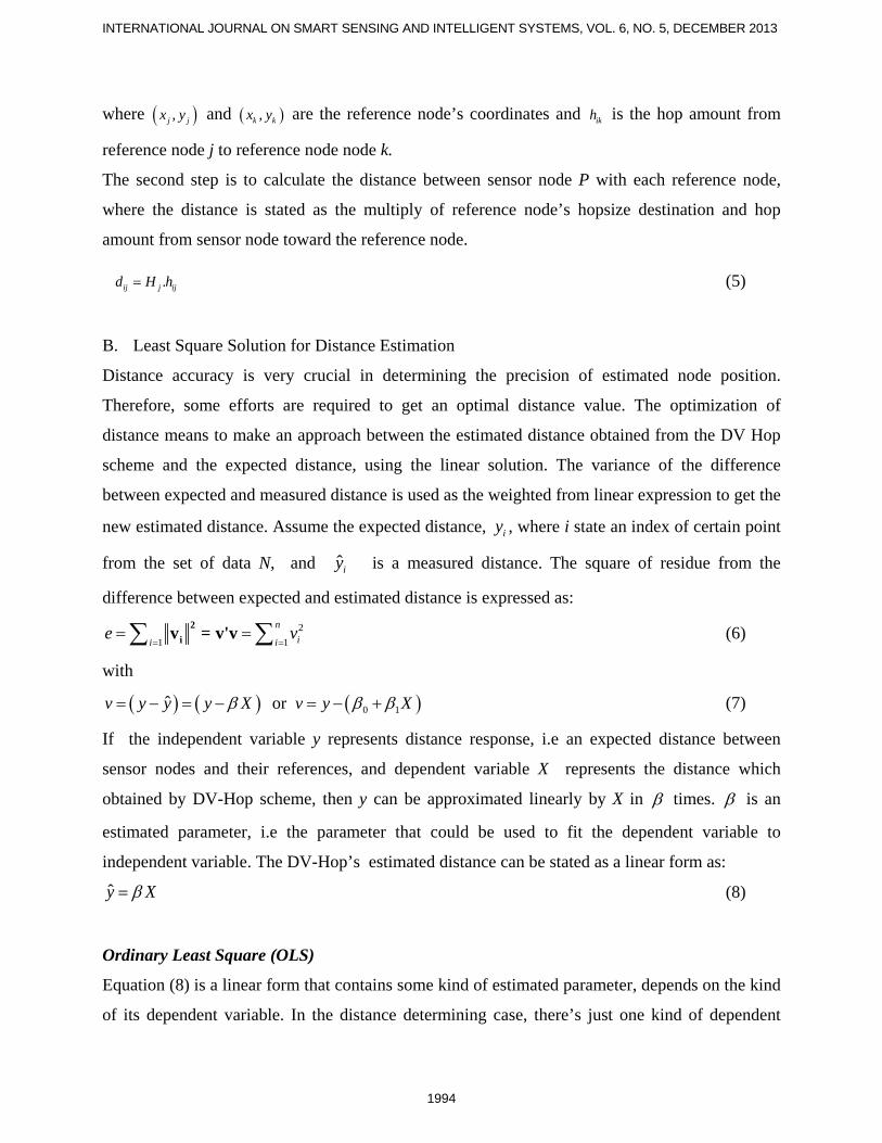
Weighted Least Square (WLS)
The WLS scheme is used to improve the estimated result that has been taken by least squares.
WLS criteria, as proposed by [7] is used to minimize residue between estimated distances and
model distance. The enhancing form of equation (7) becomes: 1 -1ε = v W v (12)
where W is a matrix covariant of random error vector ( )1 2, ,..., TNv v v v= which is the difference
between estimated distance with model distance. If we assume that the error of measured distance
among nodes, ei is independent, then W represents a diagonal element from error matrix, with
( )varii iW v= . Residue can be minimized with:
( ) ( ) ( )( )2
21 10 1
1
1var var
Ni
ii i
vv W v y Xv v
ε β β−
=
= = = − +
∑ ∑ (13)
The matrix form of W is as follows:
( ) ( ) ( )( )
( ) ( )
11 12 1
21
1
var cov . . covcov .
. . .
. . .cov . var
N
N NN
v v vv
W
v v
=
(14)
The aim of the position calculation is to obtain the estimated position of sensor nodes. The
accuracy of estimated position is to be expected, or having a minimum residue toward the actual
position as stated in:
( ) ( )( )2 2
1
n
i i ii
x x y y dε=
= − + − −∑
(15)
The least square solution in matrix form is expressed as:
ˆi ii
i i
x xy y
ε
= +
To minimize ε by differentiating it into x and y and equating the differential to zero,
and = 0x yε ε∂ ∂∂ ∂
for each nodes , we obtain the linear solution of closest distances of reference
nodes:
1996

Prima Kristalina, Wirawan, Gamantyo Hendrantoro, WEIGHTED HYBRID LOCALIZATION SCHEME FOR IMPROVED NODE POSITIONING IN WIRELESS SENSOR NETWORKS
( ) ( )( ) ( )( ) ( )
( ) ( )
2 221 1 1
2 222 2 2
2 223 3 3
2 22
N N N
d x x y y
d x x y y
d x x y y
d x x y y
= − + −
= − + −
= − + −
= − + −
(16)
where ( ) ( ) ( ) ( ){ }1 1 2 2 3 3 1 2 3, , , , , ,..., , , , , ,...,N N Nx y x y x y x y d d d d are the coordinates and estimated
distance of reference nodes. Hence, by substituting each estimated distance to the reference
distance, for instance, we use 1d as the reference distance, then the form of equation (16) could
be expressed as: 2 2 2 2
1 1 12 2i i i i id d x x x y y y− = − + − (17)
In matrix form, it could be written as: 2 2 2 22 2 2 12 22 2 2 2
3 3 3 3 3 1
2 2 2 21
2 22 2
2 2
i
i
N N N N N
x y d dx yx y x x y d d
yx y x y d d
+ − + + − + = + − +
(18)
Or Ax = B
where 2 2 2 22 2 2 12 22 2 2 2
3 3 3 3 3 1
2 2 2 21
2 22 2
, = , =
2 2
i
i
N N N N N
x y d dx yx y x x y d d
yx y x y d d
+ − + + − + = + − +
A x B
The estimated position can be obtained as follows:
( )ˆ-11 1x = A A A B (19)
1997

INTERNATIONAL JOURNAL ON SMART SENSING AND INTELLIGENT SYSTEMS, VOL. 6, NO. 5, DECEMBER 2013
IV. PERFORMANCE ANALYSIS AND EVALUATION
In this section, we will analyze and evaluate the performance of the system. This evaluation is
distinguished into simulation scheme and experimental work. The performance of proposed
algorithm is examined using Matlab in simulation scheme, whereas the environmental
characteristic is measured in experimental work in order to obtain the variation of signal strength
received by nodes. This work is implemented using Imote2. The diagram of the relationship
between simulation and experimental work is illustrated in figure 3. In this figure, RSS values are
obtained by measuring the received signal from reference nodes. Furthermore, the RSS values are
converted to the distance, as described in the next section, and evaluated as input of the H - Loc
algorithm. WLS scheme refines the estimated distance issued by H-Loc algorithm, after the
evaluation is completed, this scheme is developed in each sensor node.
Figure 3. The relationship between simulation and experimental work
A. Simulation scheme
The simulation parameter as listed in Table 1, consists of the maximum number of nodes,
observation area, communication range of each node, path loss coefficient of the observed
environment, and power received by sensor node, 0RP at a reference distance, 0d . The deployed
nodes are classified into reference nodes and sensor nodes, where each node has common
communication range. The maximum communication range is set equal to the maximum length
of the observation area. This area is simulated as a squared form. The RSS method is applied
based on the measurement results from the outdoor environment with a certain path loss
coefficient. The communication mechanism is Line of Sight (LOS). Node deployment is
RSS value
Estimated distance
Simulation
I. Evaluate H-Loc Algorithm and simulate in Matlab
II. Refine estimated distance using WLS scheme and evaluate the scheme in Matlab
III. Calculate Error Localization
Experimental Work
I. Measure RSS using Imote2 nodes in indoor and outdoor environment,
II. Develop WLS scheme in sensor node to refine the estimated distance
III. Calculate Estimated Position
1998

Prima Kristalina, Wirawan, Gamantyo Hendrantoro, WEIGHTED HYBRID LOCALIZATION SCHEME FOR IMPROVED NODE POSITIONING IN WIRELESS SENSOR NETWORKS
0 2 4 6 8 10 12 14 16 18 200
2
4
6
8
10
12
14
16
18
20
X Position
Y P
ositi
on
Reference NodesSensor Nodes
illustrated as in figure 4, where sensor nodes are configured as C-shape and reference nodes is in
a random normal distribution.
Table 1. Simulation Parameter
Parameter Value Number of nodes max. 200 pcs Observation area 100mx100 m Communication range 40-100 m Path loss coefficient 1.6 – 2.2 Reference Power Received 102 dB Reference distance (d0) 1 m
Figure 4. The Scenario of Node Deployment
1. Performance Evaluation of Algorithm 1: H-Loc Scheme
The performance of proposed algorithm will be evaluated by comparing it with the original DV-
Hop and RSS method. The average error localization is evaluated based on the ratio of reference
nodes and number of sensor nodes, adjusting the communication range and the density of the
system (number of nodes per squared area). Figure 5 implies that the original DV-Hop results
the worst accuracy, followed by the RSSI method. The proposed algorithm could enhance the
accuracy up to 88 % better than the original DV-Hop. This algorithm also reduces the average
error position to 66% lower than the RSS method.
1999

INTERNATIONAL JOURNAL ON SMART SENSING AND INTELLIGENT SYSTEMS, VOL. 6, NO. 5, DECEMBER 2013
In the adjustment of communication range, the algorithms are simulated to evaluate the average
error position of the system when the communication range ratio is increased. The simulation
result shown in Figure 6 describes the convergence of algorithm in solving the average error
position occurs in 60% of communication range ratio. The proposed H-Loc algorithm offers a
better performance than the others.
Figure 5. Average Position Error vs Reference Node ratio
Figure 6. Average Position Error vs Communication Range Ratio
2000

Prima Kristalina, Wirawan, Gamantyo Hendrantoro, WEIGHTED HYBRID LOCALIZATION SCHEME FOR IMPROVED NODE POSITIONING IN WIRELESS SENSOR NETWORKS
The proposed algorithm is specifically examined based on the adjusting observation area and
communication range of reference nodes. The result shows, as in Figure 7, the wider the
communication range adjusted (40,60 and 80 m respectively) in an increased observation area
(from 40×40m2 to 200 m2), the higher the average error position obtained. In the simulation, a
fixed number of nodes are deployed (50 nodes and 5 reference nodes) and the area is increased
from 10×10 m2 to 200×200 m2. As we know, enlarging the area will increase the range between
nodes. The H - loc algorithm will select adaptively whether selected reference nodes could be
reached in one hop or not.
Figure 7. Average error vs Border Length for H-Loc Algorithm
2. Performance Evaluation of Algorithm 2: DV-WLS Scheme
The other scheme proposed in this paper is for refining the performance of the DV-Hop scheme.
Actually, DV-Hop scheme has dependencies in hop count between nodes. The nodes which have
the same reference nodes and the same hop count will have the same estimated coordinate
position, even though the actual position is rather different. Using a weighted factor of least
squared error position, it can be proven that the accuracy of the estimated position is increased, as
illustrated in figure 8. DV-WLS scheme has the capability in reducing the average position error
when the node is increased, up to 3.611 % comparing with standard DV-Hop. Meanwhile, DV-
LS just reduces 0.1 %. The H - Loc scheme could reduce up to 0.572431 %.
The influence of communication range changes is examined in our proposed scheme. The
simulation result shows the wider the communication range increase, the bigger the error position
2001

INTERNATIONAL JOURNAL ON SMART SENSING AND INTELLIGENT SYSTEMS, VOL. 6, NO. 5, DECEMBER 2013
0.1 0.2 0.3 0.4 0.5 0.6 0.7 0.8 0.912.5
13
13.5
14
Node Ratio
Ave
rage
Pos
ition
Erro
r(m)
DV-HopDV-HlocDV-LSDV-WLS
0.4 0.5 0.6 0.7 0.8 0.9 113.6
13.8
14
14.2
14.4
14.6
14.8
Communication Range Ratio
Ave
rage
Pos
ition
Erro
r(m)
DV-HopDV-HlocDV-LSDV-WLS
occurs in the system. The phenomenon is shown by DV-Hop scheme and its improved schemes,
as drawn in figure 9. The reason of this phenomenon can be explained as follows: increasing the
communication range of each node yields the overlapping area.. This overlapping area yields
some errors in selecting references for each node. The accumulated error due to overlapping area
yields accumulating error position estimation. The performance of system could be reached by
DV-WLS and DV-LS scheme as 3.33 % and 0.875 % better than standard DV-Hop scheme.
Figure 8. Average Position Error vs Node Ratio for DV-Hop scheme and its improved schemes
Figure 9. Average Position Error vs Communication Range Ratio for DV-Hop scheme and its
improved schemes
2002

Prima Kristalina, Wirawan, Gamantyo Hendrantoro, WEIGHTED HYBRID LOCALIZATION SCHEME FOR IMPROVED NODE POSITIONING IN WIRELESS SENSOR NETWORKS
1 2 3 4 5 6 7 80
2
4
6
8
10
12
14
16
Node number
Ave
rage
Dis
tanc
e E
rror (
m)
RSSDV-HopDV-LSDV-WLS
We evaluate the average distance error for a set of sensor nodes towards a certain reference node.
In our case, the distance comes from sensor node 1,2,3,4,5,6,7,8 towards the reference node 1.
The average distance error of them is shown as in figure 10. The average distance error of RSS
scheme is 4.740261m, or 23 % of the length of the observation area, followed by the average
distance error of DV-WLS scheme (4.9711m or 24.8 % of ratio with the length of observation
area). The worst is using DV-Hop scheme, which shows 46.75 % of the length of the observation
area.
Figure 10. Average Distance Error for each sensor node
Finally, the accuracy of position concerns the capability of the proposed scheme to achieve the
actual position of the node [20]. The scheme is running in n iteration to solve a certain position of
node. We apply a particular node with the coordinate (8,3) as an actual node, and the algorithm is
iterated n times until the convergence is obtained. The closest value of estimated position
obtained by DV-WLS scheme is (10.24032,10.42694), and obtained by DV-LS scheme is
(8.333,3.3363). The DV-LS scheme seems to be better than the DV-WLS scheme, but shows
instability, as shown in figure 11c and d.
2003

INTERNATIONAL JOURNAL ON SMART SENSING AND INTELLIGENT SYSTEMS, VOL. 6, NO. 5, DECEMBER 2013
Figure 11. The convergence of the proposed scheme to the particular node with coordinate (8,3).
B. Experimental Work
In this work, we concern on LOS observation area, both in indoor and outdoor environment. The
aim of measurement is to observe path loss coefficient which represents signal characterization
received by wireless device in certain area. Multipurpose building at Politeknik Elektronika
Negeri Surabaya, Indonesia is selected to represent indoor environment, meanwhile the soccer
field around campus area is represented as the outdoor environment. The photograph of the
measurement in the two areas is shown in figure 12. A pair of nodes is attached in the
observation area. Imote2 applies 802.15.4 series 1 with 1 mW of power transmit for the
communication system among nodes. The first node acts as a reference node, which broadcast the
information packet and RF signal to the second node. The aforementioned node will receive the
packet, measures RSS level signal and converts it to the estimated distance, based on the
0 1000 2000 3000 4000 5000 6000 7000 80000
2
4
6
8
10
12
14
16
18
20
Iterasi
Y-W
LS
0 1000 2000 3000 4000 5000 6000 7000 80000
2
4
6
8
10
12
14
16
18
20
Iterasi
X-W
LS
(a) (b)
0 1000 2000 3000 4000 5000 6000 7000 80000
2
4
6
8
10
12
14
16
18
20
Iterasi
Y-L
S
0 1000 2000 3000 4000 5000 6000 7000 80000
2
4
6
8
10
12
14
16
18
20
Iterasi
X-L
S
(c) (d)
2004

Prima Kristalina, Wirawan, Gamantyo Hendrantoro, WEIGHTED HYBRID LOCALIZATION SCHEME FOR IMPROVED NODE POSITIONING IN WIRELESS SENSOR NETWORKS
modeling of path loss as described in (2). This node is shifted away from the reference node with
2 meters spacing. The height of each node is 0.45 m. In the same distance, the received signal
strength is measured 12 times by the 30o difference angle of receiving antenna. The scenario of
measurement procedure is shown in figure 13.
Figure 12. Observation area for Signal Strength Measurement
a. Indoor LOS b. Outdoor LOS
Figure 13. The scenario of RSSI measurement procedure
2005

INTERNATIONAL JOURNAL ON SMART SENSING AND INTELLIGENT SYSTEMS, VOL. 6, NO. 5, DECEMBER 2013
0 5 10 15 20 25 30 35-85
-80
-75
-70
-65
-60
-55
-50
-45
-40
-35
Distance (meter)
Rec
eive
d P
ower
(dB
m)
Data Distribution and Data Mean in Outdoor LOS with n=2.2040
Data Mean
Best fit line y=0.04x2+-2.19x+-43.38Data Distribution
0 5 10 15 20 25 30 35-95
-90
-85
-80
-75
-70
-65
-60
-55
-50
-45
Distance (meter)
Rec
eive
d P
ower
(dB
m)
Data Distribution and Data Mean in Indoor LOS with n=1.6027
Data Mean
Best fit line y=0.04x2+-1.98x+-51.21Data Distribution
1. Performance evaluation of Environmental Characteristic
Distance measurement among nodes is fully dependent on the environment where the nodes are
deployed. In the measurement process, 12 samples of signal strength data were taken by the
receiving node in the same distance, with 30o angle difference for between them. The
experimental results of Outdoor LOS environment show that the range of power received is -
37.8571 to -77.0714 dBm and the results of Indoor LOS have the range between -52.9167 to -
74.2500 dBm. Using path loss modeling as (2), the path loss coefficient, n of outdoor LOS was
obtained as 2.2040, and in indoor LOS was obtained as 1,6027. The experimental results were
approached by polynomial modeling order 2. The derivation of this modeling and experimental
data yield the values as follows: mean, variance and deviation standard of data error on indoor
LOS are 1.4807, 56.37945 and 7.5086 respectively, whereas in outdoor LOS these values are
2.0345, 156.0797 and 12.4932. The variance of receiving power in an outdoor environment, as
shown in figure 14b, is larger than the variance in indoor, and the path loss coefficient is larger
too. These values indicate that indoor measurement yields poor quality of signal caused by
reflection and attenuation of the building.
Figure 14. The measurement received power towards the distance
a. Indoor LOS b. Outdoor LOS
2006

Prima Kristalina, Wirawan, Gamantyo Hendrantoro, WEIGHTED HYBRID LOCALIZATION SCHEME FOR IMPROVED NODE POSITIONING IN WIRELESS SENSOR NETWORKS
0 2 4 6 8 10 12 14 16 180
5
10
15
20
25
30
35
40
45
meas.no
dist
ance
(met
er)
actual distanceestimated distance
0 2 4 6 8 10 12 14 160
0.1
0.2
0.3
0.4
0.5
0.6
0.7
0.8
0.9
1
x
F(x)
Empirical CDF
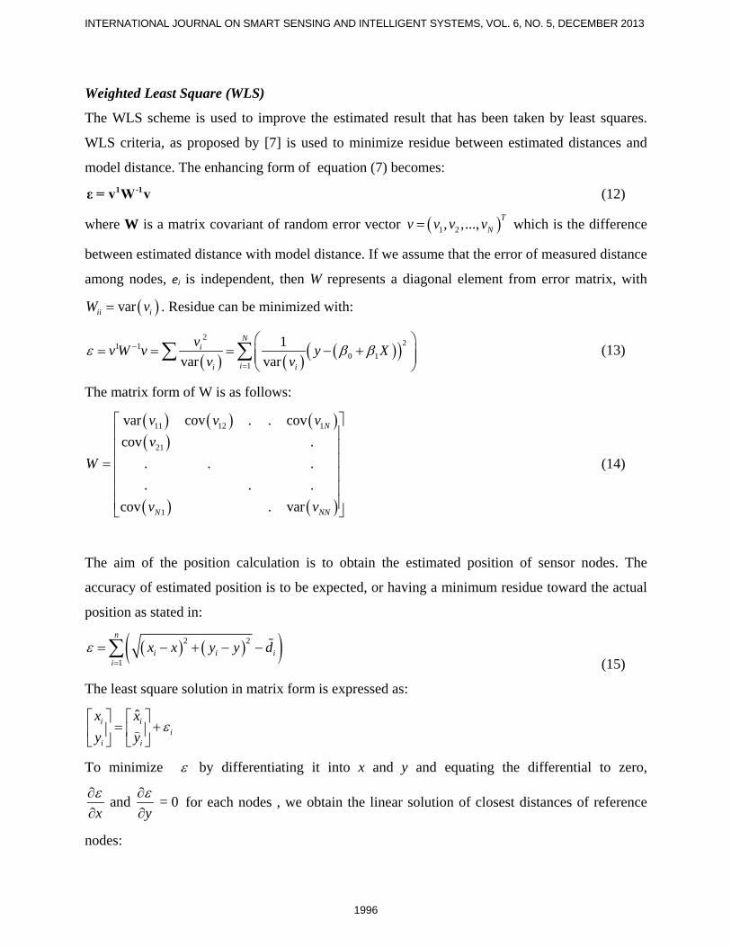
2. Performance evaluation of Estimated Distance
The variation of received signal strength indicates the unique pattern othe observation areaea.
This pattern is represented by a path loss coefficient, which implies the category of the
observation area, whether indoor, outdoor, Line of sight (LOS) or Non line of Sight (NLOS).
Using the path loss coefficient, estimated distance is calculated as equation (4). The estimated
distance obtained by path loss modeling are compared with actual distance. From the various
distance measurement in an indoor environment, the average of the difference between estimated
and actual distance or mean square error (MSE) of distance is 4.6959 m. The variance and
standard deviation are 20.6903m and 4.5486m, respectively. The comparison of estimated and
actual distance is illustrated in figure 15a. Meanwhile, the MSE, variance and standard deviation
of distance in outdoor LOS are 4.153, 23.2539m and 4.8222m, and the comparison of the data is
shown at Figure 16a. Cumulative distribution function (cdf) of error between estimated and
actual distance for indoor and outdoor LOS is shown in figure 15b and 16b. In indoor LOS, cdf
shows that the error estimated distance is spread evenly throughout the measurement, meanwhile,
in outdoor LOS, the spreading tend to narrow in certain measurement. This indicates that the
data error will be occurred easily in indoor area caused by the reflection or obstacle around
observed area.
Figure 15. Evaluation of Estimated Distance in Indoor LOS
a. Comparison of estimated and actual distance b. cdf form of least square error
2007
INTERNATIONAL JOURNAL ON SMART SENSING AND INTELLIGENT SYSTEMS, VOL. 6, NO. 5, DECEMBER 2013
0 5 10 15 20 250
0.1
0.2
0.3
0.4
0.5
0.6
0.7
0.8
0.9
1
x
F(x)
Empirical CDF
0 5 10 15 20 250
5
10
15
20
25
30
35
meas.no
dist
ance
(met
er)
actual distanceestimated distance
Figure 16. Evaluation of Estimated Distance in Outdoor LOS
a. Comparison of estimated and actual distance b. cdf form of least square error
V. CONCLUSIONS AND FUTURE WORK
The robust localization scheme has been proposed by combining DV-Hop scheme and RSS
scheme. The combination scheme, called H-Loc performs better than standard DV-Hop for
arbitrary nodes amount and communication range. An improvement on distance accuracy has
been solved by weighting the variance of a distance error by the least square method. The
proposed algorithm provides critical benefit on node positioning accuracy. In the future we will
apply the weighted least square scheme to estimate indoor movable node position by considering
environmental characteristic and calculation rate for self-localization in wireless sensor
networks.
ACKNOWLEDGEMENTS
The research work in this paper is supported by Directorate General of Higher Education of
Indonesia under Grant No. 062.12/PL14/PG.1/2013.
2008

Prima Kristalina, Wirawan, Gamantyo Hendrantoro, WEIGHTED HYBRID LOCALIZATION SCHEME FOR IMPROVED NODE POSITIONING IN WIRELESS SENSOR NETWORKS
REFERENCES
[1] S. Indu, V. Kesam, S. . Chaudury, and A. Bhattacharya, “Self Organizing Sensor Network
to Enhance Event Coverage,” J. on Smart Sensing and Intelligent System, vol. 4, no. 1, pp. 53 –
74, Mar. 2011.
[2] N. Patwari, I. Hero, A.O., M. Perkins, N. S. Correal, and R. J. O’Dea, “Relative location
estimation in wireless sensor networks,” IEEE Transactions on Signal Processing, vol. 51, no. 8,
pp. 2137 – 2148, Aug. 2003.
[3] G. Mao and B. Fidan, Localization Algorithms and Strategies for Wireless Sensor
Networks, 1st ed. Information Science Reference, 2009.
[4] Y. Liu and Z. Yang, Location, Localization, and Localizability: Location-awareness
Technology for Wireless Networks. Springer, 2011.
[5] F. Reichenbach, A. Born, D. Timmermann, and R. Bill, “A distributed linear least squares
method for precise localization with low complexity in wireless sensor networks,” in
Proceedings of the Second IEEE international conference on Distributed Computing in Sensor
Systems, Berlin, Heidelberg, 2006, pp. 514–528.
[6] J. Wan, N. Yu, R. Feng, Y. Wu, and C. Su, “Localization refinement for wireless sensor
networks,” Computer Communications, vol. 32, no. 13–14, pp. 1515–1524, Aug. 2009.
[7] P. Tarrío, A. M. Bernardos, and J. R. Casar, “Weighted Least Squares Techniques for
Improved Received Signal Strength Based Localization,” Sensors, vol. 11, no. 12, pp. 8569–
8592, Sep. 2011.
[8] P. Kristalina, W. Wirawan, and G. Hendrantoro, “The enhancement of node positioning
accuracy using hybrid localization method for wireless sensor networks,” in 2012 International
Conference on Advanced Computer Science and Information Systems (ICACSIS), 2012, pp. 65–
69.
[9] G. Zanca, F. Zorzi, A. Zanella, and M. Zorzi, “Experimental comparison of RSSI-based
localization algorithms for indoor wireless sensor networks,” in Proceedings of the workshop on
Real-world wireless sensor networks, New York, NY, USA, 2008, pp. 1–5.
[10] J. Xu, “Distance Measurement Model Based on RSSI in WSN,” Wireless Sensor Network,
vol. 02, no. 08, pp. 606–611, 2010.
2009

INTERNATIONAL JOURNAL ON SMART SENSING AND INTELLIGENT SYSTEMS, VOL. 6, NO. 5, DECEMBER 2013
[11] D. Niculescu and B. Nath, “Ad hoc positioning system (APS),” in IEEE Global
Telecommunications Conference, 2001. GLOBECOM ’01, 2001, vol. 5, pp. 2926 –2931 vol.5.
[12] F. Dai, Y. Liu, and L. Chen, “A Hybrid Localization Algorithm for Improving Accuracy
Based on RSSI/AOA in Wireless Network,” in 2012 International Conference on Computer
Science Service System (CSSS), 2012, pp. 631–634.
[13] L. Liu, Y. Wei, and G. Xiu, “An Adaptive Hybrid Localization Algorithm for Wireless
Sensor Network,” in 2012 Second International Conference on Instrumentation, Measurement,
Computer, Communication and Control (IMCCC), 2012, pp. 1579–1582.
[14] J. Zhao and H. Jia, “A hybrid localization algorithm based on DV-Distance and the twice-
weighted centroid for WSN,” in 2010 3rd IEEE International Conference on Computer Science
and Information Technology (ICCSIT), 2010, vol. 7, pp. 590–594.
[15] A. Bahillo, S. Mazuelas, R. M. Lorenzo, P. Fernández, J. Prieto, R. J. Durán, and E. J.
Abril, “Hybrid RSS-RTT Localization Scheme for Indoor Wireless Networks,” EURASIP
Journal on Advances in Signal Processing, vol. 2010, no. 1, p. 126082, Apr. 2010.
[16] F. Xiao, M. Wu, H. Huang, R. Wang, and S. Wang, “Novel Node Localization Algorithm
Based on Nonlinear Weighting Least Square for Wireless Sensor Networks,” International
Journal of Distributed Sensor Networks, vol. 2012, Nov. 2012.
[17] A. Ghosh and S. K. Das, “Coverage and connectivity issues in wireless sensor networks: A
survey,” Pervasive Mob. Comput., vol. 4, no. 3, pp. 303–334, Jun. 2008.
[18] C. Zhu, C. Zheng, L. Shu, and G. Han, “A survey on coverage and connectivity issues in
wireless sensor networks,” Journal of Network and Computer Applications, vol. 35, no. 2, pp.
619–632, Mar. 2012.
[19] Hongbeom Ahn and Jinpyo Hong, “DV-hop localization algorithm with multi-power
beacons under noisy environment,” 2011, pp. 7–12.
[20] L. Haiyan, H. Yun-an, and Z. Min, “Adaptive Estimation and PI Learning Spring-
Relaxation Technique for Location Estimation in Wireless Sensor Networks,” International
Journal of Smart Sensing and Intelligent System, vol. 6, no. 1, pp. 317 – 332, Feb. 2013.
2010