Embed Size (px)
Citation preview

Web Mapping? Why? How?Isn't Google enough?
Jo CookSenior IT Support and DevelopmentOxford Archaeology/[email protected]+44 (0)1524 880212

The Geospatial Stack(Diagram from Hell)

The Real Geospatial Stack

Your Data
Must be:
Accessible
Readable
Clean

Map Servers
Converting your data into web-accessible formats

Minnesota Mapserver
Download windows binaries from: http://maptools.org/ms4w/ and everything else from:http://mapserver.gis.umn.edu/download/current/

Minnesota Mapserver
Check it's working by entering the following URL in firefox:http://www.maths.lancs.ac.uk/cgi-bin/mapserv?
Simple Map File (test.map):MAP NAME "My first map" UNITS dd EXTENT -10908931.354601 -2813375.945688 8689298.182275 11986946.775106 PROJECTION 'init=epsg:4326' END IMAGETYPE PNG SIZE 400 300 SHAPEPATH "/web/home/cookj1/data/vmap0_shapefiles" IMAGECOLOR 255 255 255 LAYER NAME alaska DATA alaska STATUS OFF TYPE POLYGON PROJECTION 'init=epsg:4326' END CLASS NAME "Alaska" STYLE COLOR 232 232 232 OUTLINECOLOR 32 32 32 END END ENDEND

Testing your map
Test your map at the web prompt:http://www.maths.lancs.ac.uk/cgi-bin/mapserv?map=/web/home/cookj1/test.map&mode=map
Or from the command line:shp2img -m test.map -o testmap.png

Mapserver in the wild
http://mapserver.gis.umn.edu/gallery

Geoserver
http://geoserver.org/

Mapserver Demos
Try the demos here:http://www.maths.lancs.ac.uk/~rowlings/MapServer/workshop-5.0/

Web Mapping Services
The Power-House of your setup

WMS
A GetCapabilities request:http://wms.jpl.nasa.gov/wms.cgi?request=GetCapabilities <?xml version='1.0' encoding="UTF-8" standalone="no" ?><!DOCTYPE WMT_MS_Capabilities SYSTEM "http://wms.jpl.nasa.gov/WMS_MS_Capabilities.dtd" [ <!ELEMENT VendorSpecificCapabilities EMPTY> ]><WMT_MS_Capabilities version="1.1.1"><Service> <Name>OGC:WMS</Name> <Title>JPL Global Imagery Service</Title> <Abstract>WMS Server maintained by JPL, worldwide satellite imagery.</Abstract>
...

WMS
A GetMap request:http://wms.jpl.nasa.gov/wms.cgi? request=GetMap&service=wms&version=1.1.1&srs=EPSG:4326&format=image/jpeg&styles=&bbox=-180, -60, 180, 84&width=600&height=300&layers=global_mosaic

Additions to the map object (test_wms.map)
MAP... WEB ... METADATA "wms_title" "My first wms server" "wms_srs" "EPSG:4326" "wms_onlineresource" "http://www.maths.lancs.ac.uk/cgi-bin/mapserv?map=/web/home/cookj1/test_wms.map END END ...END

Additions to the layer object
LAYER... STATUS MINSCALE 1000 MAXSCALE 10000000 METADATA "wms_title" "My first wms layer" "wms_srs" "EPSG:4326" ENDEND

Testing your server
GetCapabilities:http://www.maths.lancs.ac.uk/cgi-bin/mapserv?map=/web/home/cookj1/test_wms.map&service=wms&request=GetCapabilities Add it as a WMS layer in Quantum GIS

WFS
A GetCapabilities Request:http://map.ns.ec.gc.ca/envdat/map.aspx?service=WFS&version=1.0.0&request=GetCapabilities A GetFeature Request:http://map.ns.ec.gc.ca/envdat/map.aspx? service=WFS&version=1.0.0&request=GetFeature&typename=envirodat

Additions to map and layer (test_wfs.map):MAP
... WEB ... METADATA ... "wfs_title" "My first wfs server" "wfs_srs" "EPSG:4326" "wfs_onlineresource" "http://www.maths.lancs.ac.uk/cgi-bin/mapserv?map=/web/home/cookj1/test_wfs.map END END LAYER ... DUMP TRUE METADATA "wfs_title" "My first wfs layer" "gml_featureid" "cat" "gml_include_items" "all" END ...
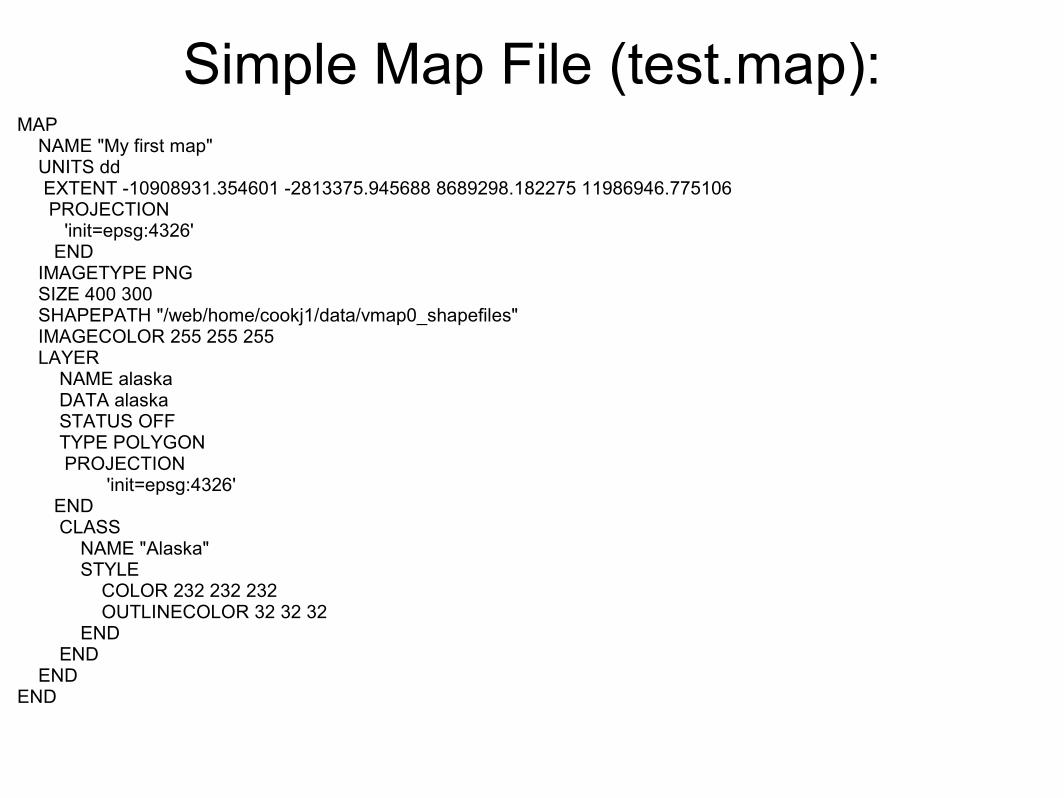
Testing your server:
A GetCapabilities Request: http://www.maths.lancs.ac.uk/cgi-bin/mapserv?map=/web/home/cookj1/test_wfs.map&service=wfs&request=getcapabilities&version=1.0.0
A GetFeature Request:http://www.maths.lancs.ac.uk/cgi-bin/mapserv?map=/web/home/cookj1/test_wfs.map&service=wfs&version=1.0.0&request=getfeature&typename=alaska

Maps on web pages
(Finally)

An OpenLayers map file (oltest1.html)<html> <head> <script src="http://www.maths.lancs.ac.uk/ol/lib/OpenLayers.js"></script> <script type="text/javascript"> var map; function init() { map = new OpenLayers.Map('map'); var wms = new OpenLayers.Layer.WMS( "OpenLayers WMS", "http://labs.metacarta.com/wms/vmap0?", {layers: 'basic'} ); map.addLayers([wms]); map.zoomToMaxExtent(); } </script> </head> <body onload="init()"> <div id="map" style="width: 600px; height: 300px"></div> </body></html>
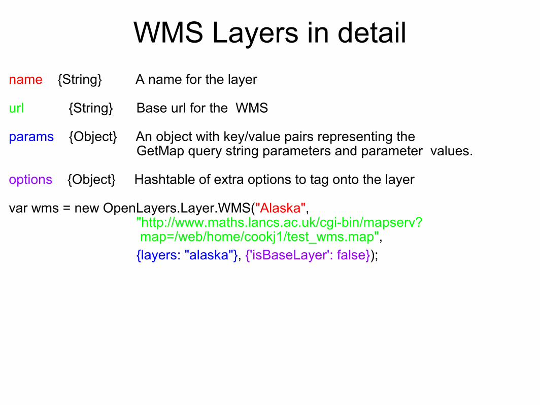
WMS Layers in detail
name {String} A name for the layer url {String} Base url for the WMS params {Object} An object with key/value pairs representing the GetMap query string parameters and parameter values.
options {Object} Hashtable of extra options to tag onto the layer var wms = new OpenLayers.Layer.WMS("Alaska",
"http://www.maths.lancs.ac.uk/cgi-bin/mapserv? map=/web/home/cookj1/test_wms.map",
{layers: "alaska"}, {'isBaseLayer': false});
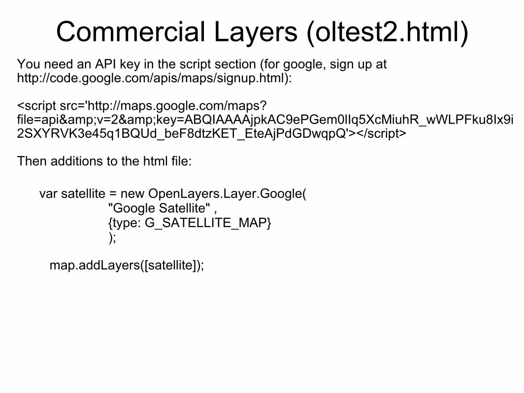
Commercial Layers (oltest2.html)You need an API key in the script section (for google, sign up at http://code.google.com/apis/maps/signup.html):
<script src='http://maps.google.com/maps? file=api&v=2&key=ABQIAAAAjpkAC9ePGem0lIq5XcMiuhR_wWLPFku8Ix9i2SXYRVK3e45q1BQUd_beF8dtzKET_EteAjPdGDwqpQ'></script>
Then additions to the html file:
var satellite = new OpenLayers.Layer.Google( "Google Satellite" , {type: G_SATELLITE_MAP} );
map.addLayers([satellite]);
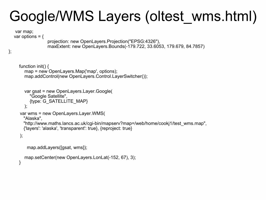
Google/WMS Layers (oltest_wms.html) var map; var options = { projection: new OpenLayers.Projection("EPSG:4326"), maxExtent: new OpenLayers.Bounds(-179.722, 33.6053, 179.679, 84.7857)};
function init() { map = new OpenLayers.Map('map', options); map.addControl(new OpenLayers.Control.LayerSwitcher()); var gsat = new OpenLayers.Layer.Google( "Google Satellite", {type: G_SATELLITE_MAP} );
var wms = new OpenLayers.Layer.WMS( "Alaska", "http://www.maths.lancs.ac.uk/cgi-bin/mapserv?map=/web/home/cookj1/test_wms.map", {'layers': 'alaska', 'transparent': true}, {reproject: true}
);
map.addLayers([gsat, wms]);
map.setCenter(new OpenLayers.LonLat(-152, 67), 3); }

WFS LayersRequire extra configuration of the server to accept external wfs requests (see http://trac.openlayers.org/wiki/FrequentlyAskedQuestions#ProxyHost):
In general, uses the same set of parameters as WMS, eg:
var wfs = new OpenLayers.Layer.WFS( "Alaska", "http://www.maths.lancs.ac.uk/cgi-bin/mapserv?
map=/web/home/cookj1/test_wfs.map", {typename: "alaska"} );
BUT:WFS layers need reprojecting to overlay correctly on commercial map layers (you may need to edit the projection file that mapserver uses- see http://crschmidt.net/~crschmidt/spherical_mercator.html)

OpenLayers ExamplesTry them out at:
http://www.maths.lancs.ac.uk/ol/examples

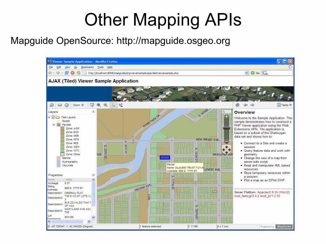
Cataloguing(Or what to do with all this fancy web-data now you've got it)

GeonetworkJava-based geospatial cataloguing system
Download at: http://geonetwork-opensource.org/

Geonetwork in the wildhttp://www.geoportal.org

ReferencesWeb Mapping Illustrated (O'Reilly) by Tyler Mitchell ISBN 0-596-00865-1
Mapserver main website: http://mapserver.gis.umn.edu/
Mapserver 5 tutorial: http://biometry.gis.umn.edu/tutorial/
Geoserver website: http://geoserver.org/
Openlayers website: http://openlayers.org/
Introduction to Openlayers (Workshop, FOSS4G 2008): http://workshops.opengeo.org/openlayers/intro/doc/
OGC Standards (for WMS/WFS etc): http://www.opengeospatial.org/standards
Geonetwork website: http://geonetwork-opensource.org/
Jo CookSenior IT Support and DevelopmentOxford Archaeology/[email protected]+44 (0)1524 880212
This work is licenced under the Creative Commons Attribution-Share Alike 2.0 UK: England & Wales License. To view a copy of this licence, visit http://creativecommons.org/licenses/by-sa/2.0/uk/ or send a letter to Creative Commons, 171 Second Street, Suite 300, San Francisco, California 94105, USA.


![Facebook For Business Hub Spot Nov2008[1]](https://img.pdfslide.us/doc/110x75/554db427b4c905ff7a8b54bb/facebook-for-business-hub-spot-nov20081.jpg)