Embed Size (px)
Citation preview

Open GIS Consortium Inc.
Date: 2003-06-10
Reference number of this OpenGIS® project document: OGC 03-036r2
Version: 1.0.0
Category: OpenGIS® Implementation Specification
Status: Adopted Specification
Editor: Jean-Philippe Humblet
IONIC Software sa
Web Map Context Documents
Document type: OpenGIS® Implementation Specification Document stage: Public Release Document language: English WARNING: The Open GIS Consortium (OGC) releases this specification to the public without warranty. It is subject to change without notice. This specification is currently under active revision by the OGC Technical Committee
Requests for clarification and/or revision can be made by contacting the OGC at [email protected].

Copyright 2003 IONIC Software sa Copyright 2003 GeoConnections / Natural Resources Canada Copyright 2003 US National Aeronautics and Space Administration Copyright 2003 DM Solutions Group Copyright 2003 Social Change Online Copyright 2003 Syncline, Inc. Copyright 2003 International Interfaces, Inc. Copyright 2003 Computer Aided Development Corporation (Cadcorp) Ltd Copyright 2003 Autodesk, Inc. Copyright 2003 University of Leeds Copyright 2003 PCI Geomatics Copyright 2003 Galdos, Inc. The companies listed above have granted the Open GIS Consortium, Inc. (OGC) a nonexclusive, royalty-free, paid up, worldwide license to copy and distribute this document and to modify this document and distribute copies of the modified version. This document does not represent a commitment to implement any portion of this specification in any company’s products. The OGC invites any interested party to bring to its attention any copyrights, patents or patent applications, or other proprietary rights which may cover technology that may be required to practice this specification. Please address the information to the OGC Specification Program Executive Director. OGC’s Legal, IPR and Copyright Statements are found at http://www.opengis.org/legal
NOTICE
Permission to use, copy, and distribute the contents of this document, or the OGC document from which this statement is linked, in any medium for any purpose and without fee or royalty is hereby granted, provided that you include the following on ALL copies of the document, or portions thereof, that you use:
1. Include a link or URL to the original OGC document. 2. The pre-existing copyright notice of the original author, or if it doesn't exist, a notice of the form: "Copyright © [$date-of-
document] Open GIS Consortium, Inc [http://www.opengis.org/]. All Rights Reserved. http://www.opengis.org/legal/" (Hypertext is preferred, but a textual representation is permitted.)
3. If it exists, the STATUS of the OGC document. When space permits, inclusion of the full text of this NOTICE should be provided. We request that authorship attribution be provided in any software, documents, or other items or products that you create pursuant to the implementation of the contents of this document, or any portion thereof. No right to create modifications or derivatives of OGC documents is granted pursuant to this license. However, if additional requirements (documented in the Copyright FAQ http://www.opengis.org/legal) are satisfied, the right to create modifications or derivatives is sometimes granted by the OGC to individuals complying with those requirements. THIS DOCUMENT IS PROVIDED "AS IS," AND COPYRIGHT HOLDERS MAKE NO REPRESENTATIONS OR WARRANTIES, EXPRESS OR IMPLIED, INCLUDING, BUT NOT LIMITED TO, WARRANTIES OF MERCHANTABILITY, FITNESS FOR A PARTICULAR PURPOSE, NON-INFRINGEMENT, OR TITLE; THAT THE CONTENTS OF THE DOCUMENT ARE SUITABLE FOR ANY PURPOSE; NOR THAT THE IMPLEMENTATION OF SUCH CONTENTS WILL NOT INFRINGE ANY THIRD PARTY PATENTS, COPYRIGHTS, TRADEMARKS OR OTHER RIGHTS COPYRIGHT HOLDERS WILL NOT BE LIABLE FOR ANY DIRECT, INDIRECT, SPECIAL OR CONSEQUENTIAL DAMAGES ARISING OUT OF ANY USE OF THE DOCUMENT OR THE PERFORMANCE OR IMPLEMENTATION OF THE CONTENTS THEREOF. The name and trademarks of copyright holders may NOT be used in advertising or publicity pertaining to this document or its contents without specific, written prior permission. Title to copyright in this document will at all times remain with copyright holders. RESTRICTED RIGHTS LEGEND. Use, duplication, or disclosure by government is subject to restrictions as set forth in subdivision (c)(1)(ii) of the Right in Technical Data and Computer Software Clause at DFARS 252.227.7013
OpenGIS® is a trademark or registered trademark of Open GIS Consortium, Inc. in the United States and in other countries.

OGC 03-036r2
Contents
i. Preface ...................................................................................................................iii
ii. Submitting Organizations....................................................................................iii
iii. Submission Contact Points ..................................................................................iii
iv. Revision History .................................................................................................... v
v. Changes to the OpenGIS Abstract Specification ............................................... v
vi. Future work ........................................................................................................... v
Foreword ..........................................................................................................................vii
Introduction ....................................................................................................................viii
1 Scope....................................................................................................................... 9
2 Conformance.......................................................................................................... 9
3 Normative references ............................................................................................ 9
4 Terms and definitions ......................................................................................... 10
5 Conventions.......................................................................................................... 11 5.1 Normative verbs .................................................................................................. 11 5.2 Abbreviated Terms ............................................................................................. 11
6 Elements of a Context Document....................................................................... 11 6.1 XML Encoding and MIME Type ...................................................................... 12 6.2 ViewContext......................................................................................................... 13 6.2.1 Version Number .................................................................................................. 13 6.2.2 Id ................................................................................................................... 13 6.3 General section .................................................................................................... 13 6.3.1 Bounding Box and Spatial Reference System................................................... 13 6.3.2 Window Size......................................................................................................... 13 6.3.3 Title ................................................................................................................... 13 6.3.4 Abstract ................................................................................................................ 13 6.3.5 Keywords.............................................................................................................. 14 6.3.6 Contact Information ........................................................................................... 14 6.3.7 LogoURL.............................................................................................................. 14 6.3.8 DescriptionURL................................................................................................... 14 6.3.9 Extension .............................................................................................................. 14 6.4 LayerList .............................................................................................................. 14 6.4.1 Layer ................................................................................................................... 14 6.4.1.1 Server ................................................................................................................... 15 6.4.1.2 Name ................................................................................................................... 15 6.4.1.3 Title ................................................................................................................... 15

OGC 03-036r2
OGC 2003 –© All rights reserved ii
6.4.1.4 Abstract ................................................................................................................ 15 6.4.1.5 Spatial Reference System.................................................................................... 15 6.4.1.6 DataURL .............................................................................................................. 15 6.4.1.7 MetadataURL...................................................................................................... 16 6.4.1.8 FormatList ........................................................................................................... 16 6.4.1.9 Format .................................................................................................................. 16 6.4.1.10 StyleList.................................................................................................... 16 6.4.1.11 Style .......................................................................................................... 16 6.4.1.11.1 Named Style description ......................................................................... 16 6.4.1.11.2 Name......................................................................................................... 16 6.4.1.11.3 Title........................................................................................................... 17 6.4.1.11.4 LegendURL.............................................................................................. 17 6.4.1.11.5 Abstract .................................................................................................... 17 6.4.1.11.6 SLD ........................................................................................................... 17 6.4.1.12 Extension .................................................................................................. 17
7 Description of a Context Collection................................................................... 18 7.1 ViewContextCollection ....................................................................................... 18 7.1.1 Version Number .................................................................................................. 18 7.1.2 ViewContextReference........................................................................................ 18 7.1.2.1 Id ................................................................................................................... 18 7.1.2.2 Title ................................................................................................................... 18 7.1.2.3 ContextURL......................................................................................................... 19
Annex A............................................................................................................................ 19
Annex B ............................................................................................................................ 26
OGC 03-036r2
OGC 2003 –© All rights reserved iii
i. Preface
This document is the result of work begun during the first and second Open GIS Consortium (OGC) Web Mapping Testbeds in 1999 and 2000 by IONIC Software and the US National Aeronautics and Space Administration (NASA) and demonstrated by IONIC in September 1999. At the OGC Technical Committee meeting in June 2002 work by GeoConnections / Natural Resources Canada and NASA was demonstrated. This demonstration showed a map comprising layers from several distinct servers being built up in one Viewer Client, the creation of a platform-independent description of that map, the retrieval of that description by an entirely different Client, and the display of the map in the second Client. The ability to read and write Context documents has already been tested in many OGC Interoperability Program testbeds such as OWS, GISD, and CIPI.
ii. Submitting Organizations
The OGC Web Map Context Documents Revision Working Group submits this Document to the OGC Technical Committee as Version 1.0.0 of the OpenGIS® Web Map Context Documents Implementation Specification.
iii. Submission Contact Points
All questions regarding this submission should be directed to the Editor:
Jean-Philippe Humblet IONIC Software sa Rue de Wallonie, 18 B-4460 Grâce-Hollogne BELGIUM +32 4 364 0 364 [email protected]
Additional Contributors
Jeff de La Beaujardière NASA Goddard Space Flight Center [email protected]

OGC 03-036r2
OGC 2003 –© All rights reserved iv
Allan Doyle International Interfaces [email protected]
Tom Kralidis GeoConnections / Natural Resources Canada [email protected]
Jerome Sonnet IONIC Software sa [email protected]
Christopher Tucker IONIC Enterprise [email protected]
Rob Atkinson Social Change Online [email protected]
Daniel Morissette DM Solutions Group [email protected]
Martin Daly Computer Aided Development Corporation (Cadcorp) Ltd [email protected]
Joshua Lieberman Syncline, Inc. [email protected]
Stephane Fellah PCI Geomatics [email protected]
Ian Turton Centre for Computational Geography, University of Leeds [email protected]
Milan Trninic Galdos, Inc. [email protected]
Olivier Ricordel Autodesk, Inc. [email protected]

OGC 03-036r2
OGC 2003 –© All rights reserved v
Support for the production of this document was provided by US National Oceanic & Atmospheric Administration, National Environmental Satellite, Data, and Information Service
iv. Revision History
Date Release Editor Description
2000-05-05 0.1.0 Jeff de La Beaujardière Dimitri Monie
First draft proposed to WMT mailing list.
2000-06-27 0.1.2 Jeff de La Beaujardière Intermediate
2002-06-11 0.1.2 Jeff de La Beaujardière Demonstration at OGC TC.
2002-06-25 0.1.3 Jean-Philippe Humblet Intermediate
2002-08-19 0.1.4 Jean-Philippe Humblet Discussion Paper
2002-12-12 0.1.5 Rob Atkinson General review. Incorporated extensibility and standard GML elements.
2002-12-20 0.1.6 Tom Kralidis Updates from previous draft and inclusion of context collection definitions
2003-01-13 0.1.6 Jérôme Sonnet Preparation for RFC submission
2003-05-14 0.1.7 Jérôme Sonnet Integrate RFC comments
2003-05-19 0.1.8 Tom Kralidis, Martin Daly, et al.
Review and addition of schemas and examples, final edits prior to submission as 1.0.0 candidate
2003-06-10 1.0.0 Tom Kralidis, Jerome Sonnet, Jeff Lansing
Fixed namespace issues in schemas. Deletion of xlink.xsd in lieu of leveraging OGC xlink schemas
v. Changes to the OpenGIS Abstract Specification
The OpenGIS® Abstract Specification requires the following change to accommodate this OpenGIS® standard:
- The abstract concept of a persistent, reusable "context" for geospatial services should be added.
vi. Future work
This document directly supports only persistence of portrayed maps created by one or more Web Map Server bindings, but is intended to be reviewed to provide an extensibility mechanism for Web Feature Server and other types of service and persisted interface object

OGC 03-036r2
OGC 2003 –© All rights reserved vi
states. It is expected that these will be developed and added to the formal schema in a backward compatible fashion.
Pending a formal extension mechanism, organisations wishing to extend the ViewContext to include non-WMS services should create a new schema that is consistent with this specification and be prepared to transform such ViewContext documents to this WMS only version if export capabilities are desired.
OGC 03-036r2
OGC 2003 –© All rights reserved vii
Foreword
This version of the specification cancels and replaces all previous versions.
OGC 03-036r2
OGC 2003 –© All rights reserved viii
Introduction
This document is a companion specification to the OpenGIS Web Map Service Interface Implementation Specification version 1.1.1 [4], hereinafter "WMS 1.1.1."
WMS 1.1.1 specifies how individual map servers describe and provide their map content. The present Context specification states how a specific grouping of one or more maps from one or more map servers can be described in a portable, platform-independent format for storage in a repository or for transmission between clients. This description is known as a "Web Map Context Document," or simply a "Context." Presently, context documents are primarily designed for WMS bindings. However, extensibility is envisioned for binding to other services.
A Context document includes information about the server(s) providing layer(s) in the overall map, the bounding box and map projection shared by all the maps, sufficient operational metadata for Client software to reproduce the map, and ancillary metadata used to annotate or describe the maps and their provenance for the benefit of human viewers.
A Context document is structured using eXtensible Markup Language (XML). Annex A of this specification contains the XML Schema against which Context XML can be validated.
There are several possible uses for Context documents:
- The Context document can provide default startup views for particular classes of user. Such a document would have a long lifetime and public accessibility.
- The Context document can save the state of a viewer client as the user navigates and modifies map layers.
- The Context document can store not only the current settings but also additional information about each layer (e.g., available styles, formats, SRS, etc.) to avoid having to query the map server again once the user has selected a layer.
- The Context document could be saved from one client session and transferred to a different client application to start up with the same context.
Contexts could be cataloged and discovered, thus providing a level of granularity broader than individual layers.

OGC 03-036r2
OGC 2003 –© All rights reserved 9
Web Map Context Documents
1 Scope
This specification applies to the creation and use of documents which unambiguously describe the state, or "Context," of a WMS Client application in a manner that is independent of a particular client and that might be utilized by different clients to recreate the application state. This specification defines an encoding for the Context using eXtensible Markup Language [XML 1.0].
This specification is relevant to Clients of the OGC Web Map Service [WMS 1.0.0, WMS 1.1.0, WMS 1.1.1]. Reference is made to normative material from [WMS 1.1.1]. In some cases, reference is made to normative material from the Styled Layer Descriptor specification [SLD]
This specification does not address the archival, cataloging, discovery or retrieval of Context XML documents.
2 Conformance
Conformance with this specification shall be checked using all the relevant tests specified in Annex B (normative).
3 Normative references
The following normative documents contain provisions that, through reference in this text, constitute provisions of this specification. For dated references, subsequent amendments to, or revisions of, any of these publications do not apply. However, parties to agreements based on this specification are encouraged to investigate the possibility of applying the most recent editions of the normative documents indicated below. For undated references, the latest edition of the normative document referred to applies.
EPSG, European Petroleum Survey Group Geodesy Parameters, Lott, R., Ravanas, B., Cain, J., Girbig, J.-P., and Nicolai, R., eds., <http://www.epsg.org/>
IETF RFC 2045 (November 1996), Multipurpose Internet Mail Extensions (MIME) Part One: Format of Internet Message Bodies, Freed, N. and Borenstein N., eds., <http://www.ietf.org/rfc/rfc2045.txt>
IETF RFC 2119 (March 1997), Key words for use in RFCs to Indicate Requirement Levels, Bradner, S., ed., <http://www.ietf.org/rfc/rfc2119.txt>.

OGC 03-036r2
OGC 2003 –© All rights reserved 10
SLD 1.0.0 (September 2002), Styled Layer Description (SLD) 1.0.0, Open GIS Consortium Proposed Implementation Specification, William Lalonde, <http://www.opengis.org/techno/specs/02-070.pdf>
XML 1.0 (October 2000), eXtensible Markup Language (XML) 1.0 (2nd edition), World Wide Web Consortium Recommendation, Bray, T., Paoli, J., Sperberg-McQueen, C.M., and Maler, E., eds., <http://www.w3.org/TR/2000/REC-xml>
4 Terms and definitions
For the purposes of this document, the following terms and definitions apply.
4.1 operation specification of a transformation or query that an object may be called to execute [OGC AS 12]
4.2 interface named set of operations that characterize the behavior of an entity [OGC AS 12]
4.3 service distinct part of the functionality that is provided by an entity through interfaces [OGC AS 12]
4.4 service instance server actual implementation of a service
4.5 client software component that can invoke an operation from a server
4.6 request invocation of an operation by a client
4.7 response result of an operation returned from a server to a client
4.8 map pictorial representation of geographic data.

OGC 03-036r2
OGC 2003 –© All rights reserved 11
4.9 spatial reference system a projected or geographic coordinate reference system
4.1 Capabilities service-level metadata describing the operations and content available at a service instance.
5 Conventions
5.1 Normative verbs
In the sections labeled as normative, the key words "required", "shall", "shall not", "should", "should not", "recommended", "may", and "optional" in this document are to be interpreted as described in [IETF RFC 2119].
The verb "deprecate" provides notice that the referenced portion of the specification is being retained for backwards compatibility with earlier versions but may be removed from a future version of the specification without further notice.
5.2 Abbreviated Terms
CGI Common Gateway Interface EPSG European Petroleum Survey Group GIF Graphics Interchange Format GIS Geographic Information System HTTP Hypertext Transfer Protocol IETF Internet Engineering Task Force JPEG Joint Photographic Experts Group MIME Multipurpose Internet Mail Extensions OGC Open GIS Consortium OWS OGC Web Service PNG Portable Network Graphics RFC Request for Comments SLD Styled Layer Descriptor URL Uniform Resource Locator WCS Web Coverage Service WFS Web Feature Service WMS Web Map Service XML Extensible Markup Language
6 Elements of a Context Document
The parent element of the ViewContext document includes as children a "General" element for layer-independent context and a sequential "LayerList" with specific details about each layer in

OGC 03-036r2
OGC 2003 –© All rights reserved 12
use. The 'version' attribute specifies the Viewer Context specification revision to which this XML Schema applies.
The General element provides layer independent context information. It states the bounding box in units of a particular Spatial Reference System that represent the geographic extent of the map and a dimension as a pair of integers that represents the suggested pixel size of the map. This element also contains some metadata about this particular WMS Context as a title, abstract, keywords, and other information.
The LayerList element encapsulates all the layers in the current context. One or more of those layers may be retained in the context but can be hidden from the display. LayerList contains a series of one or more Layer elements.
Each Layer element is nearly identical to that in WMS Capabilities. It contains layer metadata such as a title, an abstract and a legend that may reflect what is advertised by the server the layer is issued from. But, it is clear that a very common use of Context is to change the name and the description to allow either internationalization, user refinement, or eventually, a completely user defined description.
Some information concerning the current state of the layer within the WMS Context is also held there. The layer element contains a binary attribute “hidden” which, if nonzero, instructs the client that despite the layer being within the Context it must not be displayed. A client should also provide a means for the user to know that such a Layer exists and a means to make that layer visible.
The Layer element also contains information about the server it is issued from and some information about the format in which that layer may be asked for by the client. It also contains several styles that should be presented to the user to allow different presentations of the map, one of these styles being advertised as the currently selected one.
6.1 XML Encoding and MIME Type
The eXtensible Markup Language (XML) [XML 1.0] encoding of a Context document shall be valid according to the XML Schema in annex A.1 of this document. This XML Schema specifies the required and optional content of the Context document and how this document is formatted.
A Context document may reference an exact copy of the XML Schema in annex A.1 of this document. The XML Schema shall be located at a fully-qualified and accessible URL to permit an XML validating process to retrieve it.
When used with a MIME type, the context XML format should be identified by "application/vnd.ogc.context+xml".
A specified filename extension such as .cml and .ccml is suggested for Contexts and Context Collections.

OGC 03-036r2
OGC 2003 –© All rights reserved 13
6.2 ViewContext
The root element of the Context, this element must contain the version number of the Context Specification which the current Context document complies with.
The ViewContext element is composed of two elements, one for general information described in section 6.3 and another defining a list of layers described in section 6.4.
6.2.1 Version Number
An attribute “version” representing the published specification version number, contains three positive integers, separated by decimal points, in the form “x.y.z”. Each context specification is numbered independently. This attribute is required.
6.2.2 Id
An attribute “id” which should be unique and that represents a unique identifier of the Context. This attribute is required.
6.3 General section
An element “General” that contains layer-independent information about the current Context document such as the bounding box and the spatial reference system and also some information describing the Context document itself such as title, abstract, etc. This element is required.
6.3.1 Bounding Box and Spatial Reference System
An element “BoundingBox” formatted as defined in the WMS 1.1.1 Specification. It represents the geographic extent that should be presented by the client1. This element is required.
6.3.2 Window Size
An element “Window” presenting the size in pixels of the map the Context document describes. Negotiation between Context defined aspect ratio and typical client aspect ratio (according to the client’s vendor) is left to the client. This element is optional.
6.3.3 Title
An element “Title” that contains a human readable title of the Context. This element is required.
6.3.4 Abstract
An element “Abstract” that contains a description for the Context document describing its content. This element is optional.
1 Regarding the ratio aspect, the box may change across different clients, but should remain globally the same.

OGC 03-036r2
OGC 2003 –© All rights reserved 14
6.3.5 Keywords
An element “KeywordList” that contains one or more Keyword elements which allow search across context collections. This element is optional.
6.3.6 Contact Information
An element “ContactInformation” that presents contact information of the creator of the Context document. Contact is described as defined in WMS 1.1.1 Specification. This element is optional.
6.3.7 LogoURL
A reference to an image that might be attached to the Context document. It can be, for instance, the logo of the project for which the context has been setup, or an overview of the map the context describes. This element contains a link to the image as well as the dimension of the image (in pixels) and its format. This element is optional.
6.3.8 DescriptionURL
A URL reference to a webpage which contains relevant information to the view. This element is optional.
6.3.9 Extension
The Extension element is a container tag in which arbitrary vendor specific information can be included without compromising the ability of other clients to enforce schema validation.
This tag should not be used to introduce new candidate elements that are intended to promote interoperability. Content in an <Extension> element should not be expected to be preserved in transfers of ViewContext documents between different systems.
See section vi: Future Work for more information.
6.4 LayerList
A Context document contains one map defined within a LayerList. This element describes the list of all layers to build a required view (map). The Layers are presented in a bottom to top approach.
Each layer is defined in a <Layer> element in the Context document XML. If desired, Layers may be repeated with different attributes (e.g. different styles).
6.4.1 Layer
Layers attributes are
- hidden : contains true if the layer should be hidden in the client result map (required)
OGC 03-036r2
OGC 2003 –© All rights reserved 15
- queryable : contains true if the layer is set queryable (required)
The <Layer> element must enclose one or more child elements providing information about the Layer. The meaning of these elements is defined hereunder.
6.4.1.1 Server
The element defining the service from which the named Layer may be requested
Attributes are:
- Service : the type of the service according to OGC interfaces, such as WMS, WFS. (required)
- Version : Version number of the OGC interface specification which corresponds to the service (required)
- Title : the title of the service (extracted from the Capabilities by the Context document creator) (optional)
- Online Resource element: the link to the online resource (required)
This element is required.
6.4.1.2 Name
The name of the selected layer (extracted from Capabilities by the Context document creator). This element is required.
6.4.1.3 Title
The title of the selected layer (extracted from Capabilities by the Context document creator). This element is required.
6.4.1.4 Abstract
The abstract of the selected layer (extracted from Capabilities by the Context document creator). This element is optional.
6.4.1.5 Spatial Reference System
A list of available SRS for the enclosing layer. One of the listed SRS’s must be the SRS mentioned in the ViewerContext/General/BoundingBox@SRS element. This element is optional.
6.4.1.6 DataURL
This element contains a link to an online resource where data corresponding to the layer can be found. This element is optional.

OGC 03-036r2
OGC 2003 –© All rights reserved 16
6.4.1.7 MetadataURL
This element contains a link to an online resource where descriptive metadata corresponding to the layer can be found. This element is optional.
6.4.1.8 FormatList
The parent element containing the list of available image format for this layer. Image formats should be expressed with MIME types as described in WMS 1.1.1 Specification.
Each image format is defined in a <Format>. A <FormatList> shall include at least one <Format> element.
6.4.1.9 Format
Describe one output image format for the Layer. Format attributes are:
• current : contains 1 if the current image format is selected.
6.4.1.10 StyleList
The parent element containing the list of available styles for this layer.
Each style is defined in a <Style> element. A <StyleList> shall include at least one <Style> element.
6.4.1.11 Style
Style attributes are :
• current: contains 1 if the current style is selected.
A <Style> element may be composed in two different ways: named style or SLD.
6.4.1.11.1 Named Style description
Each <Style> element shall have <Name> and <Title> elements. The style name is used in the map request STYLE parameter. The title is a human-readable string.
Each <Style> element may also contain an <Abstract> element, that provides a narrative description, and a <LegendURL> element that contains the location of an image of a map legend appropriate to the enclosing Style.
6.4.1.11.2 Name
The name of the style (extracted from Capabilities by the Context document creator). This element is required.

OGC 03-036r2
OGC 2003 –© All rights reserved 17
6.4.1.11.3 Title
The human-readable title of the style (extracted from Capabilities by the Context document creator). This element is required.
6.4.1.11.4 LegendURL
The location of an image of a map legend describing the current style (extracted from Capabilities by the Context document creator). This element is optional.
6.4.1.11.5 Abstract
A narrative description of the current style (extracted from Capabilities by the Context document creator). This element is optional.
6.4.1.11.6 SLD
Each <Style> element may alternatively define the style(s) of the layer with a <SLD> element.
The <SLD> element must contain required <Name> and optional <Title> elements which identify the particular element of a Styled Layer Descriptor to be used for this style. The <SLD> element must then contain one of three alternative sources of description of a layer style:
1. an <OnlineResource> element describing a link to the specified SLD document.
<OnlineResource xmlns:xlink="http://www.w3.org/TR/xlink" xlink:type="simple" xlink:href=”http://example.org/this/is/an/example/link/to/the/sld">
This reference may be to a separately referenced SLD document or to an inline <StyledLayerDescriptor> in the same context document (which may define the styles for multiple layers within the Web Map Context)
2. <StyledLayerDescriptor> element containing inline the namedStyle or userStyle named in the enclosing <Style> element
3. <FeatureTypeStyle> element containing inline the specific feature styling instructions for the enclosing <Style> element
6.4.1.12 Extension
The Extension element is a container tag in which arbitrary vendor specific information can be included without compromising the ability of other clients to enforce schema validation.

OGC 03-036r2
OGC 2003 –© All rights reserved 18
This tag should not be used to introduce new candidate elements that are intended to promote interoperability. Content in an <Extension> element should not be expected to be preserved in transfers of ViewContext documents between different systems.
See section vi: Future Work for more information
7 Description of a Context Collection
Context Collections represent a list of context documents. Context collections could be used in several ways:
• A particular Viewer Client could use a Collection to construct a menu of default start-up views.
• A Collection of related contexts could serve as a script for a demonstration.
• A user could create a Collection to "bookmark" public or user-specific contexts. The creation of such a Collection might be managed by the Viewer Client itself.
7.1 ViewContextCollection
This element is the root element of the context collection. This element must also contain the version number of the Context Collection which the current document complies with. One or more child ViewContextReference elements must exist.
7.1.1 Version Number
The published specification version number contains three positive integers, separated by decimal point, in the form “x.y.z”. Each context collection specification is numbered independently. This attribute is required.
7.1.2 ViewContextReference
This element provides reference information for a given context document.
7.1.2.1 Id
The “id” attribute should be unique and represent a unique identifier of the Context. This attribute is required
7.1.2.2 Title
An element “Title” that contains a human readable title of the Context. This element is required

OGC 03-036r2
OGC 2003 –© All rights reserved 19
7.1.2.3 ContextURL
This element provides an online resource for the context document, accessible via HTTP
Annex A
A.1 Context Document XML Schema (Normative)
This annex contains the normative XML Schema definition for a Context document corresponding to this version of the specification. The XML schema document is published by the OpenGIS Consortium within a public schema repository at http://schemas.opengis.net/context/1.0.0/context.xsd
Comments are informative; in case of conflict with the main body of this specification the main body takes precedence.
<?xml version="1.0" encoding="utf-8"?> <xs:schema version="1.0.0" xmlns:xs="http://www.w3.org/2001/XMLSchema" targetNamespace="http://www.opengis.net/context" xmlns:context="http://www.opengis.net/context" xmlns:sld="http://www.opengis.net/sld" xmlns:xlink="http://www.w3.org/1999/xlink" elementFormDefault="qualified"> <xs:import namespace="http://www.opengis.net/sld" schemaLocation="http://schemas.opengis.net/sld/1.0.0/sld.xsd"/> <xs:element name="ViewContext" type="context:ViewContextType"/> <xs:complexType name="ViewContextType"> <xs:sequence> <xs:element name="General" type="context:GeneralType" minOccurs="1" maxOccurs="1"/> <xs:element name="LayerList" type="context:LayerListType" minOccurs="1" maxOccurs="1"/> </xs:sequence> <xs:attribute name="version" type="xs:string" use="required" fixed="1.0.0"/> <xs:attribute name="id" type="xs:string" use="required"/> </xs:complexType> <xs:complexType name="GeneralType"> <xs:sequence> <xs:element name="Window" type="context:WindowType" minOccurs="0" maxOccurs="1"/> <xs:element name="BoundingBox" type="context:BoundingBoxType" minOccurs="1" maxOccurs="1"/> <xs:element name="Title" type="xs:string" minOccurs="1" maxOccurs="1"/> <xs:element name="KeywordList" type="context:KeywordListType" minOccurs="0" maxOccurs="1"/> <xs:element name="Abstract" type="xs:string" minOccurs="0" maxOccurs="1"/> <xs:element name="LogoURL" type="context:URLType" minOccurs="0" maxOccurs="1"/> <xs:element name="DescriptionURL" type="context:URLType" minOccurs="0" maxOccurs="1"/> <xs:element name="ContactInformation" type="context:ContactInformationType" minOccurs="0" maxOccurs="1"/> <xs:element name="Extension" type="context:ExtensionType" minOccurs="0" maxOccurs="1"/> </xs:sequence> </xs:complexType> <xs:complexType name="WindowType"> <xs:attribute name="width" type="xs:integer" use="required"/> <xs:attribute name="height" type="xs:integer" use="required"/> </xs:complexType> <xs:complexType name="BoundingBoxType"> <xs:attribute name="SRS" type="xs:string" use="required"/> <xs:attribute name="minx" type="xs:decimal" use="required"/>

OGC 03-036r2
OGC 2003 –© All rights reserved 20
<xs:attribute name="miny" type="xs:decimal" use="required"/> <xs:attribute name="maxx" type="xs:decimal" use="required"/> <xs:attribute name="maxy" type="xs:decimal" use="required"/> </xs:complexType> <xs:complexType name="KeywordListType"> <xs:sequence> <xs:element name="Keyword" type="xs:string" minOccurs="1" maxOccurs="unbounded"/> </xs:sequence> </xs:complexType> <xs:complexType name="URLType"> <xs:sequence> <xs:element name="OnlineResource" type="context:OnlineResourceType" minOccurs="1" maxOccurs="1"/> </xs:sequence> <xs:attribute name="width" type="xs:integer" use="optional"/> <xs:attribute name="height" type="xs:integer" use="optional"/> <xs:attribute name="format" type="xs:string" use="optional"/> </xs:complexType> <xs:complexType name="ContactInformationType"> <xs:sequence> <xs:element name="ContactPersonPrimary" type="context:ContactPersonPrimaryType" minOccurs="1" maxOccurs="1"/> <xs:element name="ContactPosition" type="xs:string" minOccurs="1" maxOccurs="1"/> <xs:element name="ContactAddress" type="context:AddressType" minOccurs="1" maxOccurs="1"/> <xs:element name="ContactVoiceTelephone" type="xs:string" minOccurs="1" maxOccurs="1"/> <xs:element name="ContactFacsimileTelephone" type="xs:string" minOccurs="1" maxOccurs="1"/> <xs:element name="ContactElectronicMailAddress" type="xs:string" minOccurs="1" maxOccurs="1"/> </xs:sequence> </xs:complexType> <xs:complexType name="ContactPersonPrimaryType"> <xs:sequence> <xs:element name="ContactPerson" type="xs:string" minOccurs="1" maxOccurs="1"/> <xs:element name="ContactOrganization" type="xs:string" minOccurs="1" maxOccurs="1"/> </xs:sequence> </xs:complexType> <xs:complexType name="AddressType"> <xs:sequence> <xs:element name="AddressType" type="xs:string" minOccurs="1" maxOccurs="1"/> <xs:element name="Address" type="xs:string" minOccurs="1" maxOccurs="1"/> <xs:element name="City" type="xs:string" minOccurs="1" maxOccurs="1"/> <xs:element name="StateOrProvince" type="xs:string" minOccurs="1" maxOccurs="1"/> <xs:element name="PostCode" type="xs:string" minOccurs="1" maxOccurs="1"/> <xs:element name="Country" type="xs:string" minOccurs="1" maxOccurs="1"/> </xs:sequence> </xs:complexType> <xs:complexType name="LayerListType"> <xs:sequence> <xs:element name="Layer" type="context:LayerType" minOccurs="1" maxOccurs="unbounded"/> </xs:sequence> </xs:complexType> <xs:complexType name="LayerType"> <xs:sequence> <xs:element name="Server" type="context:ServerType" minOccurs="1" maxOccurs="1"/> <xs:element name="Name" type="xs:string" minOccurs="1" maxOccurs="1"/> <xs:element name="Title" type="xs:string" minOccurs="1" maxOccurs="1"/> <xs:element name="Abstract" type="xs:string" minOccurs="0" maxOccurs="1"/> <xs:element name="DataURL" type="context:URLType" minOccurs="0" maxOccurs="1"/> <xs:element name="MetadataURL" type="context:URLType" minOccurs="0" maxOccurs="1"/> <xs:element name="SRS" type="xs:string" minOccurs="0" maxOccurs="1"/> <xs:element name="FormatList" type="context:FormatListType" minOccurs="0" maxOccurs="1"/> <xs:element name="StyleList" type="context:StyleListType" minOccurs="0" maxOccurs="1"/> <xs:element name="Extension" type="context:ExtensionType" minOccurs="0" maxOccurs="1"/> </xs:sequence> <xs:attribute name="queryable" type="xs:boolean" use="required"/> <xs:attribute name="hidden" type="xs:boolean" use="required"/>

OGC 03-036r2
OGC 2003 –© All rights reserved 21
</xs:complexType> <xs:complexType name="ServerType"> <xs:sequence> <xs:element name="OnlineResource" type="context:OnlineResourceType"/> </xs:sequence> <xs:attribute name="service" type="xs:string" use="required"/> <xs:attribute name="version" type="xs:string" use="required"/> <xs:attribute name="title" type="xs:string" use="optional"/> </xs:complexType> <xs:complexType name="FormatListType"> <xs:sequence> <xs:element name="Format" type="context:FormatType" minOccurs="1" maxOccurs="unbounded"/> </xs:sequence> </xs:complexType> <xs:complexType name="FormatType"> <xs:simpleContent> <xs:extension base="xs:string"> <xs:attribute name="current" type="xs:boolean"/> </xs:extension> </xs:simpleContent> </xs:complexType> <xs:complexType name="StyleListType"> <xs:sequence> <xs:element name="Style" type="context:StyleType" minOccurs="1" maxOccurs="unbounded"/> </xs:sequence> </xs:complexType> <xs:complexType name="StyleType"> <xs:choice> <xs:sequence> <xs:element name="Name" type="xs:string" minOccurs="1" maxOccurs="1"/> <xs:element name="Title" type="xs:string" minOccurs="1" maxOccurs="1"/> <xs:element name="Abstract" type="xs:string" minOccurs="0" maxOccurs="1"/> <xs:element name="LegendURL" type="context:URLType" minOccurs="0" maxOccurs="1"/> </xs:sequence> <xs:element name="SLD" type="context:SLDType" minOccurs="0" maxOccurs="1"/> </xs:choice> <xs:attribute name="current" type="xs:boolean"/> </xs:complexType> <xs:complexType name="SLDType"> <xs:sequence> <xs:element name="Name" type="xs:string" minOccurs="0" maxOccurs="1"/> <xs:element name="Title" type="xs:string" minOccurs="0" maxOccurs="1"/> <xs:choice> <xs:element name="OnlineResource" type="context:OnlineResourceType"/> <xs:element ref="sld:StyledLayerDescriptor"/> <xs:element ref="sld:FeatureTypeStyle"/> </xs:choice> </xs:sequence> </xs:complexType> <xs:complexType name="OnlineResourceType"> <xs:attributeGroup ref="xlink:simpleLink"/> </xs:complexType> <xs:complexType name="ExtensionType"> <xs:annotation> <xs:documentation>This allows additional elements to be added to support non WMS Layer services.</xs:documentation> </xs:annotation> <xs:sequence> <xs:any namespace="##any"/> </xs:sequence> </xs:complexType> </xs:schema>

OGC 03-036r2
OGC 2003 –© All rights reserved 22
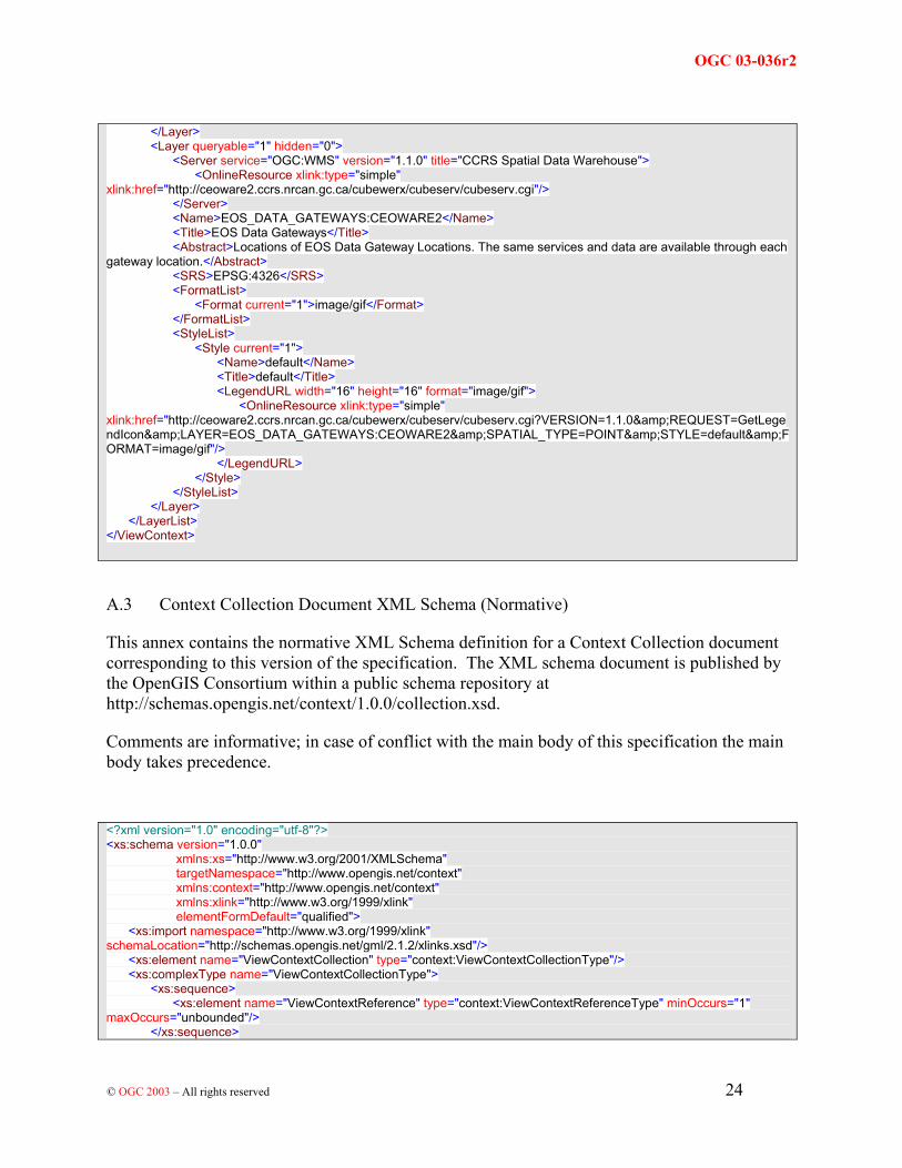
A.2 Context XML Example (Informative)
This annex contains a sample Context XML document. This example is published by the OpenGIS Consortium within a public schema repository at http://schemas.opengis.net/context/1.0.0/context.cml
<?xml version="1.0" encoding="utf-8" standalone="no" ?> <ViewContext version="1.0.0" id="eos_data_gateways" xmlns="http://www.opengis.net/context" xmlns:xlink="http://www.w3.org/1999/xlink" xmlns:xsi="http://www.w3.org/2001/XMLSchema-instance" xsi:schemaLocation="http://www.opengis.net/context context.xsd"> <General> <Window width="500" height="300" /> <BoundingBox SRS="EPSG:4326" minx="-180.000000" miny="-90.000000" maxx="180.000000" maxy="90.000000"/> <Title>EOS Data Gateways</Title> <KeywordList> <Keyword>EOS</Keyword> <Keyword>EOSDIS</Keyword> <Keyword>NASA</Keyword> <Keyword>CCRS</Keyword> <Keyword>CEOS</Keyword> <Keyword>OGC</Keyword> </KeywordList> <Abstract>Map View of EOSDIS partners locations</Abstract> <LogoURL width="130" height="74" format="image/gif"> <OnlineResource xlink:type="simple" xlink:href="http://redhook.gsfc.nasa.gov/~imswww/pub/icons/logo.gif"/> </LogoURL> <DescriptionURL format="text/html"> <OnlineResource xlink:type="simple" xlink:href="http://eos.nasa.gov/imswelcome"/> </DescriptionURL> <ContactInformation> <ContactPersonPrimary> <ContactPerson>Tom Kralidis</ContactPerson> <ContactOrganization>Canada Centre for Remote Sensing</ContactOrganization> </ContactPersonPrimary> <ContactPosition>Systems Scientist</ContactPosition> <ContactAddress> <AddressType>postal</AddressType> <Address>615 Booth Street, room 650</Address> <City>Ottawa</City> <StateOrProvince>Ontario</StateOrProvince> <PostCode>K1A 0E9</PostCode> <Country>Canada</Country> </ContactAddress> <ContactVoiceTelephone>+01 613 947 1828</ContactVoiceTelephone> <ContactFacsimileTelephone>+01 613 947 2410</ContactFacsimileTelephone> <ContactElectronicMailAddress>[email protected]</ContactElectronicMailAddress> </ContactInformation> </General> <LayerList> <Layer queryable="1" hidden="0"> <Server service="OGC:WMS" version="1.1.0" title="ESA CubeSERV"> <OnlineResource xlink:type="simple" xlink:href="http://mapserv2.esrin.esa.it/cubestor/cubeserv/cubeserv.cgi"/> </Server> <Name>WORLD_MODIS_1KM:MapAdmin</Name>

OGC 03-036r2
OGC 2003 –© All rights reserved 23
<Title>WORLD_MODIS_1KM</Title> <Abstract>Global maps derived from various Earth Observation sensors / WORLD_MODIS_1KM:MapAdmin</Abstract> <SRS>EPSG:4326</SRS> <FormatList> <Format current="1">image/png</Format> </FormatList> <StyleList> <Style current="1"> <Name>default</Name> <Title>default</Title> <LegendURL width="16" height="16" format="image/gif"> <OnlineResource xlink:type="simple" xlink:href="http://mapserv2.esrin.esa.it/cubestor/cubeserv/cubeserv.cgi?VERSION=1.1.0&REQUEST=GetLegendIcon&LAYER=WORLD_MODIS_1KM:MapAdmin&SPATIAL_TYPE=RASTER&STYLE=default&FORMAT=image/gif"/> </LegendURL> </Style> </StyleList> </Layer> <Layer queryable="0" hidden="0"> <Server service="OGC:WMS" version="1.0.7" title="The GLOBE Program Visualization Server"> <OnlineResource xlink:type="simple" xlink:href="http://globe.digitalearth.gov/viz-bin/wmt.cgi"/> </Server> <Name>COASTLINES</Name> <Title>Coastlines</Title> <Abstract>Context layer: Coastlines</Abstract> <SRS>EPSG:4326</SRS> <FormatList> <Format current="1">GIF</Format> </FormatList> <StyleList> <Style current="1"> <Name>default</Name> <Title>Default</Title> <LegendURL width="180" format="image/gif" height="50"> <OnlineResource xlink:type="simple" xlink:href="http://globe.digitalearth.gov/globe/en/icons/colorbars/COASTLINES.gif"/> </LegendURL> </Style> </StyleList> </Layer> <Layer queryable="1" hidden="0"> <Server service="OGC:WMS" version="1.0.7" title="The GLOBE Program Visualization Server"> <OnlineResource xlink:type="simple" xlink:href="http://globe.digitalearth.gov/viz-bin/wmt.cgi"/> </Server> <Name>NATIONAL</Name> <Title>National Boundaries</Title> <Abstract>Context layer: National Boundaries</Abstract> <SRS>EPSG:4326</SRS> <FormatList> <Format current="1">GIF</Format> </FormatList> <StyleList> <Style current="1"> <Name>default</Name> <Title>Default</Title> <LegendURL width="180" format="image/gif" height="50"> <OnlineResource xlink:type="simple" xlink:href="http://globe.digitalearth.gov/globe/en/icons/colorbars/NATIONAL.gif"/> </LegendURL> </Style> </StyleList>
OGC 03-036r2
OGC 2003 –© All rights reserved 24
</Layer> <Layer queryable="1" hidden="0"> <Server service="OGC:WMS" version="1.1.0" title="CCRS Spatial Data Warehouse"> <OnlineResource xlink:type="simple" xlink:href="http://ceoware2.ccrs.nrcan.gc.ca/cubewerx/cubeserv/cubeserv.cgi"/> </Server> <Name>EOS_DATA_GATEWAYS:CEOWARE2</Name> <Title>EOS Data Gateways</Title> <Abstract>Locations of EOS Data Gateway Locations. The same services and data are available through each gateway location.</Abstract> <SRS>EPSG:4326</SRS> <FormatList> <Format current="1">image/gif</Format> </FormatList> <StyleList> <Style current="1"> <Name>default</Name> <Title>default</Title> <LegendURL width="16" height="16" format="image/gif"> <OnlineResource xlink:type="simple" xlink:href="http://ceoware2.ccrs.nrcan.gc.ca/cubewerx/cubeserv/cubeserv.cgi?VERSION=1.1.0&REQUEST=GetLegendIcon&LAYER=EOS_DATA_GATEWAYS:CEOWARE2&SPATIAL_TYPE=POINT&STYLE=default&FORMAT=image/gif"/> </LegendURL> </Style> </StyleList> </Layer> </LayerList> </ViewContext>
A.3 Context Collection Document XML Schema (Normative)
This annex contains the normative XML Schema definition for a Context Collection document corresponding to this version of the specification. The XML schema document is published by the OpenGIS Consortium within a public schema repository at http://schemas.opengis.net/context/1.0.0/collection.xsd.
Comments are informative; in case of conflict with the main body of this specification the main body takes precedence.
<?xml version="1.0" encoding="utf-8"?> <xs:schema version="1.0.0" xmlns:xs="http://www.w3.org/2001/XMLSchema" targetNamespace="http://www.opengis.net/context" xmlns:context="http://www.opengis.net/context" xmlns:xlink="http://www.w3.org/1999/xlink" elementFormDefault="qualified"> <xs:import namespace="http://www.w3.org/1999/xlink" schemaLocation="http://schemas.opengis.net/gml/2.1.2/xlinks.xsd"/> <xs:element name="ViewContextCollection" type="context:ViewContextCollectionType"/> <xs:complexType name="ViewContextCollectionType"> <xs:sequence> <xs:element name="ViewContextReference" type="context:ViewContextReferenceType" minOccurs="1" maxOccurs="unbounded"/> </xs:sequence>

OGC 03-036r2
OGC 2003 –© All rights reserved 25
<xs:attribute name="version" type="xs:string" use="required" fixed="1.0.0"/> </xs:complexType> <xs:complexType name="ViewContextReferenceType"> <xs:sequence> <xs:element name="Title" type="xs:string" minOccurs="1" maxOccurs="1"/> <xs:element name="ContextURL" type="context:ContextURLType" minOccurs="1" maxOccurs="1"/> </xs:sequence> <xs:attribute name="version" use="required"/> <xs:attribute name="id" use="required"/> </xs:complexType> <xs:complexType name="ContextURLType"> <xs:sequence> <xs:element name="OnlineResource" type="context:OnlineResourceType" minOccurs="1" maxOccurs="1"/> </xs:sequence> </xs:complexType> <xs:complexType name="OnlineResourceType"> <xs:attributeGroup ref="xlink:simpleLink"/> </xs:complexType> </xs:schema>
A.4
This annex contains a sample Context Collection XML document. This example is published by the OpenGIS Consortium within a public schema repository at http://schemas.opengis.net/context/1.0.0/collection.ccml
<?xml version="1.0" encoding="utf-8" standalone="no"?> <ViewContextCollection version="1.0.0" xmlns="http://www.opengis.net/context" xmlns:xlink="http://www.w3.org/1999/xlink" xmlns:xsi="http://www.w3.org/2001/XMLSchema-instance" xsi:schemaLocation="http://www.opengis.net collection.xsd"> <!-- List of context XML URLs --> <ViewContextReference version="1.0.0" id="eos_data_gateways"> <!-- Human readable title for pick list / select box --> <Title>EOS Data Gateways</Title> <!-- URL location --> <ContextURL> <OnlineResource xlink:type="simple" xlink:href="http://cgdi-dev.geoconnections.org/prototypes/contexts/eos_data_gateways_1_0_0.xml"/> </ContextURL> </ViewContextReference> <ViewContextReference version="0.1.2" id="world_topo_0_1_2"> <Title>World Topography</Title> <ContextURL> <OnlineResource xlink:type="simple" xlink:href="http://sunrise.gsfc.nasa.gov/de/viewer/context_perm/world_topo_0_1_2.xml"/> </ContextURL> </ViewContextReference> </ViewContextCollection>

OGC 03-036r2
OGC 2003 –© All rights reserved 26
Annex B
NOTE: A complete Conformance Testing Guideline document for Web Map Context Documents may be taken up under the OGC Conformance Integration and Test Environment initiative. When complete, the Guideline will include a description and scope of each test suite, test data used in the tests, and documentation of the conformance items that constitute requirements for conformance. When a complete conformance test is available, its description will be added to this specification.
Minimal conformance with this specification requires the following:
1. Web Map Context Document Instances shall be valid against the included schema. This validity test shall use standard XML Schema validation techniques.
2. All clauses in the normative sections of this specification that use the keywords "required", "shall", and "shall not" have been satisfied.