Embed Size (px)
Citation preview
Weather Impacts BriefingNWS Nashville
December 6, 2013
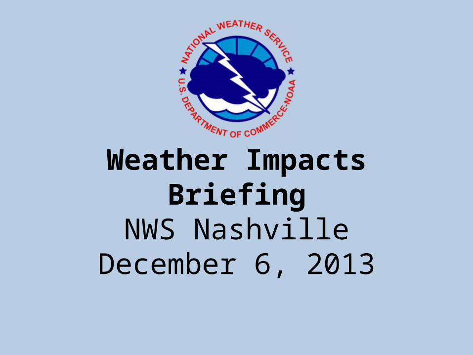
Impacts Summary• Three rounds of winter weather possible
– Round One northwest areas on Today• Clarksville, Erin, Camden, Springfield, Dickson, Linden
– Round Two Saturday evening into Sun. Morning• More widespread winter weather impacts expected than with
round one– Northwest half of Middle TN affected including the Nashville Metro area
– Round Three Sunday night thru Monday• Some light ice accumulation possible, but looking more like snow.
• Locally heavy rain through the weekend• Except Saturday when mostly dry conditions expected
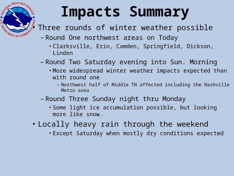
Friday System Impacts
• Rain will change to freezing rain beginning in far northwest Middle TN this morning– Mixing with sleet in the afternoon/evening– Ice accumulations of 1/4 to 1/3 inch expected
• Greatest impacts around Clarksville, Camden, Erin and Dover
• Some tree/power lines downed• Travel impacted
– Precipitation ending in the evening
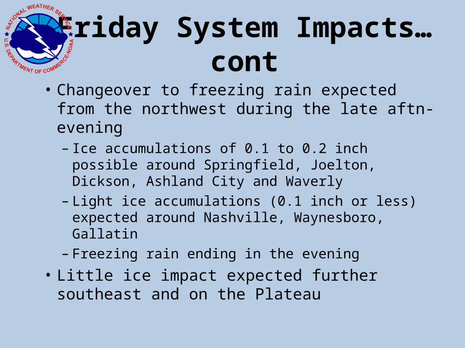
Friday System Impacts…cont• Changeover to freezing rain expected from the
northwest during the late aftn-evening– Ice accumulations of 0.1 to 0.2 inch possible around
Springfield, Joelton, Dickson, Ashland City and Waverly
– Light ice accumulations (0.1 inch or less) expected around Nashville, Waynesboro, Gallatin
– Freezing rain ending in the evening
• Little ice impact expected further southeast and on the Plateau
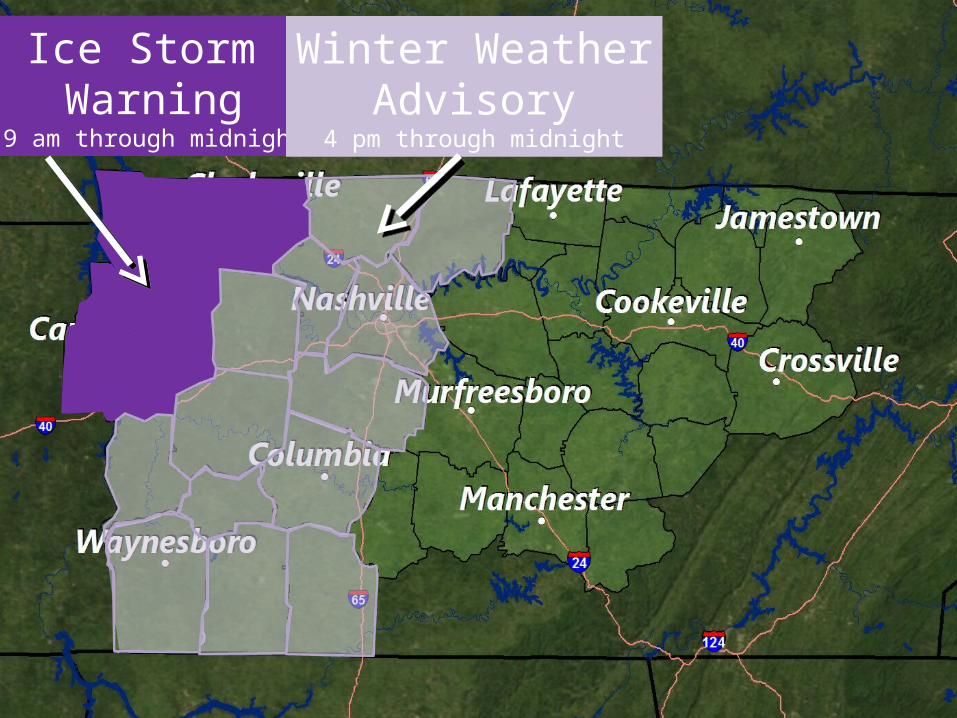
Ice Storm Warning
9 am through midnight
Winter WeatherAdvisory
4 pm through midnight
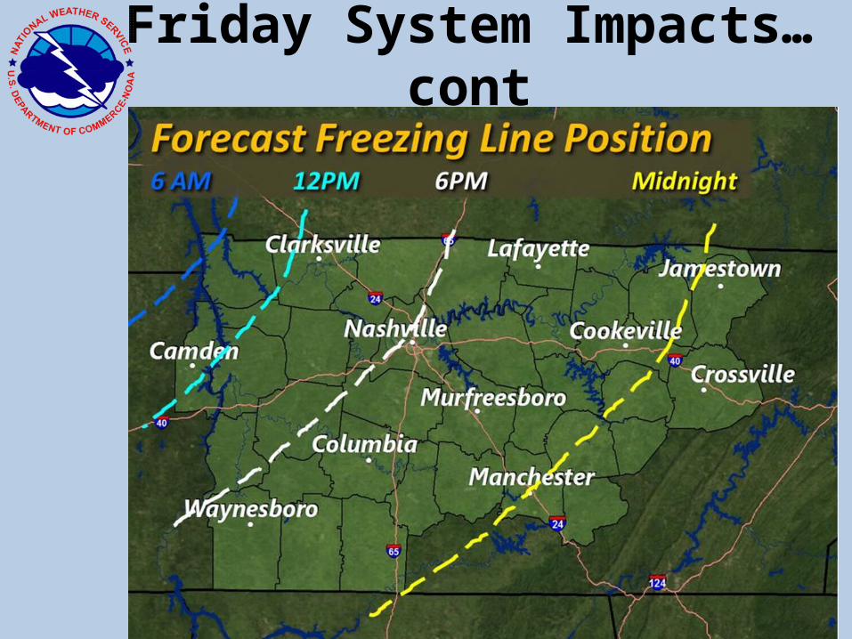
Friday System Impacts…cont
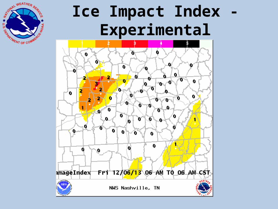
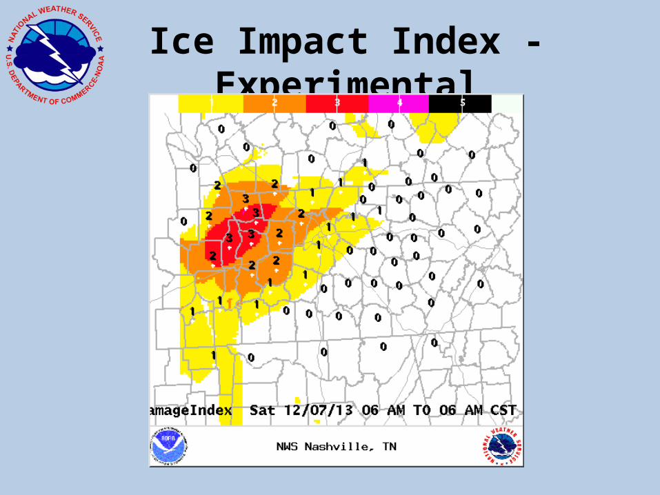
Ice Impact Index - Experimental
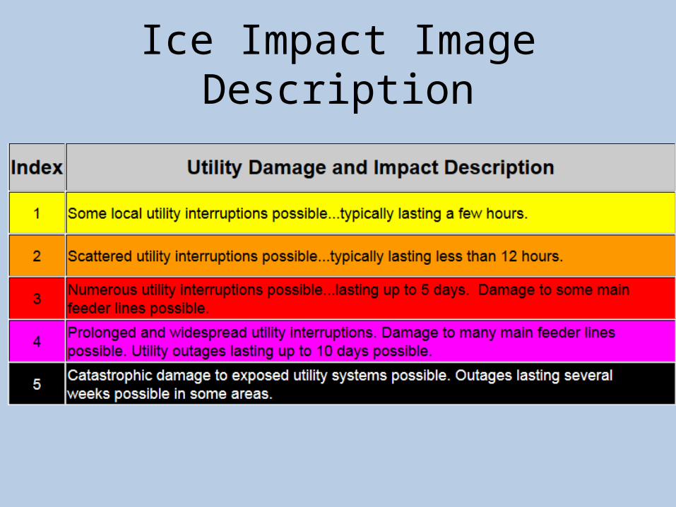
Ice Impact Image Description
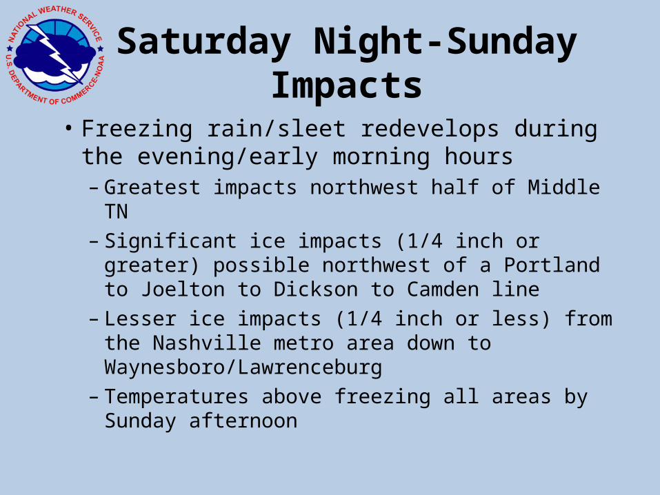
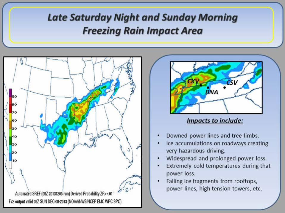
Saturday Night-Sunday Impacts
• Freezing rain/sleet redevelops during the evening/early morning hours– Greatest impacts northwest half of Middle TN– Significant ice impacts (1/4 inch or greater) possible
northwest of a Portland to Joelton to Dickson to Camden line
– Lesser ice impacts (1/4 inch or less) from the Nashville metro area down to Waynesboro/Lawrenceburg
– Temperatures above freezing all areas by Sunday afternoon
Saturday Night-Sunday
Ice Impact Index - Experimental
Heavy Rain/Flooding Impacts
• Locally heavy rains possible today into Friday – especially southeastern 2/3 of Middle TN– 2 to 3 inches of rain expected– Localized flooding problems possible
• Break in the rainfall on Saturday• More heavy rain potential on Sunday
– Greatest potential again southeast half– 1 to locally 2 inches possible– Localized creek flooding and minor river flooding possible
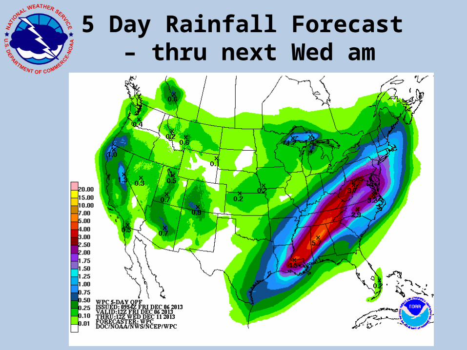
5 Day Rainfall Forecast – thru next Wed am
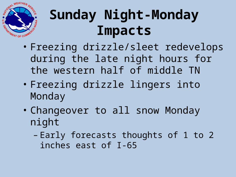
Sunday Night-Monday Impacts
• Freezing drizzle/sleet redevelops during the late night hours for the western half of middle TN
• Freezing drizzle lingers into Monday • Changeover to all snow Monday night
– Early forecasts thoughts of 1 to 2 inches east of I-65
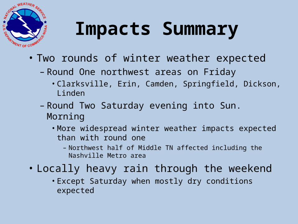
Impacts Summary
• Two rounds of winter weather expected – Round One northwest areas on Friday
• Clarksville, Erin, Camden, Springfield, Dickson, Linden
– Round Two Saturday evening into Sun. Morning• More widespread winter weather impacts expected
than with round one– Northwest half of Middle TN affected including the Nashville
Metro area
• Locally heavy rain through the weekend• Except Saturday when mostly dry conditions expected

Briefing at 430 am Friday
• https://www1.gotomeeting.com/register/347553992
• Call: 1.866.231.8384 code: 6157548500
16