Embed Size (px)
Citation preview

WALKABLELONDON

walkabilitysupports:
urbandensity
efficientmobility
communication
qualityoflife
health&fitness

competitiveedgeintheglobalmarketfordesirable
locationsforhighvaluejobsincreativebusinesses

proposition:afullnetworkofpedestrianlinesacrossallofLondon
ratherthanascatterofisolatedpedestrianprecincts

LeicesterSquare
CoventGarden

Carnaby Street
TrafalgarSquarebeforeandafterpedestrianising in2003

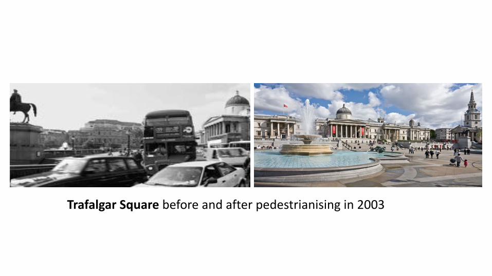
EverySundayinJulyRegentStreetisbanningtrafficforthepopularSummerStreetsseries.Themonth-longeventcombinesthemesofculture,styleandwellnesswithfoodanddrink.
Eventsincludelivemusic,family-friendlypop-upsandworkshops.
Details:http://www.regentstreetonline.com/events/summer-streets
57%
98%
increaseinfootfall
visitorapproval

RegentStreet
RegentStreet

Exhibition Road in South Kensington before and after the 2012 renovation, London, UK

KensingtonHighStreetisregardedasoneofLondon’spremiershoppingareas.In2000theRoyalBoroughofKensingtonandChelseastartedamajorimprovementschemethatincluded:
•Simplifiedroadmarkings
•Recalculationoftrafficsignaltimings
•Introductionofadditionalpedestriancrossings
•Replacingexistingstaggeredpedestriancrossingswithstraightacrosscrossings
•Wideningoffootwaysandnarrowingofcarriageway
•Introductionofnewpaving,treesandimprovedcycleparkingfacilities
•Removalofstreetclutterandguardrailing.
Kensington High Street, London, UKData:AReviewofSimplifiedStreetscapeSchemes.Preparedfor:TransportforLondon,StreetManagement.2006//http://content.tfl.gov.uk/review-of-simplified-streetscape-schemes.pdf

OxfordStreet,OxfordCircus


OxfordStreet,OxfordCircus

OxfordStreet,OxfordCircus

OxfordStreet

OxfordStreet

Knyaz Aleksandar I,Plovdiv,Bulgaria— 1.5km
Istiklal Street,Istanbul,Turkey— 1.4km
Longest
Pedestrian
Streets

Zhongyang dajie,Harbin,China— 1.4km
Longest
Pedestrian
Streets
Königstraße,Stuttgart,Germany— 1.2km

Regent'sCanal:fromPaddingtontoLimehouse 13.7km(8.5miles)
myepiphany

efficientmobility

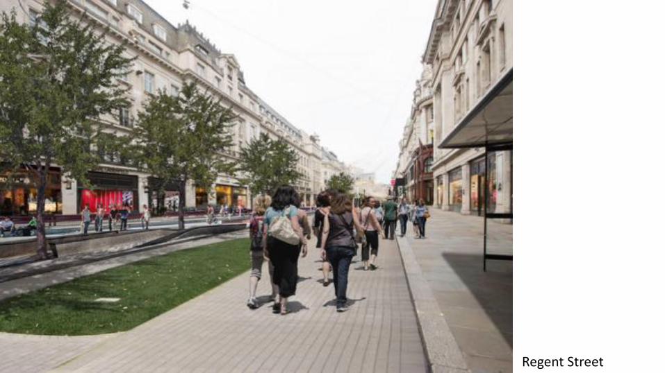
HighLinePark,NewYorkCity,U.S.
HighLinePark,NewYorkCity,U.S.
efficientmobility
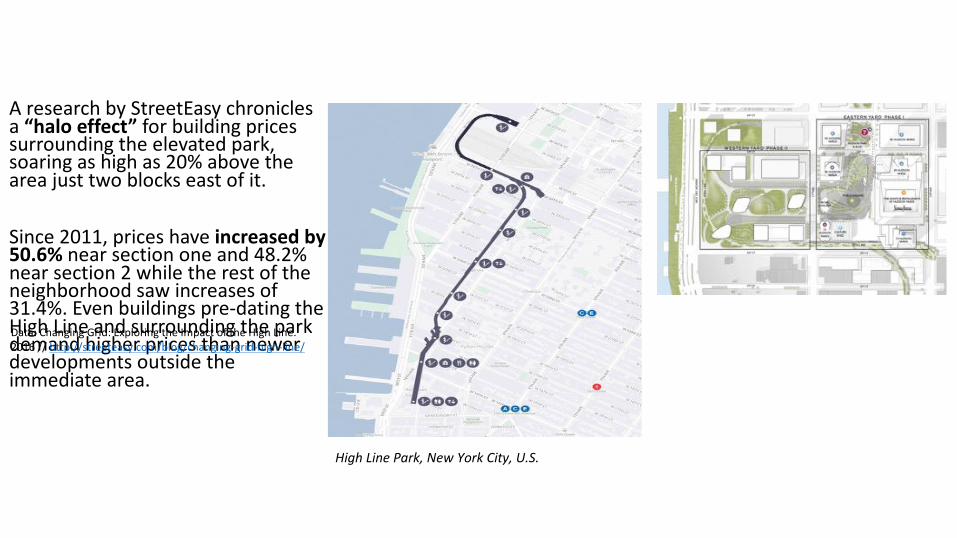
AresearchbyStreetEasy chroniclesa“haloeffect”forbuildingpricessurroundingtheelevatedpark,soaringashighas20%abovetheareajusttwoblockseastofit.
Since2011,priceshaveincreasedby50.6%nearsectiononeand48.2%nearsection2whiletherestoftheneighborhoodsawincreasesof31.4%.Evenbuildingspre-datingtheHighLineandsurroundingtheparkdemandhigherpricesthannewerdevelopmentsoutsidetheimmediatearea.
HighLinePark,NewYorkCity,U.S.
Data:ChangingGrid:ExploringtheImpactoftheHighLine.2016//http://streeteasy.com/blog/changing-grid-high-line/

ThePromenadeplantée isanextensivegreenbeltthatfollowstheoldVincennesrailwayline.BeginningjusteastoftheOpéra BastillewiththeelevatedViaduc desArts,itfollowsa4.7km(2.9mi)patheastward.
AtitswestendneartheBastille,theparkwayrises10mabovethesurroundingareaandformstheViaduc desArts,overalineofshopsfeaturingartsandcrafts.Theshopsarelocatedinthearchesoftheformerelevatedrailwayviaduct,withtheparkwaybeingsupportedatoptheviaduct.
ThePromenadeplantée,Paris,France

26
T E M P O R A RY P E D E S T R I A N I S AT I O N S
Paris – Summerembankmentpedestrianisation
ParisclosesanimportantembankmentroadduringthesummertocreateabeachalongtheSeine.
NewYork– SummerStreets
NewYorkSummerStreetsranfrom2013onthreesuccessiveSaturdaysofAugust,closingstreetsfrom7:00-13:00.
6.5miles
Car-free Champs-Elysees, Paris


WestEnd

WestEnd
City

WestEnd
City

WestEnd
City

WestEnd
City
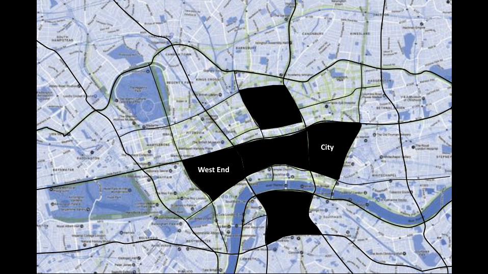
WestEnd
City

45
A N A LY S I N G B E N E F I T S A N D C H A L L E N G E S

46
I M PA C T O N C O M M E R C I A L R E N TA L P R I C E S
£47.5
to
£78.5
£49.5
to
£65
£50
to
£67.5
£52
to
£75
£60
to
£90
£70
to
£120
£55to
£80
£50to
£60
£47.5
to
£72.5
£47.5
to
£57.5
£37to
£47.5
Nonprime
to
Prime
*SummerStreetsbyRegentStreet,2013
?%Increaseindemandforcommercialproperty?
28% Increaseintrade*
Low High
Commercialrentalprice£/sq.ft.(source:MorganPryce)

47
P E D E S T R I A N I S E D R O U T E S T O U N D E R G R O U N D S TAT I O N S
0m 1000m
Pedestrianisedwalkingdistancetoneareststation
Pedestrianisedclusters
88%within1kmpedestrianonlyroutetoanundergroundstation
LondonUndergroundstation
65% within500m
27% within250m

48
P E D E S T R I A N I S E D A R E A S A F F E C T I N G B U S R O U T E S
Connectivitygrid
Pedestrianisedclusters
Londonbusroutes
ToencouragepedestrianstouseawalkableLondon,theirjourneystothepedestrianisedclustersmustbesmoothanduntroubled.
Whatistheimpactontheestablishedbusnetworkintheseareas?

49*SummerStreetsbyRegentStreet,2013
R O A D T R A F F I C A C C I D E N T S
0 High
Incidenceofroadtrafficcollisions,2015data
Pedestrianisedclusters
SomeofthehighestincidenceofvehiclecollisionsinvolvingcasualtiesarefoundintheOxfordStreet/Sohoarea.
87% Smoothtraveljourneys*
“Slightlyhighertrafficlevelson”neighbouringstreets*

50
A I R Q U A L I T Y
<16 >97
AnnualmeanNO2 airpollutionfor2013,(µg/m3)
Pedestrianisedclusters
CityofWestminsterEnvironmentalStudyofSummerStreetsfound
“significantlybetterairqualityonRegentStreet”
onpedestrianonlydayswhencomparedtonormaldays.
TheproposedpedestrianareasincludesomeofthemostpollutedinLondon.


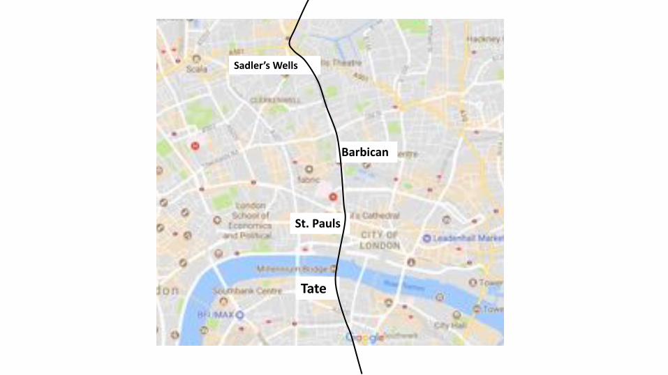
Tate
St.Pauls
Barbican
Sadler’sWells


AldersgateStreet

Goswell RoadZahaHadidDesignGallery


UpperStreet

UpperStreet

UpperStreet


Blackstock Road

Blackstock Road

Blackstock Road

EustonRoadUnderpass,London,UK
AnunderpasstoavoidthejunctionwithTottenham CourtRoadwasproposedin1961,withconstructiontakingplacein1964.
Intheearly2000’s,theGreaterLondonAuthoritycommissionedaplantoimprovetheroadfromthearchitecturalfirm,TerryFarrellandPartners.Theoriginalstudyproposedremovingtheunderpass(whichwassubsequentlycancelled)andprovidingapedestriancrossingandremovingthegyratorysystemconnectingTottenham CourtRoadandGowerStreet.
TheschemewasapprovedbytheMayorofLondon,KenLivingstoneas “thestartofchangingtheMarylebonetoEustonroadfrom
ahighwayintoaseriesoflinkedpublicspaces.”ThepedestriancrossingopenedinMarch2010.
.
EustonRoad

BigDig,Boston,U.S.
TheCentralArtery/TunnelProject(CA/T),knownastheBigDig,wasamegaprojectinBostonthatreroutedtheCentralArteryofInterstate93,thechiefhighwaythroughtheheartofthecity,intothe3.5-mile (5.6km)ThomasP.O'NeillJr.Tunnel.
TheprojectalsoincludedtheconstructionoftheTedWilliamsTunnel(extendingInterstate90toLoganInternationalAirport),theLeonardP.Zakim BunkerHillMemorialBridge,andtheRoseKennedyGreenway inthespacevacatedbythepreviousI-93elevatedroadway.
Data:BostonGlobe. BigDig'sredinkengulfsstate.2008//https://www.boston.com/boston-traffic


LasRamblas,Barcelona,Spain