Embed Size (px)
Citation preview
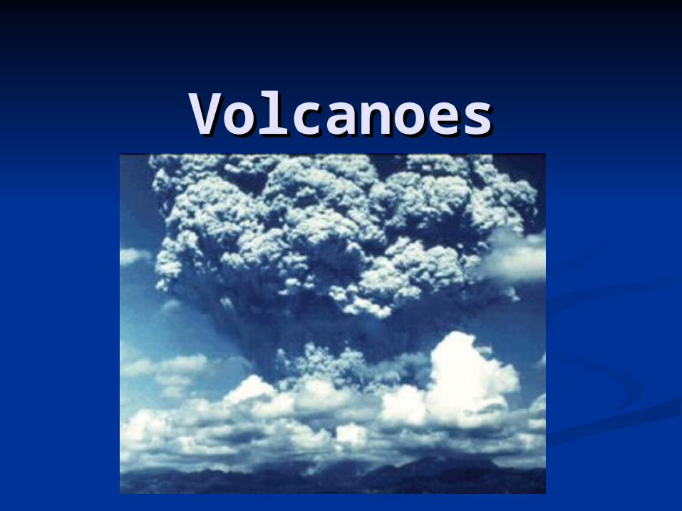
VolcanoesVolcanoes
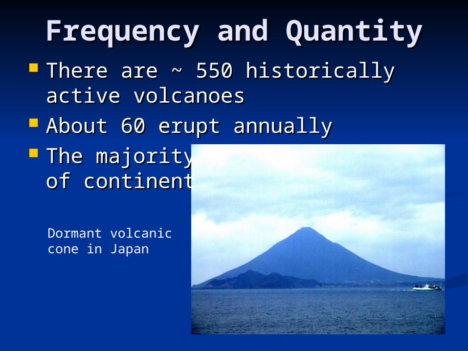
Frequency and QuantityFrequency and Quantity There are ~ 550 historically active There are ~ 550 historically active
volcanoesvolcanoes About 60 erupt annuallyAbout 60 erupt annually The majority are 1) at the edge of The majority are 1) at the edge of
continents and 2) underwatercontinents and 2) underwater
Dormant volcanic cone in Japan
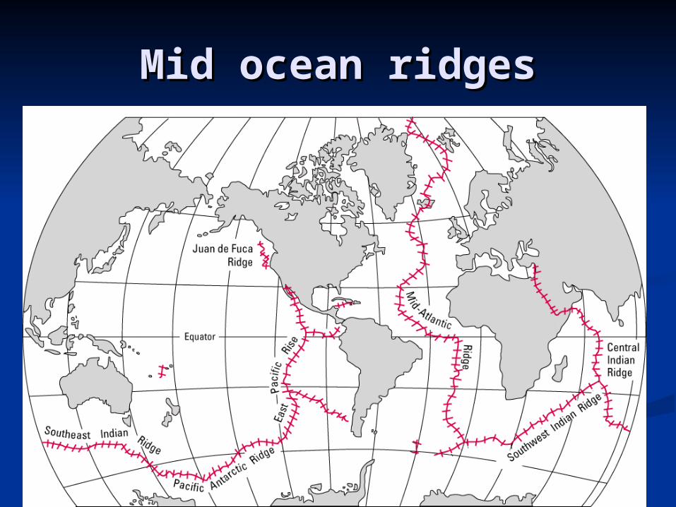
Mid ocean ridgesMid ocean ridges
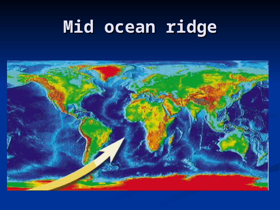
Mid ocean ridgeMid ocean ridge
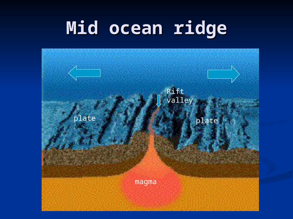
Mid ocean ridgeMid ocean ridge
Rift valley
magma
plate plate
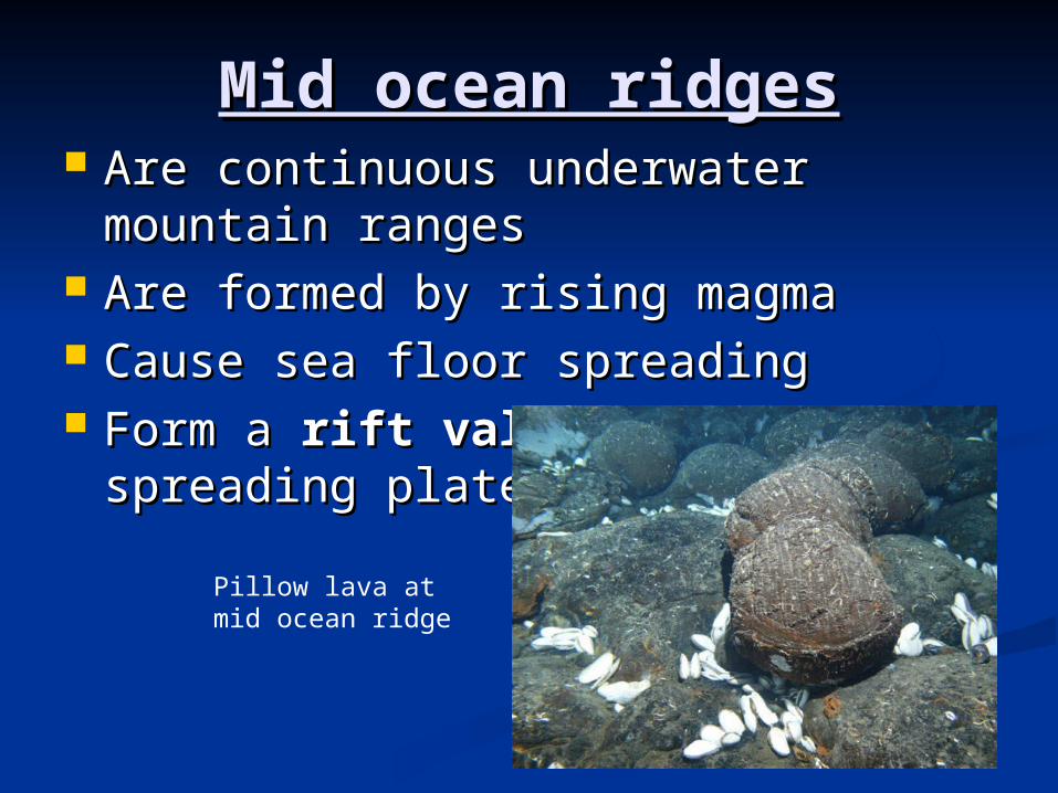
Mid ocean ridgesMid ocean ridges Are continuous underwater Are continuous underwater
mountain rangesmountain ranges Are formed by rising magmaAre formed by rising magma Cause sea floor spreadingCause sea floor spreading Form a Form a rift valley rift valley between between
spreading platesspreading plates
Pillow lava at mid ocean ridge
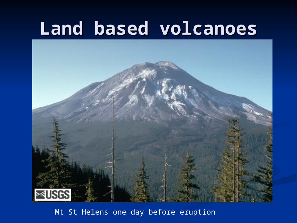
Land based volcanoesLand based volcanoes
Mt St Helens one day before eruption
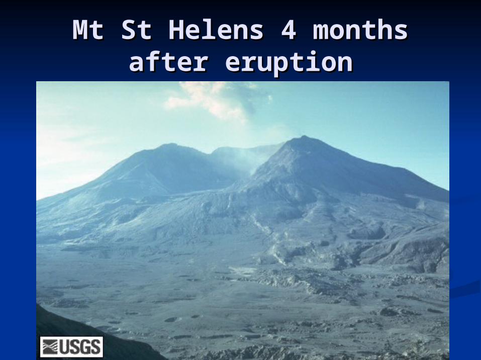
Mt St Helens 4 months Mt St Helens 4 months after eruptionafter eruption
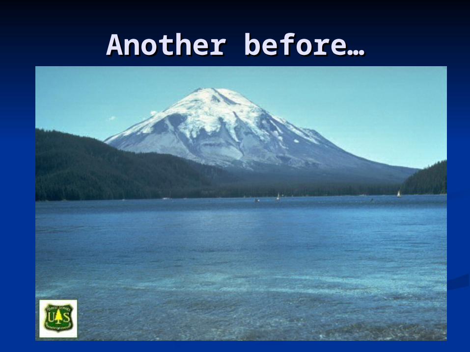
Another before…Another before…
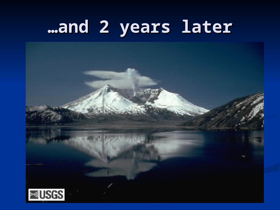
……and 2 years laterand 2 years later
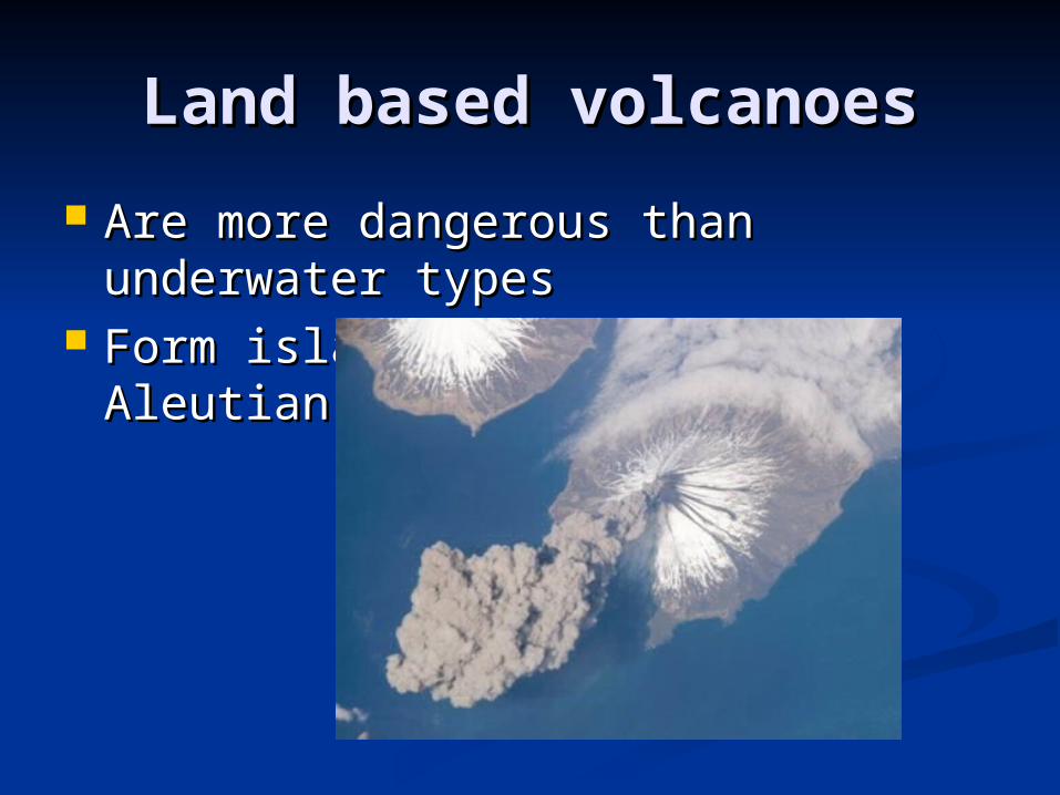
Land based volcanoesLand based volcanoes
Are more dangerous than Are more dangerous than underwater typesunderwater types
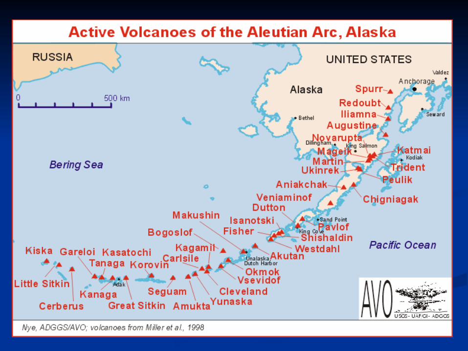
Form island chains like the Aleutian Form island chains like the Aleutian islands off Alaskaislands off Alaska
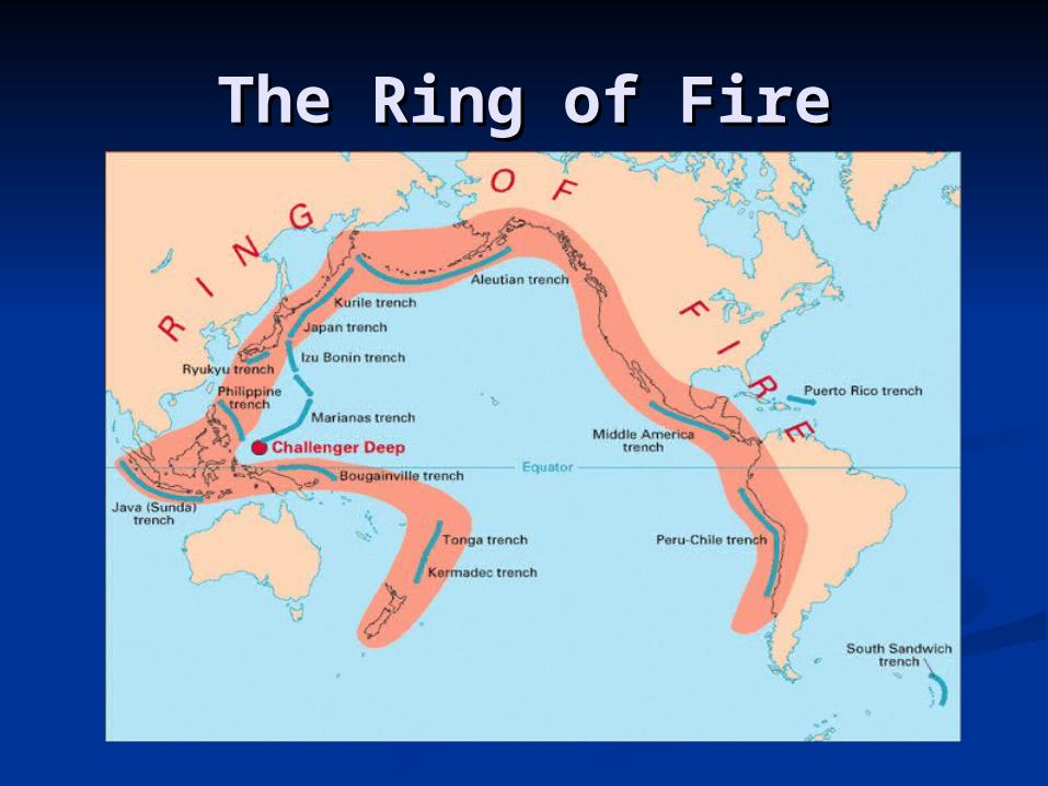
The Ring of FireThe Ring of Fire
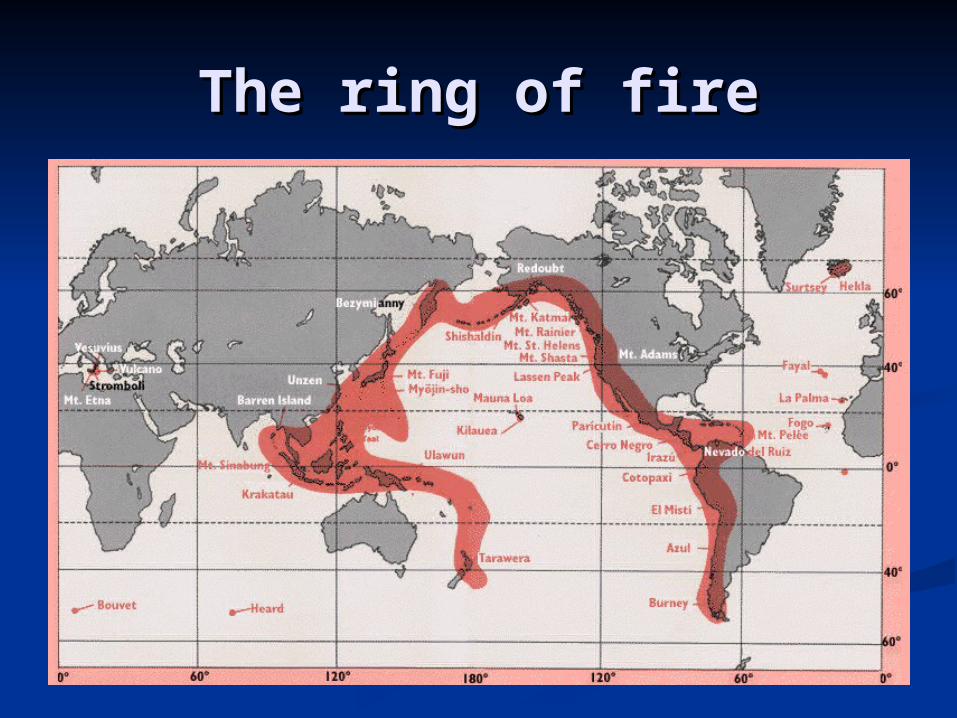
The ring of fireThe ring of fire
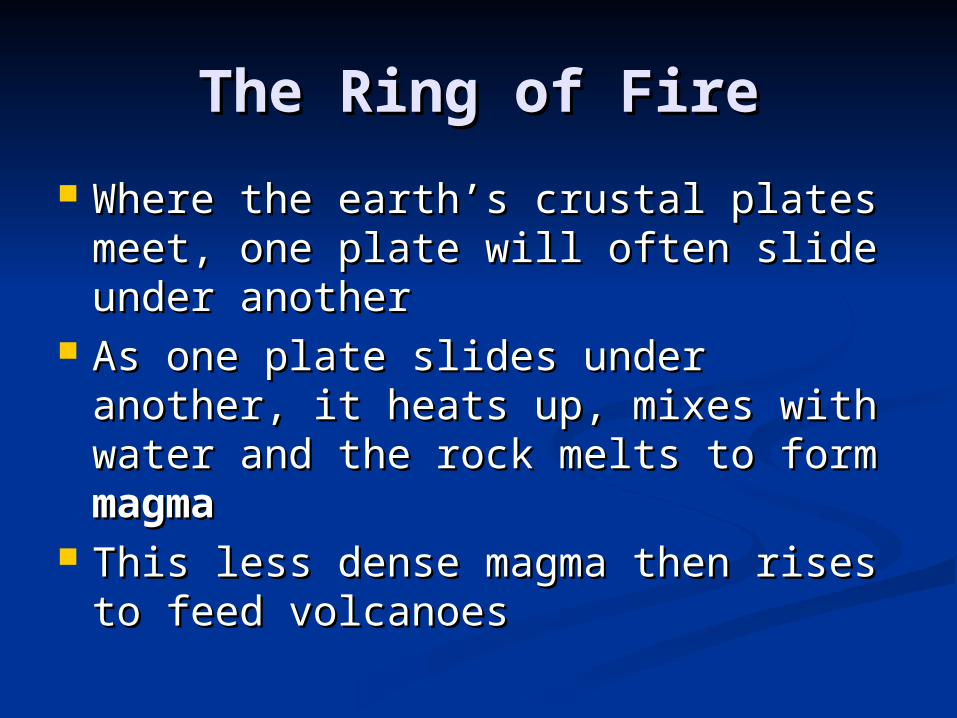
The Ring of FireThe Ring of Fire
Where the earth’s crustal plates Where the earth’s crustal plates meet, one plate will often slide meet, one plate will often slide under anotherunder another
As one plate slides under another, it As one plate slides under another, it heats up, mixes with water and the heats up, mixes with water and the rock melts to form rock melts to form magmamagma
This less dense magma then rises to This less dense magma then rises to feed volcanoesfeed volcanoes
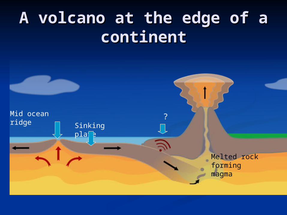
A volcano at the edge of a A volcano at the edge of a continentcontinent
Sinking plate
Mid ocean ridge
Melted rock forming magma
?

Rift valleys and Rift valleys and volcanoesvolcanoes
Valley forms hereOutward
spreading
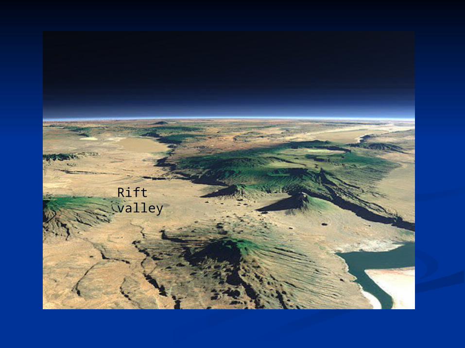
Rift valleysRift valleys
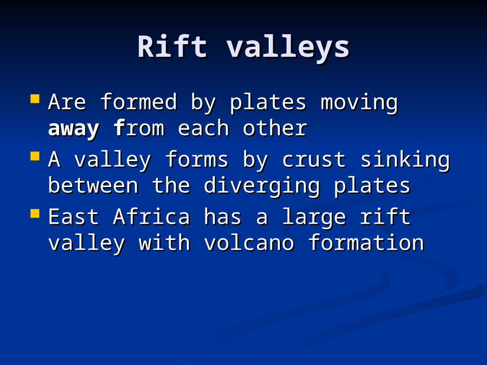
Are formed by plates moving Are formed by plates moving away away ffrom each otherrom each other
A valley forms by crust sinking A valley forms by crust sinking between the diverging platesbetween the diverging plates
East Africa has a large rift valley East Africa has a large rift valley with volcano formationwith volcano formation
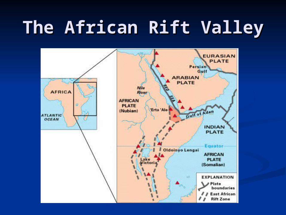
The African Rift ValleyThe African Rift Valley
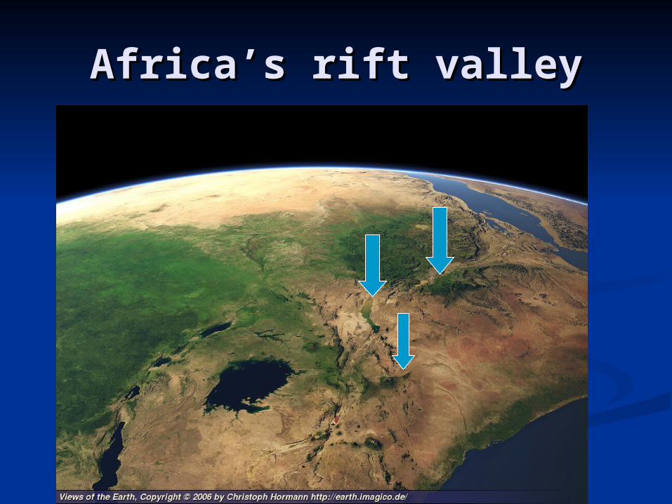
Africa’s rift valleyAfrica’s rift valley
Rift valley
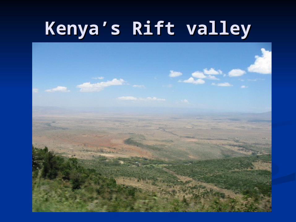
Kenya’s Rift valleyKenya’s Rift valley
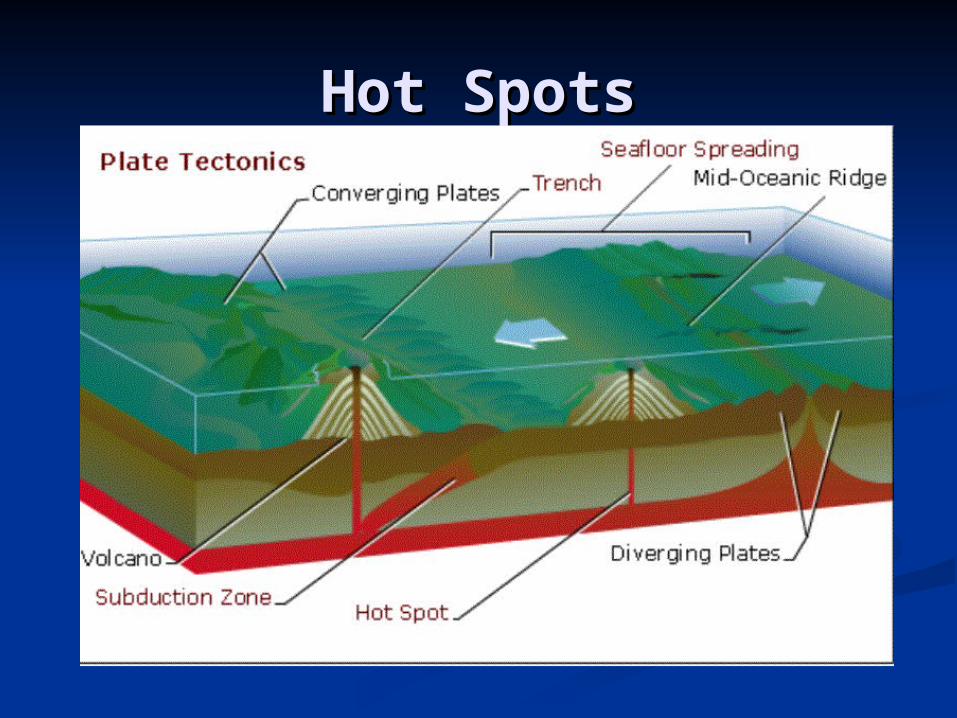
Hot SpotsHot Spots
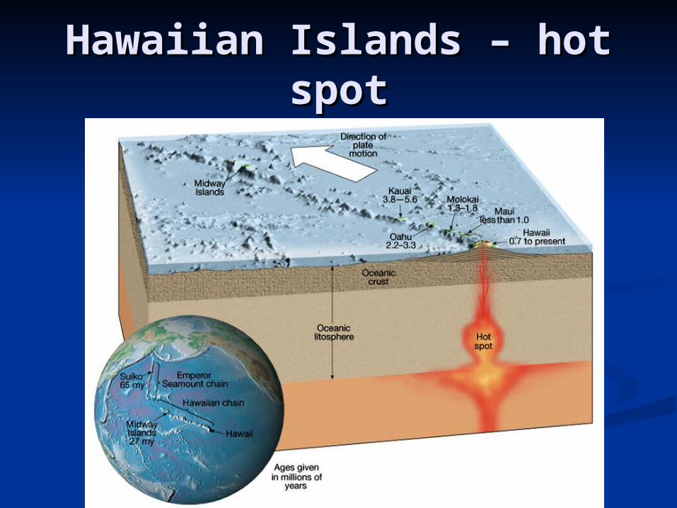
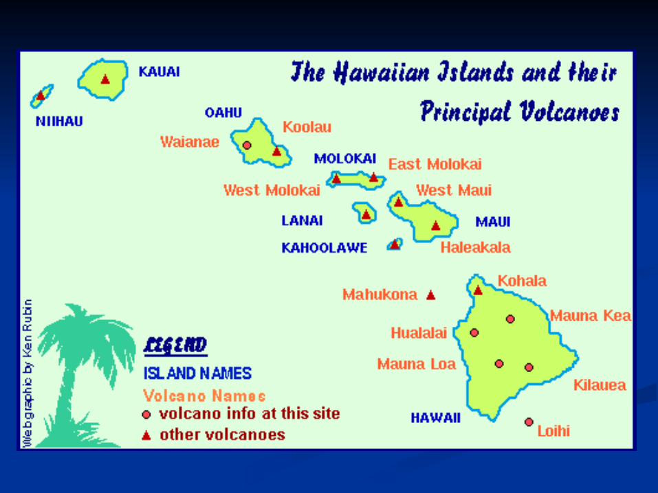
Hawaiian Islands – hot Hawaiian Islands – hot spotspot
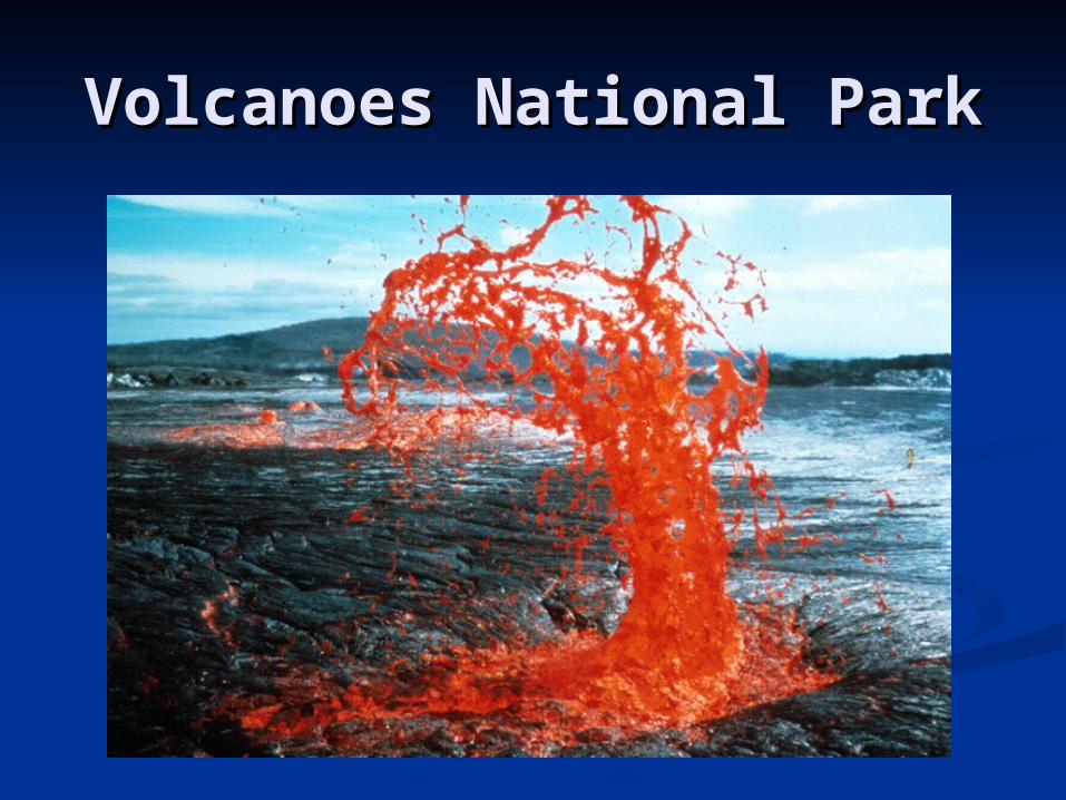
Volcanoes National ParkVolcanoes National Park
Hot SpotsHot Spots
A A hot spot hot spot is a fixed source of is a fixed source of abundant rising magmaabundant rising magma
As a plate moves over the hot spot, As a plate moves over the hot spot, magma forms undersea volcanoes; magma forms undersea volcanoes; some of which rise above the ocean some of which rise above the ocean surface forming island chains surface forming island chains
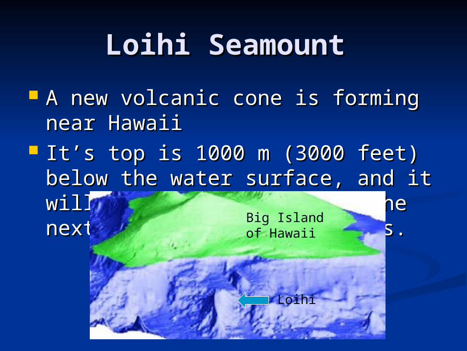
Loihi Seamount Loihi Seamount
A new volcanic cone is forming near A new volcanic cone is forming near HawaiiHawaii
It’s top is 1000 m (3000 feet) below It’s top is 1000 m (3000 feet) below the water surface, and it will break the water surface, and it will break the surface in the next 10,000 to the surface in the next 10,000 to 100,000 years.100,000 years.
Big Island of Hawaii
Loihi
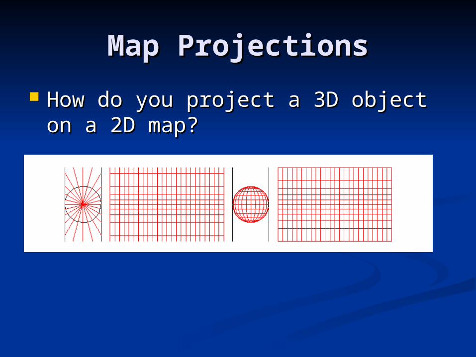
Map ProjectionsMap Projections
How do you project a 3D object on a How do you project a 3D object on a 2D map?2D map?
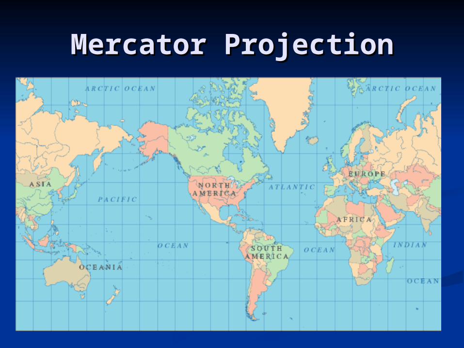
Mercator ProjectionMercator Projection
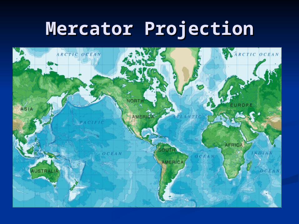
Mercator ProjectionMercator Projection
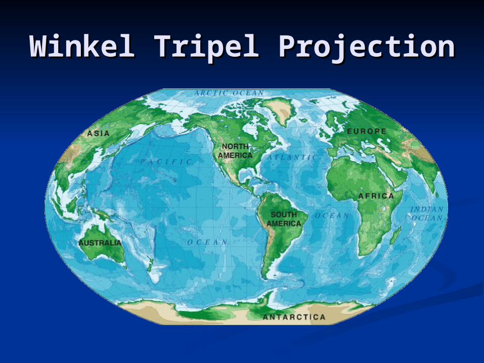
Winkel Tripel Projection Winkel Tripel Projection
Maps of the EarthMaps of the Earth Cartography Cartography is the science and art of is the science and art of
graphically representing a defined graphically representing a defined geographical area by means of a map. geographical area by means of a map.
First off, the earth is round and maps are First off, the earth is round and maps are flatflat
Map projections are ways of flattening a Map projections are ways of flattening a round earth into a useful picture; the round earth into a useful picture; the resulting picture is distortedresulting picture is distorted
There is always distortion and There is always distortion and compromises in accurately making a mapcompromises in accurately making a map