Embed Size (px)
Citation preview
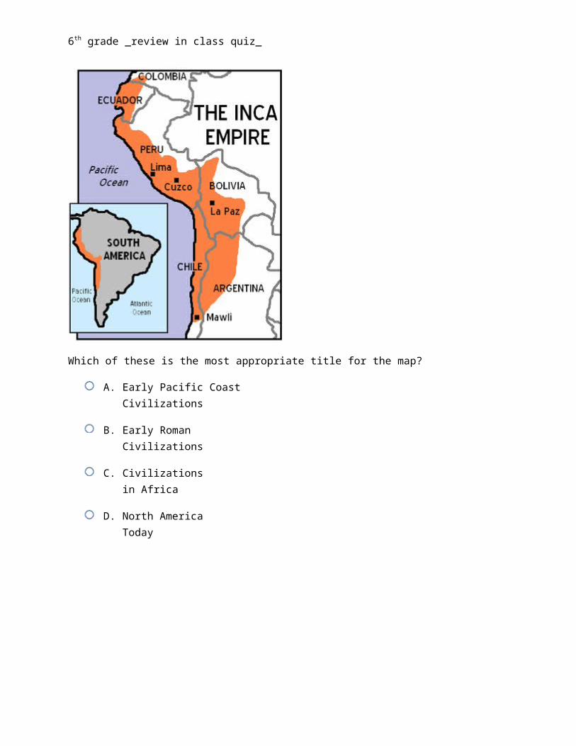
6th grade _review in class quiz_
Which of these is the most appropriate title for the map?
A. Early Pacific Coast Civilizations
B. Early Roman Civilizations
C. Civilizations in Africa
D. North America Today
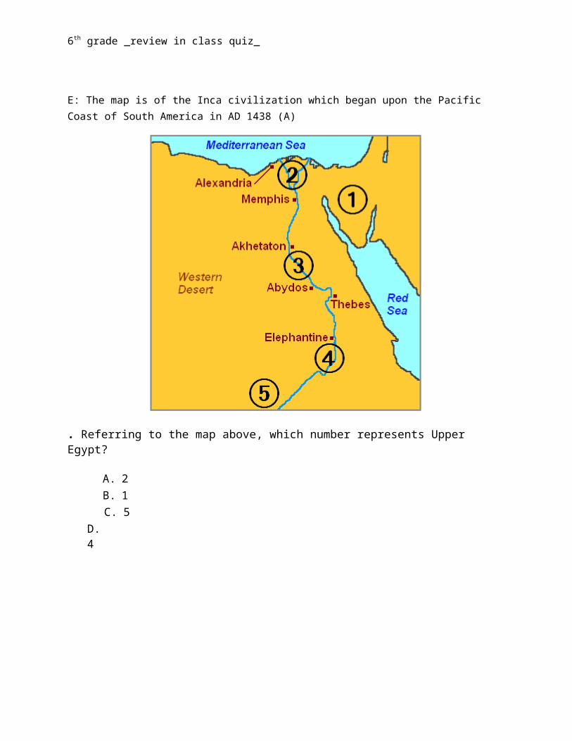
E: The map is of the Inca civilization which began upon the Pacific Coast of South America in AD 1438 (A)
6th grade _review in class quiz_
. Referring to the map above, which number represents Upper Egypt?
A. 2 B. 1 C. 5 D.4
E: Upper Egypt is shown as the number 4 on the map. Upper Egypt refers to the higher elevations of the Nile River and not the northern reaches of the river.
D
6th grade _review in class quiz_
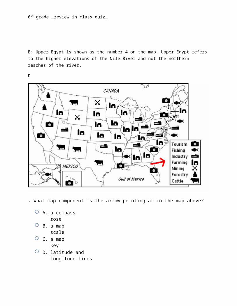
. What map component is the arrow pointing at in the map above?
A. a compass rose B. a map scale C. a map key D. latitude and longitude lines
6th grade _review in class quiz_
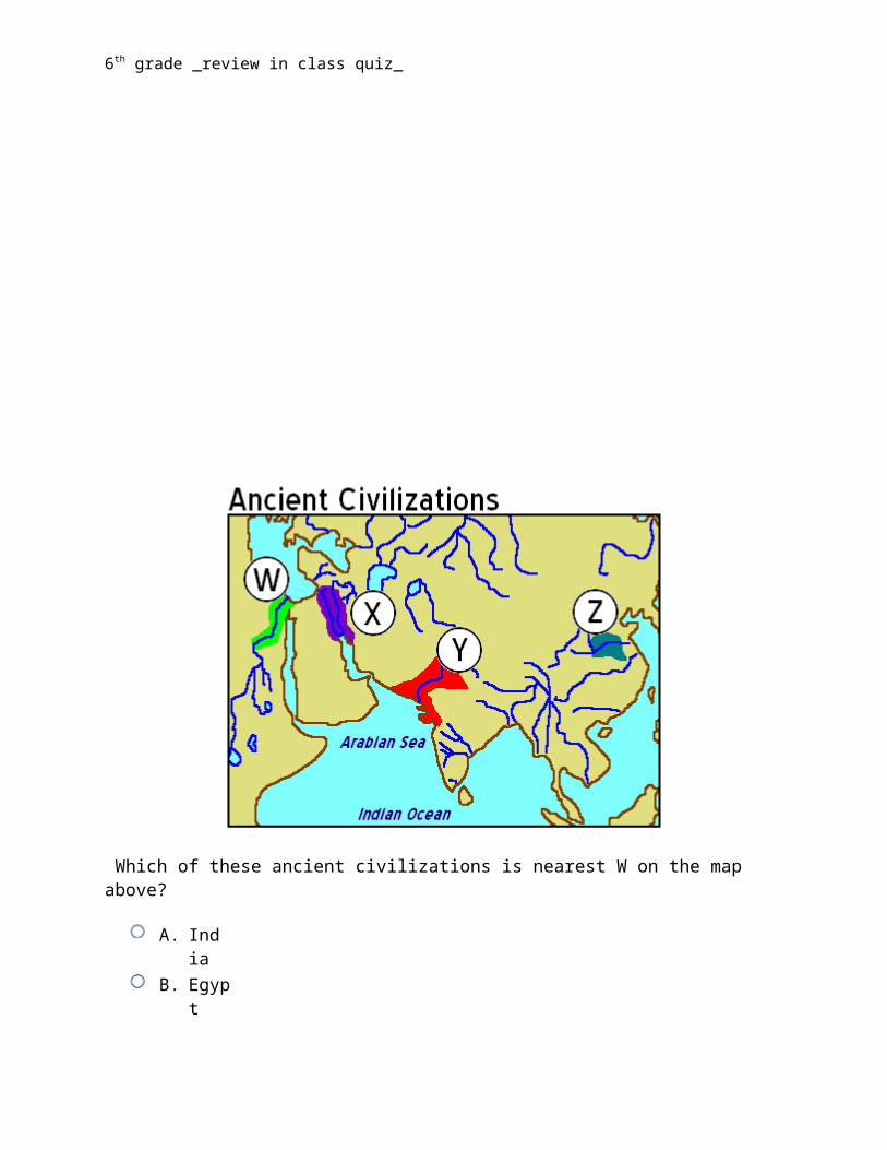
Which of these ancient civilizations is nearest W on the map above?
A. India B. Egypt C. Russia D. China
Ancient Egypt was located along the Nile River and is represented by W on the map above. Cairo is just one of many ancient cities remaining in modern day Egypt.
6th grade _review in class quiz_
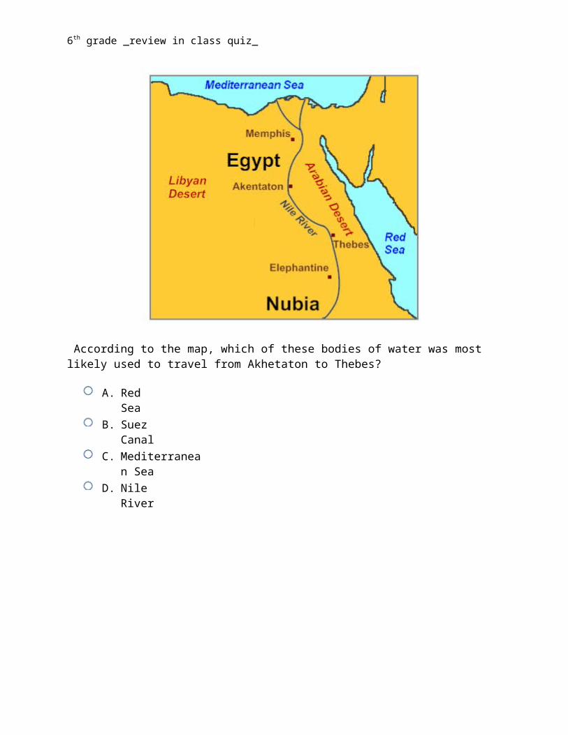
According to the map, which of these bodies of water was most likely used to travel from Akhetaton to Thebes?
A. Red Sea B. Suez Canal C. Mediterranean Sea D. Nile River
The Nile was the lifeline of the ancient Egyptian civilization, with most of the population and cities of Egypt resting along those parts of the Nile valley lying north of Aswan.
6th grade _review in class quiz_
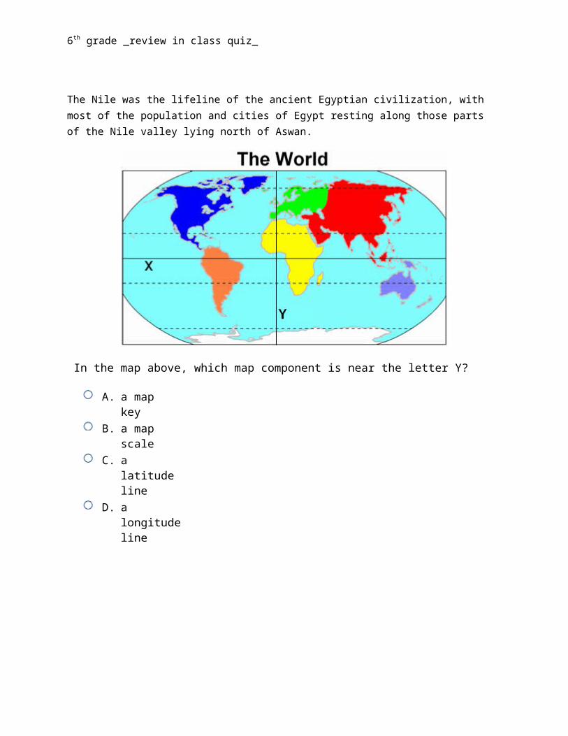
In the map above, which map component is near the letter Y?
A. a map key B. a map scale C. a latitude line D. a longitude line
Letter Y is near the Prime Meridian, which is a line of longitude. Latitude and longitude are the two grid coordinates by which you can locate any point on Earth. Longitude lines run north to south on maps of the Earth. They divide the globe into 360 equal slices.
6th grade _review in class quiz_
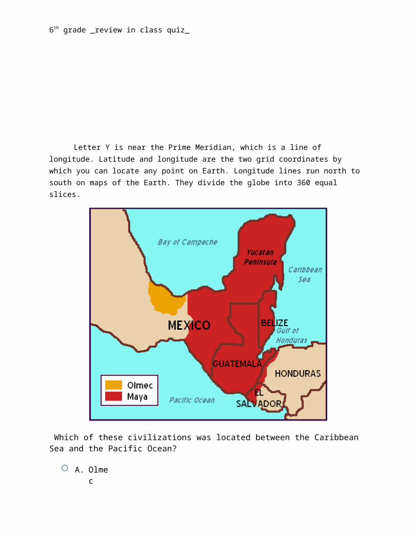
Which of these civilizations was located between the Caribbean Sea and the Pacific Ocean?
A. Olmec B. Honduras C. Mayan D. Mexican
The Mayan civilization is a historical civilization, which extended throughout the northern region of Central America. The Maya's main crop was corn, which grew upon both the coast of the Pacific Ocean and the Caribbean Sea
6th grade _review in class quiz_
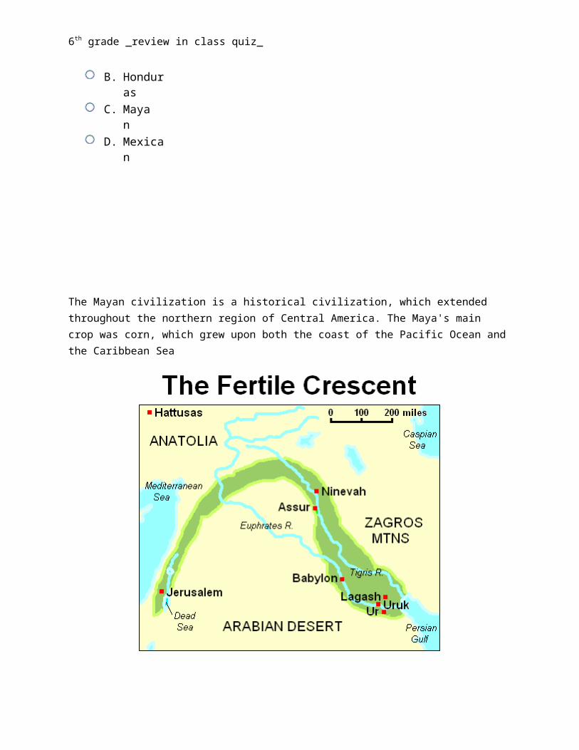
Which of these is the most likely reason for the map to be called "The Fertile Crescent"?
A. The highlighted land contained Mesopotamia where there were many babies born. B. The highlighted land is known for wheat and other bread producing crops. C. The highlighted land is located in the Arabian Desert and sand is naturally fertile.
D. The highlighted land is perfect for growing crops due to the abundance of water.
The Fertile Crescent was mostly located in the area between and around the Tigris and Euphrates Rivers. The land was extremely fertile due to sediments and soil deposited from the rivers.
6th grade _review in class quiz_
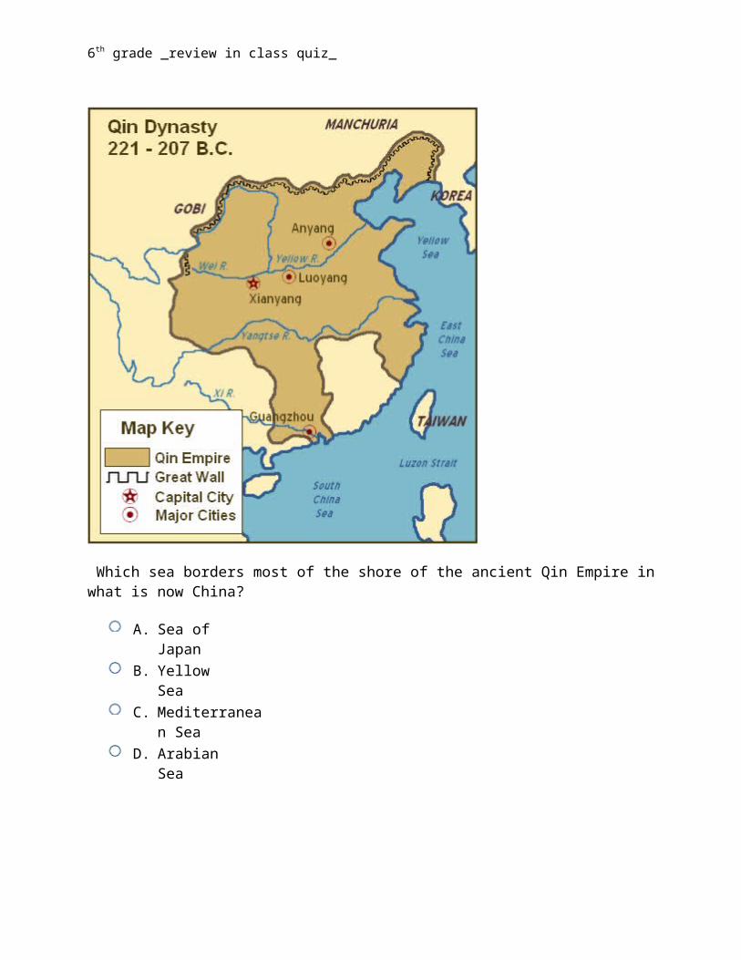
Which sea borders most of the shore of the ancient Qin Empire in what is now China?
A. Sea of Japan B. Yellow Sea C. Mediterranean Sea D. Arabian Sea
The Qin Empire is located in present day China, in the darkly shaded area on the map. The Yellow Sea borders much of the northeast and eastern shore of the Qin Empire.
6th grade _review in class quiz_
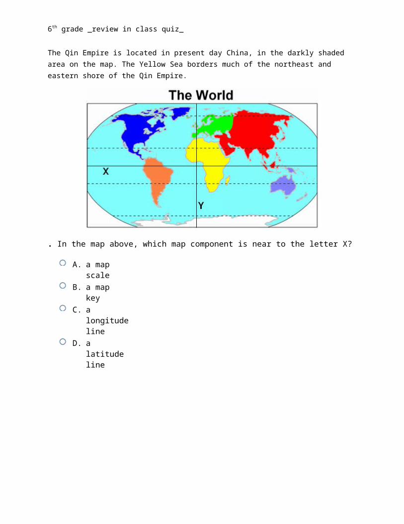
. In the map above, which map component is near to the letter X?
A. a map scale B. a map key C. a longitude line D. a latitude line
Letter X is near the Equator, which is a line of latitude. Latitude and longitude are the two grid coordinates by which you can locate any point on Earth. Latitude is measured in terms of degrees north and south from the Equator. (Any point on the Equator has a latitude of 0°)
6th grade _review in class quiz_
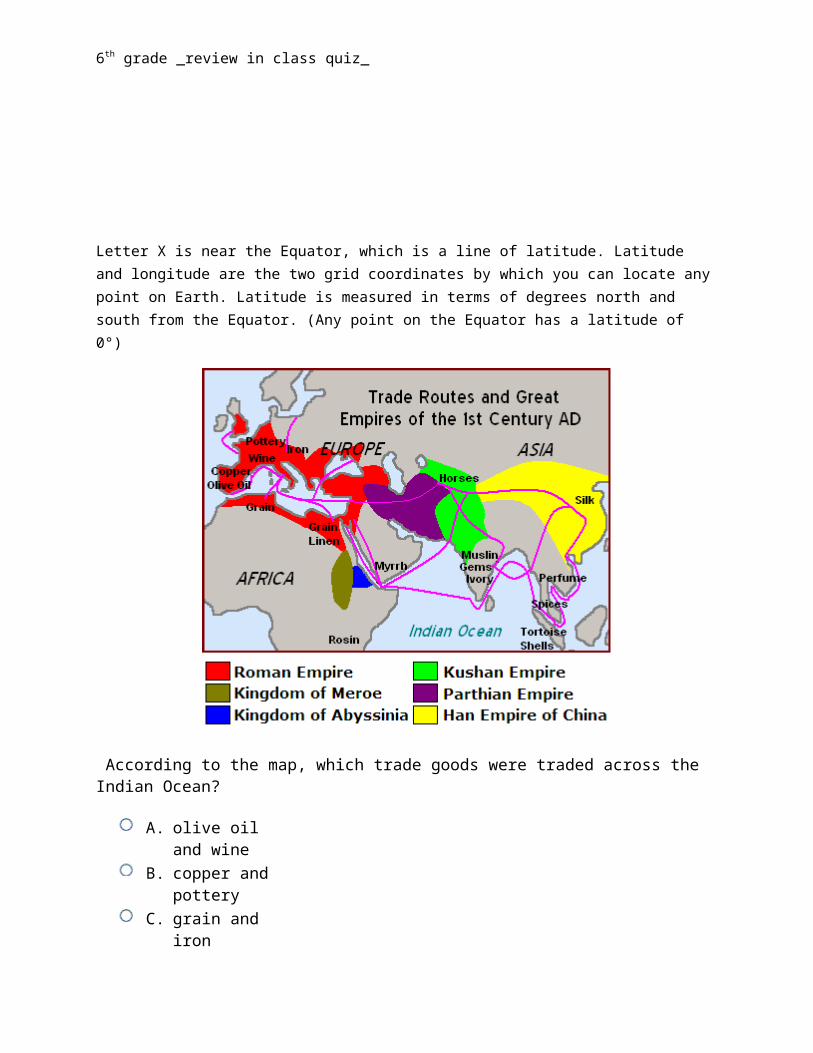
According to the map, which trade goods were traded across the Indian Ocean?
A. olive oil and wine B. copper and pottery C. grain and iron D. horses and myrrh
Horses were located in the part of the map labeled "Kushan Empire" on the east coast of the Indian Ocean, and myrrh was located in Arabia on the North West coast. Ships sailing across the Indian Ocean carried these products and allowed people to exchange these goods.
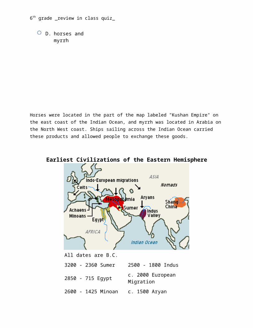
6th grade _review in class quiz_
Earliest Civilizations of the Eastern Hemisphere
All dates are B.C. 3200 - 2360 Sumer 2500 - 1800 Indus
2850 - 715 Egypt c. 2000 European Migration
2600 - 1425 Minoan c. 1500 Aryan Migration
2500 - 1700 Mesopotamian 1200 - 1445 Shang China
. According to the map, which of these early civilizations dipped the furthest south toward the Indian Ocean?
A. Minoans B. Mesopotamia C. Egypt D. Indus
The Indus Civilization was an ancient civilization along the Indus River, a tributary of the Indian Ocean, in what is now Pakistan and Northern India.
6th grade _review in class quiz_
Look at the map above. Which number represents the center of the region called Assyria?
A. 2 B. 1 C. 4 D. 3
The Assyrian culture was centered near Ninevah, number 2 on the map. The Assyrian influence stretched throughout the Fertile Crescent and into Egypt.
6th grade _review in class quiz_
KEY:
ADCBDDDCDBDDA Each questions explanation is right below the question, unless the answer is self-explanatory.