Embed Size (px)
Citation preview
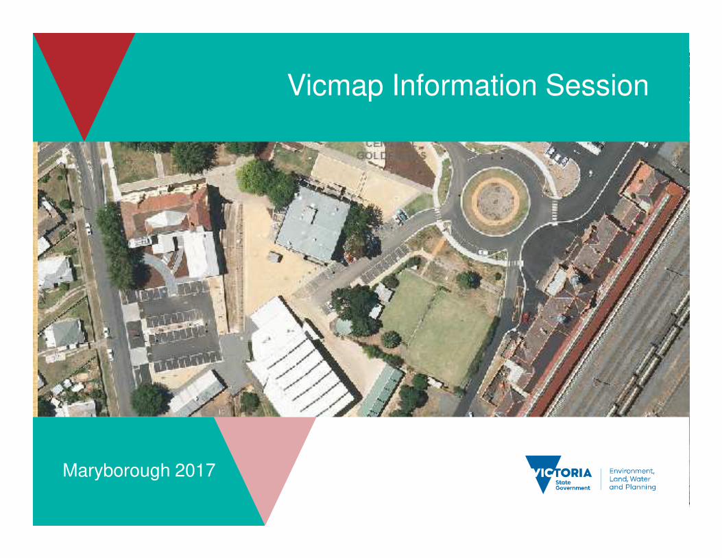
Vicmap Information Session
Maryborough 2017
2
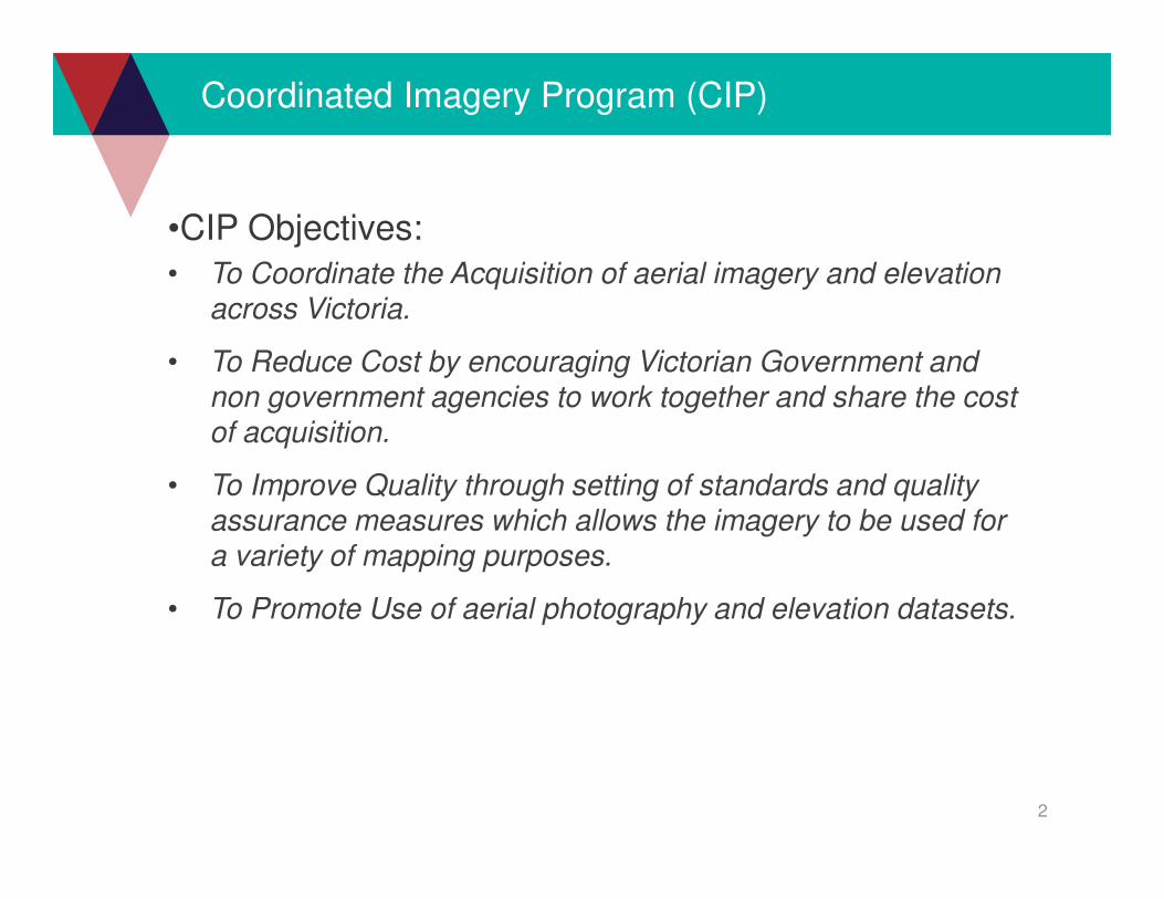
Coordinated Imagery Program (CIP)
•CIP Objectives:
• To Coordinate the Acquisition of aerial imagery and elevation across Victoria.
• To Reduce Cost by encouraging Victorian Government and non government agencies to work together and share the cost of acquisition.
• To Improve Quality through setting of standards and quality assurance measures which allows the imagery to be used for a variety of mapping purposes.
• To Promote Use of aerial photography and elevation datasets.
3
2016-17 Capture Program
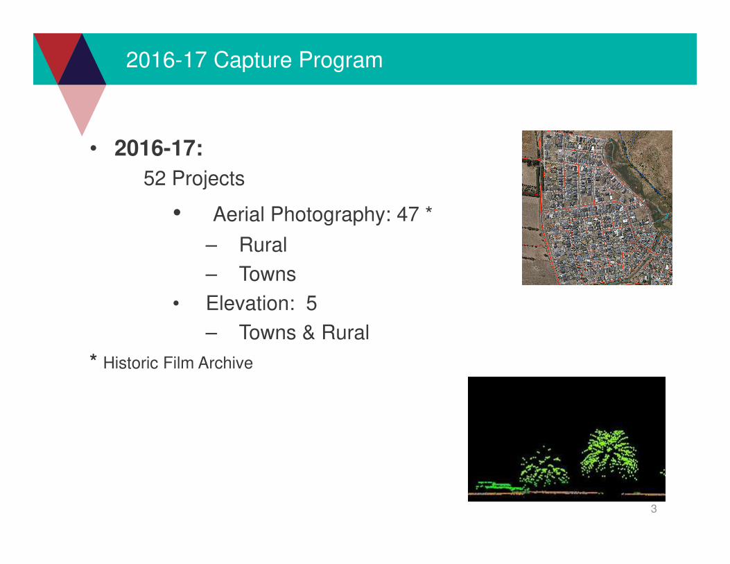
• 2016-17:
52 Projects
• Aerial Photography: 47 *
– Rural
– Towns
• Elevation: 5
– Towns & Rural
* Historic Film Archive

4
2016-17 Capture Program
5
2017-18 Capture Program
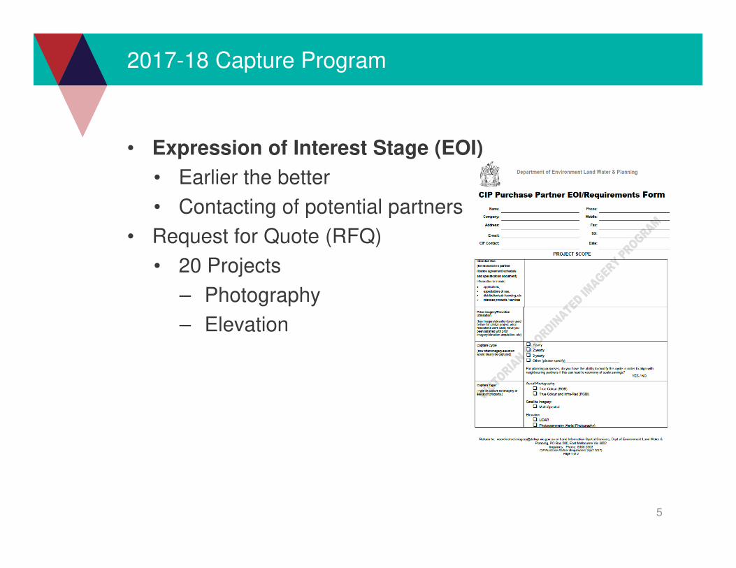
• Expression of Interest Stage (EOI)
• Earlier the better
• Contacting of potential partners
• Request for Quote (RFQ)
• 20 Projects
– Photography
– Elevation
6
2017-18 Capture Program
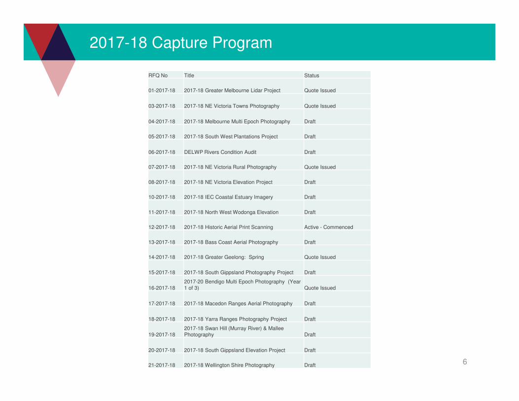
RFQ No Title Status
01-2017-18 2017-18 Greater Melbourne Lidar Project Quote Issued
03-2017-18 2017-18 NE Victoria Towns Photography Quote Issued
04-2017-18 2017-18 Melbourne Multi Epoch Photography Draft
05-2017-18 2017-18 South West Plantations Project Draft
06-2017-18 DELWP Rivers Condition Audit Draft
07-2017-18 2017-18 NE Victoria Rural Photography Quote Issued
08-2017-18 2017-18 NE Victoria Elevation Project Draft
10-2017-18 2017-18 IEC Coastal Estuary Imagery Draft
11-2017-18 2017-18 North West Wodonga Elevation Draft
12-2017-18 2017-18 Historic Aerial Print Scanning Active - Commenced
13-2017-18 2017-18 Bass Coast Aerial Photography Draft
14-2017-18 2017-18 Greater Geelong: Spring Quote Issued
15-2017-18 2017-18 South Gippsland Photography Project Draft
16-2017-182017-20 Bendigo Multi Epoch Photography (Year 1 of 3) Quote Issued
17-2017-18 2017-18 Macedon Ranges Aerial Photography Draft
18-2017-18 2017-18 Yarra Ranges Photography Project Draft
19-2017-182017-18 Swan Hill (Murray River) & MalleePhotography Draft
20-2017-18 2017-18 South Gippsland Elevation Project Draft
21-2017-18 2017-18 Wellington Shire Photography Draft
7
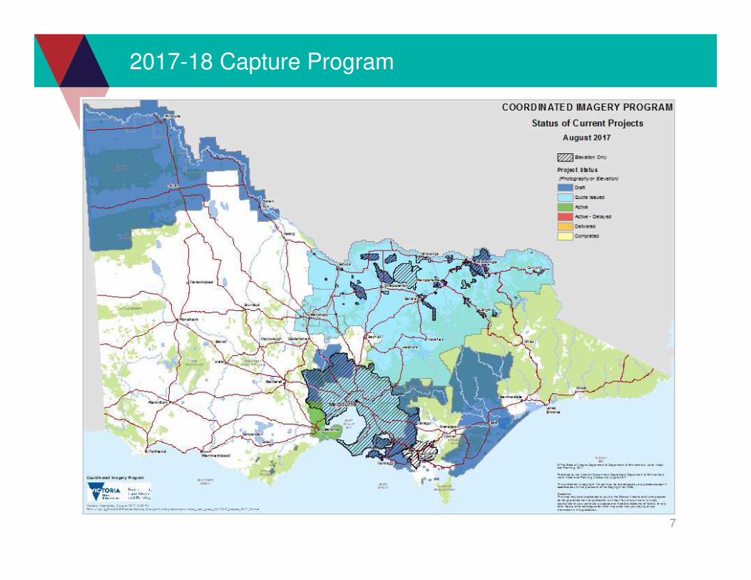
2017-18 Capture Program
8
2017-18 Capture Program: North East
Murray Rver & Mildura Photography:
• Resolution: 20cm
• Type: RGB (RGBI if budget allows)
• Relaxed accuracy:
• Spatial: +/- 4 pixels
• Capture Window: Jan 1 to 30 March 2018
• Delivery: Within 6 weeks from acquisition
• Draft stage- seeking partners
9
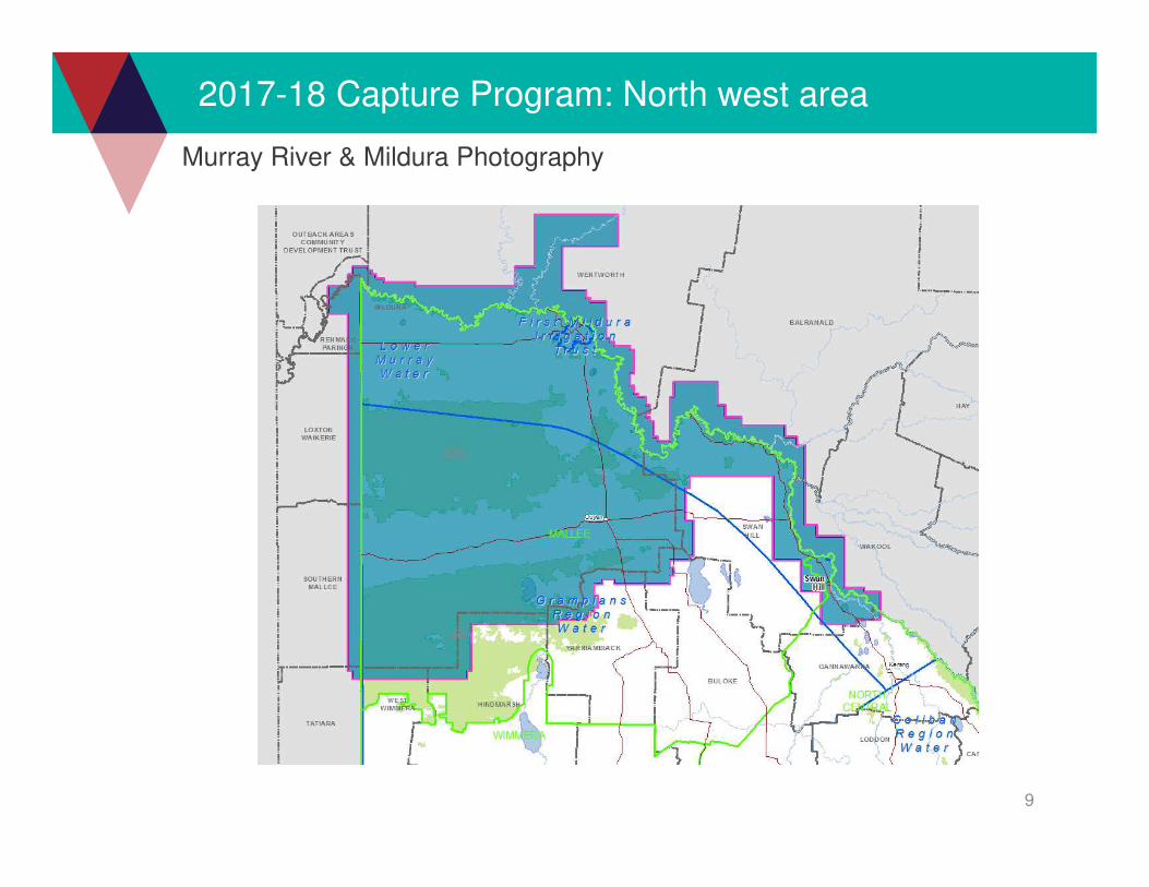
2017-18 Capture Program: North west area
Murray River & Mildura Photography
10
2017-18 Capture Program: North East
Macedon Ranges photography
• Resolution: 10cm
• Type: RGB & RGBI option
• Relaxed accuracy:
• Spatial: +/- 4 pixels
• 5 major partners
• Delivery: Within 6 weeks
• Data packaging done by contractors from now
on #
11
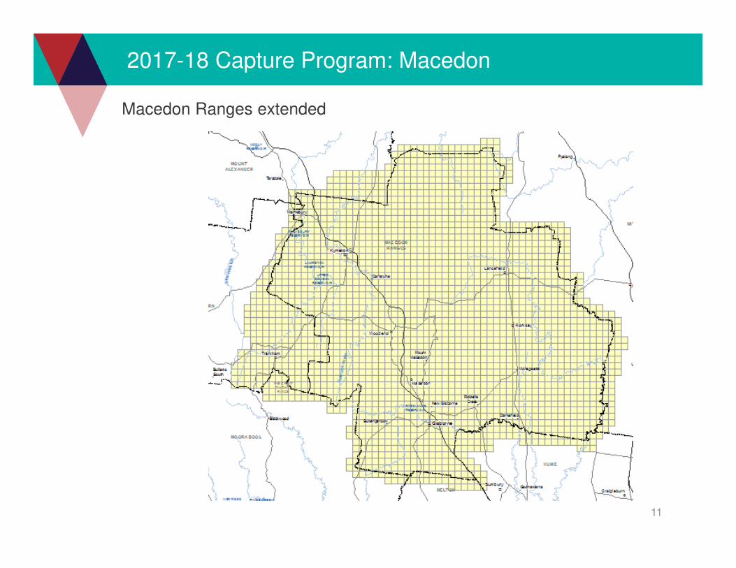
2017-18 Capture Program: Macedon
Macedon Ranges extended
12
2017-18 Capture Program: North East
North East Elevation:• Type: Lidar
• Point Density: Min 4pts/m2
• Returns: Min 4 per pulse
• Capture Window:
• 1st October 2017 – 31st January 2018
• Products:
• ICSM Level 2 Classification
• 0.5m, 1m DEM
• Contours
• +/- 10cm (at 1 sigma) vertical

13
2017-18 Capture Program: North East
North East Elevation
14
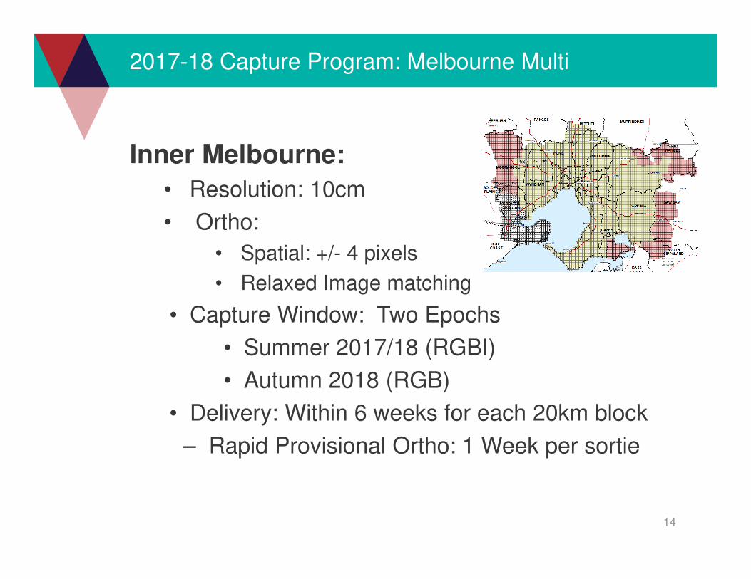
2017-18 Capture Program: Melbourne Multi
Inner Melbourne:
• Resolution: 10cm
• Ortho:
• Spatial: +/- 4 pixels
• Relaxed Image matching
• Capture Window: Two Epochs
• Summer 2017/18 (RGBI)
• Autumn 2018 (RGB)
• Delivery: Within 6 weeks for each 20km block
– Rapid Provisional Ortho: 1 Week per sortie
15
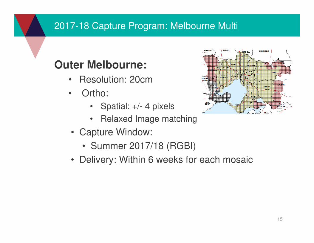
2017-18 Capture Program: Melbourne Multi
Outer Melbourne:
• Resolution: 20cm
• Ortho:
• Spatial: +/- 4 pixels
• Relaxed Image matching
• Capture Window:
• Summer 2017/18 (RGBI)
• Delivery: Within 6 weeks for each mosaic

16
2017-18 Capture Program: Melbourne Multi
17
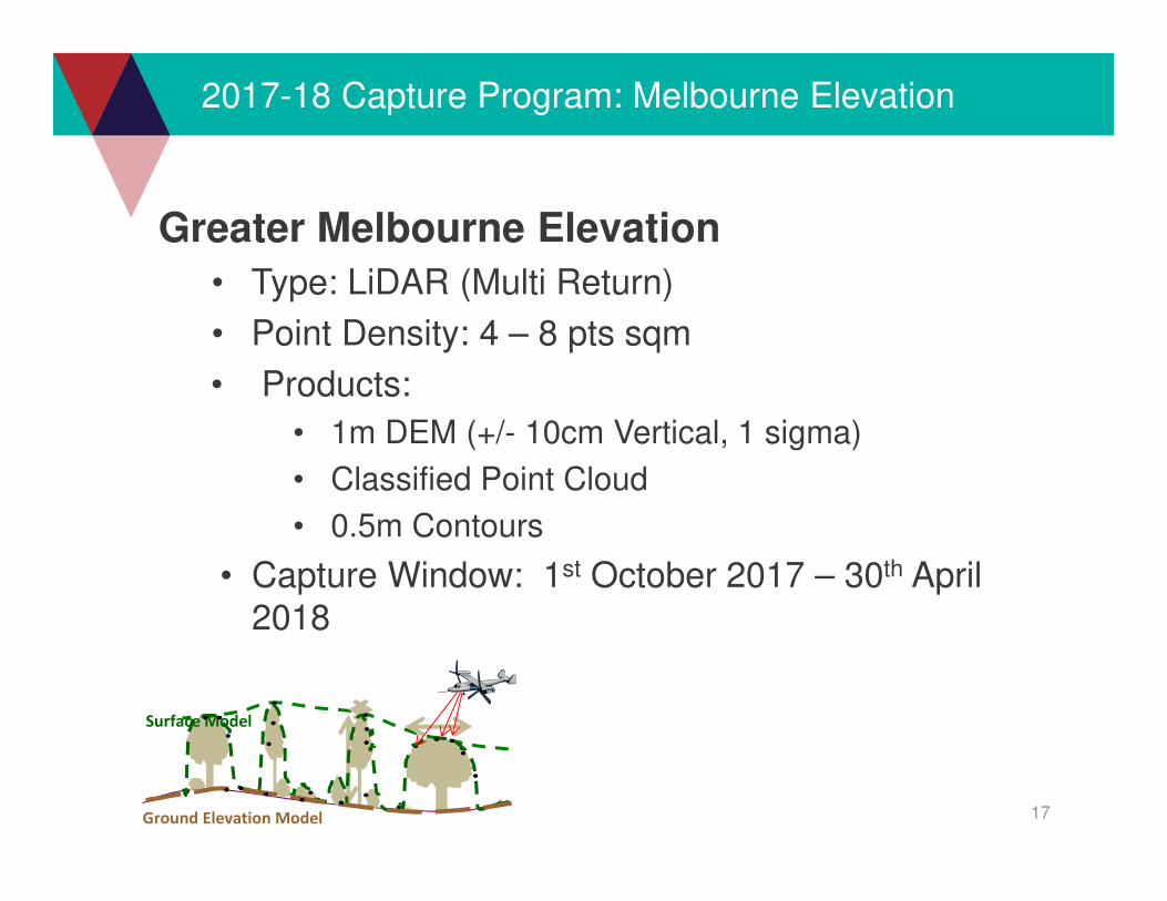
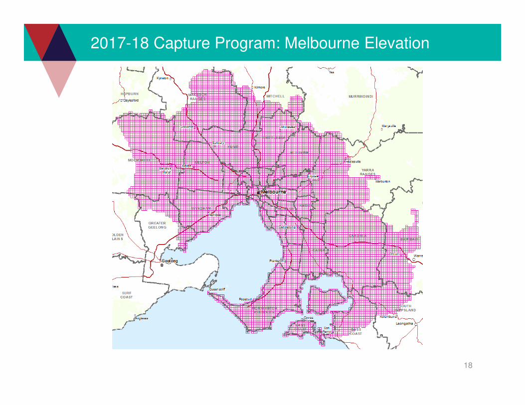
2017-18 Capture Program: Melbourne Elevation
Greater Melbourne Elevation
• Type: LiDAR (Multi Return)
• Point Density: 4 – 8 pts sqm
• Products:
• 1m DEM (+/- 10cm Vertical, 1 sigma)
• Classified Point Cloud
• 0.5m Contours
• Capture Window: 1st October 2017 – 30th April
2018
Surface Model
Ground Elevation Model
18
2017-18 Capture Program: Melbourne Elevation

19
Know our partners needs better
Investigate the needs all partners, all projects
• Timing
• Management of Multiple projects
• Quote or estimate
• Lead time
• Budget
• Aware of standards
• Collate and analyse factors
• More partners
• Annual
CIP 2016-17 Partner Survey
20
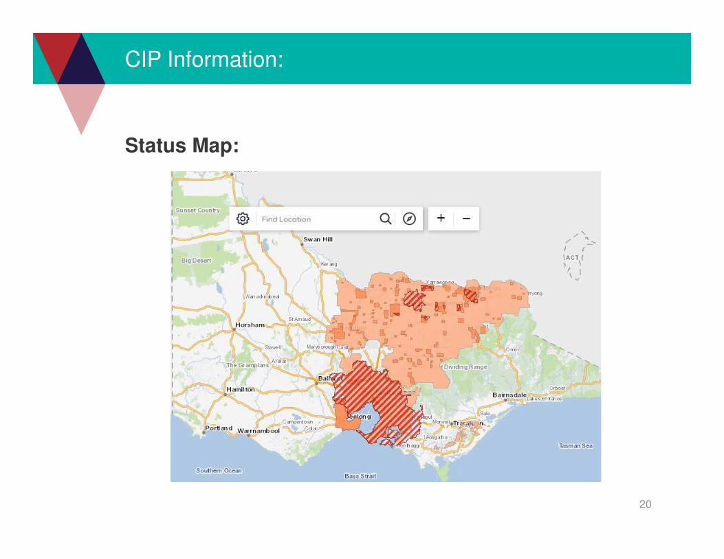
CIP Information:
Status Map:

21
CIP Information:
Building Lean: Horsham Ratio: Approx. 1:3
Forward: 100%, Side: 30%
Forward: 60% - 80%, Side: 30% - 40%
2012 2009
Building, trees, towers
22
CIP Information:
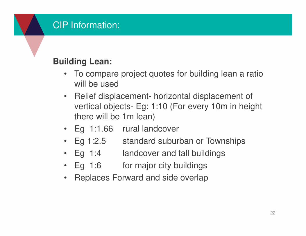
Building Lean:
• To compare project quotes for building lean a ratio
will be used
• Relief displacement- horizontal displacement of
vertical objects- Eg: 1:10 (For every 10m in height
there will be 1m lean)
• Eg 1:1.66 rural landcover
• Eg 1:2.5 standard suburban or Townships
• Eg 1:4 landcover and tall buildings
• Eg 1:6 for major city buildings
• Replaces Forward and side overlap

23
CIP Contacts:
John White
Ph: TBA
Email: [email protected]
Jeffrey Green
Mbl: 0412445153
Email: [email protected]
Mioara Benchea
Ph: 03 9194 0208
Email: [email protected]
Program:
Email: [email protected]