Embed Size (px)
Citation preview
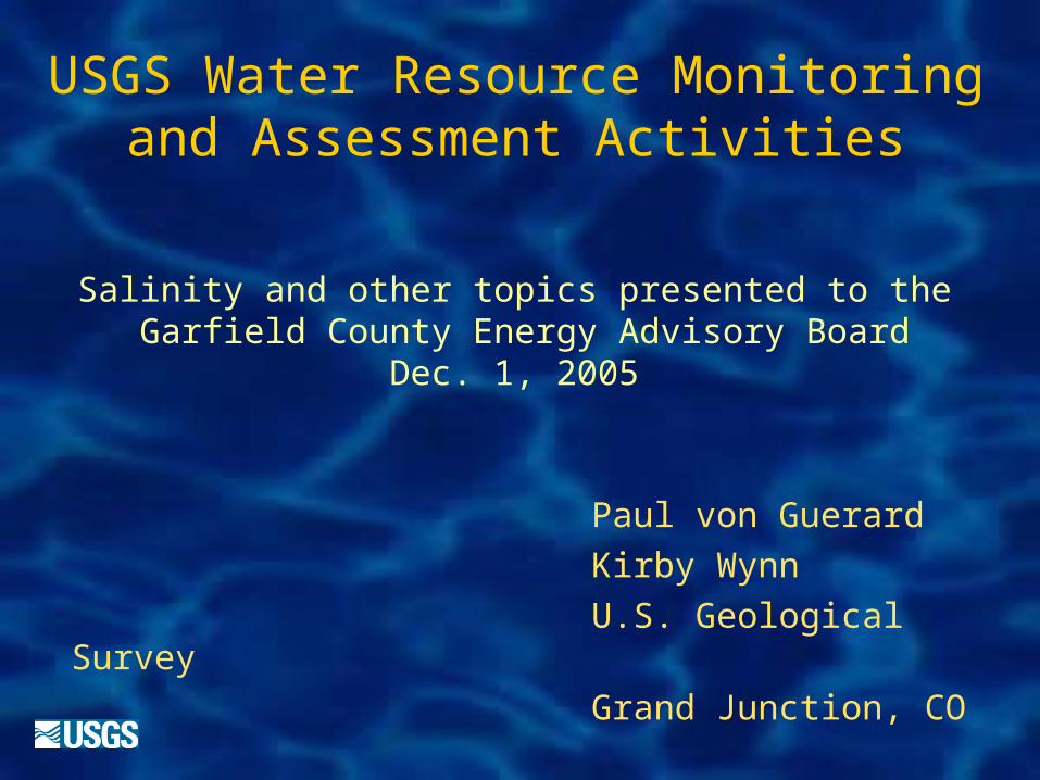
USGS Water Resource Monitoring and Assessment Activities
Salinity and other topics presented to the Garfield County Energy Advisory Board
Dec. 1, 2005
Paul von GuerardKirby WynnU.S. Geological
SurveyGrand Junction, CO
USGS Water Mission Statement• To provide reliable, impartial, timely information that is
needed to understand the Nation’s water resources to:
– Minimize the loss of life and property.
– Effectively manage ground-water and surface-water resources.
– Protect and enhance water resources for human health, aquatic health, and environmental quality.
– Contribute to wise physical and economic development of the Nation’s resources
USGS role in water-resource assessment
• Assess the quantity and quality of the Nation’s water supplies
• Collect data and conduct water-resources investigations to support local, State, and Federal needs
• Maintain nationwide hydrologic-data network and publicly available database
• Develop methodologies for the hydrologic sciences
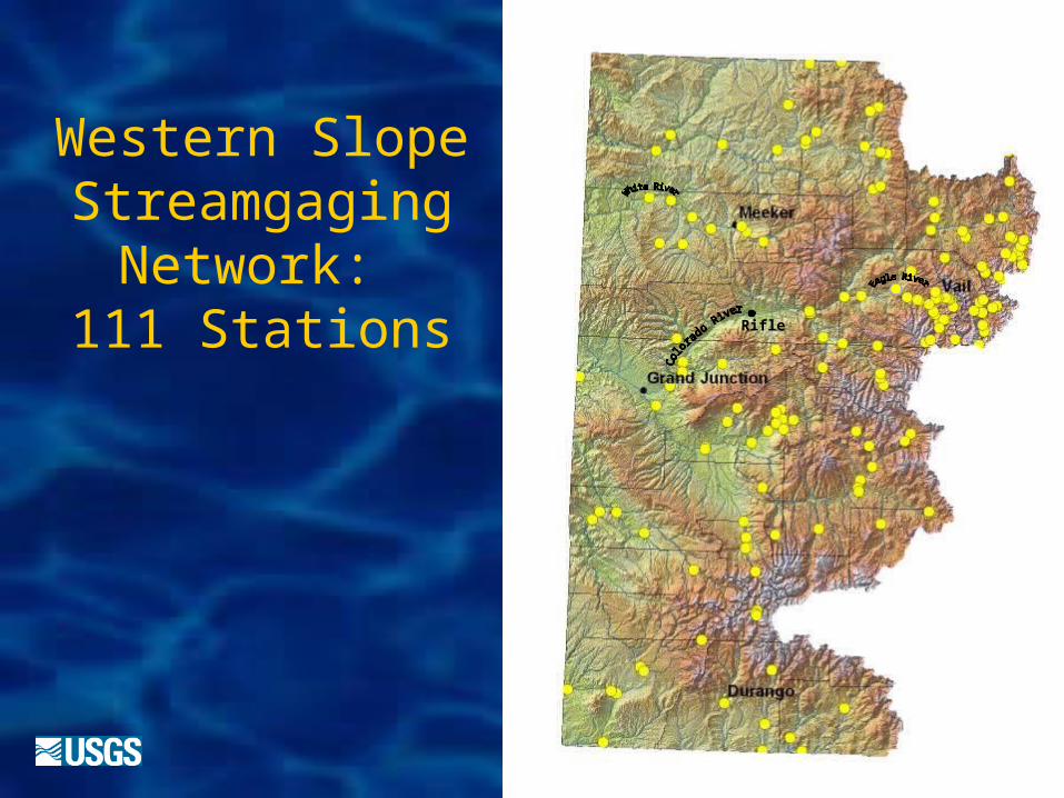
Western Slope Streamgaging
Network: 111 Stations Rifle
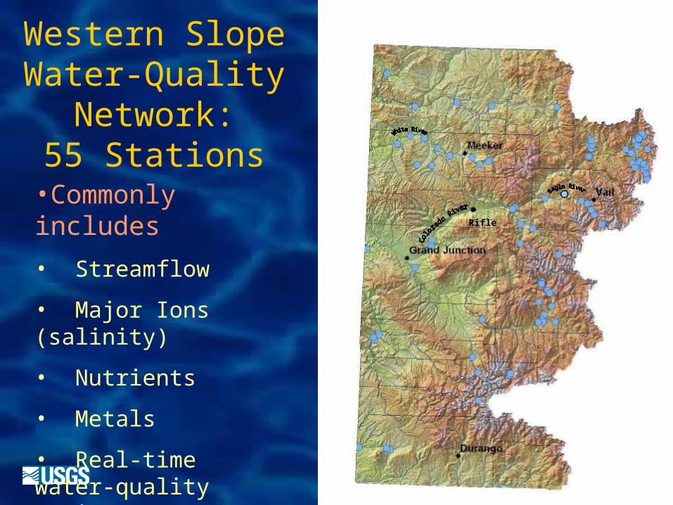
Western Slope Water-Quality
Network:55 Stations
Rifle
•Commonly includes
• Streamflow
• Major Ions (salinity)
• Nutrients
• Metals
• Real-time water-quality monitors
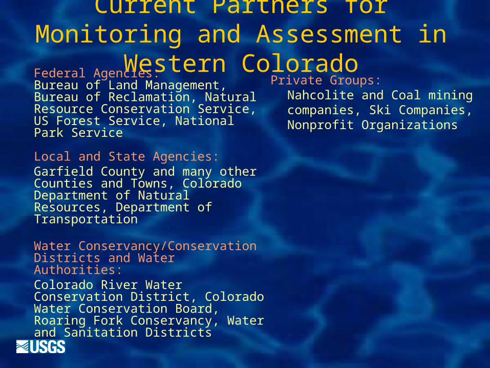
Current Partners for Monitoring and Assessment in Western
ColoradoPrivate Groups:
Nahcolite and Coal mining companies, Ski Companies, Nonprofit Organizations
Federal Agencies: Bureau of Land Management, Bureau of Reclamation, Natural Resource Conservation Service, US Forest Service, National Park Service
Local and State Agencies:Garfield County and many other Counties and Towns, Colorado Department of Natural Resources, Department of Transportation
Water Conservancy/Conservation Districts and Water Authorities:Colorado River Water Conservation District, Colorado Water Conservation Board, Roaring Fork Conservancy, Water and Sanitation Districts
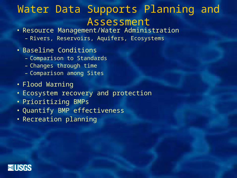
Water Data Supports Planning and Assessment
• Resource Management/Water Administration– Rivers, Reservoirs, Aquifers, Ecosystems
• Baseline Conditions– Comparison to Standards– Changes through time– Comparison among Sites
• Flood Warning• Ecosystem recovery and protection• Prioritizing BMPs • Quantify BMP effectiveness• Recreation planning
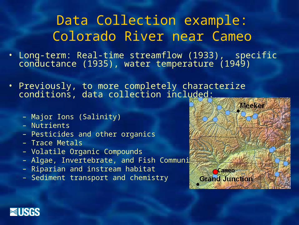
Data Collection example: Colorado River near Cameo
• Long-term: Real-time streamflow (1933), specific conductance (1935), water temperature (1949)
• Previously, to more completely characterize conditions, data collection included:
– Major Ions (Salinity)– Nutrients– Pesticides and other organics– Trace Metals– Volatile Organic Compounds– Algae, Invertebrate, and Fish Community– Riparian and instream habitat– Sediment transport and chemistry
Cameo
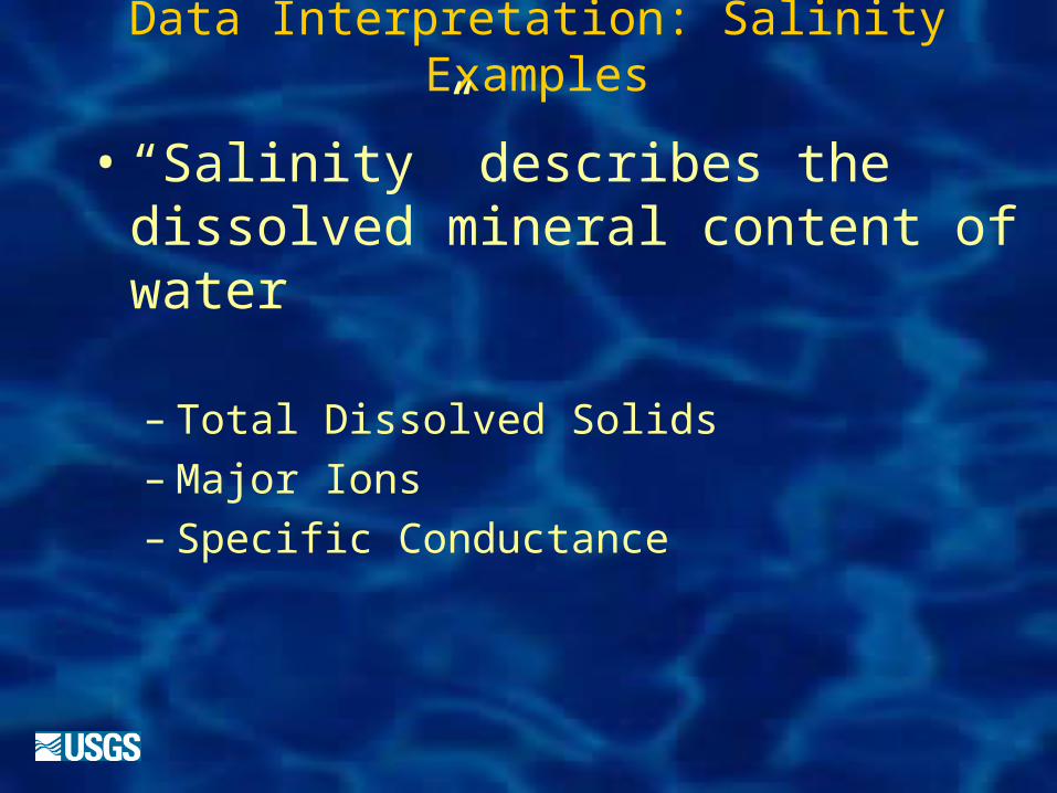
Data Interpretation: Salinity Examples
• “Salinity” describes the dissolved mineral content of water
– Total Dissolved Solids– Major Ions– Specific Conductance
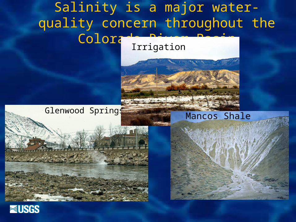
Salinity is a major water-quality concern throughout the Colorado River
Basin
Glenwood SpringsMancos Shale
Irrigation
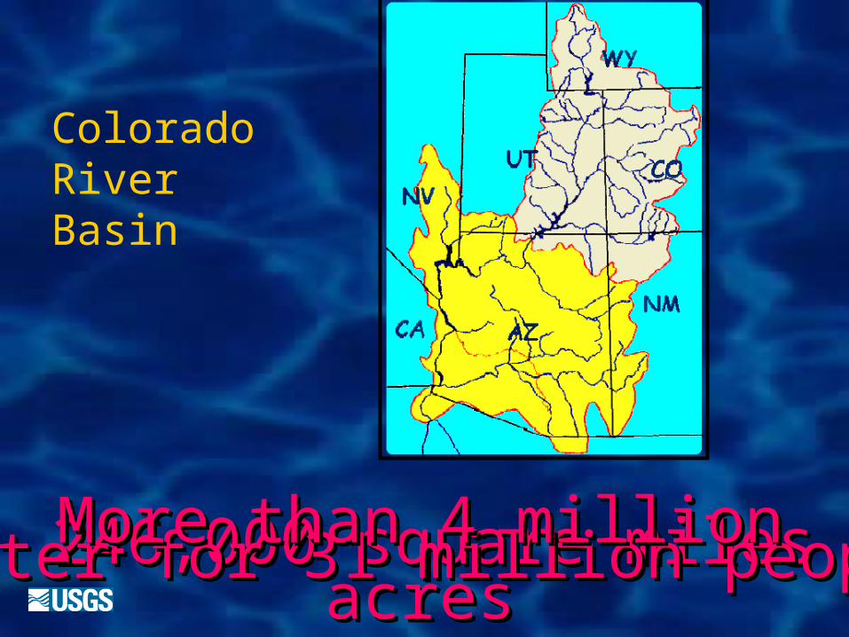
Colorado River Basin
246,000 square miles246,000 square milesWater for 31 million peopleWater for 31 million peopleMore than 4 million More than 4 million acresacres
irrigatedirrigated
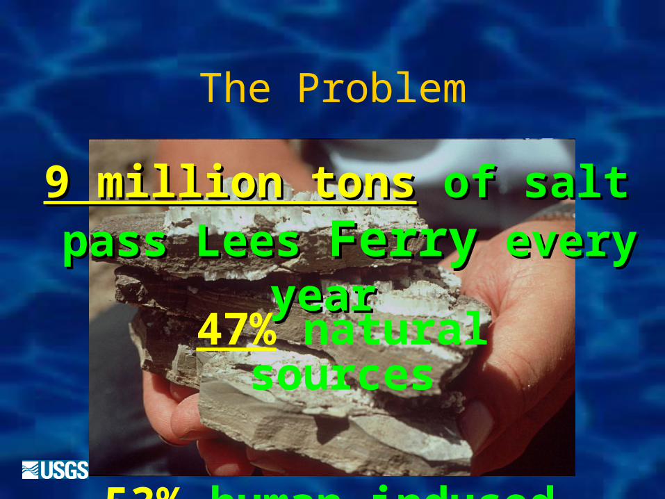
The Problem
9 million tons9 million tons of salt of salt pass pass LeesLees FerryFerry every every
year year 47% natural
sources
53% human-induced
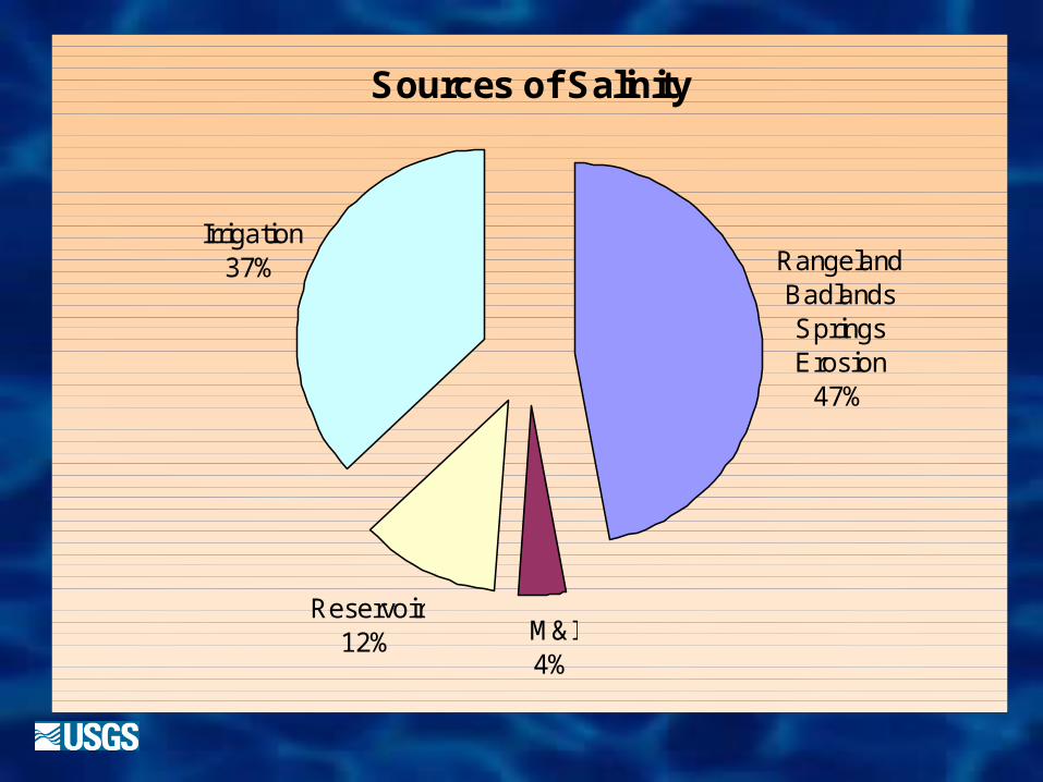
Sources of Salinity
M&I4%
Reservoir12%
Irrigation37% Rangeland
BadlandsSpringsErosion
47%
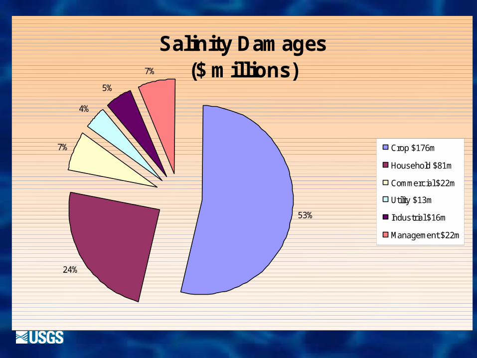
Salinity Damages($ millions)
53%
24%
7%
4%
5%
7%
Crop $176m
Household $81m
Commercial $22m
Utility $13m
Industrial $16m
Management $22m
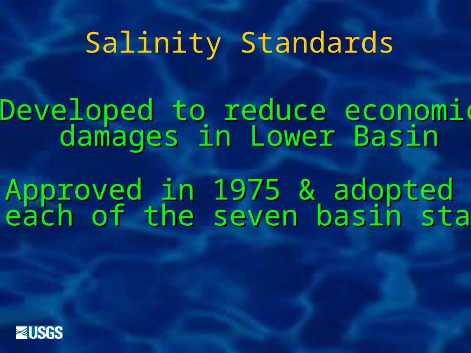
Salinity Standards
Developed to reduce economicDeveloped to reduce economic damages in Lower Basindamages in Lower Basin
Approved in 1975 & adoptedApproved in 1975 & adopted by each of the seven basin statesby each of the seven basin states
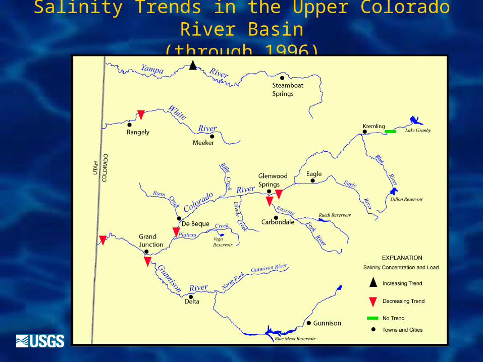
Salinity Trends in the Upper Colorado River Basin
(through 1996)
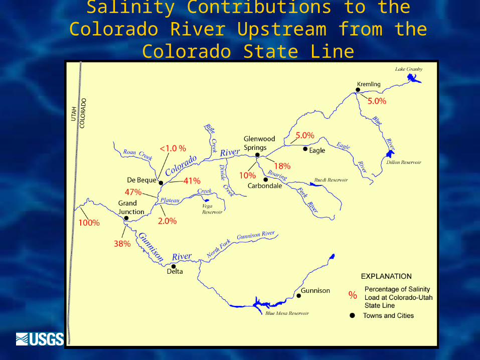
Salinity Contributions to the Colorado River Upstream from the Colorado State
Line
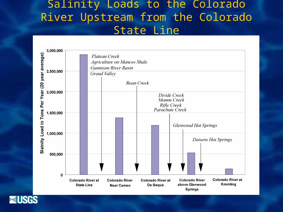
Salinity Loads to the Colorado River Upstream from the Colorado State Line
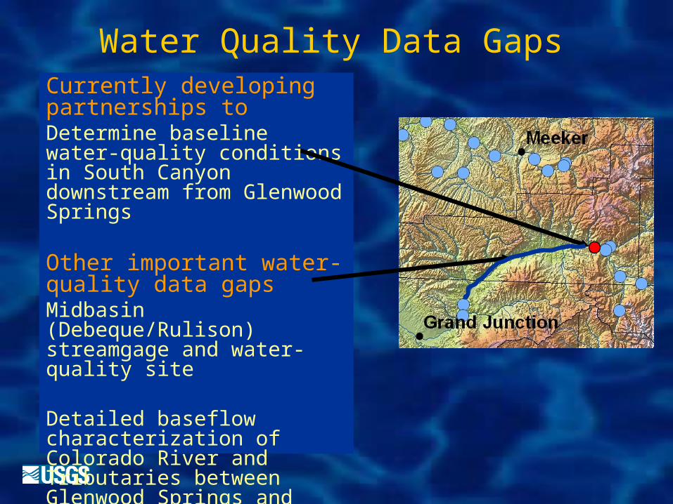
Water Quality Data GapsCurrently developing partnerships toDetermine baseline water-quality conditions in South Canyon downstream from Glenwood Springs
Other important water-quality data gaps Midbasin (Debeque/Rulison) streamgage and water-quality site
Detailed baseflow characterization of Colorado River and Tributaries between Glenwood Springs and Cameo
Contact info for follow-up
Paul von Guerard
(970) 245-5257 x14
Kirby Wynn
(970) 245-5257 x23